In short, one of the principles of Universal Design for Learning is that if you offer students multiple options for exploring content and expressing what they’ve learned, their experience is richer and  more meaningful—and this gives their learning “sticking power.”
Google Earth is a free, easy to learn tool and absorbingly fun! It’s an exciting option for immersive learning because students can delve into a topic and show their knowledge (and comprehension and analysis) through writing and/or other means while simultaneously building geospatial and technical fluency.
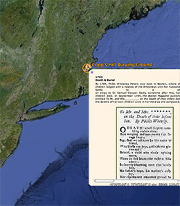
What can students do in Google Earth? They can explore a 3D model of the earth, turn numerous data layers on and off, and zoom in close—in many places to an on-the-street, photographic, 360° view of a place. Most importantly, they can create their own map views in which they placemark physical locations and into each placemark they can:
- add their own written work
- include excerpts from texts
- embed imagery, video, and audio from a website
- include links to sources
If desired, the placemarks can be gathered into an animated tour. Finally, they can save their maps and upload them to Blackboard for assessment or to share with the class.
The project possibilities are nearly limitless, but here are just a few ideas:
- In English or foreign language classes, students can explore a literary work, an author’s life or journey, or create a place-based, illustrated, poetry anthology. Example assignments might be to map 10 places from John Steinbeck’s Travels with Charley, or trace Virginia Woolf’s Mrs. Dalloway’s walk through London, include analysis or reflection of text excerpts and historical photos in each placemark. Include web-sourced audio files where possible, such as the sound of a passing train or Big Ben chiming in London.
- In history classes, students can map events or parts of events, such as wars, diasporas, revolutions, or a single person’s lifetime. An example would be to map one Civil War regiment’s movements and battles. Embed both historic and contemporary photos of the battlegrounds and include excerpts of accounts from properly cited sources.
- In fine art classes, students can search for compelling views of the planet on which to base works of art. They can capture and print their chosen sources from Google Earth and then submit these with the finished project. Examples might be to create a study of abandoned cities or densely populated areas, or the dynamism of a river, e.g., meanders or alluvial fans, or environmental contrasts or perils.
Interested in learning more?
Attend the CTL workshop on September 25th co-taught by Walter Poleman (RSENR) and Inés Berrizbeitia (CTL).
Contact ines.berrizbeitia@uvm.edu for questions about how the CTL may be able to help you develop an assignment, teach Google Earth to your students, and work with you to develop a rubric for assessing the assignment.
For a variety of resources and a link to download Google Earth, see this page in the CTL Website’s “Teaching Resources” area.
