• A-Z
  • Directory
  • myUVM
  • Loading search...

Andrew Dunstan Phenology

The first week of May visit

Posted: May 3rd, 2019 by adunstan

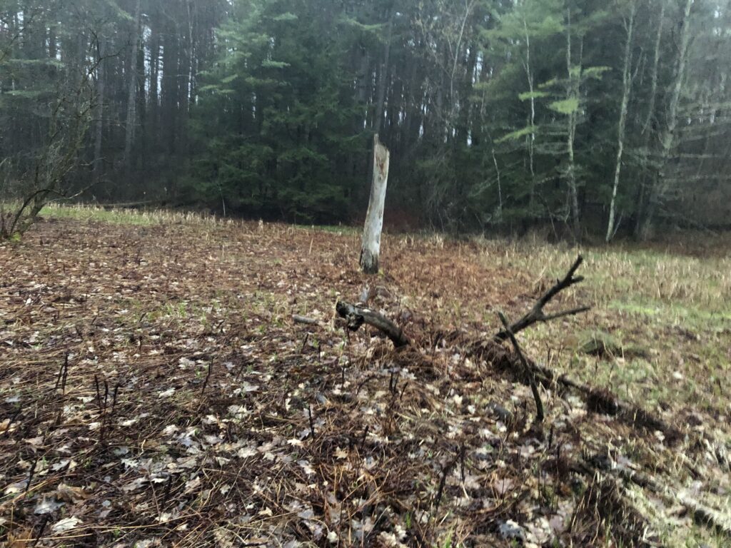
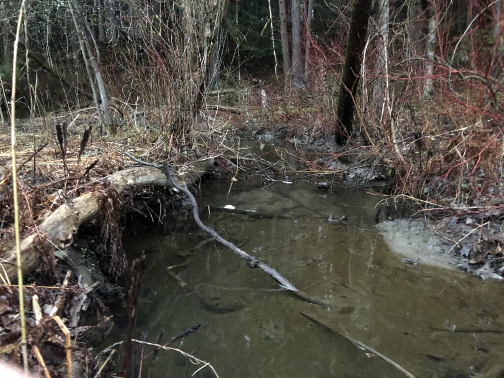
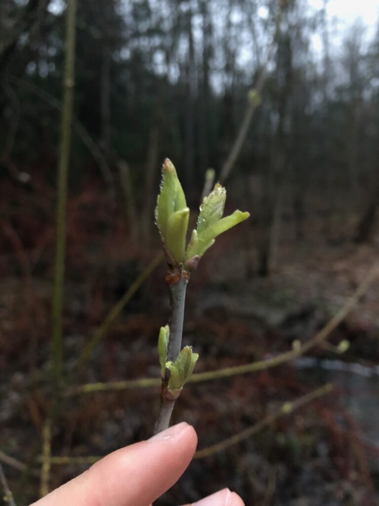
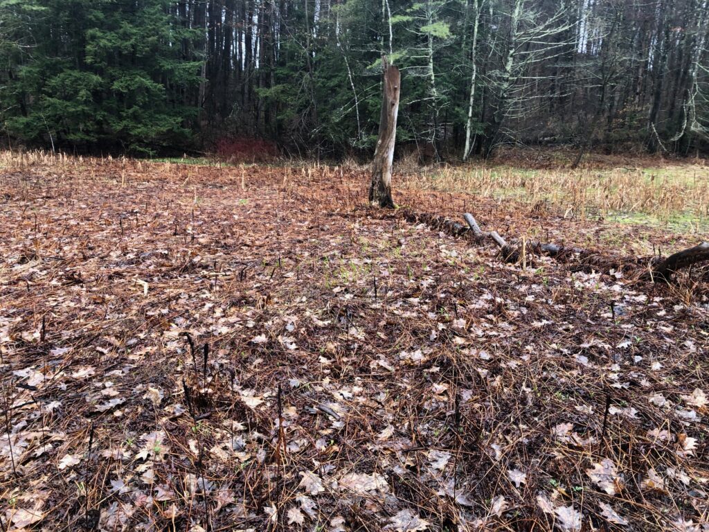
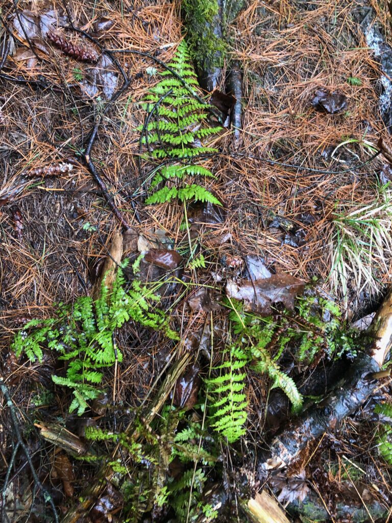
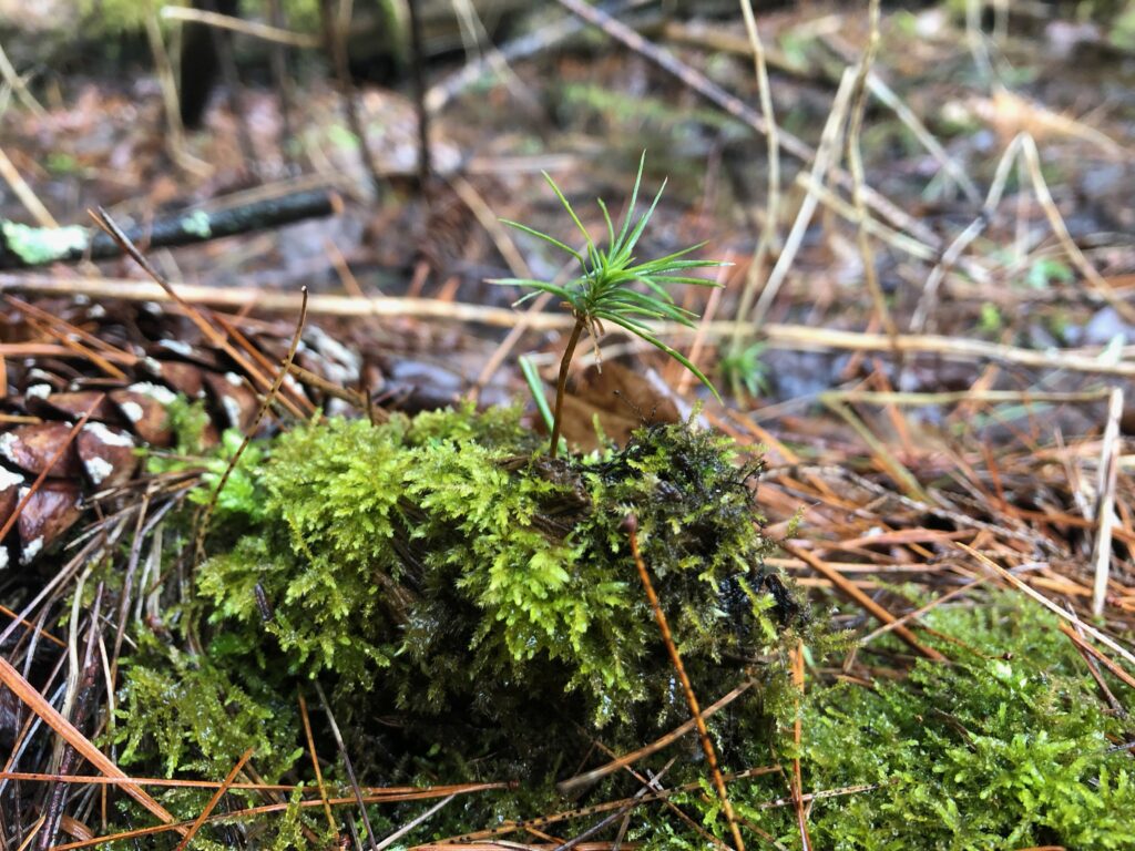
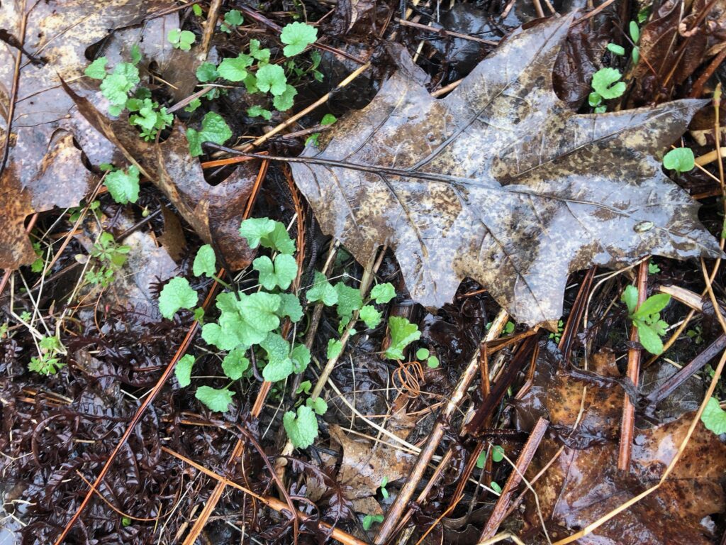
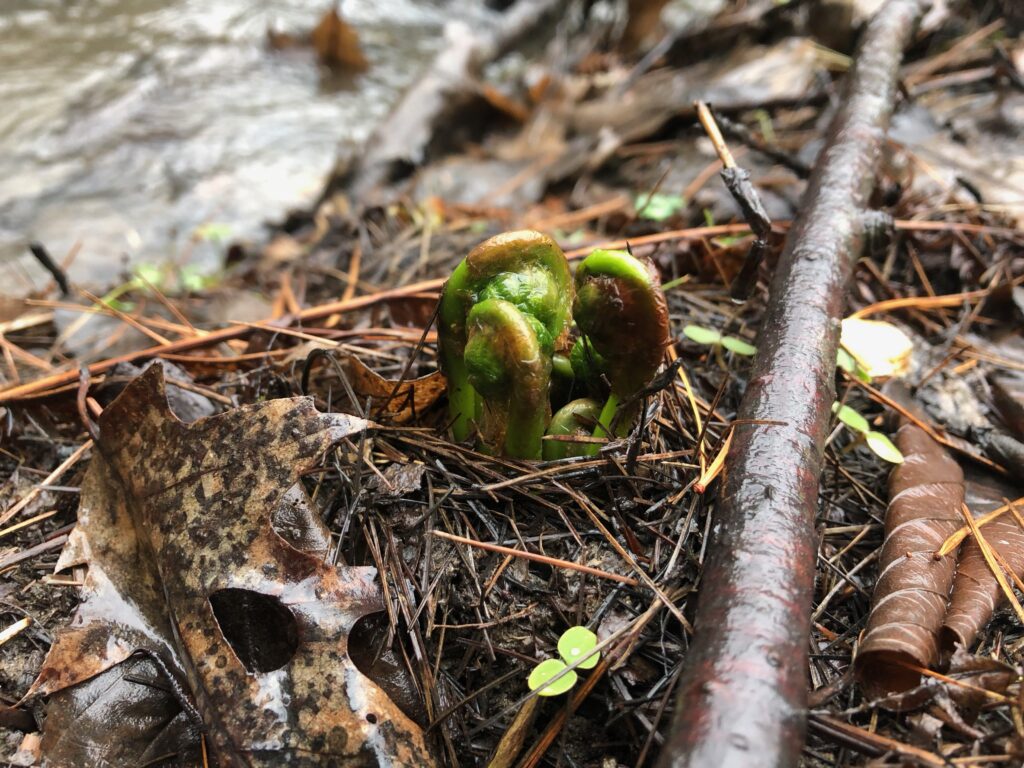
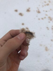
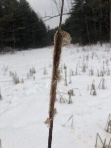
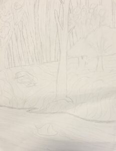
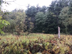
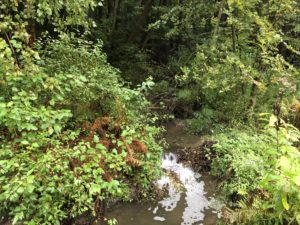
I visited my site again for the first week in May, and unfortunately, there had not been much change from the last time I had visited. There were still very minimal signs of spring. None of the tree buds were blooming, and there were still no flowers on the ground. The undergrowth filled in a little bit more since my last trip, but other than that there were not very many differences. It was a little drizzly this trip, but not nearly as bad as last time. The water levels were way down, and the water was clear so that I could see to the bottom. There were a lot of birds around, and I had a very pleasant time.

Nature and culture intertwine in Centennial Woods. My specific site is very close to two trails that are used quite often by people utilizing the woods for recreation and research. The natural areas are a large part of my university experience and a lot of my friends’ experiences. The human usage of centennial woods shows the values and the culture of the people that live near it. Scientific research and recreation.

I am not a part of my place. I do believe that it is possible for a human to become a part of a natural place, but I do not have a deep enough connection with Centennial Woods to consider myself a part of the place. My definition of “being a part of” means that the organism relies on the place to survive, and the place benefits from the organism’s presence. Native Americans used to be, and many still are, a part of the nature that they reside on. While I enjoy visiting Centennial Woods, I would not be extraordinarily negatively affected if it were turned into a parking lot. I would be upset and angry, but I would still have a home, and I would still have a source of food. The animals and plants whose lives would be extraordinarily negatively affected (or ended) by the process are a part of Centennial woods. By my definition, I am not a part of this place.

I enjoyed this project because it allowed me to see the effects of the change of the seasons on the land. Being able to get out into nature as homework was nice. I got to know the details of my spot, but I was still surprised every time I went with the new details that I noticed. I could keep visiting all four years, and I would still discover more about my site on the last visit.

Start of Spring Visit

Posted: April 27th, 2019 by adunstan

My visit to Centennial Woods this morning was really amazing and definitely a needed break from the craziness of my schedule. It had been storming all night and continued to drizzle during my walk. The ground was squishy with a thin layer of standing water in most places. The water level of the river was higher than I have ever seen it before. It wasn’t flowing out of its banks, but in some places, it was getting close. I, unfortunately, did not see any flowers poking out of the ground, or any buds blooming on trees. Fortunately, there were several other signs of springtime at my site. The birds were chirping which was nice to hear over the roaring flow of the river. There were several young plants starting to emerge as well. In the field beside the river, all the tall grasses had been crushed down by the snow, and now there were several young plants enjoying the newfound access to the sun. There were clovers, large amounts of unfurled ferns, some baby pine trees, some fiddleheads, and some dandelions. I was really amazing to be able to get out there and see the start of the changing seasons. I will definitely be visiting again before I leave to try to see some flowers.

Site From Home

Posted: March 16th, 2019 by adunstan

When I was at home, I chose to get to look at a stream that runs through my neighborhood. I picked it because it is similar in size to the stream at my phenology site, and they are both nearby urban areas. The section of the stream that I focused in on has recently been disturbed by a giant flood. The stream runs through the bottom of a valley, and the neighborhood developers wanted to connect both sides of the valley with a road. To do this, they built a culvert and piled up dirt to level out the ground for a flat driving surface. This worked well until one night a couple of months ago, there was a massive storm, and the culvert couldn’t handle the amount of the water. The water built up behind the dirt dam and eventually became too much. The culvert gave way, and a flood of water roared through tearing up everything downstream.

I wanted to look at this site, as a study of succession. The culvert has since been rebuilt and our neighbors have been trying to improve the land. Unfortunately, there are still signs of massive erosion. The topsoil is still mostly washed away leaving the banks of the river just red clay. All of the underbrush has been washed away, and some of the trees were knocked over as well leaving just the strongest trees standing. Where people have not put straw down. It is an interesting place to study because the land on one side of the road (where the water had built up during the storm) has almost completely recovered, while the side is still in the early stages of recovery. Because of this, I can see an example of what the destroyed side of the river will look like once it has fully recovered.

The wet red clay banks are perfect for showing tracks. I saw evidence of a couple of dear and a rabbit walking along the bank presumably getting a drink from the river. I also saw a couple of bird tracks which I was not able to identify. I did not hear any birds in person while I was there, and I did not run into any animals in person while I was there. The stream itself looks to be in good health. It was clear with lots of crawdads, and little fish swimming around. It does not look as though the stream bed was disturbed too much from comparing the healthy and damaged sections of the river. There are some older trees along the bank such as oaks and cedars. There are also some younger grasses in the areas where people had placed down straw and seed over top of the clay. In the unmanaged parts of the bank, there is still just red clay, with no topsoil to support any plant growth yet.

My stream at home is very different from the stream in centennial woods. This is for two main reasons, first is that they are in different locations geographically, and second is because they are in two different stages in terms of succession. The centennial woods stream has not had any significant disturbances recently, so it is relatively developed and is later on in its successionary pattern. The stream in my neighborhood has just recently had a large disturbance and right now only has lots of old growth trees. I will see a re-emergence of grasses, and primary succession trees in the future. I enjoyed my trip to the stream, and will definitely go back in the summer to see what progress has been made.

Classification of my site

Posted: March 7th, 2019 by adunstan

My phenology site is a white pine northern hardwood forest. My site is by a stream, but the soils around it are mainly dry except when the stream is overflowing. I chose to classify it as an upland forest. My site is not at a high altitude, and it does not have a lot of oaks in it which lead me to classify it as northern hardwood. It does not have a lot of hemlocks or oaks, and it is not that rich, so I defined my site as a northern hardwood forest. My site had a lot of white pines, and not a lot of sugar maples or yellow birches, so I finally defined it as a White Pine-Northern hardwood forest.

My site has changed significantly since the first time I visited it way back at the beginning of this year. The majority of those changes have been caused by the changing of the seasons. First with fall and then with winter, I watched the leaves change, fall from trees, and I watched as the forest as a whole opened up. There have not been any permanent changes, but there have been a lot of temporary changes due to seasons. The biggest change is the thining out of the forest. The underbrush has all died with the decreasing temperature, and the ground is covered with a blanket of snow. This means that the forest floor is more open and easy to navigate. The topology of the landscape is much easier to see, and I can get a better feel of where I am in the forest. The river is almost completely frozen over which is a huge change to the landscape. If you stand still and listen you can still hear the trickling of water that indicates that the river can still flow underneath the ice. The organisms that don’t need to photosynthesize are still able to function as they could in the summer.

I am not able to clearly see the impact of the increased precipitation on the sub straight because of the snow cover. Luckily my site is on the edge of a river, and the edges clearly show the substrate where the snow has not been able to pile up and cover it. I can clearly see the subnivian zone on the edges of the river, along with the dirt sides of the bank which are very frozen. Right now the increased precipitation has not really impacted the substrate because all of the moisture is locked up in an unusable form. The substrate will be more saturated with usable water when the weather cools down and the snow and ice melts. Right now the ground is hard and all the water is locked up in ice. Very poor soil conditions for plants.

Winter Tracking and Tree ID

Posted: February 4th, 2019 by adunstan

This was a really amazing visit! It was the first time going back to my site after the long break, and it was good to be back. One thing that I noticed immediately was how open the entire location was. All the underbrush was packed down with snow, and the leaves had fallen off of the deciduous trees. The entire place seemed a lot smaller, and I got a great feel for the topography of the woods. One interesting thing was how small the stream looked. Previously it had sloping banks with mini floodplains, but in the winter, everything except the fastest moving water was frozen and covered with snow. I had to watch my step when I walked to make sure I was traveling on the bank, and not on fragile overhanging ice. It was really great to be able to walk around in the field nearby my site without getting sticker seeds all over me.

Here is a picture of my site all covered in snow

I didn’t really see very many tracks other than ones that humans made traveling through before me. I did see one path that was probably made by a house dog walking with its owner. I have never seen much wildlife at all at my sight and was looking forward to seeing some evidence of critters with the fresh snow. I might have to go right after a fresh falling to make sure that I am the first one out there.

One new interesting thing on my site were these mystery seeds that I saw laying on top of the snow.

They were lying all over the place, but it took me a little bit to actually pin down the source of them. I didn’t figure it out until I saw a dead cat tail with some seed clumps still on it.

I don’t know if I am correct, but my hypothesis is that cattails wait until fresh snow falling to release their seeds, and they use their height advantage to get up above the snow level. The seeds sit on top of the snow, evenly spread out, and then when the snow melts they fall to the ground and start rooting just in time for spring. It is an interesting strategy to avoid rooting to early, but I worry what will happen if the snow melts and then we have a second cold spell with more snow.

I saw a box elder bud shown below with my expert artist’s rendition beside it. (the drawing is on the left just in case it is so life like that you can’t tell the difference)


All in all I had a lot of fun during this visit and look forward to going back!

The final visit

Posted: December 8th, 2018 by adunstan

This trip was the final visit to my site for this semester. It was snowing heavily, and it was the first time that I saw the area blanketed in white. I made sure to keep an eye out for tracks which would be visible. I was lucky to be the first one to visit my site since the flakes started falling. Well, I guess I wasn’t the first one. I walked down to the frozen stream through pristine snow in 20-degree weather. There were several delicate tracks of some birds that I was unable to identify. I stood there tracing their meandering paths backward to the moment that they landed. As my eyes wandered across the ground, I heard a soft bird call in the distance. Was it the same bird? I can’t wait till I learn some ornithology and can come back and get a better handle on what is going on here. The stream was frozen in some places and slowly moving along in others. Part of the waterfall had frozen with beautiful icicles. The field had turned into a blanket of snow with a lone snag in the center. All the leaves that do fall have fallen. Everything was peaceful. With fewer birds and a slower stream, everything was quieter too. The snow has a muffling effect on the landscape. The now forced everything to slow down. As I stood, I could hear the sound of the big fat flakes hitting the ground. I could only find the path to my sight from memory, and the tracks of trail runners who beat me to centennial that day. My site, however, remained pristine, waiting for me.

I looked out at the stand and saw a piece of yellow marking tape wrapped around it. It is incredible to me that this place gets so much use and yet remains so beautiful. The only evidence of humans are the trails, the scientific marking tape, and the occasional piece of trash. Thousands of people use this piece of land, and yet because of the respect we have for it, it remains beautiful for the next person. There is evidence of human use in the past. There is an old foundation a little bit away from my site which means there used to be a significant building a little bit away from my location. I think the open area at my place is a natural field and not the cause of human influences. There are a significant amount of fallen old growth trees at my location and the forested parts of my site have a good mix of old and young growth trees. If there were significant human influences in the past, everything looks very healthy now.

My Stream at home

Posted: November 26th, 2018 by adunstan

West Woods
Samuel Miller, VA 22901
38.073469, -78.588194

Click this Link to see the sight on google maps

When I went back home I chose to use a stream nearby my house as my location because I have so many good memories there.

(Leopold)

I walked down to the stream to see what has changed in the months that I have been away. I left right after a large storm which flooded the area. The bridges had been washed out and silt stained the banks brown. It was amazing to walk down along the streamside path after so long. The vegetation had recovered after being drowned and now the river banks were once again carpeted with grasses, shrubs, and brambles. The path was shaded by the hemlocks and the oaks towering overhead. The brook still bubbled happily along a new trajectory carved by the erosion of the powerful flood waters. The old hawk nest was still there and I sat on the bank and watched it for a while hoping that the old couple would come back. Eventually, I was pulled farther down the path by the calls of other songbirds. I recognized the blue jay, but the others had slipped my mind. I turned and walked onto one of the newly constructed bridges and looked down at the water moving over the mucky rocky bottom. I remembered years ago when I caught my first crawdad at this little bend in the river. I watched leaf boats make their way underneath me. Minnows darted around beneath my feet and the breeze rustled the branches around me. It was good to be back.

(Wright)

The ecology of the Burlington stream and the Charlottesville stream is very similar, but the phenology of the two is very different. The C stream has changed drastically over time due to the disturbance of the flood, while the B stream has not changed that much over an approximately equal amount of time. The streams’ compositions are very similar. They both are very clear with a half rocky half mucky bottom with lots of minows and other creatures darting around. The banks of both are covered with different undergrowth, but both have similar trees growing on their banks. They have different bird species and the C stream had a lot more songbirds than the B stream. There is evidence of dear and other animals all around both of the streams, but I have not yet seen a dear in person in centennial woods. Even when I go during quiet morning hours. The C stream has changed drastically as it has recovered from the damage of the storm. New undergrowth is taking hold to replace their drowned predecessors, and there are major signs of erosion along the banks. The trees at the C stream have retained some of their leaves because it hasn’t gotten cold enough yet in the south while the trees at the B stream have lost all of theirs. Maybe I am more able to see the changes at the Charlottesville stream because I have been removed from it for so long. I have missed the changes in the Burlington stream because they have happened gradually. Both streams have changed over time, but it appears that the stream at home has changed much more

Siting in the woods drawing an event map

Posted: November 5th, 2018 by adunstan

My attempt at poetry:

The moss was like a sponge soaking up the morning dew.

I was unaware of this fact until I sat on the old log resting across the stream.

My pants were soaked through as soon as I sat on its coat of thick green moss.

My bare feet rested in the cold water and my toes played in the silty bottom.

My sitting log was just one of several old trees laying next to each other wrapped in there living coats of green.

A maple leaf boat floats slowly down the river bumping into my legs briefly before continuing down stream.

It tumbles over the waterfall and capsizes.

It gets swept up in the circular currents before slowly sinking to the bottom of the river.

The bed is filled with brown broken ships, brown rocks, brown dirt and brown branches.

The entire thing is a strip of dull brown with quick clear water moving over it.

I look between my legs at one of the only splashes of color in the river: a red solo cup.

Why is the only vibrant thing in this river man-made?

I pick the cup up and walk away.

My walking path through the woods:

There was a lot of change to my site since my last visit. We have been getting a lot of rainfall and the water level of the stream has increased significantly. The tall brush in the field has died off and it is much more open walking through it. The trees are losing their leaves and the entire forest is more open. I saw several fish in the stream as well as a huge frog that hopped past me. There is a lot of activity at my site.

Overhead Site Map

Posted: October 22nd, 2018 by adunstan

It is getting colder and the land is starting to change to reflect that. The forest is starting to look more open as the underbrush is dying off and the leaves are thinning out in the canopies. The whisper of a slight breeze was accented with the crunch of the newly fallen leaves with every step I took. There were several calls from unseen sources that mixed in with the gurgling of the stream to complete the peaceful soundscape that surrounded me. I don’t know my bird calls very well yet, but I recorded them and I will get help from someone more knowledgeable than I. I the field had a trampled line of tall shrubs which could have been made by a deer or a human. The river had barges of floating fallen leaves which swirled around in the currents. The river had an interesting section in it where there were dams on opposite river banks which caused this clockwise current in a section in a place that I expected would flow straight.

Time lapse of the odd current:

IMG_3477

     There were several waterbugs in the river and I saw one or two minows darting under the surface. While I was taking the timelapse with my ungloved hands freezing in the cold, I watched as a squirrel darted along the ground. I took out my notebook and started to sketch up a map of my little area of the forest. I do not have much experience with cartography, so it took me quite a long time to get done. The dashed line is the trail, the line with dots is the path of the river, the dotted region is the field, the region willed with dashed lines is the forest. I marked notable points with letters including my center point with an X, a dead standing stump in the field with an S, and a dead V-shaped stump with a V.

The first visit

Posted: October 8th, 2018 by adunstan

My phenology location is at a bend in Centennial Brook in Centennial Woods. In order to get there walk down the main trail in Centennial Woods. At the first fork in the trail take a left, and at the second fork bear left (you should keep walking in a relatively straight line). Keep walking after the second fork until you come across a dead tree that has two trunks that form a V.

Take a left turn off the path and walk downhill to the river until you come across the positive side of a bend in its path. Cross the river to arrive at my location. There are several honeysuckles near the river with some white pines and red oaks on the far tree line. I chose this location because you get a good view of the river looking upstream and downstream and because you have a good view of a field if you look in the other direction. It has a lot of variation and a lot of potential to change as the seasons change. I look forward to watching the river freeze and watching the plants in the field flower.

Link to google maps:

https://www.google.com/maps/place/44%C2%B028’40.4%22N+73%C2%B011’10.7%22W/@44.4779,-73.188494,17z/data=!3m1!4b1!4m5!3m4!1s0x0:0x0!8m2!3d44.4779!4d-73.1863

Image of google maps:


Contact Us ©2010 The University of Vermont – Burlington, VT 05405 – (802) 656-3131
Skip to toolbar