Home|Introduction | Literature Review | Data and Analysis | Conclusion | Sources
Youth Populations Across the Country
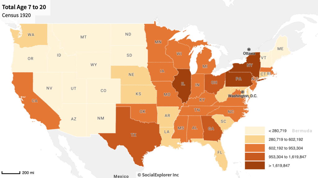
This map shows the number of children age 7 to 20 from the 1920 Census. The greater populations of children are on the East coast, mainly New York and Pennsylvania. This helps explain why summer camps and other youth organizations were concentrated in these areas. Additionally, though PA, NY, NJ, and MA, are more populated than VT, NH, and ME, camps were placed in the more northern and less populated spaces due to their outdoor and wilderness access. North Carolina, Georgia, and California were also hot spots for summer camps as they too had larger youth populations. New England states may also be correlated to the idea of the “pioneer woman” and the connections to the roots of America which come back to this area.
Race Distribution of the 1930’s
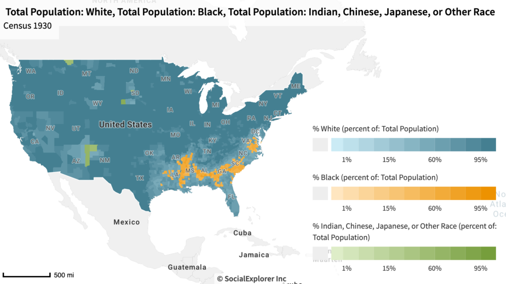
As most summer camps were located in the North East, it can make sense that their populations were of a majority white youth. However, camps in southern states served mainly white children as well, despite the Black American populations in these areas. This can be explained by the national views on race and the idea of a childhood and summer escape belonging only to white children. Though not thoroughly discussed, the book “The Girl’s Camp,” from 1933, does state that a girl “may be suddenly released from the fear that underlies racial prejudice, and discovers that there is opened up to her a new realm of human relationship” (Graham, 1933, pp. 117). This very progressive idea for the time suggests that camp community could be stronger than the fears that captivated the outside world and boundaries.
Conditions of Life Welfare Camp’s
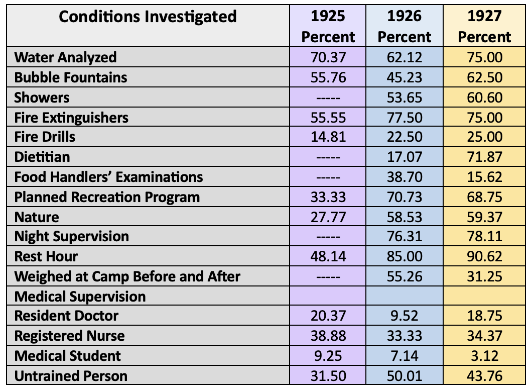
This chart comes from a study that looked at summer camps that were put together by “Life’s Fresh Air Fund” that were a welfare project for lower income families in New York city. The goal was to take kids off the streets and put them in the fresh air to build character and positive citizenship. Upper- and middle- class parents and reformers often saw lower-class or immigrant children as threats that could be molded at a young age into “safer” citizens, these camps to some degree promoted this idea. The data of this chart was from surveying and reviewing 121 welfare-based camps to measure their conditions and quality. While there were improvements over the years, it’s clear that there were still flaws and oversights in many of these programs. So, though they provided access to the outdoors one of the investigators stated “there was nothing in the whole place that seemed especially prepared and thought out for the children” (Sharp, 1930, pp. 22). This survey also allows a glance into what was required of a camp through personnel, food, and in terms of safety.
Mountain’s of Appalachia
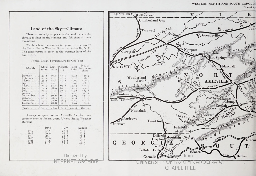
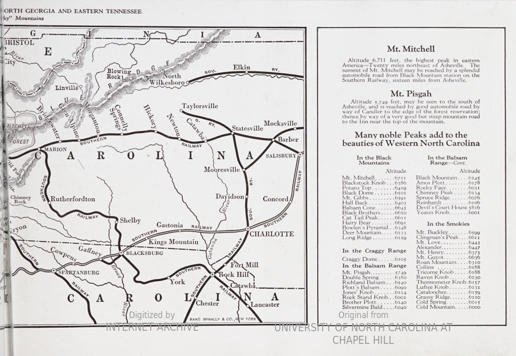
These two pages come from a pamphlet created by the Southern Railway System advertising summer camps in the Appalachian area in the early 1920’s. Through highlighting the nearby mountain peaks and the summer weather, they emphasize that camps physical locations were placed in wilderness and natural settings with beautiful landscapes. In Leslie Paris’s journal chapter about girlhood and summer camp she references how girls had “opportunity to live in a home in the woods” but “experiences of camp wilderness were often appreciably different than those of their brothers” (Paris, 2001, p. 53). However, in both primary and scholarly source, hiking is cited as one activity that nearly all girl’s camps maintained. In her thesis, Miller states “as a favored activity of many high-ranking leaders, hiking was often promoted as the epitome of a camping experience” (Miller, 2001, p. 205).
Activity Books for Camp Directors
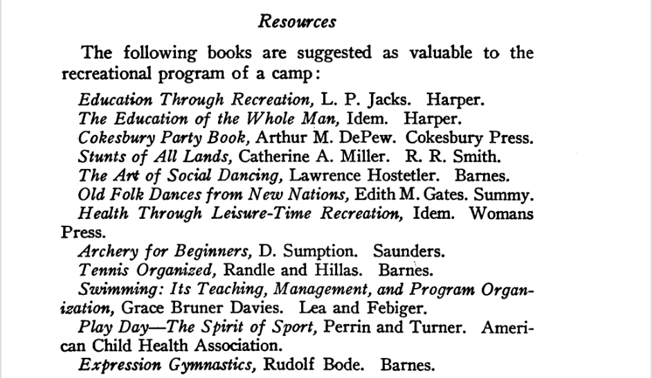
This page is from “The Girl’s Camp,” a book from 1933 written from the perspective of camp directors for camp directors, giving an overview of how to put together an educational and recreational program. These books give insight into the importance of education in camp and highlights some of the popular activities. Activities such as “expression gymnastics,” “old folk dances,” and “social dancing” were ones that would be seen solely at girl’s camps different from that of boys camps. Yet, sports were still big at girl’s camps and in Anna Coale’s account from 1919, she states that every girl will bring home a “sense of achievement, joy in newly found muscles, the feeling that she can do more and more, and, possibly, show her older brother some things he can’t do” because of a summer filled with sport (Coale, 1919, pp. 63).
Fire Girls in the News
This Boston Globe article highlights acts of service that Camp Fire Girls participated in, planting trees across different areas of Massachusetts. In Holsinger’s account of Camp Fire Girl’s in literature, she states that the girls “were encouraged to be environmentalists and to work to prevent the destruction or pollution of nature,” which is greatly depicted in this article (Holsinger, 1987, pp. 86). Nature was a huge part of camp and the continued preservation of these community gathering was strongly emphasized in order to keep the functioning not only of the camps, but the Earth itself.