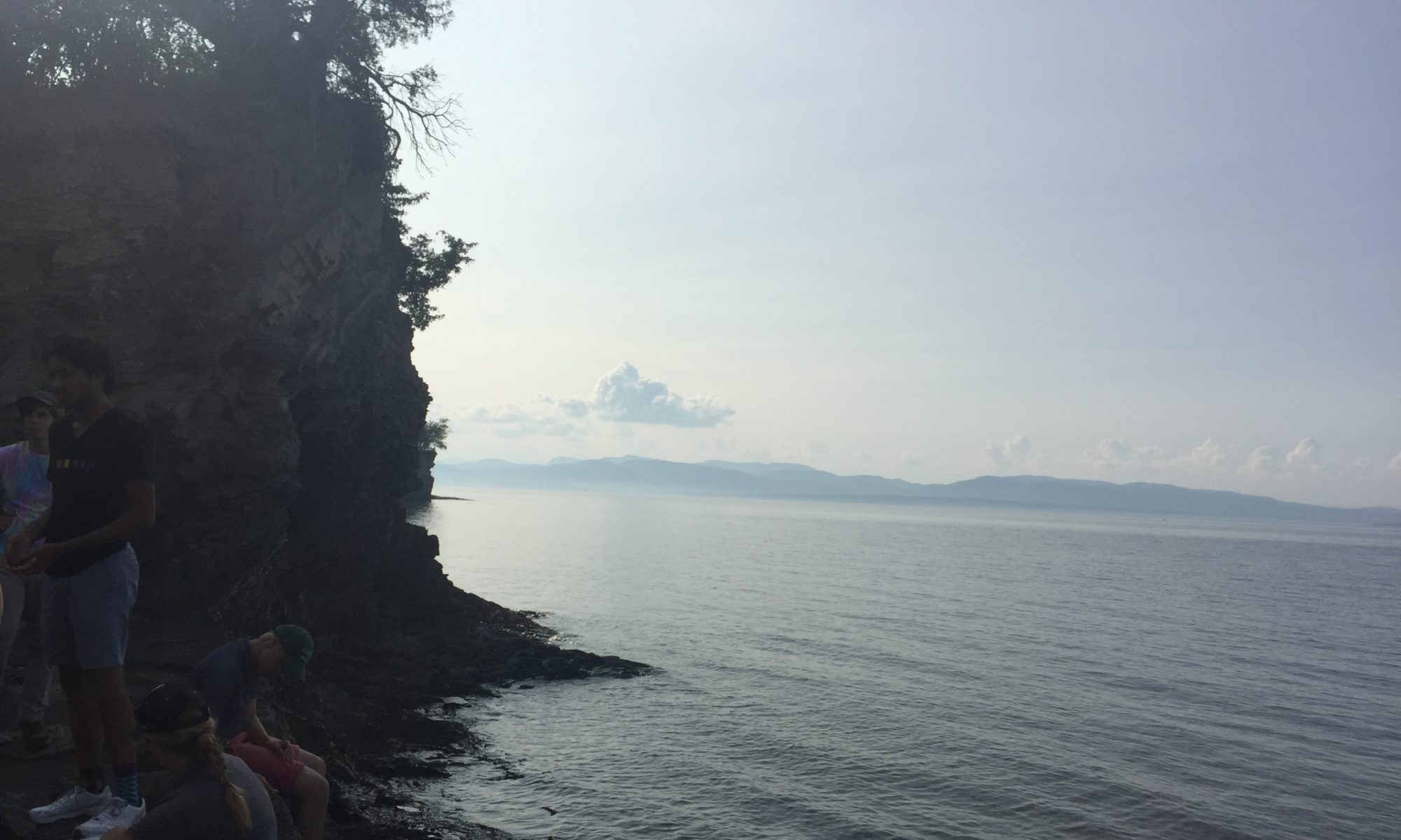
Hello, Readers of Phenology Blogs!
Recently in class, we have been using the book Wetland, Woodland, and Wildland to classify different types of natural areas. In the introduction, the book states that it does not really cover aquatic ecosystems because they are very complex and the authors had another focus in mind. My phenology spot actually happens to be an aquatic ecosystem because it is located along a river. I believe the technical term for this type of community is a riparian zone.
My phenology spot is located at Salmon Hole, which happens to be along the floodplains of the Winooski River. It was very interesting to see how much the water has risen since the warm spell last week. When I first went out to my spot during late summer, you could walk out to the island in the middle of the river, but now the river has come so far up the banks that you can’t even see the island anymore.
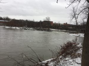 <–The whole part that is underwater currently used to be solid land that you could walk out onto.
You can tell that this happened during other warm spells because of the ice that was left behind on the banks when the temperature dropped again.
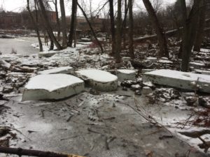
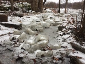
These blocks of ice are a lot smaller now than they were the last time I was at Salmon Hole because we have had an abnormally warm February.
The trees have been loving all this excess water and warmth; the buds of the boxelder trees are looking a little fuller than they were last time.
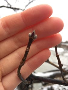 <– I have been having a lot of difficulty focusing my camera lately – I will work on that!
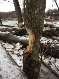
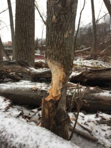
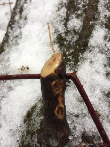
The warmth has also made a lot of critters come out to play – and these critters are hungry. Signs of mid-winter munching were present throughout the area. Most noticeably, a beaver taking a nibble of a lovely tree.
There were some other signs as well, such as twigs that had the bark scraped off, revealing the green vascular cambium.
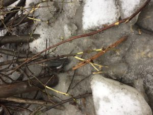
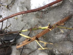
 <–also the ends of some twigs.
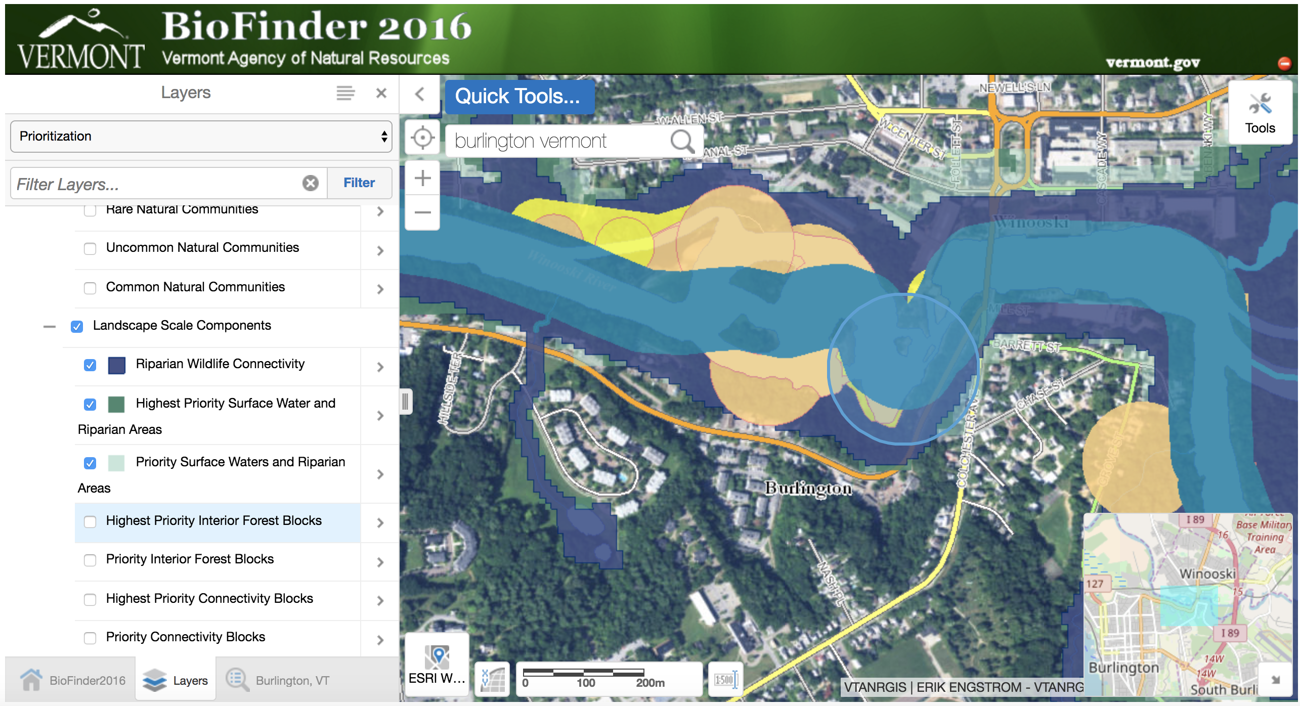
If you want to check out more about what kind of area you are living in you should look up this program called BioFinder. This is a program that Vermont's Department of Natural Resources puts out in order to help people understand where infrastructure should be placed around the state as to avoid important wildlife areas. The site itself can be a bit temperamental, but once you get it to work, it's great for showing you key features of the landscape.
When I zoomed in on Salmon Hole (the light blue circle on the map below), I found that my phenology spot has a number of special features. For an obvious example, my spot is located along an exemplary water surface – aka the Winooski River. However, there were some other cool elements that I was not aware of; such as the fact that my site has some rare and uncommon plant and animal species. The map doesn't go into the specifics, but it is very interesting to know that I am the presence of rarity.
Have a lovely day!! 🙂