Brackett Basin

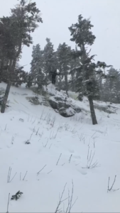
The ski resort known as Sugarloaf is actually split up into two parts: the main mountain, and Brackett Basin, which is located on the eastern side of Sugarloaf on a mountain called Burnt Mountain that is easily accessible from Sugarloaf. Brackett is an area in which I have spent many hours of my life whether it be skiing in winter or hiking in the summer.

While Sugarloaf started as a ski resort in 1950, it wasn’t until 2010 that the Brackett Basin expansion began to take place. The expansion will end in 2020, when over 600 acres of new skiable terrain will be introduced. While glade cutting is still prevalent in order to complete the expansion, there is no clear cutting of the forest and it shall remain minimal at most. However cutting is still cutting, resulting in fewer bird interactions. It being winter there are limited bird interactions in most places, but during the summer birds like chickadees, blue jays and robins frequent the trees.

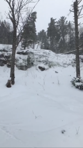
Seemingly the only birds I did come across were crows. I don’t know why I never noticed this, but besides the occasional chickadee crows were the only birds that pop up around the area. The later it gets, the more they perch themselves high up in trees and caw at each other.

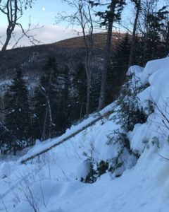
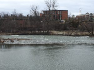
In comparison to Salmon Hole, Brackett Basin varies heavily. Salmon hole has a lightly wooded area along the perimeter of the wetland while Brackett is a woodland through and through. SH’s tree population has deciduous trees in the majority, allowing a clear vantage of the sky, while Brackett’s has many more evergreens than anything else. In some parts of the Basin you can barely see the sky due to the expanse of the trees.

https://www.google.com/maps/@45.036114,-70.3017464,3823a,35y,180h/data=!3m1!1e3 (Brackett is the area to the east of the snowy trails)

Change

Salmon Hole is certainly a natural community that would exist without human interference. However, given its purpose as a recreational landmark it does also have anthropogenic qualities due to trail maintenance, and the fact that no matter how deep you walk through the path you won’t be able to escape the urban environments of Burlington and Winooski. As a whole, there aren’t enough woods on the sides of the Winooski to classify the area as a wooded area, so with the presence of the river it should be known as a wetland.


While it has only been a month since my last visit to Salmon Hole, the changes have been drastic. I don’t have a picture for reference, but when I biked to the parking lot in February the entire area was covered with snow and made it impossible to bike through with the tires I had. Now, there is little to no snow on the ground despite it being March.

Rack area with almost no snow

On my previous visit, the river was silent as it had frozen over, giving the air a peaceful aura to it. Now, because of the premature thawing the river is once again roaring as it Should be in late April/May.

Another unfortunate change is there is now almost a complete absence of the mysterious ice blocks from last time, as most have melted due to the increased heat over the past couple of weeks. Because they were covering most of the area that wasn’t already covered by rock, the substrate has become incredibly muddy and difficult to trudge through.

I like taking pictures of the stairs that descend into Salmon Hole, primarily because it offers a good view point on how the landscape has changed. If you go back to my previous post, you can see that the land surrounding the stairs was completely covered in snow. Now, the snow is barely covering the dead leaves and branches that litter the wooded floor.

With a quick look through of the BioFinder website I was able to make a couple interesting discoveries. Firstly, Salmon Hole is one of the highest priority surface water and riparian community sights. This, on top of it being home to both rare animal, and plant species makes me really appreciate the uniqueness of my spot, as well as making me anxious to go back and see if I can identify any of these rare species.

The BioFinder map of Salmon Hole


While on my walk through the paths of Salmon Hole, I noticed a lot of large pipes that had water flowing into the Winooski River. While they could very well just be water being diverted via drainage pipes, some of them had this weird orange coloration surrounding them. I am curious as to whether or not this is natural or a byproduct of mans pollution of Vermonts water systems.

Skip to toolbar