Final Venture into Salmon’s Hole.

Birds chirp, chipmunks chip, and the rapids roar. Spring has come. My final visit to this beautiful location has me reminiscent of when I first came here in late September. While the leaves certainly aren’t out in the vibrancy that they had near the end of summer, I can see the buds blooming and the flowers finally poking out of the underbrush. The remnants of winter are long gone, and we now have the base for what looks to be a gorgeous summer in a stunning location.


The culture in Burlington, as well as the rest of Vermont rests in the outdoors. Burlington isn’t a huge city, yet there are so many hidden gems around the city dedicated to recreation in nature. That culture also intertwines with the industrial culture of old. The banks of the Winooski are lined with old factories, and a quick walk along the Salmon Hole trail provides you a brief history lesson of days long gone.


Despite my reoccurring visits every month, I don’t feel as if I am a part of this place. It was here long before I ever was, and will remain there long after I am gone. I am merely a passing transient in the ecology of this place, staying just long enough to breath it all in, and leaving soon enough to remain a guest for life.

Spring has not Sprung

As Spring has officially sprung, it has yet to truly rear its pretty head. As I perused the muddy downtrodden gallery that was my phenology spot, I noticed the majority of all the plants on the ground were still dead and rotting, most likely due to the frequent warming and freezing see-saw that has become the state of Vermont. But there is hope. Small patches of moss, and emerald green grass have slowly (but surely) started to poke through the muck.

Observing the banks and streams connecting to the edge of the Winooski River for amphibians proved to be a lost cause. My theories behind this are the fact that it is still too cold for them to properly come out, on top of the fact that the streams seem horribly polluted by both trash, and runoff.

One cool thing I found while searching was this tree with several woodpecker holes burrowed into it. Despite the absence of the amphibians, I noticed robins, squirrels, and these holes to show that even in the midst of a cold spring life is beginning to come back to the city of Burlington. The edges of Salmon Hole are both inherent and induced. The habitat edge between the river and the land is abrupt and noticeable, however in the wooded areas of Salmon Hole, as you go up it becomes induced as humans long ago cut through the forest to place roads, creating a boundary between woods and city.

Brackett Basin

The ski resort known as Sugarloaf is actually split up into two parts: the main mountain, and Brackett Basin, which is located on the eastern side of Sugarloaf on a mountain called Burnt Mountain that is easily accessible from Sugarloaf. Brackett is an area in which I have spent many hours of my life whether it be skiing in winter or hiking in the summer.

While Sugarloaf started as a ski resort in 1950, it wasn’t until 2010 that the Brackett Basin expansion began to take place. The expansion will end in 2020, when over 600 acres of new skiable terrain will be introduced. While glade cutting is still prevalent in order to complete the expansion, there is no clear cutting of the forest and it shall remain minimal at most. However cutting is still cutting, resulting in fewer bird interactions. It being winter there are limited bird interactions in most places, but during the summer birds like chickadees, blue jays and robins frequent the trees.

Seemingly the only birds I did come across were crows. I don’t know why I never noticed this, but besides the occasional chickadee crows were the only birds that pop up around the area. The later it gets, the more they perch themselves high up in trees and caw at each other.

In comparison to Salmon Hole, Brackett Basin varies heavily. Salmon hole has a lightly wooded area along the perimeter of the wetland while Brackett is a woodland through and through. SH’s tree population has deciduous trees in the majority, allowing a clear vantage of the sky, while Brackett’s has many more evergreens than anything else. In some parts of the Basin you can barely see the sky due to the expanse of the trees.

https://www.google.com/maps/@45.036114,-70.3017464,3823a,35y,180h/data=!3m1!1e3 (Brackett is the area to the east of the snowy trails)

Change

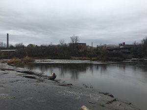
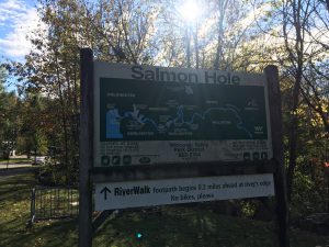
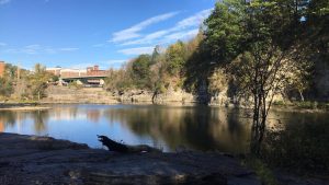
Salmon Hole is certainly a natural community that would exist without human interference. However, given its purpose as a recreational landmark it does also have anthropogenic qualities due to trail maintenance, and the fact that no matter how deep you walk through the path you won’t be able to escape the urban environments of Burlington and Winooski. As a whole, there aren’t enough woods on the sides of the Winooski to classify the area as a wooded area, so with the presence of the river it should be known as a wetland.


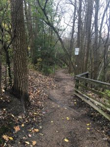
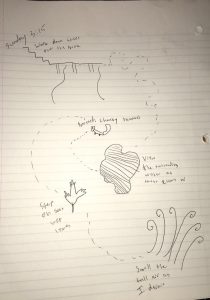
While it has only been a month since my last visit to Salmon Hole, the changes have been drastic. I don’t have a picture for reference, but when I biked to the parking lot in February the entire area was covered with snow and made it impossible to bike through with the tires I had. Now, there is little to no snow on the ground despite it being March.

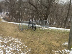
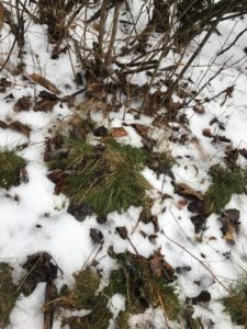
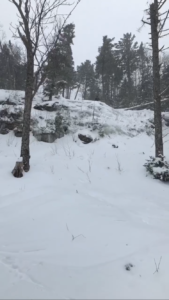
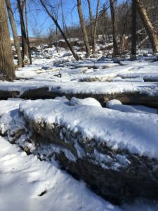
Rack area with almost no snow

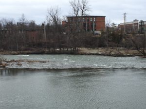
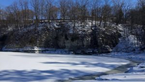
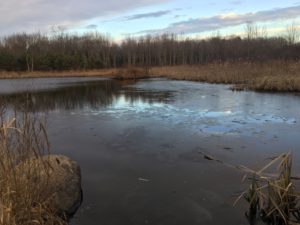
On my previous visit, the river was silent as it had frozen over, giving the air a peaceful aura to it. Now, because of the premature thawing the river is once again roaring as it Should be in late April/May.

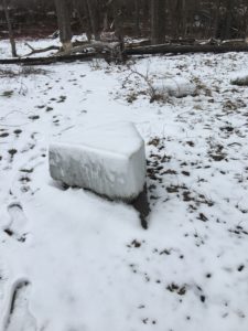
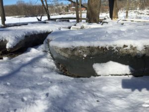
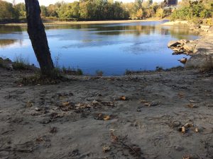
Another unfortunate change is there is now almost a complete absence of the mysterious ice blocks from last time, as most have melted due to the increased heat over the past couple of weeks. Because they were covering most of the area that wasn’t already covered by rock, the substrate has become incredibly muddy and difficult to trudge through.

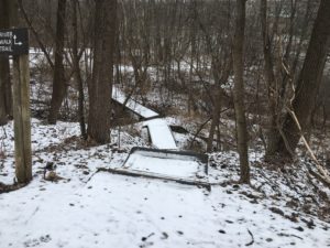
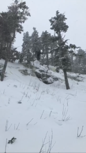
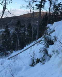
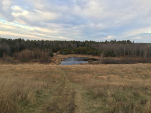
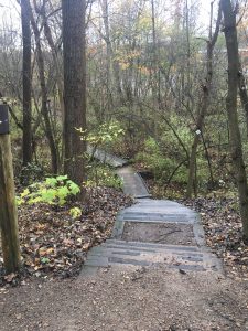
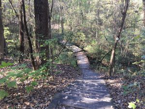
I like taking pictures of the stairs that descend into Salmon Hole, primarily because it offers a good view point on how the landscape has changed. If you go back to my previous post, you can see that the land surrounding the stairs was completely covered in snow. Now, the snow is barely covering the dead leaves and branches that litter the wooded floor.

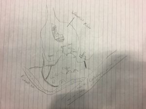
With a quick look through of the BioFinder website I was able to make a couple interesting discoveries. Firstly, Salmon Hole is one of the highest priority surface water and riparian community sights. This, on top of it being home to both rare animal, and plant species makes me really appreciate the uniqueness of my spot, as well as making me anxious to go back and see if I can identify any of these rare species.

The BioFinder map of Salmon Hole


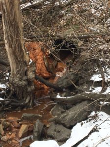
While on my walk through the paths of Salmon Hole, I noticed a lot of large pipes that had water flowing into the Winooski River. While they could very well just be water being diverted via drainage pipes, some of them had this weird orange coloration surrounding them. I am curious as to whether or not this is natural or a byproduct of mans pollution of Vermonts water systems.

Wildlife, Twigs, and Changes

More than a month after my last visit to Salmon Hole, the landscape has changed completely going from fall straight into a February winter.

I tried to take the same pictures as I did earlier in the year so you could really get a sense of how much the land changed, so if you go back and look at my previous posts you can see a really interesting shift in landscape.

The biggest change that I observed besides the obvious snow coverage, were the massive (and quite numerous) blocks of ice that formed on the banks of the Winooski River. Some were massive and thick while others broke as soon as I stepped on them. These fascinated me as I have never encountered something like this, and I am stumped on figuring out what causes this to happen. I want to say it is due to ice forming on rocks and expanding, but some of the areas in which I found the blocks didn’t have large rocks when I last stopped by.

With the fresh coating of snow on the ground, activity from the previous night was evident.

The dead of winter commences, and all but the evergreens lose their leaves. This allows for ample twig hunting! While there were many twigs to be found, I was only able to take pictures of two before the cold claimed the life of my phone.

Paper Birch Twig

White Oak Twig

I would like to apologize for my depiction of the twig, I am a horrible artist and this is really the best I can do.

One other phenological change I noticed before I left, was the overhead space in the woods. During summer/fall, it is hard to get a clear view of the sky as the canopy covers most of it. However with the area being populated by mostly deciduous trees, now when you look up you are greeted by a beautiful display of blue sky peaking through the intertwined maze of bare branches the trees have on display.

Human History of Salmon Hole

Salmon Hole was once a secluded area, far from interaction with humans. Once it was discovered by the Abenaki, it became a source of sustenance. As the years passed and the white man began to take control of things, fish population grew low due to over fishing which is why there are fishing regulations put in place today. The dam that you see there today was placed there in 1992, replacing the previous one that had been set up using timber.

Seeing how over the years it has remained a source of energy and food for the Burlington/Winooski area, it is clear that Salmon Hole is and will remain a key point in the areas ecological and economical environment.

Bangor Woods


Fresh wind brushes tired skin, soft rustling of tall grass penetrates ear drums, the rejuvenating smell of fresh rain accumulating through the field. As worn eyes pan over the surrounding area, a sense of familiarity and content wash over you while the breathtaking view from your childhood returns. The wind gently glides over the soft pond and leaves subtle ripples in its wake to entertain the resident beavers. The aroma of fresh dew on pine needles wafts through the expansive area, coating it in a cool aura of the woods. The chipper chipmunks, out to get their daily nut, roam freely through the expanse of the great Bangor wilderness on the prowl for their prized acorn.

The beginnings of a freeze take form on Beaver Pond, foreshadowing the future events of winter. Soft water slowly shifts its form into a rugged, hard sheet of natural glass. What was once ripples will soon be snow flurries as they fly across the mini tundra on Beaver Pond. A sunset kissing the tops of the trees as it falls down behind the horizon, saying good bye for the day.


In both places, the area stays fairly green as winter comes due to a high number of evergreen trees, although the presence of deciduous trees is noted and visible. While Salmon Hole has a larger body of water present, the Bangor Woods also has a few ponds scattered about, like the one pictured above. Bangor has a more open environment in places, like the tall grassy area also pictured above. Salmon hole is more closed off, and only opens up once you get to the rocky surfaces with no trees and the river. Given both spots are in New England, the ecology and phenology of the specific areas nearly mimic each other, with similar soil types as well as similar trees and animals. One of the biggest differences in the two spots is the presence of rocks. Salmon hole has a large presence of rock faces mainly around the riverbed, but the Bangor Woods lacks any major rock surfaces.


November 6

As we enter late fall, the typical changes have rolled through Salmon Hole. The entire area is less green than before, with heavy amounts of dead leaves on the ground. There was a noticeable size difference in the squirrels and chipmunks as they appear to have been gorging on food for the past few weeks to stock up for the winter. Due to the recent heavy rain, the river itself appeared to be very silty and dark, a result from sediments entering the stream from runoff. The rapids were also much more active and energetic as increased rainfall added to the amount of water passing through.

Entrance to the path


Event Map

Map

Map of Salmon Hole


Overall, the changes in the vegetation have been subtle due to the increased temperatures we faced this fall. There is noticeably larger amounts of fallen leaves on the ground, but nothing like it should be late October. As far as wildlife, the closer I’ve paid attention the more so I have come across animal scat (admittedly I could not identify as I am not a poop expert), but have also seen chipmunks, and squirrels scamper across the trail as well as birds singing in the trees.

Salmon Hole, October 17 2017

Map before the trail head

Salmon Hole is one of Burlington’s most stunning natural settings, as well as the go to spot for many of Burlington’s anglers. After a quick walk through a grimy part of town (the end of Colchester Ave just before crossing the bridge into Winooski), you’ll find yourself at a small parking lot, with a trailhead located a brisk gander past.

Beginning of the path

Take the first right, and walk down these steps.

Take your next right, and you will come across a narrow path that opens up onto the rocky face of Salmon Hole.

Salmon Hole

My biggest trait I was looking for when choosing my location was that it be located near a body of water. This was primarily due to areas surrounding water being diverse, having more wildlife, and generally being prettier to look at. To my surprise, the landscapes here varied much more than I anticipated.

Sandy beach opposite the rock face you initially come out on

From cliff faces to sandy shores, this place seemingly has it all. The vegetation in the area going from path to water, starts out as a hardwood area filled with American Beeches, Boxelders and Basswoods to woody shrubs like Honeysuckle and Buckthorn.

Salmon Hole is a terrific spot, and I recommend it to anyone looking for some scenery paired with walk as there is a trail that leads down the Winooski for some ways. You’ll even encounter this hidden gem:

The Hut


You can find Salmon Hole at: 236 Riverside Ave, Burlington, VT 05401


Skip to toolbar