February; Survival

Wildlife Activity

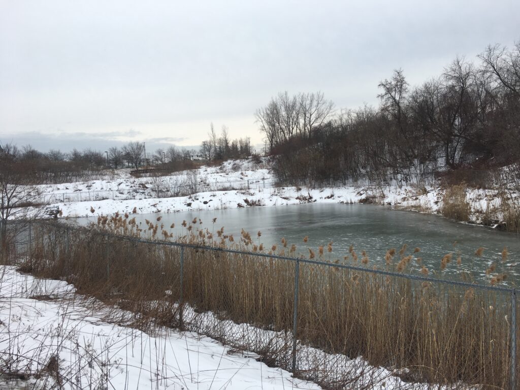
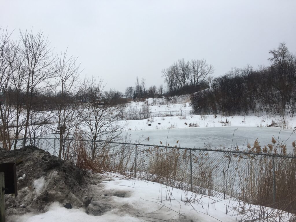
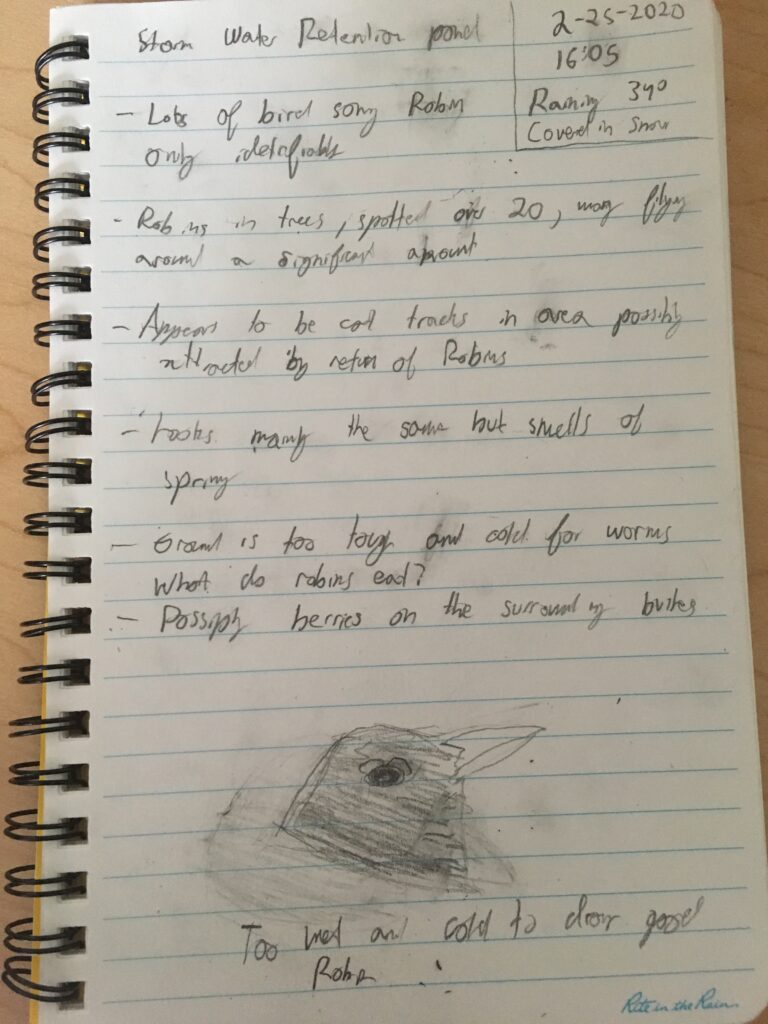
Revisiting my blog spot in late February, I saw very little visual change in my phenology site. Snow still covered a great deal of the ground and the stormwater retention pond was still covered in ice. That is because the greatest change that was occurring is in the sounds and the smell of the area. When I visited the stormwater retention pond it was raining and the first thing I noticed was the smell of spring. This smell is caused by a chemical reaction created when soil-dwelling bacteria, called actinomycetes, produce the compound geosmin. The areas that were free of snow were releasing this chemical. 
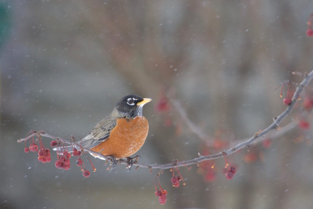
Davis, S. (n.d.). Robin on Branch. Retrieved from https://www.audubon.org/field-guide/bird/american-robin#photo6

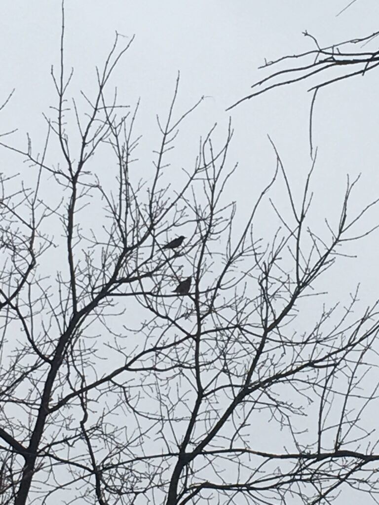
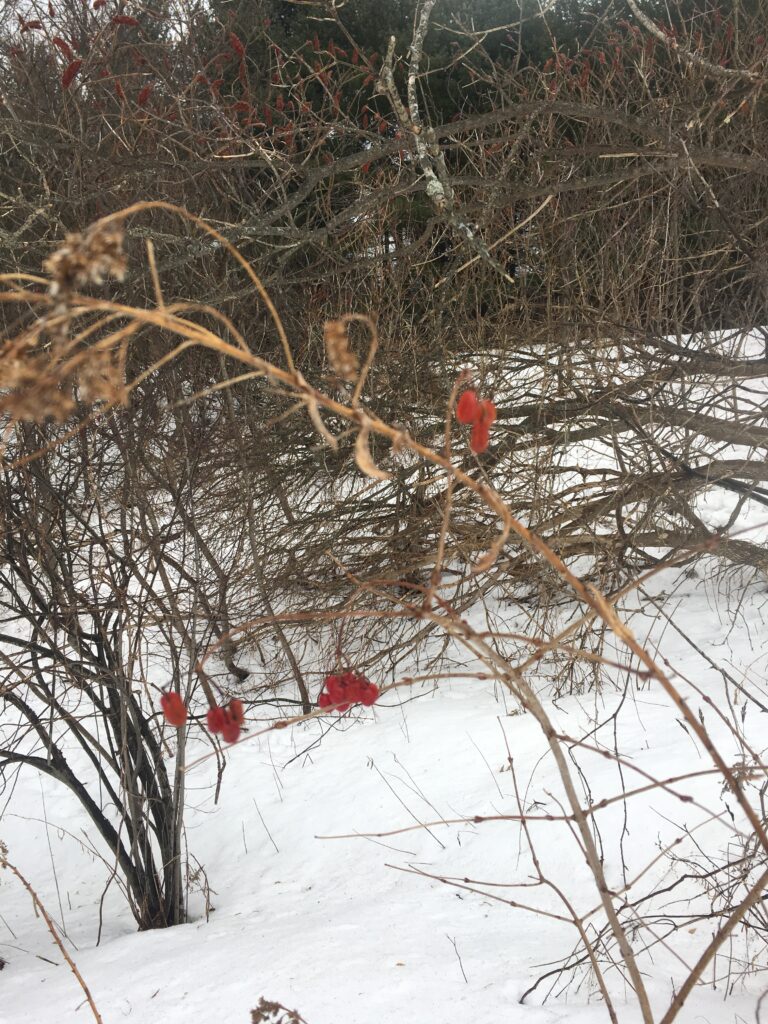
The other major change included a great deal of bird song, this mainly came from the many robins perching in the trees. Seeing the robins at my phenology spot was the first time I had seen robins in Burlington this year. They tend to migrate back from the southern US as well as central America during late February and late March, they are typically known as heralds of spring since they are one of the first groups of birds to migrate back and their easy identification. According to the Cornell Lab of ornithology, robins spend approximately 75% of their day perching quietly in trees while the rest of their time is spent foraging for food or calling to one another. The robin’s diet consists mainly of fruits when they are seen foraging for worms, they are hunting for their young. Therefore their diet during this time consists of the berries still clinging to some bushes. Robins are essential for the dispersion to many woody plant species, like many other birds they digest the fruit and then disperse the seeds in their fecal matter in different areas.

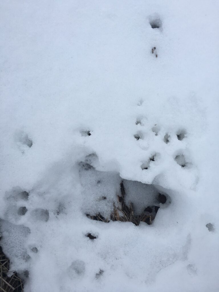
Robins also face many predators this time of year including hawks and owls, however, the largest threat to birds in areas like Burlington are domestic cats. Since robins tend to hop along the ground they are at risk of being hunted by free-roaming cats among many other tacks of humans and dogs I thought I made out cat prints according to the Mammal Tracks and Scat guide which is possible since there are residential areas not too far from my site. A free-roaming cat could wander the area in search of a bird. Now since robins are not endangered cats don’t create a great deal of a threat to their population. However, this can be a major issue for endangered bird species. 
Citations:

American Robin. (n.d.). Retrieved February 29, 2020, from https://birdsna.org/Species-Account/bna/species/amerob/foodhabits

Cooper, E., Hyndmansays, M., Gogishvilisays, D., & Cooper Realty. (2016, January 11). The Chemical Compounds Behind The Smell Of Rain. Retrieved February 29, 2020, from https://www.compoundchem.com/2014/05/14/thesmellofrain/

Levine, L. (2014). Mammal Tracks and Scat.
January; Endurance

Tracking Wildlife

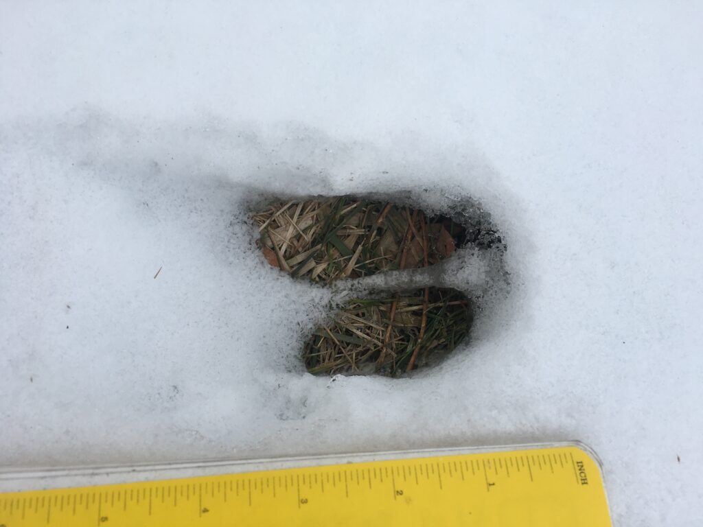
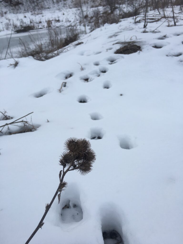
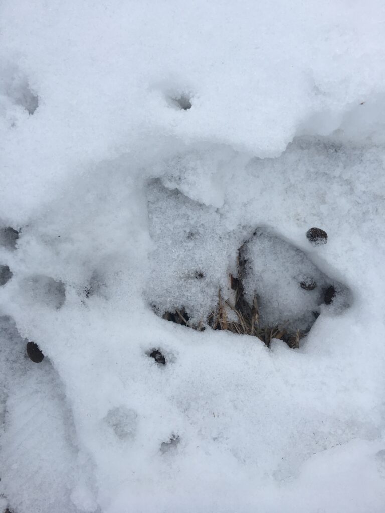
With a coating of snow covering my phenology spot, it is possible to track the wildlife that may pass through or live near the area. On return to my phenology blog location, I found the scene very similar to how I left it. The major difference included the retention pond being frozen over. Most of the phenology area is dominated by the pond, so it was difficult to find many tracks since a great deal of the snow in the area was covered by human and dog tracks. I decided to venture onto the ridge that separates the two ponds, essentially expanding the scope of my phenology area. I believe that I found the tracks of a deer as seen below. The cleft feet leave two indentations in the snow.

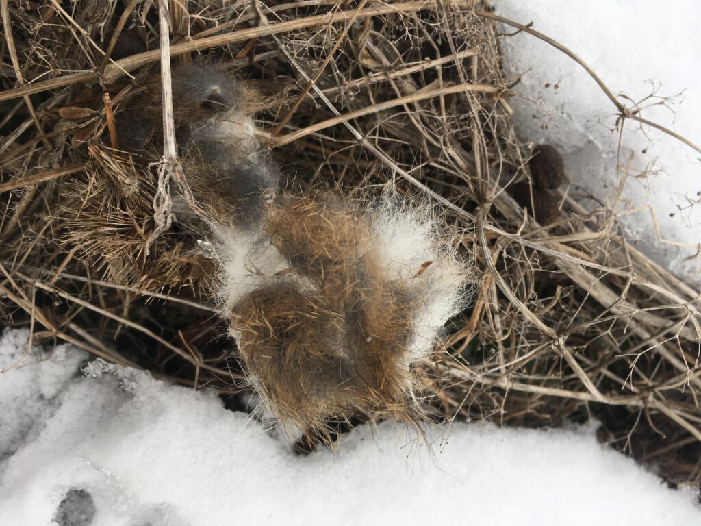
I was unable to properly identify since these tracks were older since they had malted and refroze in some areas. It wasn’t until I was able to track the prints to some droppings that I was able to identify clearly as deer. I also decided to take a closer look along the path of the tracks, since there were several prickly bushes that my own coat got caught on several times. So there was reason to believe that the deer’s fur also may have gotten snagged.

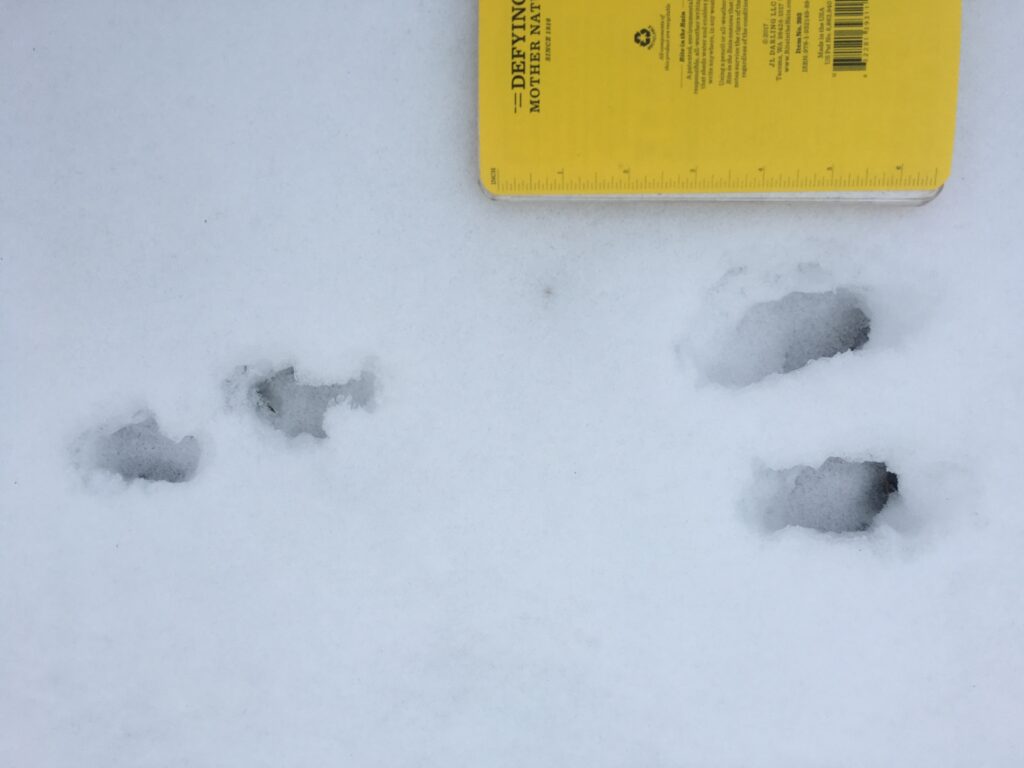
As the picture depicts, I was able to find some hair but it was softer than I expected a deer pelt to be. I also found rabbit tracks nearby (it matches the shape and size of a squirrel but as shown below the back feet are not parallel but staggered meaning that it is most likely a rabbit), so it is possible that it had actually belonged to a rabbit. During late fall there were many berry bushes in this area, so it is likely that these animals left centennial woods to look for more food sources so close to the road.

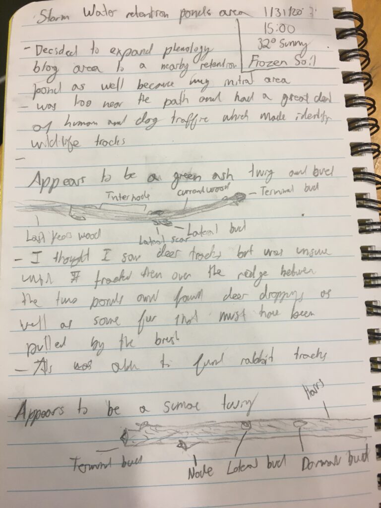
Along with tacking wildlife, I also attempted to identify several deciduous trees by looking at their twigs and buds. I hoped to upload pictures but my phone’s camera was having difficulty, due to the cold. Instead the sketches above are of two of the most common deciduous trees in the area, including green ash and sumac.

I was surprised to find deer tracks wandering so far outside Centennial; I figured I would find plenty of squirrel and rabbit tracks. It just proves another point of the success of this blend of natural and manmade space.

Levine, L. (2014). Mammal Tracks and Scat.
Home and Sense of Place

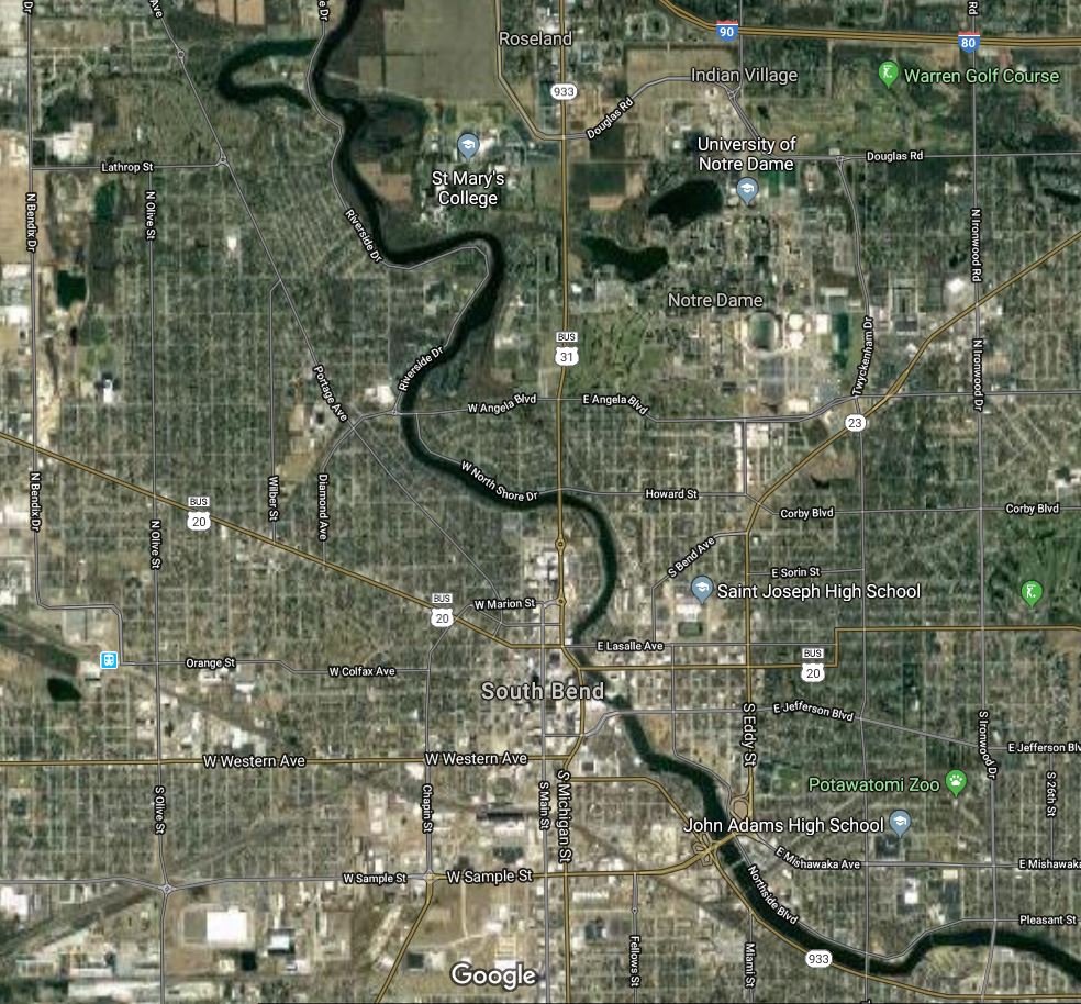
A map of South Bend and the Saint Joesph River

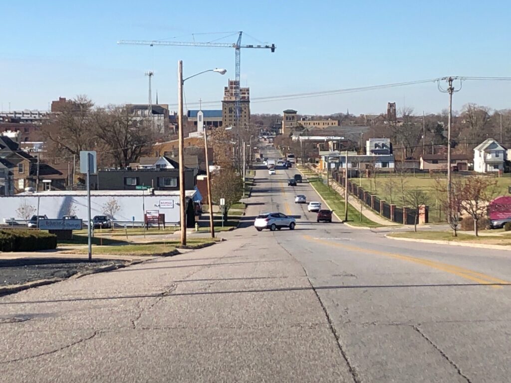
I was not able to spend my Thanksgiving break at home but I think that being away from home gives me a unique experience to reflect on it from a distance. Being away from home has really shown me what I appreciate about it and what I have come to think is important about it. South Bend, Indiana is the city that I call home, rests in a large basin that looks nothing more than a hill. However, this hill is evidence of the ecological history of the area. Around 10,000 years ago the Wisconsin ice sheet covered the landscape in which the city of South bend now sits today. As the glacier moved it carved out the basin leaving behind a massive river about 20 times larger than as it is today.

This river was called the Sakiwäsipi river by one of the indigenous tribes of the area, the Miami people. These peoples likely used it as a source for food and water as well as transportation along with the Pottawatomi another indigenous tribe. This land was populated by elk and white-tailed deer and by native tree species such as maple, ash, oak, elm, walnut, and beech. Then when French settlers came to the area the french called La Rivière des Miamis (The river of the Miami by the French). Thes settlers in the area used the river for transportation trade good to Lake Michigan, especially for power for sawmills and to transport timber from logging. These settlers like the native peoples saw the river as a source for their livelihood. However, as we have studied thoroughly throughout the class they lacked a sustainable attitude towards the river and deforestation shaped the landscape and the future use of the river into what it is today. I have gone into detail about this land history not only because I already knew quite a lot due to my own past research on the topic but also because by analyzing the historic land use it can give some insight on why now the river is not as healthy as it might have been.

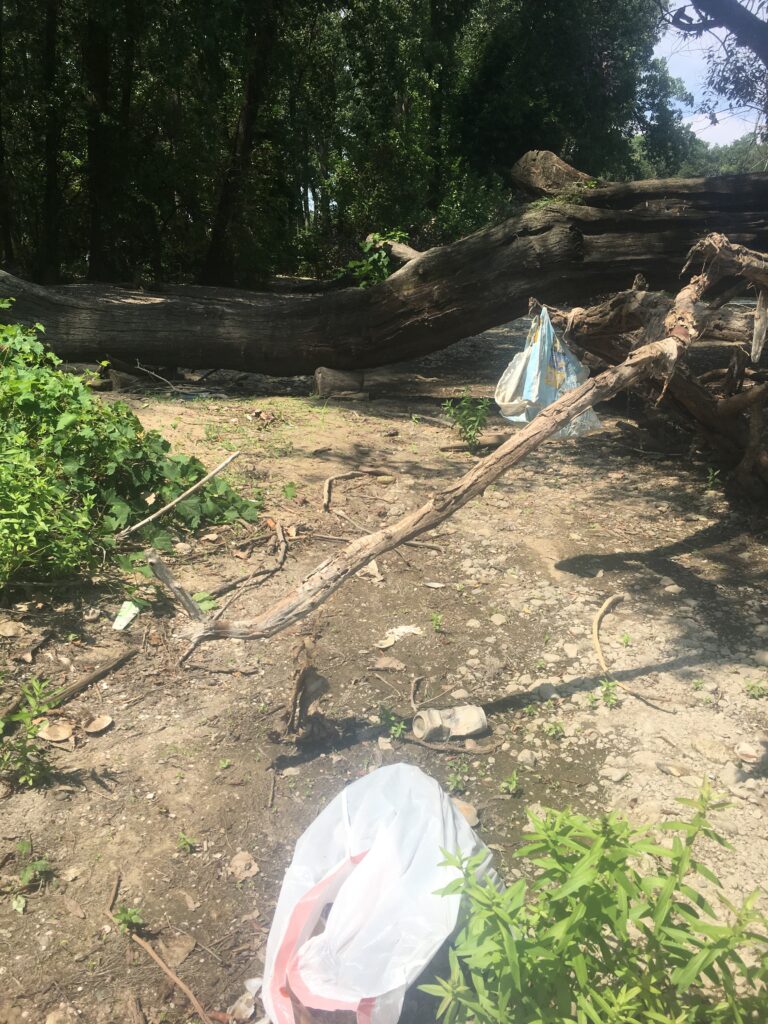
An image of the river bed after a period of time without rain

In the present-day, the Saint Joseph River is not the most healthy, I know because I was born at a hospital an out a block away from the river and lived for 18 years in a house even closer to it. I also found after doing some water quality tests for another project. This is likely because the residents subconsciously still hold the settler’s view of the river. Simply as a resource to be used at humans disposal. I like to believe that I don’t share that view because growing up I spent several hours each day by the river, first in a stroller on walks with my parents, then playing in a river park with friends, then search it out as a spot for respite from schoolwork or stress. I came to create an association between these positive experiences and the Saint Joseph River. Due to this, a core part of my sense of place is being close to bodies of water and attempting to be in dialogue with the area. I feel at home when I am able to access a body of water. That is why when coming to UVM I have been so engaged in the labs relating to gaining information on Lake Champlain the more I can be around this body of water and the more I know about it, the more at place I feel here. Also, the more I learned about Champlain in my Natural Resource class the more parallels I found to my own home and the Saint Joseph river which also connected to my sense of place. By looking at the history of a landscape and breaking it down into its foundations, one can find that there are so many similarities With this mindset, I believe that I can find a home anywhere, which going forward in life will help support my well being as I enter new places.

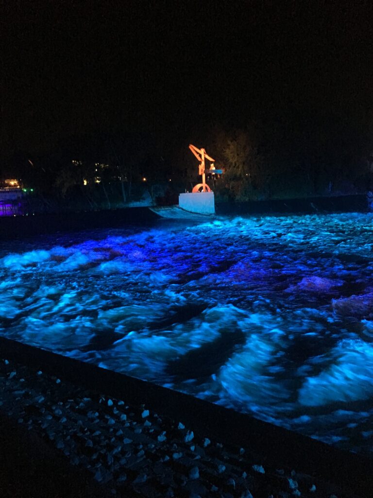
An image of the Firekeeper’s sculpture lit by the river lights on the Saint Joseph River.

Research Cited:
DeGraves, A. (2005). st. joseph river watershed management plan. Retrieved 5 December 2019, from https://www.in.gov/idem/nps/files/wmp_stjoeriver-lakemich_01-399.pdf
Wilson, J. (2008). How the Ice Age Shaped Indiana. Retrieved 5 December 2019, from https://www.csu.edu/cerc/researchreports/documents/HowtheIceAgeShapedIndiana.pdf

Phenology and Place

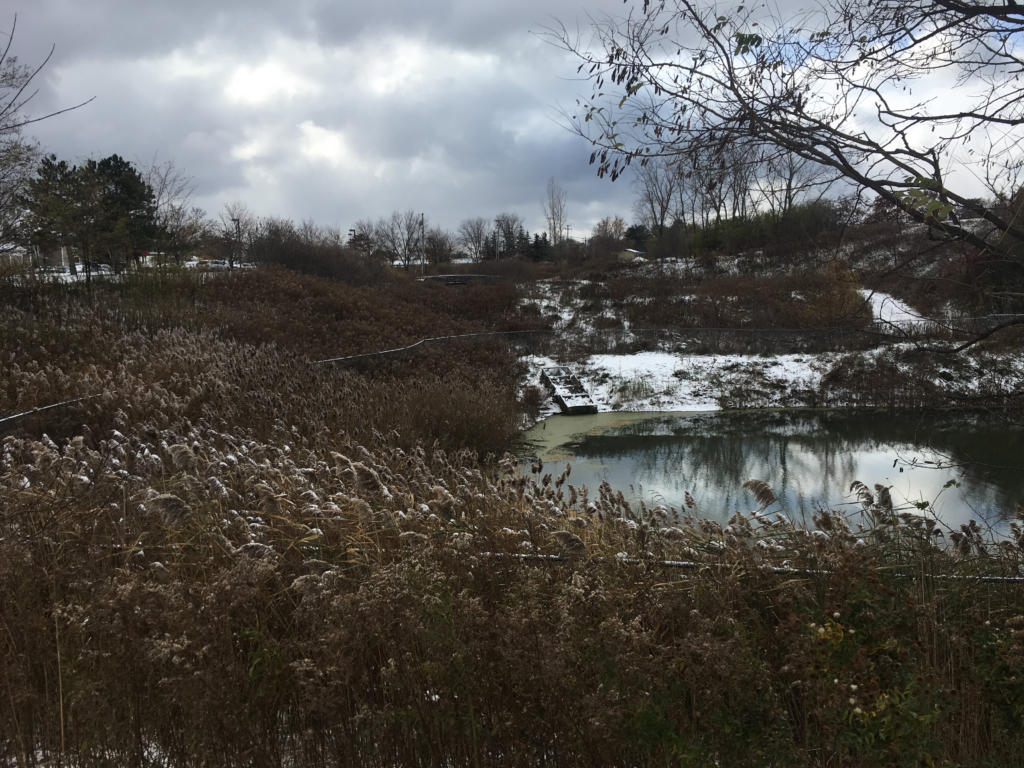
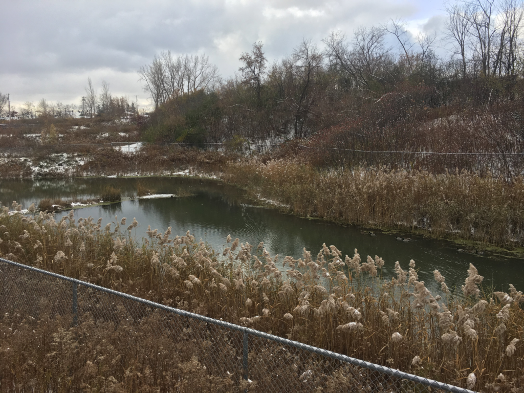
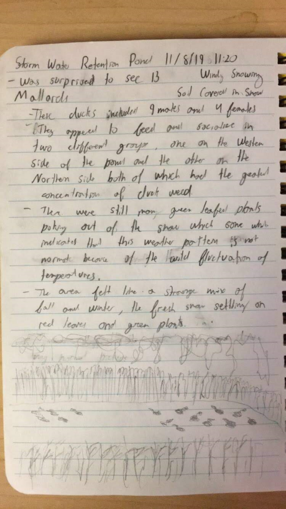
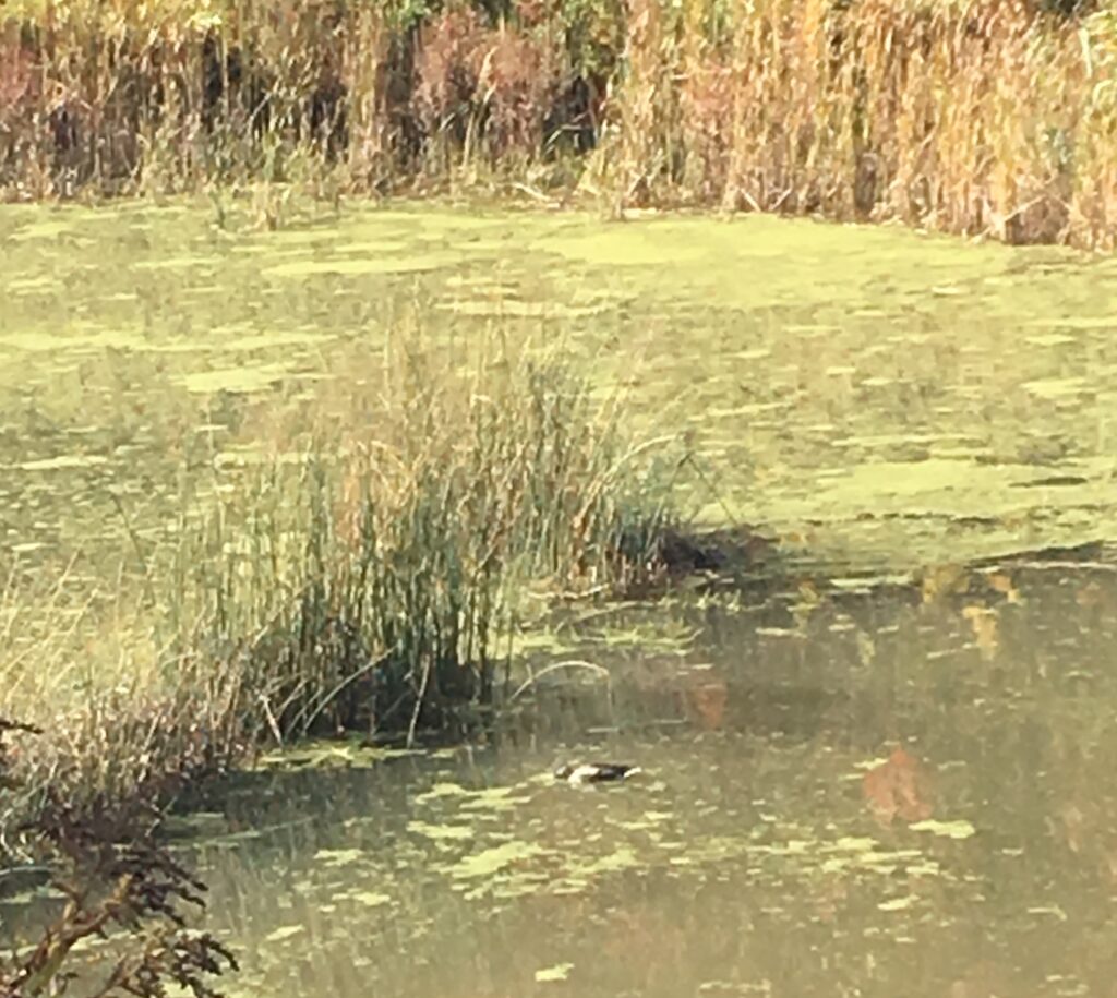
Upon my more recent visit to my phenology area, I observed a dramatic transformation. Within a day the area went form the bright colors and green banks of fall to a snow-covered scene. It must have been even more of a shock to the green plants that were on the ground then to myself.  The area that was so vibrant and lively with birdlife that the change to a white and snowy landscape changed my perspective of the area. I was even surprised to see thirteen mallard ducks floating along the pond. The snow-covered landscape looked so different from its first appearance in early fall that I was reminded that this site likely experienced dramatic historic changes. It likely didn’t even exist even a couple of decades ago. I assume that this site was man-made but I was unable to find any information on the previous site if in case it was at one point a pond or wetland. Looking at the slant of the landscape I imagine that water would naturally flow through the area either leading to a pond or would later feed into the nearby Centennial brook.

A Winter Scene

Although it may be strange to have chosen a site for phenology that is essentially unnatural due to its a human construction. As I mentioned in a previous post, part of why I was so attracted to this area because it is an attempt for humans to have a healthy interaction with the environment. The space feels like nature is actively recalling the area which reminds me of my hometown, South Bend Indiana. South Bend is a small city surrounded by corn and soybean fields. There are very few untouched or natural spaces, however, there are countless spaces that are slowly being reclaimed by nature and you can see natural succession in action. I feel that since I was brought spaces like this I naturally gravitate to them.

The Mallards Referenced Can Be Seen Here

Spaces like these are either examples of how humans and the environment can coexist or how they can fail to coexist. As time progresses, we would hope that so too would our positive relationship with the environment. The stormwater retention pond is a clear example at an attempt to do so and thinking of the greater Burlington and the issue of algal blooms, systems like the pond are essential for managing nutrient runoff. 

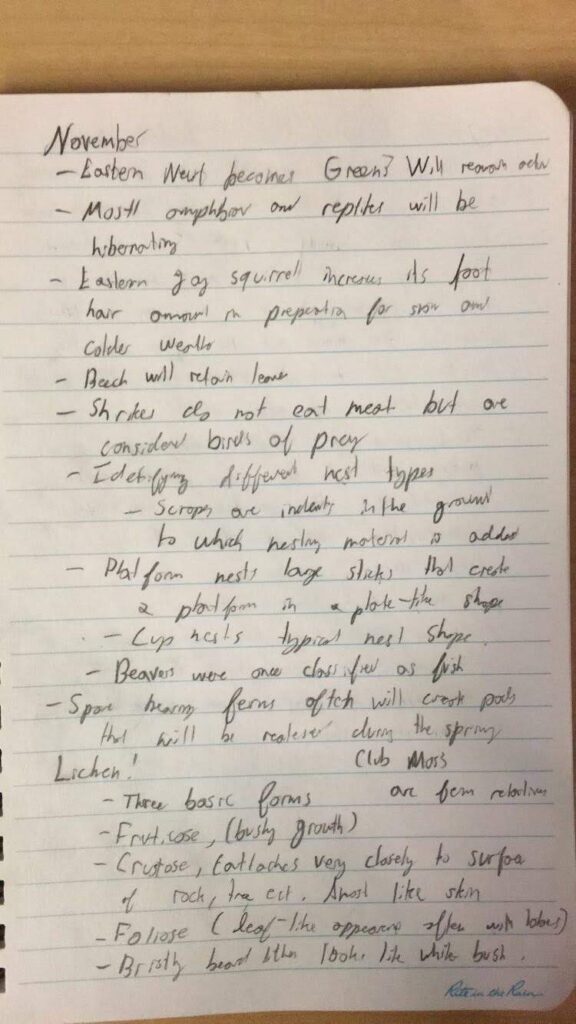
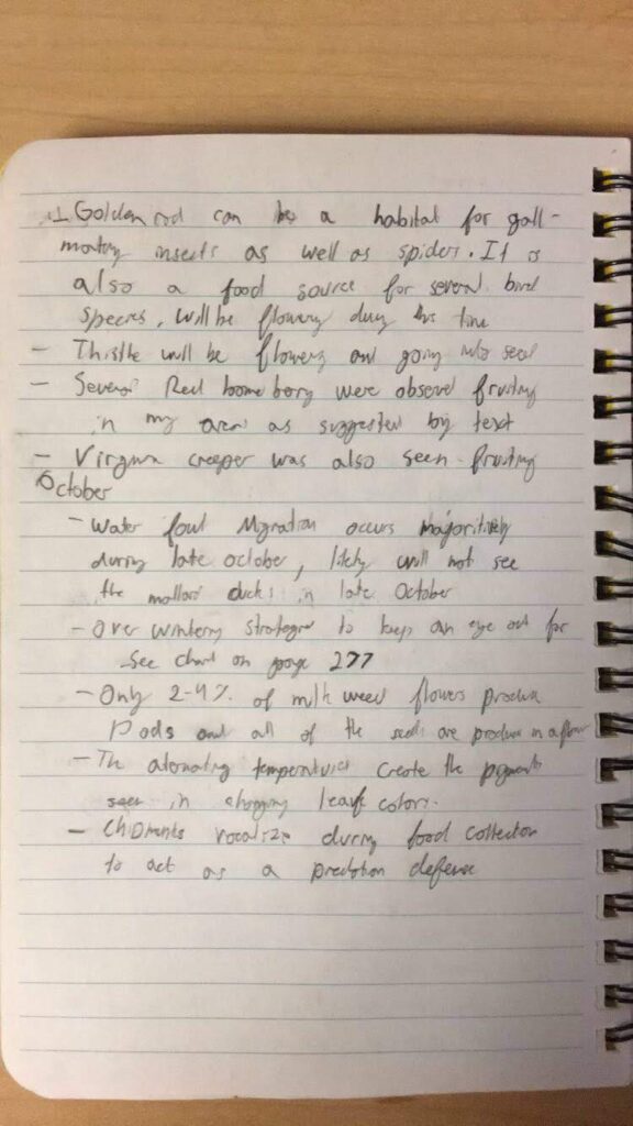
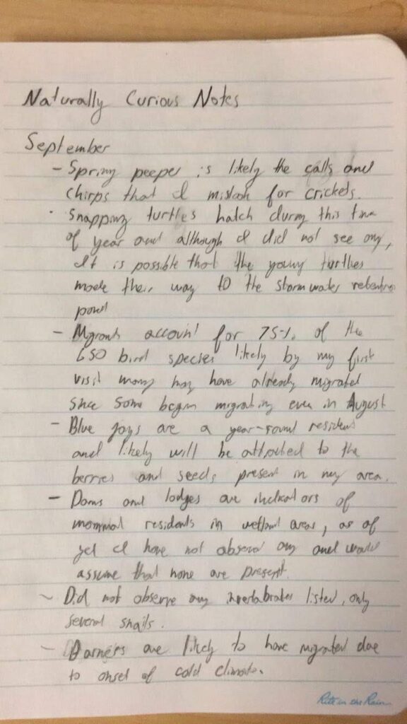
My Notes For This Phenology Visit

Above can be seen several pages of notes from the book Naturally Curious on the fall seasons

Mapping and Charismatic Species

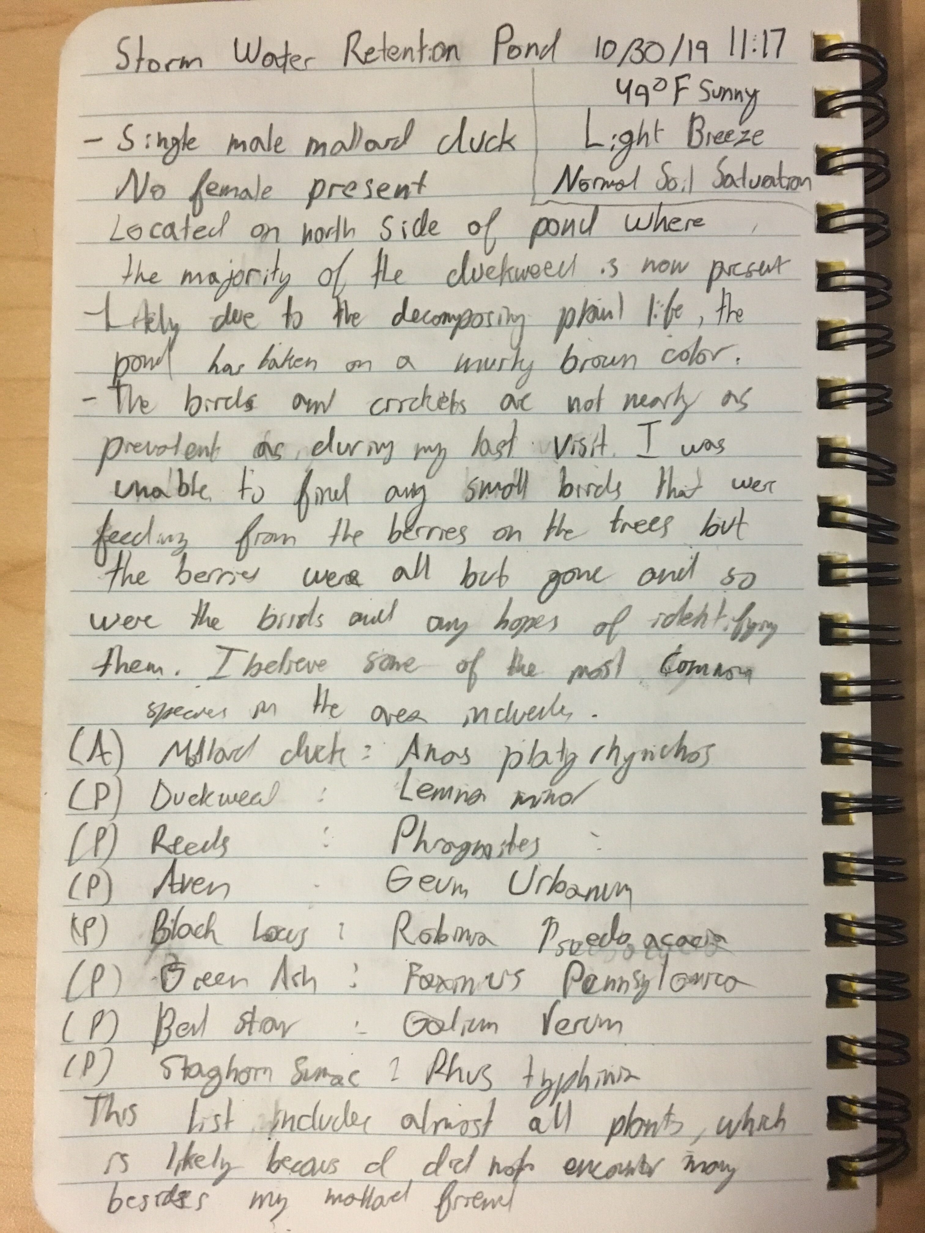
The fall season is in full swing and the muffled chirping of crickets and birds remind me that the wild and plant life that I have come accustomed to won’t be present as winter approaches. I tried to pay closer attention to some of the common species of this site. My mallard duck companion, species name Anas platyrhynchos, appeared to be alone today, his female companion was absent. He spent most of the time in the northern end of the pond, again feeding on the duckweed, species name Lemna minor, which appeared sporadically on the edges of the pond except in the northern end where the mallard duck was feeding. The amount of duckweed has greatly decreased from covering about 10% of the pond to about 5%.

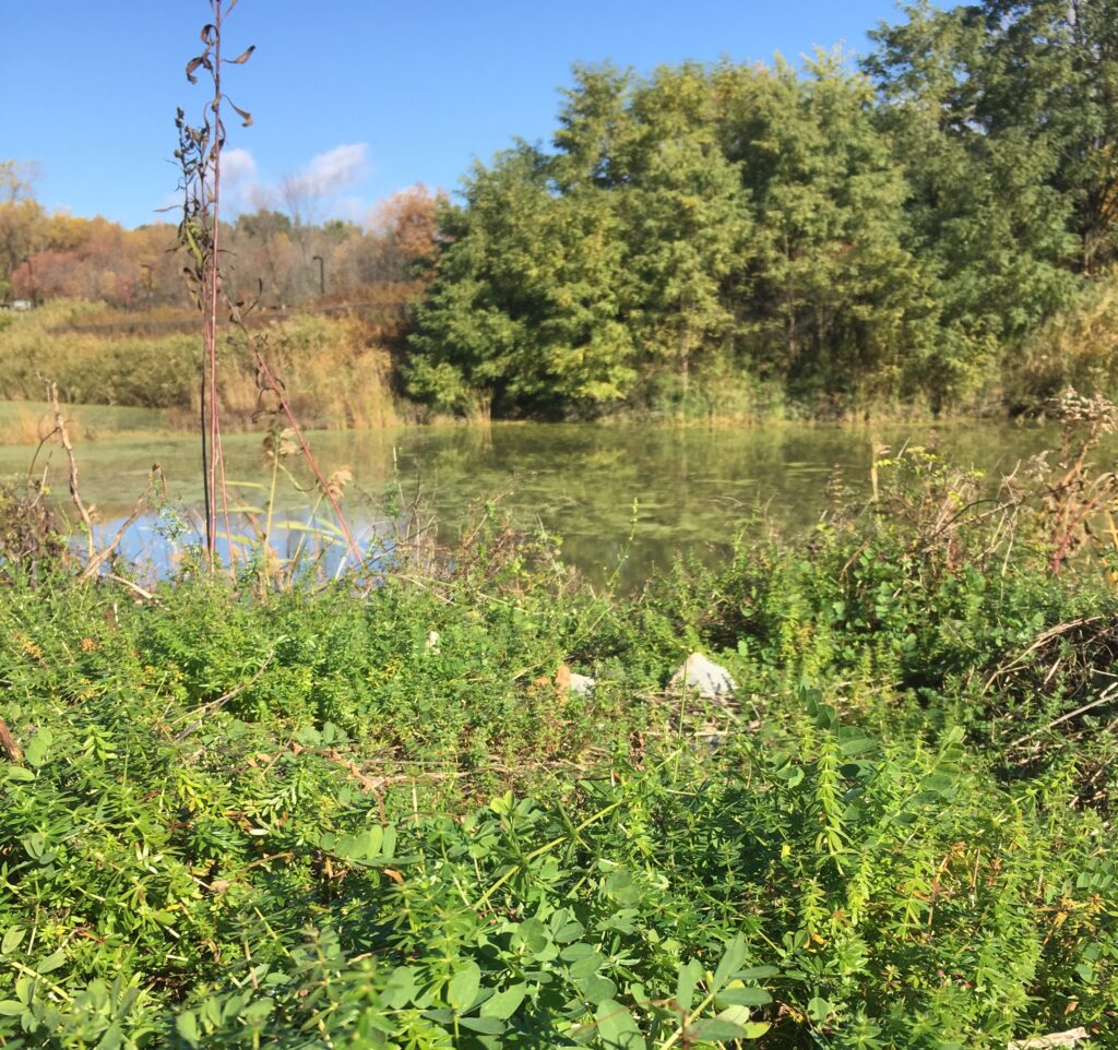
This image is from a few weeks ago and is also low quality but presents the relationship between the duck and the duckweed

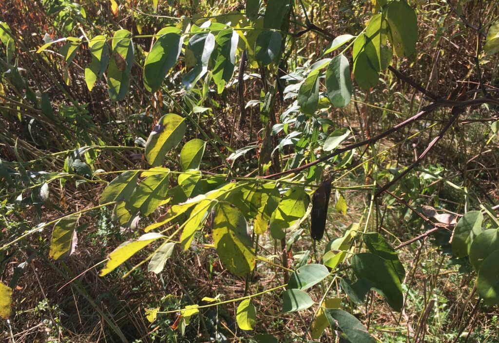
As for the bank of the pond, the area nearest to the water is populated mainly by reeds, scientific name phragmites (due to their smaller seed structures and size I believe that they are native as opposed to invasive), these make it almost impossible to reach the water along with a fence. Above this layer of reeds, a strip of rocks covers the bank to prevent erosion which makes it difficult for plant cover, however, it appears that some brave avens navigate the rocky shore, it is difficult to tell which species of aven they are without flowers but I assume that it is Geum urbanum. These aven lay at the roots of a tree that I could easily identify as a black locus, scientific name Robinia pseudoacacia after getting caught on the large thorns attempting to get a closer view of the herbaceous plants on the bank. The other prominent tree of the easter bank is green ash, species name Fraxinus pennsylvanica, which were about equally frequent as the black locus.

Geum urbanum (Aven)
Robinia pseudoacacia (Black Locus)

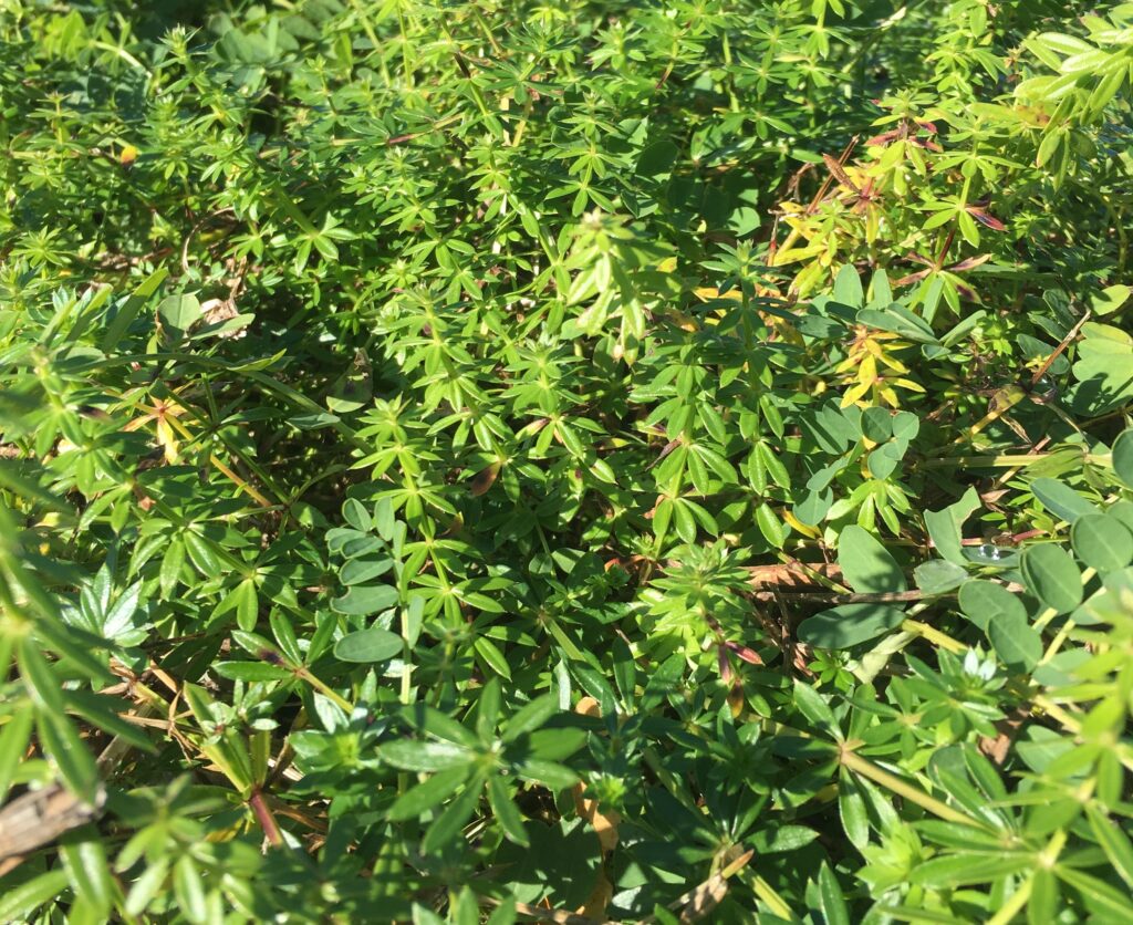
On this visit to the site, I decided to take an excursion to the south-west side of the pond where there is an access path with no tree cover which has allowed for bedstraw, species name Galium verum, to cover the path to the stormwater drain.

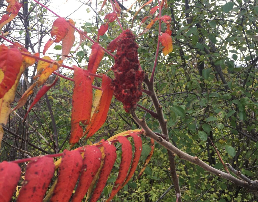
The northern bank is covered in staghorn sumac, species name, Rhus typhinia, which are beginning to lose its leaves leaving its red berries. All of the foilage has either turned to vibrant yellows, oranges, and reds or fallen from the trees and although I will miss the wild and plant life I am excited to see how the area transforms going into the winter months. 

Another top-quality photo, this time of Rhus Typhinia (Staghorn Sumac)
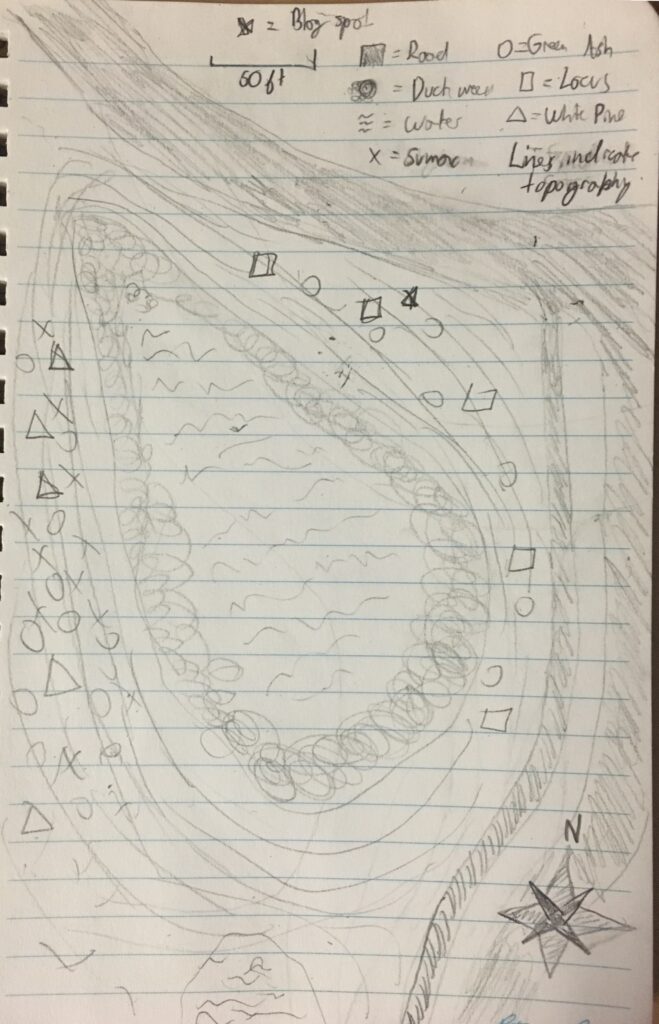
This map was drawn from memory and until I began to try to incorporate topographical lines that I realized how much the slanted land in the area impacted the land. It appears when the rainwater retention pond was of course built with the capture of as much runoff in mind and the location reflects this.

Thank you for reading and I hoped you enjoyed.

Introduction To The Site

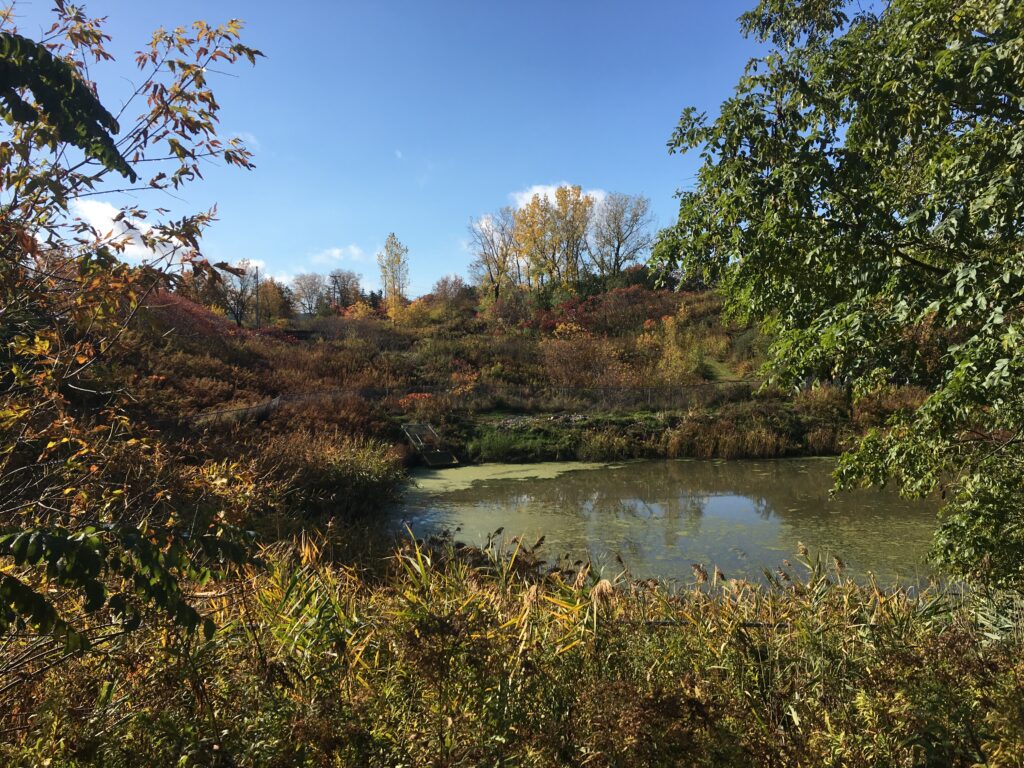
A short bike ride from Harris Millis, across a busy street and down a road just past the entrance to Cenntenial Woods. Lies an area that is pleasantly serene, a stormwater retention pond. A man-made pond may seem like a strange place for a phenology observational location, but that very aspect I find to be the most important about the location.

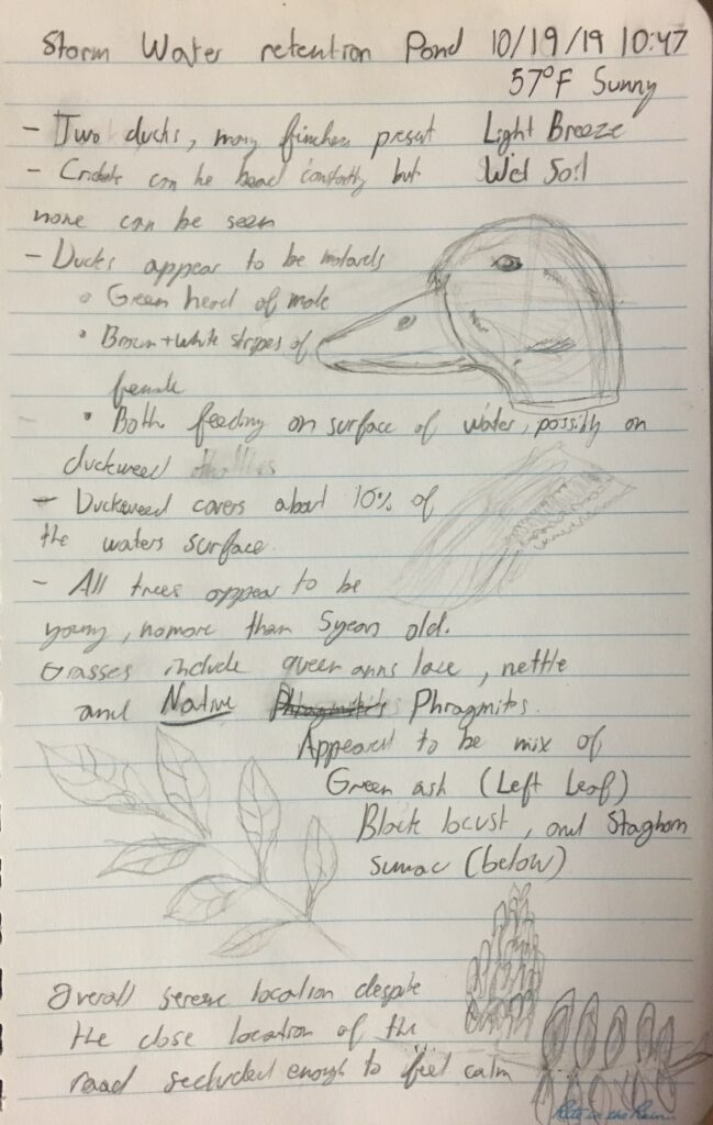
I initially wanted to choose a location in Centennial woods but when I came across the pond I decided it was a far more representative of the area. It is a functioning system to reduce human impact on the environment that has become almost a small haven for wildlife. Despite it’s vicinity to busy I-89, the prevalent chirping of finches and crickets made it easy to forget about the hustle and bustle going on nearby.

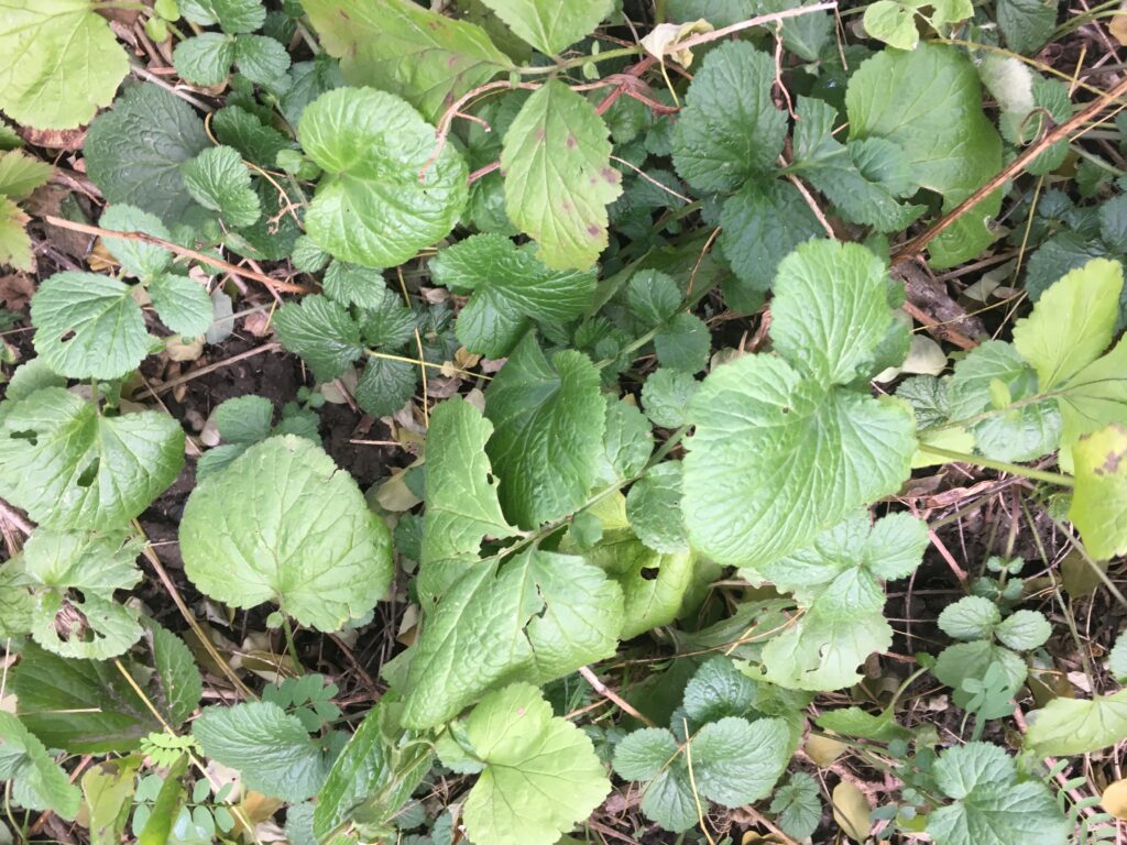
There is little evidence of erosion, no doubt due to groundcover like this

After identifying several trees and plants in the area it appears that there is about a fifty-fifty ratio of native to non-native species in the area. Since the area must have been cleared a number of years ago to build the pond, I was somewhat surprised that there were any native species since non-native species generally can generally outcompete native species as an area begins to be reclaimed by plants. Regardless of the native or non-native nature of the plants in the area, there appears to be a plethora of berries, seeds, and duckweed for animal wildlife to sustain themselves on. Although there was no human traffic through the area I was joined on my first visit to the pond by a solitary male mallard duck. Upon my return, I found what I assume to be the same duck with a mallard female, bobbing away on the surface of the pond, eating the duckweed that is a prevalent feature along the bankside of the pond. Simply watching the ducks feed, I was able to lose track of time in that space. The only reason I didn’t spend several hours at the location was a reminder for my next class, If there was only a nice bench overlooking the pond it would be the perfect location to spend a wonderful Vermont fall afternoon.