Posts

City Nature Challenge 2021

I had a lot going on this past weekend, but I fortunately was able to make it out to Centennial Woods on Sunday. I spent three hours exploring the woods, taking photos of different plant, animal, and even a fungi species. I always love making the trek over to Centennial, and it’s amazing that the woods are right next to campus! It’s the perfect spot to head to and destress when you’ve had a tough day. As I near the completion of my first year at UVM, I already feel such a deep connection to these woods. They are not my phenology spot so I did not spend as much time in these woods as I believe I should have, but even just these three hours I spent in them on Sunday connected me to them so much more because I was identifying the different species that inhabit these woods.

I identified many tree species during my trip, as I remembered a lot of the species we ID’ed during our first NR1 lab (the self-guided tour of Centennial Woods). I unfortunately did not realize the pictures taken on the iNaturalist app would not automatically save to my camera roll, but here is a link to my observation of Eastern white pine looking particularly grand: https://www.inaturalist.org/observations/76682996.

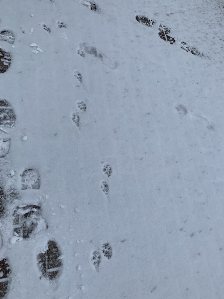
Among plant species, I also identified a few animal species. It was more difficult to get clear pictures of the animals, as they have evolved to blend perfectly into their environment so even when you zoom in on your phone’s camera, they simply appear to be part of the vegetation. There were three animals that I was lucky enough to get good enough photos to post. The birds were particularly difficult to take photos of. I did manage to snatch a photo of a black-capped chickadee. This was really difficult because she kept flying from branch to branch, making her fast, twitching movements as she did so. Here is my observation of the black-capped chickadee: https://www.inaturalist.org/observations/76690432.

The other bird that I interacted with involved my favorite moment of my observations. While making our way out fo Centennial, my friend and I noticed a mallard duck on the water near the beaver dam. Another person was also there enjoying the nature. He seemed like he frequents Centennial as when the mallard flew in, he commented, “First mallards of the season!” After I made my observation of the male mallard, a female flew in, and he again remarked, “Second mallard of the season!” It was clear these two ducks were a couple. I enjoyed this moment a lot because there is nothing like the beauty of nature to bring people together. Of course, I was connected to thousands, maybe even millions, of people via the city nature challenge, but having those interactions in person is really something else.

Figure 1: Male Mallard in Centennial Woods

Another favorite moment of mine in Centennial was seeing some mushrooms growing out of a fallen tree. Seeing this fascinated me because it displayed how nature repurposes dead trees. I also just love seeing any sort of fungi, as I know they are not quite animals nor plants, but they are closer to being animals than plants. I would love to expand my knowledge about fungi far enough to be able to identify them myself, but I am not quite there yet so I used the ID that iNaturalist gave, which was pinewood gingertail.

Figure 2: Pinewood Gingertail Growing out of a Fallen Tree Trunk in Centennial Woods

As far as other reports coming from other areas, I thought it was really interesting that many of the towns in the lead were cities. I guess this isn’t as unexpected as I think because the event is called the City Nature Challenge, but I have always been under the impression that if you live in a city, you are less connected to nature. It has become obvious to me over the past semester that this assumption is inaccurate, because many people who live in cities do feel very connected to nature; this is displayed by the mass amounts of reports coming from cities like Hong Kong and Boston.

April at Rock Point

Spring is in full swing at Rock Point. The rebirth of life is evident through its ecology. Budding and sprouting plants can be seen everywhere.

Figure 1: Bright Green Leaves of a Shrub Juxtaposed Against Still-Dead Trees

Some plants have blossomed earlier than others, and this is evident in the above photo. I am not sure what species of plant this is, but they must have an earlier growing season than some other plants at Rock Point. The green leaves are vibrant against the grayish-brown of the plants that have yet to react to spring.

Figure 2: Fresh Buds

Figure 2 displays buds that probably popped up very recently before my visit. These buds may belong to a red maple because they are rounded, opposite, and dark red. The bark is also a dark reddish brown, matching the criteria for a red maple. Buds like these were common throughout Rock Point.

Figure 3: Freshly Exposed Leaves

Figure 3 shows a stage of budding soon after the stage displayed in Figure 2. The leaves are oval shaped with serrated edges, like the leaves of a paper birch. The bark is also grey like a paper birch’s would be. This is evidence that the weather recently has been optimal for trees to grow their buds and go even further for their buds to begin opening. You can tell how young these leaves are because the leaves still have some red from when they were buds; a mature paper birch will have green leaves.

With the rebirth of nature also comes an increase of people enjoying the outdoors. People enjoy the warm weather they have not experienced in months and bask in the fresh, warm air. Because of this, there were many more people walking along the trail at Rock Point than there have been in my previous visits this semester. I believe an increase in foot traffic is why I had trouble spotting wildlife at my phenology spot. In the past, I have noticed rabbits, squirrels, and chipmunks scurrying across the forest floor and climbing up trees. During this April visit, I did not notice any creatures in Rock Point at all. They may be intimidated by the increase in people coming to their homes. Despite this, there was evidence of wildlife via birds. Sea gulls and ducks were seen sitting on the water and flying across the lake.

Figure 4: Seagulls Bobbing on the Surface of Lake Champlain

Above are two seagulls sitting on Lake Champlain along North Beach, right next to Rock Point. While this is not necessarily in Rock Point, the lake is so close that the water birds of Lake Champlain interact with the ecology of Rock Point. Birds are a strong indication of spring being underway because when birds are here, it means the weather is warm enough for them to migrate back from their winter vacation somewhere warm. Song birds’ calls could be heard while in the woods, but I did not capture any photos of visible ones.

Figure 5: Species Interaction Diagram of Rock Point

Above is a species interaction diagram of a possible scenario from the wildlife found at Rock Point. I personally have never observed a white tailed deer or eastern screech owl in the woods of Rock Point, but I have seen deer tracks during the winter, and I spotted a screech owl in the Jericho Woods, so I am assuming they could be found at Rock Point as well. The red maple and paper birch are seen in competition because they are competing for the same resources to grow (sunlight, water, etc.). White tailed deer eat the leaves of woody plants, and for the purposes of this diagram, they are benefiting from the leaves from the paper birch. Squirrels (specifically when they are babies and small enough for an owl to pick up) and chipmunks are competing for acorns sources from red maples, and both of these rodents can be eaten by eastern screech owls, which are birds of prey.

Phenology of Early March in Burlington

Figure 1: Human Footprints in Snow

On the walk down from campus to the water front, I observed a lot of human footprint tracks. This makes sense because there are frequently people walking around campus. These tracks must have been made by someone taking a shortcut, because they weren’t on a path. It also appears that snow has partially filled in the tracks indicating that they were made a few days prior.

Figure 2: Ice Pattern on Sidewalk

Here is a patch of ice seen on the walk down to the waterfront. This ice likely formed from the freezing and thawing that occurred during the warm temperatures of this past weekend followed by the single digit temperatures from the following Tuesday. It does not appear to have snowed since the ice formed.

Figure 3: Dog Tracks Beside Human Tracks

As Figure 1 shows, human tracks were a frequent sighting. Human footprints were sometimes accompanied by dog prints. While these particular humans went on the walks that made these tracks, they brought their canine friends. When human tracks are seen with dog tracks, it makes me think that the person on that walk went for leisure, not to walk from point A to point B. These dog prints appear to have been made by a smaller dog.

Figure 4: Ice Patterns on Lake Champlain

Most winters the lake freezes over at least somewhat. As we enter March and leave February behind, the ice on the lake is beginning to melt, creating unique patterns. It is visible that the ice is mostly consolidated at the edges of the lake, likely because the middle of the lake is the last bit to freeze over and the first bit to thaw. This ice pattern is certainly an indication that spring is almost here!

Figure 5: Bird’s Nest in Tree Near Lake Champlain

Near the top of the tree there is what appears to simply be a spot in the photo. This is not just a mere spot, but a bird’s nest! As spring is underway, birds prepare to have their babies, so they make their nests in the late winter, early spring. This nest is just another indication that winter is ending and spring is around the corner!

First Spring Semester Visit to Rock Point

Phenological changes at Rock Point

The change from fall to winter is dramatic, especially in the New England area, and Rock Point is not immune to this change. Many trees and bushes that were once covered in colorful leaves are now bare, there is less animal activity, and snow covers the ground.

Figure 1: North Beach in February

Above is a photo of North Beach, which you have to walk across in order to get to Rock Point, covered in snow. A place that during the summer is a popular spot for sunbathing and swimming becomes almost unrecognizable during the winter months simply due to the snow. The snow makes it easy to forgot there’s sand on North Beach at all.

I noticed that due to the snow, Rock Point and North Beach look very similar during the winter. The biggest difference between the two is no longer North Beach beach-y vibes because those were stripped away with the falling snow, but now the lack of vegetation on North Beach is the most distinct difference. Below is a picture of the view from Rock Point. Because of the snow and Lake Champlain, you can see how similar North Beach and Rock Point look during the winter.

Figure 2: Outlook at Rock Point in February

When strolling around Rock Point during the fall months, one would commonly see different types of birds flying by to make their way south for the winter. Well, now all of the birds have gone south, and one sees no birds in the sky above Lake Champlain. While animal tracks in the snow were visible, there was noticeably less animal activity. During the fall, you could hear geese honking or chipmunks rustling in the leaves, but because the birds are gone and the snow muffles the sound of scurrying rodents, Rock Point becomes almost silent; it is extremely serene.

Animal Tracking in the Snow

While the auditory signs of animal activity are now lacking, there are other ways to tell there are still animals active during the winter at Rock Point. A simple way to do this is to take notice of the tracking in the snow.

Figure 3: Squirrel Tracks on the Walk to Rock Point
Figure 4: Animal Tracks at Rock Point

Above you can see two examples of animal tracks on the way to Rock Point. The first example (seen in Figure 3) was spotted at the camp site on the way to Rock Point. These trackings appear to be from a squirrel, because the tracks are wide, in a straight line, and lead up to a tree where they disappear, making it obvious that the animal climbed up the tree. The second example (seen in Figure 4) was spotted at Rock Point. These tracks are long and narrow, making me think of a rabbit’s foot. Unlike the previous tracks, these stay on the ground like a rabbit would.

Phenology Blog Citations

References

Berrizbeitia, I. (n.d.). Focal Places in Burlington. Retrieved from https://www.uvm.edu/place/burlingtongeographic/focalplaces/rockpoint.php

Burlington, Vermont Early 20th-century Postcard Views. (n.d.). Retrieved from http://www.uvm.edu/~hp206/2012/leckie/webfinal/hopkins.html

How to tell these evergreen plants apart? (n.d.). Retrieved from http://identifythatplant.com/how-to-tell-these-evergreen-plants-apart/

Pictures. Retrieved from

Julia Lindau

The History of Rock Point

Rock Point sits right above Lone Rock, making their history’s the same. This area is very nutrient rich because Vermont used to be near the equator about 4 million years ago. Because the sea by the equator at the time was shallow, many rocks that formed near this land was infused with calcium carbonate from the fossils of carbon-rich sea creatures. This created an abundance of Dunham Dolostone at Rock Point. The Champlain Thrust Fault provides a unique history for this place, making it a popular attraction in Burlington. This feature is so interesting because the younger shale sits below the older dolostone. This phenomenon is due to the collision of two land masses that are now Maine and New Hampshire colliding against Vermont. This created the Green Mountains and the intense heat and pressure of this event occasionally buckled the bedrock, causing slips and fractures that push one plate below the other (Burlington Geographic). The Champlain Thrust Fault is not the only place where this has occurred, but the Champlain Thrust Fault is unique in that the exact point of the two rock types involved in this event are exposed at eye-level; the entire fault spans 200 miles, from Canada to the Catskill Mountains.

Much of Rock Point is composed of sandy soil and sandy loams. This can be explained by Lake Vermont, a lake that used to cover much of Vermont and was far bigger than Lake Champlain. Lake Vermont was formed from the melting glacier that preceded the lake. Rivers from Lake Vermont eventually flowed with immense power, depositing sand and slits at their deltas. One of these deltas was located where Burlington sits today, which is why Rock Point has very sandy soil. The soil type seen at Rock Point makes it very well drained, which formed what we now see at most of Rock Point: Mesic Maple-Ash-Hickory-Oak Forest, a forest type uncommon to Vermont. It is similar to a Northern Hardwood Forest, but contains more species that are typically found in central and southern Appalachia.

Because Rock Point is located at the shore of Lake Champlain, historical human activity of this place was high. Archeologists categorized Rock Point as having “high prehistoric sensitivity” due to the Abenaki people using Rock Point for a variety of activities. There is evidence of this because multiple chert projectile points were discovered along North Beach, which is located south of Rock Point. Rock Point’s south side was cleared for logging, while the northern peninsula remained covered. The peninsula then remained covered with its native evergreen species which was mainly hemlock.

Bishop John Henry Hopkins purchased Rock Point and on it he built the Diocese of Vermont. The land transformed from Hopkin’s family farm to a center for Episcopal education and a home for future bishops. It is now owned by the Trustees of the Vermont Episcopal Institute. Unfortunately, the Institute burned down in 1979 and all that remains is a set of lone stairs on one of Rock Point’s trails.

Hopkins Hall, unlike the Institute, remains standing today under a different name, Rock Point School. Hopkins Hall was built to be an all girls school to accompany the all boys school already located on the Rock Point property. The school was originally opened in 1888, then had to close a little over a decade later due to financial difficulties. It reopened in 1913 only to close again for the same reason as before in 1929. This time, financial struggles were born out of a rising tuition that Vermonters could not afford. So when it reopened, the school had a new mission of helping destitute local girls. The school then became co-educational in 1972. Today, Rock Point School remains in operation for students who have not found educational success in traditional school settings for students in grades 9-12.

Please see “Phenology Spot Citations” for citations.

Shingletown Gap Visit 11/29/20

Link to Shingletown Gap on Google Maps: https://goo.gl/maps/nyLkdeGx8rdnEKV66

Shingletown Gap my favorite hiking spot in my hometown. I have a great sense of place to it, so much so I got my senior pictures taken there. I remember sitting in my dad’s backpack as he carried me up the mountain when I was a toddler, and even today, especially during a time of social distancing, my friends and I frequent the hike up Shingletown Trail.

Rock Point and Shingletown Gap vary more than they are similar in ecological landscape. At the beginning of the hike, a surplus of rhododendron. This is unsurprising because in PA, if there is a creek in the woods, there likely will be rhododendron as well.

Figure 1: Rhododendron Growing Next to the Creek at Shingletown Gap Trail

Pennsylvania’s state flower, the mountain laurel, is spotted at the upper part of the trail; I have yet to see this plant anywhere in Vermont, although I know they grow in most of the eastern United States. They appear very similar to rhododendron, but they can be differentiated primarily through their blooms. But because it is winter, these evergreen plants are not blooming. However, due to recent warm weather and high moisture, a little bloom can be seen on this rhododendron (Figure 2):

Figure 2: Buds on a Rhododendron

I know that this plant is a rhododendron because the buds are pink. Rhododendron have pink blooms, while mountain laurel have white. Higher up the mountain, where the mountain laurel were spotted, there were no buds observed. However, I could still tell that the plant was a mountain laurel from its leaves. Mountain laurel leaves are usually darker on the underside than the underside of a rhododendron leaf (identifythatplant.com).

A big similarity between the two forests is the fact that both are very young forests. The understory is much more grown than the overstory, and many trees are obviously very young. The evergreen presence in this forest is also greater than at Rock Point. I saw both eastern white pine and eastern hemlock. The descent is much steeper at Shingletown Gap with a creek that runs along side the entire trail. The trail itself is (ironically) rockier at Shingletown than at Rock Point as well, the reason of which I could not explain. The ascend of the hike does look over a valley, because State College is a valley, so maybe the rocks are from the separation of tectonic plates which formed the valley. The most stark difference between the two spots is the water that is present. Rock Point sits on the shores of Lake Champlain, giving it those sandy soils and phenology that comes from being next to a lake. There is water at Shingletown Gap, but only in the form of a stream. The soils are much darker and less sandy, but still very nutrient rich at Shingletown.

Figure 3: Overlook of Valley at the Summit of Shingletown Gap

The phenology of the two places seem more similar than the ecology. Squirrels and song birds live in both locations. The differences are shown by the presence (or lack thereof) of amphibians. I have yet to see any amphibians at Rock Point, but Shingletown Gap has many toads hopping around due to the presence of the creek. However, it is wintertime and these toads are hibernating so I did not see any during this particular hike. I would presume there are more larger mammals such as bear and deer in the woods at Shingletown as it is a more secluded location than Rock Point, and both of these animals are shy towards humans. In Pennsylvania, it’s hunting season. Shingletown Gap is located in a state forest, making it fair hunting ground. While we were making our way back down the trail close to the bottom, we noticed two men sitting silently wearing orange clothing. It would be safe to assume they were hunting, meaning there definitely are black bears and deers in Shingletown Gap. There are likely more bears than deer because deer tend to like flat planes and are less likely to enjoy the side of a mountain. Despite this, it would not be wrong to think there may be some deer in that forest.

There is one final big distinction between Shingletown Gap and Rock Point: a small black dog named Fiona! When we hiked Shingletown Gap for this assignment, we brought our dog Fiona, who loved to hike. If she had been with me in Burlington, maybe Shingletown Gap and Rock Point would have her in common, but for now, she’s only been spotted in Shingletown Gap.

Figure 4: Fiona at the Summit

Rock Point Visit 11/6/20

The shift into November marks the etching towards winter. The weather may not be reflecting this shift, but the plants of Rock Point know it’s that time of year. The sugar maple and buckthorn are all almost completely bare, while the coniferous trees retain their bright green needles, causing them to stand out in the landscape. Dead fallen leaves blanket the hiking trail, making it almost impossible to see ground beneath them. The rustling of the leaves creating as I was walking through make it difficult to hear anything else. Another indication of the seasonal change was a flock of geese flying in a V-shape southward (see figure 6 below); their honking was so enticing that my friend and I deciding to honk right back at them.

Because this visit was on a nice day (hopefully one of the last of its kind before the coming spring) there were more people wondering the woods than during the previous visit; their voices melded with the ecological sounds of Rock Point, as if they were part of the natural landscape.

Figure 1: A Squirrel Poking His Head Out of a Tree on the North Beach Campgrounds
Figure 2: Ducks Bobbing on the Surface of Lake Champlain
Figure 3: The Field in Rock Point’s Woods Shows Signs of Winter
Figure 4: Northern White Cedar Glistens its Green Needles in the Sunlight
Figure 5: A Bare Buckthorn
Figure 6: Flocks of Geese Migrating South
Figure 7: Event Map of Rock Point

Rock Point Third Visit 10/24

In recent weeks, the entire Vermont landscape has become more colorful. The leaves are changing as deciduous trees begin depleting their leaves of chlorophyl, turning them bright orange, red, and yellow shades, and shedding them in order to conserve energy during the cold, dry winter months. This phenomenon is dramatic at Rock Point. There was evidence of this change during the second visit as well; dead leaves scattered the path and some trees displayed hints of warm colors. Now, as we reach the end of October, the warm colors are far more vibrant and widespread. Pretty much every deciduous tree has begun changing their leave’s color and some even appear bare. The leaves crushed along the path are more than just dusty brown bits as fresh, vivid leaves lay create a new leaf layer. These leaves will soon become the same brown dust that lays below them.

During the previous visit, there was not much to note as far as wildlife goes. Some squirrels were spotted here and there, but I predict because Rock Point exists on a popular hiking trail with lots of foot traffic, it is not where the wildlife prefer to be. Nonetheless, a few squirrels were spotted scurrying around in search of a nut to burry or a spot to burry an already-acquired acorn. Some small song birds were also seen landing on trees, but it is likely there were more birds visible during the previous visit as many fly south to follow the warmth or simply become less active during the winter months. As a result, the distant chirping of birds has grown more faint.

Figure 1: Birdseye View of Rock Point

Skip to toolbar