Since my return to Salmon Hole in February, so much has occurred climate-wise. Only a few weeks ago, Burlington saw a few days in the fifty to sixty degree range. But it seems that we are returning to some nearly normal temperatures for March (just in time for spring break of course). Today it was cloudy and windy… again, and the temperature did not exceed thirty five degrees.
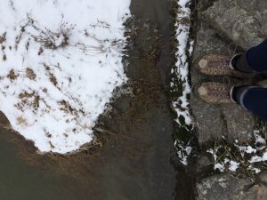
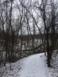
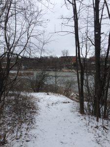
When I walked in, the wind was rattling in the trees, and the sound of the Winooski River drowned out the sounds of mid afternoon traffic and city life. It did snow last night, without much accumulation. I had hoped to find some tracks to identify, but it seems I was the only living being on foot at Salmon Hole today. On my last visit, there was enough snow for mice to burrow, although it may not have formed a total subnivean zone. Also the ground was frozen solid, and the river level was far lower than it was today. Due to the warm-ish weather, the ground was soft, but not quite muddy.
Snow, Earth, Moss and Rock (Palmer, 2017)
(Palmer, 2017)
The trees and shrubs surrounding Salmon Hole consist predominantly of hardwoods, mixed in age. There are no coniferous trees to be found, but a surplus of maple, oak and other small shrubs. Additionally the area has a lot of exposed bedrock, with otherwise sandy and muddy substrate due to the presence of the River. Based on the information in Wetland, Woodland, Wildland, I would classify this area somewhere between Northern Hardwood Forest and shares some characteristics of the boreal talus woodland, however those only occur at higher elevations. To be completely honest, none of the profiles from Wetland Woodland Wildland really fit Salmon Hole. That’s probably mainly to do with the Salmon Hole’s history. Referring back to my post “Nothing But Names on the Namaskik”, the damming of the Winooski in 1830 and the clearing of land during the age of the Burlington Woolen Company had serious impact on the stand’s composition. Although there is a variety of tree ages, it is evident in some areas that clearing occurred, where most of the trees are young. Additionally, Salmon hole floods in the spring, and I can’t imagine that this community could be classified as a forest when really it seems to be more similar to a wetland. However, I have little experience in this topic, so I’ll leave that up to the experts.
(Palmer, 2017)
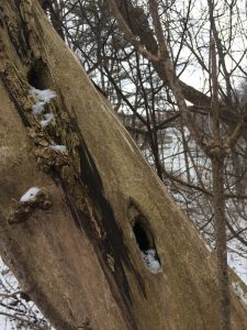
Along the water however, the diversity of ages is the highest. Snags are in abundance, and in exploring the age composition I noticed how many holes were drilled into the snags, probably from Woodpeckers in the area. During the fall, these patterns were not as noticeable due to the foliage, however with the leaves gone, it is interesting what new aspects of the community I notice.
(Palmer, 2017)
One of the first of my fellow beings I walked by, an old snag, had woodpecker holes clearly exposed. I realized that I have walked the same path a number of times now and this was the first time I noticed what now seems like a distinct mark of the community.
The information I gathered last semester in special collections, correlates to what I found on BioFinder. Salmon Hole was adversely affected by the damming of the Winooski, and pollution and clearing from the Burlington Wool Company. The affects of this industrialization are demonstrated on the second figure from BioFinder that shows in orange the rare animal species, in yellow the rare plant species, and the greenish color shows the uncommon natural communities (this piece of the map actually underlies the other two and is included in that area).
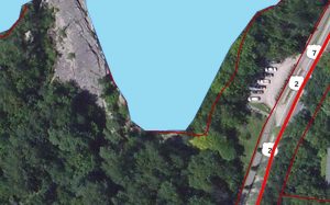
Figure 1. BioFinder (roads, waterbodies, land parcels)
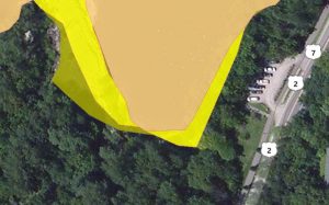
Figure 2. BioFinder (rare species – plant, rare species – animal, uncommon natural communities)
*Update: Since learning more about natural communities I would definitely say that my location at Salmon Hole is a floodplain, after learning about tree species and characteristics of such areas.