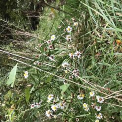
According to Wetlands, Woodlands, and Wildlands, a natural community is an interacting assemblage of organisms, their physical environment, and the natural processes that can affect them (Thompson, Sorenson). As my phenology spot is in centennial woods, the broad terms I would use to describe the natural communities are that it is a woodland with a mix of a wetland.
A woodland is a place where one can stroll through the woods seeing trees such as sugar maples, beech, and spruce. I specifically classify my spot as a Northern Hardwood Forest. The species in my spot that convinced me it was a woodland, however, are striped maple, beech, red maple, and birch. The soils are also well-drained, which is a characteristic of a Northern Hardwood Forest.
A wetland can be a dark forest with moss. Centennial woods fills that definition. This is because the wetland surrounding the stream that runs through the woods is home to gray squirrels, white-tailed deer, and amphibians. These species prefer wooded wetlands. In addition to this the soil surrounding the stream is always full of water; a characteristic of wetlands. It is usually wet when the surrounding woods are dry. The tracks of gray squirrel and white-tailed deer can be seen at the spot currently.
There is a rolling topography at Centennial Woods. This is characteristic of the Champlain Valley, the bioregion in Vermont that these woods reside in. The stream that cuts through a hardwood forest is a giveaway that this community is a mix of woodland and wetland.
With the large amount of precipitation, one can see the interaction between substrate and hydrology. The stream, though frozen, seemed to have risen, probably due to the precipitation running into the water from the surrounding soils. The melting snow also seemed to find its way into the stream, causing the water to increase.
I saw this once before in the early fall. After a heavy rainstorm the creek was flowing higher and heavier than in previous visits. The sides of the creek are hollowed out showing that the water can rise or fall. This leads me to believe that water from the woods flows into the creek during times of heavy precipitation. However, since there are below freezing temperatures out, the water rises below a frozen creek; so the ice on top indicates where the stream is flowing.
With winter in its full force, the stream transformed from a place where water flows to a place where it is frozen; a wetland with amphibians abound to a mystery hunt for tracks.
The trees lost their leaves, buckthorn grew its berries, and the animals are seldom seen now. The tracks of their visit are the only indicators that they were there.
By the time I return after spring break, I am hoping to see the creek unfreeze slightly.
References
Thompson, E. H., & Sorenson, E. R. (2005). Wetland, woodland, wildland: A guide to the natural communities of Vermont. Montpelier: Vermont Dept. of Fish and Wildlife and the Nature Conservancy.
