One last time at Oakledge Park

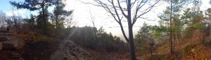
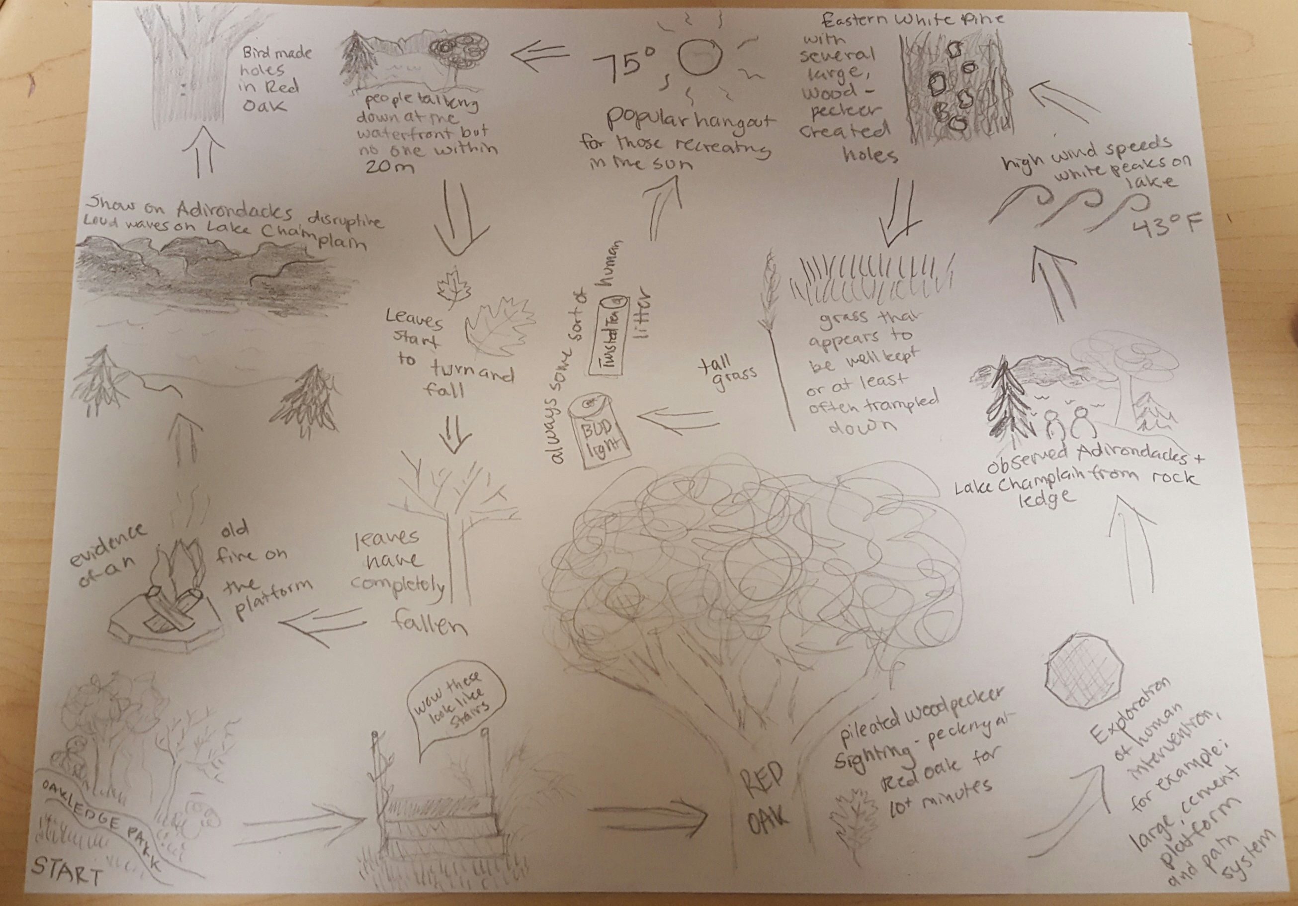
Today was my final visit to my spot at Oakledge park this school year. It was strange and a bit nostalgic, but overall a nice visit. It was approximately 64 degrees out, humid, and especially buggy. There were mosquitoes and small, black bugs everywhere. This, of course, was not ideal but I tried to make the best of it.

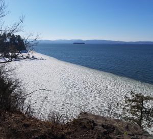
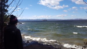
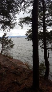
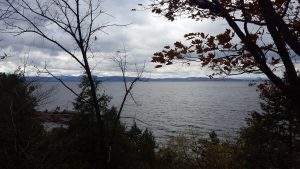
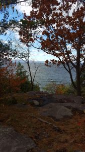
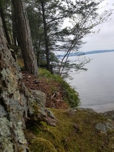
Lake Champlain was the most calm I have ever seen it. There were hardly any waves. I think this was because there was no wind.

(Hoag, Franni. Still Lake Champlain. 2017 JPG File.)

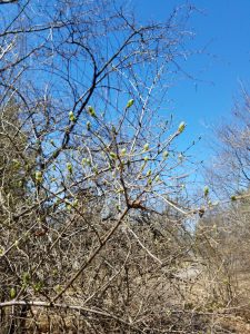
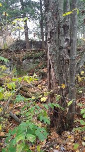
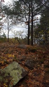
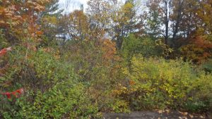
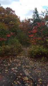
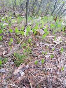
It was nice to see the grass have color on it and new plant growth peeking up through the undergrowth.

I can’t seem to figure out what these leaves popping up out of the brush are called, but they are quite pleasant and “springy” looking. (Hoag, Franni. Spring Greens. 2017 jpg File.)

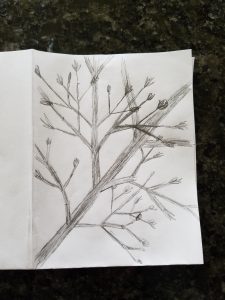
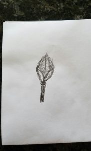
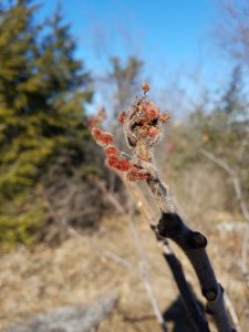
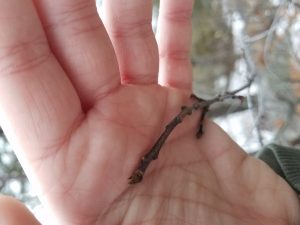
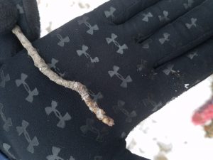
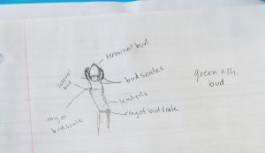
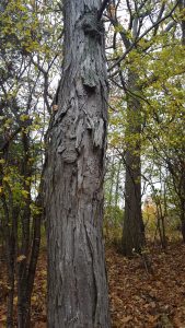
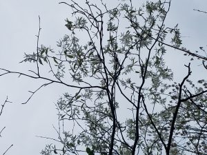
Several trees were flowering, which was beautiful. One in particular caught my attention, which I interpreted to be a Star Magnolia (Vermont Tree Selection Guide). The tree was not very tall, with thin branches and grayish bark. The flowers were white with long skinny petals.

Star Magnolia. (Hoag, Franni. Star Magnolia. 2017 JPG File). 

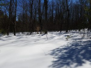
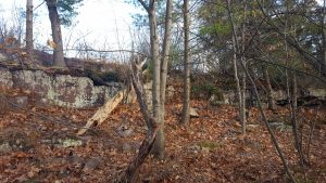
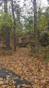
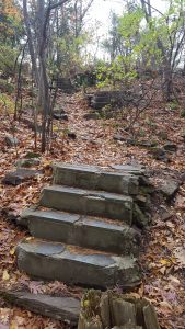
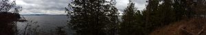
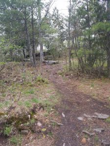
The trail leading to my spot is much greener than it has been since the fall, which was also a welcome sight.

Trail leading to spot. (Hoag, Franni. Trail. 2017 JPG File).

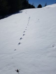
One cool thing that I observed from my spot today were Mallard ducks flying above Lake Champlain. They flew close to the water, and unfortunately I could not get a picture of them.

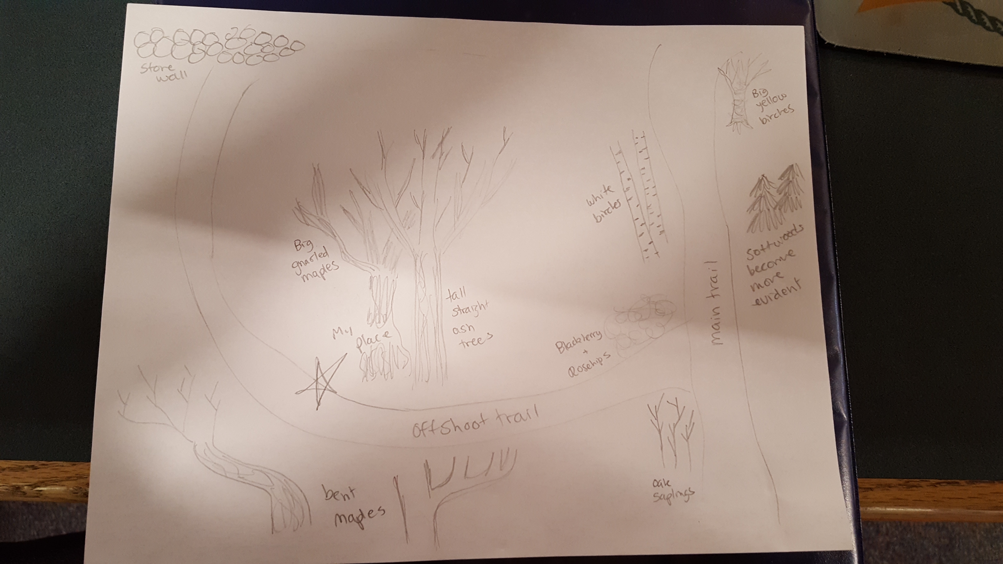
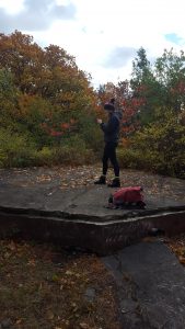
I think that my spot is a particularly good example of nature and culture intertwining, if you consider both the history and current use of the place. As I wrote in a separate blog post, my spot has been used for recreation for quite some time now, but has only been part of a public recreational park for a little while. Although my spot isn’t in the most visited park of Oakledge Park, people still come by and look out over the lake. People will come to sit, play music, or hang out with their friends at this space, all while the animals and plants go about their functions as well. I think that it is definitely a good thing that Oakledge Park was partially left undeveloped. This way, humans can have their space for their activities and animals also have their space to grow and live.

I, however, do not consider myself part of my physical spot. I may have an understanding of and relationship with my spot that not every average passer-by has, but I think saying that I am one with my space almost gives me ownership over this space, as I have ownership over my own body or material possessions. The land that my spot is on is public land, and therefore belongs to the public, and therefore anyone could potentially become “one” with my spot. Not to mention, my spot is in a natural place. I think that humans have a place in nature, as all living things do, but I think that being part of it still retains some sort of ownership that I do not think that I have or deserve. I think that I have respect for my spot and the land surrounding it, but I don’t think that I am a part of it.

Returning one last time to this place at Oakledge Park was certainly a good way to start to wrap up freshman year for me. I enjoyed watching the plants change as the seasons went by and spending time looking out over Lake Champlain in this mostly secluded area. This phenology project was very interesting, and I am excited to maybe return to this spot in my subsequent years at UVM.

“Vermont Tree Selection Guide.” (n.d.): n. pag. Vermont Department of Forests, Parks & Recreation. Vermont Urban & Community Forestry Program. Web. 4 May 2017. .

Spring at Oakledge Park

I think that its safe to say that spring has finally sprung in Burlington for the year. Friday, I visited my spot at Oakledge Park and was happy to see the first signs of the new season. I did not see any signs of wildflowers or new vegetation, except for maybe ferns. I did, however, notice that many of the trees and shrubs were starting to bud leaves. This was most exciting to me, because it means that soon enough, there will be leaves back on the trees. The shrub that I decided to draw had opposite branches and bright green buds that were approximately a centimeter long. The messy sketch of the branches was just meant to show how entangled the limbs of the shrub were, and the sketch of the bud was more detailed. The photo is what I decided to draw from, and my camera refused to focus so it is a little blurry.

(Hoag, Franni. Shrub Buds Sketch. 2017 JPG File).
(Hoag, Franni. Shrub Bud Sketch Detail. 2017 JPG File).
(Hoag, Franni. Shrub Buds. 2017 JPG File.)

The moss was also starting to turn a bright green color, and the land was beginning to dry out. There was also little-to-no ice left along Lake Champlain. I noticed several robins (through their calls and their orangey-red bellies), which is always a welcomed sight. I personally did not noticed any signs of amphibian life; I don’t think that my spot, which is located near a cliff is a good habitat for the animals. The most obvious sign of spring that I noticed was the plant life. Although no new flowers were blooming, it was very exciting to start to see speckles of green along the tips of tree branches. Buds are finally here!

Since Oakledge park is a long-developed (one of my previous posts discusses the history of the park) segment of land, there is hardly an interior forest at my place. The nearest edge to my spot is about 25-30 feet downhill, where the pathway and the grassy part of the park resides. I would say that for the most part, there are no interior species within my spot, because there isn’t much of a deep forest interior, and humans do frequent the surrounding area. I do think that my spot harbors a lot of small animal activity, because I often notice signs of birds (their calls and feces) and squirrels (literally seeing them) and rabbits (tracks in the winter). I think that my spot offers good habitat for animals living in and around the neighboring residential community where animals can have lesser interactions with humans. I don’t think that my spot would provide a good habitat for larger species, even if they thrive on edge habitats because the edge near my spot is quite narrow, and humans do regularly trek through it.

Phenology away from Burlington

This spring break I returned to my hometown and visited the same relative spot as I did first semester, in Eastern Vermont. Since this spot is in such close proximity to my home, I am going to refrain from posting a map. The spot is an organic sugar bush, which has been maintain for several decades. Quite a long time ago, it was pastures and farmland, according to the numerous stone fences.

I visited this spot after my region got a foot of snow. It was very sunny out with little wind. The woods were almost silent. I did not see signs of many birds, but it was prime animal tracking conditions.

Snowshoe Hare Tracks. (Hoag, Franni. Hare Tracks. 2017 JPG File).

The most remarkable set of tracks that I was able to observe were a set of snowshoe hare tracks, relatively fresh in the deep snow, headed north.

The first set of tracks that I came across were either coyote or fox tracks, heading east. They appeared quite clear and undisturbed, making me think that they were also relatively fresh.

Canine Tracks. (Hoag, Franni. Canine Tracks. 2017 JPG File).

Since this was a sugar bush, I made sure to make note of if the sap was flowing through the tubing. Unfortunately, on this day it wasn’t, because it was in the 30-degree range and therefore a little too cold. The woods were mostly silent, as I stated previously, little sign of birds. This is especially strange, because the sugarbush is usually home to a lot of bird life. The silence of the woods was incredible. I was hiking with my mom, and we both were amazed at the absence of noise. It wasn’t an anxious quiet, or a dormant one. It was just that we happened to be alone in a sugarbush, which was quite the experience. It would have been nice to see some of the creatures making the tracks that we observed, but seeing the tracks alone was pretty interesting.

One thing that I noticed was how the snow truly blanketed the forest. It is rare to see mostly intact snow cover an area. The animal tracks were really the only thing to disturb the snow.

(Hoag, Franni. Snow Blanket. 2017 JPG File).

Another thing I noted was that several trees had fallen down or were cut since I visited this area last. One particularly remarkable maple that I did not take a photo of was completely toppled over, roots and all. The tree was quite large, leading me to think that it must have been rather old. This is a rare sight, especially in a sugar bush. I have no speculation as to why the tree was in this state.

Natural Communities and the First Signs of Spring

This past Sunday I ventured to my spot at Oakledge Park. It was a very sunny, cold day with considerable wind gusts. There was little-to-no snow on the land and buds were starting to become evident on the trees. There were also quite a few birds all around my spot, my favorite of which being a fat female cardinal. I was not able to get her picture, but she was along the trail leading up to my spot, in a tree.

A beautiful sumac bud. (Hoag, Franni. Sumac Bud. 2017 JPG File).

There was a new, impressive, possibly man-made hole in one of the trees on my spot, which baffled me. I have never seen a bird make a hole this big. My best guess is that maybe a bird started the hole and it was then worsened by a human. It was a surprisingly aggressive new sight.

Large hole, odd amounts of missing bark. (Hoag, Franni. Aggressive Tree Hole. 2017 JPG File).

Another interesting thing that I noticed, although not part of my site, was the ice on the lake. There was a thin sheet that extended out from the shoreline that moved with the waves. I am wondering how this formed, if it was water that froze quickly and then had snow accumulate on top of it, or if it is some sort of receding ice melt. This was a really neat phenomenon to witness.

Thin ice layer on Lake Champlain. (Hoag, Franni. Ice Layer. 2017 JPG File).

After paging through Wetland, Woodland, Wild, I decided to classify the natural community of my place as an Upland Natural Community, specifically as an upland cliff. I am not entirely sure if it is a Temperate Acidic Cliff or a Temperate Calcareous Cliff, but I am leaning more towards the Calcareous option because they are more abundant in the Champlain Valley. There is also ample shrubbery, which is a key habitat aspect of the Calcareous cliff.

After plugging Oakledge Park into Biofinder, I learned that there is actually had quite a lot of rare plant species throughout the area. There also seems to be some high-priority animal crossings around the park’s edges. In my area specifically, both of these things seem to be existent. I would say that according to Biofinder, Oakledge is a very ecologically special place worth protecting. I had no idea that it had particularly rare or uncommon species present, and knowing this now makes me even more excited about my spot. It is funny how we go about our lives visiting areas with little-to-no information about the species that live there.

Wetland, Woodland, Wildland Source: http://www.vtfishandwildlife.com/common/pages/DisplayFile.aspx?itemId=245022

Return to Oakledge Park and My Spot

Sunday, February 5th marked the first time that I was able to visit my phenology spot and record information since the new semester started. I do not remember visiting my site with this much snow on the ground before, so I was excited to check it out with an inch or two of solid snow. The underbrush and debris from the trees still poked out from the snow, so instead of having a blanket effect on the land, it was like a heavy dusting of flour or powdered sugar. One of the first things that I noticed about my spot was the excess of rabbit tracks. I would say that these rabbits were probably hopping around, looking for food. The tracks did not seem to be distressed. The hind feet on the tracks were about 3-3.5 inches long, which would lead me to believe that a cottontail hare created them.

Rabbit tracks, traveling north-south. (Hoag, Franni. Rabbit Tracks. 2017 JPG File).
Rabbit tracks, heading south-north. (Hoag, Franni. Rabbit Tracks. 2017 JPG File).

One new and interesting bit of animal evidence that I noticed on this particular trip was a new birds nest. I found it in-between the boughs of a cedar tree, relatively low to the ground. I found this height to be very interesting because usually, bird’s nests are pretty high up in trees to ensure their safety. It was also quite a large nest. This speculation leads me to believe that this might not actually be a bird’s nest. However, if it isn’t a birds nest, I have no idea what it could be.

Possible bird’s nest. (Hoag, Franni. Bird’s Nest?. 2017 JPG File).

I did not notice too many different types of trees since I recorded them last semester. There is still the presence of white oaks, sugar maples, green ash, eastern white pine, eastern hemlock, and sumac. Most of the trees have visible buds, although many of the branches are too high for me to reach. The buds were mostly hard, small, and brown.

Possibly a sugar maple or ash bud. (Hoag, Franni. Tree Bud. 2017 JPG File).
I decided that this was some sort of ash bud. I have seen lots of these buds out on lab and also at my phenology site. I would like to be more sure of what it is. (Hoag, Franni. Tree Bug. 2017 JPG File).
Sketch I made of the green ash bud. I think that this is what I have been seeing everywhere. (Hoag, Franni. Sketch of Tree Bud. 2017 JPG File).

The History of My Place and One Last Look

Fullest image I could take of my place

Hoag, Franni. (Oakledge Park Spot) 2016 JPG File

Looking up at my spot from the path

Hoag, Franni. (Oakledge Park Spot) 2016 JPG File

Over the past weekend, I visited my phenology spot one last time before the University of Vermont closes for winter break. The leaves were entirely absent from the hardwood trees and the temperature had dropped substantially. There is no question that it is now winter and everything is getting ready to settle down for several months. The wind was atrocious and the air itself was hardly forgiving. I saw very little evidence of animal life. The Lake looked glassy and although the wind did create a substantial ripple on the surface of the water, there were no white peaks.

In researching Oakledge Park, I found that it became a park in 1999. The first person who owned the land was Albert Brinsmaid in 1793, a Burlington silversmith and jeweler (More than Meets the Eye). In 1850, Napoleon Proctor started a shipyard in South Cove (More than Meets the Eye). In 1883, William Seward Webb bought 245 acres and transformed Oakledge Park into something a little more familiar to what we see today (More than Meets the Eye). Eventually, the Webb Family then went on to establish and live at the famous Shelburne Farms. In 1926, Oakledge was purchased by several Burlington businessmen in hopes of developing it (More than Meets the Eye). In 1961 Oakledge was bought by people who worked for General Electric, and was turned into the Cliffside Country Club (More than Meets the Eye). In 1971, the city of Burlington purchased Oakledge in hopes of turning it into a park (More than Meets the Eye).

The Webbs built a house in 1883, where is now where the picnic stands at Oakledge Park (A Manor for All Seasons). Prior to being a picnic shelter, the house was adapted into part of the Oakledge Manor Resort, which operated from 1926 to 1961 (A Manor for All Seasons). After this, from 1961 through 1970, it was a clubhouse for the Cliffside Country Club (A Manor for All Seasons). In 1971 it was burned to the ground by the Burlington Fire Department in a training exercise (A Manor for All Seasons).

The Oakledge Manor Resort was created by Allen Beech, and could be considered the most notable piece of history about the park surrounding my place. It was a high class establishment, with fine dining, a driving range, horse-back riding, shuffleboard, and tennis (Fun and Games). The Manor has twenty rooms, accompanied by another nine rooms in the gatehouse, and fourteen cottages in the woods surrounding the park (The Lost Resort). Due to it’s relatively close proximity to where the old Manor, as well as being feet away from several chimneys in the woods, I believe that the concrete platform at my site used to be part of a foundation for one of the cottages at the Oakledge Manor Resort. I think that this is really interesting and I am glad that I finally got to the bottom of the strange, concrete platform.

As far as geological history goes, I found out that the park is essentially on top of Monkton Quartzite. The South Cove, where much of this rock is evident, was still a popular swimming place when Oakledge Park operated as a Resort, and one can still find remnants of the rich history that once took place there (History on the Rocks).

I am thankful that I was given the opportunity to go out and explore this spot over the past semester. I ended up becoming quite familiar with it and enjoying the day outings that I took there. I am excited to continue to learn more about it and I found the history of Oakledge Park quite interesting as well.

Sources (I think I found the signs that line the park online):

“A Manor for All Seasons.” (n.d.): n. pag. Lake Champlain Basin Program. Governor’s Institute of Vermont. Web. 10 Dec. 2016. .

“Fun and Games.” (n.d.): n. pag. Lake Champlain Basin Program. Governor’s Institute of Vermont. Web. 10 Dec. 2016. .

“History on the Rocks.” (n.d.): n. pag. Lake Champlain Basin Program. Governor’s Institute of Vermont. Web. 10 Dec. 2016. .

“More than Meets the Eye.” (n.d.): n. pag. Lake Champlain Basin Program. Governor’s Institute of Vermont. Web. 10 Dec. 2016. .

“The Lost Resort.” (n.d.): n. pag. Lake Champlain Basin Program. Governor’s Institute of Vermont. Web. 10 Dec. 2016. .

A Different Place: My Experience in a Different Place

Map I sketched of the Sugar Bush

Hoag, Franni. (Sugar Bush Sketch) 2016 JPG File

The place that I chose to explore this Thanksgiving Break is the sugar bush behind my house. The forest is maintained by my neighbor and it has been certified as an organic maple orchard. At one point, a section of this sugar bush was used as farmland, as made evident by the stone wall that runs along the lower edge of the property. The sugar bush is predominately (if not entirely) hardwoods in the eastern most point, but slowly transcends into a mix of soft and hardwoods, before turning into a predominately softwood, swampy area. The most common tree present is inarguably sugar maple, although ash is also scattered throughout. As more softwoods are present, more yellow and white birch are also seen. The softwoods present include hemlock, pine, and spruce. One specific spot that I particularly like was along a very faintly marked trail. Several of the trees were bent. This was in the predominately hardwood section of the forest.

Closer look at one of the significant "bent" trees
Closer look at one of the significant “bent” trees

Hoag, Franni. (Home Spot) 2016 JPG File

This is a much more remote location than my usual place in Burlington, at Oakledge Park. It’s also not quite as beautiful; there is no Lake Champlain to look out onto. I am, however; much more familiar with the place that I visited this break. I have been exploring this sugar bush since I was very young; my family uses the trees that have naturally fallen for firewood every year. I have a very strong connection to this place.

Ecologically, this place also differs greatly from my place in Burlington. There are several Red Oaks that frame my place in Oakledge Park; however, there are very few in the sugar bush. Most that I saw were saplings. My place at Oakledge Park is also much more diverse in the sense of plant species present. I would say that there is not really a dominant species in my place at Oakledge; however, Sugar Maple, unsurprisingly, is the most prevalent species in the Sugar bush. The elevation of the sugar bush is also much higher, at approximately 1130 feet (according to my phone’s barometer) at it’s highest point. My town borders the Connecticut River Valley, but the sugar bush is in the hills leading westward from the river, attributing to our high elevation.

A Different Place: Pictures of the Place I visited over Break

Big, gnarly sugar maple we found walking.

Hoag, Franni. (Home Spot) 2016 JPG File

An ash that some bird(s) has their way with
An ash that some bird(s) had their way with

Hoag, Franni. (Home Spot) 2016 JPG File

Appears to have fallen off naturally, although my neighbor (who manages the forest) seems to have started to split the fallen log for firewood

Hoag, Franni. (Home Spot) 2016 JPG File

Closer look at splitting tree

Stonewall running at edge of forest

Hoag, Franni. (Home Spot) 2016 JPG File

Unidentified, somehow still-green leaf

Hoag, Franni. (Home Spot) 2016 JPG File

Closer look at one of the significant "bent" trees
Closer look at one of the significant “bent” trees

Hoag, Franni. (Home Spot) 2016 JPG File


View looking down into the sugarbush

Hoag, Franni. (Home Spot) 2016 JPG File

Event Map, More Changes, More Photos

This week’s phenology assignment revolved around the creation of an event map. Prior to reading Hannah Hinchman’s “The World As Events” I had never heard about an Event map. An Event Map is essentially a map of one’s personal experience in a place; a way to record things natural and unnatural that occur in a place of observation (or at least that is what I interpreted it to be). I tried my best to recreate an Event Map in reference to my place in Oakledge Park.

My Event Map
My Event Map

Hoag, Franni. (Oakledge Park Spot) 2016 JPG File

I sort of drew events and occurrences chronologically as I visited my place. I began the map (assuming that Event Maps are allowed to have a definite beginning) of when I first found my place, which was walking along the bike path at Oakledge Park and noticing the offshoot trail, which in real life, looks like this:

20161106_121453

Hoag, Franni. (Oakledge Park Spot) 2016 JPG File

This then led me to travel up the path, to a set of steps (below), which I also photographed the most recent time I visited Oakledge park. From this point in my map I listed many notable occurrences and observations.

20161106_120225

Hoag, Franni. (Oakledge Park Spot) 2016 JPG File

Here are some pictures of the things that I recorded on my Event Map:

Small holes in Red Oak tree. I assume that they are from a woodpecker because I have seen woodpeckers peck at this tree multiple times.

Hoag, Franni. (Oakledge Park Spot) 2016 JPG File

Very large woodpecker holes in (if I remember correctly) a pine, several feet downhill from my place.

Hoag, Franni. (Oakledge Park Spot) 2016 JPG File

Up-close image of woodpecker hole, dripping sap/pitch also visble
Up-close image of woodpecker hole, dripping sap/pitch also visible.

Hoag, Franni. (Oakledge Park Spot) 2016 JPG File

White, foamy, caps on waves on Lake Champlain, high wind speeds that day. Sunny, clear, cold outside. Down the hill from my place.

Hoag, Franni. (Oakledge Park Spot) 2016 JPG File

Evidence of fire on concrete platform.

Hoag, Franni. (Oakledge Park Spot) 2016 JPG File

Below are some new pictures that I took this past Sunday, some relevant to my map but many just of the scenery visible from the concrete platform as well as the exposed rock ledge.

Panorama of the view taken from several feet below the exposed rock ledge and concrete platform.
Panorama of the view taken from several feet below the exposed rock ledge and concrete platform. One of the pathways is visible.

Hoag, Franni. (Oakledge Park Spot) 2016 JPG File

Image of my place from the trail leading up to my place.

Hoag, Franni. (Oakledge Park Spot) 2016 JPG File

Unidentified tree, the bark appears to be that of a shagbark hickory, but I am not entirely certain that this tree is a shagbark hickory because the range of said tree doesn't necessarily extend into northern Vermont.
Unidentified tree, the bark appears to be that of a shagbark hickory.

Hoag, Franni. (Oakledge Park Spot) 2016 JPG File

View looking towards the platform from the rock ledge.

Hoag, Franni. (Oakledge Park Spot) 2016 JPG File

View of Lake Champlain, little ways downhill from my place.
View of Lake Champlain, a little ways downhill from my place.

Hoag, Franni. (Oakledge Park Spot) 2016 JPG File

View of Lake Champlain from rock ledge at my place.

Hoag, Franni. (Oakledge Park Spot) 2016 JPG File

Not much has changed at my place since I last visited. More leaves have fallen and a considerable amount of human litter was on the platform, including beer cans, alcohol bottles, and clothing. This was sort of sad to see. My place does not seem to be frequented by people, but when people do find it, they leave it a mess, which makes me sad. I am hoping to see less of this as the temperature continues to drop, making Oakledge Park a less desirable place for irresponsible people to hang out.


Sketches, Changes, Pictures

This week I traveled to my place with my friend by bike. It was a 45 degree October day, sunny, and so windy there was white caps on the waves in Lake Champlain.

Last time I visited my place, the sun was setting and the most of the leaves were still on the trees, although most of the deciduous trees had shown signs of leave-color change. This time, I visited my place in broad daylight and many trees had lost about 25%-60% of their leaves. The ground was littered in brown, fallen Red Oak leaves and yellow fallen ash leaves. Orange pine needles were also everywhere. As for animal activity, I did not see or hear much of it this time around. I think that this could be attributed to the high wind speeds. I did see a few chickadees and fat gray squirrels, but no sign of their homes. There was some evidence of woodpecker left behind on some of the trees, which I believe I mentioned witnessing last week.

Below is my sketch of my place. I sketched this from the concrete platform because it is a good centerpiece for this area. This concrete platform appears to be some sort of abandoned foundation for a structure, although this is just speculation. It is in the shape of a what I believe to be a decagon. If you are facing the lake while sitting on the concrete platform, your view is framed directly by Sumac and blackberry shrubs. There is also a pathway in front of you, leading to the right as well as a pathway a little behind you, leading to the left. A few feet in front of the concrete begins a rock ledge. This is also a good place to sit. In front of the rock ledge is another path, and in front of the path are several notable trees. The biggest of which is a Red Oak tree. Neighboring this oak tree are several Eastern White pines. Farther left is a medium-sized Eastern White Pine. Beyond this is sort of a dramatic down slope, which I probably won’t ever explore in regard to my own safety. The slope is covered in Hemlock, Cedar, and Red Oak trees as well as many unidentified shrubs. Directly behind the platform is a row of shrubs that I also do not recognize (which is why I did not include them in my sketch; I was unsure of how to label them). They are planted relatively close together and sort of frame the boundary of the platform. Also behind the platform is a sizable Oak tree and another, grassy path. Behind this is, essentially, a row of sumac. If your back is to the lake, there is a relatively large hemlock to your right. Behind the row of sumac are oaks, maples, and quite a few ash trees. Considering that this is a fairly woody area, I did not list every tree present, just the ones that I found to stand out due to size.

Sketched Aerial View of My Place

Hoag, Franni. (Oakledge Park Spot) 2016 JPG File

Sitting on the platform, looking out onto the lake. The American flag that was present last week appears to be missing.

Hoag, Franni. (Oakledge Park Spot) 2016 JPG File

A slightly blurry photo of the vegetation behind the platform.
A slightly blurry photo of the vegetation behind the platform

Hoag, Franni. (Oakledge Park Spot) 2016 JPG File

One of the paths leading from the platform

Hoag, Franni. (Oakledge Park Spot) 2016 JPG File

A more complete picture of the platform along with the friend that I brought along with me.

Hoag, Franni. (Oakledge Park Spot) 2016 JPG File