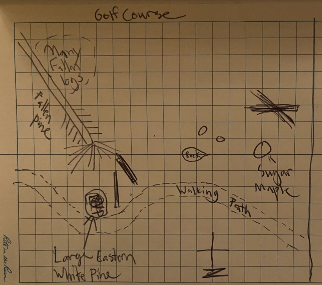
This visit, I sat down on a rock in the middle of my location (labeled “rock” on the map) and tried to pick up on the differences that have taken place since my last visit. Below is a hand-drawn map of the area. Please note it is oriented to the South to be easier to interpret when viewing the area from the walking path. The biggest difference in the vegetation that I noticed was the greater amount of sun reaching the understory, as the taller trees have dropped all of their leaves for the most part. None of this new sun is reaching the soil surface, however, because the O-layer is thick with Sugar Maple and Beech leaves. The open space in the middle/ top is filled with younger sugar maples and yellow birch.