
Rye Nature Preserve June 24, 2021 at 3:00pm
The Rye Nature Preserve is in Rye NY. It is made up of an upper section which is forest, followed by a marsh and then a land bridge which connects the upper part to an island which borders the harbor. Even though this was a relatively small piece of land there seemed to be three very different environments. The upper section appeared to be all forest and the least diverse. The marsh had a distinct start as the upper section became a steep hill and eroded. The marsh is made up of deltas and channels. Towards the edge of the marsh in the mud there was cat tail and long grass. The long grass and marsh flowed into the island and once again became forest with similar vegetation. The transition from forest to marsh was much more subtle than the upper section.
Questions…
Why are there so many dead trees?
Why do some of the trees have no leaves even though it’s summer?
Why does it turn from marsh into forest?
How does the weather affect the wildlife?
Why is there a little island off the marsh
Why are there large rocks along the edge of the island?
Why are the structures surrounded by plants?
How did the island form?
How did the marsh form?
How did the deltas in the marsh form?
Why are some of the deltas larger than others in the marsh?
Why are there so many different kinds of plants?
How does the weather affect the plants?
Why do the plants change when you go from the main forest to the island?
Why is the center of the island so green but the edges toward the mainland are not?
How did the marsh form?
Why are there a lot of the different plants grouped together?
How did the land bridge connecting the main land and the island form?
Why are the big trees burned?
Why are the bushes so tall around the path?
Why are all the gray reeds pushed down?
Why is it windier between the mainland and the island?
Why are the plants so different on one side of the land bridge than the other?
How does the location of the island affect the vegetation?
How are the plants that receive less sun exposure affected?
Why is there so much plant growth around old structures?
Why is one side of the island covered by trees and the other side is covered by tall grass?
Do the deltas and channels change shape or get bigger over time?
How old is the area and how long has it looked like how it looks now?
Was there always marsh here or was the island connected to the main land?
Did the marsh used to be forest and/or did the forest used to be marsh?
Why is the island so much lower than the rest of the forest?
I have been to the Rye Nature Preserve many times before but going there today and being much more observant and asking questions made me see it in a different way. It made me wonder how it all came to be. One question I keep going back to is this — why does the island exist and how was it formed? I never noticed prior to this visit how these three different pieces of land or environments relate to one another but after today I believe they are all connected.
Bellow is a link to the Rye Nature Center’s website.
https://www.ryenaturecenter.org
Long Grove Park, Long Grove Il, July 1, 2021 at 8:00am
My second entry comes from a different location than my first. Therefor I was able to see different wildlife and vegetation then I saw from the Rye Nature Preserve. Additionally, the ecosystem was very different. It was a park, with much less trees and more human impact rather than untouched forest.
Black Walnut Tree (Juglns nigra):
Habitat: Rich Woodlands
Description: Grows up to 75-150 feet tall at a rate of 13-24″ per year. Grows in environments with high sun exposure.
Soil: Acidic, alkaline, loamy, moist, rich, sandy, well-drained, wet and clay soils.
Nut: Begins growing nuts after 12-15 years. Ripe in early-mid autumn. The nut is eaten by woodpecker, foxes and squirrels.
History: Native Americans had used this tree for food, color dyes, medicine, fence posts, gun stocks and furniture.
Too identify this tree I looked at the bark, leaves and nuts. I noticed that the bark was long and solid pieces. The leaves were green, soft, and oval with point on one end. And the nuts were green and soft on the outside, had a yellow layer on the inside and the had a white core. Using this with what trees were common in the area I was able to identify the tree.
Link: https://www.arborday.org/trees/treeguide/TreeDetail.cfm?ItemID=934
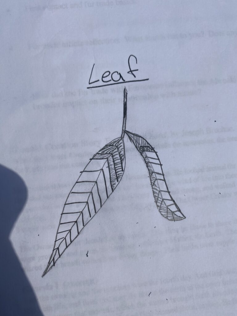
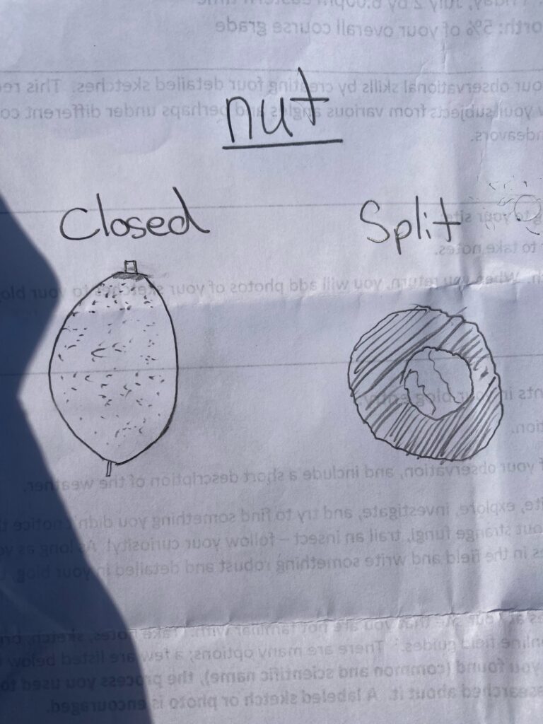
Conclusion: I was surprised how easy it was to identify the tree. I feel like I collected more than enough characteristics in the field to help me identify it. Sketching it was a bit tricky as I’m not very artistic. However I feel like I did a good job depicting it. I chose not to draw the bark and instead focus on the nuts and the leaves as those were more relevant for identifying the tree. I found identifying the small details to be most challenging. I felt like every time I looked at the tree I noticed something new. I would like to come back in autumn when the nuts are ripe to see the difference and how the tree changed.
Long Grove Park, Long Grove Il, July 6, 2021 at 1:00pm
There are definitely some noticeable differences today compared to a few days ago. It has not rained in a few days and it’s supposed to rain tomorrow so it’s very hot and humid. There was no morning dew like last time or cooler morning temperatures. It’s also much more windy out than last time. Since its later in the day there is definitely more human disturbance, there are much more leaf blowers, cars, people and noise in general. I hear a lot of birds however I see less birds. I am really surprised that I didn’t notice last time how closer to the stream the vegetation seems to get a lot more green, more abundant and the type of plants change. Im noticing a lot of bushes, trees and ferns really close together along the bank of the stream. Compared to the rest of the park that was mostly open spaces of cut grass with small areas of trees, bushes and flowers.
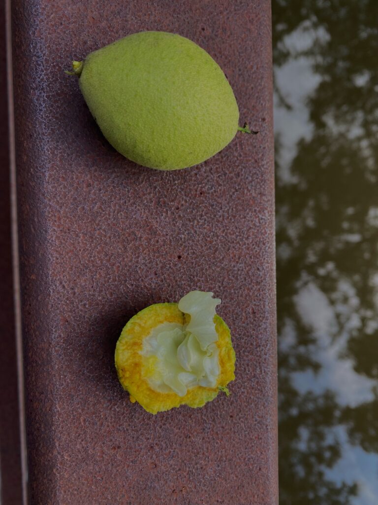
tree nut 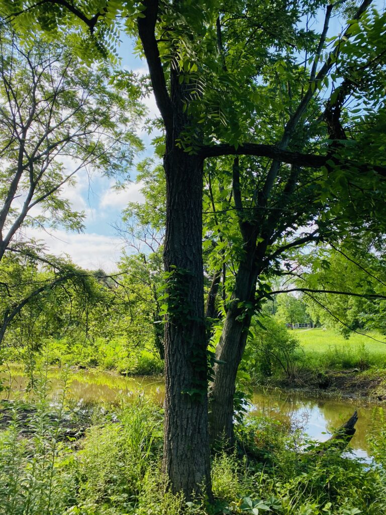
black walnut tree 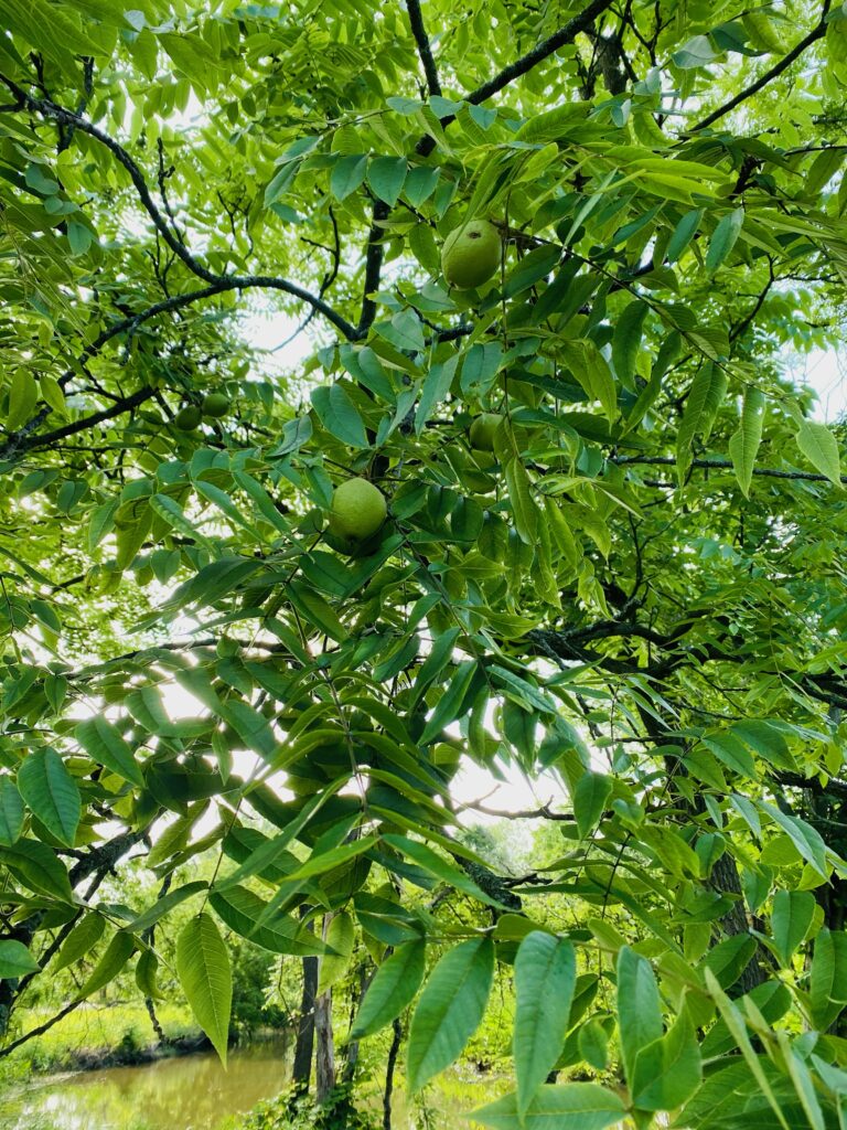
black walnut leaves and nut 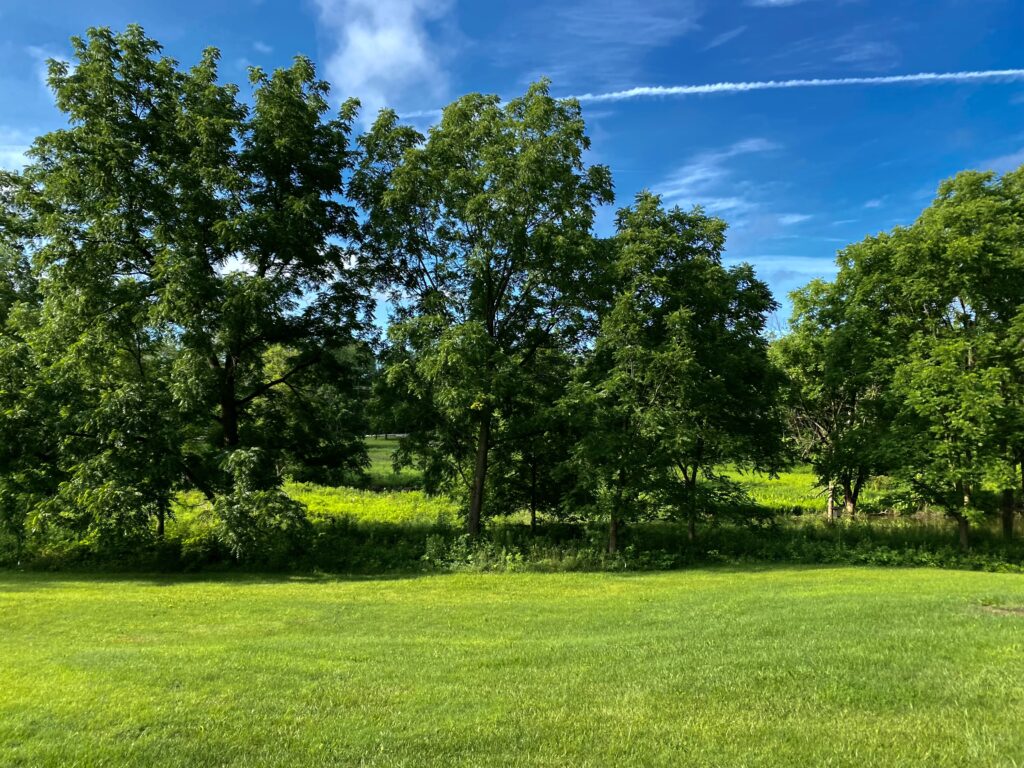
grass, bank of stream in back round 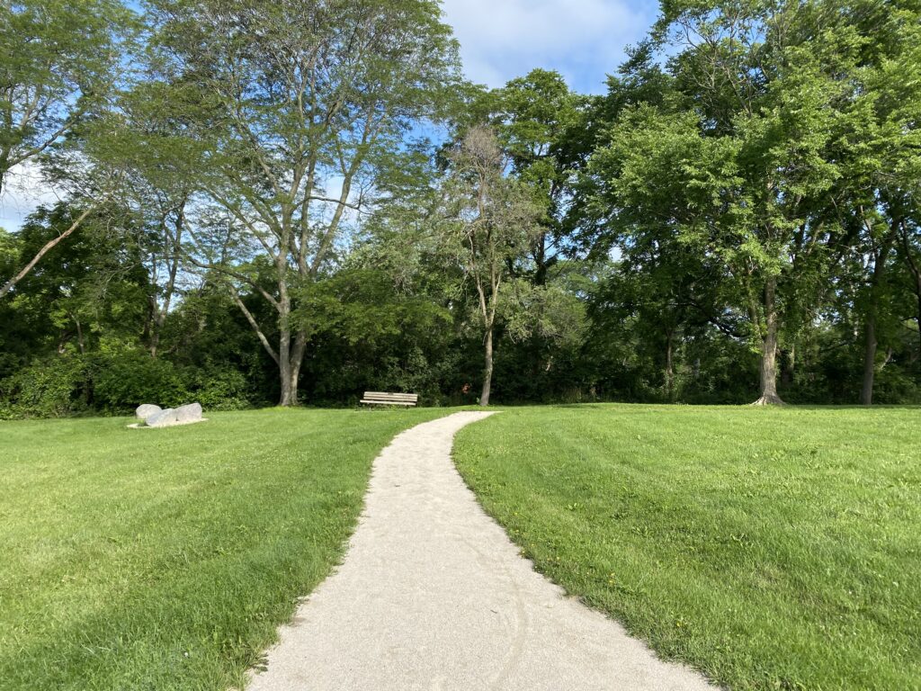
path threw park
I chose similar objects that I drew from last time to compare how the drawing and the picture represent something. I am not totally satisfied with how all my pictures came out, I tried playing around with the brightness to create a focus in the picture. I think because it was very bright out my screen looked a lot darker than the actual picture was. However I think third, fourth and fifth pictures came out very well and give a good theme to focus on without just zooming in on one piece.
After this entry I was left with the question, Why are there so many plants and different kinds of plants around the stream? I had two answers for this but there definitely could be more. The soil is most likely much more rich near the bank because it is on a slope and it is near water. Therefor its soil supports more of variety of vegetation. Additionally, it’s much less altered by humans compared to the rest of the park. It seems like everything along the water is untouched while the rest of the park is cleared out.
Rye Nature Preserve July 13, 2021 at 9:00am
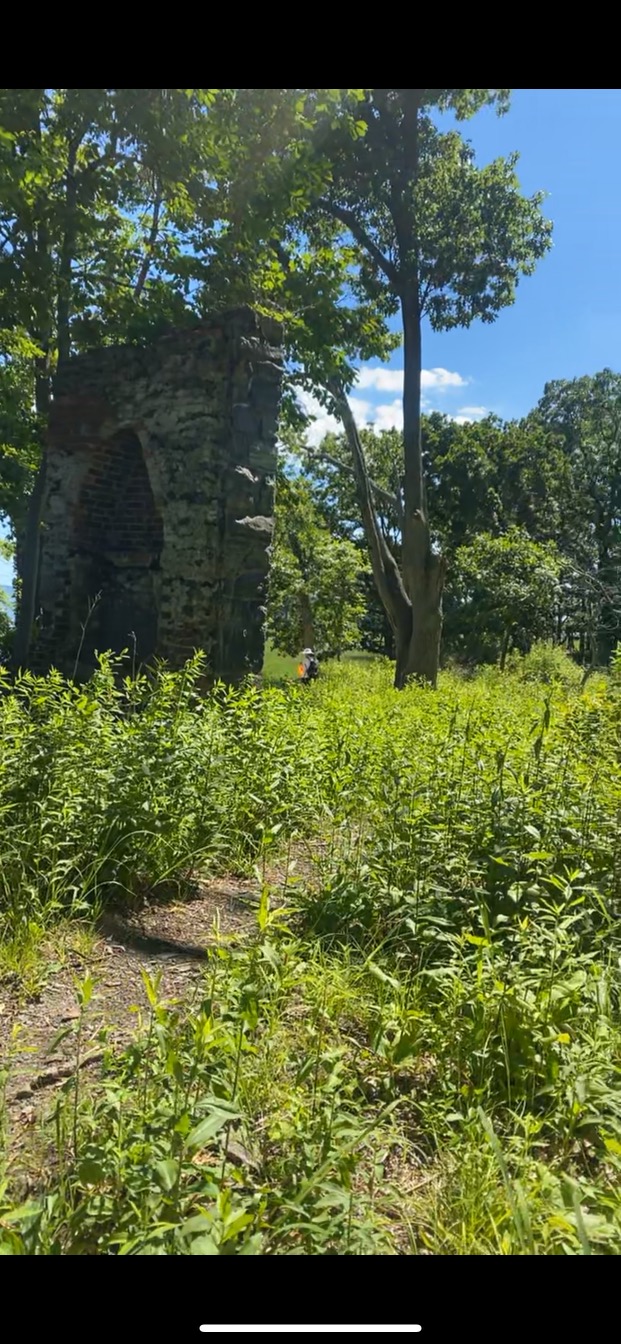
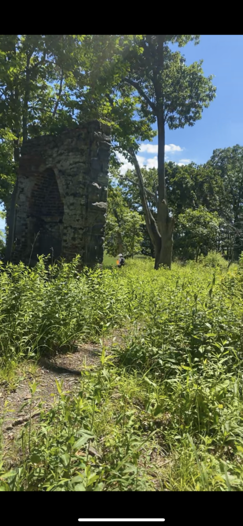
For my final entry I revisited my first location. The conditions were very different. The weather was cool and less humid because it was earlier in the day and very overcast. It has been raining here a lot causing the marsh to be flooded in some parts. It also looked a lot more green and lush, the grass in the marsh and the grass in the field on the upper part was taller and thicker. This change could especially be seen around the old building foundation on the island that was now covered in vines and was harder to walk through without stepping on plants. This time I also saw much more wildlife, I saw a lot of deer and turkeys, unfortunately I was not able to get any pictures of them. I decided to take pictures this time because I thought it would be the best way to show my location and the changes. Additionally I thought the lighting gave me a really good opportunity to take good pictures. I also wanted to include a map to give my readers a better visualization of my location especially when I am referring to the upper part, the marsh and the island.
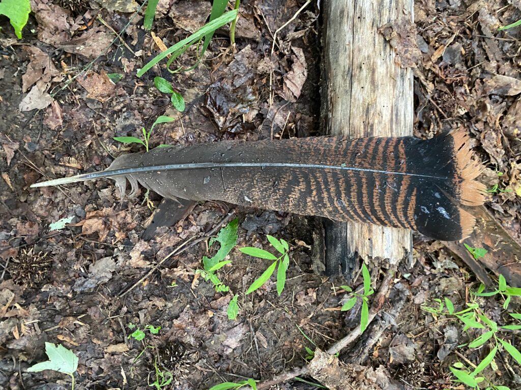
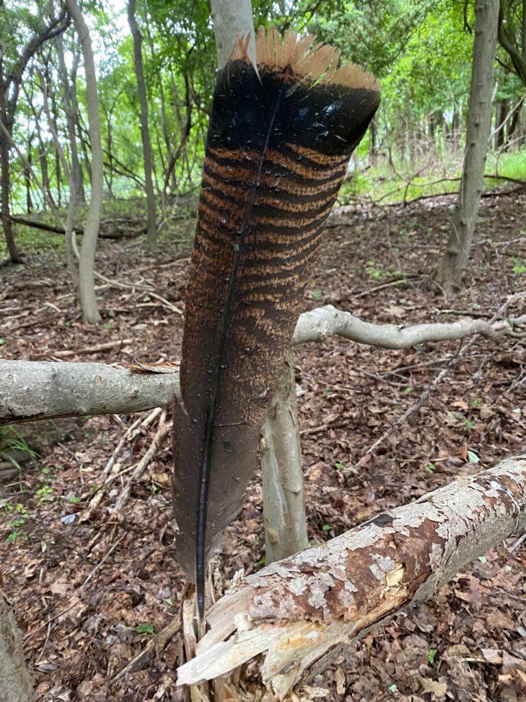
I found this feather lying on the ground when walking in. This was the hardest thing to take a photo of and make it stand out against its background. From my prior knowledge and what I know to be in the area I thought it was either a red-tail hawk feather or an osprey feather. From comparing it to others online it looks like it is a red-tail hawk tail feather.
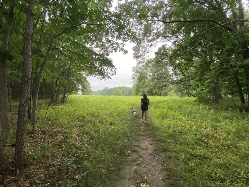
This was taken on the upper section at the edge of the forest and field. I thought it would be interesting to give it some perspective with people. I took a few different pictures with different lighting and I thought this one was the best. This is also was taken with a wide angle lens to give more perspective.
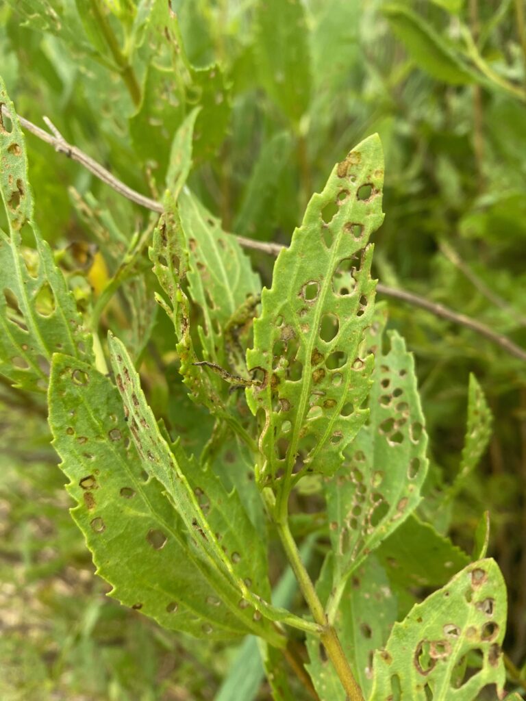
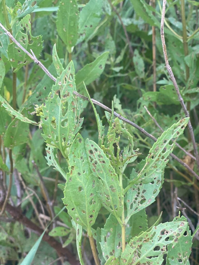
For the first picture I took it close up with my normal camera mode. For the second I used portrait mode to try and make the leaves stand out. The pictures were taken on the land bridge that goes through the marsh. I thought this was interesting because it did not look like these naturally grow like this. I don’t know what caused this, I had trouble researching what caused this because I couldn’t identify what plant it was but I am guessing it was some sort of insect.
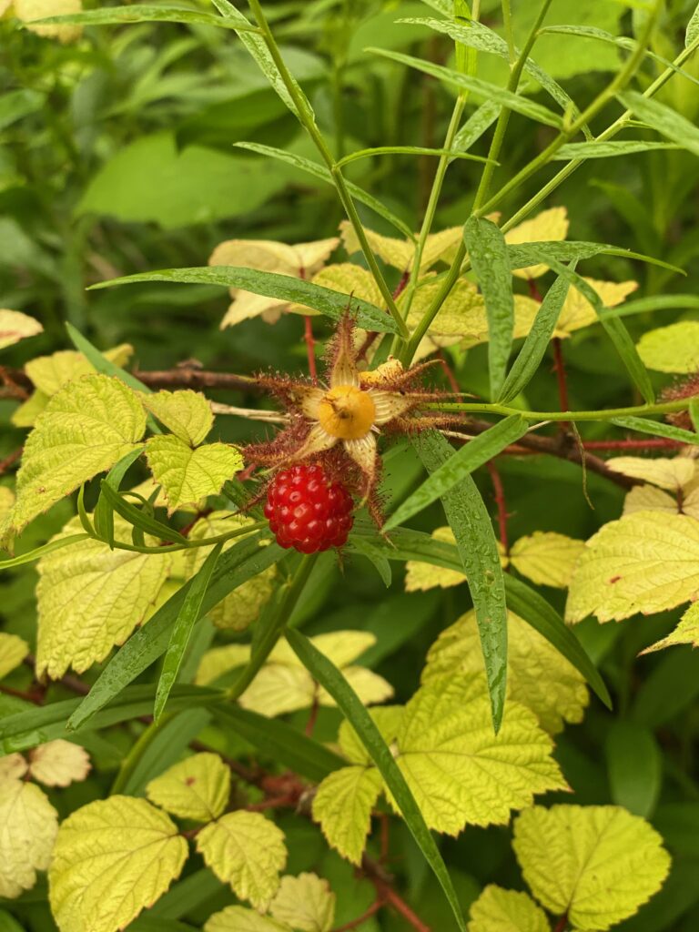
I also used portrait mode for this to try and really make the berry stand out. I wasn’t sure what it was so I used https://plant.id/identification/MLjECSNaZU0X0jf to help me identify it. It looks closest to the Rubus phoenicolasius. A few other plants had similar leaves but the thorns and stream looked most similar. It seems like there are a few different variations of Rubus phoenicolasius.
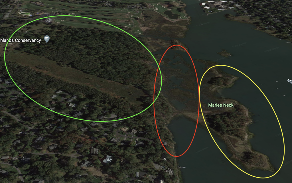
This is a satellite image of the nature preserve. The green part is what I have been referring to as the upper section. The red part is the marsh with the land bridge in the center. And the yellow part is the island.
I really enjoyed going back to my original location after a few weeks had passed and seeing the changes. I also realized how I payed much more attention to detail this time. This made it much easier creating an entry. I also think my photos have definitely improved. I enjoyed playing around with different camera functions. I think this last entry gave the best representation of my location by giving lots of detail, good photos and a full image of my location. I think if I was to do this project again I would have tried to give more variations of visual perspectives throughout my project.