Birds Eye View

bird-eyes view map

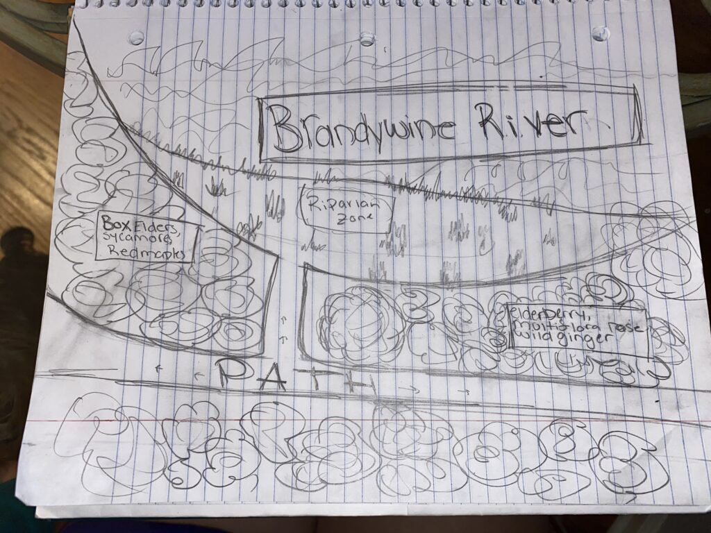
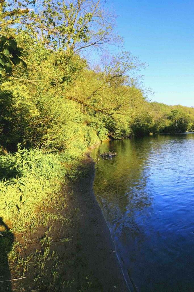
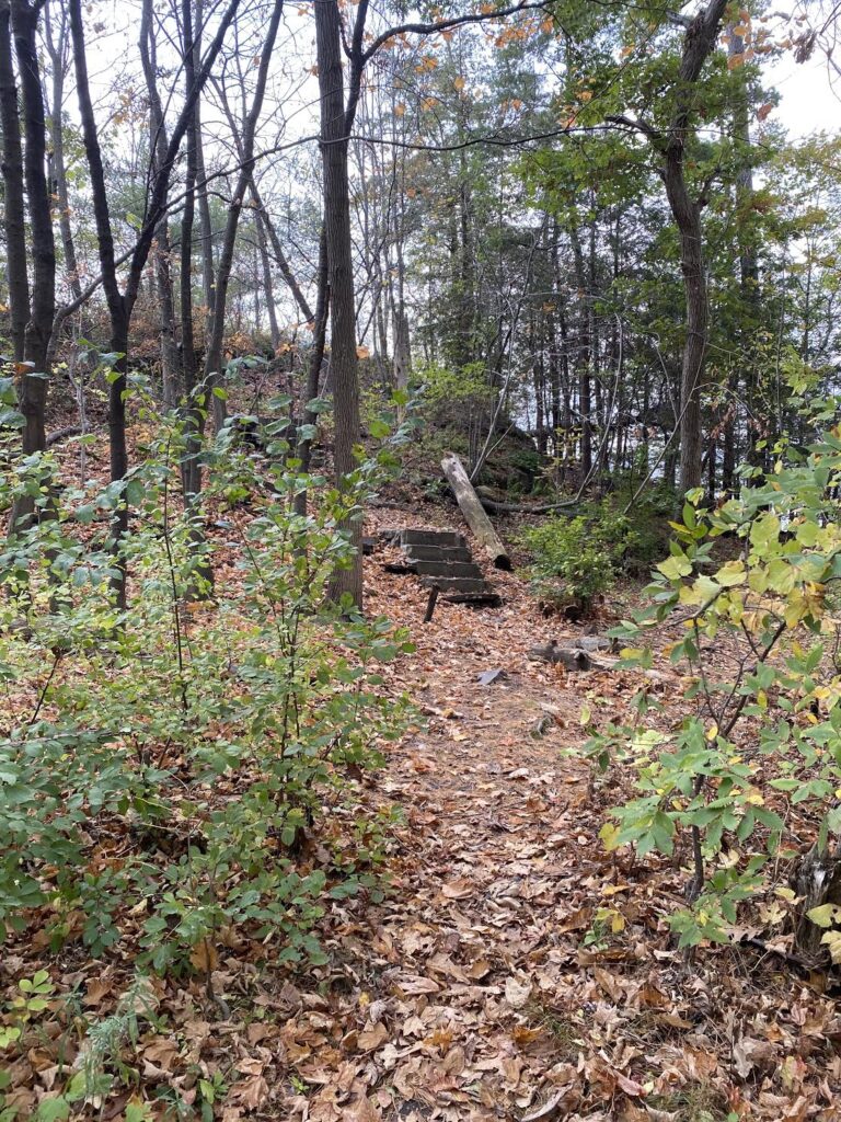
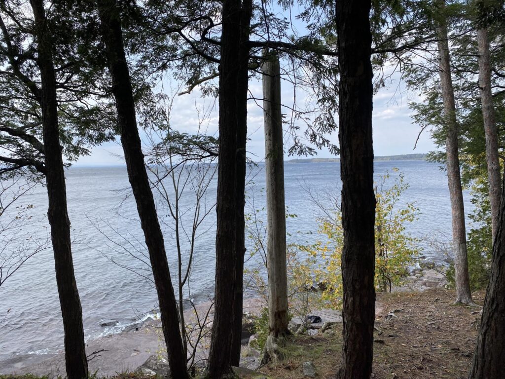
It’s been a little less than two weeks since I have last ventured to my location, and not too much has changed. The color of the foliage has slightly started to shift from the previous dark green to more muted colors. However, the Red Maple’s leafs stood out with their vibrant red and orange coloring. With limited leaves falling, the density of the foliage and canopy was relatively the same to my previous visit.

This floodplain forest inhibits quite a bit of wildlife. Although I did not see any birds, their sounds radiated through the trees and multiple of their nests were visible in the branches. Numerous squirrels were running around the ground and others jumping from tree branch to tree branch, gathering food to prepare the colder months ahead. Closer to the riverbank, tiny toads lurked. These creatures buried themselves deep under the fallen leaves, only revealing themselves after making noises.

just joking! here’s the new location!

Greetings from Brandywine Creek State Park! The easiest way to reach this hidden gem is to park in the lot off of Thompsons Bridge Rd in Wilmington, Delaware. Then follow the path for half a mile, passing under the bridge, until coming to a fork in the road; take the path to the left and walk until reaching the water. Welcome, you have arrived to my phenology spot!

The forest right before reaching the river bank of the Brandywine, is dominated by mostly Box Elders. However, Sycamore, Red Maples, Sweetgum, and Silver Maples also compose the canopy. The understory is made up of the common species: elderberry, multiflora rose, wild ginger, spicebush, and summer grape.

google map link: https://www.google.com/maps/d/u/0/edit?hl=en&mid=1N3e6t8o_n7okLyR_UnNP_6TgRi3xodJS&ll=39.81759955560423%2C-75.571592201783&z=17

INTRO TO OAKLEDGE

Greetings from Oakledge Park! This land houses two large shelters, two public beaches, a playground, tree houses, countless walking trail, tennis, bocce, and volleyball courts, grills, picnic tables, bathrooms, along with acres of open land. The park is located in the South End of Burlington, just north of the opening to Shelburne Bay. Without a car, the fastest way to get this spot would be by taking a shuttle down to the waterfront and then taking the Island Line Trail until reaching the pavilion next to the park lot. However if one does have access to a car, pull all the way down to the parking lot, left of the pavilion. Once at the pavilion, begin walking down the paved path for roughly 500feet before seeing a set of stairs with multiple paths branching off. Do not climb up the set of stairs but rather walk the path directly in-front of them. Take a couple more steps and you have reached my spot!

In deciding where to go to pick my spot, I knew I wanted to be able to clearly see the water but also be surrounded by lots of wildlife and trees. Oakledge instantly popped into my head. I had been there a multitude of times and just felt a connection to this spot. I’m very excited to have the opportunity to closely look at this land instead of just appreciating its beauty.

When adventuring around the plot of land I choose, I noticed how the vegetation lessened and changed nearing the ledge as there is much more exposed bedrock. Red Oaks and Sugar Maples are dense towards the paths but as approaching the ledge Eastern Hemlocks, Red Pines, and Northern White Cedars are much more prevalent. Lots of common milkweed, marginal wood ferns, moss, and common buckthorn was also present in the vegetation.

google map view

Skip to toolbar