Posts

Featured

Hello world!

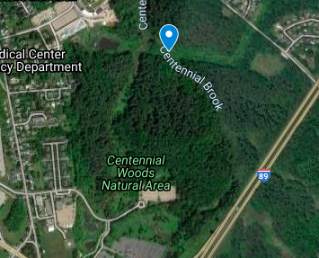
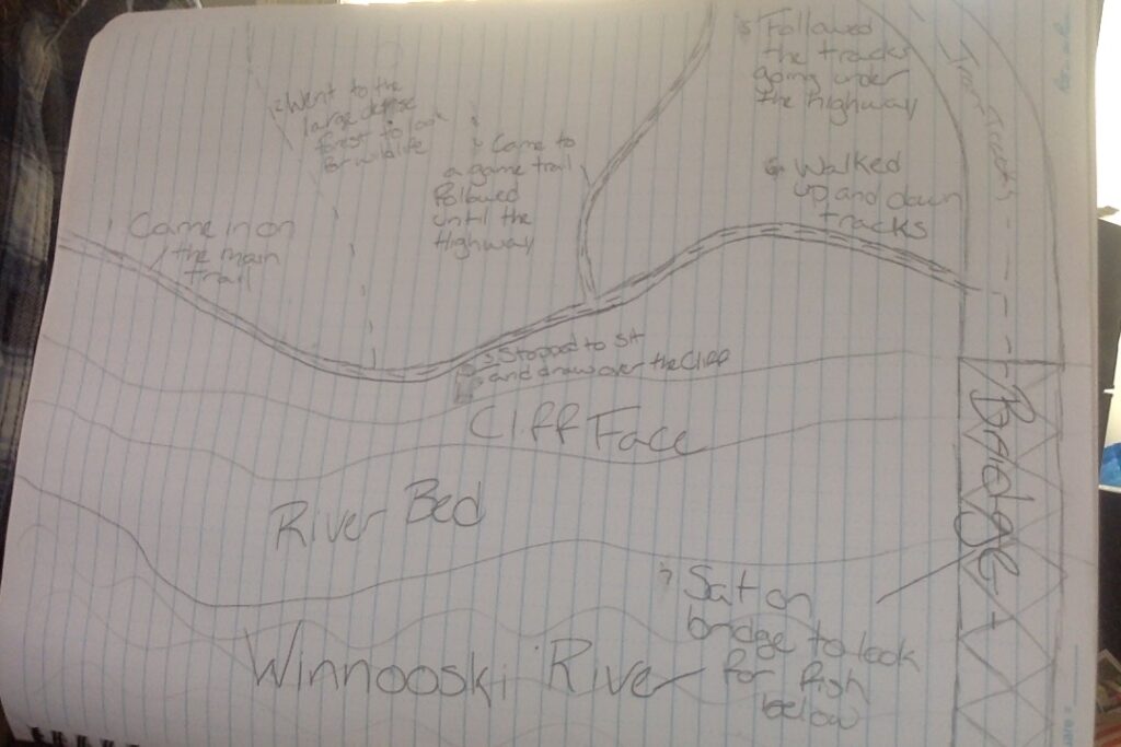
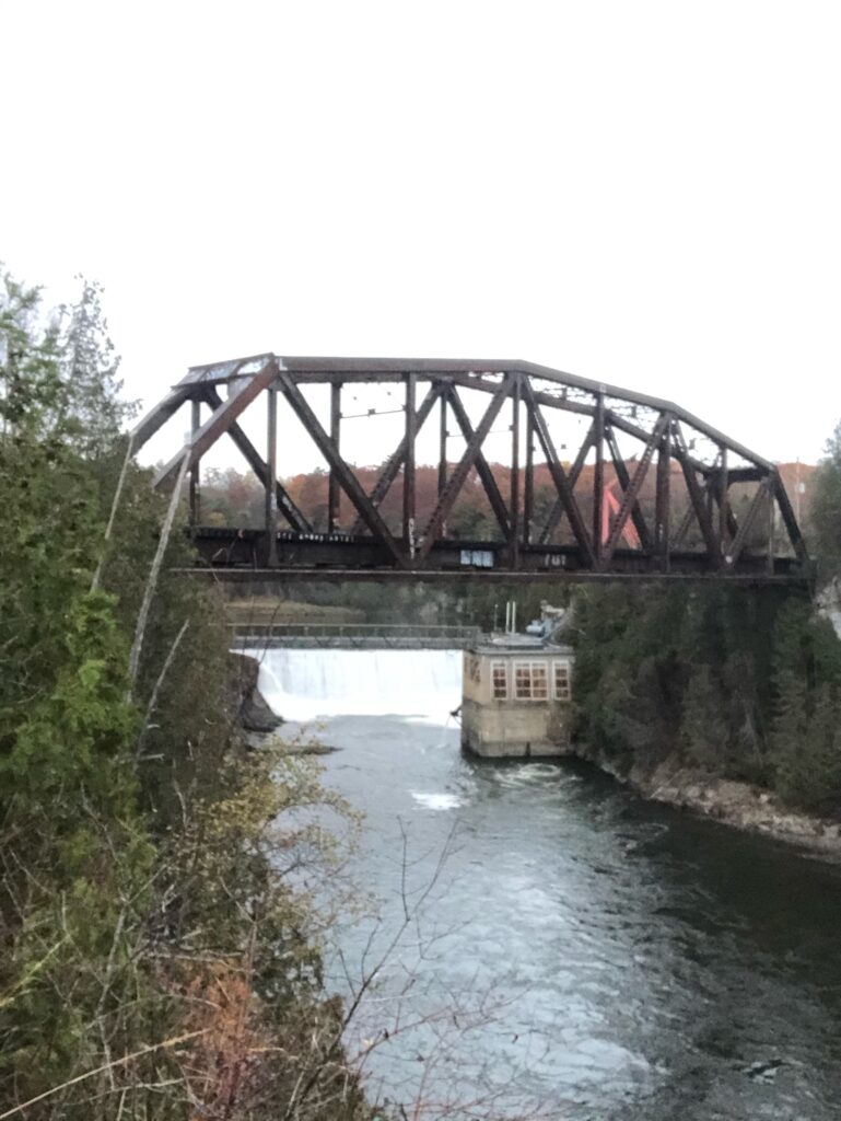
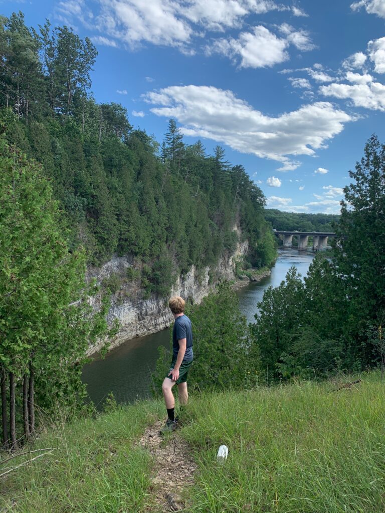
Welcome to the Winooski River Walk. To access this site enter the Winooski roundabout and exit onto Winooski Falls Way. Here you will see the river to the right side, and a turn ahead. At the location, the turn begins is the beginning of the Natural area. The specific location being looked at is down the path and continue on this path until the bridge for the highway. Once at the bridge hug the left side of the trail in the direction of the train tracks until you reach a large cliff face overlooking the river. This area is part of the Winooski Gorge.

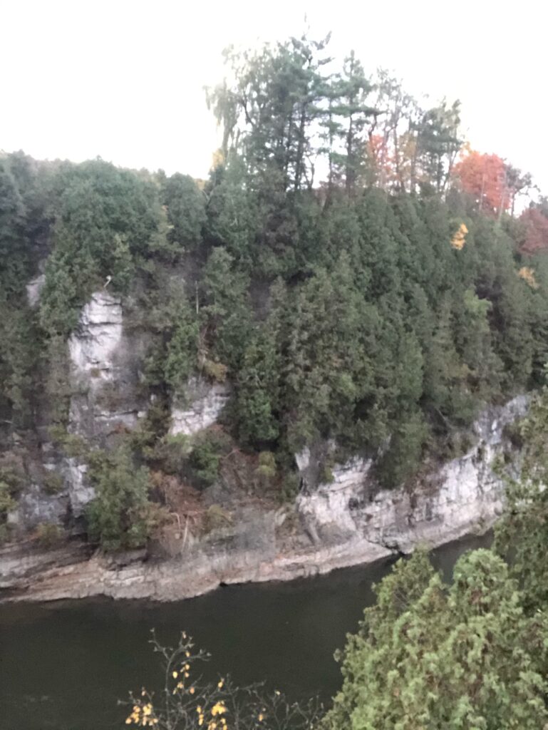
Once in the location, you’ll notice a large number of evergreens along the cliff along with a few maples dropped in, and as you get farther from the cliff other hardwoods begin to mix in. The face is dominated by cedars. The ground was lined with long unidentified grass.

Not much wildlife has been witnessed in this area so far. I have seen a few rabbits and many birds, but no sign of predator or game species. Below the cliff, the river holds an abundance of life. From bottom-feeding white sucker to salmon they cn be found in this stretch of the river. The most abundant fish in this area though however is the smallmouth bass.

Human History of Areas

The history of humans on the Winooski River is vast, from indigenous culture to large constructions of dams and salmon elevators. Below is a picture of the gorge in 1847 that was later replaced by another that is much more modern. The area was much different and now you could not walk through the center of the river as it’s very deep in that area now. The use of this portion of the river was largely for milling and not as much recreation. As time went on the area built up more and more adding dams, a quarry, modern bridges, and much more for human use. Now the area is used for transportation of goods via the bridge and maintaining the bridge and dams as there are buildings and heavy machinery. The construction of the dam changed the water levels and changed the structure of the river greatly. Recreational use of this area has improved as well with the Winooski riverwalk being created and the trails mapping all the way to the train tracks where there is no trespassing.

Photograph citation:

Easterly, Thomas M. (Thomas Martin), 1809-1882, “High Bridge Across Winooski River,” Digital Vermont: A Project of the Vermont Historical Society, accessed December 6, 2020, https://digitalvermont.org/index.php/items/show/1103.

Centennial Woods

https://www.google.com/maps/d/edit?mid=1xPLSzyC7RbSv1XYNifrApI-xKMeLn5zM&usp=sharing

For my newest blog post I attended centennial woods. Centennial is a very special place to me as for the past few years it’s been somewhere I can exercise, do homework or just escape the monotony of college.  I chose a specific area of centennial that was very different than my original place. This area was the lowest point in centennial and is currently undergoing rapid change. Unlike my other location in Winooski where it’s on an eroding cliff face, this area is a wetland and accumulates a lot of water. The most interesting thing about the area in centennial woods was how the beavers have rapidly changed the landscape of the natural area in the fall. Up until this semester the area was just a trickling brook, but now at points its over three feet deep. I thought it was interesting to compare the two areas as Winooski Gorge undergoes very slow change through erosion and weathering, while this area is undergoing rapid change due to wildlife. The wildlife reclaiming this area gives hope to the future, while giving a glimpse of what the area has looked like in the past.

Since my last visit, the area has shown fall setting in more. The leaf litter is thick but more dry compared to the last visit. Despite the new colors of the area, it was much warmer, and wildlife was much more active. There was a game trail visible with deer and dog or coyote tracks. The water level below has risen greatly and looks much cloudier as the dams have all been reopened.

Seasonal Change of Area

The area has underwent a lot of change since my last visit. There are changes due to seasonality such as loss of leaves, and change or color, but there is also human caused change as well. One major thing noticed is the opening of all the dams and the significantly higher water level. Also there was a lot more trash seen on this trip, possibly due to the new tents added to the outside of my plot.

Birds Eye View Map

Here is a map of all of the important features that best show this area. One thing left out of the map is two sets of four power lines that just cross into both sides of the map border. There were no apparent signs of animals in this area as it has heavy foot traffic that has destroyed trails and tracks.
Skip to toolbar