Final Phenology Visit

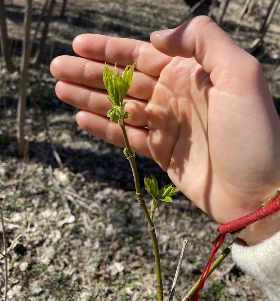
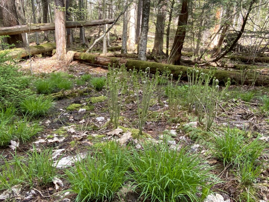
Since the last time I visited my phenology site, much more new growth has emerged. Many of the fiddleheads had opened up more or were fully open, and the ferns were much taller than last month. There were blooming flowers, particularly trilliums and small field flowers, scattered across the ground. There was also a lot of understory growth, with tiny 1-2 year old sugar maples only a few inches tall beginning to leaf out. The rest of the more well-developed understory had filled out much more, with more leaves unfurling on the branches. Similarly, the forest sounded much more active; I constantly heard an array of bird calls (particularly woodpeckers and chicadees), rustling, and chipmunks.

I think that the biggest way in which nature and culture intertwine at my spot has to do with recreation in the area. Although my area is off the trail, I’ve seen quite a number of individuals hammock or hikers wander down into the valley when I’ve been down there, implying that human interactions are still occurring at the site. Although there may be less damage to the ecosystem than right off the trail, there is still trampled plants and disturbed ground. As with the rest of Centennial, the woods offer locals and students the ability to experience the outdoors within the city. Personally, stepping into my site has offered me a sense of peace and tranquility, despite the sound of the planes overhead or sirens in the distance. I think that Vermonters value the woods, whether its for running, hiking, reading, school, or just wandering around. As Centennial is easily accessible, the area offers a chance for humans to disappear into the outdoors for a bit.

I don’t necessarily feel as if I’m a part of my place, but I do feel a connection to it. Because I do not largely impact the ecosystem, I don’t necessarily think I have a large role in the place as a whole. However, I do recognize I fit into the system, as my presence impacts the life around me. I think that the biggest way that I “fit into” my site, however, is through a self-decided connection to the area just from watching it and routinely visiting it throughout the semester. Although I don’t see the site as “mine” and I recognize other people visit it, I do feel as if I have gotten to know the place well and associate a sort of importance to the area. I noticed this most on my last visit, as I realized I was a little bit sad about it being my last official “phenology visit”. I also noticed how I felt almost proud to see all of the new growth, and a connection to all of the small saplings sprouting or flowers opening up. It was nice to see a place that I had created a connection with thrive and healthily enter into spring after such a long winter.
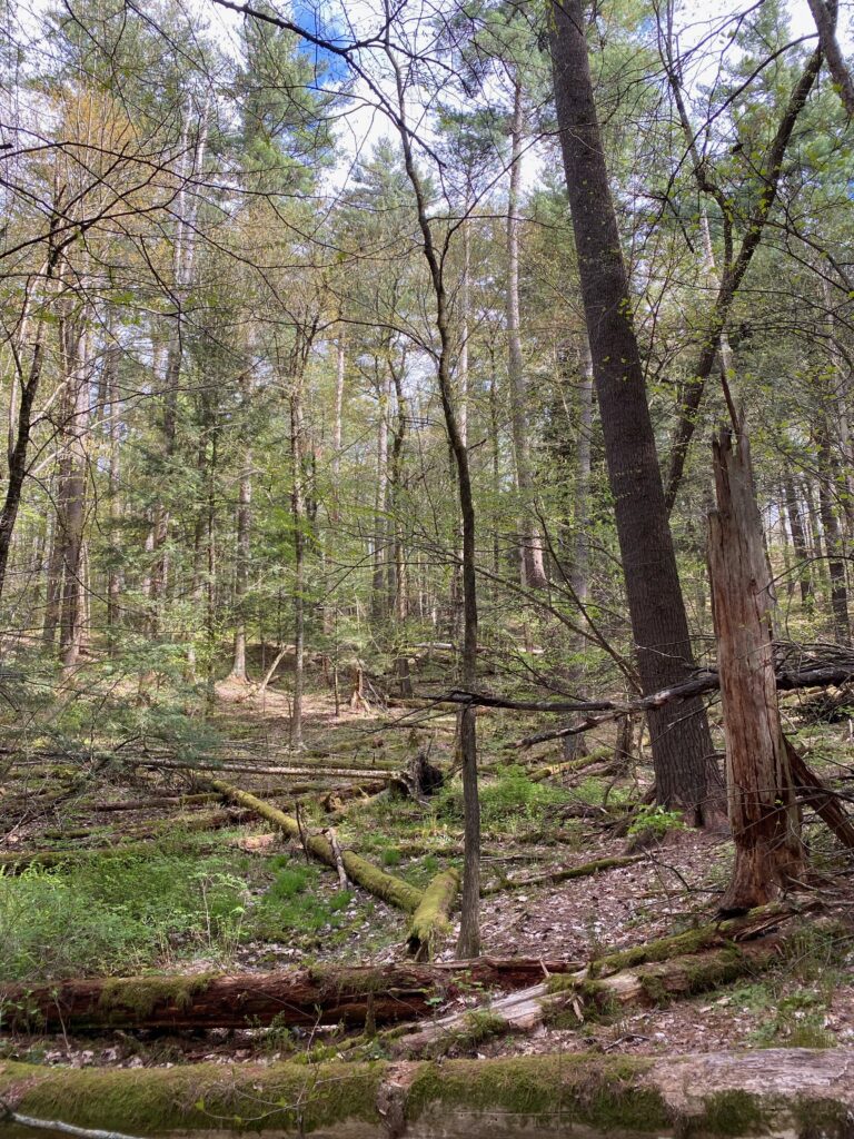
Overview of my site
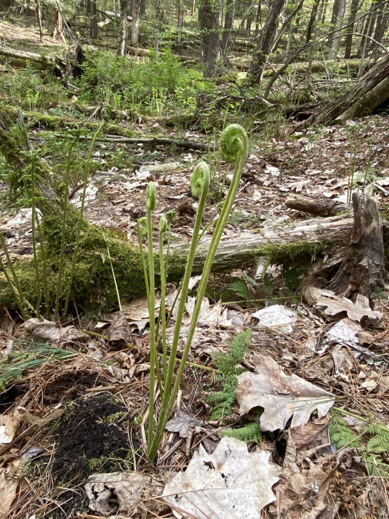
New growth of ferns, grasses, and other greens in the clearing. The fiddleheads are still still opening up, although they were much taller (around 2 to 3 feet tall).
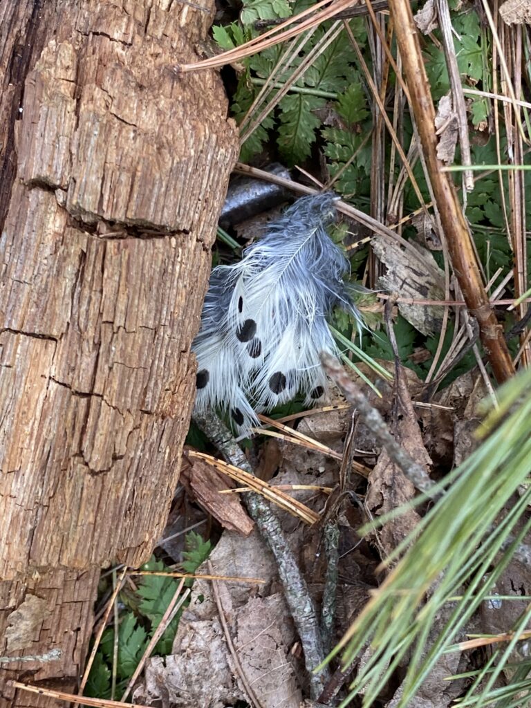
A small bird feather I found on the ground, indicating bird activity and moulting in the area.
A close up of some of the fiddleheads at my site.
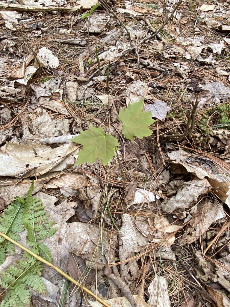
A small sugar maple sapling sprouting and opening up.
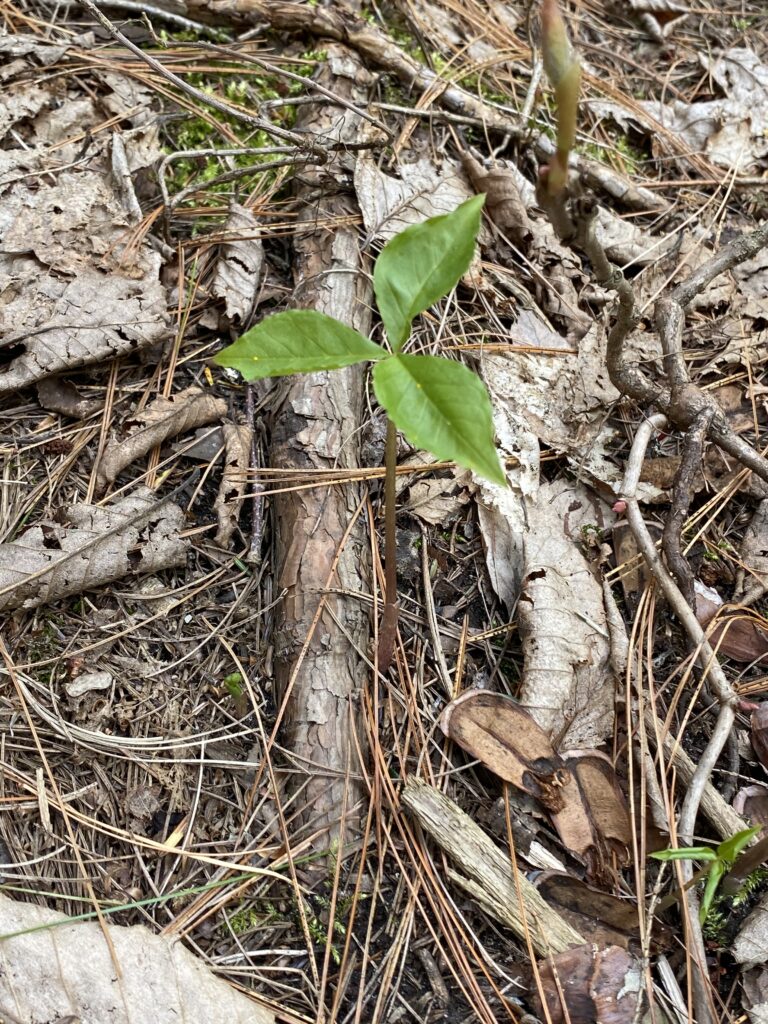
Another small plant sprouting (potentially a trillium?)

City Nature Challenge

This city nature challenge, I explored around campus, down Main street, and around Lake Champlain. Although I didn’t run into too many shocking observations, I had a really good time looking around more urban areas of Burlington and documenting the wildlife present. I liked the challenge because it made me more aware of my surroundings; instead of just walking to the dining hall, I was paying more attention to what species of grasses and flowers were growing on the ground next to me, or kept my eyes on the sky searching for birds. I especially appreciated doing the challenge in spring, as I picked up on more seasonal changes than I would have otherwise. When I was little, my parents and I would go out looking for as many “signs of spring” as possible. Doing this challenge was the first time in a while that I remember going out specifically in search of signs of spring, and it reminded me why I loved doing it with my parents so much when I was little.

My experience using INaturalist was pretty positive. I found it relatively easy to use, and I liked how I could upload photos from my camera roll directly. I also thought it was really helpful that INaturalist recommended species for the photos, as I oftentimes didn’t know the exact answer or the scientific name. I found it relatively confusing to join my lab group, but after an email from Greta, I’m relatively sure that I was able to successfully log my observations under our group.

Looking at observations from around the world was a really interesting way to see species that I usually don’t. For example, I really enjoyed some of the marine species observed, such as bay barnacles and the Atlantic Blue Crab. I also really enjoyed some of the bird species, such as the Glittering-bellied Emerald hummingbird seen Brazil.

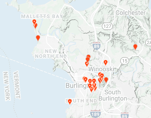
Image of my lab group’s observations on a map.

Attached above is a photo of my lab group’s observations. I thought it was really interesting to explore all of the different species recorded in different areas, especially the ones in areas I haven’t been to very much (for example, Malletts Bay). It was also interesting to look through all of the observations closer to campus and get a better understanding of what species are seen on the daily right by where we live.

April – Species Interactions

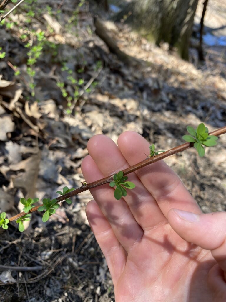
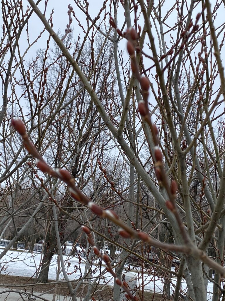
All of the snow at my phenology site has completely left, the ground was dry, and signs of spring were everywhere from emerging ferns and ground cover to bird calls. Because my site is mostly evergreen, there weren’t too many budding trees. However, there were ferns covering around 60% of the forest floor, uncoiling and stretching upwards. A photo of the ferns is attached below. There were also some barberry budding along the entry point to my site, with new green growth sprouting outwards. The one budding tree at my site was what I think is a boxelder, from which the buds had begun to open up.

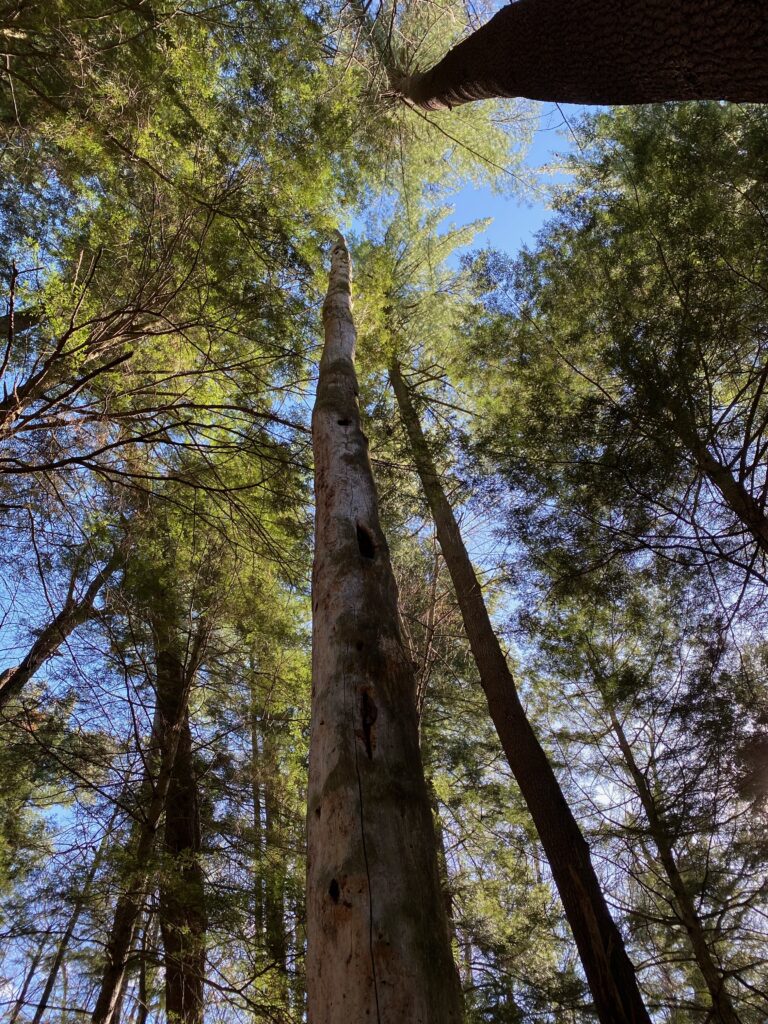
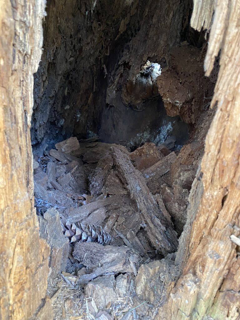
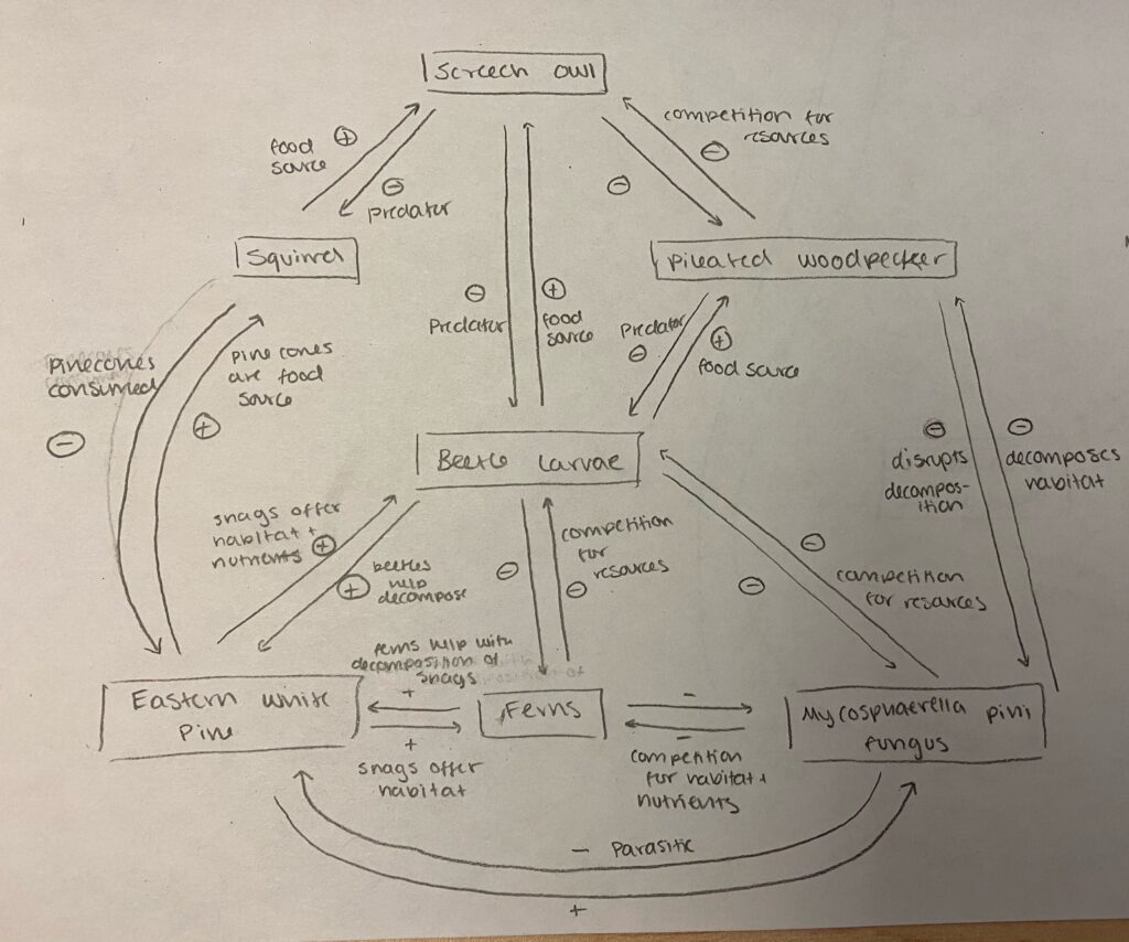
As mentioned earlier, while sitting at my site I heard a variety of different bird calls. Although most of them I couldn’t recognize, I did hear one owl hoot. I also saw holes in the snags at my site, likely left from wood-eating insects such as ants or beetles. Another sign of life I saw was a collection of pinecones left in a hole at the base of trees. As squirrels eat pinecones to eat the seeds, this could have been leftover pinecones from a squirrels stash over the winter. Photos are also attached below, as well as a species interaction map depicting the relationship between different plants and animals at my phenology site.
Snag tree and other tree species taken from below
Budding boxelder plant.
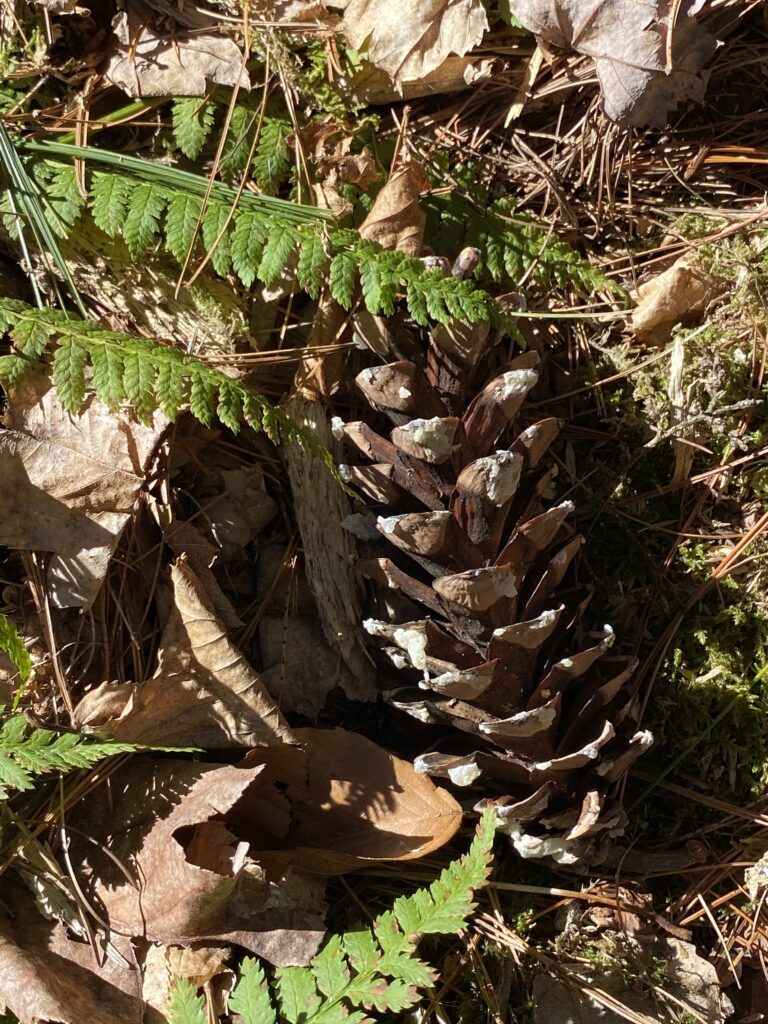
Pine cone and ferns on the forest floor.
Abandoned pinecones in the base of a snag. Potentially a sign of a squirrel inhabiting the area over winter.
Budding tree, potentially a boxelder.
A species interaction map with tropic levels showing the interactions between eastern white pine, ferns, fungus, beetle larvae, squirrels, pileated woodpeckers, and screech owls.

March – Signs of Spring in Burlington

For this phenology assignment, I explored around the waterfront along the coast of Lake Champlain as well as around Salmon Hole. Overall, I noticed mostly small animal tracks in the snow, as well as a few other small signs of spring such as budding branches, melting ice, and signs of bird activity. Attached below are photographs from my exploration as well as brief explanations.

The buds of an unknown tree beginning to emerge, indicating the tree transitioning into spring and potential seed dispersal.

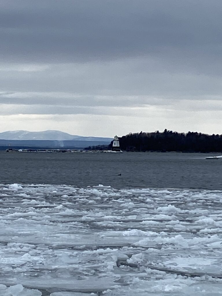
Lake Champlain with melting ice sheets. Although it’s hard to see in this picture, different species of ducks and a few seagulls were also sitting on the water. This indicates a return of some birds to Vermont after migration.
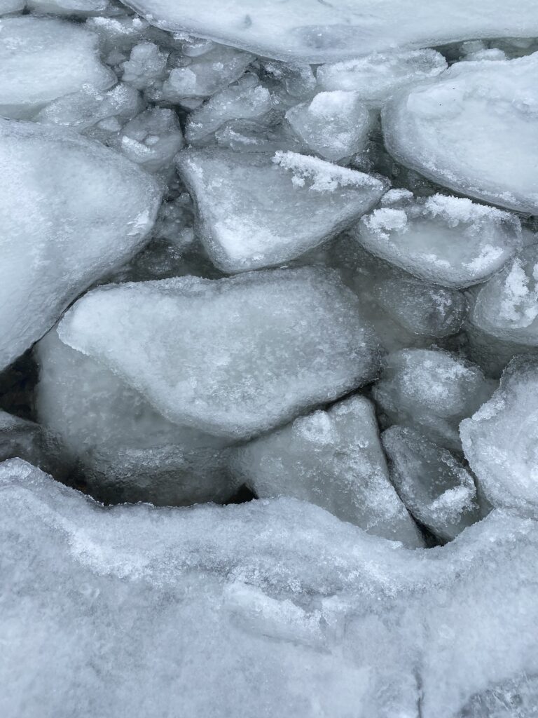
A closeup of the melting ice. There is no longer one connected sheet, but instead smaller fragments of ice. This indicates a physical change of the natural environment as we begin to approach spring, and warmer temperatures.

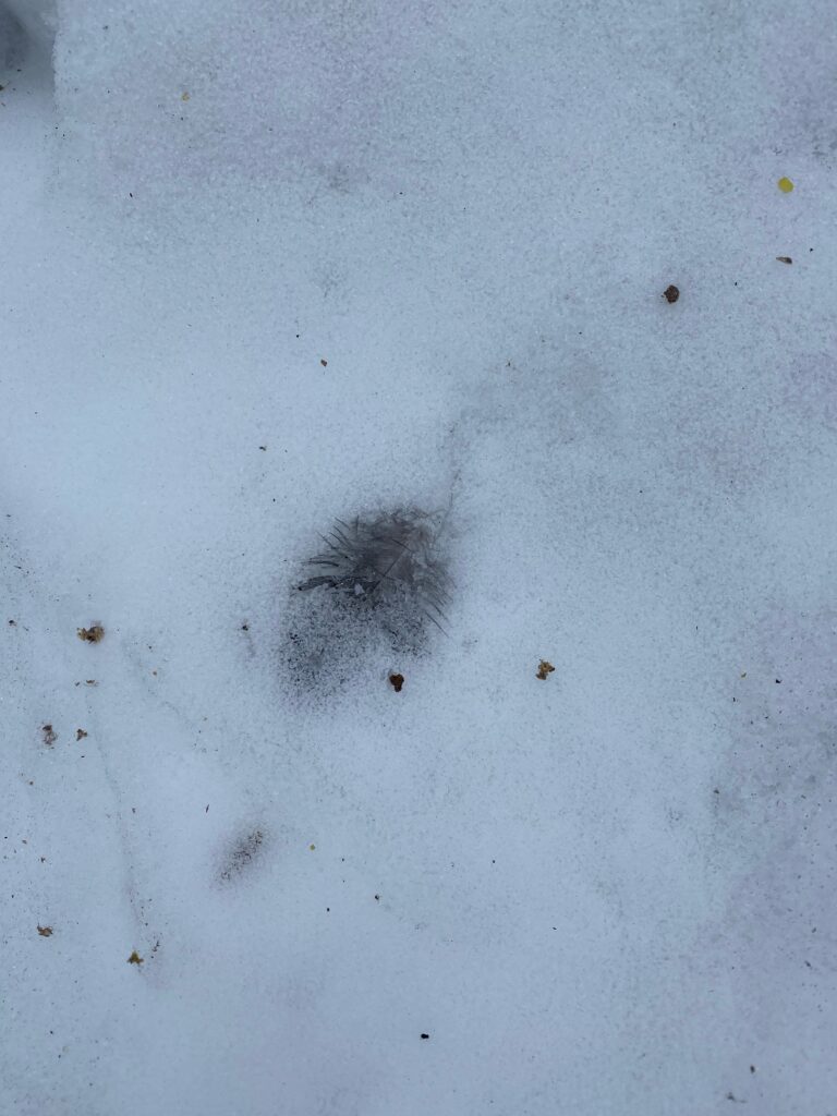
A bird feather found frozen into the snow at Salmon Hole. Although I’m not sure what species it is, it is evidence that birds have been in the area, implying a return of birds to the site.
An unidentified, small birds track in the snow along the banks of Salmon Hole.

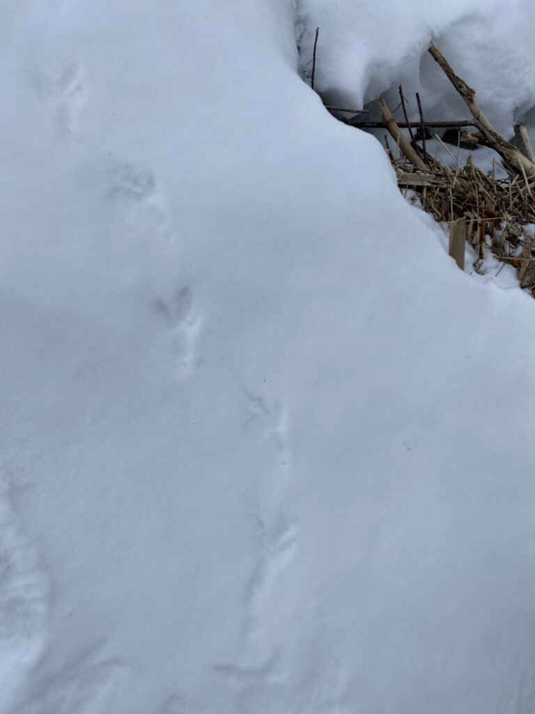
A small mammals prints in the snow. Although the prints weren’t clear enough to properly identify it, based on the grouping of the print and location (near salmon hole), I believe it was a weasel.
A closeup of the unidentified mammals tracks.

February – New Site and Wildlife Activity

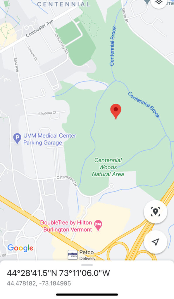
Unfortunately, my old site is no longer accessible now that there is snow, so I’ve moved my location to a spot in centennial woods. You can reach my site by following the main trail at the entry for about half a mile until you arrive at a relatively large clearing where the trail splits in two. If you follow the trail downwards instead of up the hill and cut to the right about 200 feet off the trail, you will arrive at my site. The coordinates are (44.478182, -73.184995), and a picture of my sites location is included below.

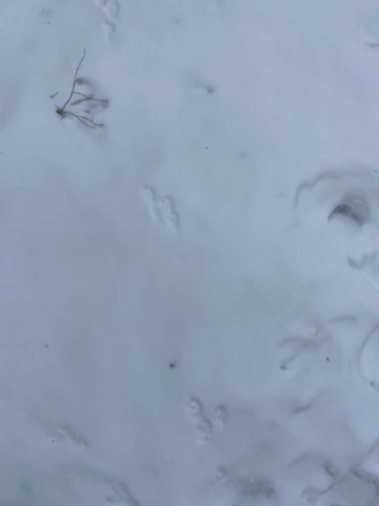
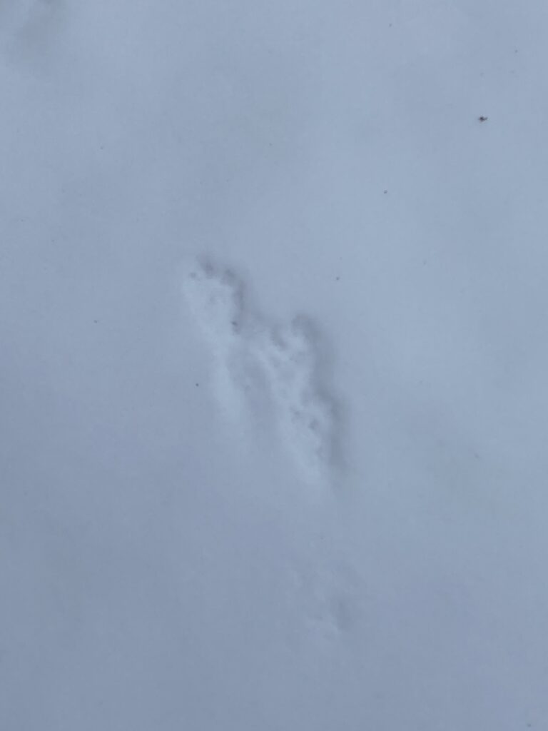
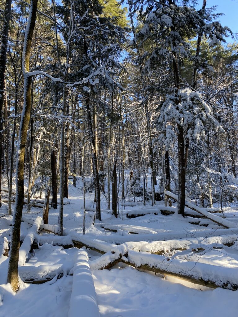
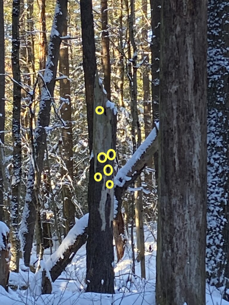
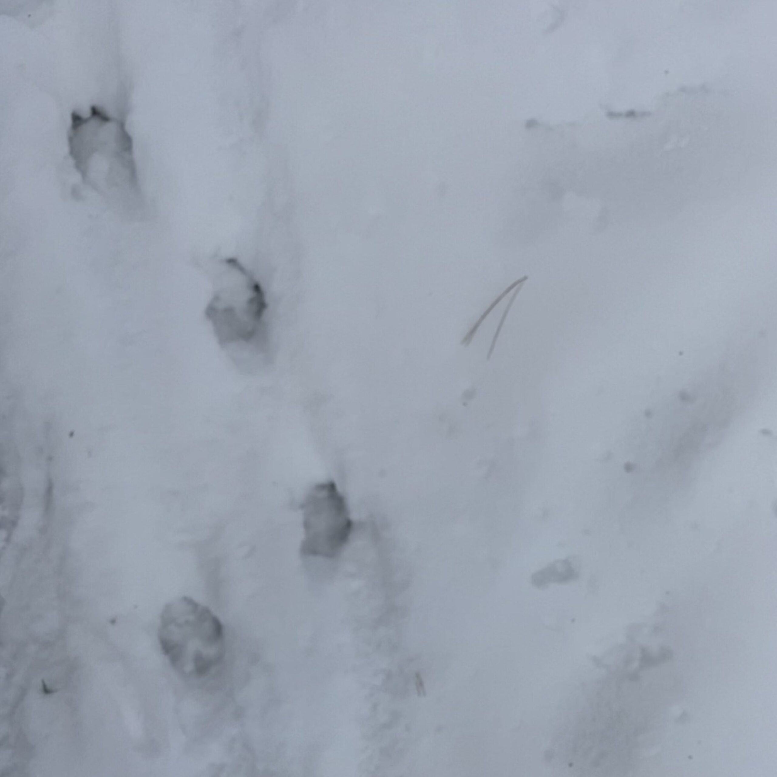
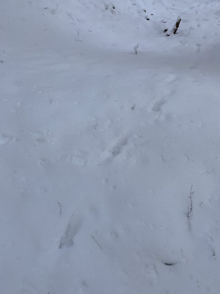
My site is largely dominated by eastern white pine, eastern hemlock, and yellow birch trees. Most trees are relatively large, with around 60% of living tree species in the overstory. There is also a large amount of fallen logs and snags, potentially offering a good habitat for surrounding wildlife and other plant species. There was not much evidence of wildlife activity at my site, as much of the snow was fresh. However, I did notice clusters of holes in some of the snags, likely left by woodpeckers. These holes could offer shelter for birds or small mammals, such as squirrels. I also noticed two sets of tracks around my site, as can be seen in the photos below. I think that one set of tracks is just from a dog passing through the area, but the second set I haven’t identified. I think that there is a good chance they were left by a cottontail rabbit because of the size and close proximity of the prints. The tracks were around 9 cm in length and distanced about a foot apart from each other, like the animal was hopping.

The location of my site on a map of centennial woods, as represented by the red dropped pin.
An overview photo of my site, showing the snags and fallen logs as well as the local tree species.
One of the snags with holes left in the trunk, marked with the yellow circles.
The first set of animal tracks — likely dog tracks.
The second set of animal tracks — potentially rabbit prints, specifically the cottontail rabbit.

Site History

As my site is not situated near any particular location of importance, it was difficult to learn about the history of the exact location I chose. However, my site is located right off of Highway 127 and the Highway 127 bike path (Google, n.d.). Although there is also limited information about the history of the highway, it was built in 1950 as the result of a petition and initially only covered 0.147 miles (“State Highways”, 2007). Since then, it has been expanded once in 1971 by 1.600 miles and then reverted -1.600 miles in 1980 (“State Highways”, 2007). Despite no direct ecological impacts being recorded, it can be assumed that the creation and continuous alteration of both the bike path and the highway caused deforestation and clearing, habitat fragmentation, and a decrease in biodiversity as a result.

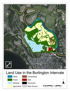
Although located on the far west section of the Burlington Intervale, my site is technically included in the extended map of the natural land associated with the Intervale. The Intervale is a floodplain that reaches across 870-acres and has historically provided Burlington with a location for rich biodiversity and sustainable food systems (Berrizbeitia, n.d). Acting as a habitat corridor, many animals have used the Intervale throughout the past as a safe way to traverse the landscape. Similarly, frequent flooding has left the soil extremely fertile and allows for a wide range of plants to grow. The fertility and biodiversity of the site created an ideal location for indigenous Abenaki to live, with the oldest evidence of Native use of the land dating back to 3000 BC (Berrizbeitia, n.d). The remnants of Abenaki life, such as burial sites, ceramics, and various agricultural tools show the history of land use in the Intervale and disclose various seasonal patterns (such as hunting and gathering patterns used by the Abenaki) (Berrizbeitia, n.d). During the late 18th century as European settlers colinized the area, hundreds of acres of the Intervale were cleared and converted into farmlands. It was not until the 1980s that the Intervale began to become converted back to organic farming, largely by Will Raap. Raap went on to found the Intervale Foundation, now known as the Intervale Center, near the end of the 20th century (Berrizbeitia, n.d). The Intervale has been officially recognized by the Intervale Center over the past 20 years as a hub for local food systems, including local farmers, community gardens, and community access to natural spaces.

Berrizbeitia, I. Land Use in the Burlington Intervale [map]. Burlington Geographic
Map of the land use in the Burlington Intervale. My site is located on the far west near the highway, around halfway up the western border. The site technically falls under the treed category, although part of the wetland is noticeable from my site (the marsh).

Works Cited

Berrizbeitia, Ines. “Focal Places in Burlington.” Burlington Geographic, www.uvm.edu/place/burlingtongeographic/focalplaces/int-context.php.

Google. (n.d.). Retrieved from URL

“State Highways History.” Vermont Transportation Maps, Vermont Agency of Transportation, 5 Oct. 2007, vtransmaps.vermont.gov/Maps/Publications/Historical/History_byRoute.pdf.

Late November – Comparison Between Portland and Burlington

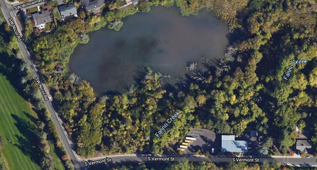
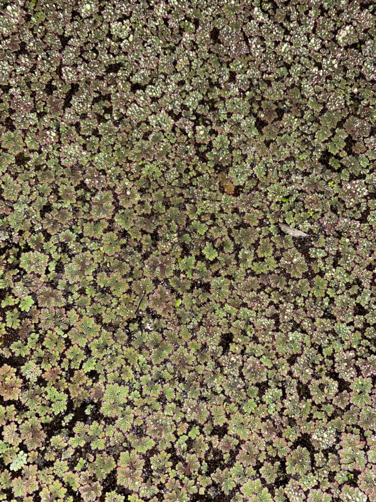
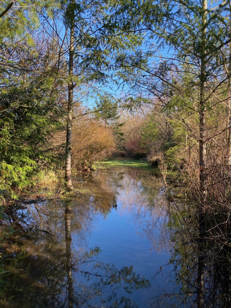
The phenology spot I chose in my home town is a small wetland located near my neighborhood and old school. The wetland isn’t too large, it’s roughly the size of a soccer field. The area is dominated by small woody plants and shrubs, although there were a few larger trees as well. The largest trees in the area were birches planted along the dirt path leading to the site, although there was multiple ashes and a few boxelders closer to the water. There were also a few young pines and barberry shrubs along the path. The area had some grasses and weeds, although most of the ground was covered in wet, decomposing leaves that had been freshly shed. Historically, the site has had a problem with an overgrowth of aquatic plants on the surface of the lake. I’m not entirely sure what species of plant it is, but it has slowly been taking over the wetland for the past couple of years. The condition of the plants has worsened such that a thick layer of the small plants ranging between a half an inch and a full inch thick has developed across the water’s entire surface. The plants were so thick that I watched a small sparrow walk across the surface.

Other than the sparrow, a few other small birds were seen quickly or heard through their calls. The only bird I could identify through its call was a chickadee, although there were multiple other species present. I also witnessed a huge flock of between 20 and 30 geese fly overhead, although none stopped. When I visited the site again a few days later earlier in the day, many ducks were sited along the edges of the wetland. Three male mallards were seen and around 8 younger female mallards.

This site is similar to my Burlington site in the sense that both are centered around some small body of water. Similarly, both bodies of water are dealing with a type of plant growth on the surface, with my Portland site being covered in an aquatic plant and my Burlington site having a few small algal blooms. Both sites have a range of birdlife, although it seemed that my Portland site had a wider range of species and was potentially a more ideal habitat given the number of birds seen and heard. Geese, although likely different species, were spotted at both sites. Although the vegetation was largely different, a few similarities include a high frequency of smaller bushes and a few ashes present at both locations. My Burlington site was dominated by reed plants, such as cattails and bulrushes, although no reed plants or longer grasses were present at all near my Portland site. The cold, overcast, and damp weather I experienced in Portland when visiting my site reminded me of the weather conditions of my Burlington site on my most recent visit, as both sites are reflecting the slow transition to winter.
Google Maps (n.d.). [map]
An overview of my site on Google Maps. The entrance to my site is a trail that veers off of Vermont street and goes right around Fanno Creek, and is noticeable by a thinning of the trees in the area. This photo was taken before the aquatic plants began to take over. My neighborhood is north, where there are a few houses noticeable, and my school is south. Right past Vermont street is my high school’s soccer field, with the school buildings further down. To the left is a golf course.
Wetsel, E (2020). Untitled [photograph].
A close up of the aquatic plants on the wetland’s surface. Since this was taken near the edge of the lake, it is much thinner than the rest of the plants towards the middle of the water. In this photo, the individual plants can be seen in their small clusters.
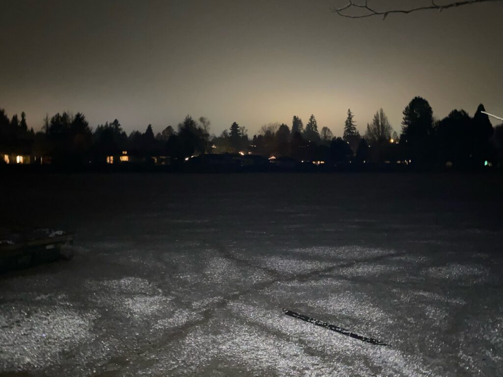
Wetsel, E (2020). Untitled [photograph].
A photo of the wetlands at night. The white layer along the surface of the water that looks a little bit like snow is the plant growth. You can clearly see through this photo the severity of the issue, as well as the plant’s nature to group into denser clumps. The neighborhood can be seen on the far side, as well as some larger pines along the horizon.
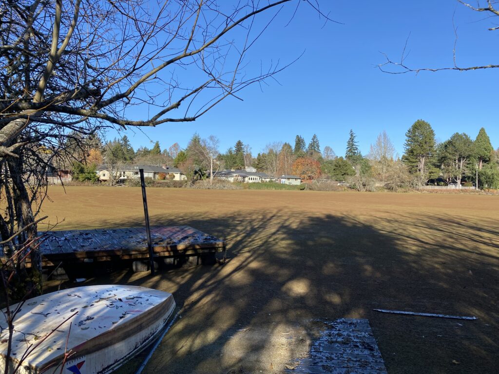
Wetsel, E (2020). Untitled [photograph].
The wetlands during the day, with the plant growth more visible. Also noticeable in the picture are wooden docks and an overturned boat, both examples of human interference with my site.
Wetsel, E (2020). Untitled [photograph].
Overflowing of the wetlands into the nearby grassy land as a result of increased rain throughout the fall and early winter season, causing flooding.

Early November – Events Map and Observations

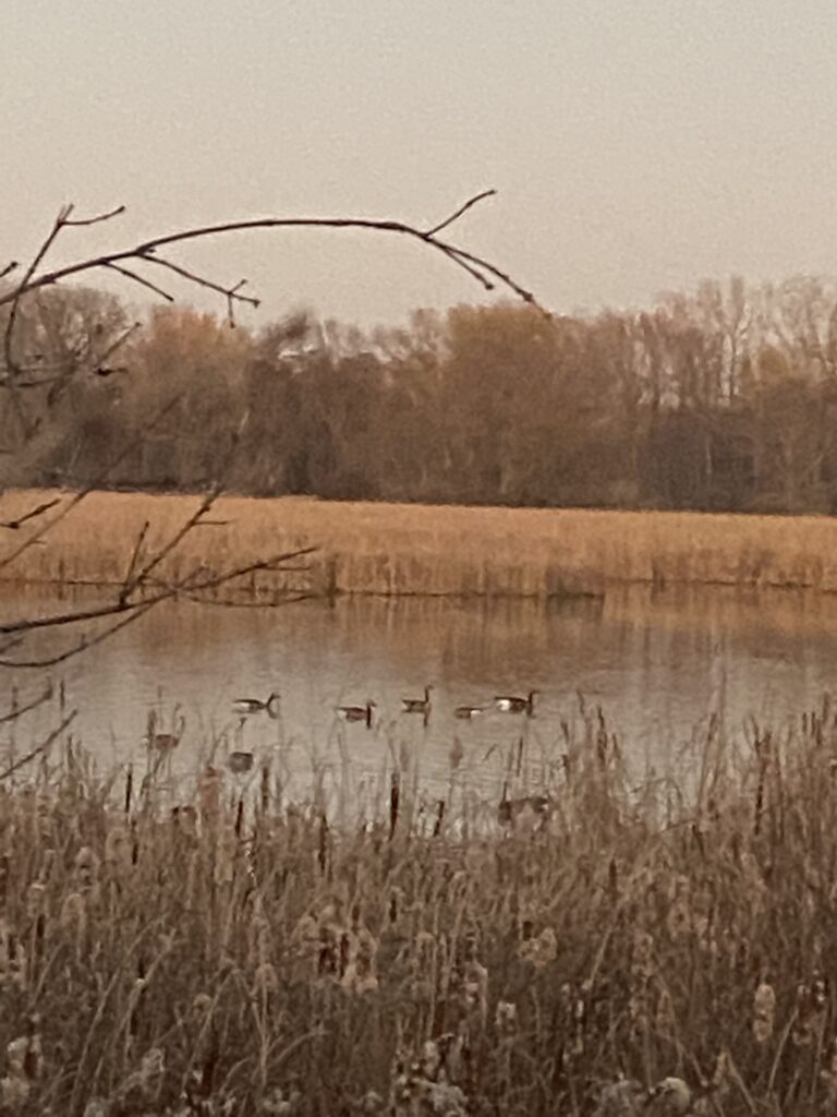
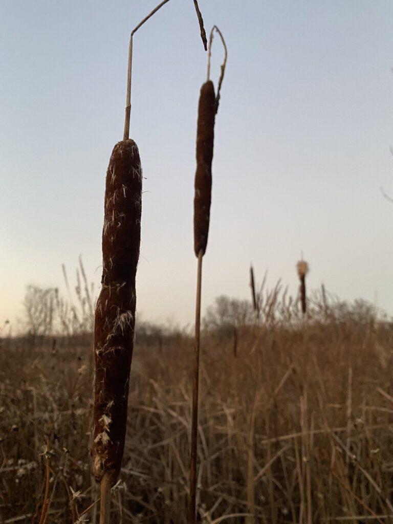
The main change in my site since I last visited were with the vegetation. The green ashes lost their remaining leaves, with only a few dried leaves hanging on to the branches. The buckthorn shrubs had also lost the majority of their leaves as well. Overall, there was a shift from more green vegetation to brown and yellow vegetation as the long grasses and weeds surrounding the site died off and the majority of other plants lost their leaves, resulting in bare branches. The bulrushes and other reed plants are still in the process of seed dispersal, and nearly every bulrush had small white tufts of seeds slowly coming out. The algae blooms on the lake were gone, potentially due to colder waters making it harder for the algae to live.

Snow geese were still present at the site. There were two relatively large flocks swimming in the marsh, around 20 total. The geese were relatively calm, honking occasionally but mostly inactive. No other birds were sighted. Similarly, no birds nests were found—even in the snag—which surprised me.

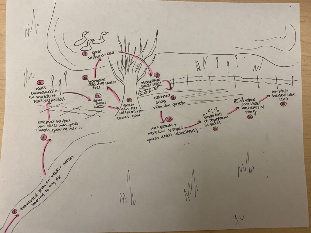
I found more evidence of human life at my site today than in the past. There were multiple pieces of styrofoam, a crushed can, a few large and partially buried plastic bags, and a small plastic shovel under the green ash tree. Similarly, I found that half of the barbed wire fence to the left of the green ash tree was collapsed with weeds and grasses growing over it. The trampled paths of grass leading down to my site were also more distinct, potentially implying that more people have been visiting it.

Wetsel, E (2020). Untitled [drawing].
Events map of my phenology site on 11/8/2020
Wetsel, E (2020). Untitled [photograph].
Eight geese pictured swimming on the lake.
Wetsel, E (2020). Untitled [photograph].
Bulrushes opening up for seed dispersal near the lake.
Wetsel, E (2020). Untitled [photograph].
An unknown woody plant flowering.
Wetsel, E (2020). Untitled [photograph].
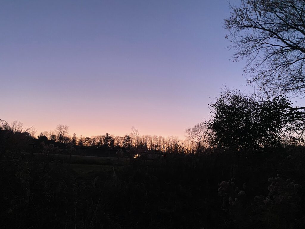
The sunset to the backside of my phenology location as I was leaving.

Late October – Birds-eye Overview and Seasonal Changes

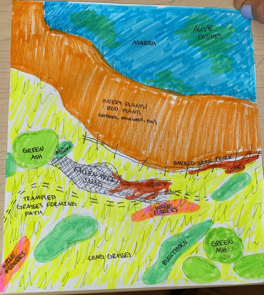
Attached below is a birds-eye overview map of my phenology site. The different tree and plant species are labeled with corresponding colors, and the area is broken down into three main areas: the marsh itself (in blue), the rod plants growing on the outskirts of the water (in orange), and the grassy land primarily dominated by long grasses and scattered trees and woody shrubs (yellow). Also shown in the map are the components of my site that have been impacted by humans, such as the barbed-wire fence separating the grassy land section from the rod plants section as well as the trampled grass forming a sort of path through the site.

The biggest changes in vegetation since my last visit are relatively typical and expected for this time of year. The green ash trees had lost the majority of their remaining leaves. The buckthorn shrubs still had the majority of their leaves, as can be expected due to their tendency to shed their leaves later in the fall than most leafy plants. Most of the reeds near the marsh looked relatively similar in appearance, although most of the reeds and grassy plants had shifted from darker green colors to more diluted brown colors. The majority of the milkweeds at my site had shed their seeds and were empty shells.

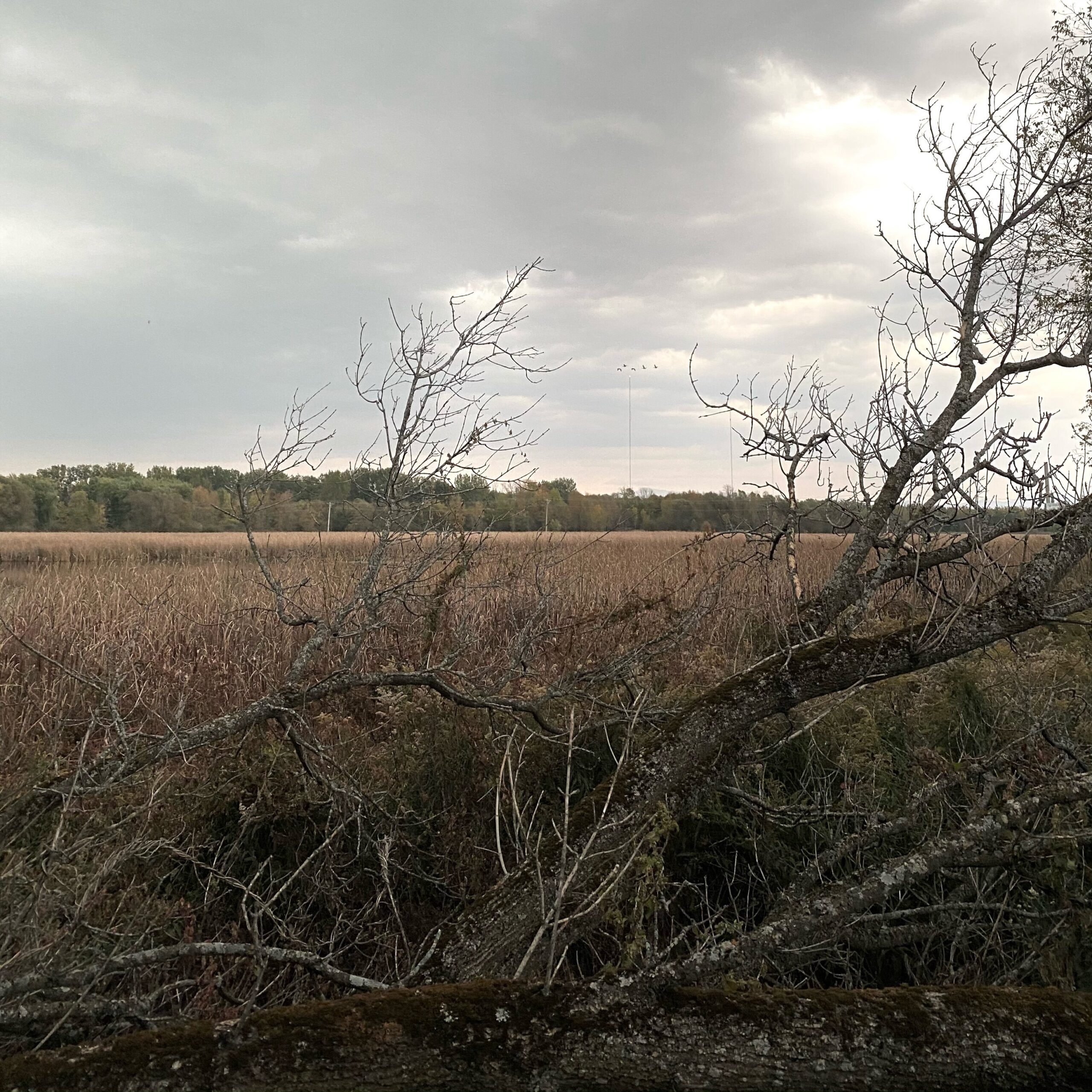
The biggest evidence of animals using my site as habitat is the continuous presence of birds at the site. The presence of the large snag in the center of my site seems to be an ideal habitat for birds, insects, and other small animals. Small birds were seen again sitting on the snag and darting down into the reed plants. I couldn’t capture any photos of the birds themselves, but an image of the snag is attached below. There were also berries strung along the snag that I couldn’t identify, but they could potentially act as a food source for nearby birds (a picture is also attached below). Another flock of geese was spotted flying over the site, as can be seen in image four. Although they didn’t land at the site, my phenology location could potentially be a stopover site for geese during migration due to the presence of the marsh and nearby food sources (grasses and seeds). Because of the barbed wire fence, I couldn’t get close enough to the marsh to look for aquatic life or macroinvertebrates that could have been at the site.

Wetsel, E (2020). Untitled [drawing].
The birds-eye overview map of my phenology site, with the different plant species labeled with corresponding colors and the three main sections of the long grasses, rod plants, and marsh represented by yellow, orange, and blue.
Wetsel, E (2020). Untitled [photograph].
An image of the snag located at my site, acting as a potential habitat for nearby animals.
Wetsel, E (2020). Untitled [photograph].
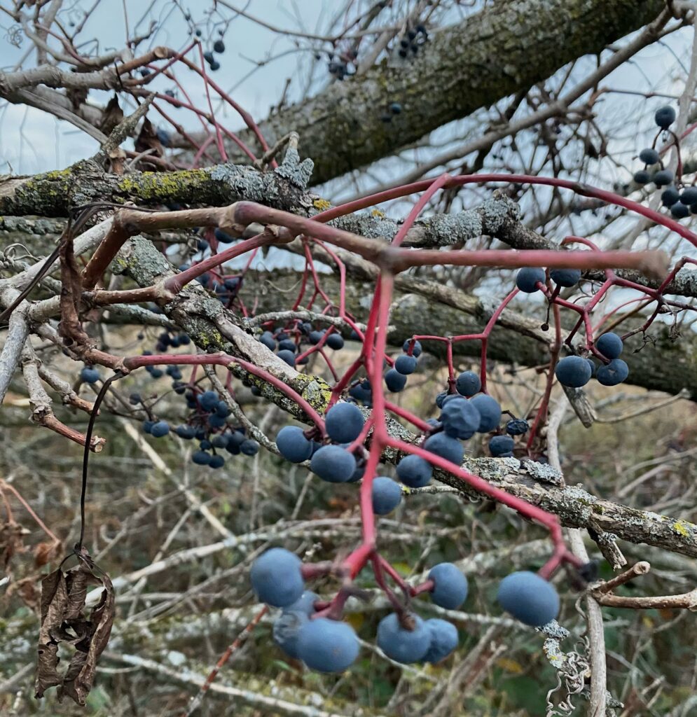
The unidentified berries found coiled around the snag. Depending on the species of plant, the fruit could potentially be a source of food for birds and other animals.
Wetsel, E (2020). Untitled [photograph].
A flock of geese flying over the marsh behind the central green ash tree.

Site Introduction and Overview – October

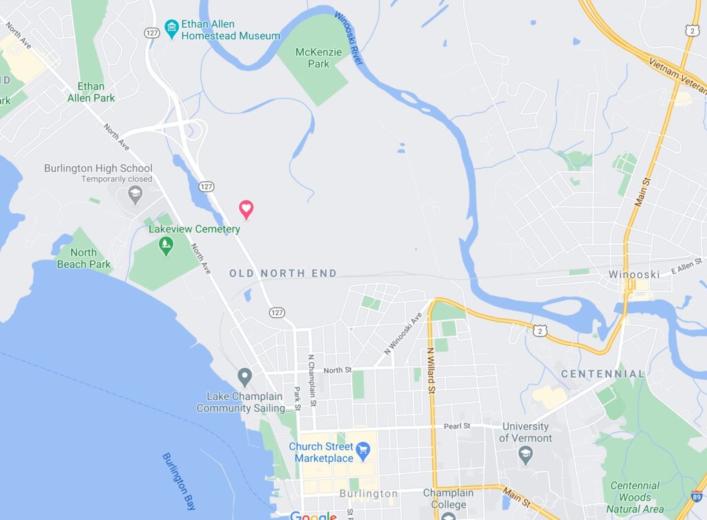
My phenology site is located along the bike path on the way to the Ethan Allen Homestead (coordinates 44°29’43.1″N 73°13’27.3″W). Biking to my location from campus takes around 15 minutes and is relatively straightforward—you ride down North Prospect street, turn left on Bright, right on Oak, left on Louis, and then take the bike path down for around one mile. My site is a large and easily noticeable wetland to the left right off of the path.

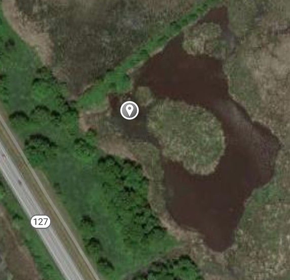
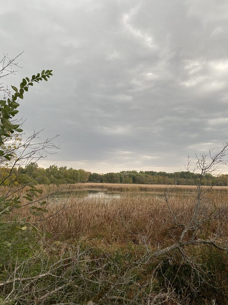
The wetland itself is around 150,000 square feet, although my site hones in on the banks of a smaller section of open water thats around 15,000 square feet. The water is mostly still, only moved occasionally by the wind. Multiple dark green patches of algae were present on the surface of the water, indicating potential algal blooms as a result of the still water and potential pollutants entering the lake. The area itself is largely open and dominated by long grasses and weedy plants, such as cattails, bullrushes, milkweed, and Joe Pye Weed. The only trees present were green ash trees, and there were around a dozen scattered across the area. All of the green ashes were large, varying between 30 and 50 feet, indicating that they are all relatively old and have been present at the site for a while. Common buckthorn also dominated the area, largely growing near or under the green ashes, and were also relatively large in size and well developed (size varied between 3 to 8 feet).

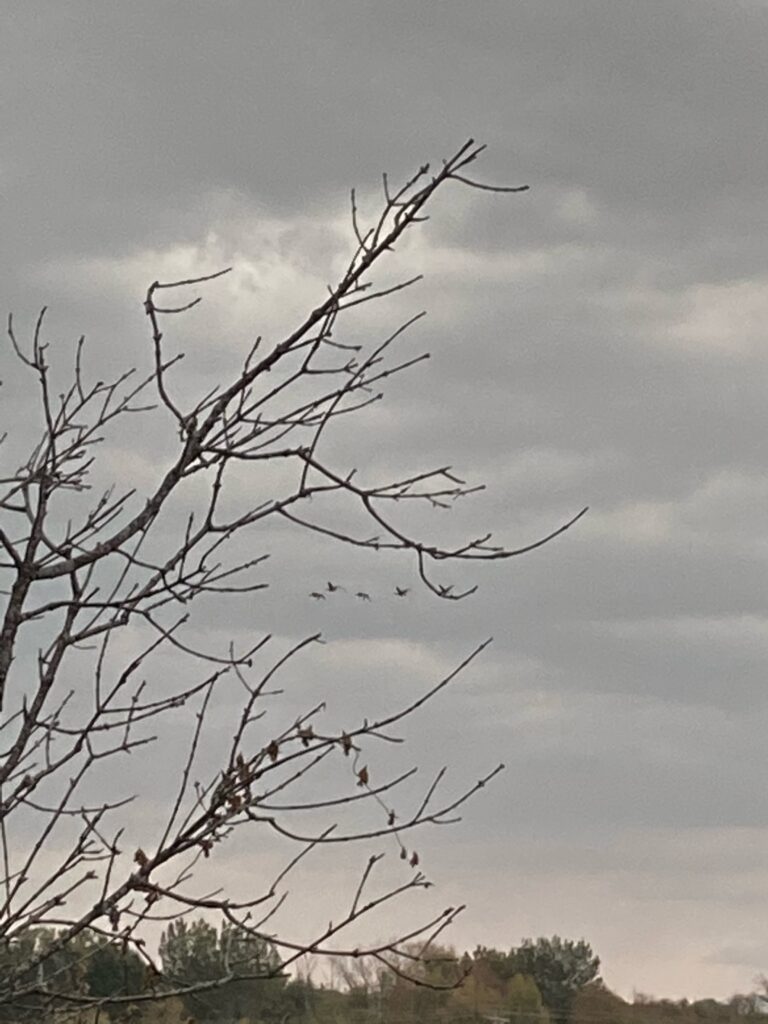
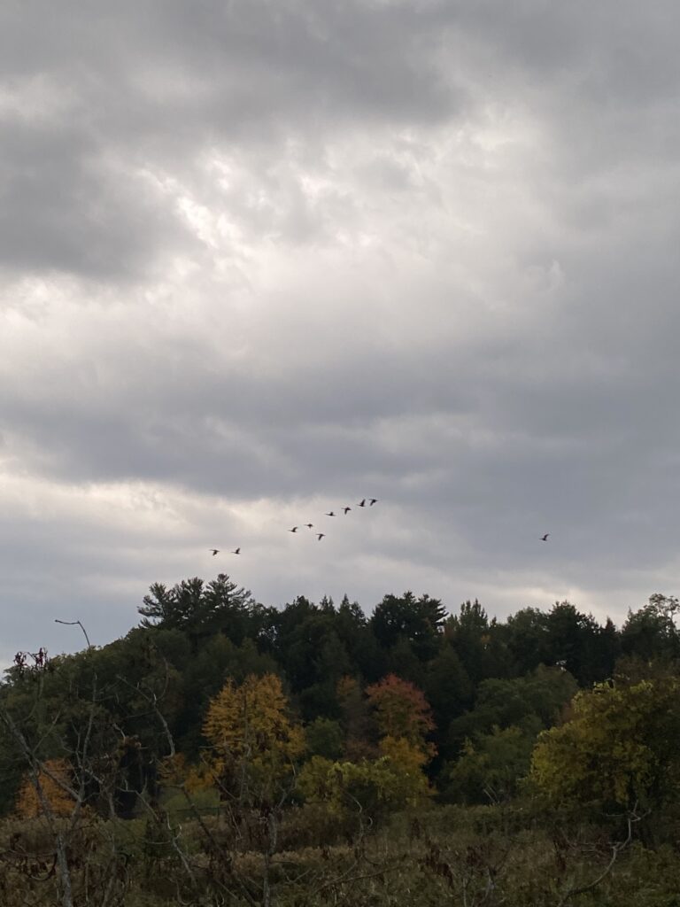
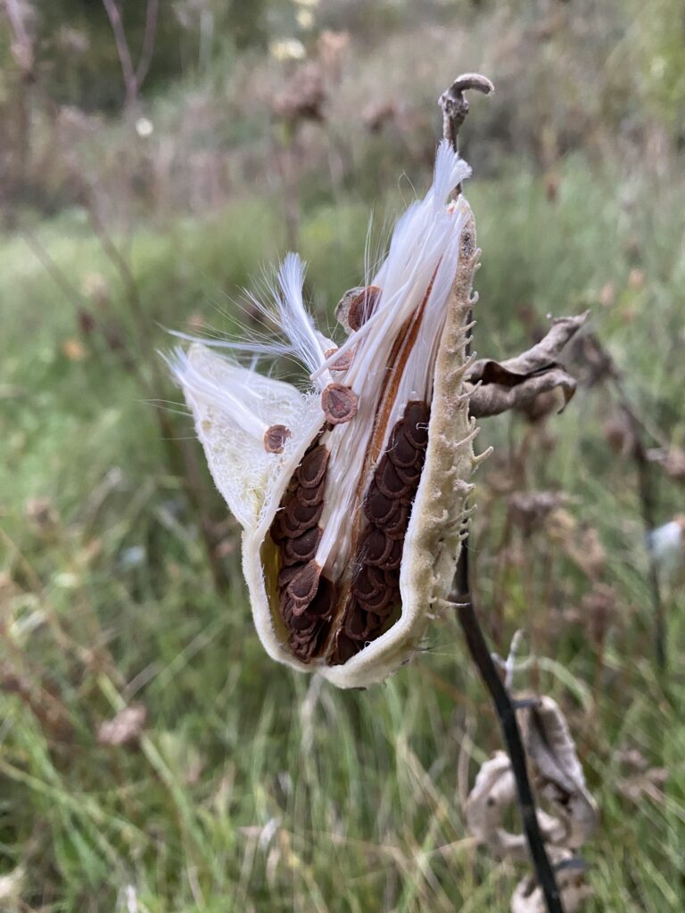
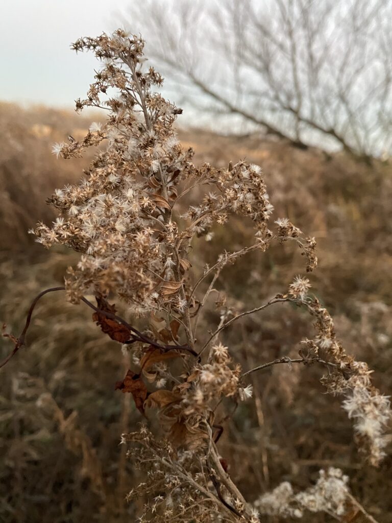
Multiple flocks of geese flew overhead while I was at the site, indicating the migration currently occurring as bird species move south. A few small sparrows were also spotted in the green ashes. The milkweeds spotted had mostly already opened to disperse seeds, although around 20% were either still closed or beginning to open. Most cattails were still closed, although a few spikes had begun to open as well. As October is the month in which most seeds are dispersed, this behavior is characteristic to the fall and expected for the area.

The weather while observing my area was around 65 degrees, overcast, and rainy. A thunderstorm began while I was at the site, potentially impacting the animal species in the area.

Google Maps (n.d.). [map]
My site, indicated by the favorited pink pin, on a map of the greater Burlington area.
Google Maps (n.d.). [map]
A closeup of the site, with the grey pin in the middle of the section of the wetland I observed.
Wetsel, E (2020). Untitled [photograph].
An overview of the site, with the marsh observed in the center.
Wetsel, E (2020). Untitled [photograph].
Geese flying overhead during migration.
Wetsel, E (2020). Untitled [photograph].
Milkweed beginning to open for seed dispersal.