I haven’t had a chance to return to the quarry since I made my event map on November 4th. I was hoping to see it once more before I leave but I’m currently in quarantine after being exposed to someone who tested positive for COVID-19 (I feel healthy and they don’t have any symptoms, fortunately), and I’m driving straight back to Massachusetts when I get out to avoid being exposed to the virus on campus. However, before I went into quarantine I paid a visit to the Silver Special Collections, housed at the Billings Library, to research the history of Redstone Quarry. I would like to thank the librarian Prudence Doherty, who was invaluable in assembling primary sources for the information below.
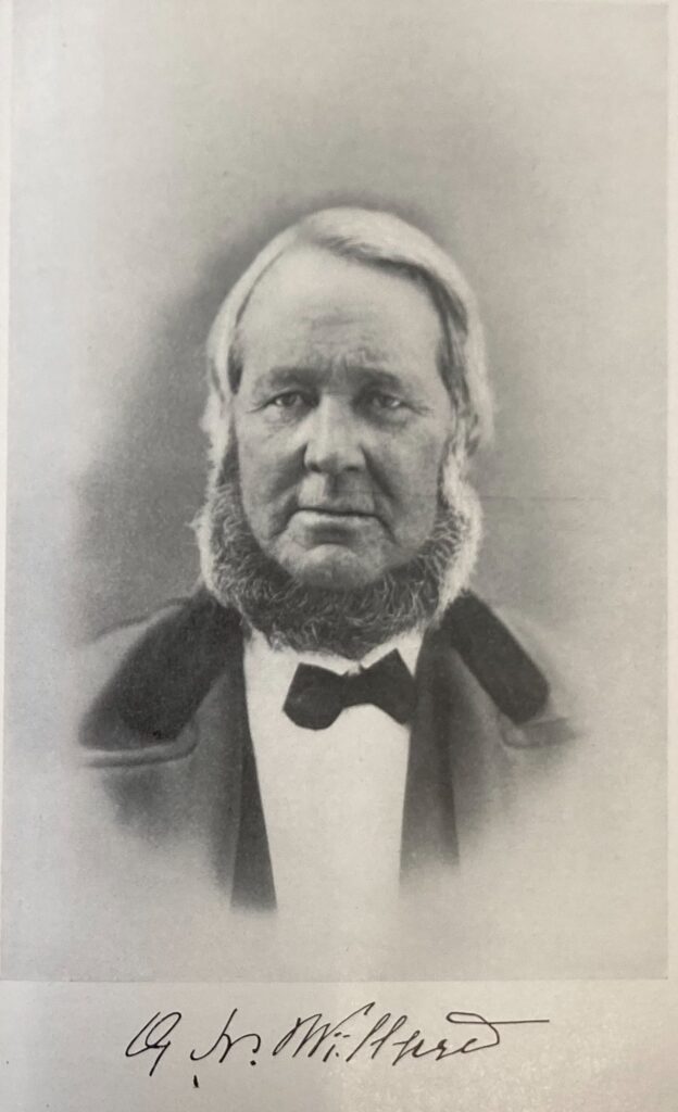
Redstone quarry was known as Willard’s Ledge during its history as a working quarry. The Willard family, who gave it its name, lived on Willard Street, off of which the quarry is found. Levi Willard, the landowner, opened a successful quarry on the site in 1805. Following his death his son Guy N. Willard assumed control of the quarry and built it into “one of the most famous [quarries] in the state” (Carleton, p. 470). It employed 50 men by 1882 and provided stone for the Cathedral, the Methodist Church, much of UVM’s Redstone Campus, and numerous other construction projects.
Guy Willard, from Adams, First Annual Report on the Geology of the State of Vermont.
Guy Willard married Bulah Bishop in 1836, and the couple had three children before her death in 1843: Eliza A., Hymon G., and Hollis B., who died at age four. Hymon pursued a career in civil engineering, but returned home and took over his father’s business just prior to his 1892 death. Around this time the city of Burlington also operated a rock crusher at the site, which was used to crush gravel for streets. In November 1894 the shed it was housed in caught on fire, and the damaged crusher was relocated to the dock in April of the following year.
A Blake stone crusher, as used at the quarry
After Hymon Willard, the quarry’s proprietors are unclear, but in 1958 the University of Vermont purchased the site from Robert Patterson at a price of $500 to use “for geology class study purposes” (UVM Board of Trustees, as cited in UVM Trustees Vote to Buy Quarry, Accept Ski Project). The University of Vermont had conducted field trips to the location since at least 1935, and college students visited the site in 1890 or earlier. It is now managed as a natural area by the University of Vermont, and is a frequent destination for class trips thanks to its interesting geology and its proximity to campus.
The “redstone” at Redstone Quarry is referred to by a confusing variety of names, including “red sand-rock” and “Winooski marble.” However, scientifically it is neither sandstone nor marble; it is principally dolomite and Monkton quartzite. The transition between the two is characterized by ripples and stripes, answering the question I had about the pattern part way up the cliff face. My hypothesis that it is the same dolomite as Rock Point was correct – dolomite bedrock extends throughout much of Burlington and the surrounding area.
I’m not sure when I’ll be able to visit the quarry next, but expect more posts in the upcoming months.
Works Cited
(1890, April 24). Morrisville News and Citizen. https://www.newspapers.com/clippings/download/?id=62601494 [p. 3]
(1892). Twenty-Seventh Annual Report of the City of Burlington, Vermont. Burlington, VT: Free Press Association.
(1894, November 12). City and Vicinity. Burlington Daily Free Press. https://www.proquest.com/docview/1949124155/9CB67C5F367A4D25PQ/4?accountid=14679 [p. 6]
(1895). Thirtieth Annual Report of the City of Burlington, Vermont. Burlington, VT: Free Press Association.
(1895, April 26). City and Vicinity. Burlington Daily Free Press. https://www.proquest.com/docview/1949124155/9CB67C5F367A4D25PQ/4?accountid=14679 [p. 8]
(1896). Thirty-First Annual Report of the City of Burlington, Vermont. Burlington, VT: Free Press Association.
(1935, October 17). Burlington Clipper. https://newspapers.com/clippings/download/?id=62600900 [p. 3]
(1958, June 14). UVM Trustees Vote to Buy Quarry, Accept Ski Project. Burlington Free Press. https://search.proquest.com/hnpvermontcollection/docview/1954613082/E5111963E76B4215PQ/11?accountid=14679 [p. 11]
Adams, C. B. (1845). First Annual Report on the Geology of the State of Vermont. Burlington, VT: Chauncey Goodrich. [p. 58]
Beers, F. W. (1971). Atlas of Chittenden Co Vermont. Rutland, VT: Charles E. Tuttle Company.
Carleton, H. (1903). Genealogical and Family History of the State of Vermont. New York, NY: The Lewis Publishing Company. [p. 470-471]
Child, H. (1882). Gazetteer and Business Directory of Chittenden County, Vermont for 1882-83. Syracuse, NY: The Journal Office. [p. 105]
Hitchcock, E., Hagar, A. D., Hitchcock, E., Jr., & Hitchcock, C. H. (1861). Report on the Geology of Vermont: Descriptive, Theoretical, Economical, and Scenographical (Vol. I). Proctorsville, VT: Albert D. Hagar. [p. 338]
Hitchcock, E., Hagar, A. D., Hitchcock, E., Jr., & Hitchcock, C. H. (1861). Report on the Geology of Vermont: Descriptive, Theoretical, Economical, and Scenographical (Vol. II). Proctorsville, VT: Albert D. Hagar. [p. 751, 773-774]
Keith, A. (1923). Cambrian succession of northwestern Vermont. American Journal of Science, 5th series, 5 (26), 97-139. https://ngmdb.usgs.gov/Geolex/UnitRefs/WinooskiRefs_4440.html
Lathrop, W. (2018). Finding Burlington’s Past in Redstone Quarry. Retrieved November 21, 2020, from https://enjoyburlington.com/redstone-quarry/
Michaud, D. (2016, January 15). Blake Jaw Crusher. Retrieved November 21, 2020, from https://www.911metallurgist.com/blog/blake-jaw-crusher
Steward, D. P. (1973). Geology for Environmental Planning in the Burlington-Middlebury Region, Vermont. Montpelier, VT: Water Resources Department. [p. 40 and plate II]
