For my wonder blog mini-project, I decided to create an illustrated trail map of the Salt Pond Preserve.
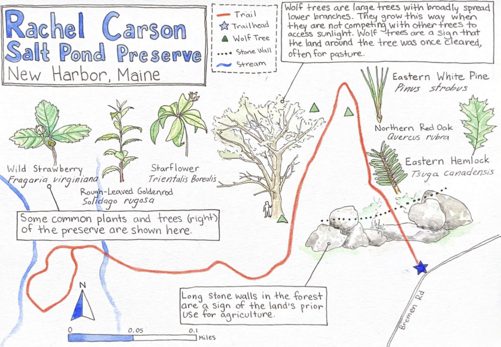
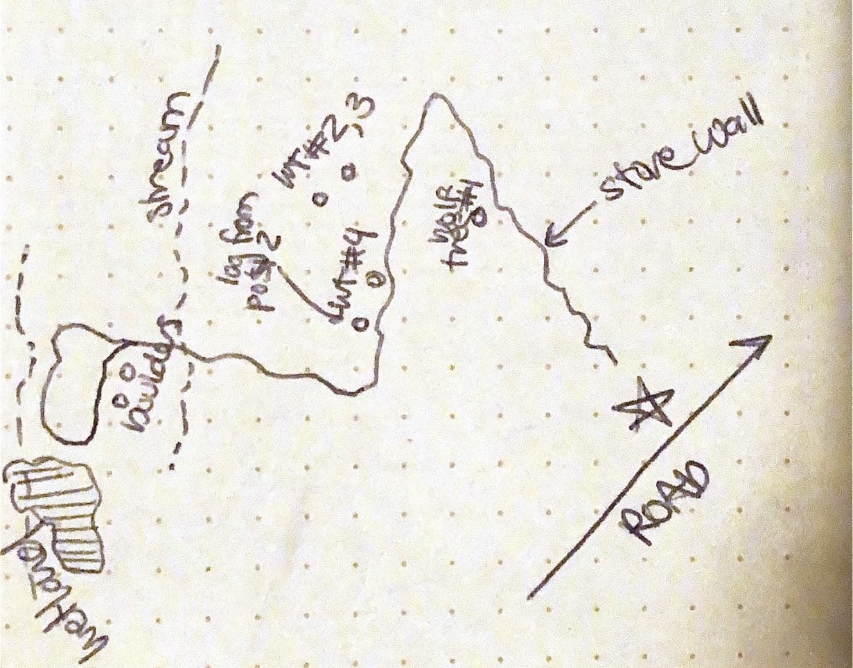
To start out, I returned to my site for a final visit. I had a few different goals for this visit. First, I wanted to record the locations of some of the things I had mentioned in previous blog posts so I could add them to my map. Before I began walking the trail, I sketched the trail map from the sign at the trailhead, and as I walked along, I made notes of certain locations, including the stone wall that crosses the trail and a few of the wolf trees I identified.
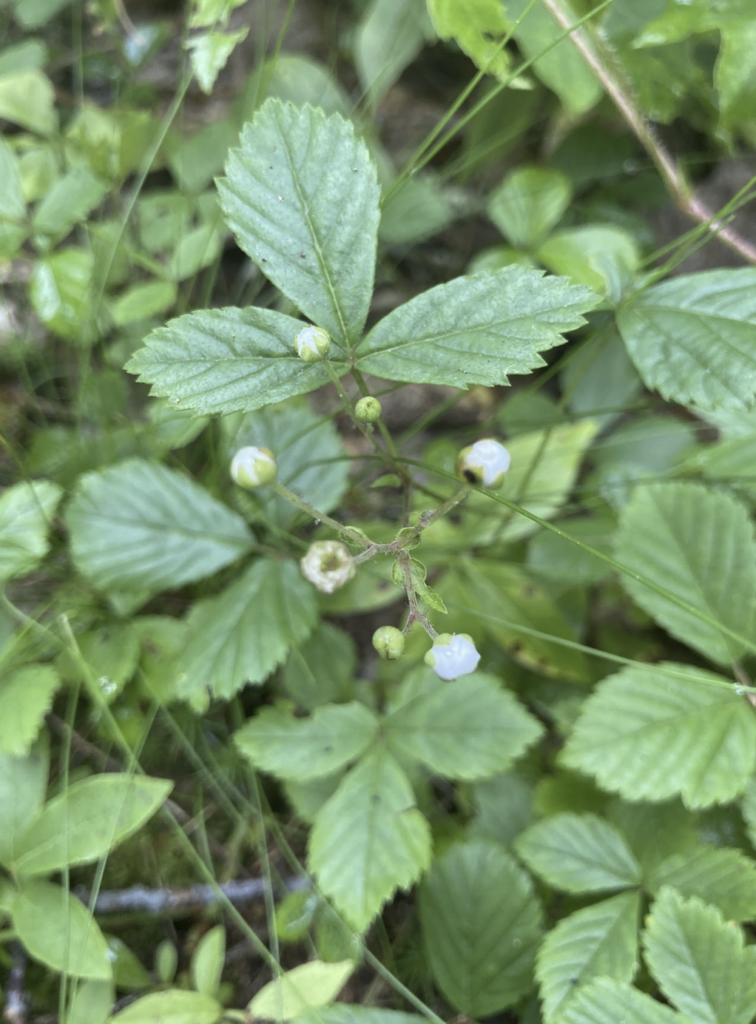
I also wanted to add a list of common plant and tree species, so that someone using this map could identify some of the plants along the trail. I took several photos of some of the most common plants in the undergrowth and some of the dominant tree species, so I could identify them when I returned from my visit.
After identifying these common plants and trees, it was time to decide what information to include on my map. Throughout my visits to the preserve, I’ve learned a lot about the natural history and different plant species of the site. I wanted to design the map so that someone could visit the trail and have a similar experience observing and learning from the site. To give a complete summary of the location, I decided to include the locations of the stone wall and wolf trees that helped me learn about this land’s agricultural past, as well as a short field guide to a few plants that are common on the trail.
I found the process of laying out the information to be especially challenging. I’ve never tried to create an informational illustration of this kind before, and balancing the right amounts of text and images to create a map that was educational but not overwhelming was difficult. I wanted to make sure that I was able to connect and communicate all of the different topics I’ve learned about over the past month.
Overall, I really enjoyed creating this map. I was able to combine aspects of each of the visits I made to the preserve, including the answer to my Entry 1 question marathon and sketching and plant identification skills from Entry 2. The map tells the stories of the areas of my site that inspired my curiosity and helped me learn more about the history and conditions of the Salt Pond Preserve, and I hope that it would communicate those same experiences to someone reading it as they walk the trail.
References:
“Broadleaf.” Weed Identification. Virginia Tech. Accessed July 10, 2023. https://weedid.cals.vt.edu/selectors/1
Forest Trees of Maine: Centennial Edition. Augusta: Maine Forest Service, 2008.
Hausheer, Justine. “A Walk in the Woods: Reading New England’s Forests.” Cool Green Science. The Nature Conservancy, last modified January 26, 2023. https://blog.nature.org/2020/01/13/a-walk-in-the- woods-reading-new-englands-forests/
“Plant Database.” Lady Bird Johnson Wildflower Center. University of Texas. Accessed July 10, 2023. https://www.wildflower.org/plants/index.php