Category: Uncategorized


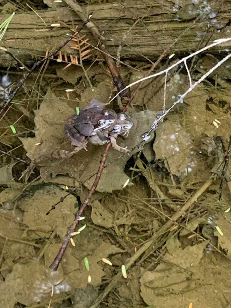
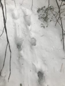
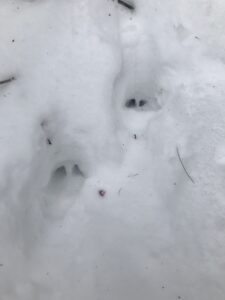
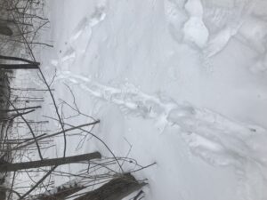
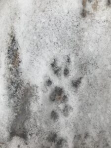
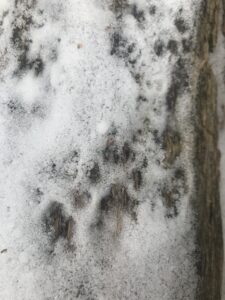
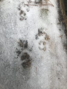
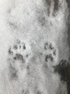
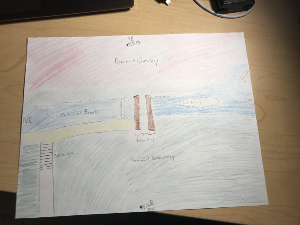
As I took my last visit to my phenology location for the year to observe the continued greening of Centennial Woods I reflected on the connectedness of nature and culture on my site and in Centennial as a whole. Throughout the year I observed a plethora of hikers in and near my location. In particular, my location is a hot spot for dogs being that Centennial Brook is very shallow and relatively calm here; there were numerous times throughout the year when a gleeful dog would be splashing around playing in the brook. On one particularity occasion I was on the floodplain side of the brook when a dog came sprinting down the hill of the leveed side of the brook to say hi to me. In terms of Centennial Woods as a whole nature and culture collide in a variety of ways. For example, during the winter I occasionally encountered cross country skiiers riding the paths throughout. A few weeks ago Centennial served as the location for a BioBlitz in which citizen scientists voluntarily cataloged some of the observed species in the woods. More over, having vernal pools attracts curious herpers, such as myself, hoping to encounter some breeding amphibians. Similarly, the high amount of song birds attracts many birders throughout the year.

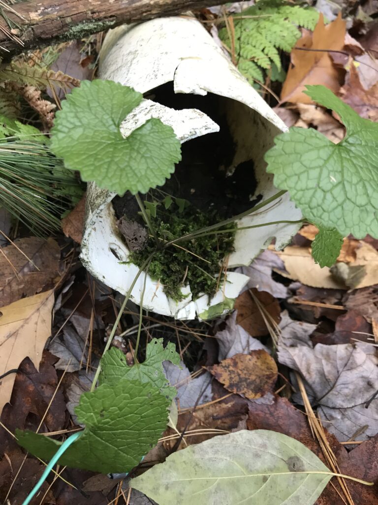
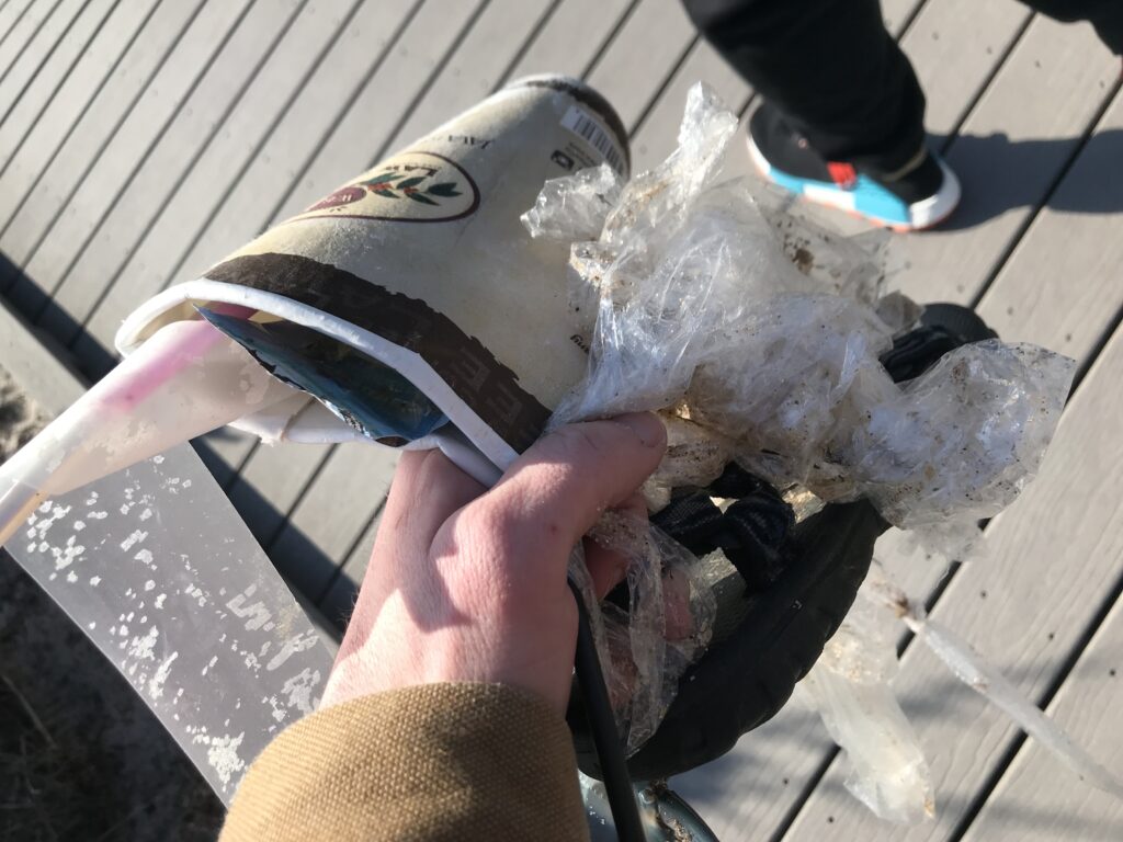
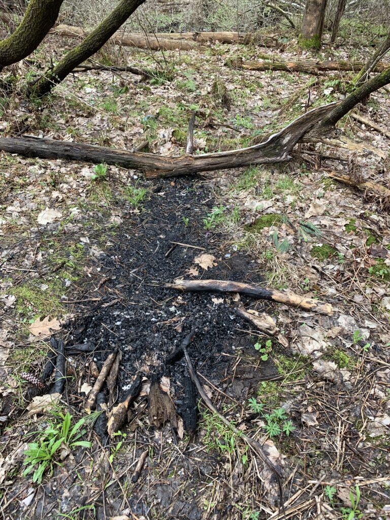
While the above examples illustrate nature and culture intertwining in non-impactful ways there are certainly examples of their collision in ways that damage nature. For example, throughout the year I found myself carrying various litter out of the woods. Additionally, it appears someone lit trash on fire in my phenology location that spread to some of the surrounding leaf litter.

Fire in my location

After numerous trips throughout the year I certainly consider myself to be a part of my location. As the year progressed my interest in the location greatly increased; when I first began visiting I found myself simply visiting to get the information to complete the assignment. After a few visits, i thoroughly developed an interest so I began taking the time to make careful observations of everything, including things irrelevant to the assignment. Additionally, I definitely had various impacts on my location even if it was inadvertent. As previously mentioned I picked up litter from my location numerous times. While this is beneficial to the natural community I am very aware of some of the inadvertent negative impacts I had throughout the year from exploring off of the designated paths. Some of these impacts include trampling some small plants and increasing the rate of erosion along the bank of the brook.

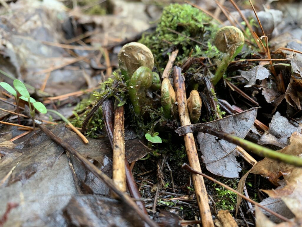
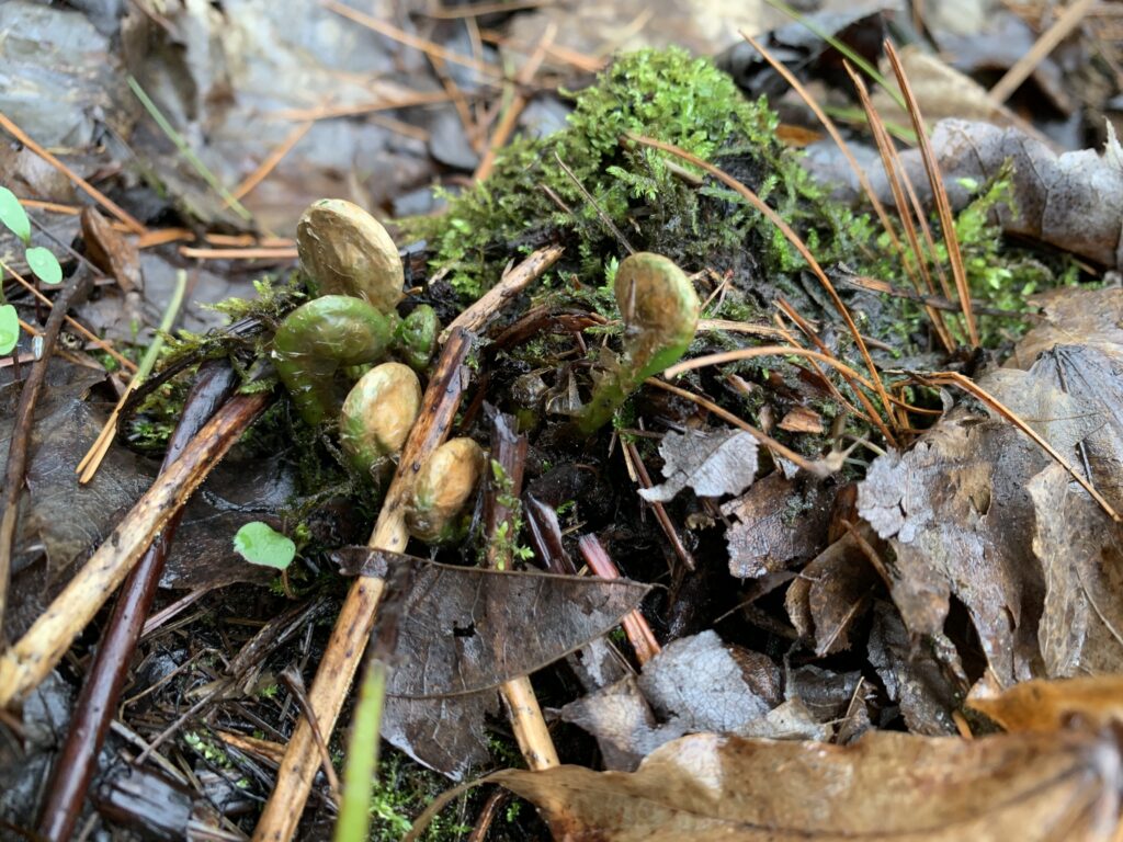
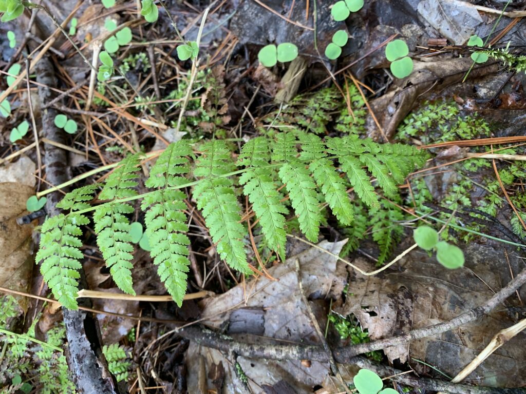
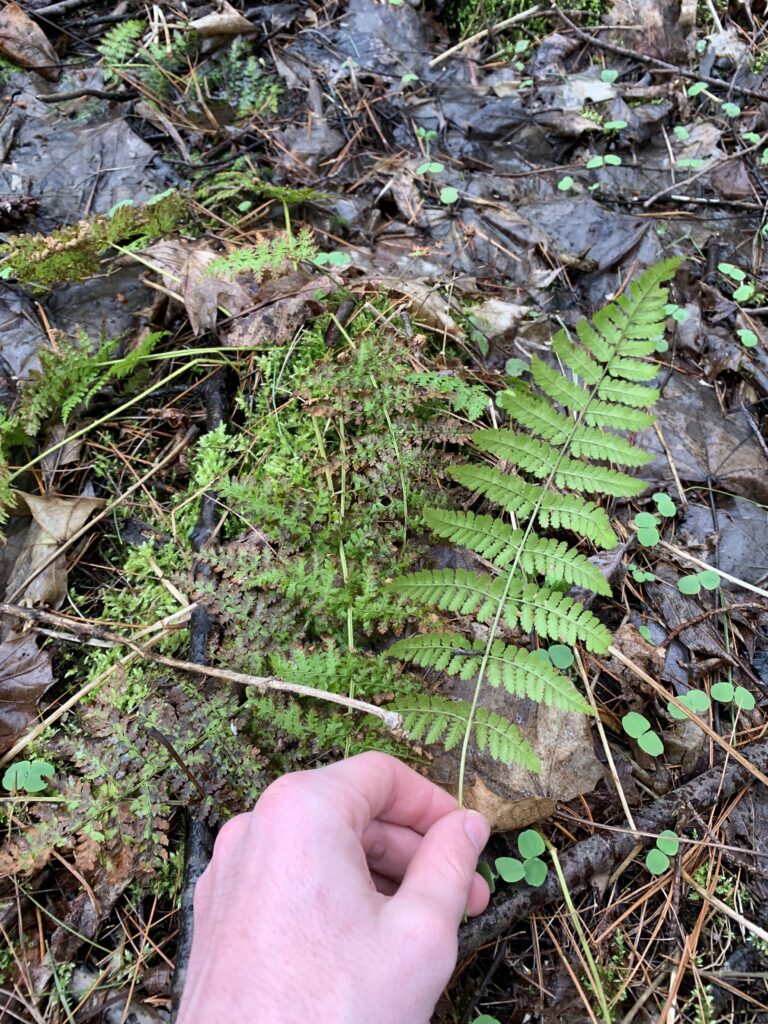
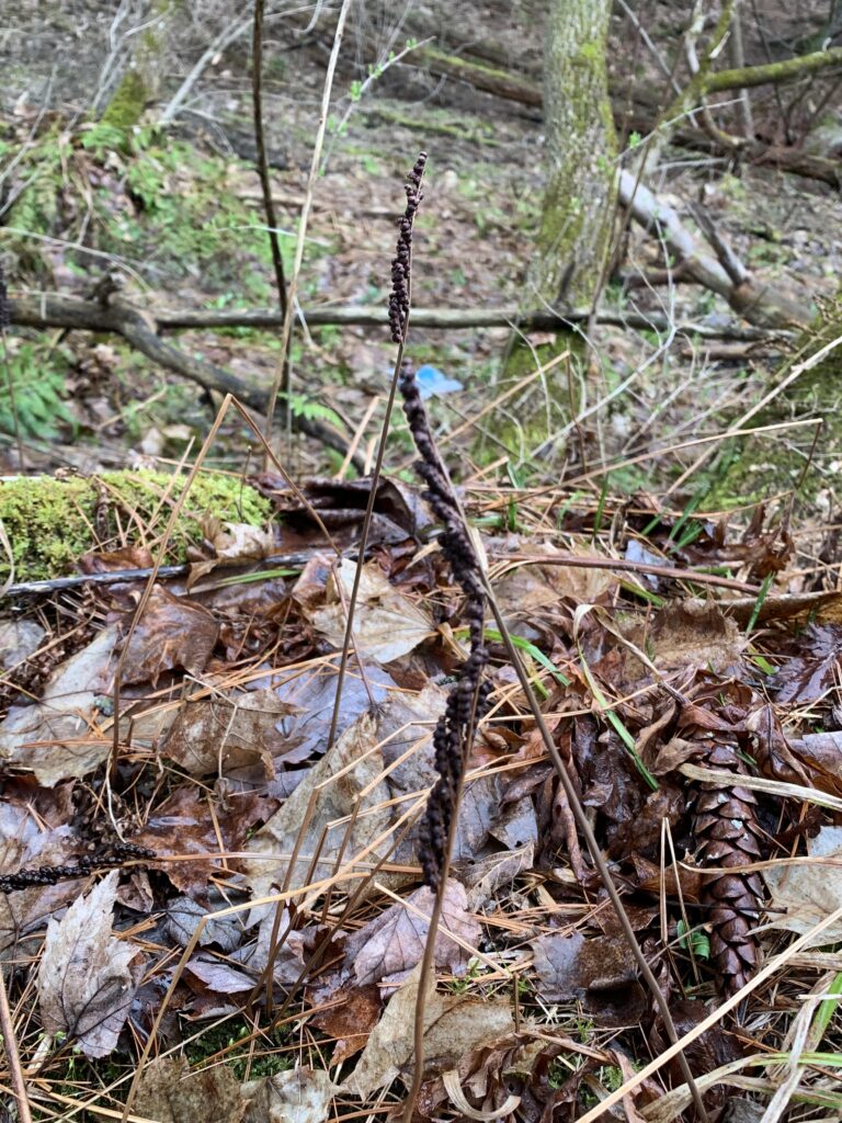
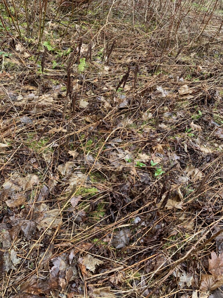
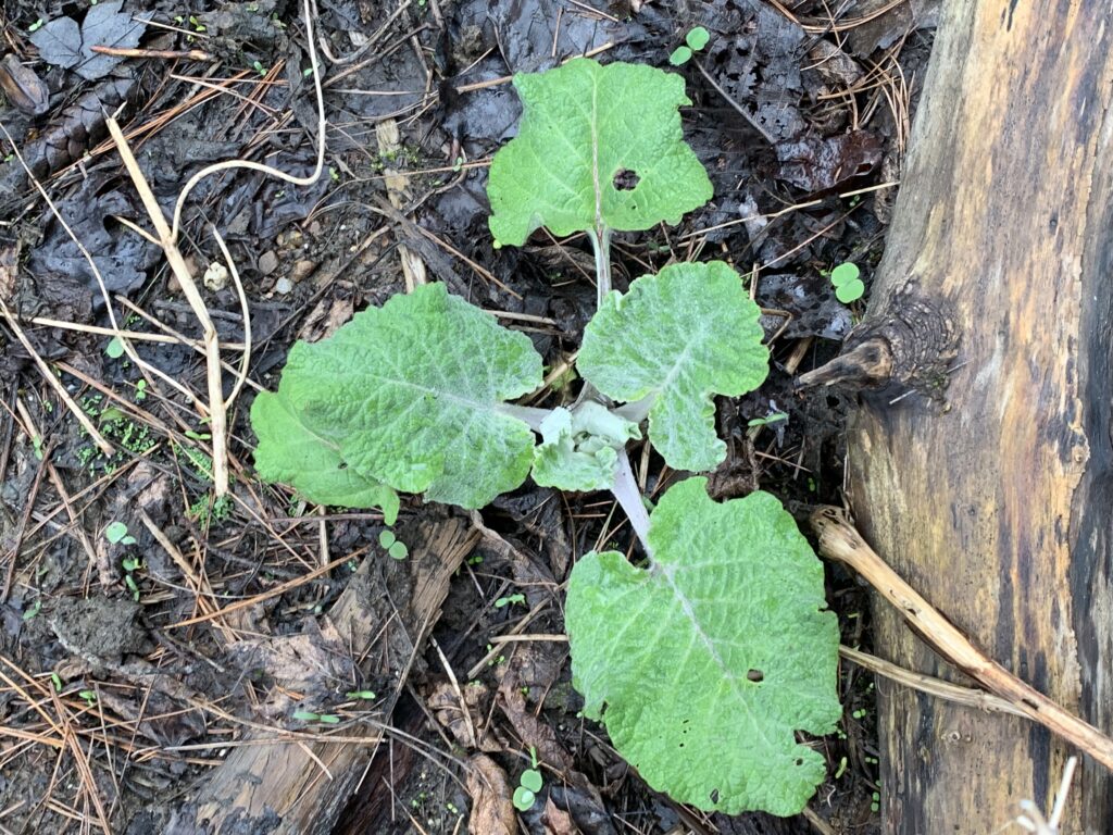
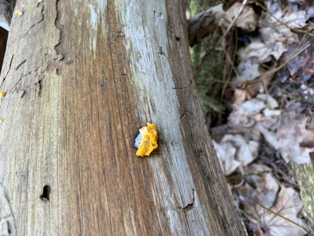
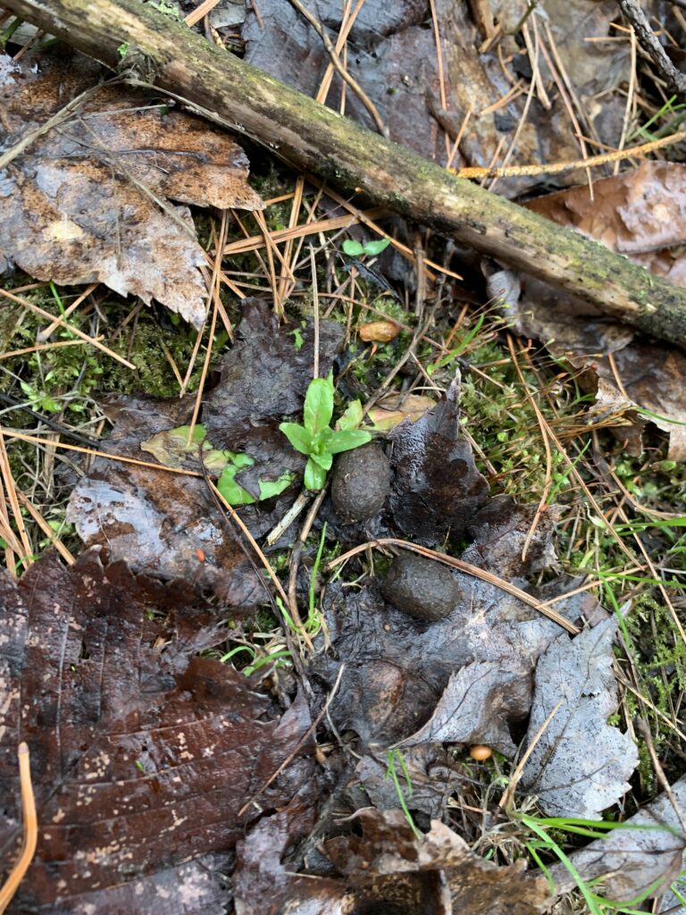
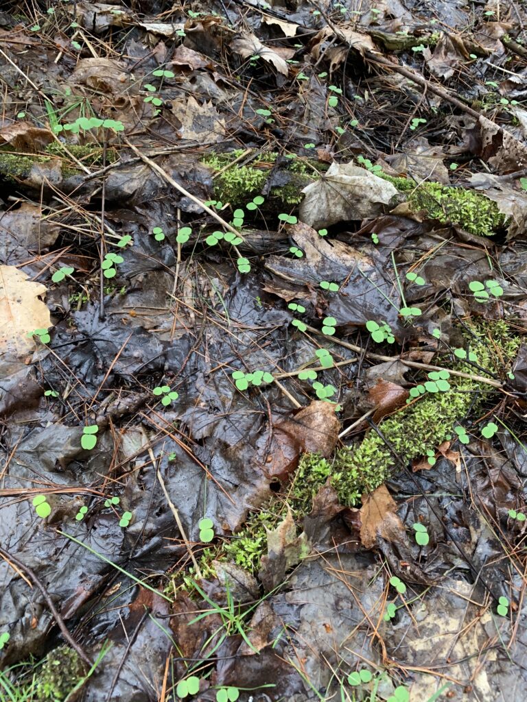
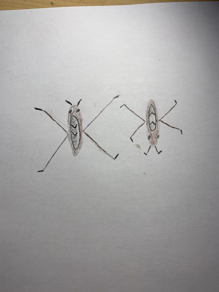
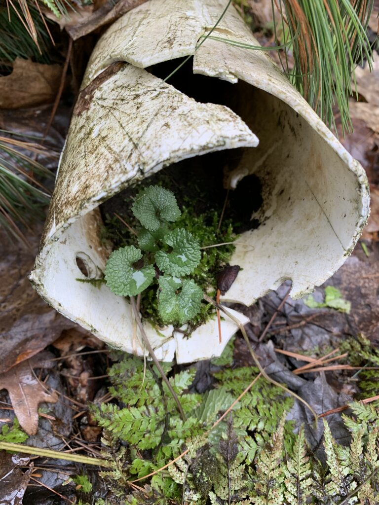
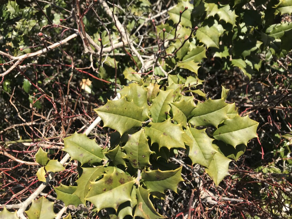
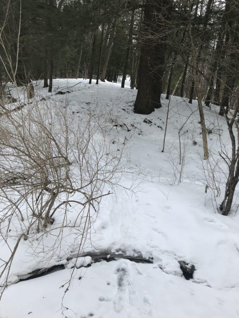
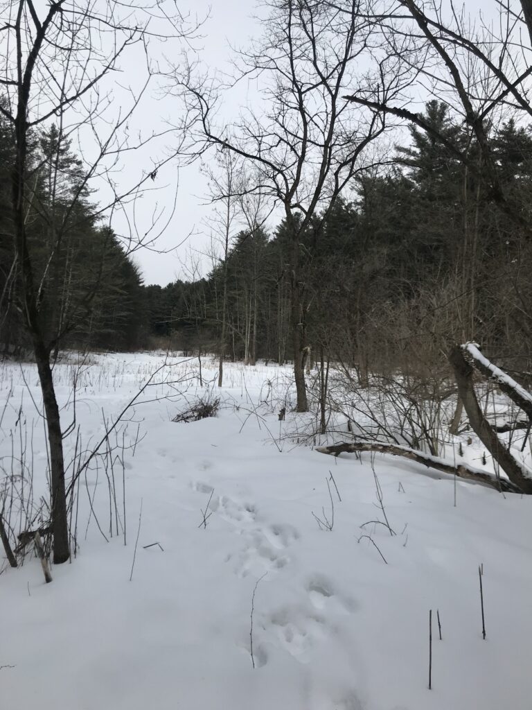
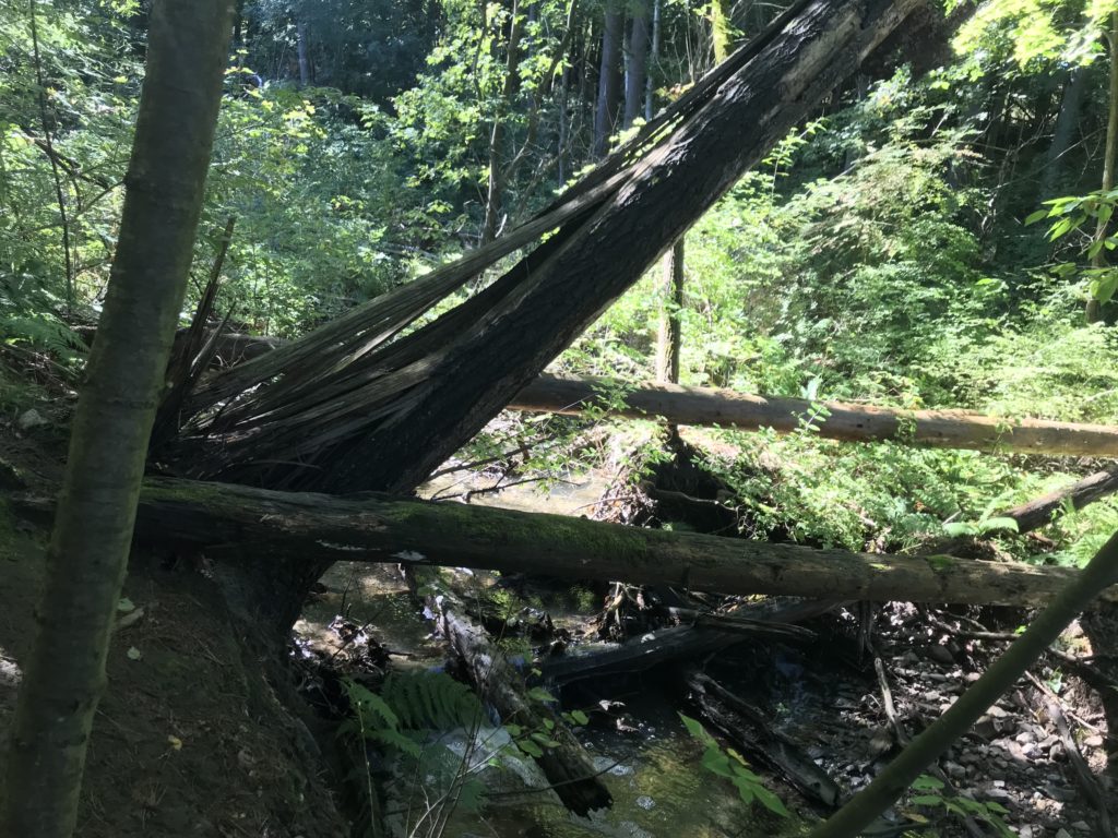
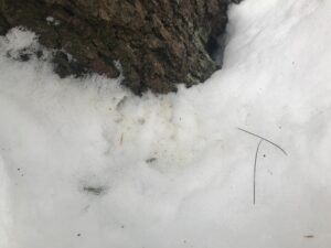
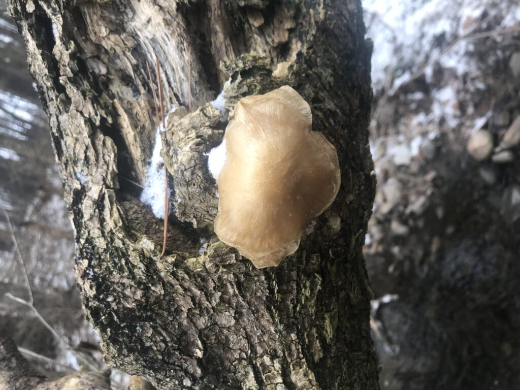
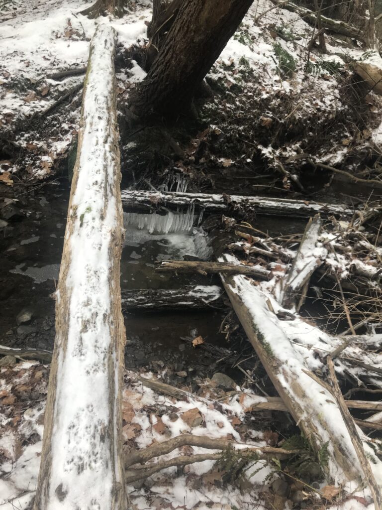
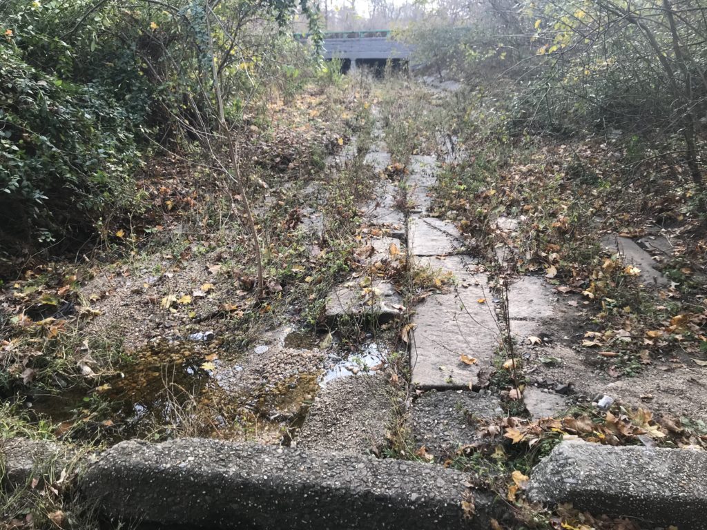
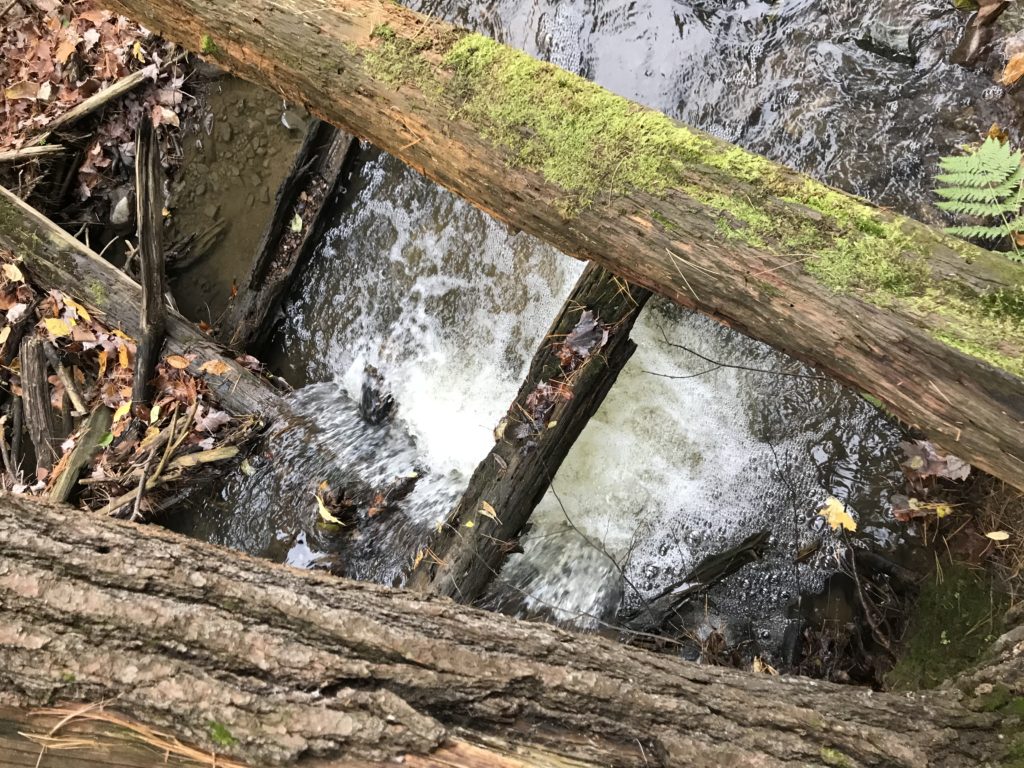
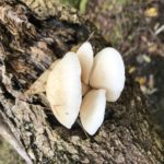
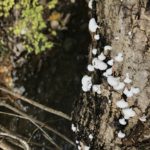
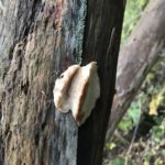
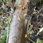
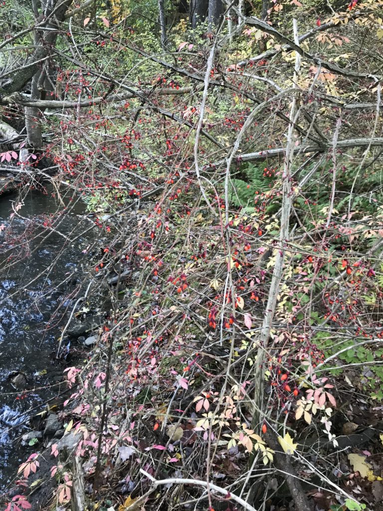
Not much has changed in terms of phenology at my location. As expected, the greening affect I observed continues along the floodplain bank. Fiddlehead ferns are slowly becoming more common with there being 5 clusters now as opposed to 1 during my last visit. Additionally, while I could not find the Witches Butter fungus again a new white, fuzzy fungus has grown on some trees. Moreover, a decreased velocity of the brook has brought many more Waterstriders to my location compared to my last visit.

During my last visit to my phenology location I observed the initial signs of the changing seasons. Now, the changes are abundant and Spring is evident to even the most unenvironmental of people. Last week during a trip to a Vernal pool to wood frog hunt I observed virtually no greenery around my location. Today, upon my initial entrance to the location I was confused, as I was expecting to see greenery with all of the recent rain. Interestingly, the sprouting that has begun is doing so in a gradient fashion along the floodplain of Centennial Brook. In the furthest southwest area of my location sprouting has begun intensely, with various non-woody plants, grasses, ferns, and mosses present. As one moves northeast along the floodplain the greening becomes less intense with an odd sapling here and there. This trend is most likely caused from the intensity of flooding along the plain; the southwestern area of the floodplain is significantly more waterlogged. While the floodplain section of my location is showing signs of the impending bloom explosion, the leveed side of my location has no saplings and none of the trees throughout my location have begun to flower/leaf-out.

In terms of identification of the wildflower saplings, they appear to have just sprouted-potentially overnight due to all the rain- making identification quite difficult. There is one extremely abundant sapling that I cannot identify as all of them protrude barely an inch above the leaf litter. Another less common, much larger plant was also present throughout; its large leaves and fuzzy stems lead me to believe it may be Wild Ginger. In addition to wildflowers, I observed a variety of mosses and fungi, including the shockingly orange jelly fungus known as Witches Butter. Interestingly, I only observed this particular fungus when last semester’s temperatures were similar to what they are now leading me to assume the seasonal transition periods are the ideal climate conditions for this fungus- aka another indicator of spring. Additionally, I observed a plethora of Ostrich Ferns including some dead fiddleheads and those that somehow survived the winter. After much searching I also found one cluster of unfurling fiddleheads, completing the trifecta for Ostrich Fern life cycle observation.

With all of the recent rain it is no wonder that the plant community is showing signs of a blooming spring. Akin to their vegetative acquaintances, the animal kingdom alike is showing signs of spring. For example, migratory birds can be heard singing their songs and wood frogs are busy mating in the vernal pools throughout Centennial. Additionally, the Common Water Striders have returned to an oxbow section of the brook in my location. To me, this is the ultimate sign of spring as the absence of waterstriders was the first sign of winter I observed. Since I could not get close enough to them to take a good picture, I decided to sketch them. The left sketch is a top view highlighting the four long legs that support the majority of their striding and the two antenna. The right sketch is a front view to highlight the two smaller legs underneath the face that support striding.

Common Waterstrider Sketch

Miscellaneous Stuff:

I may not have included it in this blog, but I tracked this pipe microhabitat throughout the year. I’m glad to see it is blooming again, and it appears to be the same species.

Mating Wood Frogs!!

These guys were in a vernal pool not located in my phenology location, but I found it too cool not to share.

p.s.- I uploaded two observations to Inaturalist (Waterstrider & Wood Frog) but I couldn’t really figure out how to upload them to the NR2 Earthweek project.

Nestled along the Southern shore of Long Island, NY lies a series of barrier islands. With six in total, there is no definitive explanation for their formation but three main theories. The off-shore bar theory proposes that waves stir sediments from the sea floor that are deposited in a bar formation back along the floor, eventually accumulating enough to protrude out of the water and form an island. The split accretion theory suggests that breaker waves stir coastal sediments to form a split, or a barrier island attached to the mainland at one end. Over time, waves and storms would break this split to form a true barrier island. The submergence theory suggest that mainland wetlands are flooded and waves form beach ridges that stick out of the water, creating an island. Being that studies have disproved the first theory, the second or third theory are most likely how Long Island’s Barrier Islands were formed.

One particular barrier island is of critical importance to Long Island’s ecosystem because it contains both a state park and a national seashore. Fire Island, the largest, most central barrier island contains both Fire Island National Seashore and Robert Moses State Park. With no direct access to the Seashore, visitors must park in Robert Moses State Park and travel along a boardwalk until one hits the Fire Island Light House and Museum. This board walk takes visitors through woodland beach ecosystems and marshlands, and it is where the majority of my observations came from. Being that this is a beach and marshland ecosystem, very few plants were those which could be found in Vermont, so i had some difficulty identifying them. Throughout the walk I only noted three distinct woody plant species, with the rest being grasses and non-woody plants. The only species I am 100% certain on is Pitch Pine. The other two species I noticed I could not identify nor find any information on in my post-trip research. When walking through the marshland parts there was an abundance of phragmites and marsh grasses but no woody plants.

Apart from plants, I was also looking for any signs of wildlife along the boardwalk. Having barely even entered the boardwalk, I already observed tracks in the sand that most likely belonged to a deer. The tracks were large, and appeared to be a hoof with two toes. With deer being the only wild ungulates in the area, the tracks must have belonged to one. Additionally, I observed a pile of scat in proximity to these tracks, most likely also belonging to a deer. Although we did not see any deer in the park, we saw some on the side of the highway when we were leaving. Additionally, I was also on the lookout for any new bird species. However, the only birds i really saw were seagulls, which is most certainly not a new species.

After reaching the end of the boardwalk, we continued our walk onto the Fire Island National Seashore. Although there were no plants for me to identify here, there were definitely signs of wildlife. This includes broken shells on the hard surfaces, as many shore birds drop shelled mollusks on hard surfaces to access the meat inside. Additionally, I found some blue crab claws and carcasses. As there was not nearly as much to look at on the beach, I also took this as an opportunity to pick up some trash including a few cans, some straws, lots of single use plastic and a sandal.

I have to admit, I greatly struggled in classifying my spot in Centennial. My initial thoughts led me to a Northern Hardwood forest because of its composition. The location has some Sugar Maple, Beech, and Birch, all of which are species indicative of Northern Hardwood Forests. However, being that Centennial Brook runs directly through the center of my location, I began to think it could be classified as a forested wetland. More specifically, a floodplain forest because Centennial is certainly not a swamp or a seep. The first indicator that it may be a floodplain forest is the Brook. Secondly, the “hill” that i have been referring to along the Southeastern boundary is not so much a hill but rather a levee. Additionally, on the other side of the brook is a backswap, or low-lying wet areas on the floodplain away from the active channel. This backswap continues for a brief time towards the southwest and then deep into the Northeastern stretch of centennial. Although this area is not constantly filled with water, there were often shallow puddles and deep mud earlier in the year. Today, when i ventured N.E. out of my location a bit I noticed places with partially frozen over water. Therefore, I think it is safe to classify this land as a backswamp thereby confirming my suspicion that is area may be a floodplain forest.

Further classifying this Floodplain forest into a subcategory also presented some challenges. There are four subcategories of floodplain forests, with two being dominated by silver maple and one being adjacent to a lake, leaving only one option for my floodplain forest; Sugar Maple- Ostrich Fern Floodplain Forest. These forests are typically dominated by sugar maple, basswood, and boxelder. Being that all three of these species are present in (and maybe slightly outside) my location this would be a good classification. However, the presence of Ostrich Fern is also a crucial aspect to these ecosystems and being that it is winter with snow covering everything, there are not many ferns present. I do remember there being a considerable number of ferns earlier in the year, but I do not remember what they look like well enough to say if they were Ostrich Ferns. Therefore, I am going to say that my Centennial Location is most likely, but not definitely a Sugar Maple- Ostrich Fern Floodplain Forest.

Although I couldn’t find any picutres of the levee during the fall face on, it can be seen on the left.

In terms of phenological changes, I am starting to see signs of a coming spring. During my last visit, I noted the complete silence throughout the forest. This time, though definitely quieter then autumn time, I began hearing some of the usual sounds of the forest especially some bird calls. Additionally, the brook was entirely frozen over upon my last visit while I could hear the sounds of running water this time around (though I could still cross without fear of falling in). Another interesting change i noticed was a heavier presence of cone bearing evergreens although I do not know if this has any correlation with the impending spring. However, winter is still here and snow is still covering just about every inch of Centennial making any observation of substrate/hydrology interaction virtually impossible for the time being.

After a long break of brutally cold weather, my first steps back into my Centennial phenology location immediately elicited feelings of surprise. Throughout all my previous visits I was immediately greeted by a thick wall of bushes and vines, virtually eliminating any view of what lays to the Northwest of my location. However, upon entry the usual greeters were all dead/dormant, buried under snow revealing the clearing to the Northwest. Travelling further into the site added to my surprise as the usually turbulent brook was completely frozen over allowing for an easy crossing. On all previous visits I had to balance over the typically waterlogged trees that fell over the brook, leading to the occasional slip and inevitable feelings of regret for choosing such a difficulty traversed area as I continued working soaking wet. Needles to say, I was quite happy to see the frozen brook.

The complete burial of the thick undergrowth that I have become so accustomed to combined with the lack of leaves on all angiosperms created a sense of eerie lifelessness throughout Centennial Woods. This was added to by the complete absence of the usual bombardment of the sounds of the forest being that the most vocal of birds migrated for the winter. Though there was a general silence throughout my visit, it was occasionally disturbed by the creaking of trees blowing in the wind, heightening the sense of eeriness. One Eastern White Pine in my location was particularly noisy being that a partial downed angiosperm (that I could not identify) was resting on its branches, creating a symphony of creaks with each gust of wind.

Although the absence of noise created a sense of lifelessness, any brief observation of the snow underfoot would reveal that Centennial Woods is anything but lifeless. Throughout my site there were various sets of tracks in the snow, indicating the recent passage of a ground dwelling animal. With such a high prominence of people in Centennial a lot of the snow was previously disturbed, making identification difficult. However, after venturing slightly off the normal path I identified various tracks. 

This first track still greatly eludes me. Seeing as how there are four tracks with the back lacks being larger then the front two, I immediately assumed that the animal who made this is a galloper. My initial thought was that these prints belong to a Cottontail Rabbit; however, the stride length is much too great to belong to a cottontail so my next thought went to a Snowshoe Hare. Even still, the stride length appeared much to great for even a larger hare making me question if these four prints even belong to the same animal. A reevlaution of the front paws illuminated that they might be too inline with each to be derived from a galloper, further adding to my confusion.

This next set of track did not present much of a mystery. They were clearly made by a diagonal walker as there were only two prints indicating a direct register. The absence of toes and the shape resembling a hoof illuminated that these prints belong to an ungulate mammal. As these prints are rather small and the indent created by the “V” in the hoofs is not particularly deep, I believe that these are tracks belonging to a White Tail Deer.

Like the first track, this set of tracks also present a conundrum. Initially, I believed these tracks belonged to another diagonal walker because I believed there was only two prints for each stop. However,  reevaluating the gait pattern revealed that these belong to a pacer. These tracks were also different from the supposed deer tracks because there was a slight channel created as if the animal was dragging something, most likely a tail, leading me to believe they could belong to an opossum or beaver. The depth of the tracks stray me from this thought because such small animals would not be able to make such a deep impression in the snow. Also adding to the mystery is that fact that some of the clearer tracks showed two distinct holes as if an ungulate punctured  the snow with its pointy hoofs. Though I cannot say for sure what animal exactly made these tracks, following them (albeit outside the boundaries of my location) revealed my first sign apart from tracks of animal habitation: a pile of urine.

Although I identified these prints last semester I would like to revisit them in light of recent knowledge about tracking. Because I believed I saw an “X” mark in the track, I identified these prints as belonging to a fox. However, I now believe they are from a domestic dog because of the direction of the nail marks and distance between each toe. If these were from a wild canine one would expect to see all nail marks generally facing parallel to the direction of travel as opposed to pointing at various angles. Additionally, the distance between the toes reveals that the animal lacked the strength to keep its toes from splaying out upon impact, further emphasizing the idea that these tracks are derived from a wild canine.

As this was my first trip to Centennial where the deciduous trees had completely abandoned their leaves, this was the first opportunity to identify trees based solely on their twigs and buds. Throughout my site I identified a Sugar maple, Boxelder Maple, Norway Maple, and a Northern Red Oak (this last identification coming from prior knowledge of the area as opposed to the twig/bud method. Additionally, I identified a new species for the first time; what I believe to be a Shadbush based upon the hairs on the terminal bud.

Supposed Shadbush Twig and Bud

Twig Diagram, unidentified

p.s.- I’m sorry for the lack of twig photographs in the field, my phone died after only taking one from spending too much time taking pictures of tracks.

Throughout the various landscapes of Vermont there is evidence of a people existing on this land as long as 12,000-13,000 years ago. These people, the Abenaki, lived in conjunction with the landscape, living a life with little ecological impact until first European contact in 1609 by Samuel Champlain. Although Champlain visited then. it was until 1615 that the Abenaki were contacted by Europeans (Klyza, Trombulak). Whi1le the French requently visited the area that is now Vermont to trade fur with the Abenaki, no official European colonies were established here until 1763. BY this point Europeans had discovered the fruitful bounty that the forests of the North East can provide so by the 1800s mass deforestation efforts were underway. Prior to this “Great Cutover” some trees had been exported to be used as naval masts for the British Navy however it was until they were deprived of their main lumber source in the Balkins that this trade flourished (Klyza, Trombulak). Since the majority of forested land was viewed as a nuisance to farming, the Great Cutover took place during the 1800s with the initial goal of clearing land for sheep farming. Seeing as how Centennials woods fell under the category of nuisance land, most of it was most likely cleared. This assumption is evidenced by the high presence of new growth species such as birches. Additionally, throughout Centennial there are trees with barbed wire growing in them. Since barbed wire was used extensively during this sheep farming era, one may assume that these are remnants from this time, especially because it would take many years for the trees to begin incorporating the wire into themselves.

While I do not know the exact use each family had for the land, UVM purchased Centennial from Baxter, Ainsworth, Hickock, Kirby, and Unsworth in 1891, 1904, 1908, 1938 and 1968 respectively. After purchasing the land, the University used it for various purposes such as a dumping ground for cadavers from the medical center (credit TA Mike Perrin for this story). In 1974, the Universities Board of trustees established Centennial Woods to be one of 9 UVM Natural Areas. Establishing the status of a Natural Area protects the land with its strict guidelines so Centennial now serves the needs of UVM students and  hikers alike. Today, Centennial Woods is primarily used as hiking ground and as an area for UVM students of professors to conduct environmental work.

Citations:

Board of Trustees, University of Vermont. (1974, April 20). UVM Natural Areas. Retrieved from: http://www.uvm.edu/~uvmsc/Centennial%20Woods/UVM_Natural_Areas_1974001.pdf

Klyza, C. M., & Trombulak, S. C. (2015). The story of Vermont a natural and cultural history. Hanover: University Press of New England.

UVM Libraries Research Guides: Centennial Woods Natural Area: History. (n.d.). Retrieved from http://researchguides.uvm.edu/c.php?g=290508&p=1935271

Throughout every previous visit to Centennial I have had the same experience: constant bombardment of sound, with birds causing the largest raucous. However, today’s visit did not bring about the usual noises of the forest. Typically, I am slammed with the sounds of birds calling from the second I enter Centennial bright up until I leave yet today I only heard the calls of a chickadee twice. With the snowiest November on record since 1900 this is not surprising as many locations are experiencing phenological changes typically associated with winter. One of these changes that struck me the most was how desolate the landscape is. After visiting my location on the more temperature Long Island, I was surprised to find not only the deciduous trees completely barren of leaves but also the understory to appeared to be dead. In fact, when I first entered the location I questioned if I was in the right spot because the usual wall of thick shrubs that greets me have been reduced to mere twigs sticking out of the ground. Additionally, the majority of fungi is virtually gone with only 1 remaining mushroom in the entire plot. Another interesting phenomenon I observed is that there was a high presence of squirrels for every visit, excluding this one. However, with the snow on the ground for this visit, I discovered footprints on the downed trees that cross the brook that I believe belong to a fox. Although the tracks were rather small, the four toes in the formation of an X, the shape of foot pad and absence of human tracks along side it led to my identification as a fox track. I will admit, after some discussion with Chris (see Chris’s Blog) there is a fair chance that the prints belong to a small dog that may have been let loose while its owner took an alternative route to cross the brook.

The lone mushroom.


One more note of slight interest:

On 10/13/18 the temperature of the Centennial Brook was 56.5 °F while the temperature on today’s visit, 12/5/18 was 38.5 °F.  Admittedly, the thermometer used is most likely not suitable for this type of work being that it’s intended for cooking (my Dad shipped it from home so I didn’t have to buy one). However, being that water has such a high specific heat I would think that a 27° drop in temperature that quickly is abnormal for this time of year, especially because winter has not officially begun. I intended to track the temperature change further and compare it to other statistics but I forgot the thermometer a few times and could not find any available data for Centennial Brook’s average temperature.

Partially frozen Centennial Brook.

While I most definitely enjoyed the liveliness and abundance of early fall, the silence I experienced combined with the light snow fall from this early onset winter left me with a sense of serenity that made this trip to Centennial fantastic.


The Chair

Nicknamed “The Chair” by locals, my second phenology location resides off of Wantagh State Parkway behind some backyards in Wantagh, New York. This place is a slightly wooded area with an old drainage ditch resembling a large chair (hence the nickname) as the center. Being that there is a drainage ditch, there is concrete throughout location making for an interesting terrain. One reason I chose this place to compare to my location in Centennial Woods is because of its proximity to a major highway and the fact that it is virtually a part of the backyards in the neighborhood. Being that Centennial Woods is a protected natural area, I speculated there were be vast differences between it and The Chair because the Chair is exposed to the stresses of residing in a modern urbanized society. Additionally, many visitors to The Chair treat it like a trash room. This fact combined with the high amount of concrete in the area makes The Chair a viable location to observe how humans impact their environment.

Beyond the interesting observations that may come from comparing a place such as the Chair to Centennial Woods, I chose The Chair because of its importance to me. Although my friends and I only recently discovered it, the Chair has became a place of comfort and home for us as we spent countless nights hanging out here throughout the past year. We visited here virtually every weekend of senior year in high school and multiple times a week during the summer so I spent the last year observing phenological changes here (although I did not realize it at the time).

Path leading to The Chair.

View from entrance to The Chair.

Concrete lining ground with Wantagh State Parkway in the background.

When comparing the vegetation between my site in Centennial and the Chair there are not many similarities. In terms of composition, the two sites only had Norway Maple and Northern Red Oak  in common. Apart from the Norway Maple and Red Oak, the only other species I was able to identify was a Red Maple as most of the vegetation in the area are shrubs that appear to be invasive. Another difference (that I was very surprised to find seeing as how my Centennial location was relatively desolate of leaf bearing trees) is that a lot of plants have  retained most of their leaves at The Chair. Even more surprising is that many of them still haven’t broken down their chlorophyll, meaning they are still green. Although I found this observation initially surprising, upon reflection it makes sense when accounting for Long Island’s more temperate climate. Additional differences can be drawn when comparing the structure/age of the trees. Most of the trees at the Chair appear to more mature then those in Centennial as they are larger with thicker trunks and denser crowns (this last one being somewhat hard to compare at this stage of the year). Additionally, many of the trees at the Chair have been warped and now grow and various angles while the trees in Centennial generally grow in a typical fashion. The limited space and its location in an urbanized area leads to competition for resources/space, accounting for the strange growing patters at the Chair. Since Centennial Woods is an open forest, the tress have more room to grow and more available resources.

https://www.google.com/maps/d/edit?hl=en&mid=1USwOglK4awnuAph9jorz6oOQJSgqwB1N&ll=40.70226558895928%2C-73.52084919999999&z=18


During today’s visit to my location in Centennial woods, I noticed a vast amount of changes brought about from the previous week’s daily rain showers. All of the flat ground on the N.W. side of the brook was completely water logged to the point where it reminded me of a bog. Additionally, the rain brought about a number of changes to the brook. The mass amount of precipitation caused the brook to increase in velocity and therefore discharge. Because the velocity increased there was most likely a higher rate of erosion, evidenced by the increased turbidity of the water. Additionally, a root system along the bank of the brook was more uncovered more then ever before.  Interestingly, this was also my first visit where I could not find any Waterstriders gliding across the brook. This is most likely due to the fact that the increased velocity has increased turbulence, causing the typically calm areas where I find them to be rough and choppy.

Area that is typically calm and teeming with watergliders now disrupted from heavy precipitation.

In terms of vegetation, the unidentifiable shrub with pink leaves and red oblong berries has lost most of its leaves and the berries appear as if they are dying. While a few pink leaves remain, they are no longer a vibrant shade of pink but actually more of a mix of pink and yellow. Additionally, many of the trees are almost completely devoid of leaves with exception to the conifers. Interestingly, while some of the Striped Maple in the understory lost their leaves, there is a mature Striped Maple that appears as if it hasn’t lost any. The most striking change from this visit came from the high number of fungi observed. Previously, I spotted mushrooms here and there but on this visit I found 3 definitive examples of fungi all within close proximity of each other and one mysterious substance I believe is a fungus

(11/4/18) Unknown shrub with less leaves and a loss in vibrancy

While I typically see many squirrels throughout Centennial, one encounter on today’s trip was particularly interesting. I was standing on the NW side of the brook when I heard commotion coming from the other side so upon further investigation I saw two squirrels chasing each other. When the squirrel that was being chased noticed me, it crossed the brook, ran within inches from me and then hid by a tree I was standing next to. The other squirrel aimlessly followed it until it noticed me when it was halfway across the brook, at which point he turned and ran. This was interesting to me because I believe the squirrel that hide by me is so desensitized to humans that it realizes humans can be of some advantage.

During this trip I also created an event map, enjoy!

p.s.- I’m sorry for my terrible art skills, I thoroughly tried I am just not good at any type of drawing or art

Upon my initial visits, I observed this location to be vibrantly green throughout. As the seasons were changing from summer to fall, the abundance of green diminished and other fall colors replaced them. While the majority  of plants are showing typical fall colors such as red, orange, and yellow, one woody plant located proximal to the Boxelder has turned almost completely pink. On my initial visit, only slight traces of the pink were visible, with it turning consecutively more pink with each visit until it was dominant over green. Additionally, there were initially a few small, oblong berries on the plant and now they are plentiful. Although I believed this to be Barberry due to the red berries, the leaves are too large and pointy so I do not know the species at this time.

Red berries with pink leaves (species unknown)

Although there are a plethora of locations prime for wildlife habitat in this location, I have observed significantly less wildlife then expected. In the brook itself, one can find common water striders gliding across the surface in the water. Additionally, I observed two moths mating on a twig from the Eastern White Pine along the N.W. border. Further more, there has been a variety of birds that visit the trees, with chickadees being the most common visitors.

Mating Moths


Birds Eye View of Location

Skip to toolbar