Posts

March Phenology Post BenB

View of the Northern Taconics from a ledge overlook

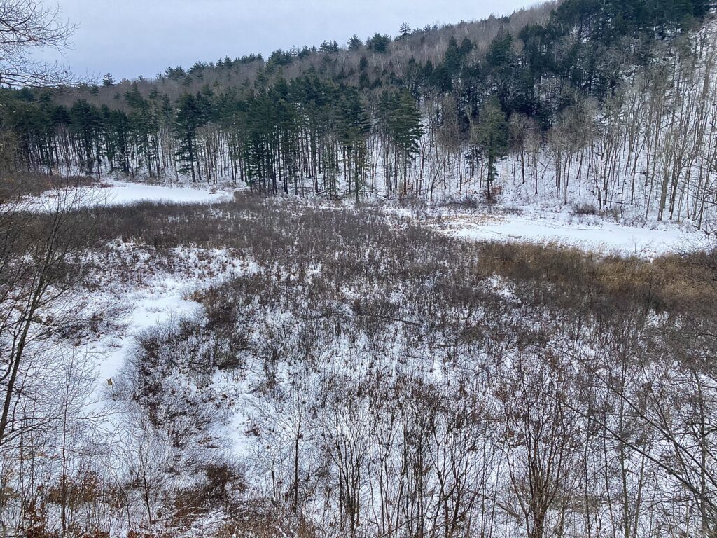
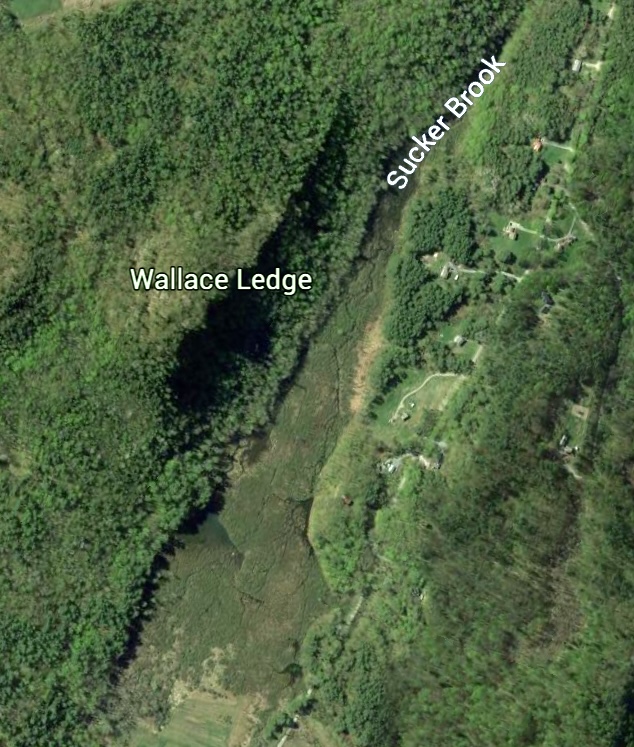
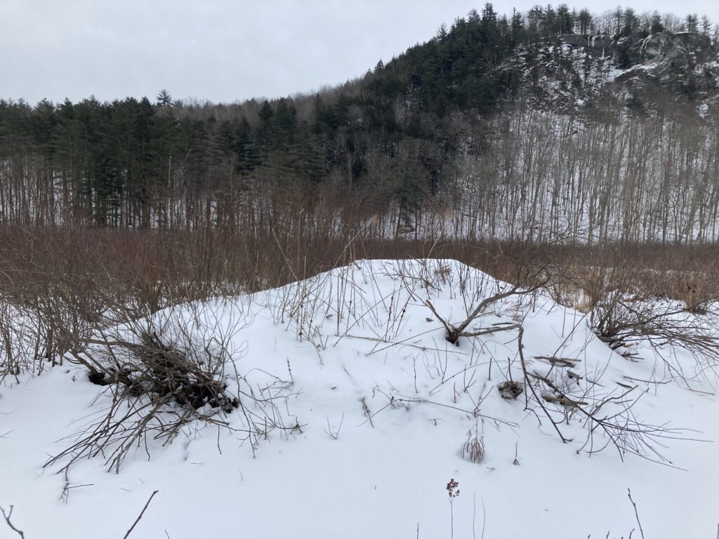
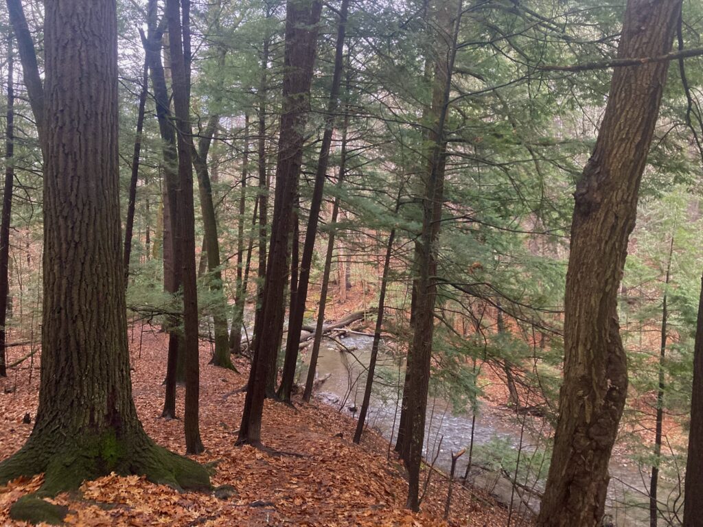
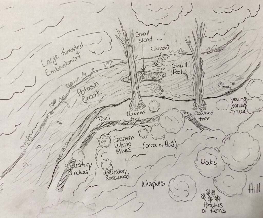
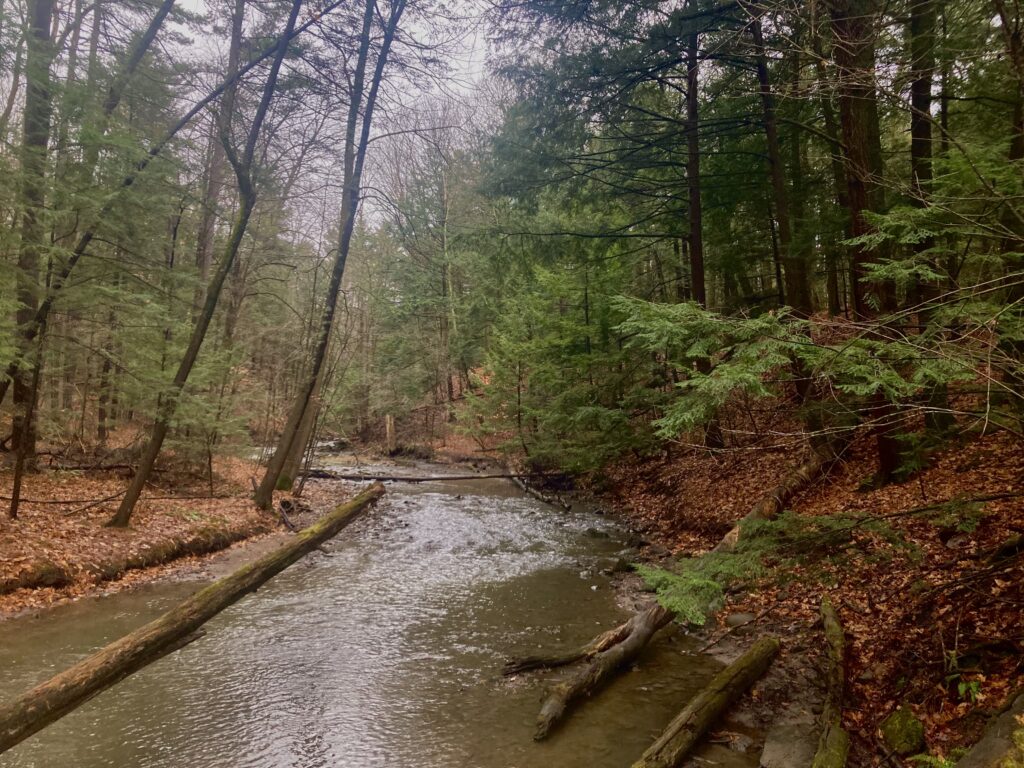
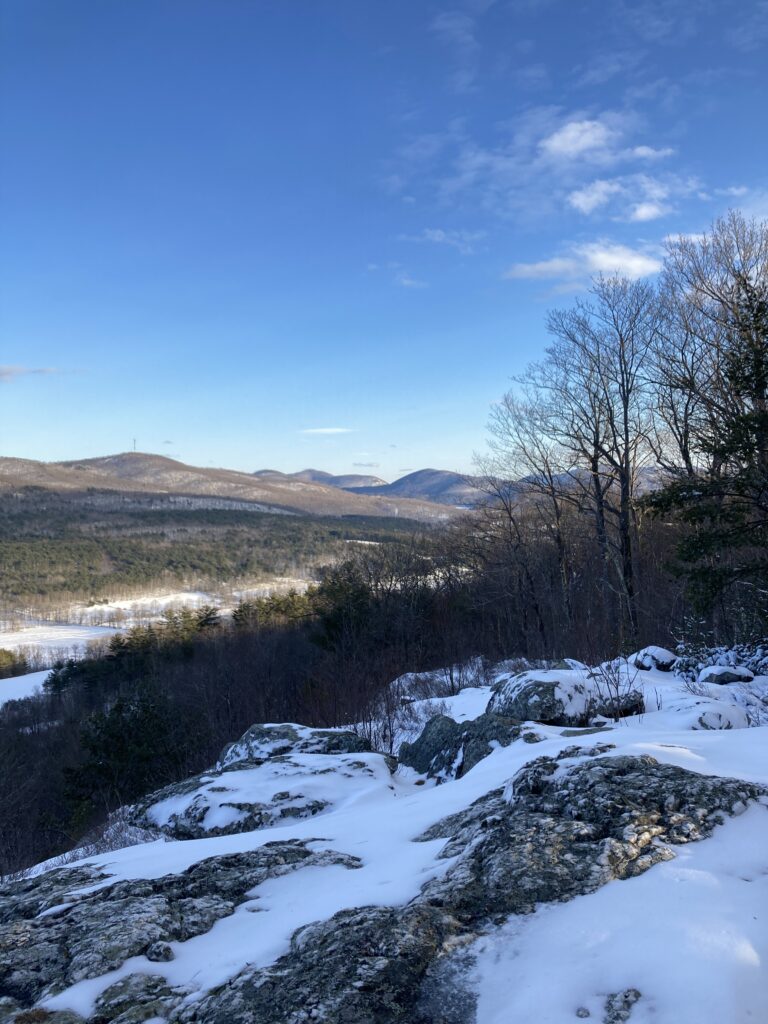
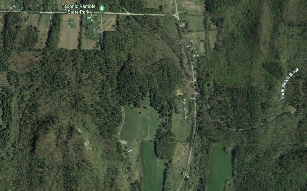
My new phenology place for March was Taconic Ramble State Park. It’s a relatively small 200 acre area of land within the Northern Taconics located in Hubbardton, Vermont about 5 minutes down the road from my house. It was established in 2016 after the late film maker Carson Davidson donated the land to the State, making it Vermont’s newest state park. The area has an extensive collection of hiking trails that wind through a variety of different forest types, up to beautiful overlooks, and along a river with multiple waterfalls. Like most of Vermont, the land was once largely cleared for agriculture as evidenced by the sections of new growth forest that are criss-crossed with decrepit outlines of stone walls. There’s a field in the middle of the park that has continued to be used for hay production to this day, as well as being actively managed for bobolink and meadow-lark nesting habitat in the early summer. Adjacent to the field there’s a sizable eastern white pine stand full of almost exclusively large mature pine trees, while the rest of the park is primarily covered with mixed northern hardwoods and areas of young birch, beech, and aspen. The geology of the area is largely made up of regions of schistose rocks and shale/slate, the land then transitions into chiefly calcareous rock going north up into the Champlain Valley.

Map of the Park from Google Earth
View of the mountains from the entry road
Trail through an early successional hardwood forest

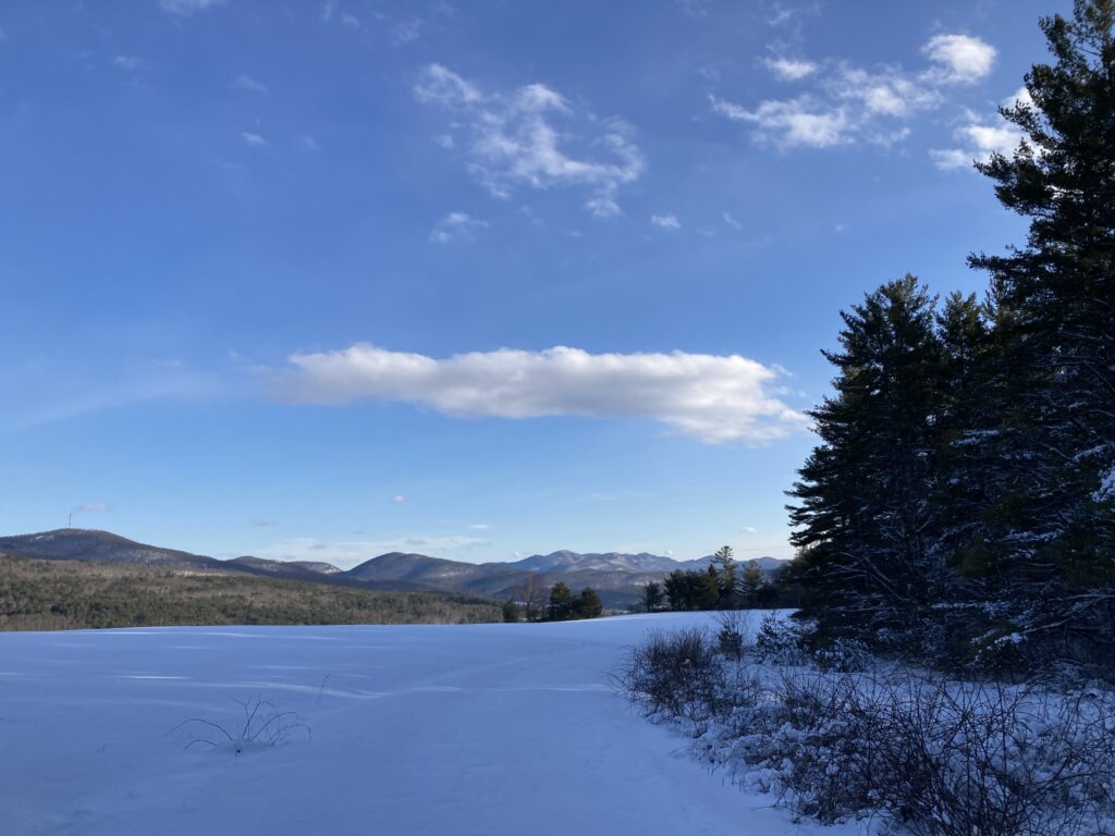
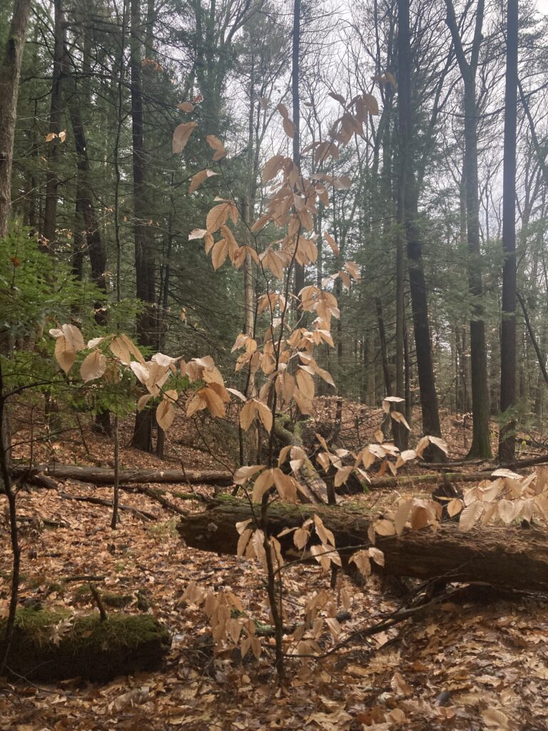
The most obvious and significant difference between this site and Burlington is in the level of urbanization. While there are a few small homesteads and cleared fields scattered across the park, it’s otherwise almost entirely forested. In contrast, Burlington is largely developed and so the natural areas are interspersed between busy roads, parking lots, and buildings/houses, resulting in a distinct natural community. The early successional sections of forest in the state park are comparable to many of the wooded areas in Burlington as they’re only about 60 miles apart and are both relatively recently recovering from deforestation and/or development. Additionally, the white pine stand reminded me of some sections within Centennial Woods that are similarly dominated by pines and other coniferous species like eastern hemlock. Just like in Burlington, although there had previously been some warm days, the trees had not yet started to bloom and the only sign of hardwood leaves were the dead American beech leaves that were still hanging on from last year.

Striped Maple

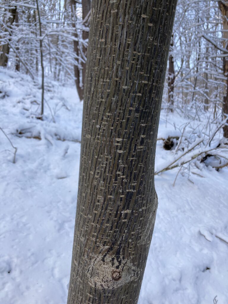
Similarly to many places in the Burlington area, striped maples were very common throughout sections of the forest and made up a significant portion of the understory.

Turkey tracks

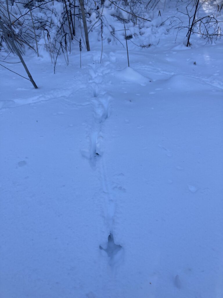
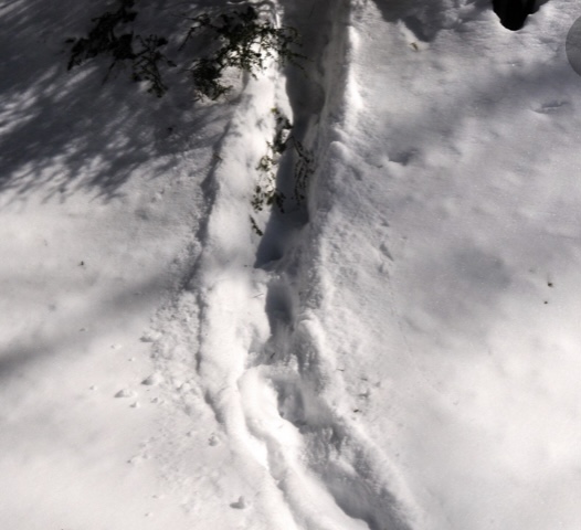
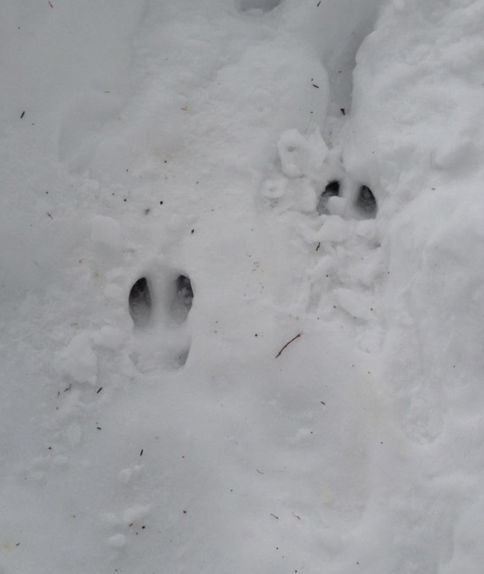
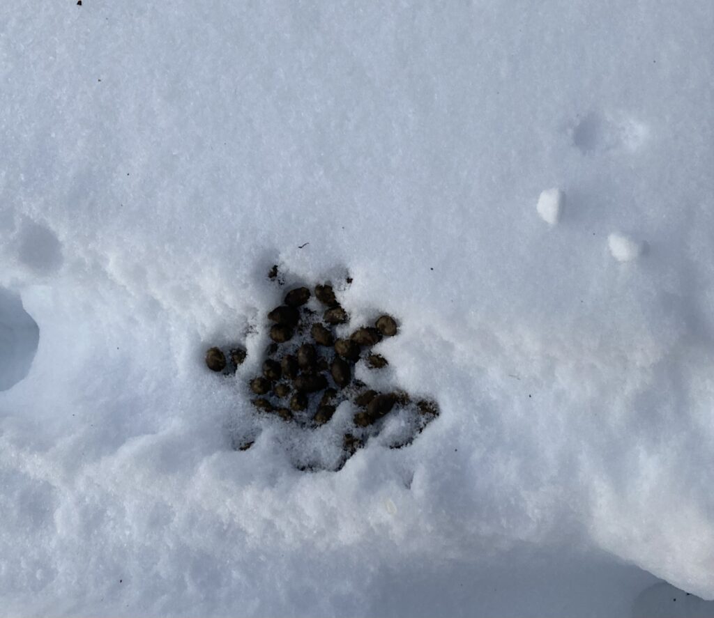
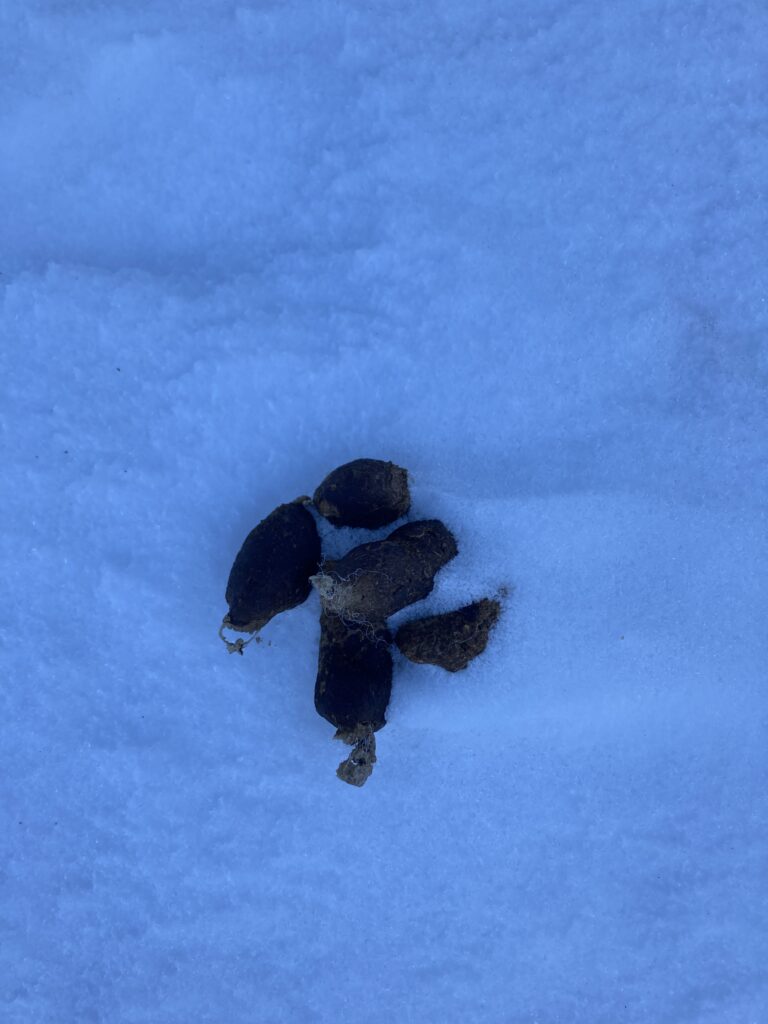
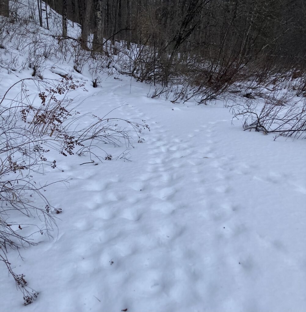
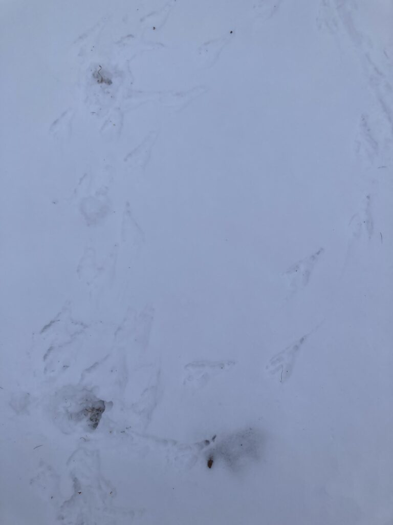
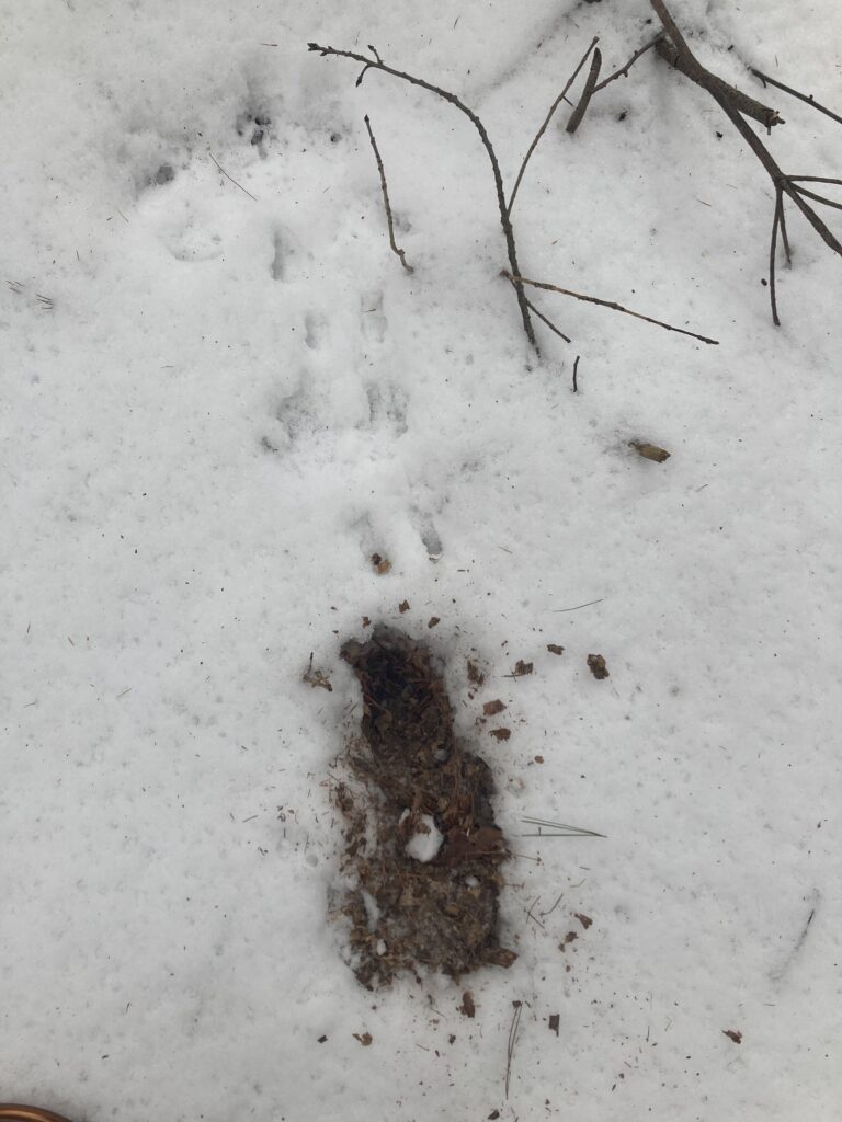
It had snowed the day before and the temperatures were just above freezing, so the conditions were great for noticing animal signs and following tracks. I saw and heard many Chickadees while on the trails, saw lots of Turkey tracks, and noticed a few ravens flying overhead, all of which stay in Vermont throughout the winter. In terms of early migratory birds, I heard the songs/calls of many Red-wing blackbirds up in the trees, and saw a Turkey Vulture high above circling in the sky.

Deer tracks
Squirrel tracks

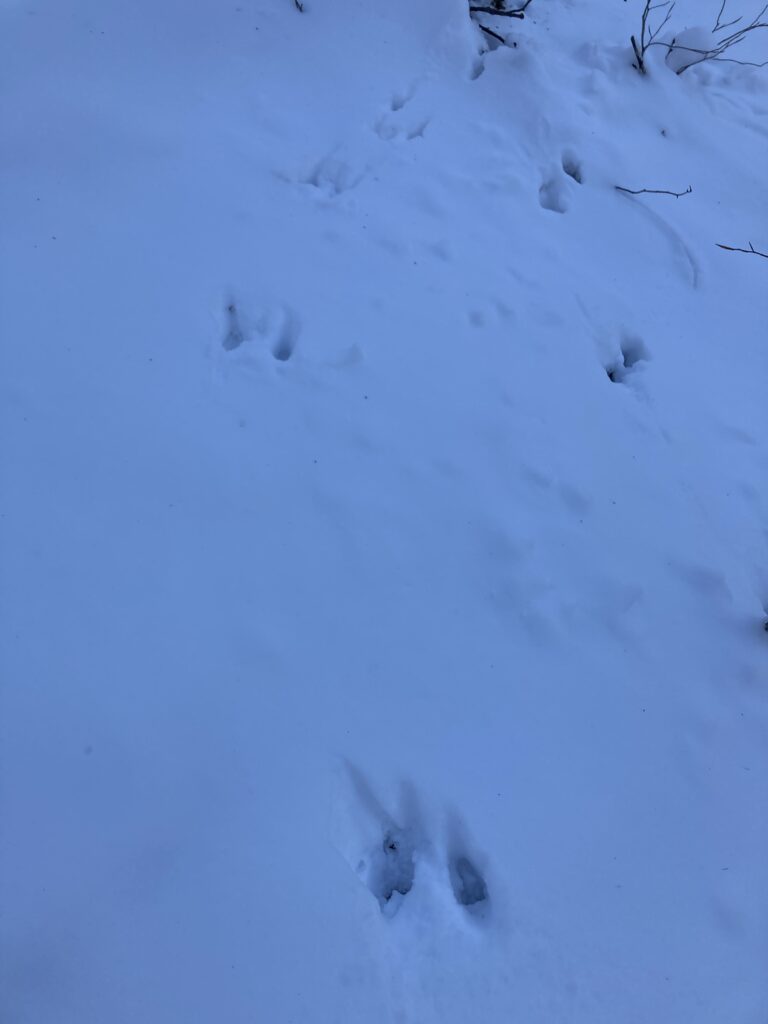
While hiking the trail network I saw signs of various animals such as white-tailed deer tracks, squirrel tracks and dug up caches, and the collapsed tunnels of meadow voles, all of which are also common in Burlington.

iNaturalist Exploration Phenology Posting

I went down to the Centennial Woods Natural Area for a couple hours on Saturday and walked around exploring the trail network through the pine stands and along the beaver marsh. It was a little above freezing and partly cloudy out, and the snow from the storm the week before had been melted a little bit and was relatively packed down. Although I didn’t have any direct encounters with an animal, I observed plenty of activity left behind by an exciting variety of different species, ranging from a Pileated Woodpecker to an Eastern Coyote. Overall, my experience with the iNaturalist app was very positive. The process of recording each observation in the app was straightforward and the location function made it easy to exactly pinpoint where in Centennial Woods I saw each track. I’m looking forward to getting some feedback on my identifications from other users because I might be wrong on a couple of them.

Porcupine Trail

The first animal sign I came across was a porcupine trail cutting through the forest and heading North up a small hill just off the side of the path about a quarter of a mile in past the secondary entrance. At first, I wasn’t sure what it was because of its wide profile, but once I got up close and saw the pacing gait and the size difference between the front and hind tracks, I realized that the edges were made by quills and that it must be a porcupine. I followed its trail for a minute or so before it began to loop back around on itself near the base of a mature Eastern White Pine tree. It may have climbed up the tree at one point, although I couldn’t see into the canopy very well to tell if it was still there or not.

White-Tailed Deer Tracks
White-Tailed Deer Scat

I regularly saw signs of deer activity all throughout the forest. There were some individual trails and then larger patches that seemed to have come from a group searching for food under the snow. Although I was pretty confident with my identification already, when I came across the clear hoof imprint in a shallow patch of snow under a large White Pine, along with the scat, I knew it had to be White-Tailed Deer.

Pileated Woodpecker Activity (I think)

In the side of a medium sized Northern White Pine, I came across what I think are signs of a Pileated Woodpecker drilling for carpenter ants. The wood chips at the base of the tree were fresh and the cavities had sap oozing out of them so it might have happened earlier that same day. Because of the size and oval shape of the cavities I think they must have been made by either a Pileated or Hairy Woodpecker, and I’m guessing Pileated because of their larger size.

Eastern Coyote Scat (I think)

I’m very tentatively guessing that this is Eastern Coyote scat. It could also easily be from a Gray or Red fox, or even a porcupine, although they usually make larger piles. It was in a shallow and packed down patch of snow and so I couldn’t make out any tracks to help with the identification.

BenB January 29 Phenology Blog

Overlooking the wetland.

My new phenology spot is a large wetland area along Sucker Brook in Castleton, VT that’s been formed by beaver damming. The spot is near my house roughly an hour and a half south of Burlington and UVM. The beavers have created multiple dams across the small valley that slow down and backup the stream, forming three separate ponds and many interconnected water channels flowing in between them, all of which have fully frozen over. The area is a great place to find tracks, and although many of them were old or dulled by the wind, I was able to identify multiple different species that had been using the frozen waterways.

Aerial image map.

Aerial map taken from Google Earth of the wetland between Wallace Ledge and Pencil Mill Road along with the surrounding forest and Sucker Brook flowing out South. In the summer the various beaver channels running throughout the area are visible as they slowly connect back together to reform Sucker Brook, which eventually flows into Lake Bomoseen.

Beaver lodge with Wallace Ledge behind.

The beavers’ lodge is located on the edge of a pond in the middle of the wetland behind their main dam.

Eastern coyote tracks.

Although the tracks are relatively old and windswept, I think they were left from a group of eastern coyotes. I also didn’t see any scat, but I often hear their calls at night close by and I’m pretty sure they’re not dear tracks.

Turkey tracks.

On the edge of the wetland within the trees there was a large area scattered with turkey tacks and scratchings left from their search for food under the snow.

Squirrel activity.

Next to the wetland in the forest there were many holes and consequent dirt piles left by squirrels digging for their caches. In the bottom of one of them I could see the indentation of an acorn left in the frozen ground.

Unknown tracks

In the middle of the wetland along the beavers’ main dam some animal I couldn’t identify had taken advantage of a snow covered beaver trail cutting through the underbrush.

December 11th Phenology Post

Looking down at my site

Although the snow had just been melted by a recent rainstorm, the phenological signs of winter were nevertheless prevalent at my site. Most noticeably, nearly all of the deciduous trees were fully bare, except for a few young American Beeches that were still managing to hold onto many of their leaves. This dramatically opened up the canopy and allowed me to see into the highest sections of the forest in a new way. The lack of leaves revealed three different squirrel nests each up in the cruxes of large oaks, as well as one much smaller nest about 25 feet up in a medium sized Beech tree, presumably belonging to a bird rather than a squirrel. It was too high up to see with any detail and I didn’t notice a bird fly in or out of it, so I wasn’t able to identify it. Down below, a few scattered fern patches in the understory were still green, which might signify that they’re evergreen wood ferns and so will likely stay active all through the winter.

Unfortunately, since the snow was melted I couldn’t see any animal tacks, but I was still able to notice some signs of fauna activity. Throughout the whole time I was there I could hear multiple chickadees singing somewhere near by up in the canopy. I also saw a small songbird fly over the stream when I first walked up, I was able to get a good look at it and I’m pretty sure it was a tufted titmouse due to the shape of its head. Deeper into the forest there were a few piles of white-tailed deer scat in a flat spot under a large Eastern White Pine. The area was trampled down and it seemed like they might have been using it as a sleeping spot to get cover from the snow. There was also a standing dead deciduous tree nearby that was covered in Pileated Woodpecker holes. I don’t remember noticing them when I was there previously and so they may have happened recently, although the wood chips at the bottom of the tree didn’t look extremely fresh. As I was walking down the path on my way out, I also caught a glimpse of a large bird flying overhead that I would guess was a cooper’s hawk, but I didn’t see it well enough to make a confident identification.

Young Beech tree holding onto its leaves
Woodpecker holes in a standing dead

Event Map – Ben Boggio

Event Map

From campus I took the bus to Essex and rode my bike to the Butler Lodge Trailhead. I then hiked up the Butler Lodge Trail and took the connecting route to Maple Ridge. Once on the ridge, I continued north until I got to The Chin and spent some time on the summit before heading back along the Laura Cowles Trail and CCC Road.

November 1st Phenology Post Ben Boggio

Map of Phenology Site

While sitting on a fallen tree that rests along the edge of Potash Brook, I attempted to exclusively focus on the world immediately around me and made an effort to observe its natural systems as thoroughly as I could. Initially, the most predominant feature was the unyielding presence of the brook. The noise of the water flowing downstream was very noticeable for the first few minutes before it eventually faded into the background of my perceiving mind as I shifted my attention into the forest. I could hear a large flock of ravens circling overhead above the canopy and observed a few chipmunks and squirrels scurrying through the freshly fallen leaves underneath. The air was cold yet comfortable and I felt a few scattered drops of rain hit my jacket which reminded me of the downpours we had gotten throughout the days prior. The stream was resultantly swollen and the ground was muddy. Looking down, I noticed the mud on the edge of my shoes and saw an earthworm wriggling into the dirt. When I picked my head back up, a gust of wind rolled through and sent a collection of leaves drifting down towards the ground. A few landed in the stream and the current subsequently carried them away at a rate that seemed especially fast. The branches of the trees in the understory were covered in bunches of brown Eastern White Pine needles that has gotten caught on their way down.

Relating to the site’s phenology, the effects of autumn were increasingly noticeable. As compared to the last time I was there, the canopy was made up of a lot less green and primarily took the form of vibrant yellows or bare branches. There were a few immature trees in the understory that managed to remain mostly green, but they were hard to come by. The ground was covered in a lot more fallen leaves, which was quite beautiful as most of them still held their color, but it also made following the trail unexpectedly difficult. The interspersed patches of ferns took on a darker, less vibrant, shade of green and the tips of their fronds were beginning to curl. I also notices some nip twigs scattered across the forest floor, which might be a sign of increased porcupine activity. The weather was also indicative of fall, as it was a brisk 48 degrees with some interspersed glimpses of sunlight making their way down through the canopy.

Ben Boggio Phenology Blog

My Phenology site is located along Potash Brook within the East Woods Natural Area in South Burlington. To get there, head south from the main UVM campus down Spear Street for about two miles, then take a right onto Swift Street. Continue straight for another half a mile until you reach a pull-off on the right where you can then enter at the East Woods Trailhead. Alternatively, you can keep going strain down Swift Street for another .3 miles until you see Klinger’s Bread Company on the right just before the intersection with Farrell Street, where there’s then another access to the woods behind the building. You can also take the South Burlington recreation path from the UVM athletic complex down to Farrell Street and then get to either of the trailheads that way. Once in the East Woods, my site is located about half a mile upstream into the forest from the trail access behind Klinger’s Bread. Follow the trail up along the stream, over a hill that takes the path away from the water for a couple minutes, back down, and finally around a wide bend in the brook. You’ll know that you’ve reached the specific spot when you see a couple of large fallen trees that span over the water with a subtle natural pool that’s formed just below them in the stream. Additionally, the land area adjacent to the brook’s edge is relatively flat before it gradually transitions into a hill farther into the forest, while the opposite side is a large, relatively steep, embankment.

I chose this site primarily because of the stream. I wanted a body of water to be a relatively significant part of my site, and after the lab at Potash Brook I wanted to go back and explore that area further anyways. The forest is also full of large old trees, both deciduous and coniferous, making it a beautiful spot to study in the fall. Furthermore, although it’s roughly a 45 minute walk away from my dorm, the recreation path gives me a direct and easy way to get there on my bike.

Descriptively, the brook is a small yet active stream about 20 to 30 feet in width with a rocky bottom. There are many modest cascades along its course, as well as various quiet pools that breakup the water’s otherwise steady flow. The surrounding forest full of medium to large trees that form a dense canopy, with a comparatively spare understory beneath. The overstory is mainly made up of mature Eastern White Pines, Norway Spruce, Red Oak, Sugar Maples, and Norway Maples. The understory is composed of a scattered collection of young Norway Spruce, small birches, some very small Basswoods saplings with only a few leaves, and patches of ferns growing out of the base of downed trees.

Potash Brook flowing through my site
Skip to toolbar