The 200 acres of land that are included in the Rock Point peninsula possess a rich human history dating back to the Abenaki tribe. These people used the land in a minimally invasive manner before European settlers arrived. Once Europeans arrived, much of the land was logged. This was especially true on the southern end of the peninsula during the mid 1800s.
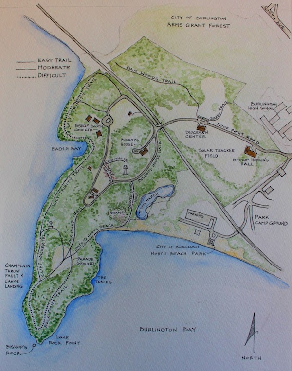
At the same time, Bishop Hopkins, the First Bishop of the Diocese of Vermont, bought 100 acres of Rock Point and used this land to build a house for his large family. Once this house was completed, the rest of the land was used for subsistence farming. The land that was flat and rolling was used for farming which meant that much of the forest was cleared in these areas. In contrast, the land on the peninsula was not cleared because it was used for woodland purposes.
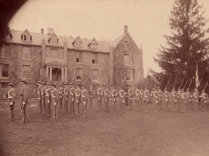
After the Bishop established his home, he allowed the Trustees of the Vermont Episcopal Institute to own the land, which allowed a boy’s school and theological seminary to open. These establishments caused many land changes to occur. One of the most notable changes occurred during the Civil War when the boy’s school became a military school. Because of this shift, a cleared area was needed so that the boys could practice drills. Thus, the parade ground was cleared, changing the landscape.
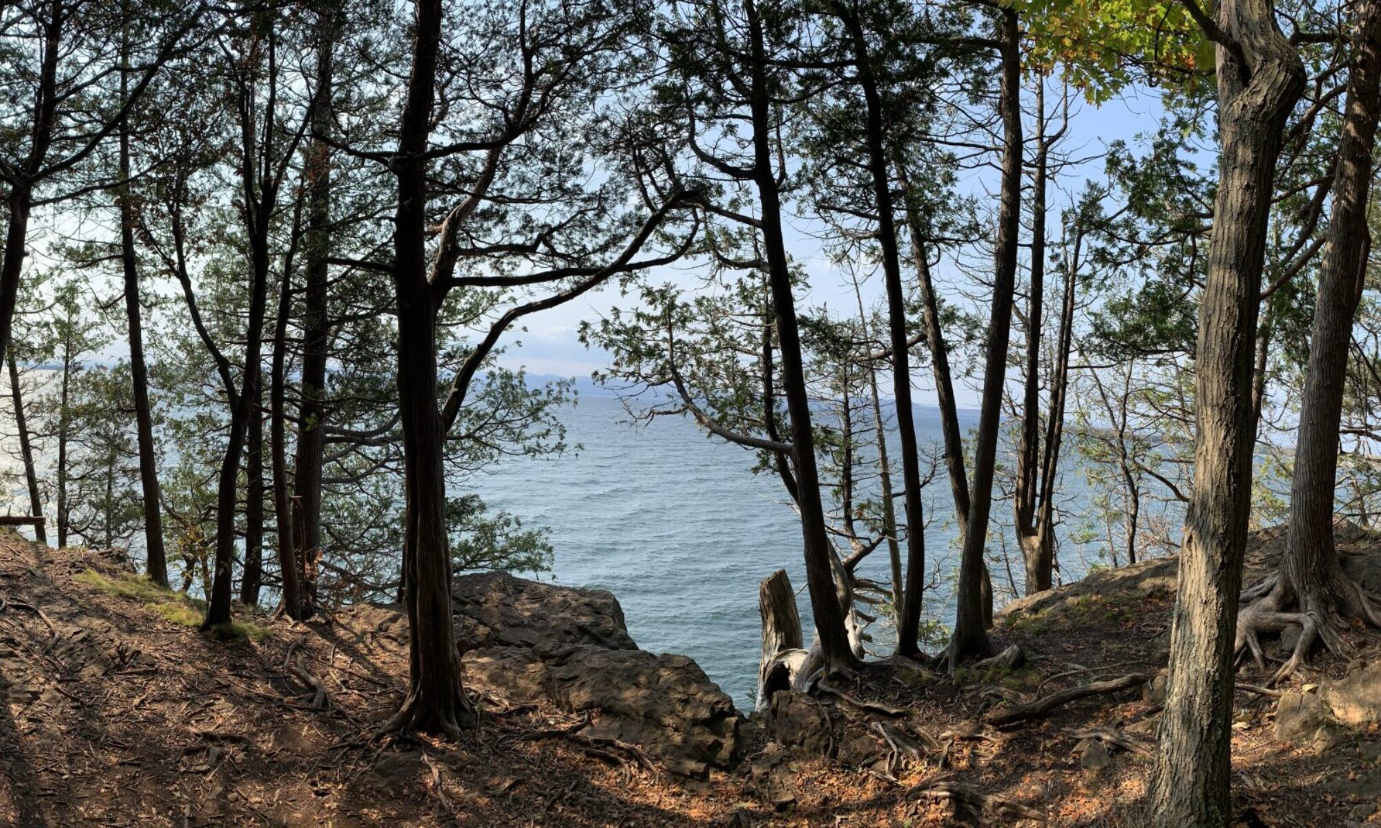
These past land uses directly impact the landscape of Rock Point today. At my site, a predominantly old growth forest is present. This is the case since those that inhabited Rock Point in the past did not clear this land for pasture. On the other hand, the forest in the parade ground is much younger due to the clearing that occurred during the Civil War. These examples highlight the lasting effects that human land use has on landscapes.
Today, Rock Point is owned by the Episcopal Church of Vermont; however, the church allows the public to use the land. The church prioritizes environmental stewardship which positively impacts the natural communities found on the peninsula. In addition, the land is used to build community which is emphasized by the community garden that is on site. A more complete list of the land uses of Rock Point are summed up in the vision statement found on the Rock Point Website. It states: “To be a welcoming sanctuary of spirituality, creativity, community, education, training, and environmental stewardship” (para. 4). Because of this vision, the pristine landscapes found at Rock Point (such as my site at Lone Rock Point) will be maintained and cherished for many years to come.
References
[Map of Rock Point]. (n.d.). Retrieved from https://www.uvm.edu/place/burlingtongeographic/focalplaces/rockpoint.php.
[Military school]. (n.d.). Retrieved from https://www.uvm.edu/place/burlingtongeographic/focalplaces/rp-landuse.php.
Berrizbeitia, I. Focal Places in Burlington. https://www.uvm.edu/place/burlingtongeographic/focalplaces/rockpoint.php.
About Rock Point: Burlington, VT. https://www.rockpointvt.org/about-rock-point.