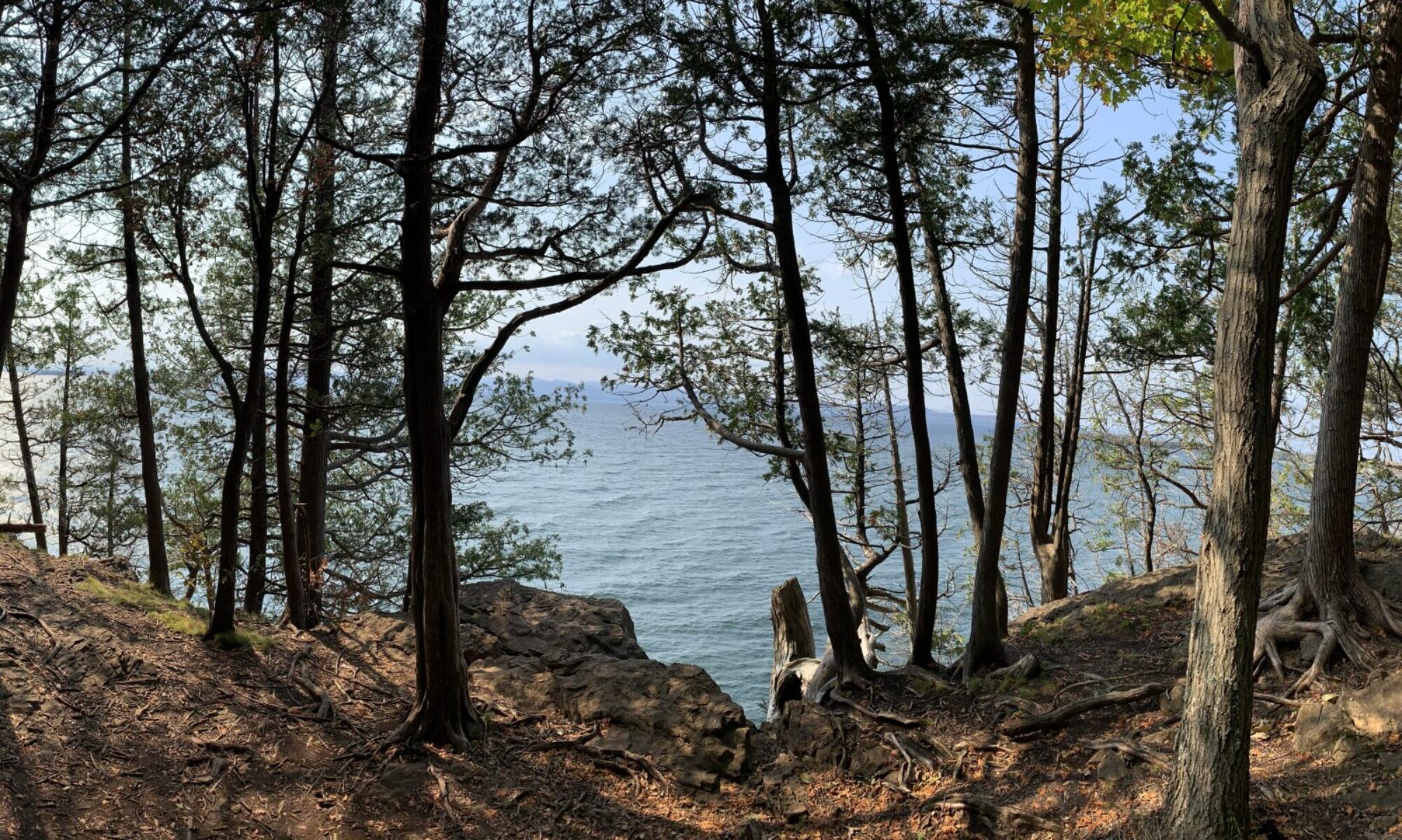
Hello Everyone! I have decided to do my phenology project at Lone Rock Point. I now have my bike on campus, which makes getting to Lone Rock Point much easier. Although it isn’t the closest option to campus, I felt such a connection to the landscape when I visited this area for lab #2 of NR1. I have always found peace while looking over a body of water, so I am elated that my location has a magnificent view of Lake Champlain. In addition, I have many personal connections to water since I have been a competitive swimmer for seven years. I also enjoy sailing, so I am very passionate about protecting water resources since I have personally benefited from the recreational uses that these spaces provide. Thus, studying the changes that occur in the landscape right next to Lake Champlain was a natural choice.
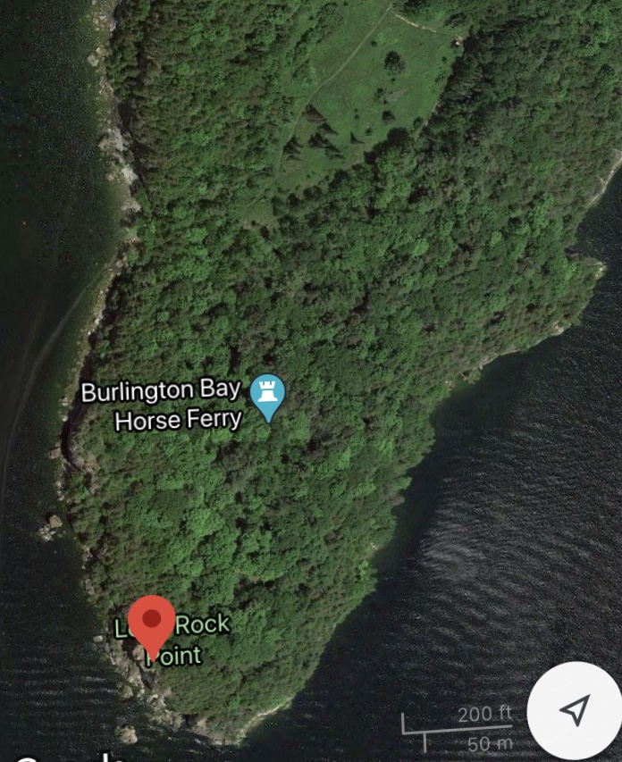
Getting to my spot takes some time since it is roughly 3.5 miles from campus. Start by heading down College St., and then take a right onto the bike path. Once you get to North Beach, prepare to take a right into the North Beach Campground. Once you are through the gate of the campground, take your first a left into the main Rock Point entrance. Follow the paved road until you locate the bike rack. Lock your bike at the rack next across from the community garden. Walk over the bridge that crosses the bike path and take your first left. Follow this trail until you enter a clearing. Continue onto the Rock point trail, and walk straight through the parade ground. Continue on the trail until you notice a set of stone steps off to the right. Climb the steps and enjoy the view from my awesome spot at Lone Rock Point.
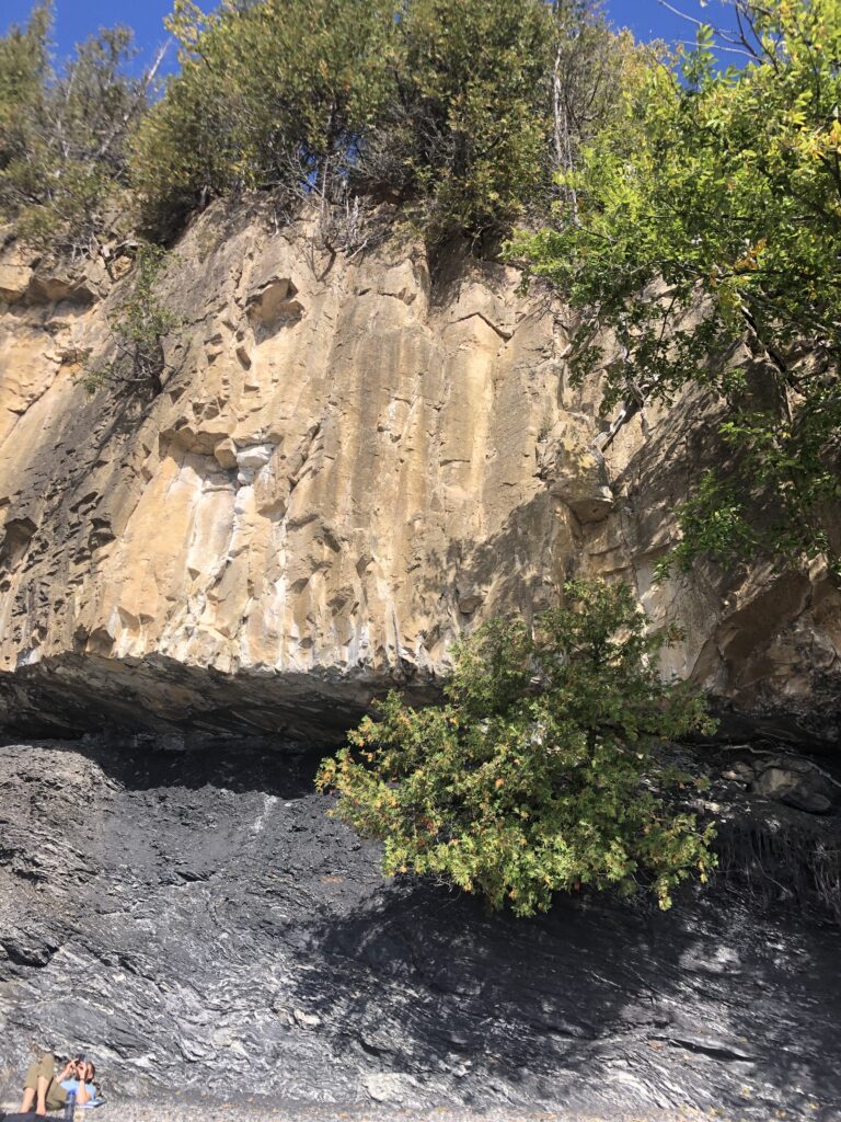
My spot is located right on top of the Champlain Thrust Fault. This is an incredible geologic formation which is composed of shale and Dunham dolostone. What makes this fault so fascinating is that the older Dunham dolostone is found above the younger shale. This flip flop in the usual progression of rock formation occurred during the Taconic Orogeny. An orogeny is a mountain-forming event. In this orogeny, the older dolostone slid over the younger shale, causing this unusual order of bedrock to occur.
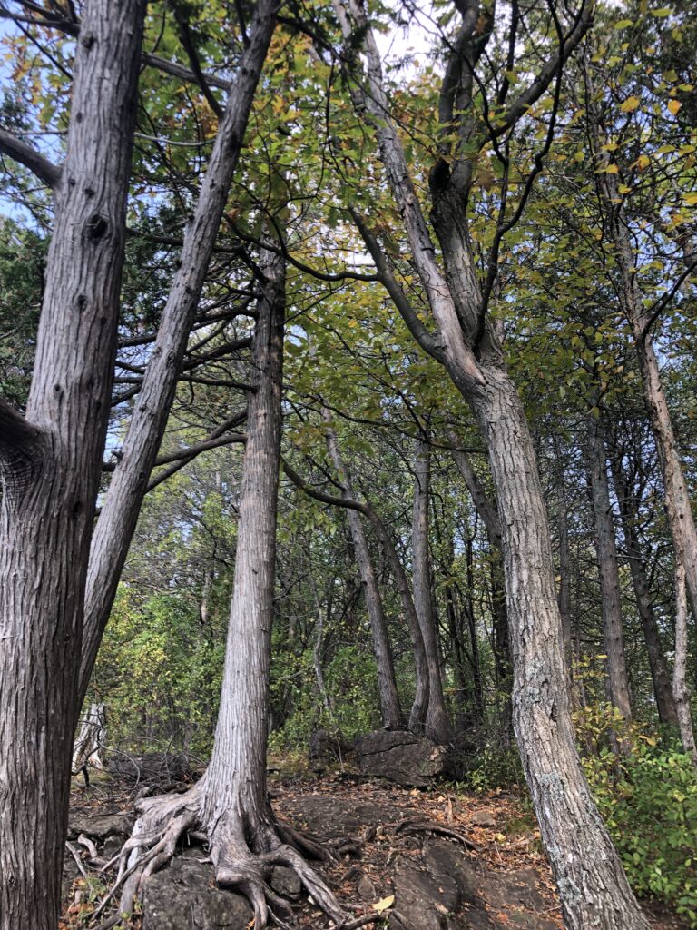
Observations of Vegetation and Woody Plants
While I was observing the landscape around me, I noticed patches of moss as well as many small grasses. In addition, I noticed an abundance of jewelweed that was gone by. Towering above the vegetation, I identified many northern white cedars, northern red oaks, and shagbark hickory trees. The distribution of the woody plants is interesting to note. At the edge of the lake, the dominate species is the northern white cedar. As one goes inland, the shagbark hickory and northern red oak become more prevalent. This change in distribution reflects the fact that the northern white cedars are well adapted to the harsh conditions that the lake produces.
The observations that I made at my site are directly impacted by the natural community that it resides in. At my spot, the Limestone Bluff Cedar Pine Forest natural community is found. This is a rare natural community that occurs here due to the unique climate that the lake creates. Thus, this will be an interesting site to study for the foreseeable future.
References
Koval, A. (Photographer). (2020). Untitled [Thrust Fault, Photograph].
Koval, A. (Photographer). (2020). Untitled [Woody Plants, photograph].
Google Maps (2020). [Lone Rock Point. Burlington, VT]. Retrieved October 11, 2020, from https://www.google.com/maps/d/edit?hl=en&mid=1ce2ie-G8gJjTYhSiTmUfBBdhaE0L2eze&ll=44.48923158235482%2C-73.24788169204241&z=18.
Berrizbeitia, I. Focal Places in Burlington. https://www.uvm.edu/place/burlingtongeographic/focalplaces/rockpoint.php.