After visiting my phenology spot last time, I was left wanting to connect more with my spot, learn more about the area it is in, and really dedicate a solid chunk of time to this second blog post. Because of this, I cleared one Sunday morning to go to my phenology spot, leaving myself plenty of time to take the bus over, explore for as long as I wanted to, and also walk back to campus. Giving myself this much time and freedom in how I spent my visit to my phenology spot helped make the entire experience so much more enjoyable and peaceful, despite my phone dying after only about 30 minutes of being there! (the reason why I “decided” to walk back to campus instead of taking the bus)
After taking the bus to the closest stop to the park, I was left to walk through a neighborhood and across the park to my phenology spot on Oakledge Cove. Along the way, I noticed a bunch of informational signs that I hadn’t noticed at my last visit, and decided to read them, the first of which was titled “The Lost Resort” and explained some of the land use history of Oakledge Park. I read that the park was once a resort called Oakledge Manor Resort, open from 1929-1961, that had bungalows along the shore of Lake Champlain where people could stay, most commonly during the summer months.
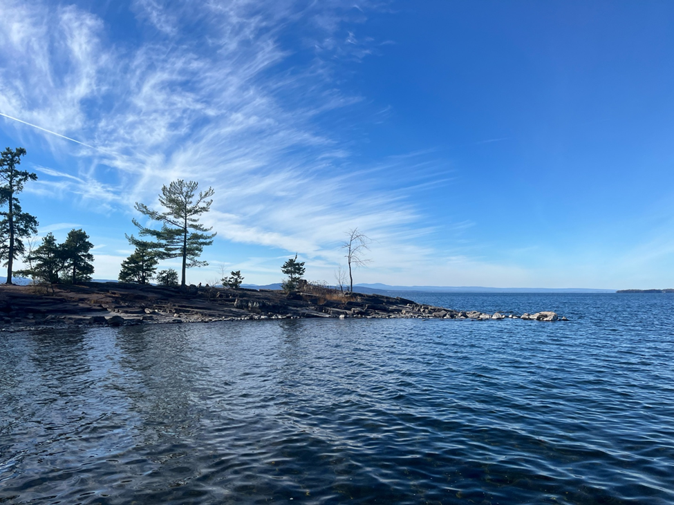
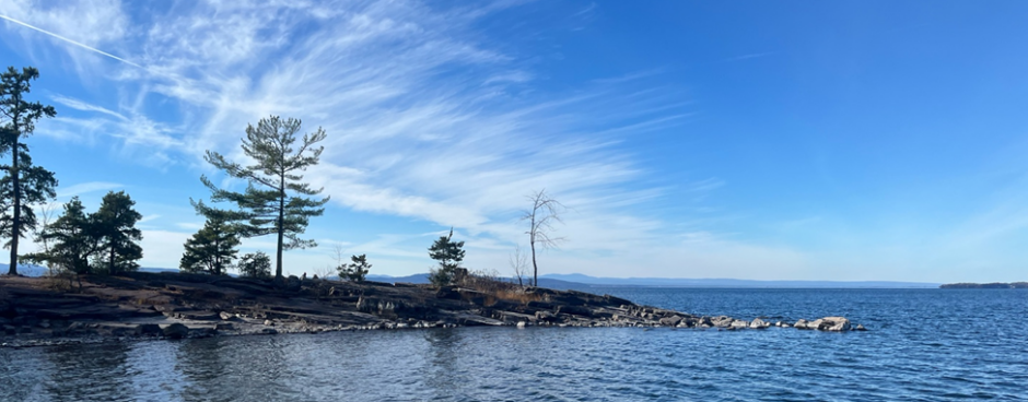
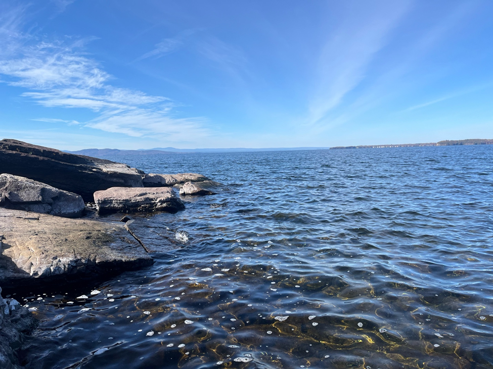
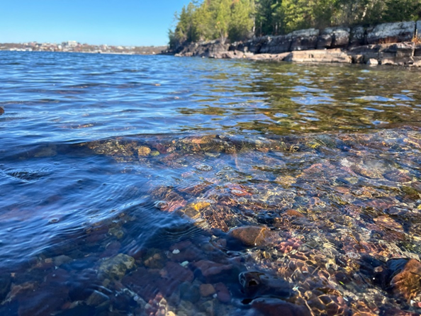
When I finally reached my phenology spot, I was happily surprised that I was the only one there. I retraced some of the spots I had looked at during my first visit and settled in a spot on the end of the rocky peninsula, overlooking Lake Champlain while still having the little cove in view too. While I sat and observed for 15 minutes, I noticed that the rocky peninsula had a mix of trees with their fall foliage, trees that were now bare, and evergreen trees that still had their foliage. On the opposite shore, on the other side of the sandy beach, almost all the trees along the shoreline had their leaves, as they were mostly evergreen trees. One thing that also really stood out to me during these 15 minutes was the clarity of the water along the shore; I was able to see right down to the smooth rocks below the surface of the water, and was able to get a closer look at some of the muscle/barnacle type organisms that were covering the rocks along the waterline. I tried thinking back to my first visit to my phenology spot, wondering if I had noticed the clarity of the water then or the little tide-pool like areas between some of the rock formations, but couldn’t if I had noticed anything.
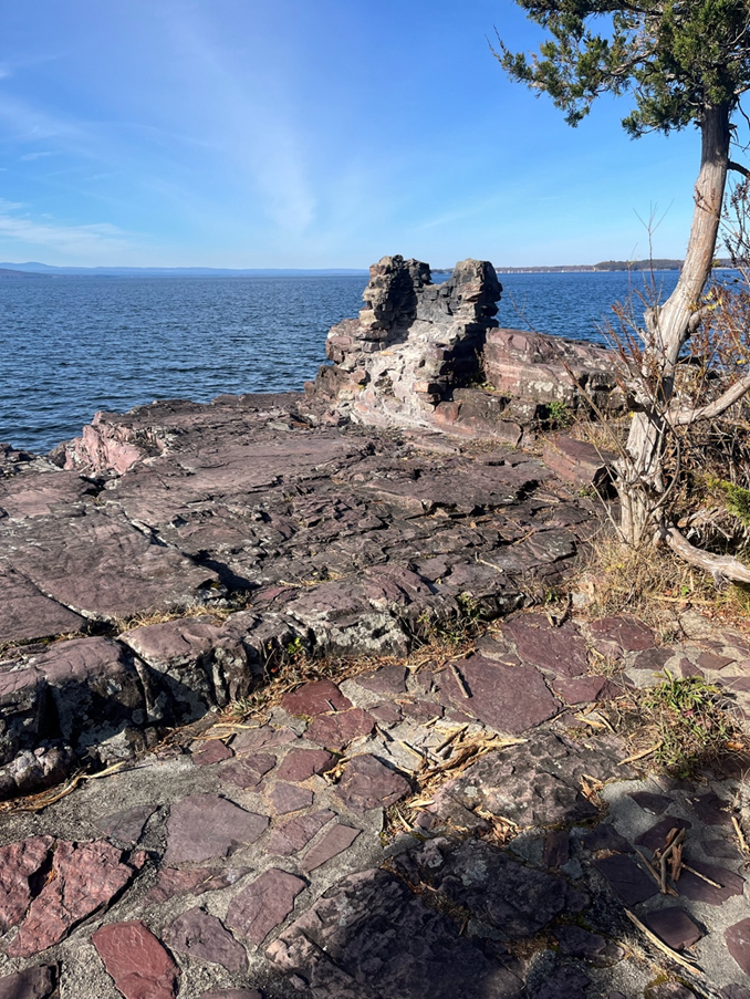
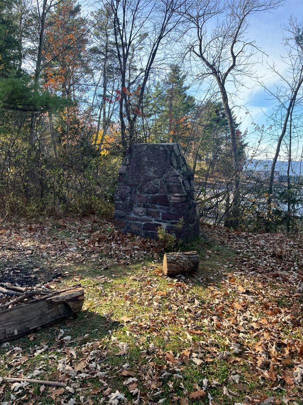
After my 15 minutes of observation, I decided to look closer at some of the other areas around my phenology spot again to see if I could notice any other small details I might have missed from before. Walking around the peninsula, I found an area that appeared to have human-made stone flooring with a large chimney/stone oven type structure next to it (#6 on my map drawing). Thinking back to the sign I had read about the history of Oakledge, I realized that it must be the remnants of the bungalows that had lined the shore during the mid-1900s. This thought was confirmed when I then explored further, finding another informational sign, this one focusing on Oakledge Cove specifically; it mentioned that there were bungalows along this specific shoreline, and that there was also an old stone fireplace built for cookouts too, which I included on my map drawing as well (#1)!
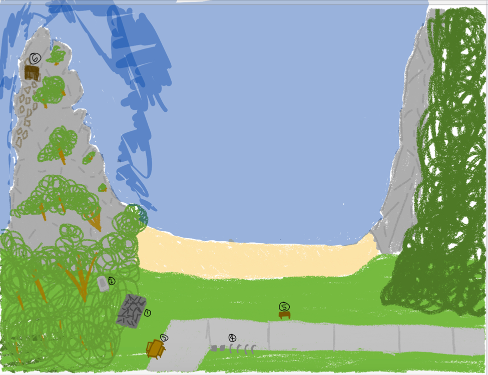
Birds-Eye Map of Oakledge Cove
#1 = old chimney/fireplace type structure
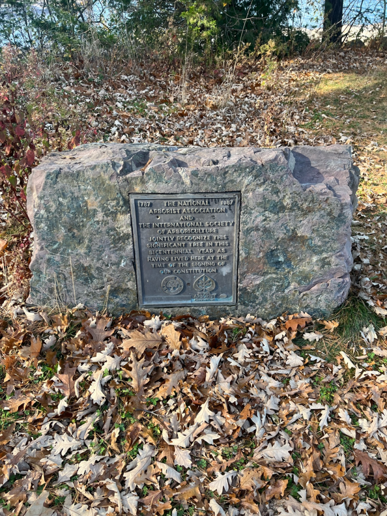
#2 = plaque about tree being from when the constitution was signed
#3 = picnic table/seating area
#4 = bike rack and trashcans
#5 = informational sign titled “History on the Rocks”
#6 = little chimney area with the stone flooring – possible remnants of an old bungalow!
Before heading back to campus, I noticed one final thing that stood out to me, which I also included on my map drawing, labeled #2; it was a stone with a plaque engraved on the front which read, “1787-1987 The National Arborist Association and the international society of arboriculture jointly recognize this significant tree in this bicentennial year as having lived here at the signing of our constitution”. Despite it being a small aspect of the natural area of my phenology spot, it was cool that they dedicated a rock/plaque to a tree that had lived through so much history at this spot!
After my visit today, I feel so much more connected to my phenology spot, not just because I learned so much new information about its history, but also because I feel like I was really able to take the time it deserved to appreciate all the little details that make it special. I really enjoyed skipping the perfectly flat rocks along the shoreline, admiring all the intricate details that I maybe wouldn’t have noticed if I had rushed my visit, and just dedicating a day to appreciate this spot and have a moment to take a breath!