Final Visit: Salmon Hole 4/27

Tree in the water

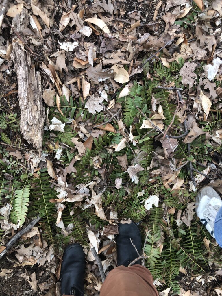
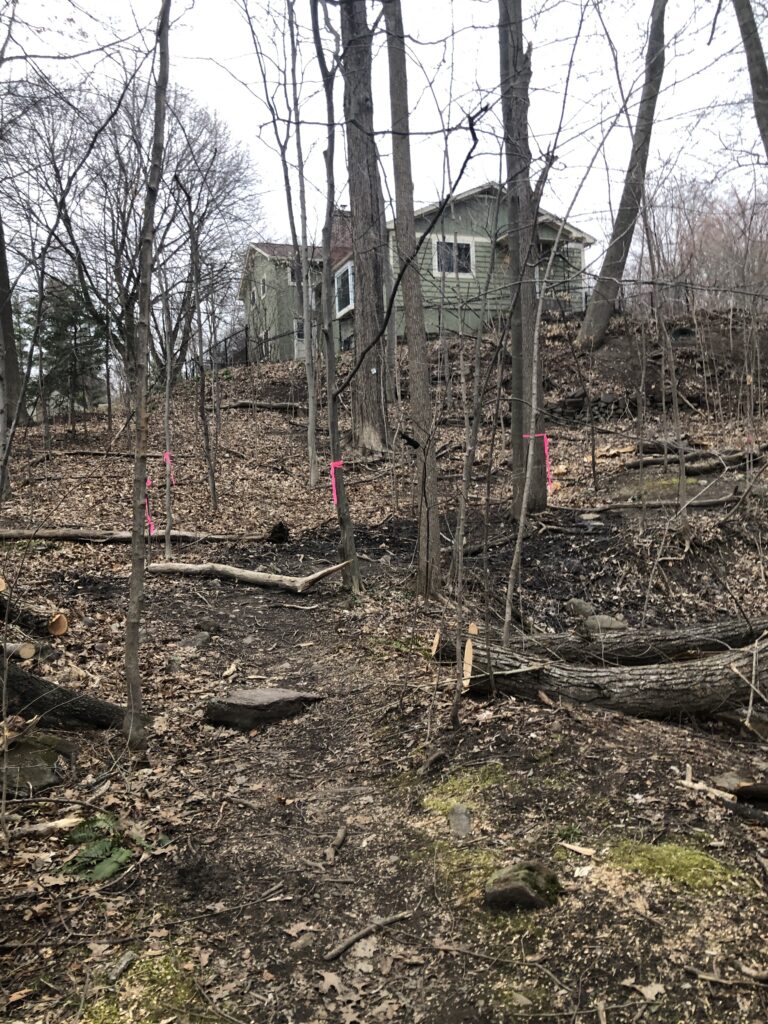
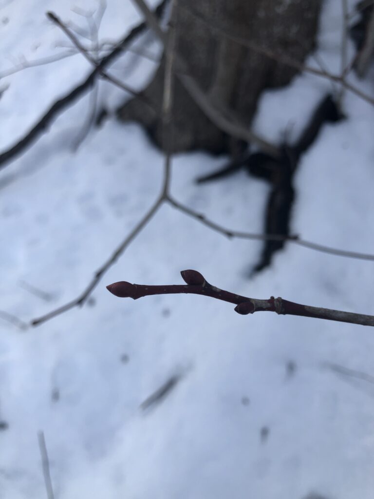
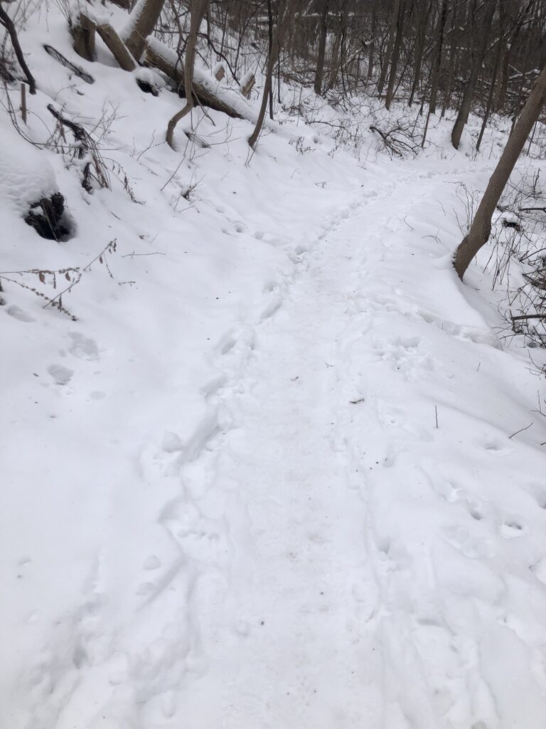
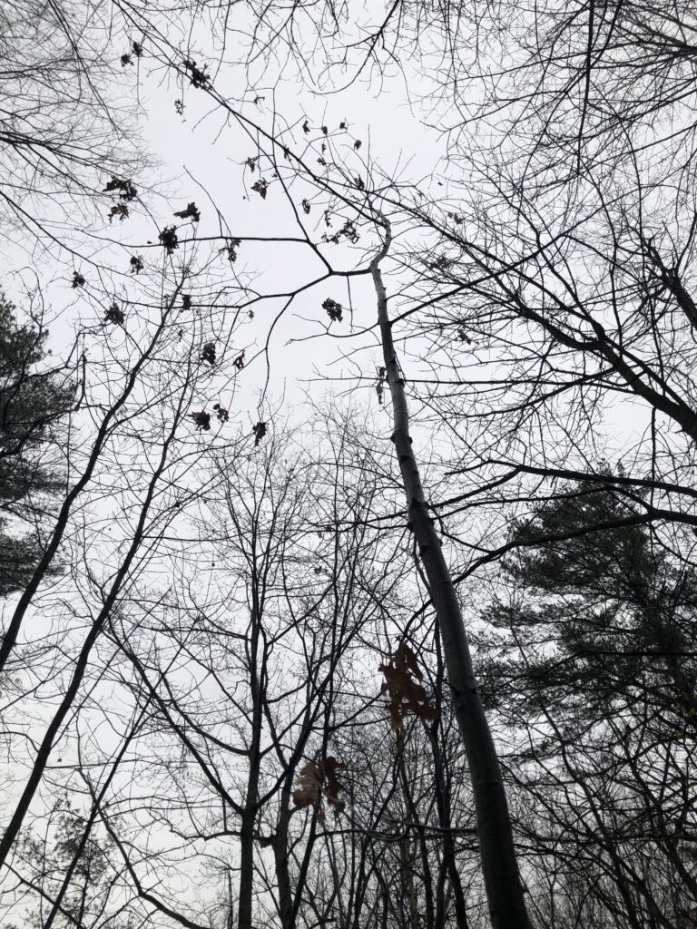
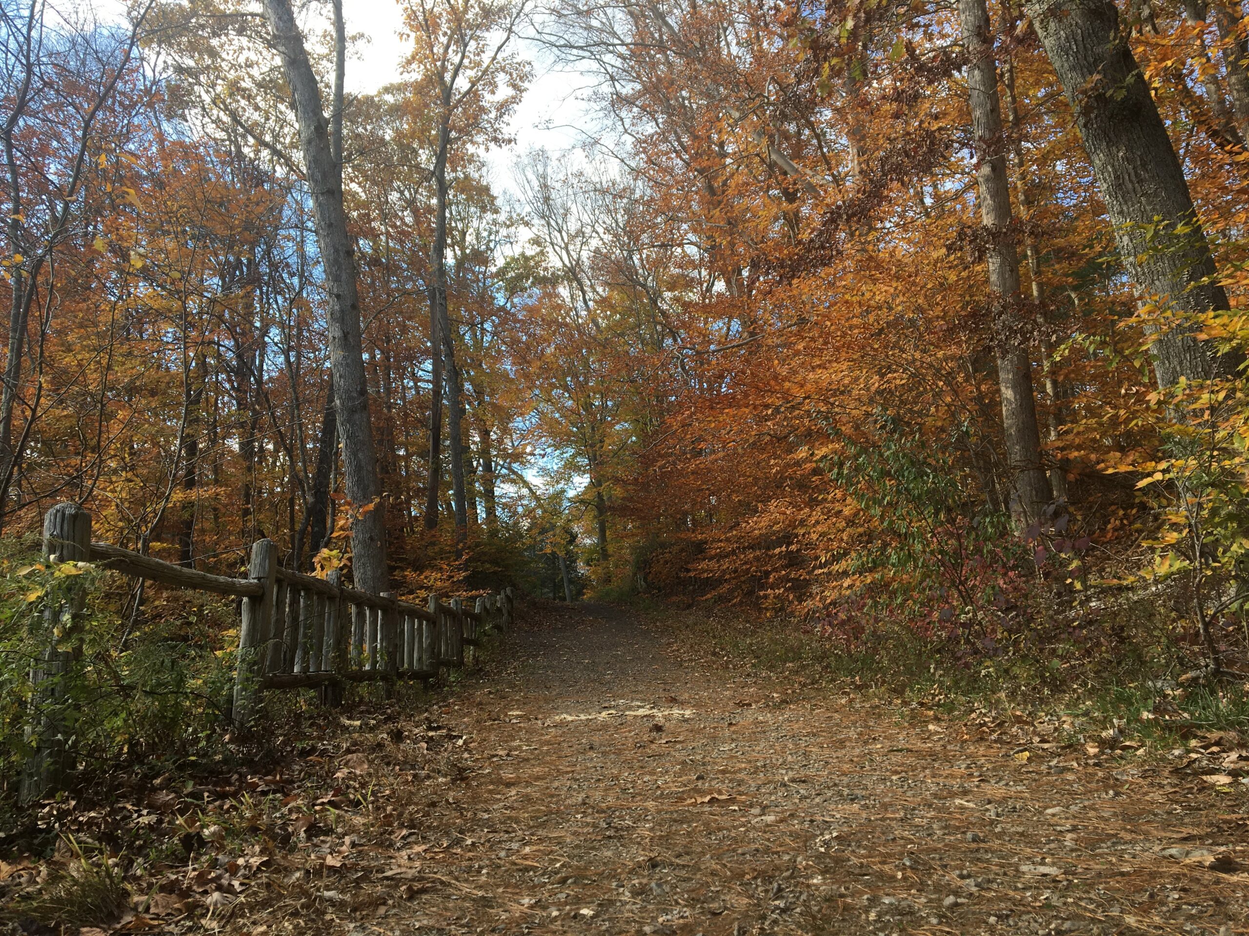
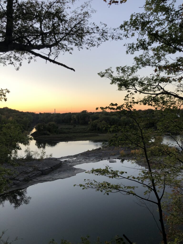
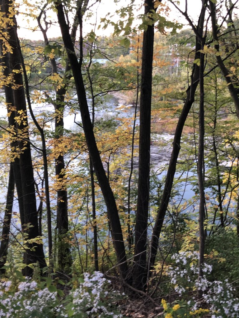
My final visit to Salmon Hole has to be one of my favorites. I started visiting this site at the beginning of the first year. It has become one of the points in Burlington that I have become very familiar with. When looking at my original phenology post, I can see the physiological changes that have occurred over time in this area and my work. I did not go down to the water when I initially visited because I had yet to learn where the trail was. In this area, I have consistently observed human activity through the dam towering over the river to all the trash pulled up to the rocks from the water. On my initial visit, I noted a lot of wildflowers in the area and a substantial understory. When I visited this time, I saw the understory start to come back up, and green leaves were growing. My favorite portion was seeing all the ferns unrolling.

View of the dam

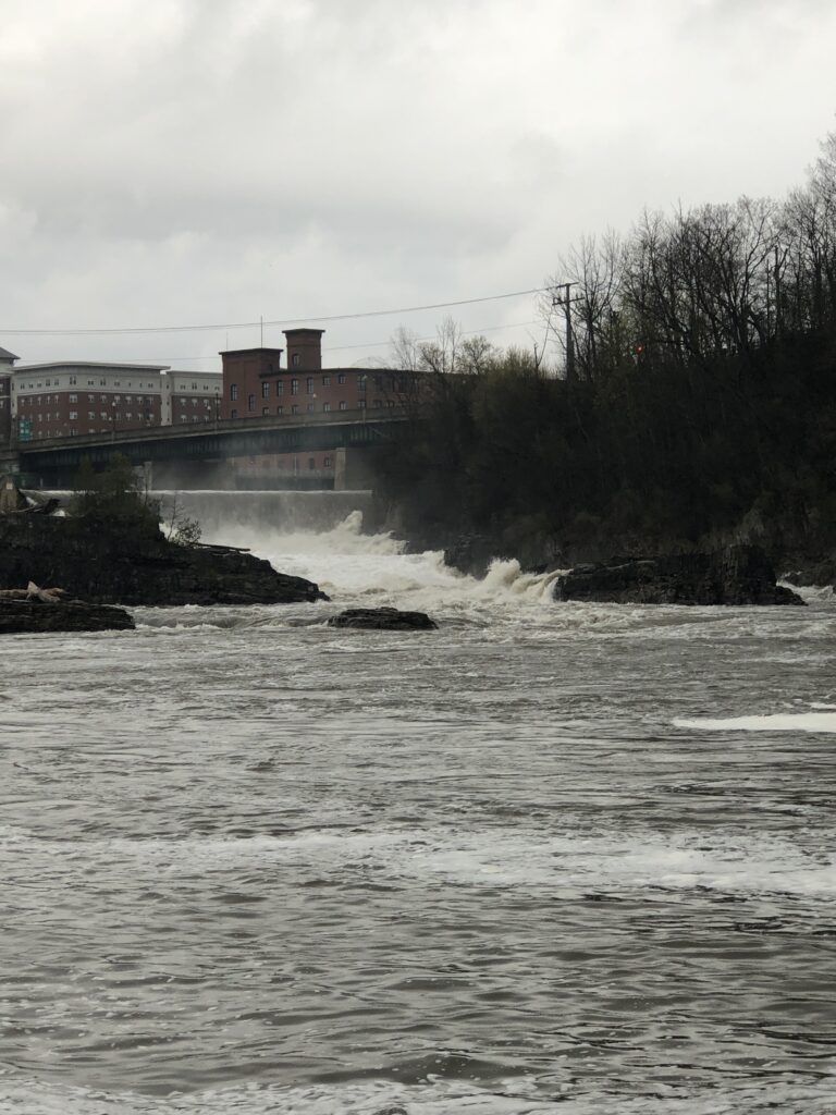
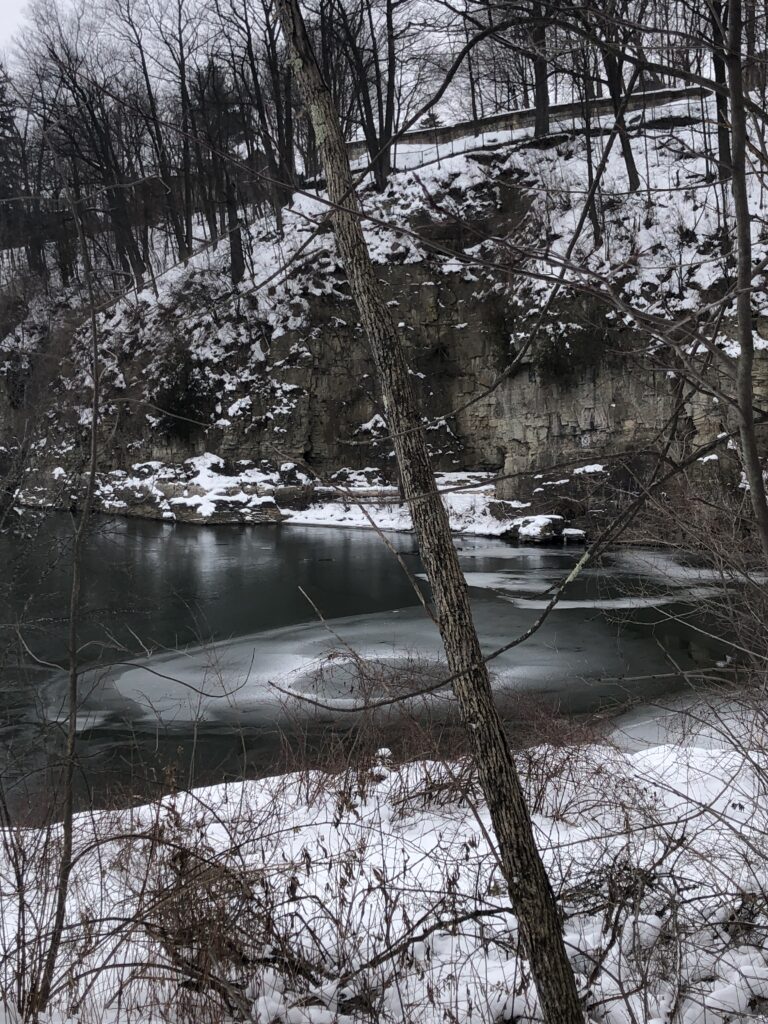
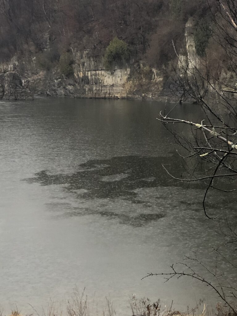
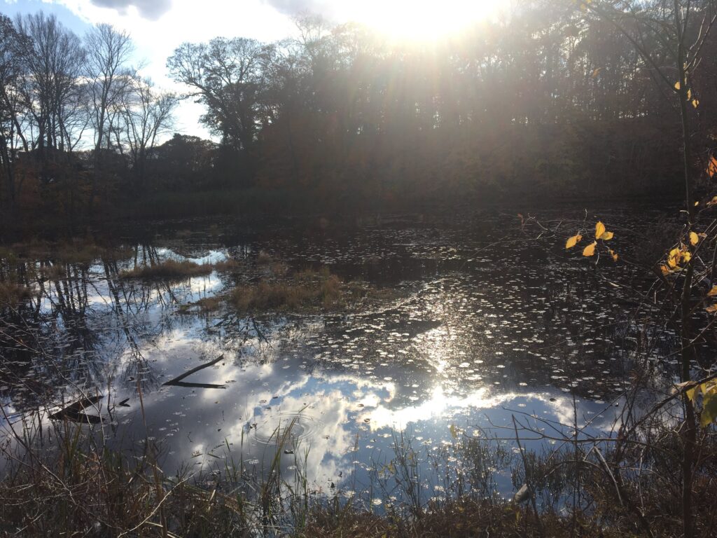
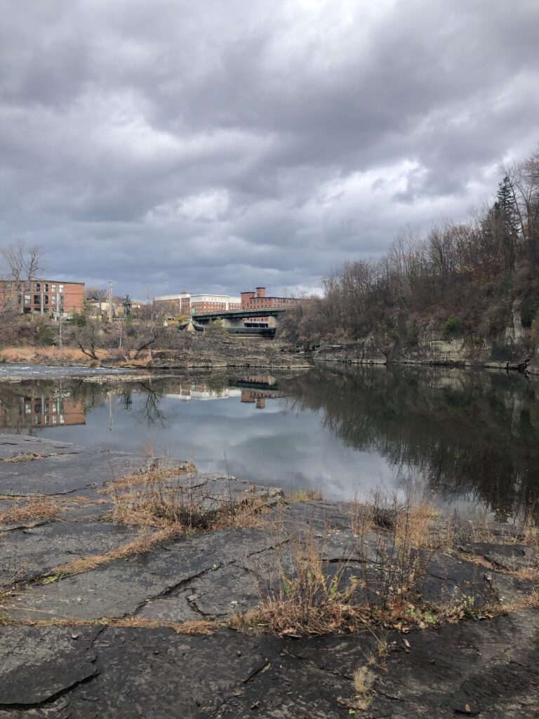
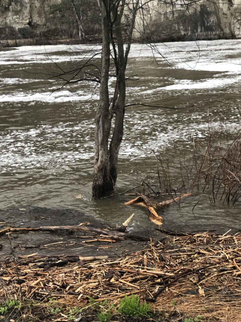
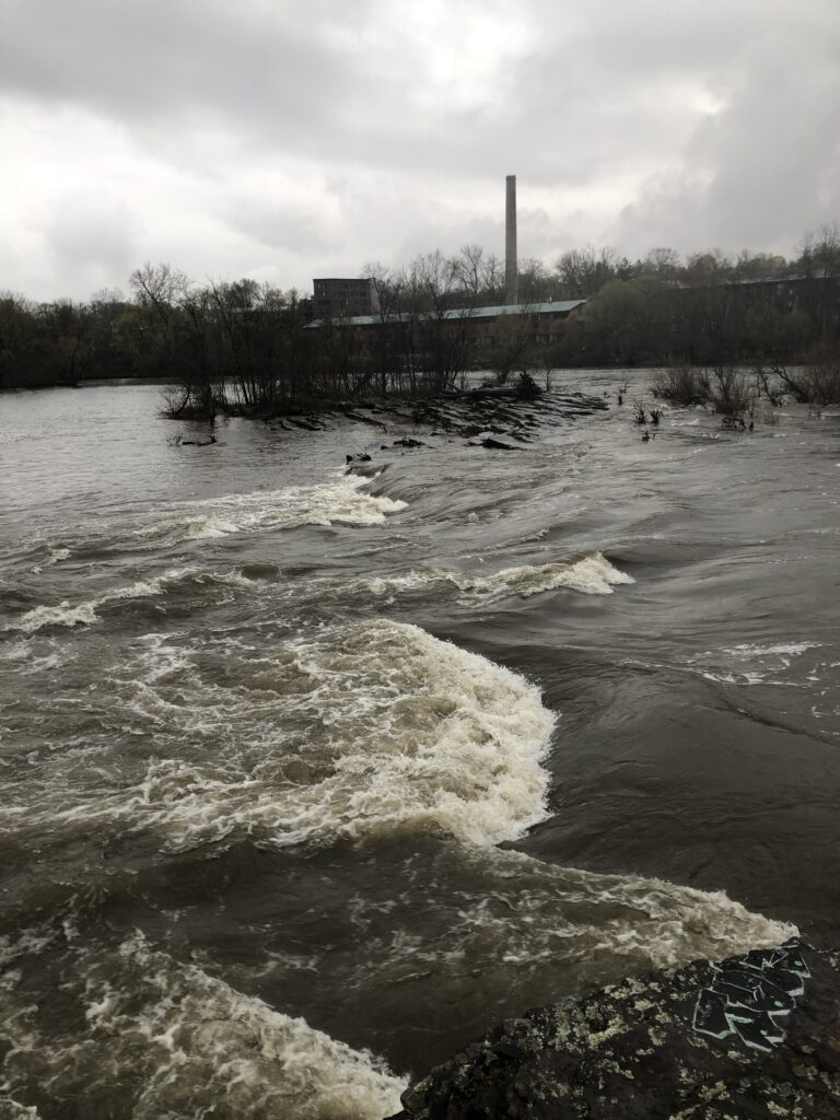
What was truly intriguing about this visit was seeing the water level, and I could observe this change when seeing the water levels from my original photos. Now the dam was releasing way more water than was expected. This is probably due to all the recent snow melt and the rainy conditions that have been occurring lately. The water was rushing over rocks that it usually could not even touch, and the power of this flow was so strong it almost created a push and pull on the rock I was standing on. It looked like rapids were in the area. This pressure made a lot of foam pushed into the slower-moving area. Now at the end of the rock, I usually walk to the rocks connecting that section to the middle rock section entirely consumed by the river. The rocks exposed at the beginning of the year were encased in a river, giving no opportunity to see them. The portion had such a strong river flow that it began to look like a rapid had always been there.

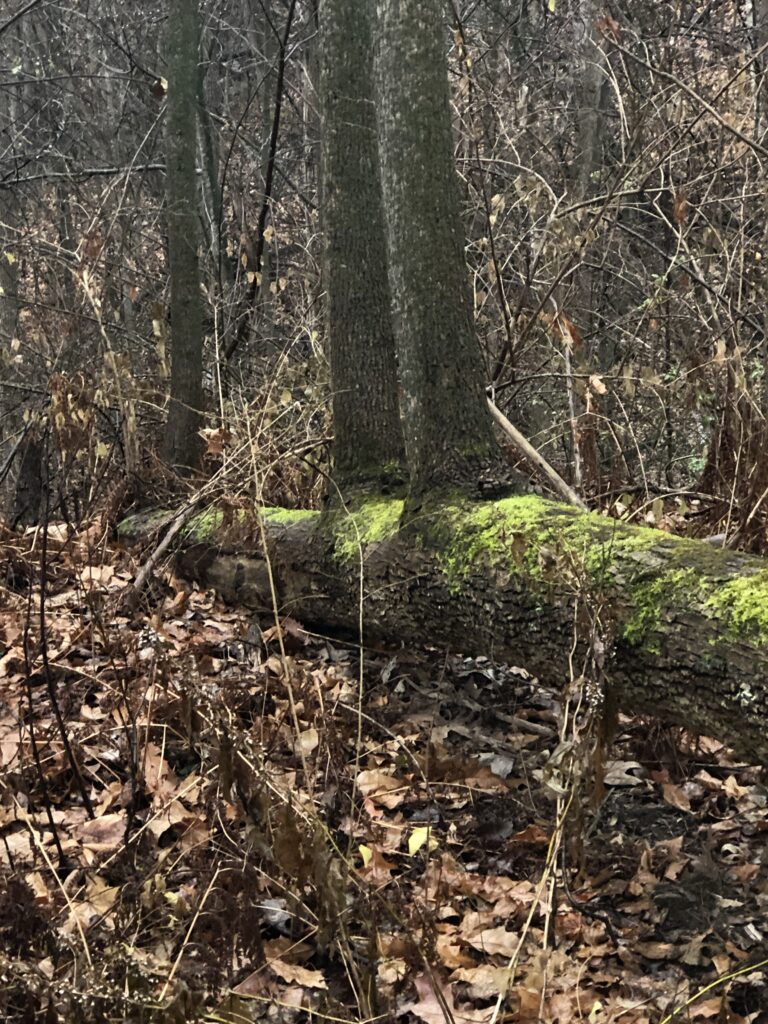
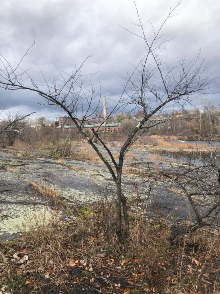
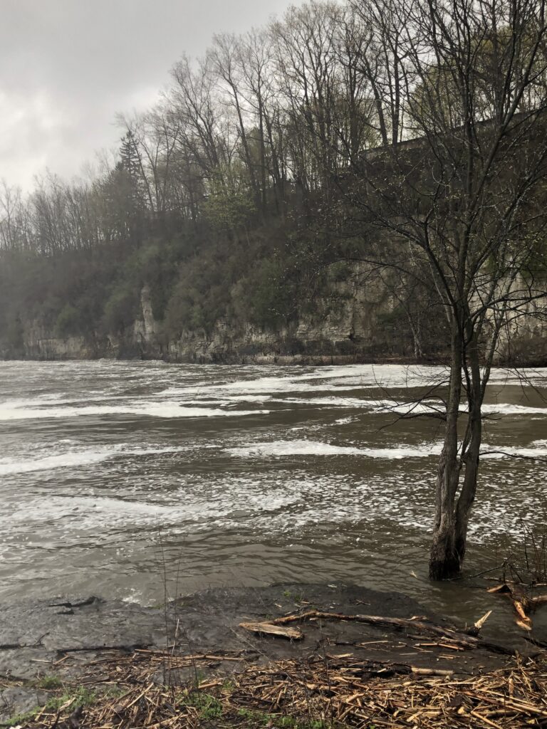
I first noticed the high rise of the water when I saw a tree that was generally on land consumed by the water. This occurred with other trees down the path that was a good couple of inches in the water.

Foamy water

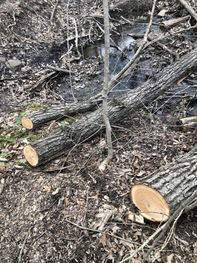
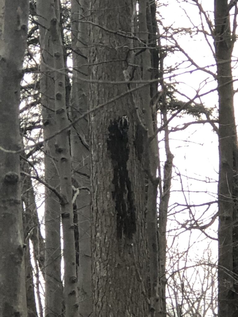
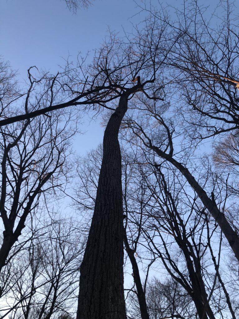
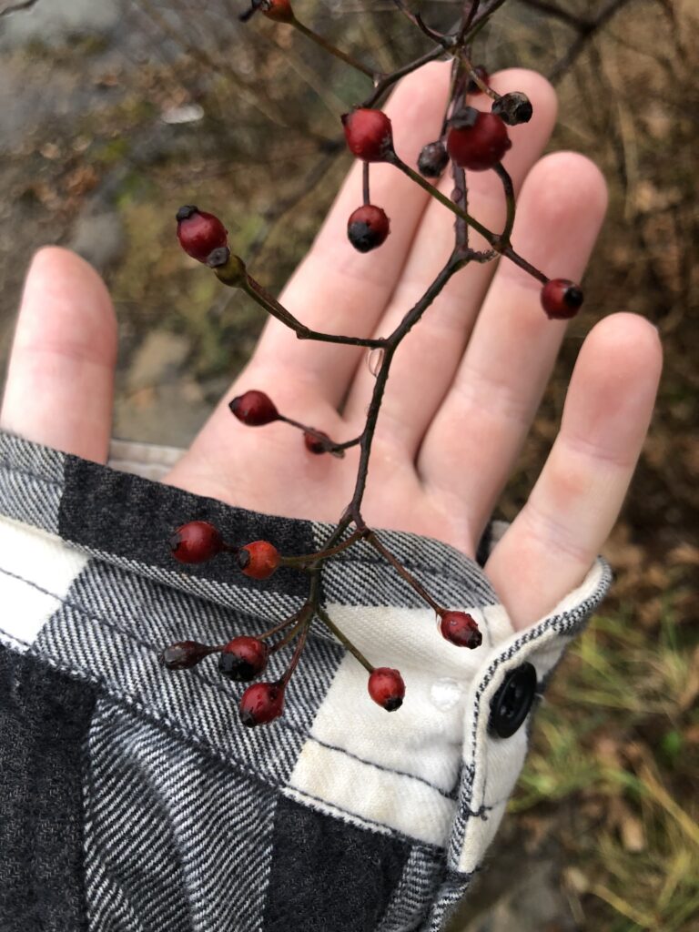
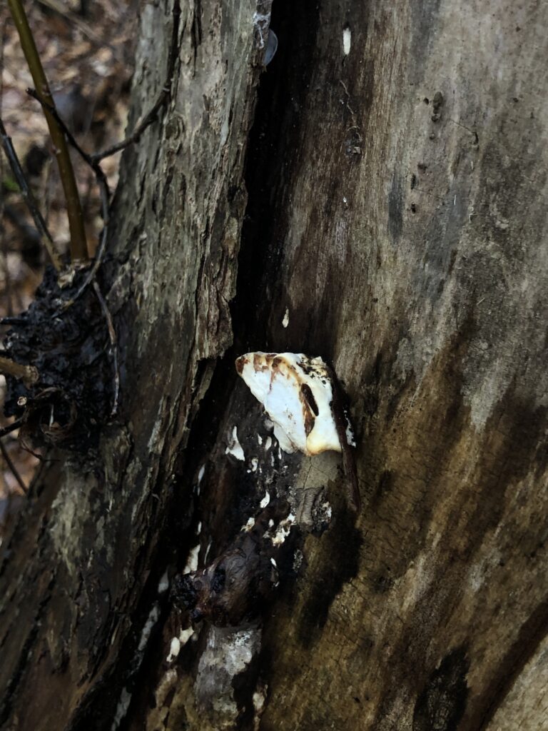
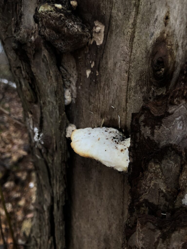
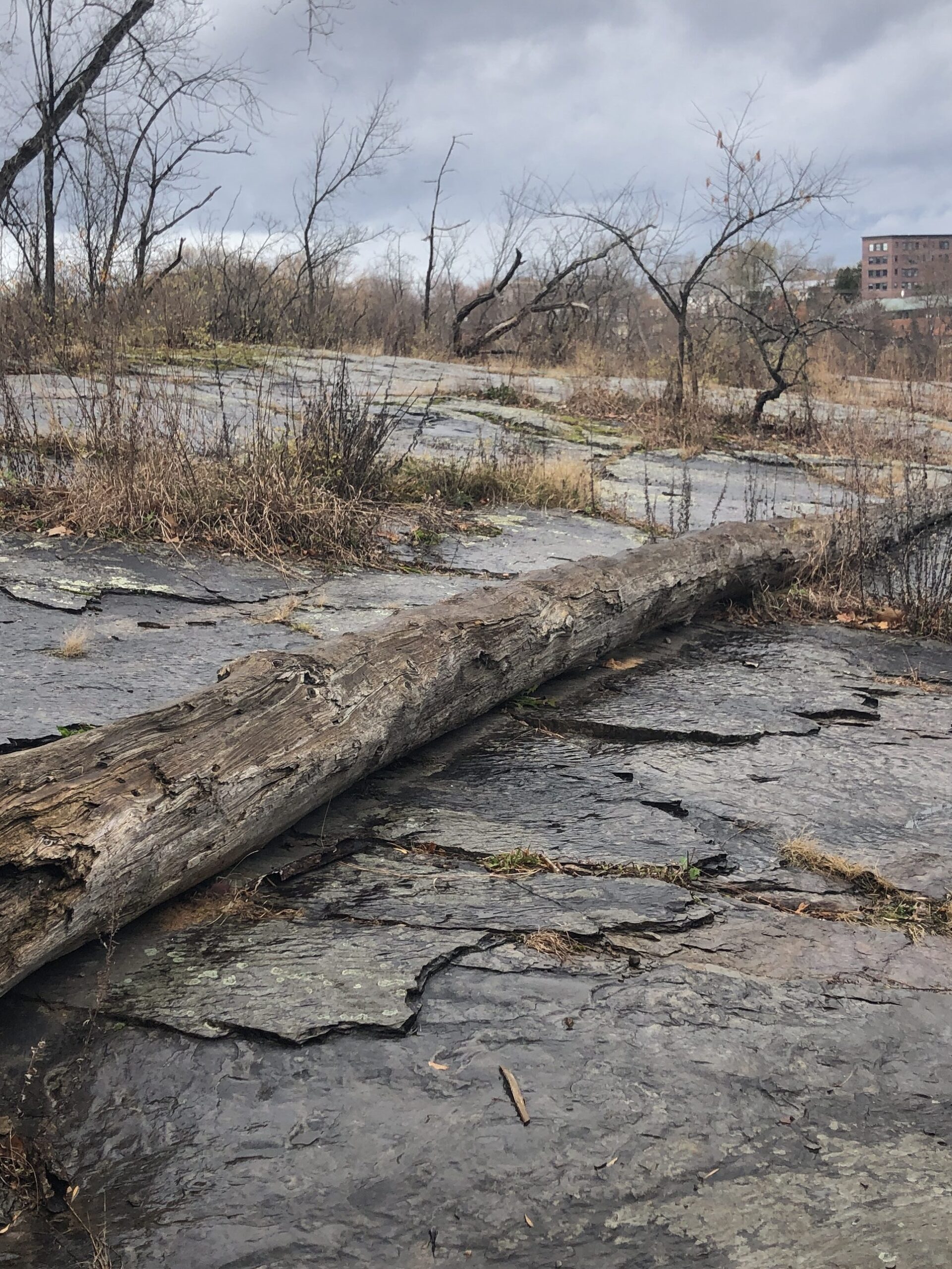
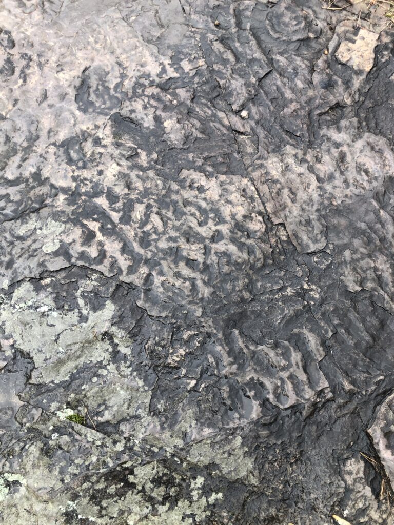
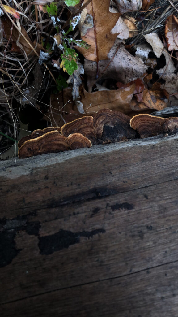
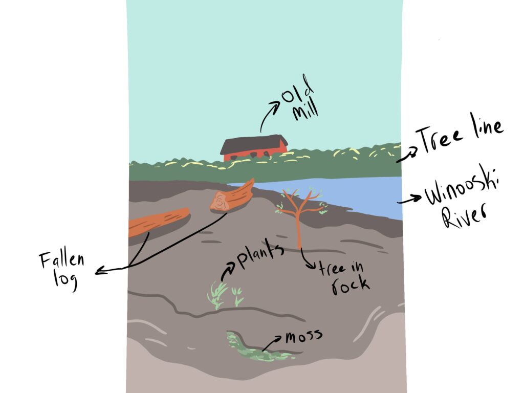
A significant landmark I have become familiar with is the log that rests on the rocks in Salmon Hole. In the fall, when I first visited, mushrooms were growing on it, and plants surrounded it. But as the year has gone on, this growth has stilted. The rocky area in Salmon Hole has a very prominent organization. The waves in the rocks and all the trees grow in the cracks.

There used to be rocks here

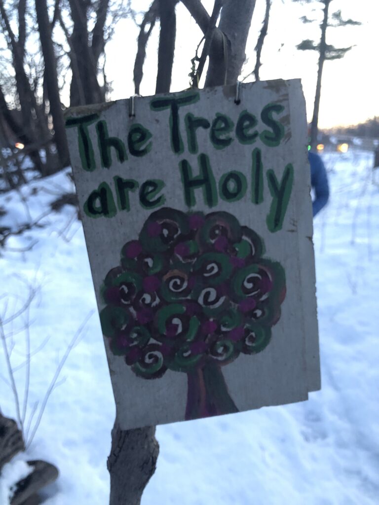
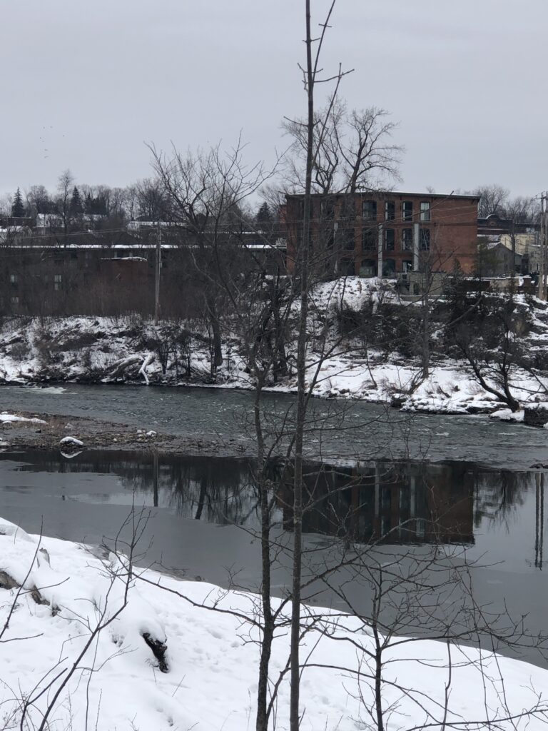
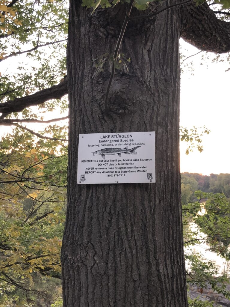
This area shows precisely the way culture and nature intertwine. This is the beginning of Burlington Wildways, which has Vermont’s culture of protecting the natural land and trying to get more people out there and exploring. It’s impressive how well taken care of these sections are; benches encourage people to sit and enjoy their surroundings. On a more negative note, Salmon Hole also shows the culture of trying to control and use nature, such as the dam. This prevents the water from being released, causing effects in the lower lands if there is a flood. Along with this, interviews with the salmon travel upstream. At the same time, this dam needs to be maintained because it can not just be destroyed, as that would cause a lot of houses along the shore to be flooded. 

My little sketch

Overall I consider myself a part of this place. This area is inconvenient for me to get to as I live on the Redstone campus. So when I would wander down to Salmon Hole, I would have to be willing to spend a couple of hours on my travels. The most recent time, I got caught in the rain for about three hours. I have found this spot significant to me, and even if I am not a part of this place, it is a part of me.

Visiting Salmon Hole reminded me of preserving our natural resources and caring for the planet we call home. It reminded us to step back from our busy lives and appreciate nature’s simple yet profound beauty. 

Tree Phenology: Possibly Oak

The clearing of trees
Possibly oil

Once again, I am visiting the suburban woods that are Crescent Woods to see my lovely, possibly oak tree. I still need to be 100% able to identify this tree, but I believe it is an oak tree. There are a lot of white oak leaves surrounding the tree, so this is still my best estimate. Now my main observation in this area, in general, is the pollutants I found filled in the foot pockets of the mud. The pollutant’s reflective surface makes me assume it’s an oil. It makes me curious how much of this pollutant is in the woods and where it originated. My main guess is that it was washed off the road into the woods during the recent rain.
The next portion that changed from the last visit was the fallen tree in the way of the trail. This time the tree must have been cut by a chainsaw to clear up the trail. Other branches that had fallen in the path were now moved to the side of the trail. Again, it was amazing that even smaller wooden areas were being cared for and not just left in disorganization.

Ferns
My tree

My favorite portion of this entire excursion was wildlife spotting. After seeing my tree, I took a decompressing break from my long day. During this time, I heard a slight taping sound on a tree. When I looked up, I saw that one of our keystone species: the pileated woodpecker. I watched it for around 10 minutes hopping up and down the tree, constantly pecking at it. Since I started these phenology posts, this was my first wildlife spotting besides squirrels. During the last portion of the visit, I saw some small ferns appear. I am still determining what kind they are, however.

Woodpecker sighting
Some tagging done by NR students

Tree Phenology: Visiting the Maple

My attempt to adventure to Crescent Woods was more miscalculated this time. I went during the night, which made identification of the tree more difficult in the process. Nevertheless, this was my only time to wander there, so I took the opportunity.
Now the most significant change in my tree is I misidentified it. Initially, I thought it was a maple which, in my defense, was my most educated guess. This week for the lab, we went to Rock Point to learn about the maple process. Part of what I learned was how to identify sugar maples with their bark. Their bark is way more shaggy looking but still needs to peel. During this time, the instructor mentioned that people often misinterpret sugar maples for oaks, which is why some of the oaks had puncture marks.
So in this discovery, my tree is an oak due to its very straight edge bark and also its pure size of it. My pictures could have come out more nicely, so I had to make do with what I had. I have yet to identify whether the tree is a red or white oak. These while being the questions about my next visit.

Some wonderful trees at night.
Apparently, the bud from my visit is in the birch family.

Tree Phenology: 3/11/2023

For this phenology assignment, I wondered about a different portion of Burlington than Salmon Hole. So, I visited Cresent Woods, an area conveniently close to the Redstone portion of the campus. Along the walk, one notices the amount of neighborhoods surrounding the woods, and at the end of the woods, it leads to a busy road filled with businesses. Yet, even in the woods, you can see the houses that stare over the woods.

Some buds

I thought I spotted a red maple when I went into the woods. The bark is dark brown bark with vertical stripes. So, I looked at the surrounding trees to figure out the type of maple. The buds on these lower trees had red maple buds similar to the red maple. Since it is early in the season, there appear to be fewer buds on the trees, but it still has them. To confirm I checked the leaves that were under the tree, which majority were red maples. This led me to believe this tree was not one of the lookalike maples.

Potential red maple

Centennial Tracking: 2/20/2023

I went to centennial woods to track some species for my phenology spot. I wanted to adventure away from Salmon Hole and explore a new area of Burlington that I have yet to track in. I did this tracking on Sunday, the 19th. There was still some snow on the ground, but not a considerable amount; luckily, I got out before the rain came and washed away some of the tracks. Later in the day, there were some flurries. This led to some fresher tracks by lighter animals, but the tracks appeared to be older for the bigger animals. Using iNaturalist for this was fun. I liked looking at similar tracks that others found and compared. I also went to the woods alone, so I had no one to converse with in my observations, but the app communication helped.

The first track I ran into was on the right of the trail around the first curve. Now, these appeared to be canine tracks. The paw had an X shape across and nails showing in the snow. However, I wonder if these tracks were from a house dog, coyote, or fox. These trails were older, so not all the nails were showing. Along with this, there are different paw sizes. I ventured off farther into the woods following these tracks, and they appeared to come from farther in the woods, So unlikely a dog. If it were a pet dog, the track would lead from the trail to the woods, not the other way around. I was not confident in this track, so I could not identify it.

The next set of tracks I found was very faded in the snow. Some more recent snow slightly hid them, but I could still barely see them. I chose to look at these because there were only a few other tracks around this area. From the five back toes, I counted and the four tracks being together, I am making the educated guess that the animal who left these marks was a squirrel. Unfortunately, I could not find other tracks from it, so these potentially melted or got hidden under the snow.

Lastly, I found a fresher pair of tracks in an open fielded area. They started at the end of the field, more towards the urban area, and went into the more wooded section of Centennial Woods. This shows it was heading away from the urban setting, maybe going there originally to eat trash, and returning. The tracks had five twos; the back foot was bigger. It was very similar to the description and looked like a skunk track. Leading me to believe it was a skunk tracks.

Salmon Hole: 1st Visit of the Semester (1/30/2023)

Here is pictured an icy trail and my shoes that have little to no traction.

I started my trek to Salmon Hole on a chilly Monday morning. The way there leads to a slight drizzle of snow, prepping for the week of freezing temperatures. One of my first observations of Salmon Hole was how icy the trail is. This is due to the popularity of the area, which I was shown by the packed-down snow on the trail, almost making it feel like I was walking on an ice slide. I had just come from class when visiting and sadly forgot my ice spikes.

Compacted snow showing the constant track of people walking through

Along with the tracks of people, I saw many animal tracks, most of which were from dogs. The snow revealed the number of dogs owners bring on these trails and which ones walk off-leash. I found the most interesting track right before an oak tree (Image 3: Animal Track). This was one of the only tracks I found that did not appear to be from a dog but instead from a wild animal. My guess is a squirrel, as the tracks start and end in front of the tree. Leading to the conclusion that the animal must have climbed the tree and run away. The prints were also tiny, eliminating the majority of animals that could be around. Besides these tracks, there was a lack of animal signs, such as fur or eaten berries.

Image 1: Dog?
Image 2: Dog
Image 3: Squirrel

The last component of Salmon Hole that caught my attention on this visit was the river. The area closest to the rocks I visit has begun to freeze by the edge. This makes sense as the area’s water is slower, making it easier to ice over. As the temperature drops this week, I want to see how much of the river freezes over, especially in these sections. The rest of the river was running fiercely and moving faster than the last time I visited. This could be from the recent snowfall.

Frozen over river section
Fast moving waters

10/06/2022: Final Visit

On Tuesday, December 6, 2022, I made my final trek of the semester to my phonology spot. The weather for today was on the colder side and had constant rain showers. It was around 40-50 degrees out during this visit, which is shocking to have such warm temperatures in the winter, especially in Vermont. 

Northern red oak, left with a couple leaves left

On my initial visit to Salmon Hole, I mainly took note of the trees, like the northern red oaks and red maples. These trees lay bare as their leaves scattered across the forest floor. However, when reviewing photos from my November visit to my site, I saw a drastic change in just a month. When I visited the site at that point, I said a lot of the area lacked leaves and less vegetation on the ground. Looking at these old photos, however, I still see a lot of life on the site. Smaller grasses on the big rock were still green, and to the understory plants that still kept their leaves, a good amount was left.

Picture of the rose hips

The only tree in the area still contained its leaves was a red oak in the understory. These leaves were all extremely brown and still stuck on the tree. Due to the recent rain, most leaves fell entirely off the trees. In Naturally Curious by Mary Holland, the December section begins to talk about the animals and plants found in this time frame. I could not find any animals or tracks of them; I even looked at trees to see if a porcupine had been around. Potential evidence of an animal being around was an eaten mushroom on the tree. Mushrooms generally grow 1-2 days after rain, and the mushrooms on the tree were tiny, so they grew from the recent rain. This means there must still be animals out and about to eat these mushrooms. One fruit I saw was the rose hips, which come from the wild rose plant, a plant I identified earlier in the phenology spot. The wild rose plant was one of the only plants that still had a majority of green leaves, which I found interesting. 

The eaten mushroom
A small non-eaten mushroom

When wandering deeper into the woods, I saw a fallen tree, with its base covered in soil and roots still in contact. Growing from this were two healthy trees with their branches and systems. It’s amazing how trees can continue to grow even when put in these unconventional situations. Even when this tree fell, it stayed healthy and grew. 

The two trees growing from the fallen tree

During my time on my phenology project, I was left with one last question, which was about the Winooski River. When I looked into a still part of the river, I noticed that the water was a darker color than the rest of the river (as pictured below), which made me question why the river appeared to be two different colors. At this point, I could only think of one potential. My idea is that from the winter cycle, many sediments settled to the bottoms of the river. But as the rain hit recently and the river looked more powerful than last time, some of that settled sediment began to rise. It could cause that color change.

Why is the river two different colors?

Phenology Spot: Break Location

Gillette Castle State Park

11/25/2022

Gillette Castle State Park is a state park located in Lyme, CT. This is the perfect phenology spot, showing the connection between humans and the land.
The main attraction of this state park is the castle that sits prominently in the center of the park. This castle was built in 1919 on a 184-acre piece of land. The castle was created with medieval gothic architecture, giving the castle a strong medieval look. The castle was owned by Gillette and later purchased by the State of Connecticut in 1943. One of my favorite features of this eccentric castle is the train tracks. When the castle was built, Gillet had train tracks throughout the property. A mini train would then take visitors through the property and allow them to see all it offers. Now, this train no longer runs, but the tracks still stand. It is interesting to see such an extensive display of money that Gillette was able to build a castle and add fancy features such as this train.

View of Gillette Castle
The Connecticut River, located right next to the state park

One rock formation in the park is the Hebron formation, made of calcite and quartz-rich genesis. This gives the formation the banded texture, with a green and gray-like coloring. For the stairs of the main entrances of the buildings, schist rock is used because schist is easy to make into slabs.

A small pond found on the grounds of the state park.

When walking around, the primary plants were ferns, mainly cinnamon ferns. A tree species in the area is American Beech; most of the beech are carved by people who put their initials into the wood. The carved trees show that people will still affect the land even when trying to persevere it. Carving into these trees potentially opens the tree to infection or infestation. Along with the beech are old white oaks, making most of the land a hardwood forest. Showing that the land was probably not entirely cleared when Gillette owned it because it was not used as farmland but instead as a wealthy estate; there was no real need to remove all of the forest. Since Connecticut is in the New England area, these white oaks, at the time of the colonizers, would be used for the mast of ships and, therefore, at a specific size, would be the property of the King. My favorite tree I saw was a Shagbark Hickory. It has impressive bark that pulls from the tree in long vertical strands, making it easily identifiable. Overall, Gillette Castle State Park is an interesting spot as it combines an interesting history with the natural environment around it.

Map of Gillette Castle State Park

11/07/2022: Salmon Hole in November

I went to Salmon hole on Sunday, the sixth of November. The weather during this time was explicitly interesting for November, as it was around 70 degrees outside. Not only this, but as I reached my spot, it started to drizzle out. This was enjoyable because there was no one at Salmon Hole; I got to fully enjoy the area without many human disturbances besides a fisherman who was leaving. However, the impact of humans was still there, as the ground was scattered with litter that people left in the area. The majority were cans, so they were purposely left instead of accidentally left.

View from 15-minute sitting spot
Log that I sat on in my phenology spot

Now, when sitting on a fallen tree for 15 minutes, I first noticed the noise. Salmon hole is a beautiful natural area, but it is also directly next to a busy road. Sitting there, all I could hear was the cars going by. This perfectly illustrates a conserved natural area placed in an urban setting. The influences of Winooski and Burlington directly affect the site and, more importantly, the water. Salmon Hole is at a lower elevation than the towns surrounding it, so all the pollutants from these areas go into this water. While sitting, I got bored and decided to walk around instead. As I walked across the rock, I slipped and fell entirely on my side. At first, I was embarrassed to have dropped on the rock, but it gave me two new observations. The first was that some algae or bacteria grew on the rock, which became highly slippery because of the rain. It brought my attention to what could be potentially growing on this rock that I would not have noticed if I had not fallen. The second is that it emphasizes the texture of the stone. The rock was extremely smooth and had smooth lines like divots in it. This was most likely caused by erosion.

Full view of the area around my phenology spot
Examination of my phenology spot at Salmon Hole

The main change was the overstory. Last time at this spot majority of the trees still had their leaves and were starting to change color. Now walking in, the trees were bare, and their leaves covered the forest floor. There was less vegetation on the forest floor as the leaves covered it. The undergrowth still had some green leaves, or they were starting to turn yellow, such as the Alder Buckthorn. The American aster still had some open flowers, but most were closed.

Ripples in the smooth rock that I fell on. You can see some of the green stuff growing on the rock.
American Hornbeam that is growing in a small plot of dirt in an area dominated by rocks.
Conifer Masengill growing on the side of the log I was sitting on. The entire log was covered in them.

Salmon Hole 10/17/2022: First Visit

Salmon Hole is a part of the Winooski River in Winooski, Vermont. Living on the Redstone campus makes it hard to reach this area, so to get here, I use the bus. Now, in the general vicinity to get to the plot you need to cross the bridge from the Burlington side to the Winooski side. Go left at the end of the bridge and climb down the rocks. Keep walking forward to an area with an open view of the water and trees surrounding it. I visited this area at sunset and, therefore, could not explore the site as much as I wanted to.

Here it shows the above view of Salmon Hole from the walking trail

Mainly I chose this area because of the fish that live there. The name itself comes from the salmon that spawn below the dam. This makes the area’s habitat even more important as key species live in this area as it provides perfect foraging grounds for the fish. Some common fish in the area are trout, bass, salmon, and even some pike. An interesting attribute of the land here is the rock formations which create channels and holes for these fish to hide in. When observing these, it can be seen the rocks have ripples in them. This is caused by erosion and the current that this river has. Around the plot is the dam, which creates a higher water flow rate. It also adds a direct human aspect to this area. People created that dam and it affects the flow of the water and the habitats in it. Salmon hole, in general, is caught right in the center of the town, so people have a more predominant effect on it than, say, a river hidden in the woods. All the litter from people sweeps right into these waters. Not only that, but all the runoff from the town can go straight into these waters.

Picture showing the act to conserve the natural environment in Salmon Hole
Picture of the plants and trees that grow around the river

In the plot the most common tree seen was the northern red oak along with a variation of red maples and sugar maples, which at this time have an orange tint to the leaves and probably will fall off in around a week. On a smaller scale there were some glossy buckthorn and honeysuckle. In the rocks there were a lot of grasses and moss growing in the cracks. On the high part of the walking trail there were mainly eastern white pines, but none located in the plot. It just shows that the pines grow away from the rock and higher up on the bank, which likely affects the soil, in which pine needles that fall off making the soil acidic.

Salmon Hole Map: Alannah Fleming: Salmon Hole – Google My Maps

Skip to toolbar