A UVM blog Thrust Fault Views

Posts

Land Use History of Lone Rock Point

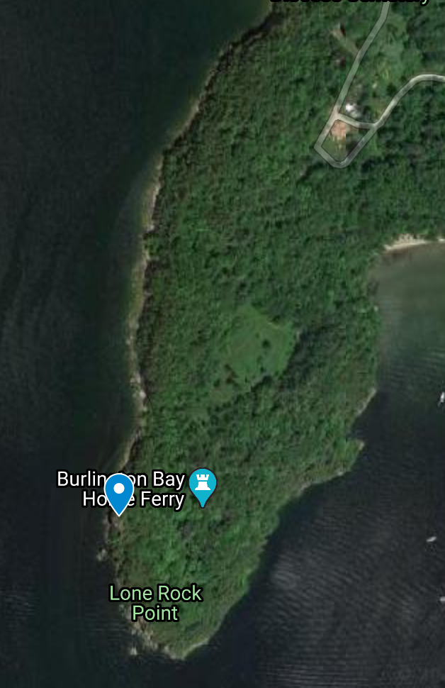
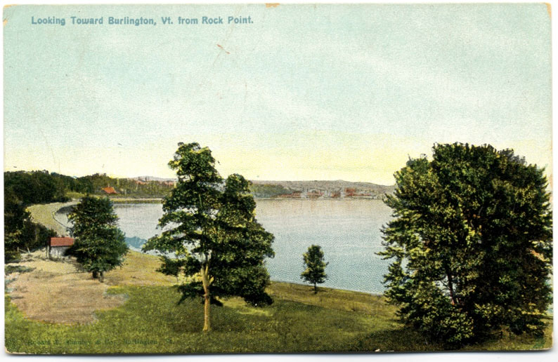
In modern times, many Burlingtonians walk the open trails of lone rock point enjoying the rich variety of ecosystems and incredible views. People travel using wild new technology like automobiles and planes to see the thrust fault. You might work for a company who has rented out the conference center, or be a kid at summer camp there. Many people stay in the rental cabins available near the bishop’s house. If you are the Bishop and live in his house, congratulations.

One hundred years ago things wouldn’t have been all that different. The dolomite Rock Point School was running as it does now, though with a more Gothic aesthetic. The area had already been turned into a center for education with public walking trails.

Things changed during the civil war, when the Rock Point School became a military school, and the parade grounds were used for drills. This period conjures dramatic imagery of soldiers marching around the fault, thankfully the war never came this far north, and we won.

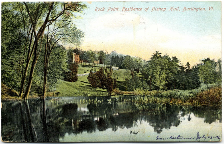
Reaching back further to 1841, and the land is purchased by the first Bishop of the Diocese of Vermont, Bishop Hopkins. Hopkins recognized the value of the sight immediately. He and his thirteen children (eleven of whom survived to adulthood) set to work farming the land until 1854, when the transition to education center began.

Early 1800s and Vermonters do what we did everywhere, clear cut Rock Point. To be fair, they left the northern peninsula alone, and it was likely the stunning vista they created that led the Bishop to purchase it and make it what it is today. But still, generations of ecological and land-use history before that point were lost.

Pre-colonialism it is speculated that Lone Rock Point was a center of Abenaki activity, do to its location on the shore of the lake and it’s grandeur. Chert projectice points were found on North Beach. Unfortunately a few arrow heads are all we have, after decimating their culture and flattening the land.

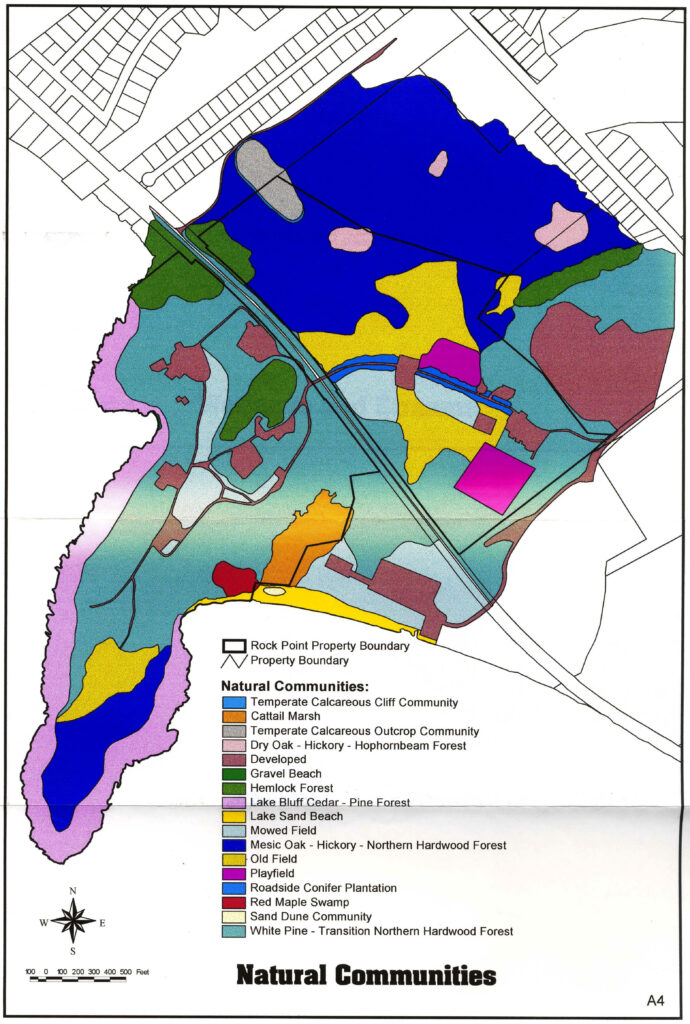
In summary, Lone Rock Point is privately owned by the Diocese. Dominion has been claimed over the beautiful territory. Non-human life is allowed to exist within the confines of man. The land use history of the colonizer has had a narrowing effect on the sublime awe of the site. It’s hard to get perspective when we’ve tried our best to make everything smaller than us. Having said that, Lone Rock Point remains a beautiful sight that inspires plenty of awe in travelers. Even from my view on the wooden walkways, built so I don’t roll my ankle or have to step in the mud, Lone Rock Point will continue to inspire reverence in me every time I visit.

All information and imagery gathered from:

Berrizbeitia, I. (n.d.). Rock Point: Human Land-Use History. Retrieved December 05, 2020, from https://www.uvm.edu/place. /burlingtongeographic/focalplaces/rp-landuse.php

My Home Place: Phenology of a lifetime

My home in Strafford, VT

I was fortunate to go home this Thanksgiving. I quarantined, got tested, and could finally hug my mom after so many months of social distance and masks. While our house is in the valley, our property extends up the hill. My junior year in high school we read Thoreau, and I began building a tiny 8×12 cabin (shed) in a field up there which I finally finished this summer. It’s a great place to watch the seasons unfold.

Fish-eye view from the back corner of the cabin, facing south to the porch.

The cabin looks across the valley (to the right of the picture above), so I could see the different forest vegetation. Unlike Lone Rock, the forests here are eastern hardwood forests, with rich soil and a wide variety of deciduous and evergreen species. Although there is a pocket of cedars along the river, planted a hundred years ago by a previous owner who was thinking generations ahead. The sun beams through the bare branches of trees on the hillside across the valley. I looked at the trees upside down (through my legs), and the branches give the illusion that the trees are drooping towards the sky, barely holding on to the ground. We should all take pride in our phenomenal efforts against gravity.

Frosted ground cover this morning displays the rich species variety.

Decades ago the area around the cabin was cleared, and so the land has a smooth successional transition from established forest to more a tangle of mid sized trees, to small trees, to brambles and ferns, and finally grassland. While Lone Rock Point has a lot of mosses and exposed stones, the ground here is a textured stew of green mulch and cover species (see image).

Overall, while both natural communities share similar climates and generalities, the eastern hardwood forests tucked into the rolling hills are starkly different than the rugged wind-blown limestone cedar bluffs that line Lone Rock Point.

Another view of the point! (hand drawn this time)

From the map you can see the evergreen cedars in the Limestone Bluff cedar pine natural community. The northern hardwood forest in all it’s colorful splendor, as well as the cliffs. The clearing is for community gatherings. North Beach can be seen in the top left of the image.

This visit was bird-focused, with dozens of ducks in the water and little birds in the air. A cardinal landed near me. I watched a Red-Headed Woodpecker for a while until it flew off.

Below is a photo from where I’ve been sitting for a clear view of the mossy cedar forests. I sit on the northern side of the point facing Burlington Bay.

View from the sit-spot!

Lone Rock Point Stands Out!

Lone Rock Point is a ten minute bike from my house, it’s become an important place for my health and well being, partly because it’s secluded, mostly because it’s stunning! I used to visit to see the views from the rocky cliffs, but now I visit to see the forests. Climbing down the cliffs, there are many secluded beaches with the monolithic thrust fault of Dunham Dolomite resting on Iberville Shale. Across the point there are many different ecological communities, here is a handy map!

https://www.uvm.edu/place/burlingtongeographic/focalplaces/rp-ecology.php

The most common woody plants are Northern White Cedar, Red Maple, Sugar Maple, Oak and Hemlocks. There are beautiful mosses and ferns in the under story as the forest shifts. The south and the north sides have different vegetation. The marsh in the center grow golden rod and purple aster, last time I went to the field was swarming with bees! The most exciting sighting I’ve had was a red fox, thirty feet off the trail, chewing on a squirrel. I watched it for a while until it ran off silently. Fluffier than I could’ve imagined.

Here’s the my map pin, I’ll be returning as much as I can.

Skip to toolbar