Posts

Collecting Data, Visit #4 – 7/12/24

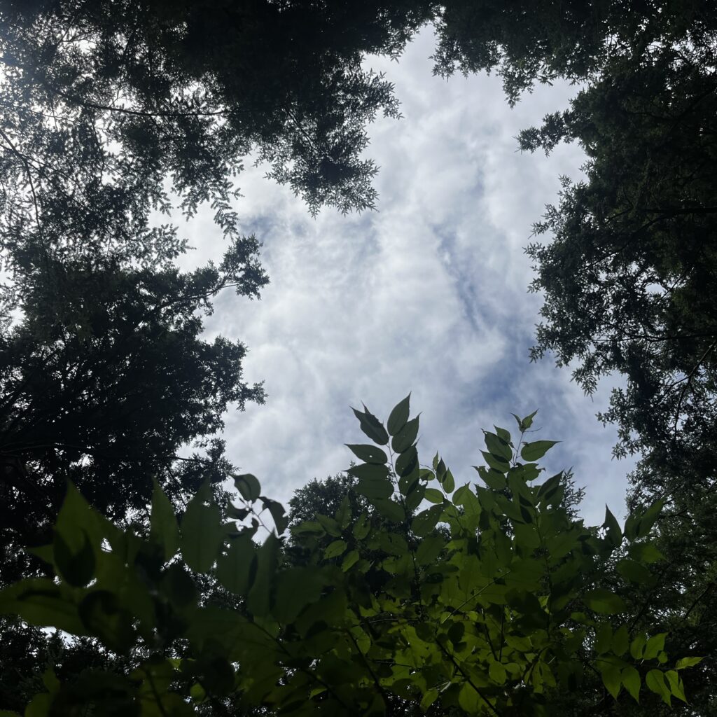
I got to the gap around 10:40 this morning. The temperature was 75 F and the sky was partially filled with clouds. I could feel the humidity rising as yesterday’s rain was evaporated out of the forest.


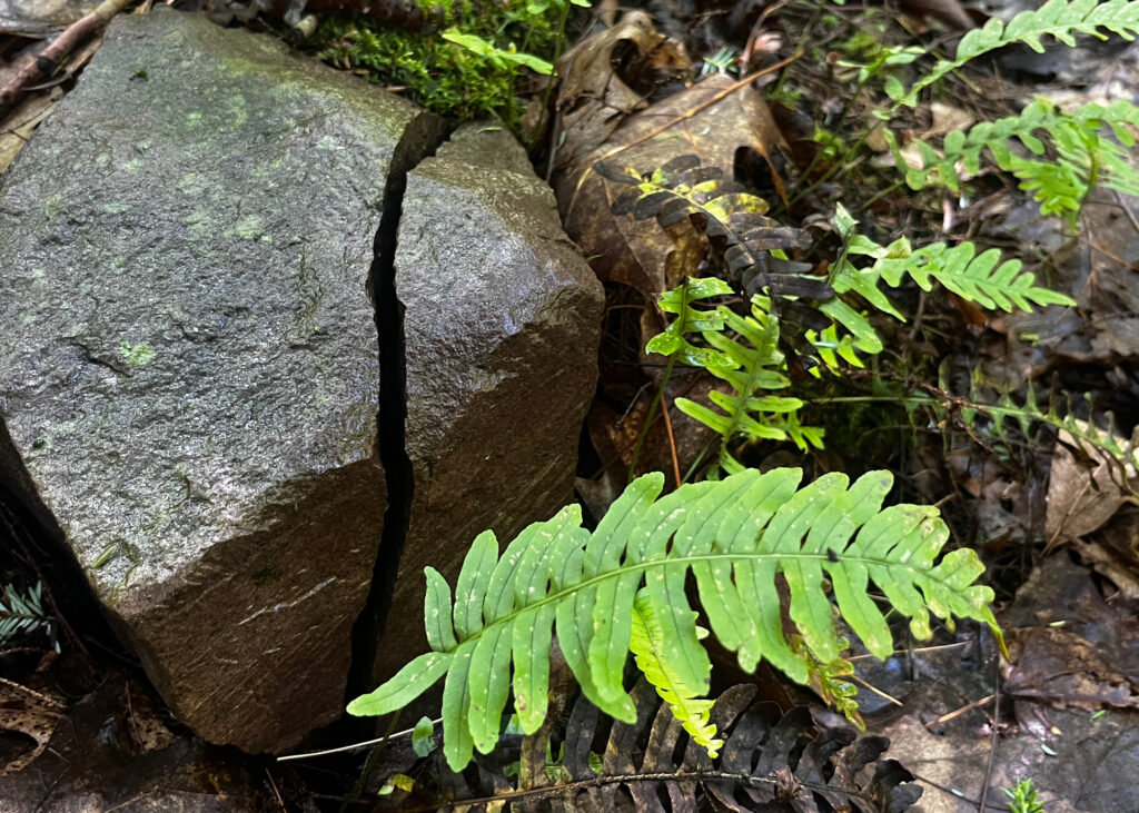
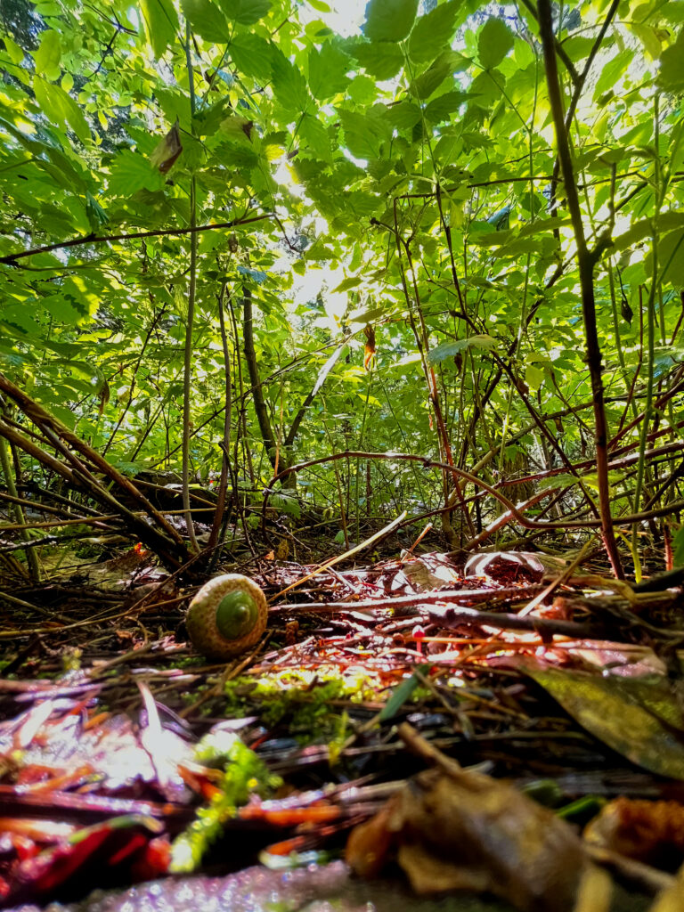
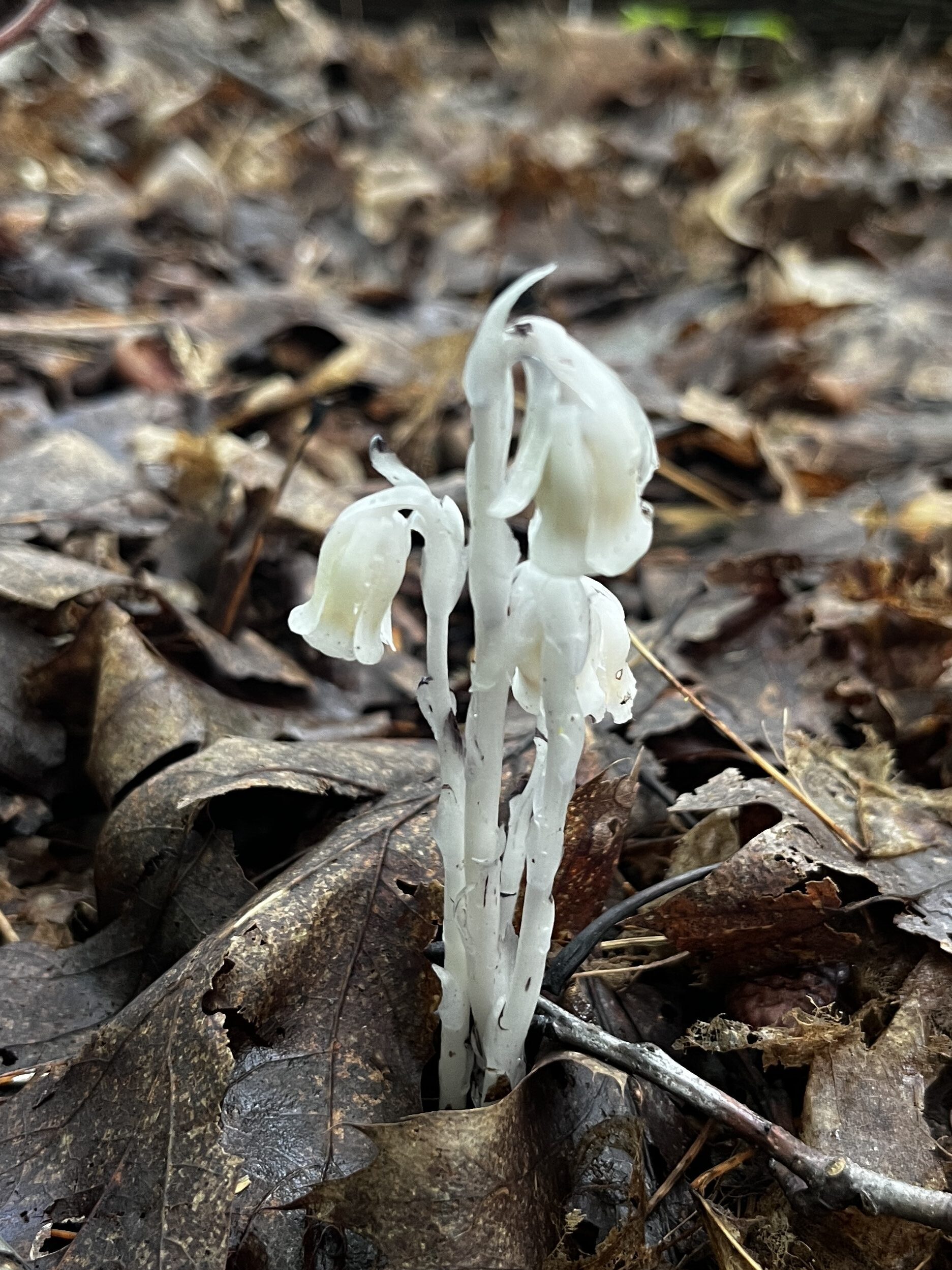
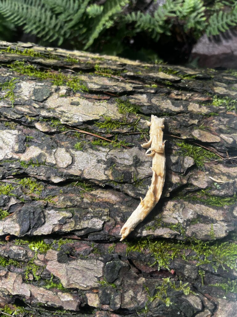
I started my visit today listening to the birds because I noticed it was the first time I really heard any in all of my visits. I pulled out the Merlin bird app and started a recording: black-throated green warbler, red-eyed vireo, black-capped chickadee, cedar waxwing, and eastern wood-pewee. I’m pretty certain I was in the presence of a black-throated green warbler, a black-capped chickadee and a red-eyed vireo. But the rest I was unsure of. I didn’t think I was in the right ecosystem for cedar waxwings and I didn’t hear the infamous “PEE-WEEEE” of the eastern wood-pewee, although it’s entirely possible the Cornell Lab of Ornithology knows better than me. Today I also saw some ghost pipes on my walk to the gap and also evidence of somebody dining on a mushroom. I forgot to take a picture of of the tan, flat-capped mushrooms growing next to this spot, and frankly I wasn’t very interested in them as identifying mushrooms isn’t why I came to the gap today.

Ghost pipes popping through the damp layer off duff on my way to the gap.
A mushroom stem laying on the hemlock log with some “samples” taken out of it, likely by a small mammal.

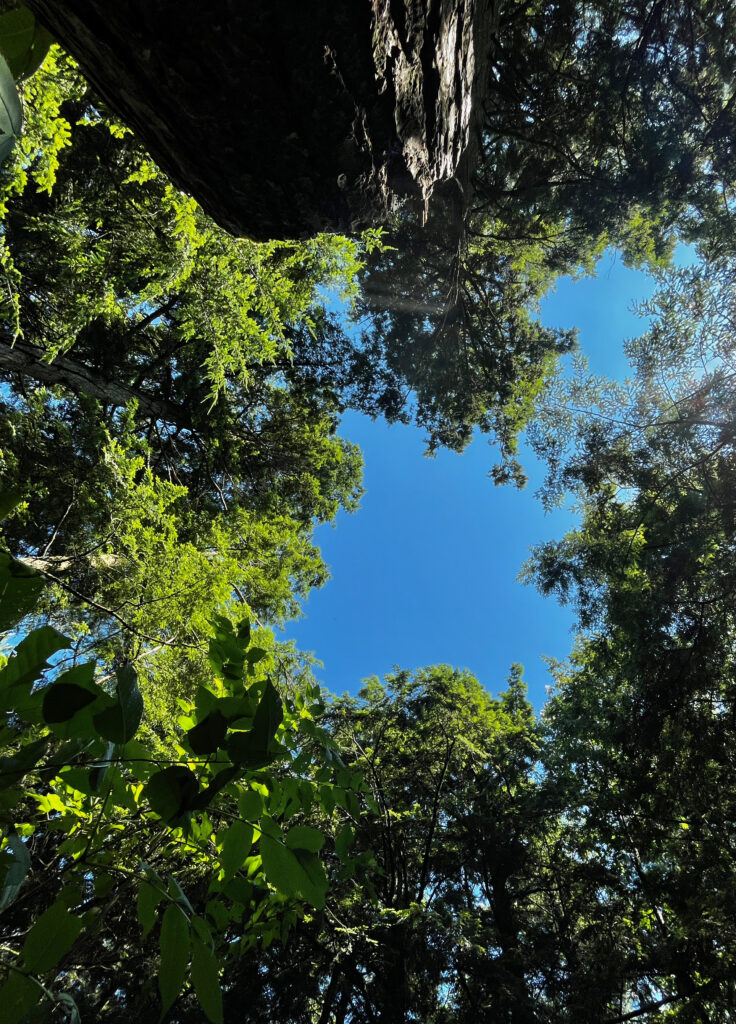
I came to the gap today to get answers. I wanted try and quantify the effects of light levels in different parts of the gap on plant growth in those locations. I have been remarking all along about how there is a tremendous amount of plants growing directly in the middle of the gap where there is more sun but up until today, I didn’t have much evidence to prove it – to show there is a difference between in the gap and next to the gap. To test this theory, I devised a simple study to gather data on how many plants (individuals and species) are growing in different parts of the gap and relate that to the amount of canopy cover over that spot.*


Hypothesis

Due to higher light levels in the middle of a forest canopy gap, there are more plants growing per square foot than locations adjacent to the gap.


Methods

  1. I decided to do a sort of seedling/herbaceous study and to use a sampling scheme of 1-sqft. micro-plots at 1ft, 6ft, 11ft, and 16ft along a transect in each cardinal direction emanating from the center of the gap which would give me an idea of how things changed as I got further away from the center of the gap. I marked the center of the gap with a stick to keep it constant throughout sampling. I used a compass and a tape measure to locate and size the 1-sqft. plots.
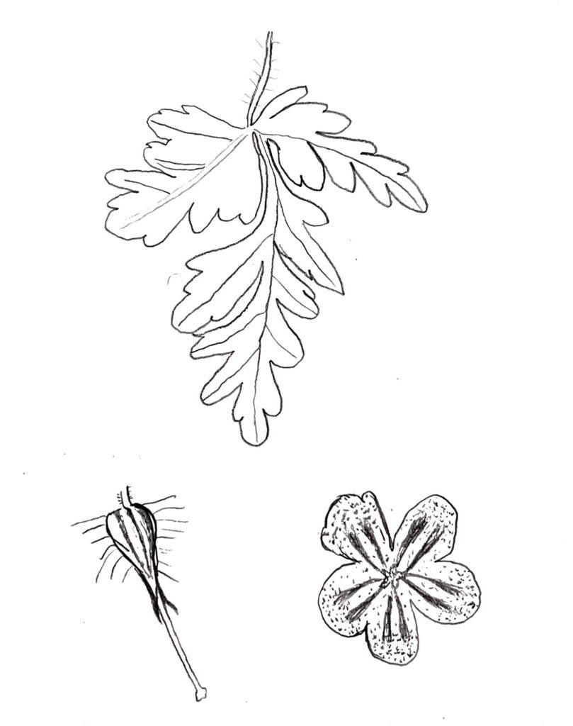
  2. At each plot, I counted the number of stems that originated within that plot. For raspberry plants that had both new and old growth stems coming from the same plant, I made sure to only count the plant and not the number of stems coming from that plant. For ground cover that originates from a single plant such as polypody’s, partridgeberry and herb robert, I only counted the number of plants (which basically said if it was present or not).
  3. After collecting the plant data, I took a square-formatted picture looking directly up from the center of the plot. I took the picture from just above the plant growth at that plot which happened to be about 2ft above the ground in most cases.
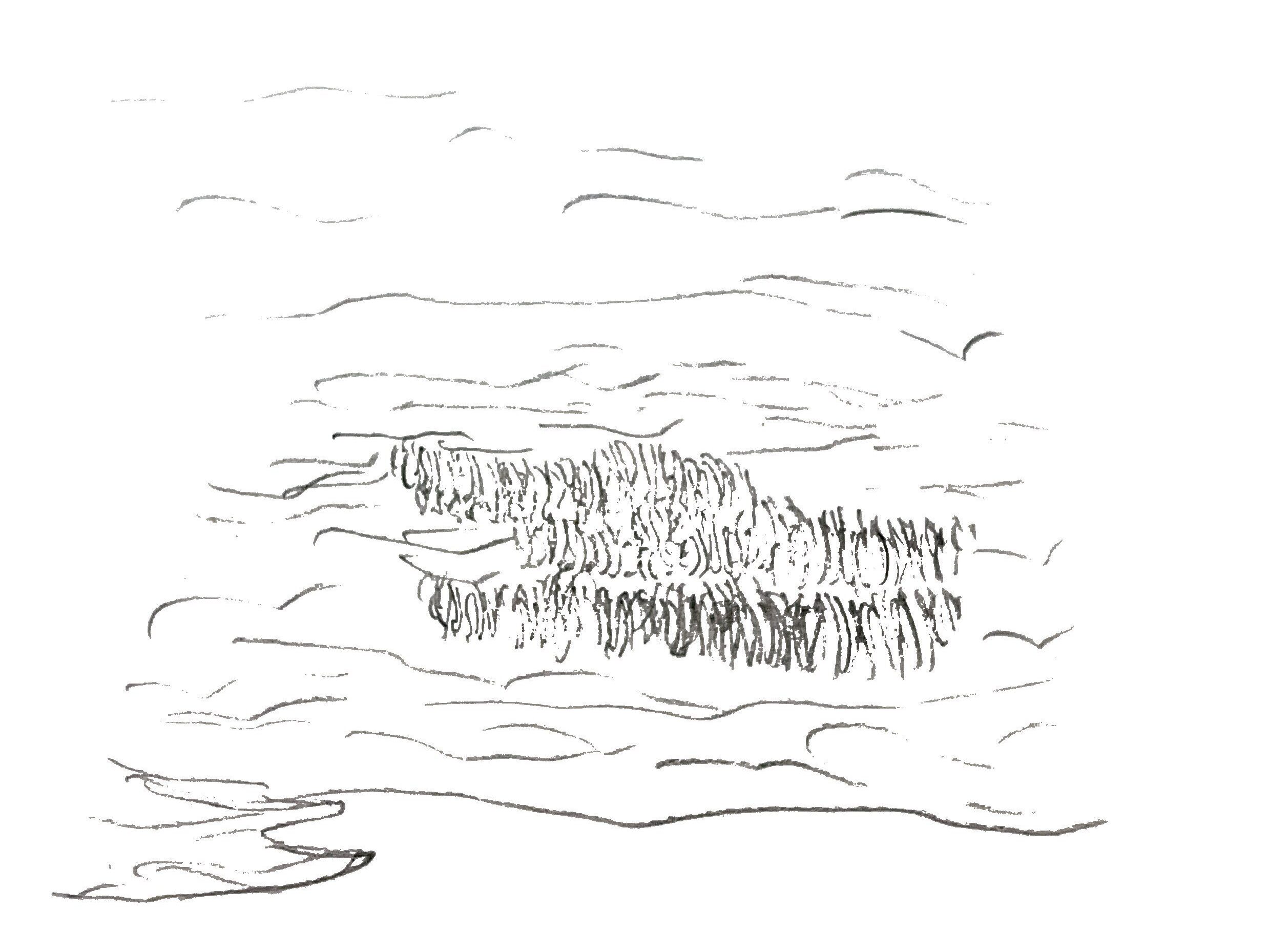
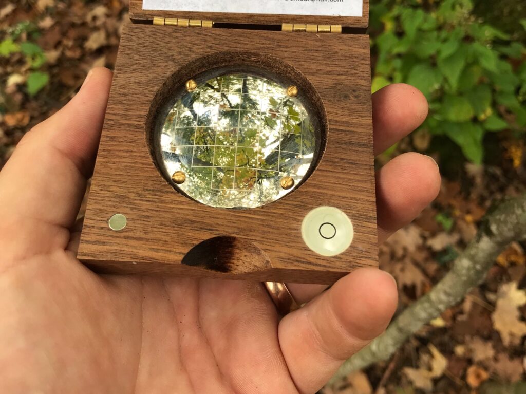
  4. At home, I wrote a MATLAB script to calculate the percent canopy cover by determining how many of the pixels in the picture were of plants vs sky. In forestry, a canopy densiometer would actually be used in this instance although those instruments are ridiculously expensive for what they are (a curved mirror with a grid of squares). A densiometer is used by holding it flat and counting how many quadrants of each square are showing the sky versus plants. Because densiometers have 24 squares, a total of 96 quadrants and you usually take 4 measurements looking in each direction at each plot, I decided to reduce the resolution of the pictures I took to have a coarser pixel (or quadrant) resolution. A picture of a forest densiometer is shown below.
  1. Once I had plant and canopy cover data for each plot, I calculated a simple biodiversity metric by dividing the number of species present by the total number of stems counted which results in a value between 0 and 1 (with 1 having the “greatest” biodiversity). I then averaged the values obtained for each distance from the center of the plot and graphed my results.

Results

Below is a graph of my results with the number of species, number of individual stems and biodiversity index compared to the percent canopy cover. Note that the x-axis only goes from 65% to 90%. The number of stems per square foot has an inverse relationship as locations with more canopy cover had, on average, less stems growing. However, the number of species per square foot and the biodiversity peaked in the plots 6 feet from the center of the gap and decreased with higher and lower levels of light.

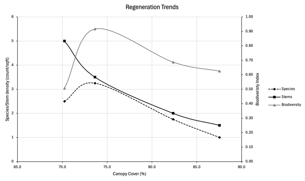
Below is a table showing the values used in the graph above. Note that all values besides the distance from the center of the gap (which was fixed) is an average of the four micro-plots taken at each of the distances. Further below is a table listing the total number of species found between the four plots from each distance along with what those species were. The species are listed the tree species first, then woody shrubs, then herbaceous ground cover.

Distance (ft)Canopy Cover (%)Species density (#/sqft)Stem density (#/sqft)Biodiversity index
170.32.550.51
673.73.253.50.92
1182.41.7520.69
1687.611.50.63
Distance (ft)Total number of speciesSpecies
19eastern hemlock, ironwood, paper birch, raspberry, red osier dogwood, wild grape, raspberry, partridgeberry, polypody
610green ash, grey birch, sugar maple, pin cherry, striped maple, red osier dogwood, raspberry, clubmoss, herb robert, intermediate wood fern
117ironwood, red maple, chokecherry, wild grape, Canada mayflower, blue-stemmed goldenrod, polypody
163ironwood, red maple, polypody

Discussion

I think that the results show the story of forest canopy-gap-scale regeneration very well. The results give an answer to my question that higher light levels do lead to higher numbers of plants growing in that particular location. From a resources stand-point, this makes sense as there is physically more sunlight, or photosynthetic opportunity, available per square foot of ground which allows that parcel to support more plant growth.

What I wasn’t expecting was the difference in number of species present at each of the light levels. I had anticipated the center of the gap to have the highest number of species but what the data show suggests a much more nuanced story. I believe the fact that the plots 6 feet from the gap center showed the highest species diversity is because this location is effectively an edge habitat – a place where species from both ends of the spectrum co-habitat. Because there is an intermediate amount of light, the space can support a large set of species that prefer more shade and more sun. It’s also cool how the plots far away from the gap are essentially status-quo plots that show how the forest understory would look without the influence of a canopy gap.

Because I was simply doing counts of stems and species, the data do not say anything about the size of each plant which suggests how long that plant has been growing. It is important to point out that not all of the plants found during this study only were there because of the gap. Species such as sugar maple and eastern hemlock dominate the “advanced regeneration” regime of the forest floor which means grow well in deep shade while the canopy is closed and then are ready to take advantage of higher light levels if/when the canopy is opened. Ironwood, or American hophornbeam, and green ash can also grow under a shaded canopy and was likely there before the gap was created. Pin cherry, on the other hand, germinates from dormant seeds that are present in the soil and begin growing immediately when sunlight hits the ground in high enough levels which suggests they weren’t there before the gap was created. Grey and paper birch also likely weren’t there before the gap as they require higher sunlight levels and were probably blown into the gap by the wind. Striped maple is somewhere between these two camps of shade tolerant and intolerant species and was likely growing before the gap was created and took off once it had enough sunlight.

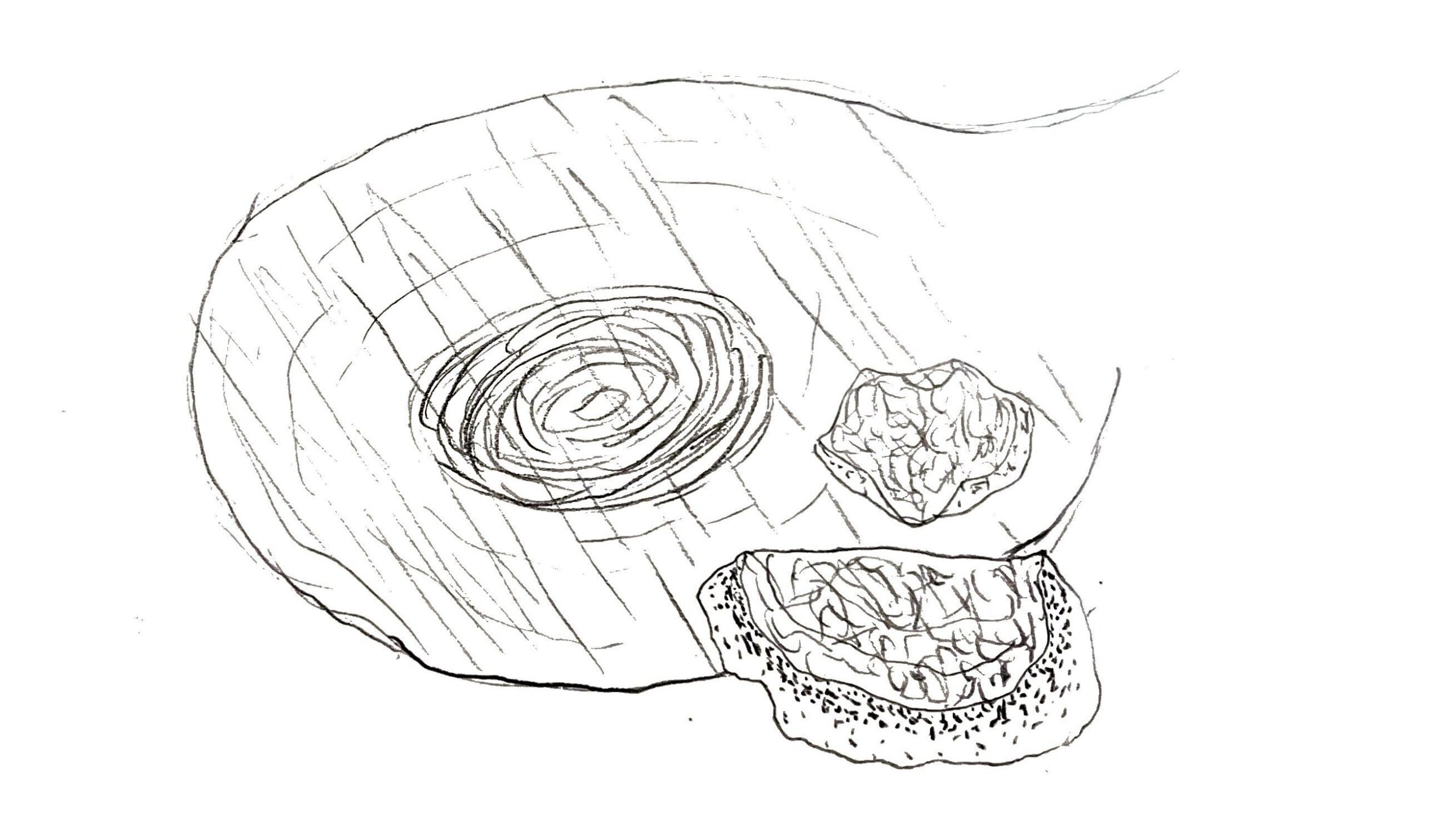
I am very happy with how my canopy cover MATLAB script works for this process. Using the RGB (red, green, blue) color format, I can easily tweak the script to correctly identify the sky whether it is cloudy or blue skies. To show how the process works from taking the picture to calculating canopy cover, the picture from plot N1 (or the plot on the north transect 1 foot away from the gap center) is shown below in each step of the process. It is not perfect but gives a good estimate of the canopy cover. I think that decreasing the number of pixels isn’t completely necessary (the script produces roughly the same results with pictures of 0.5 pixels/sqin and 20 pixels/sqin) although I think it makes a good approximation for how the same data would be collected with a forest densiometer.

1) The raw picture taken in the field
2) The “shrunk” picture with larger pixels
3) The processed picture showing what pixels are mostly the sky (white) versus pixels that are mostly plants.

Limitations and Lessons Learned

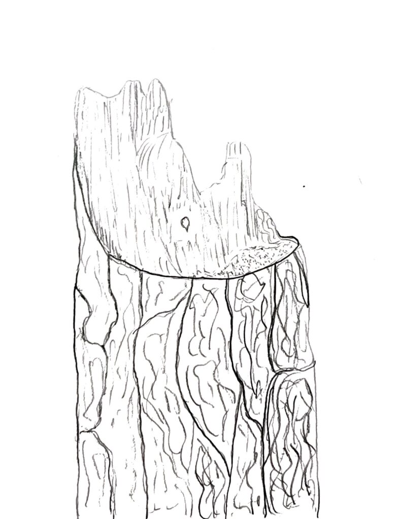
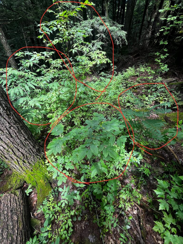
There are a few things I would do differently if I were to do this study again. For one, I would increase the sample size. Having only four plots at each distance leaves some opportunity for variability to skew results. I would also increase the size of the plots to be a square yard or square meter. Although there are a number of species listed as being found in the plots, there were some heavy hitters present in the gap that didn’t get counted in the study. Below is a picture of the gap which shows how much of the space is taken up by a few plants: a staghorn sumac, a green ash, a pin cherry and a BIG elderberry. Additionally, I would make a sample plot boundary with some sticks or pieces of wood in a square that I could place on the ground to have a better idea of what stems are in or out the sample plot.

The four largest plants in the gap, clockwise from the top: pin cherry, staghorn sumac, green ash, elderberry.

Closing Remarks about The Gap

Simply put, I’ve had a great time getting to know this little gap of regeneration in Red Rocks park. I loved seeing how the gap changed between visits and also noticing different parts of the site that had stayed the same. I had a great time learning new herbaceous species and bolstering my woody plant ID by getting to identify species I know well but in their often-tricky, seedling form. I am very comfortable with identifying mature woody plant species but seedlings are something that I’ve steered away from in the past so I’m happy to have gotten to learn more about them and gain some experience. I’d like to thank Red Rocks park and my professor Laura Yayac for providing this opportunity to become close with the gap and learn some of its secrets!

Capturing the Essence, Visit #3 – 6/30/24

I visited the gap around 10:00 when the sky was clear and sunny, the temperature was 75F, and there was moderate humidity. It was my first visit to the gap when everything wasn’t still releasing latent raindrops.


A mystery I wanted to investigate after this visit was concerned with the timing of things, specifically how long coarse woody debris stuck around on the forest floor and how long it takes for moss to colonize recently exposed sapwood. I was hoping the answer to the second of these questions could help me estimate how long ago the hemlock had fallen down and therefore the age of the gap.

From a few quick searches, I found that in eastern forests it can take anywhere from 57 to 124 years for conifer DWD to decompose and depends on climatic factors (https://doi.org/10.1007/s10021-014-9757-5). I wasn’t able to find much about mosses and their colonization of dead wood but I did find an article from the New York Times in 1992 which talks about the five classes of dead wood. Based on the lack of decomposition and the fact that the hemlock stump still has all of its bark, I believe it is still in the first class of decomposition and can’t be more than a few years old (https://andrewsforest.oregonstate.edu/sites/default/files/lter/pubs/pdf/pub3306.pdf). Some more dominant timber species often have associated growth rate curves from years of research but no such research has been done on pin cherry so its difficult to determine how old the sapling in the gap is. It would make sense that its consistent with the estimation of the hemlock coming down which is a few years.


Below are some pictures I took at the gap and decided were the most intriguing:

These polypody’s are the dominant ground cover at the site outside of the direct influence of the gap. They have an intimate relationship with the bedrock at the site as they often grow directly out of the cracks and cling to the rocks with tenacity. I liked the lines of this scene and how it shows that even rock is ever changing, sometimes under the influence of a mere soft-bodied plant.
Another example of how the rock polypody’s are masters of the bedrock landscape. This polypody is growing maybe 2ft above the ground but it must feel much higher to a plant with its proportions. I struggled when deciding how much of the rock to include in the picture but i think it helps show the scale of this micro-environment. I also like the lichens growing on the rock and i think that the shallow depth of field helps to draw attention to the polypody with such a blurred background.
I had a hard time deciding if I liked this picture or not because I didn’t really know if it had a subject or not. Nothing it really in focus and there aren’t many colors going on. However, after looking at it longer, i realized that the gap is the subject – this glorious hole in the canopy that has changed the ground beneath so much and will continue to have influence for decades. In the picture you can see the stump of the hemlock that once filled this space and the leaves of the elderberry and pin cherry reclaiming the newly enriched ground.
In many regards, this is the absolute central subject of the gap – where it all started and is starting again. This is the stump of the hemlock with a micro-ecosystem already starting to appear. Most of the exposed sapwood is covered with moss and organic material has begun to accumulate on the flat surface. Among many dead and decaying things, there is also life – a hemlock seedling staking its claim in the sunlight on the back of its great aunt or uncle. If things go right, this small seedling could turn into an over story tree in many decades as it feeds on the stump and expands its root system down the decaying matter to the more stable ground 5ft below.
I have to admit, I did influence this scene as I placed the acorn in this spot but I think it tells a good story and is most importantly completely plausible. Just feet from the polypody outcrops and barren forest floor, this is a picture taken from beneath the dense understory growing in the gap. I love how this scene makes it look like another mini forest is growing beneath the forest that has its own players and dynamics. It’s also incredible to see how the sunlight being let down by the hole in the canopy is already being captured and taken up by plants so much so that the actual forest floor is beginning to be shaded once again. I love how this scene shows the multitude of scales that forest dynamics are playing out on a day to day basis.

It did feel a little limiting to only have my phone to take pictures. With such a green and complex matrix of plants in the background, i found it difficult to show a subject in a more landscape composition and kept falling back to close-up photography. This macro-style of portrait taking is done very well with the 0.5x lens on my phone which is why I used it so often (pictures 3 and 5).

I’ve always had an interesting relationship with photography. Similar to how we heard in class, i think it can so often take away from the actual experience of being in the place and feeling centered there. On the other hand, if done well, it can tell incredible stories and convey deep emotions. Because I have more experience with photography than sketching, and it’s so difficult to sketch things perfectly, I think I like using photography to capture scenes and information more than sketching. Especially in the age of cell phones, it is very easy to just keep pressing the shutter and gather lots of information in the form of pictures. Additionally, the ease with which pictures are taken means experimenting with each photo to formulate your preferred message is relatively easy. On the flip side, its much easier to look past the details and every part of a scene when taking a picture. When sketching, it is up to me to look and understand each shape and form and relate that to the page.

I think taking pictures will always be my preferred method of capturing a visual of my site but i’m glad to have gotten experience with both sketching and photographing. I’d love to hear how these pictures convey information and emotion about the gap to anyone who reads this blog.

Seeing The Details, Visit #2 – 6/24/24

I visited on June 24th at around 6:30PM. The weather was partly cloudy, 66 degrees with moderate humidity. Most of the forest was damp after a day of rain showers.

Today when I visited the gap, the sun and the clouds decided my focal point for me. A small portion of bedrock outcropping was lit up by a stream of sunlight filtering down through the dense hemlock canopy. As I crouched down to view this spot closer, I noticed small, vividly green islands of moss growing on the reddish bedrock. Although the rain had stopped more than an hour before, the rock still had a film of moisture clinging to its surface and it became clearer why algae, moss, and lichen so often colonize exposed bedrock. The moss islands were speckled with some kind of fruiting body attached to the end of stalks that were just taller than the green photosynthesizing structure of the moss. Looking closer at the outcropping, I noticed nearly every crack and pit in the rock had a network of spider silk with needles, insects, water droplets, and even a hemlock cone caught in the webs. I didn’t see any spiders while I sat there but I knew they couldn’t be far away. The deeper cracks were filled with the roots of rock polypody’s which provided most of the canopy for this micro-ecosystem. Growing on the small ledges of the rock were hemlock seedlings that looked so fragile they could be knocked down by a mouse’s foot. All the way down on the forest floor (about 1ft) was a honey mushroom emerging from the duff layer. This small area of interest was teeming with organisms.


A picture and some sketched of the plant I identified is shown below and is known as Herb Robert (Germanium robertianum). I tried to use some of the resource linked in the wonderblog PDF but wasn’t able to find this species through those methods – likely because my plant biology is a little rusty and I wasn’t able to narrow down the choices far enough. I turned to Wetlands, Woodlands and Wildlands and found the section for Limestone Bluff Cedar-Pine Forest. Although I don’t think my location is truly within this natural community, it shows many characteristics consistent with it: shallow bedrock, calcareous bedrock, dominantly coniferous canopy and close to the lakeshore. In reality, I think the gap is somewhere between this natural community and a Dry Oak-Maple Limestone Forest. In any case, as I was looking through the herbs associated with the cedar-pine forest, I noticed herb Robert and it made me think of how much the flowers of the plant I had seen resembled those of geraniums, so I looked up a picture and it looked just like it! Doing some more research on the plant I found that it is an invasive (sad) that has mostly naturalized in the northeast and prefers “rocky forests, talus slopes, trail edges, [and] ledges” which described exactly where I found it (https://gobotany.nativeplanttrust.org/species/geranium/robertianum/). This herb is said to smell like burnt tires when crushed and will repel insects if rubbed on the skin.


Below are some sketches of plants and fungi I found at the gap:

This is a little hemlock I found growing in the understory. I really liked its crooked and twisted shape and how persistent it was to someday replace its parents above. This sketch doesn’t quite capture the amount of fine twigs and needles it actually has.
This is the broken stump of the hemlock that fell in order to create the gap. There was some moss growing on the exposed xylem cells which indicates it has been a handful of years since it fell.
This is some cool fungi I found growing on the bottom of a rotting log. They were white and looked like little hairs hanging down from the log. I liked how hidden they were and how the coolness of their form only comes out when you look really close.
These were some cool mushrooms I found growing on a log that had been cut with a chainsaw at one time. I tried to capture the diagonal lines on the surface of the cut that showed how it was a chainsaw that made the flat surface. The mushrooms were flat and had a black, hard looking inner portion and then a smoother ring along the outside that changed from bright orange to white.

I found sketching at my site a little daunting and frustrating at first. I know I am a perfectionist so it was tough to grapple with the fact that my sketches are not at all an exact representation of the object I see in the field and rather my own perspective and experience with the object. Stippling takes a lot of patience and I found myself coming back to it to represent color and hue. It is cool now that they’re done that I can look back and remember the objects so well just because I have the sketches. I’m excited to follow up on the Herb Robert and see how many of the buds turned into flowers by the next time I visit the gap.

Meeting Red Rocks, Visit #1 – 6/19/24

Hello all! This is the first of many posts highlighting my interactions with Red Rocks park –  a Burlington city park located in the south end of town on Lake Champlain. As I walked through the park towards the lake, a lighted section of the canopy caught my eye and drew me in so I decided it would be my location of interest for the next few weeks. Although this space was merely the width of a single tree canopy, I decided to call it “the gap.”

I visited the gap around 6:30PM after a hot and muggy day with scattered showers so the leaves still glistened with lingering rain drops. I could feel the moisture in the air, along with lots of mosquitos, and smell the petrichor of the earth. I heard a few different birds, boats and trucks. As I ventured off the path and into the gap, I stepped over poison ivy and other small herbaceous plants. As I got closer to the hole in the canopy I could see it was where an eastern hemlock once stood and had snapped off around 6ft from the ground. As I looked around, I saw lots of exposed bedrock – reddish in hue with a very plate-like and blocky structure. The rocks were covered with lichen, moss, ferns, herbaceous plants and even trees where there was enough soil to cling to. Nearly all of the ground had some sort of slope to it – undulations in the surface. The closer I got to the hemlock stump in the gap, the denser the vegetation became as each plant battled its way towards the sky to claim as much newly acquired sunlight as possible. I was excited to recognize numerous plants: sugar maple, red maple, Norway maple, striped maple, shagbark hickory, American basswood, eastern hemlock, eastern white pine, pin cherry, choke cherry, staghorn sumac, ironwood, northern red oak, green ash, common buckthorn, elderberry, flowering raspberry, maple-leaved viburnum, wild strawberries, oriental bittersweet, Canada mayflower, partridgeberry, low-bush blueberry, bellwort, dandelion, Virginia creeper, and blue cohosh. Also to my excitement, I saw many plants I did not yet know how to identify such as three different ferns, a species that resembled nettle and some other herbaceous plants. The more I looked around, the more evidence I could see of natural succession and forest dynamics occurring which made me really happy to see so close to home and the developed world.

One thing I had never seen before was the early stages of elderberry fruit ripening on the plant, which I took a picture of and included below. I learned this species a few years ago but don’t remember ever seeing it fruit.

Some questions that came up while I was at the gap:

  1. How long ago did this eastern hemlock come down?
  2. When was the last time somebody stood on the ground under my two feet?
  3. Are there coyotes in Burlington?
  4. How long does it take for sticks, branches and logs to decompose on the forest floor and how does that differ between species?
  5. What ecosystem benefits do ferns contribute to their sorroundings?
  6. What has happened in this spot in the past and how altered has it been by humans?
  7. What makes trees lose their leaves/needles during the growing season?
  8. How do chunks of rock end up feet away from bedrock outcroppings?
  9. What is the underlying hydrology/drainage like in this site?
  10. What kind of insect is eating this certain kind of plant?
  11. How long does it take lichen to grow? How long can it live?
  12. How many species of lichen are there and what are the details of that symbiotic relationship?
  13. Are there any bats that live in red rocks part?
  14. What species of ferns have spores on the underside of their fronds and why are some brown and some green?
  15. Are the brown and orange/red daddy long leg spiders different species?
  16. When did invasive species (Norway maple, common buckthorn, oriental bittersweet) first colonize this spot and how did they get here?
  17. How much carbon is held in one square meter of this forest?
  18. How much water is held in one square meter of this forest?
  19. Why are there so many mosquitos?
  20. How many insects are beneath my feet?
  21. How many of the plants around me are connected through mycelial networks?
  22. What kinds of birds live in this habitat?
  23. Why aren’t I seeing any northern white-cedar?
  24. Did any large mammals (bear, catamount, bobcat) used to live in this spot?
  25. How and why did poison ivy evolve to excrete an irritating oil?
  26. How much money does the city expend each year to maintain the park? Does it provide any revenue?
  27. How important is this space to the people and animals of Burlington?

The question that stuck out to me and made me want to do some research was about lichen as I think they are such an interesting life form. The Vermont Land Trust (VLT) has a cool webpage that shares some interesting facts about lichen (https://vlt.org/2024/01/25/lichens-partners-for-life/). Lichen is a symbiotic relationship between a fungus (which provides structure and protection) and either an algae or cyanobacteria (which photosynthesizes and provides food). There are three main types of lichen: foliose (leaf-like), fructicose (bush-like), and crustose (crust-like). Given that there are numerous types of fungus, algae and cyanobacteria, it makes sense there are at least 18,000 different species of lichens! Back to my original question – some species of lichen can live for over 1,000 years.

I am excited to get to know the gap over the next few weeks as plants fruit, grow and reproduce. Although it’s not a long time, i’m expecting to notice a lot of change as the forest is such a dynamic place. One thing that caught my attention during this first visit is the veracity with which the early successional species in the gap are shooting for the skies and I am looking forward to watching this continue during the peak of the growing season. Hopefully i’ll get to see some more wildlife, too!

Skip to toolbar