Nature, Culture, and Belonging in a Place

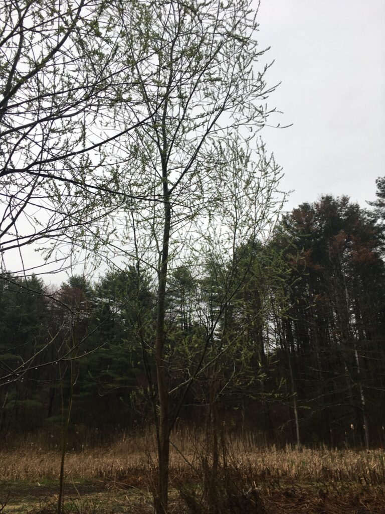
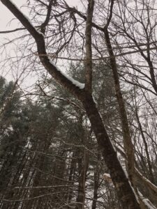
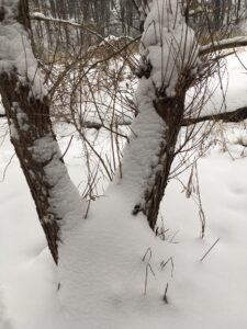
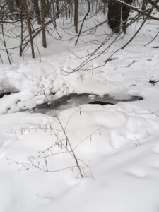
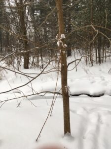
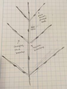
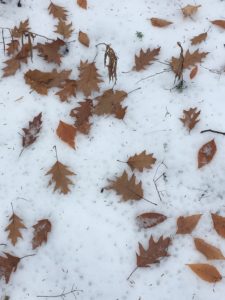
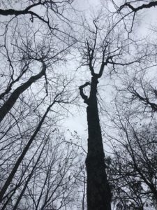
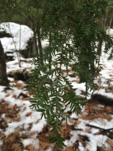
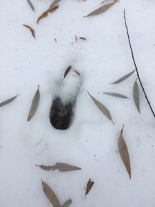
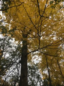
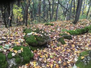
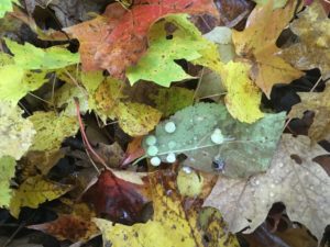
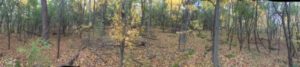
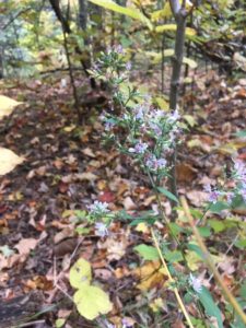
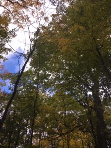
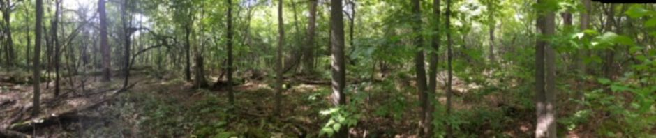
In terms of phenological changes, my little corner of the forest is starting to truly feel like spring. Birds are abundant, and species I haven’t seen since fall are returning. The canopy is greening as buds on larger trees like the ash trees along the river begin to open. I imagine that in a week or two, my site will begin to fill with mayflies and other insect species. Right now, it’s still a little too cold!

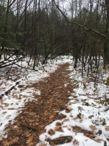
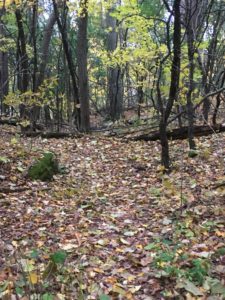
Nature and culture intertwine in many ways at my place. First of all, Centennial Woods is used as an “outdoor classroom” by many UVM classes. When I visit, I am rarely alone on the trails. This is one of the things I love most about the university’s approach to ecology; hands on learning is encouraged. I have definitely reinforced much of my knowledge about seasonal changes in the land and tree species by visiting this spot regularly. Secondly, Centennial Woods is centrally located in Burlington and is surrounded by homes and businesses. This stretch of relatively undisturbed forest is one place in the “urban” area of Burlington where people can access and enjoy the natural world. Having places like this is important for conservation because people have a tangible reminder of the importance of natural areas for native flora and fauna.

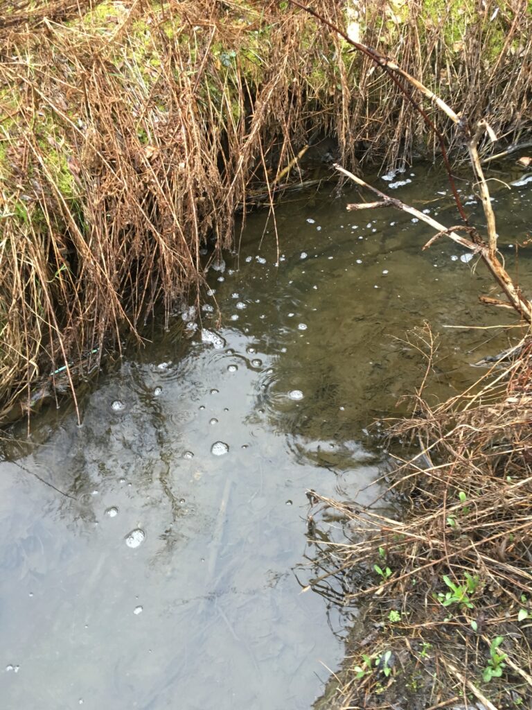
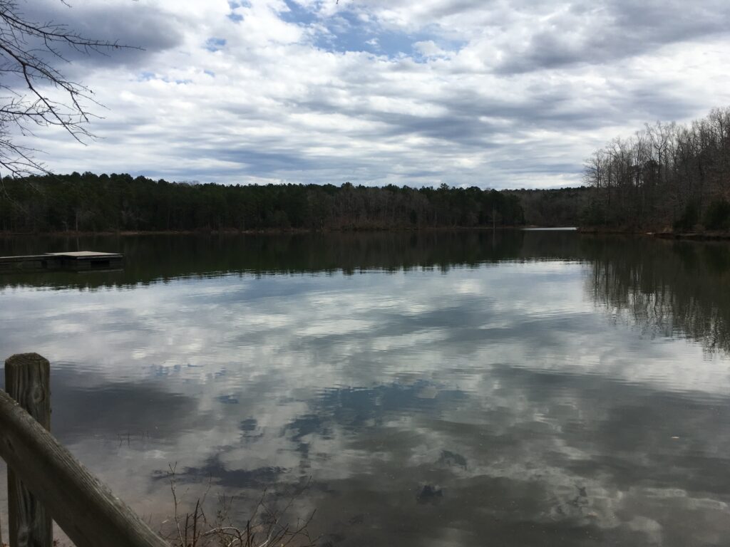
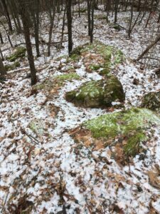
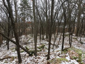
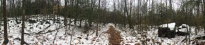
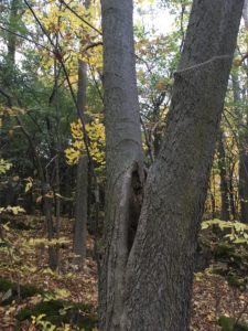
I don’t really consider myself a part of my place. When I visit, I try to leave as little impact as possible. I don’t rely on the environment of Centennial Woods for food or shelter, and I don’t think that I have had much of an effect in changing or shaping the area. That being said, I do find my phenology spot a really reassuring place to visit, and it does in some ways feel like home. I have always been drawn to water, whether it’s small streams, ponds, lakes, or even the ocean. I also feel really at home in forested areas, since I grew up walking and hiking through Vermont forests. Being in an area that is not dominated by and crowded with people is a calming and rejuvenating experience, and I love going down to listen to the sounds of the stream, explore the details of the landscape, and watch for birds and amphibians around the water. In this way, I identify my site as a familiar place even though I don’t think that I am part of it.

Posted in Uncategorized | Leave a comment

April 28th: Mud Season in Vermont

As the title indicates, the trail down to my phenology spot was pretty wet and muddy. It was raining a little as I walked down, and the next week or two is supposed to continue to rain quite a bit, so I can imagine my site will get somewhat flooded. Some trees have begun to leaf out, though I did not see any flowers on trees or peeking through the leaf litter. In particular, the small trees in the understory seemed to be furthest along in leafing out. I noticed mostly honeysuckle buds starting to open.

I noticed a large tree that had been downed since the last time I visited. We’ve had a few windy and stormy days in the past few weeks, so it makes sense. Coarse woody debris provides good habitat for insects, and subsequently, birds, so I am excited by this addition to the landscape of my spot.

When I got down to the riverbank, I enjoyed the sound of flowing water. The stream is very small along this stretch of woods, but it did almost completely fill the bank and was flowing faster than I had seen it before. There was a washed-out sandy stretch further along, clear evidence of bank erosion caused by the stream’s increased flow. There were lots of birds around the river. I was able to identify the Eastern phoebe and chickadee. I stumbled across a set of UVM birdfeeders that explained the increased bird presence.

Below are some photos of the site, as well as a hand-drawn sketch that provides a “birds-eye view” of my site.

Posted in Uncategorized | Leave a comment

Spring Break in Georgia

This past week, I left my home state of Vermont and drove more than seventeen hours to get to the Richard B. Russell State Park in Elberton, Georgia for a crew spring training trip. The weather was much warmer than Vermont, about forty degrees in the morning and evening and reaching seventy degrees in the afternoons, and very humid. We stayed in cabins at the edge of the water, where the Savannah River meets Lake Russell on the border of South Carolina and Georgia. We rowed almost every morning and every afternoon, exploring the many inlets around the lake.

The land was less hilly than Vermont, but it shared abundant forest cover. The forests were composed mainly of white oak trees, all around sixty to eighty years old. There were also some deciduous trees, some flowering and some with leaves already out. There were many daffodils and other spring flowers around the more sunny areas of the park. Since it was much warmer than Vermont, the foliage was much further along in its spring development.

In terms of wildlife, there were deer, squirrels, a track that was likely a coyote, and many birds. On the lake, we noticed an osprey nest and were fortunate enough to see an osprey soaring above. In the forest, there were cardinals, yellow warblers, and sparrows. Though it was warmer than Vermont, many migratory birds were still missing from the landscape. Georgia has a milder winter, but it does still get occasional freezes and snows.

The park has been a common recreational area since it was founded in 1987. It has a series of trails for walking, a golf course, and a boathouse. There are many recreational fishermen who visit and stay in cottages on the park property (similarly to what we did). In 1980, several Native American sites were excavated near the park. These sites were from more than ten thousand years ago, indicating that the area has a long history of human settlement.

Posted in Uncategorized | Leave a comment

March 8th: Ecological Communities and Early Signs of Spring!

My site sits right at the intersection of a forested area, a river, and an open meadow. The forested area is an oak-pine-Northern hardwood forest, with tall white pine trees, some red oak, ash, and younger red maple. The soil is mostly frozen but seems to have some moisture, though it is not saturated, classifying the area as an upland community rather than a wetland. Water moves through the area via a small offshoot of the river that winds through Centennial. The soil is mostly clay and silt, remnants of when this entire area was at the bottom of Glacial Lake Vermont. The open area, where tall grasses and small shrubs grow, always has moist soil and has no exposed bedrock, marking it as a wetland rather than an upland outcropping or meadow.

Much has changed since the last time I visited this site. Though much of the forest is still covered in snow, there are patches of exposed ground and the tallest snowbanks are only around ten inches. Small thaws have caused the river to become cloudy with substrate as small trickles of melted snow reach the wetland and stream. Animal tracks are still scarce, with a deer and a red fox being the only visitors (other than myself) that I could detect. The buds on the trees are a good reminder that spring is just around the corner!


Posted in Uncategorized | Leave a comment

February 3rd: New Phenology Site!


This semester, I chose a site in Centennial Woods. My site can be reached by following the path into Centennial Woods from the northeast side of campus, taking a right down towards the river, and stopping where the stream meets the edge of the forest.

(link to Google Map: https://goo.gl/maps/YCqAXfg8W3R2)

When I visited the site this weekend, it was about 30 degrees outside, with 100% cloud cover, and it was sleeting. The canopy cover was about 25%.

At my site, I found tracks that mostly likely belonged to a deer going across the stream and meadow towards the forest. The tracks were of a diagonal walker with a five centimeter straddle and a 1.5 meter stride. I could also hear chickadee calls.

(deer tracks in the deep snow)

Deciduous trees found at my site included ash, red maple, black cherry, common buckthorn, honeysuckle, and box elder. Below is a photo and sketch of a honeysuckle twig. 

Posted in Uncategorized | Leave a comment

Resources

Burlington Geographic Images (from December 5th post):

Burlington Geographic. (2018). 1890 Map of the City [infographic]. Retrieved 8 December from http://www.uvm.edu/place/burlingtongeographic/maps/interactive/index.html#

Burlington Geographic. (2018). 1937 Aerial Photography of Burlington, VT [infographic]. Retrieved 8 December from http://www.uvm.edu/place/burlingtongeographic/maps/interactive/index.html#

Burlington Geographic. (2018). Bedrock Geology [infographic]. Retrieved 8 December from http://www.uvm.edu/place/burlingtongeographic/maps/interactive/index.html#

Burlington Geographic. (2018). Elevation Gradient [infographic]. Retrieved 8 December from http://www.uvm.edu/place/burlingtongeographic/maps/interactive/index.html#

Burlington Geographic. (2018). Soil Types [infographic]. Retrieved 8 December from http://www.uvm.edu/place/burlingtongeographic/maps/interactive/index.html#

Writing Influences (from November 26th post):

Holland, Mary. Naturally Curious. Trafalgar Square, 2010.

Leopold, Aldo. A Sand County Almanac. Oxford University Press, 1949.


all other photos from blog posts are original, taken by Sarah Clauss

Posted in Uncategorized | Leave a comment

December 5th: Signs of Winter and Human History


It was about 25 degrees out and cloudy. The canopy cover was about 50%. The ground was frozen and covered with a light dusting of snow. There was a barberry tree filled with bright red berries, providing food for hungry winter birds. I noticed a deer print frozen in the dirt.

My site is just overlooking Burlington High School, which was built in 1964. Maps from Burlington Geographic can help illuminate the history of the area.

The bedrock geology of the site includes limestone, dolomite, carbonate-rich sediments, and marble. Limestone and other carbonate-rich sediments introduce nutrients into the soil, so the bedrock geology in this area could support agriculture.

The soil type is extremely variable in the general area of my site.

The elevation gradient is relatively steep at my site. The ground is hilly, with many small mounds and depressions. This likely means that the site was never tilled for growing crops, so it was never smoothed out by agriculture. It could, however, have been used as a pasture for sheep or dairy.

This 1890 map shows who owned property in the area. My site is within a plot of land owned by P.V. Manwell. This was right around the height of the sheep craze. My site has the remnants of a stone wall running through it, so the land was likely used for sheep farming. It was likely clear-cut around this time, because the trees are fairly young (except for a few large maple trees along the stone wall).

This aerial photograph taken in 1937 shows a partially forested landscape, but my spot is still in a cleared section of land. It has been considerably reforested since this point.

More modern human influences include a trail system, neighborhoods that have fragmented the woods, and noise pollution from the construction of houses and the high school.

Posted in Uncategorized | Leave a comment

November 25th: Thanksgiving Phenology Spot

Google Maps Link: https://goo.gl/maps/np9vQxQmVvz

November

Winter’s Arrival 

Though it’s not yet winter in the calendar, the first snow marks the start of the cold, dark, and often dreary season in Vermont. Within the last week, a carpet of white has transformed the land, covering the autumn leaves and small plants that populate the forest floor. All the leaves are gone from the trees, with stubborn buckthorn, beech, and oak the last to fall. The only colors in the forest come from the hemlock trees that populate this part of the forest. All around the spot are large rocks topped with rich green moss and covered with individual blankets of white. The path is trodden down with footprints, mostly people and their dog companions, but also raccoons, foxes, and deer. Chickadees perch among the bare branches of the deciduous trees. The forest in winter is quiet, like the whole land is holding its breath. But it is not inactive. Overripe berries and dropped seeds feed birds like chickadees, cardinals, and blue jays, all year-round residents in Vermont. Prints in the snow mark the travels of small mammals, many of whom have donned winter coats for the colder temperatures. Today, a steady drip of rain has begun to melt some of the snow. The snow may be receding, but it will soon be back as another Vermont winter begins in earnest.

A Closer Look: Forest Succession

Neither the Burlington nor the Shelburne forest phenology sites are close to being old-growth forests, but they are at very different stages. In Burlington, mature sugar maples dominate. The undergrowth is populated by elm, ash, and buckthorn. There are very few conifers found in this stretch of forest. When the leaves are out, the canopy cover reaches about 85%, and with leaves fallen it is about 60%. Though this site is not a mature, it is well into the understory reinitiation phase, which is to say that it is a two-age forest. In contrast, the Shelburne site is populated by buckthorn, black cherry, hemlock, and a few larger oaks. Without leaves, the canopy cover is about 35%, but with leaves it could reach about 60%. This site is in a much earlier stage of development; with a few exceptions, all of the trees are about the same age and this forest is likely in the stand initiation phase, characterized by sunlight and space, as well as shade intolerant trees like black cherry.

Posted in Uncategorized | Leave a comment

October 31st: Phenology, Photos, and Poetry!


The forest floor is carpeted with yellow maple and elm leaves. Only the buckthorn leaves are still green and have yet to fall from the trees. The forest is much more quiet, as many birds have started migrating south. The canopy cover is about sixty-five percent. It rained a lot this week, so the ground was moist.

Event Map

forest floor

underneath the canopy

in a blanket of yellow leaves

worlds exist within

a footstep in the dark moist soil

left by a watcher in the woods,

stepping through time and space.

a drop of water

is teeming with life 

a drip of mud is a natural community

a rotting log is an ecosystem

here is where the forest is found

in every inch of space.

Posted in Uncategorized | Leave a comment

October 21st: Wildlife, Vegetation, and Site Map

It was a cloudy and windy day, around 35 degrees with the first light snowflakes of the season just hitting the ground. The canopy cover at the site was about seventy percent – compared to about eighty percent when I first visited in early October. Many of the maple and elm leaves were starting to turn yellow, but the buckthorn trees still hadn’t showed any change. The forest floor was carpeted with a layer of maple and oak leaves. There was a barberry tree with bright ripe red berries right next to the rocks of my site.

Over the course of my visits, I’ve noticed grey squirrels, chipmunks, crows, and piliated woodpeckers. The forest floor is also home to quite a few spiders and terrestrial insects.

Bird’s Eye View Map:

(a note on the map: looking at the image upright, the top of the page is north!)


Posted in Uncategorized | Leave a comment