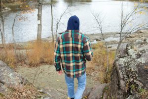
When I woke up on Saturday morning and saw the snowflakes falling outside of my window, I knew a visit to my Salmon Hole Phenology site was on the agenda for that day. After bundling up in an assortment of warm layers, I made the walk down to Winooski to see what the changing seasons had brought to my spot.
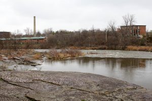
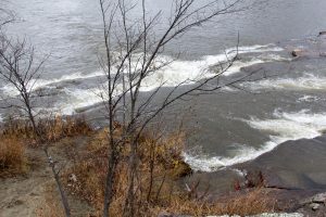
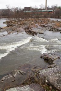
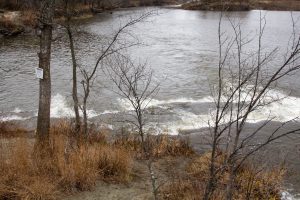
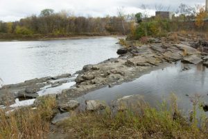
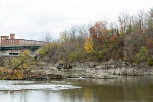
Aside from the floating white flakes, I was shocked to find that the water level of the Winooski River had risen dramatically, with rushing white rapids covering the smooth rocks that I had once been able to climb on during warmer days.
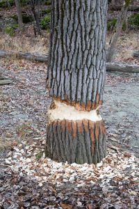
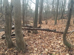
Another shocking find on my visit was evidence of beavers. Previously I had been struggling to find any signs of animals at Salmon Hole aside from the fish in the river, but on this most recent visit I spotted a tree that had clearly been gnawed at by a beaver very recently.
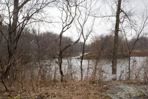
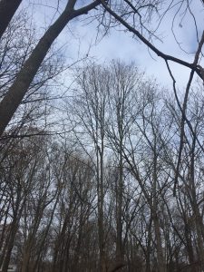
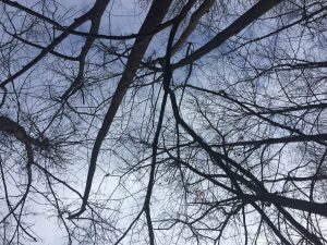
Compared to my first visit to this spot, the landscape has changed dramatically. Aside from the increase in water level, the trees had lost all of their leaves, and the landscape went from vibrant greens to gloomy grays and browns. The river, once calm, clear, and blue, is now rushing and reflects the grey skies that have taken the place of the summery blue skies. Without their leaves, the trees stick out harshly against the skies like skeletons, dancing in the wind.
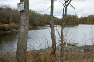
Salmon Hole is called such because of its land use history of fishing. Especially in the warmer months, it is common to see multiple fisherman wading in the waters of the Winooski River, as I witnessed on my first visits to this location. The underwater topography of the river is home to many pockets where food collects in the current for the fish, and the most popular fish found here are Steelhead Rainbow Trout and Atlantic Landlocked Salmon, hence the name Salmon Hole. Additionally, years ago the Abenaki Indians lived here and farmed on the Winooski River’s fertile banks.
Over the Thanksgiving holiday, I visited my home in semi-rural upstate New York. While home, I found a new phenology location to observe, right in my own backyard! This location showed some very stark differences to my Burlington location at Salmon Hole. First, this location was located in a much more wooded area, and there was much more of an overhead canopy than my location at Salmon Hole.
The trees consisted mostly of Basswood and White Oaks. The Basswood was easily identified by its bark, and the ground was littered with oak leaves.
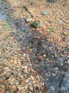
Similar to the Salmon Hole location, this land also contained a body of water. However, the stream that runs through this forest is much smaller than the Winooski River that runs through Salmon Hole. Additionally, because of the lack of precipitation this past summer and fall, the water level was shockingly low, much lower than it has normally been in past years. And rather than being surrounded by rock the way that Salmon Hole is, this stream is surrounded by soil, with a few small rocks resting in the stream itself.
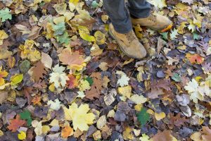
The biggest difference between the two locations was the amount of fallen leaves on the ground. At my home phenology spot, the carpet of fallen leaves was so thick that it felt like walking on pillows, clearly built up over years and years of leaves falling. On the contrary, Salmon Hole is mostly hard rock surfaces, and whatever leaves are scattered on the ground have just fallen this year. Similarly, there are significantly less trees at Salmon Hole to drop leaves, and their leaves are much smaller than the large oak trees at my home phenology location.
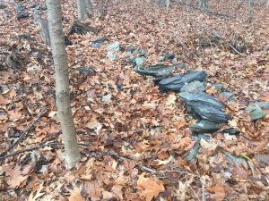
One interesting thing I found was an old rock wall running through the forest, almost completely buried by the abundance of decaying leaves.
The wall is clearly quite old, and made me consider the previous land use history of my property and backyard. I know that much of the land in the area was/is still currently used as farmland, and finding this rock wall makes me think that this land also used to be used as farmland. It was very similar to the rock wall that we found at Ricker Mountain on the lab a few weeks ago, when we were examining the land use history.
The trailhead is littered with leaves that once used to adorn the surrounding trees.two weeks priorpresentlyToday, there is much less foliage on the trees – the beautiful fall color has departed for the season, and Salmon Hole is showing more and more signs of winter on the horizonTwo weeks prior, the treetops were ablaze with autumn hues.Water levels continue to riseOnce full of color, Salmon Hole has quickly become much more bleak in the space of just two weeks. The gloomy skies are representative of the increased participation during these weeks as well, which has made water levels rise.The trees have shed their fiery, golden decorations in preparation for the harsh Vermont winter to come.As November breaks into full swing, layers and hot beverages are a must for staying warm while exploring on these chilly autumn mornings!
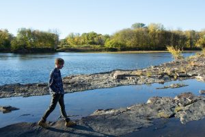
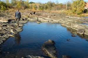
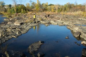
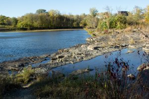
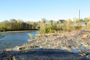
Upon visiting my spot this week, I noticed some definite changes in the landscape of Salmon Hole. First of all, due to the increase in rain in the past week, the water level was visibly higher, with more areas of the exposed rock face covered by small pools of water. In addition, the water was definitely flowing more rapidly, and was significantly deeper as well – waterproof boots are a must when exploring! Besides the change in water level, many of the trees, which previously were just beginning to transition to their beautiful autumn hues, have fully blossomed into various shades of crimson, amber, and golden yellow, and the once dirt paths around the park are now blanketed in a quilt of fallen leaves. The only signs of animals I could find were through the paw prints pressed into the sandy shores of the Winooski River, clearly left by that day’s dog walkers, clearly not wildlife. Due to the minimal vegetation immediately surrounding my location, I doubt the area has much wildlife at all besides the salmon and other fish that swim in the river. But on this particular afternoon even the fish were absent; in the past, the river was littered with various fishermen hoping for a lucky catch, but now they were absent. As temperatures continue to drop and threats of snow begin to appear in the forecast, one can only imagine what Salmon Hole will look like in a few weeks or even days.
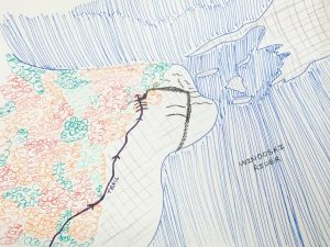
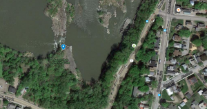
A bird’s eye interpretation of my location at Salmon Hole
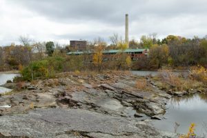
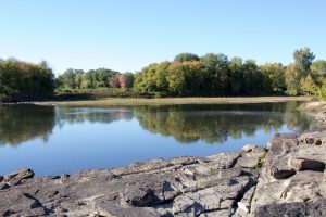
A quick walk away from Trinity Campus is Salmon Hole, the ultimate escape hidden in the nearby town of Winooski. Wooded trails lead down to a bend in the Winooski River, where the currents ripple over exposed bedrock, bordered by dense foliage beginning to show the first signs of fall color. Industrial smokestacks and the tops of building peak over the treetops, reminding you that the city and campus are just around the corner.
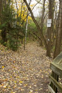
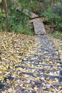
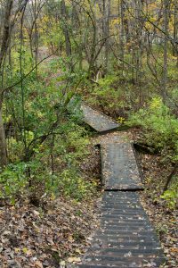
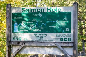
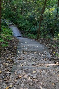
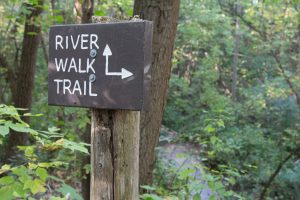
From Trinity Campus, take a left out of the driveway and head down Colchester Avenue. The road curves around a corner, then quickly begins to descend into the town of Winooski. At the intersection, make a left and cross the street in the crosswalk, and make another left. From there, you’ll soon see the sign for Salmon Hole, a small parking lot, and your first views of the river’s bend through the trees. Continue walking down the sidewalk until 2 stone pillars appear on your right, marking the trailhead. As you head down the leaf-covered dirt path, you’ll encounter a fork in the path, labeled the River Walk Trail, one continuing with stairs and one without. You can take either path; it’s actually a loop, and both will lead you down to the same location.
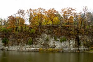
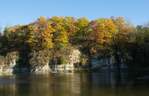
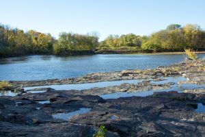
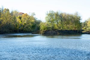
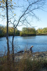
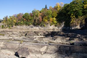
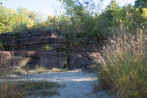
At the end of the stairs, take the path to the right towards the water, you’ll come upon a clearing and see your first glimpse of the Winooski River and the rock face. Often times, there will be fishermen wading in the currents, either salmon or fly-fishing. Adventure out onto the smooth rocks, and be careful! If you look to your left, you’ll see multiple layers of rock, assumably shaped by ancient glaciers, backed by a beautiful curtain of trees which are just beginning to turn vibrant shades of crimson, scarlet, mahogany, and gold. If you’re lucky enough to visit on a clear day, the blue sky
Looking to the right at the beautiful fall foliage beginning to change colorsThe view to the left of the Winooski River
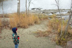
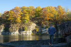
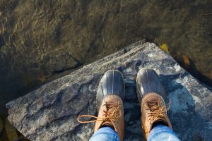
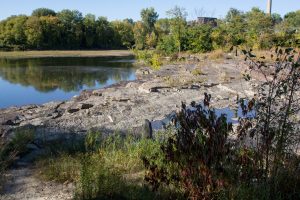
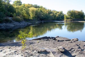
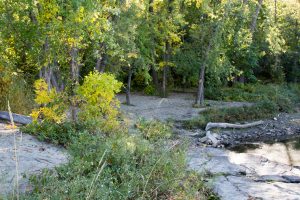
After admiring the view, continue heading left along the divide between woody plants and rock, towards the calmer part of the river. You’ll notice that the riverbank forms a small beach area, maybe an 8ft drop from where you stand on the rocks. From here, you have a great view of the entire area, with the nearby city of Winooski peaking over the fluorescent treetops. Head towards the edge of the rock face, and you’ll notice a set of nature-formed “stairs” – climb down carefully, especially if it has rained in the past few days – they will be slippery, and the drop is bigger than you think! Strategic foot placement is key, and you may want to slide on your bottom, keep your hands free to aid you, or remove any packs you may be carrying.
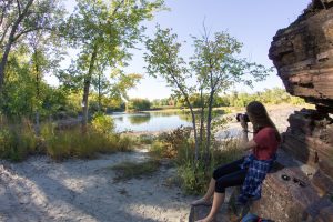
We’ve arrived – my favorite spot!
You’ll find yourself in a little alcove created by the half-wall of rocks that surround you, and the path you just climbed down doubles as the perfect spot to take a seat and absorb the pure beauty of the landscape that surrounds you. Enjoy the serenity of the Winooski River, the rustling of the leaves, and the peacefulness of this perfectly picturesque sanctuary, far enough from campus to escape all stress, responsibility, and worry; the perfect place to immerse yourself in the beauty of nature. That’s why I love this location; it’s a place where I can come to be alone with my thoughts, enjoy the company of friends, share a picnic, read a book, take photographs, and take a break from college for an hour or two. It’s a safe haven, secluded from the rest of the world.
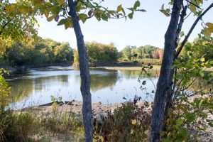
Looking from the sandy river banks up towards the trees
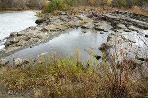
A view looking at the rock “wall”, to left you’ll see the shelf which perfect for sitting and enjoying the view of the river
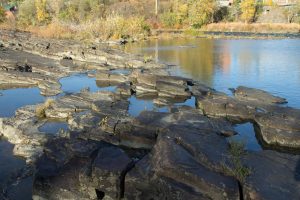
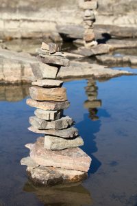
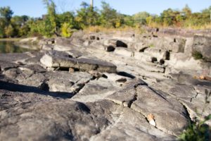
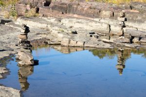
From here, you can continue to explore to the left or to the right; each is equally beautiful and rewarding in its own way. Heading to the right, you’ll find yourself hopping around on exposed bedrock, jagged and home to the occasional pool of water from the last rain. There’s very little vegetation here, but you will find rock towers expertly crafted by others before you, defying the odds of gravity with their perfect balance. From here, you’ll likely notice more fishermen wading in the waters with their bait and tackles, hoping for a good catch. If you’re feeling adventurous, feel free to splash in the puddles and jump from rock to rock – overwhelming memories from childhood will come rushing back as you carelessly embrace the moment.
Precariously perched rock towers reflecting in the crystal clear watersWatch your step!A beautiful autumn afternoon
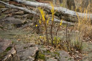
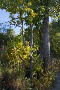
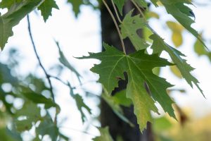
Heading to the left, you’ll notice that most of the exposed bedrock has been replaced by coarse, rocky white sand. Instead of wide open air, the landscape has become more densely wooded, with much more vegetation as you head back towards the forest. Here you’ll find a variety of woody plants and trees, including red maples, silver maples, yellow birch, american beech, and black cherry, in addition to various shrubs and other small plants.
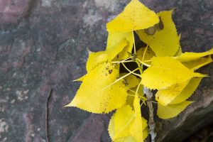
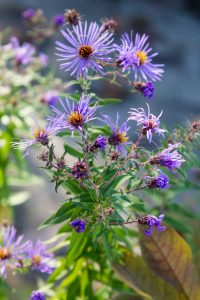
Yellow BirchNew England Aster in bloom adds a beautiful touch of colorA view to the left of the more forested area of my locationA Silver Maple tree