Reclaiming Land From the Sea

By Alison, Wildlife and Fisheries Biology; Sophomore

Initial point at which scouting for Flevoland began. Photo by Allison.

This post relates to our adventures on 30 May:

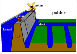
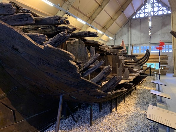
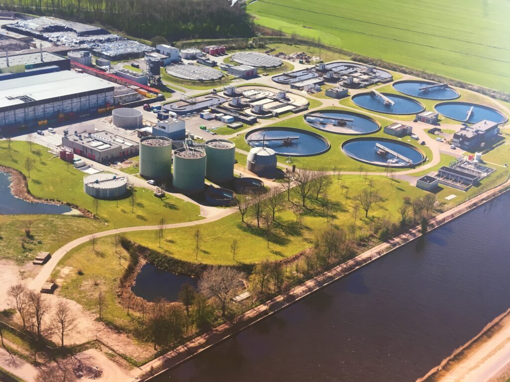
For today’s new adventure in the Netherlands, the group traveled from Lelystad to Apeldoorn. From the Apollo hotel we stopped at Museum Nieuwland also known as Batavia Land and Maarten taught us about the rising sea levels in the Flevoland province. Areas were flooded and people were looking for a dry and safe place to live. A solution to this was the Plan Lely: Zuiderzee Project where people wanted better safety, water management, connections soils for agriculture, space for cities and nature. The goals of this plan were flood protection for people around the Zuiderzee, land reclamation for production of food for the increasing population in the Netherlands, improving water management, and to have a low maintenance costs for the dykes. In order to create a polder there has to be construction of a ring dyke and pumping stations, pumping out the water, dredge canals and ditches and maturation of soil. Once the polder was constructed there were problems like having too much water and not enough air in the soil. A solution was to let the water out and the air in to make the soil better for the farmers whose crops were failing. Not everyone was in favor of this new plan like people’s homes who were right on the water and many people near the water as well. It was interesting to find out that the polder created happen to be on the very grounds we were standing on and the area had once been completely underwater. Maarten had presented this on a PowerPoint presentation and showed us a film right after about it. We were also able to see a large boat which was one of many that have been found in old shipwrecks in Flevoland.

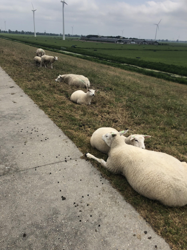
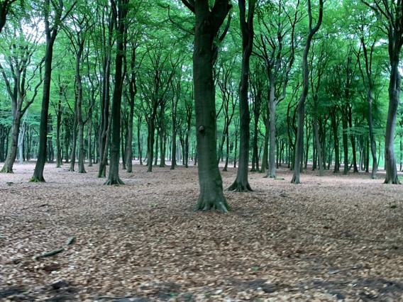
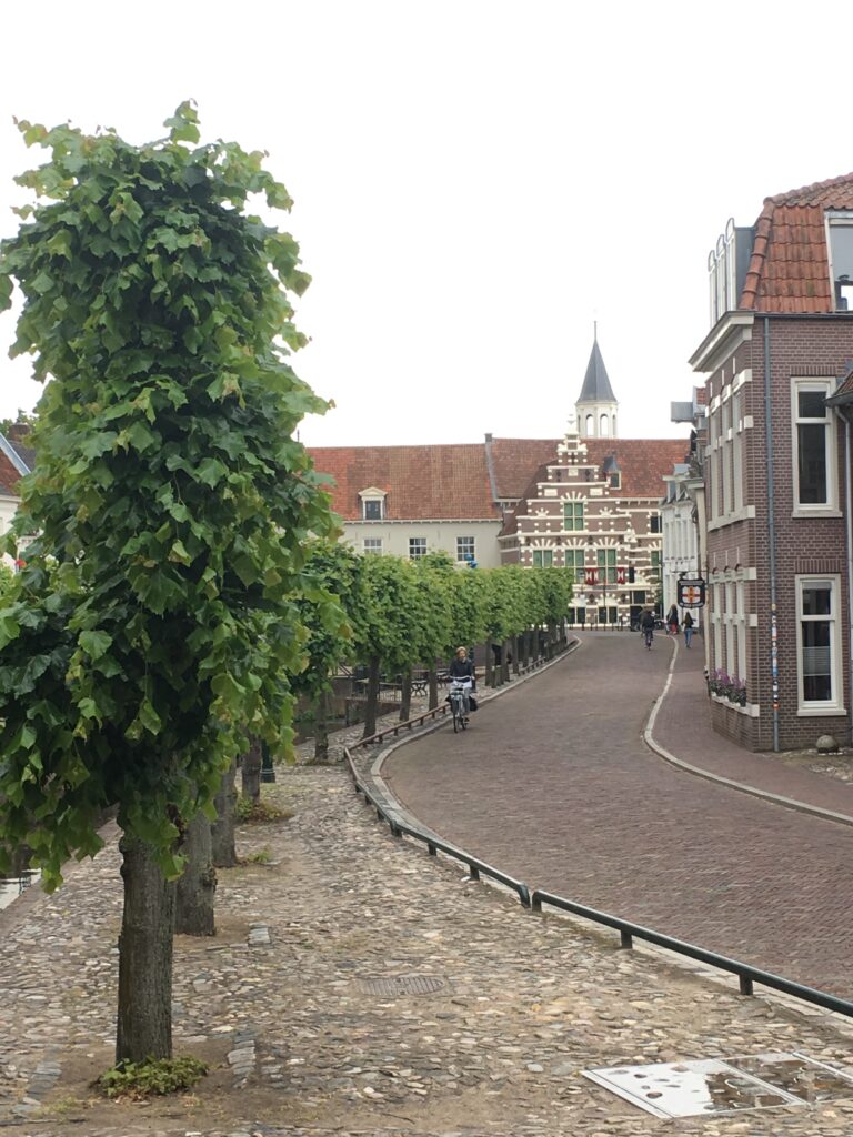
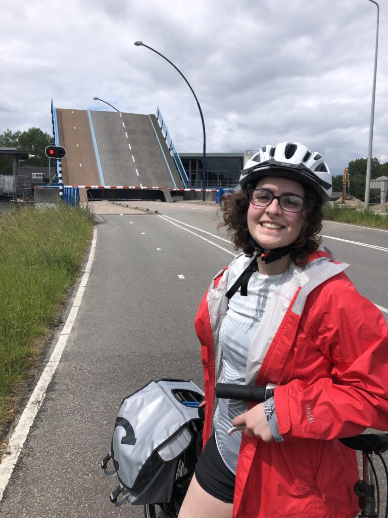
There was also a part in the museum where 14 women had sown lots of different events in the area over time. After learning lots about this, Maarten went out of his way to show the group a pumping station near the museum and then we proceeded to the Stayokay hostel in Apeldoorn. Along the way we were biking near some sheep as well as some beautiful trees in the forest and the hostel ended up being in the forest too.

Embroidered timeline of the history of Flevoland, from the glaciers to inhabitance. Photo by Allison.
Sheep along our biking path. Photo by Allison.

Room for the River Waal – Nijmegen

By Kelly, Environmental Studies; Sophomore

Bridge over the River Waal at the Room for the River project site. Photo by Kelly.

Today our bike travels led us through the woods out of Apeldoorn and onto the dikes of Nijmegen. Along the way we visited a small fruit stand which offered an apple cherry drink (lekker!) and stopped to make friends with some “paarden.” Before meeting our host Andrea, we had the opportunity to try another Dutch food called bitterballen.  Then Andrea arrived and brought us to the dike between the River Waal and the new area of water created to withstand potential flooding of Nijmegen. The Room for the River Waal project began in 1995 after flood threats in previous years showed the potential to inundate the area surrounding the river in a matter of 20 minutes. The solution involved displacing some local residents to create an adjacent waterway and floodplain to give the water room to spread with reduced damage to surrounding areas.  They were met initially with great opposition, but is now viewed as a success and critical part of Nijmegen’s landscape.  In some places, the walls have holes at varying heights to allow water to move freely, and along the sides there are 20 meter deep screens to protect local residential areas from being affected by seepage. The island in between the two water elements is the site of beaches, bridges, animal habitats, and other buildings.  After our tour, we enjoyed dinner in central Nijmegen while watching a biking race and walked around a local park. The park had an awesome tower, birds, deer, goats, and peacocks. Today in Nijmegen was definitely my favorite day so far!

Room for the River Project in Nijmegen

By Elizabeth, Environmental Science; Sophomore

The River Waals in Nijmegen. Photo by Elizabeth.

Imagine your home, the one in which your family has lived for generations, will be demolished so that a river can flood. How would you react? What thoughts are going through your head? What does your home mean to you?

For the trip today, we biked following the story of The Room for the River Project. This project was created to make more space for the river to flow, to prevent major floods in vulnerable areas. The idea was not to battle against water, but to “live with the water.” The Waal river in the space between the cities, Nijmegen and Lent, was one of the locations where the river was widened. There had been previous floods where people had to be evacuated so it made sense for this area to be part of the project. When residents found out, they became alarmed learning that there would soon be water where their house was located. Immediately they became angry and requested to voice their concerns. Previously, solutions to rising water levels was to extend the land but this time, despite concerns by local people by the river, the national government decided that allocating space for flooding was in the best interest of the people. 

Andrea, an architect and stakeholder coordinator for this project for the City of Nijmegen, spent time with these families, as emotional support for their transition. It was touching to hear how she stayed beside those families in the difficult moments like the last day in their house. A house, like people, has so much value. To many it is a place that holds years of memories and is part of their identity. There were pictures and videos taken of each house bulldozed, to give a voice to what was lost. These meetings with families demonstrate the importance of communication and human connection. Even now, several years afterwards, Andrea mentioned that she gets invited to events by these residents. 

Surprisingly enough, residents agreed to the project and ended up being a part of the project team. They were able to voice their concerns for safety, for example, building a wall to block water from the homes west of project in Lent. The Room for the Riverproject team also agreed to take measures to preserve cultural heritage. Residents were able to adapt and enjoy the changes, and city dwellers started to appreciate the river more. Stopping on a bridge we noticed bikers riding the curves. There were also fun chairs, so there is space to relax, look out and enjoy nature. 


The Room for the River Projectwas the start of more development of Nijmegen and Lent, to create a welcoming place-a new home for everyone. This is a story of coexistence between humans, change, and the river.   


Today’s biking distance: 62.2 km (38.7 miles)

Provinces we have visited we have visited or biked through (of 12 in the Netherlands): 4

Flevoland

By Beck, Natural Resources: Ecology/ Green Building & Community Development Major; Senior

After a much needed rest, we awoke in the Apollo hotel in Lelystad. We had a wonderful breakfast provided by the hotel then set out towards Nieuwland Museum (Batvia Land) in the province of Flevoland. In the museum, we were greeted by a nice man named Maarten. Maarten then took us into the Museum’s theater room to teach about the area’s history and how its land was reclaimed from the sea.

View from Nieuw Land Museum. Photo by Beck.

Without dikes and polders all of the province of Flevoland would be under water. After suffering from deadly floods throughout much of the 1800s, the minister of Water Management Cornelis Lely came up with a plan to counter these floods and open up these lands for development and agriculture. The project named the Zuiderzee project was passed in 1918, but unfortunately the project did not start until 1930 after Lely’s (1854-1929) death. In 1932 they began piling up rocks to create a dike across the Zuider Sea. In 1948 the Northeast polder in Flevoland was built during World War II, then in 1957 the polder where the town of Lelystad is now located was completed. Finally in 1975 the final dike and polder was completed to create the most recent piece of land in Flevoland. 

Cornelius Lely. Source: https://en.wikipedia.org/wiki/Cornelis_Lely

A lot of work goes into creating a dike and polder. It starts with the construction of a ring dike, which is basically the piling of rock and dirt in open water to create a divide. Once the ring dike is complete, water pumping stations are situated in front of canals and pump all the water out through the canal until the area behind the dike is dry. Dredge canals are then put into place to remove the remaining muddy water in the polder, allowing the soil to mature. Once the soil has matured the land is ready for agricultural production. 

Source: http://socialsystemsloes.blogspot.com/2012/09/polder-model.html

Since the completion of the dikes and polders, the land has seen a rapid rise in population, agricultural production, and less floods. Old shipwrecks are marked and serve as a reminder that this land was once a part of the sea. 

One of hundreds of shipwrecks discovered when Flevoland was reclaimed from the sea. Photo by Beck.

The Zuiderzee project proved that significant accomplishments can be made with land development and water management. As sea levels continue to rise at rapid rates, it is imperative that tremendous achievements such as the Zuiderzee project are referenced and perhaps replicated in areas that may be reclaimed by the sea in the near future.

A forest along our biking route. Photo by Beck.

After the museum presentation and tour we biked approximately 59 km to the town of Apeldoorn. Although the ride was long it was rather peaceful riding through dense forests, beautiful meadows, and endearing small towns. I am excited for what’s in store tomorrow and can’t wait!


Day’s total distance: 69.8 km (43.4 mi)

Provinces we have visited or biked through (of 12 in the Netherlands): 4

Amersfoort Nutrient and Resource Factory

By Preston, Environmental Studies; Senior and course TA

After a long day of biking yesterday, we wandered around the old part of Amersfoort, which was centered around the hof and contained within walls built at the beginning of the 14th century. Then we got a much needed good nights rest, and awoke to bike to the Amersfoort Wastewater Treatment Plant (WWTP).

The view from inside of the old fort walls, constructed in 1340. Photo by Preston.

Beyond the standard equipment of a WWTP such as clarifiers and filters, the Amersfoort plant utilizes several additional technologies to reduce their environmental impact, produce energy, and recover phosphorus. These technologies include anaerobic digesters, biogas engines, and phosphorus recovery systems. 

A simplified diagram of the Amersfoort plant process. Credit: Eliquo Water and Energy

They began the improvements to the WWTP in 2011, motivated by water quality issues and the increasing scarcity of phosphate rock. However, this approach is not only beneficial to the environment. The phosphorus recovered from waste is turned into Crystal Green Fertilizer and sold across the globe by a company called Ostara. In Amersfoort, they are able to generate revenue from the fertilizer product they produce, and save money on energy and transport cost of sludge. So, even though these technologies are quite costly to implement, the Amersfoort WWTP is expected to break even after just a decade. They are now exporting energy to the power grid while powering their own plant. Plus, with revenue from selling the fertilizer they can have funds set aside for improvements to other plants in the region. 

Ultimately, what the Amersfoort WWTP shows us is an opportunity to shift the paradigm of wastewater management. What is currently viewed as “waste” and something to get rid of is actually quite valuable in the form of energy and nutrients. That’s why the staff of the Amersfoort plant refer to their plant as a Nutrient and Resource Factory. This shift is a necessary one to make, as both phosphate rock and fossil fuels become more scarce. It also presents an opportunity for our food and waste system to become a more circular economy, where the nutrients in the food we eat come from our waste (and therefore our food). 

Although a system like this may seem like a lofty goal for a place like Burlington (the Amersfoort plant serves a population of 315,000 people) it is still important to learn from this example. Plus, these technologies are subject to constant innovation. In short, the future seems bright for wastewater treatment- or rather, nutrient and energy production from waste. 


Today’s biking distance tracked by Helene: 57.6 kilometers (35.8 miles)

Provinces we have visited or biked through (of 12 in the Netherlands): 2

The Gang’s All Here

By Kris Stepenuck, course instructor

All the students have arrived, and started to have the opportunity to observe and learn about life in the Netherlands. From buildings that tilt due to the unstable (somewhat watery) base upon which they are laid, to the magnificent rows of trees that line the bike paths along the canals, to artwork of famous Dutch artists over time, the impact of water in this culture and society is evident. In addition, the influence of strict zoning regulations create a stark contrast between cities and their surrounds, and allow a country with a population of 17 million people living in 42,500 square km (not quite double the size of Vermont, which is 24,500 square km) to feel rural.

Over the next few weeks, biking from city to city, we will be considering environmental, economic, and social aspects of a variety of water management and sustainability-related sites and projects. Students will take turns sharing their insights from our country tour here. We hope you will enjoy learning with us as we go.

Everyone made it safely, and is headed from Schiphol to Amsterdam on the train – just ahead of the national strike of public transport. Photo by Kris.
Do any of these Amsterdam buildings look askew to you? Photo by Kris.
Allison waits for a draw bridge to close. Photo by Kris.

Our first two day’s estimated total biking distance: 16.2 km (10.1 mi)

Provinces we have visited or biked through (of 12 in the Netherlands): 1

Last minute preparations…

As this year’s NR195 course nears, final preparations are underway. The bike company in Amsterdam is ensuring we have bikes to fit people of all sizes. The students are beginning to read about Dutch water management history and practices. Packing comes next, and a few people are already having their own adventures in Europe ahead of our official start date. I am looking forward to being able to share our learning and adventures here soon!

First lesson learned

Sunday May 20, 2018

by Kris Stepenuck

We made it! The three leaders, that is. We spent the day – which happens to be Carolyn’s birthday – visiting each site of the first half of the days of the travel course by car. The weather was perfect – sunny, temperatures around 22C, and just the slightest of breezes. The towns each have their own character, many with lovely cobblestone streets (called kinder cops, or “children’s heads”!), which are narrow in places and have long chains of row houses that are occasionally separated by a church or a tower (making it all very picturesque). And, of course, no matter where you look, there are people on bikes, bikes in racks, and bikes paths – an endless criss-cross pattern of bike paths. And there is water – in canals, rivers, lakes, and the sea. These two things are key to why we are here in the Netherlands, and we eagerly anticipate the many visits we will make to learn how the Dutch manage water for so many purposes – from agriculture to domestic to wastewater recycling to living life at, nearly at, or even below sea level.
Continue reading “First lesson learned”