RSS
 

Archive for the ‘Uncategorized’ Category

A Final Post

05 May

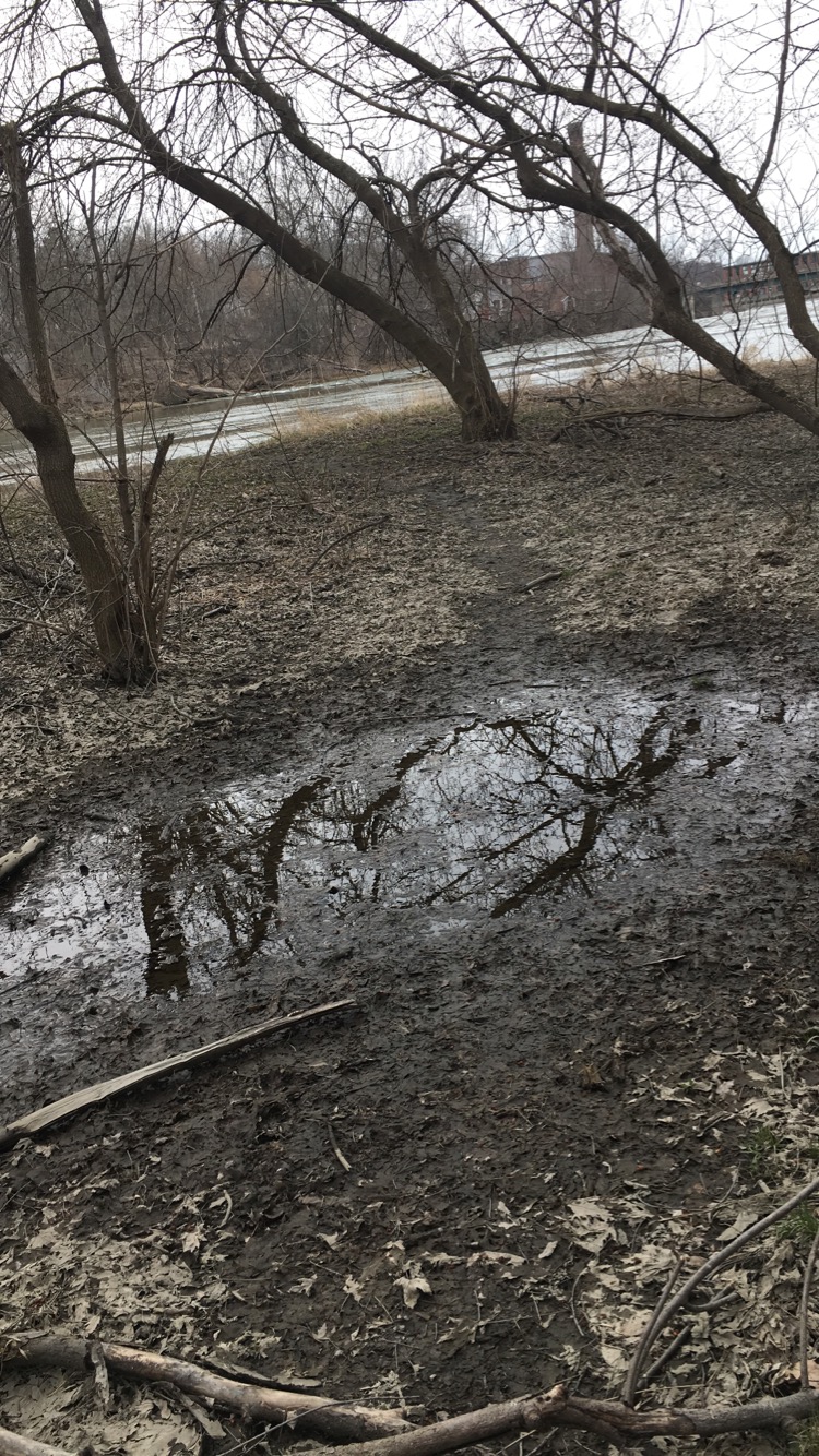
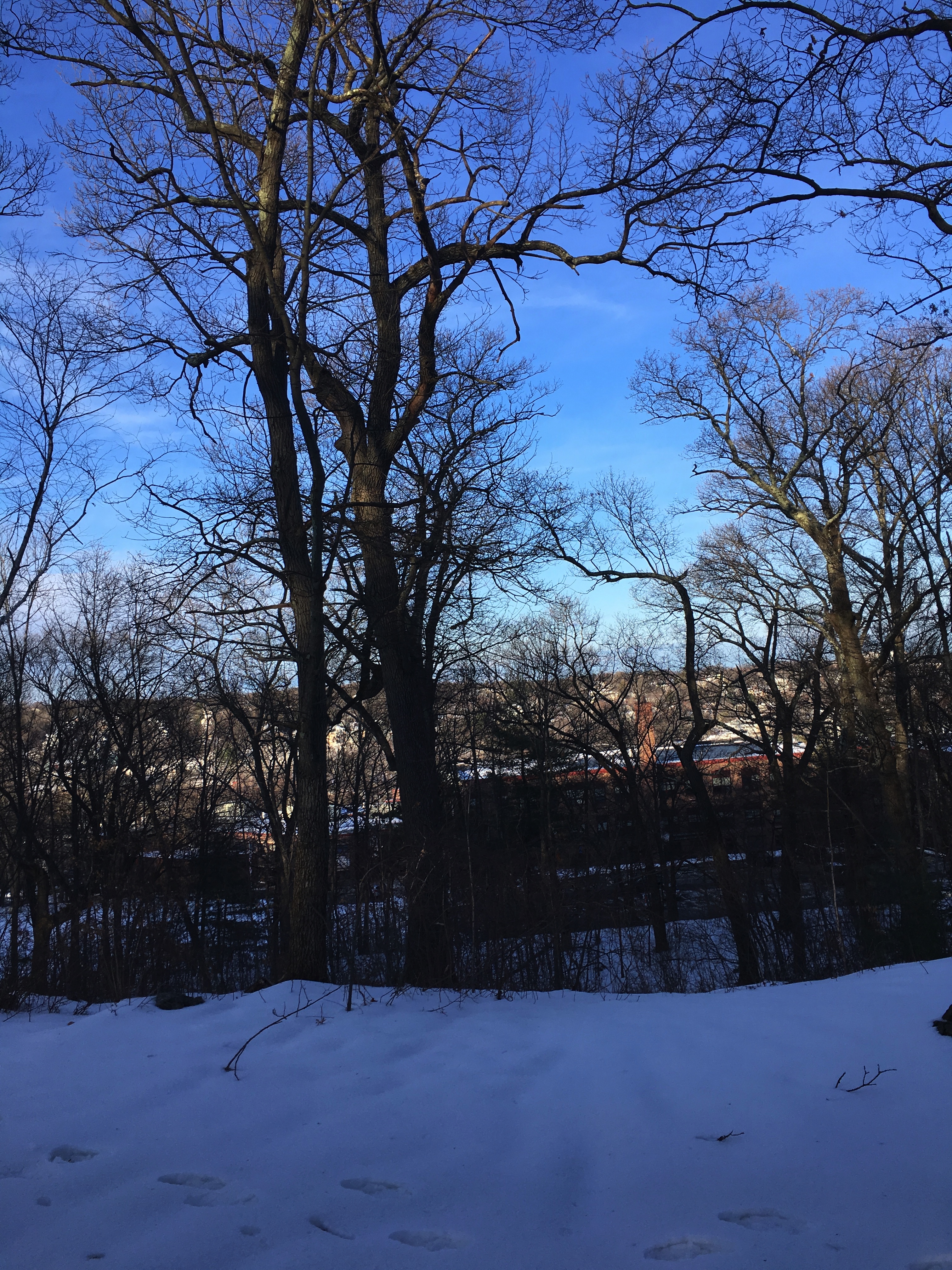
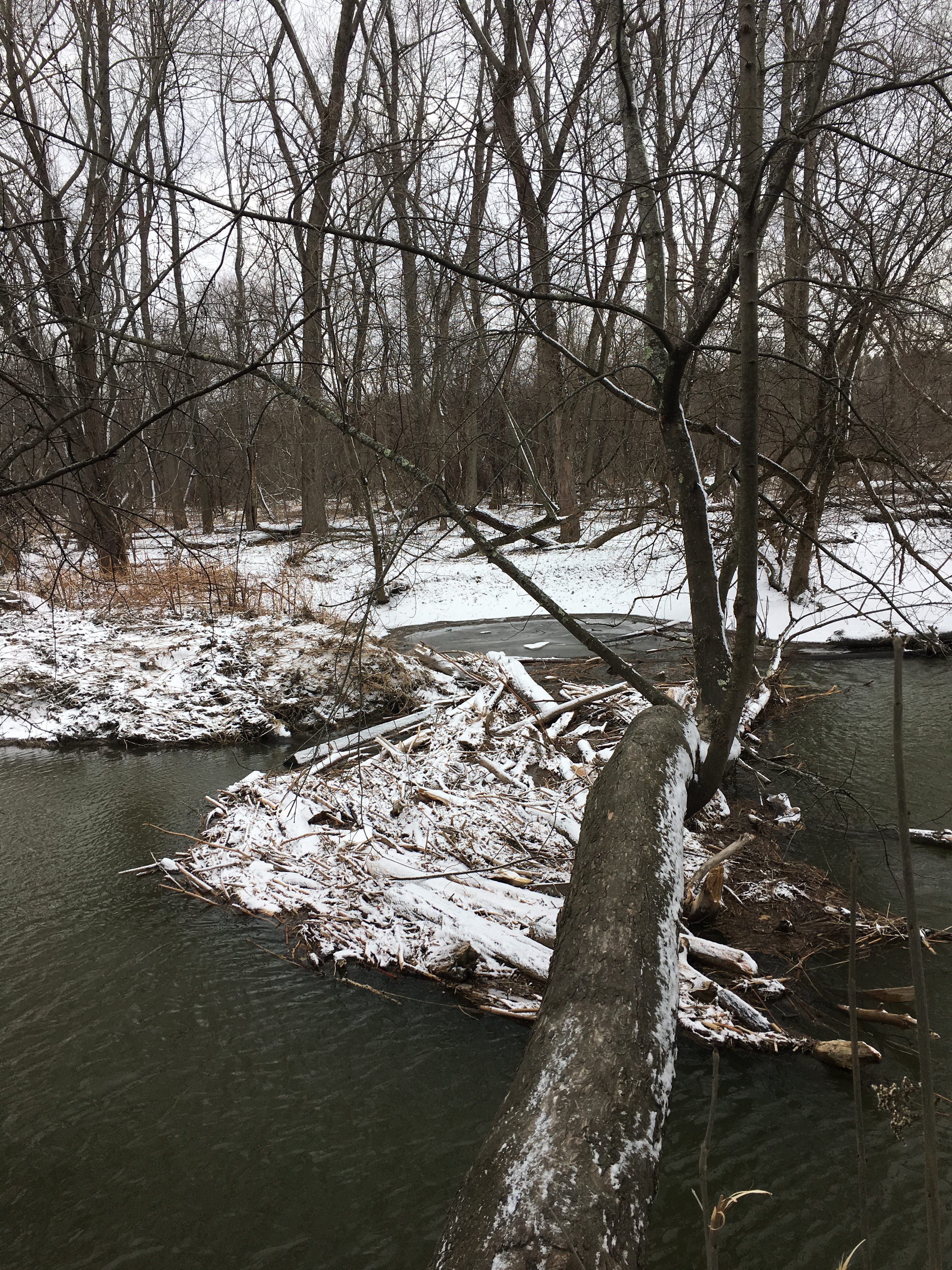
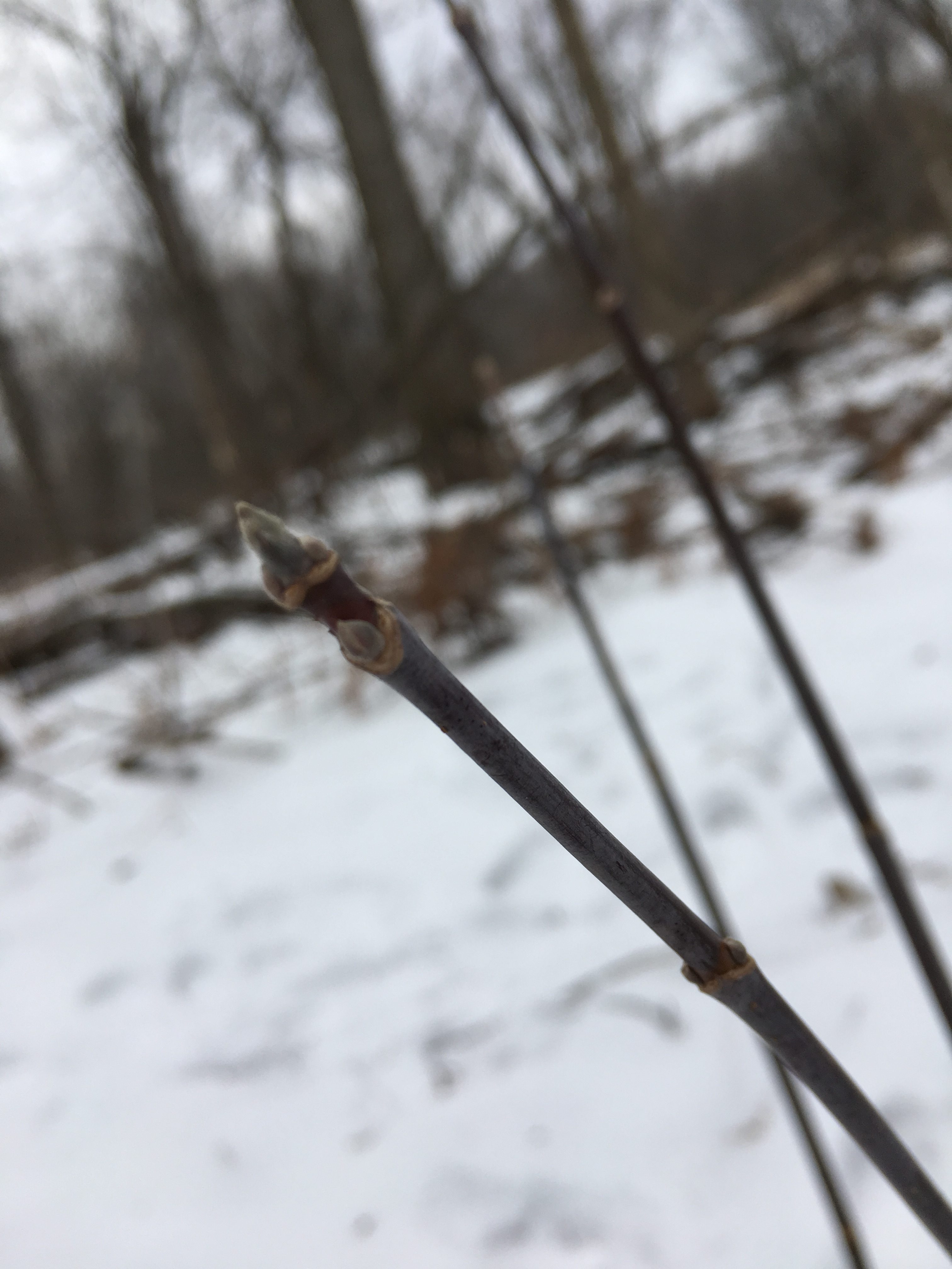
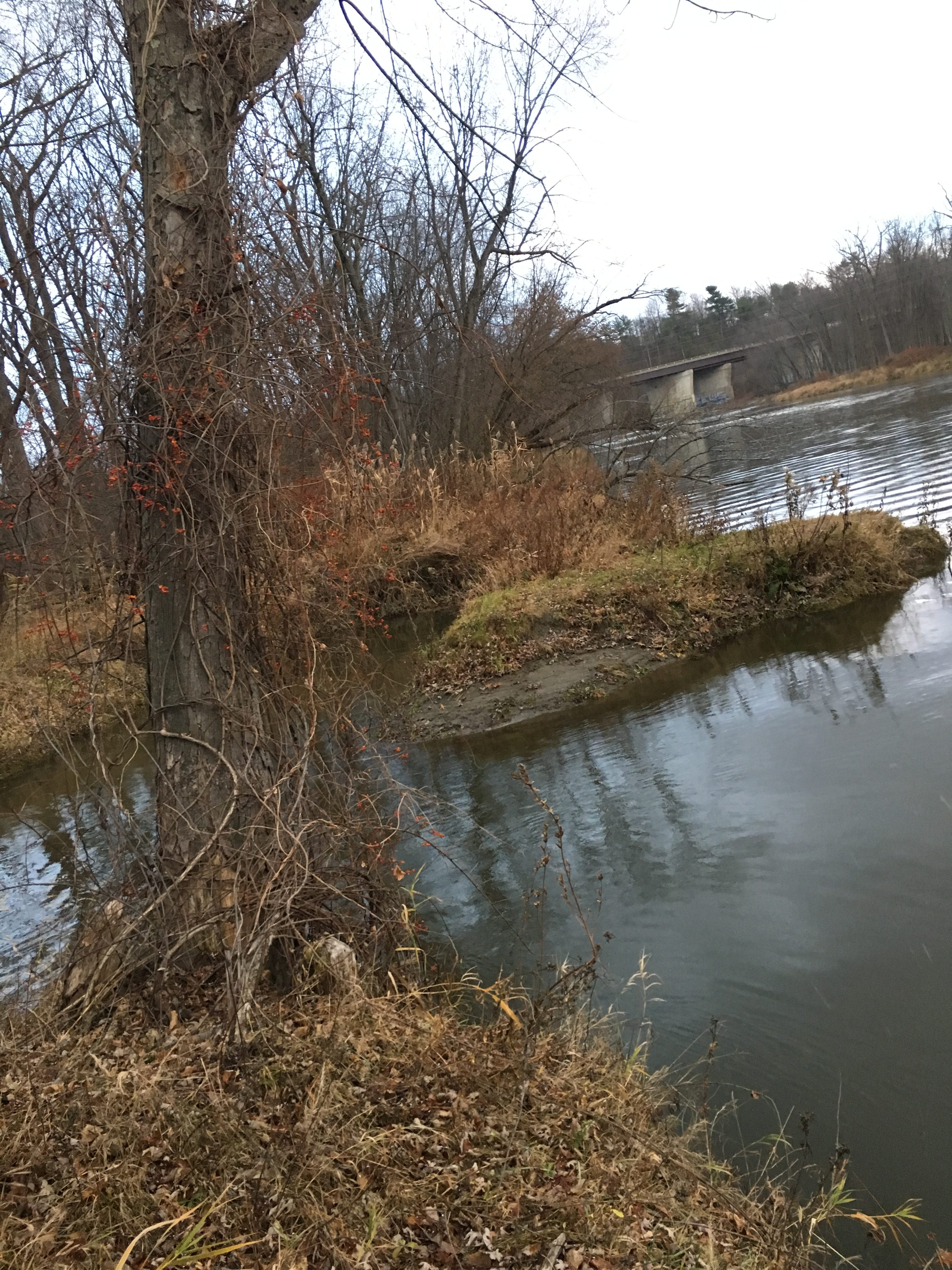
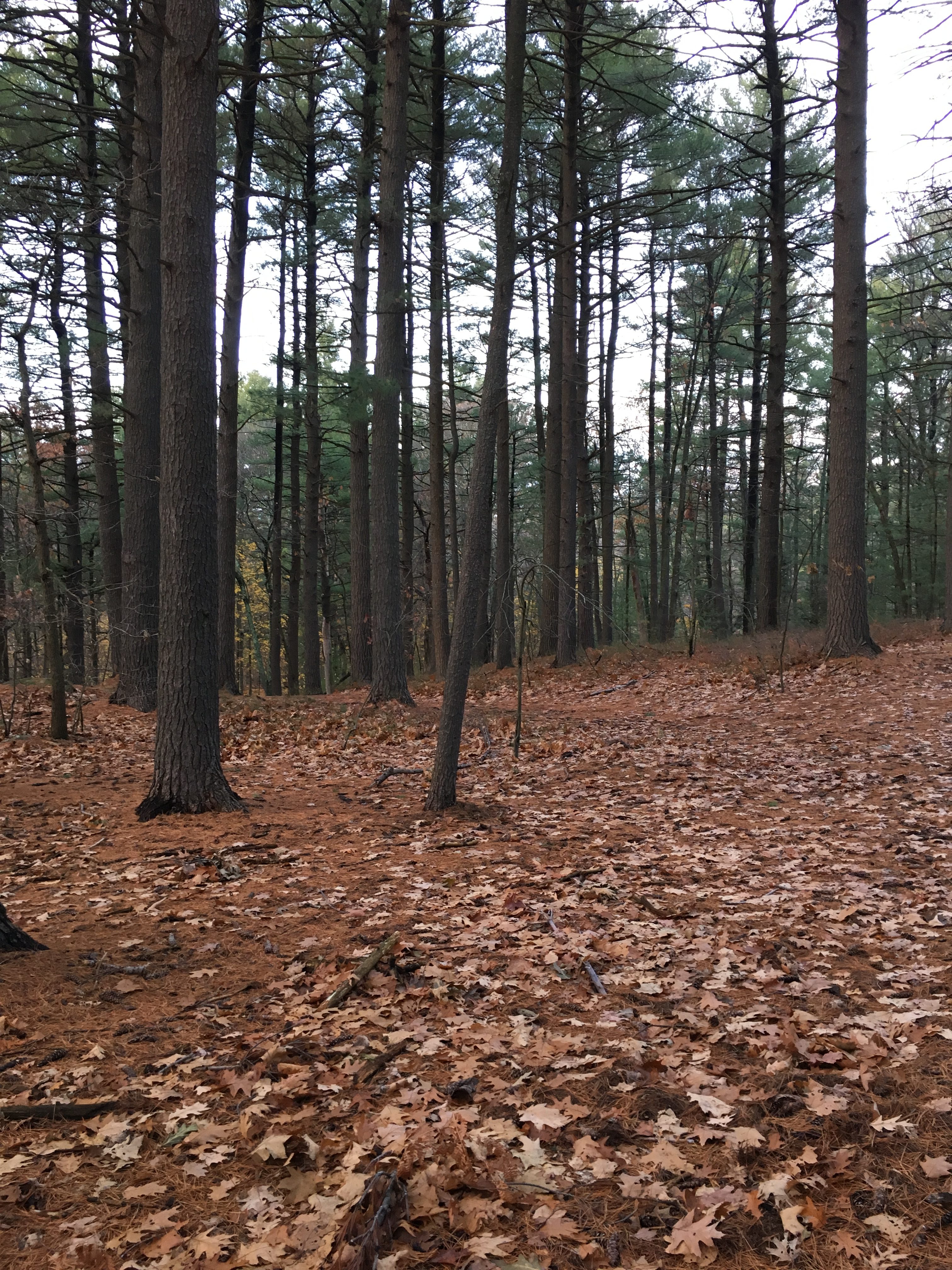
 As I entered the Casavant Natural Area for the last time this year, the signs of Spring were fully visible. My spot was vibrant with green silver maples and was sprouting with fiddle heads covered in rain water. The ubiquitous green color that filled the trees and ground reminded me of my first few visits to my phenology spot back in the fall semester. I am very pleased that I choose the area I did, since changes to the environment were quite dynamic. I think this is best illustrated by the fact that I could only get to my original location in the fall, when the river was dry, and in the winter, when the river was frozen solid.

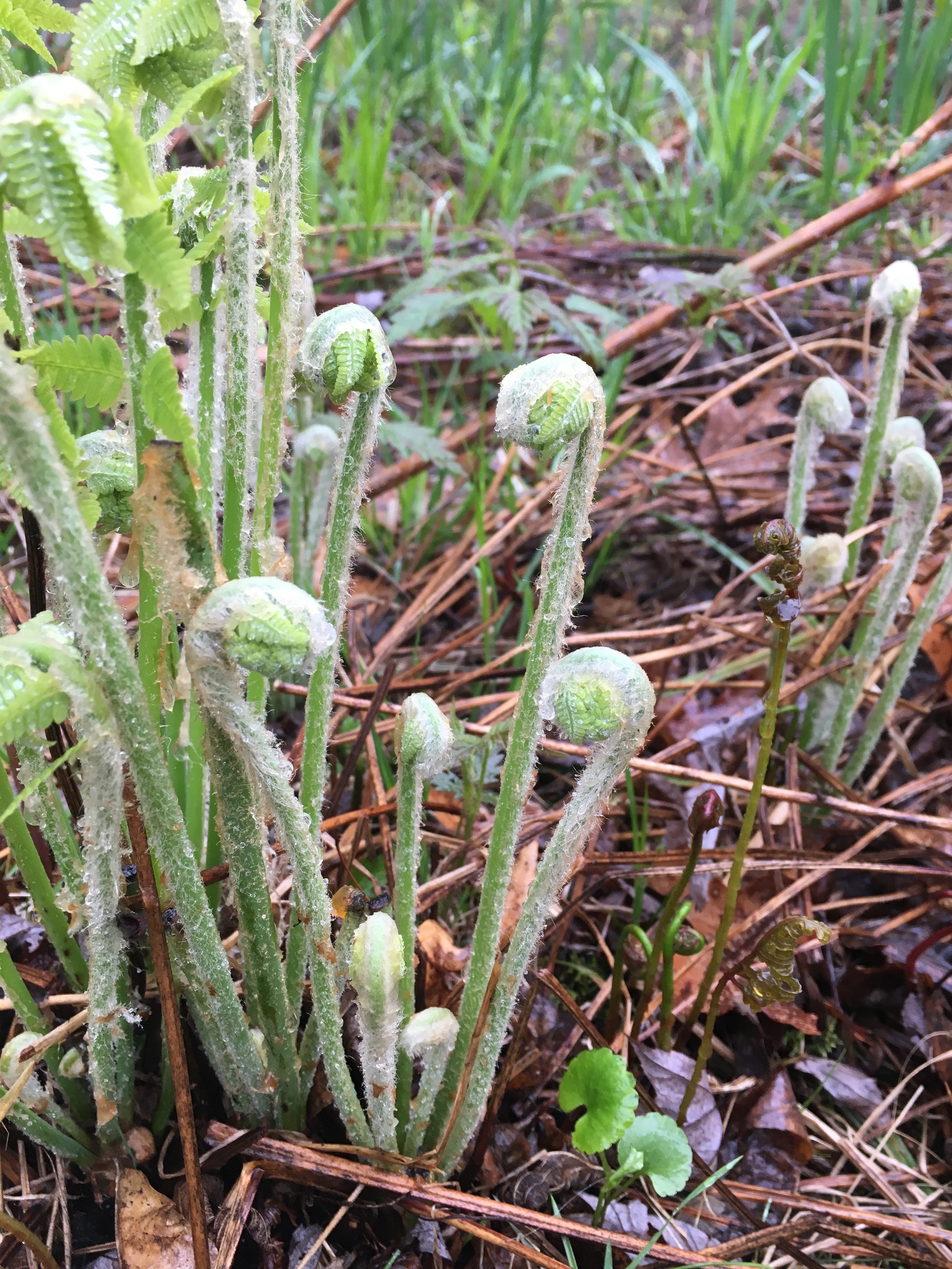
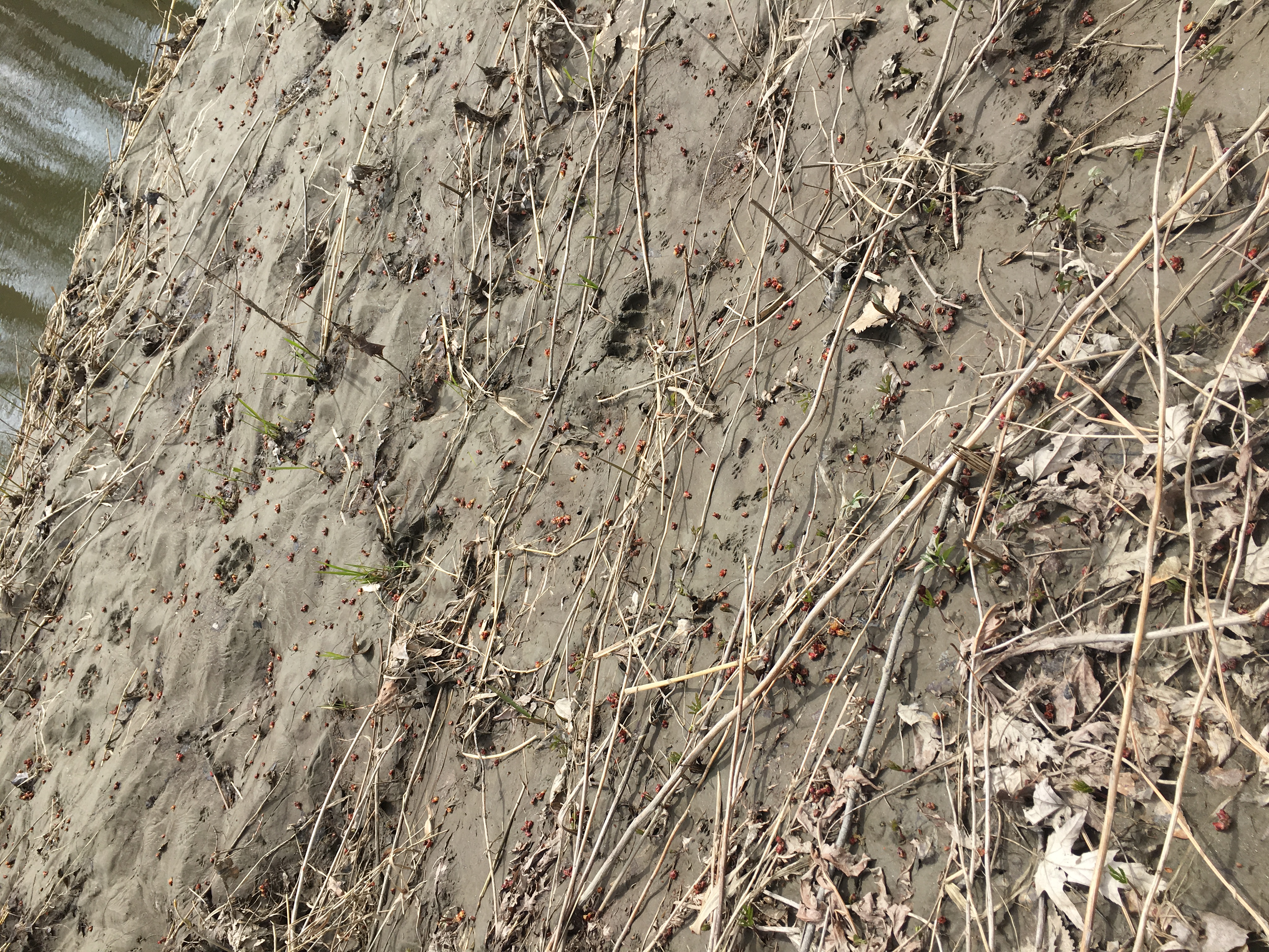
Fiddle heads under a little fall of rain

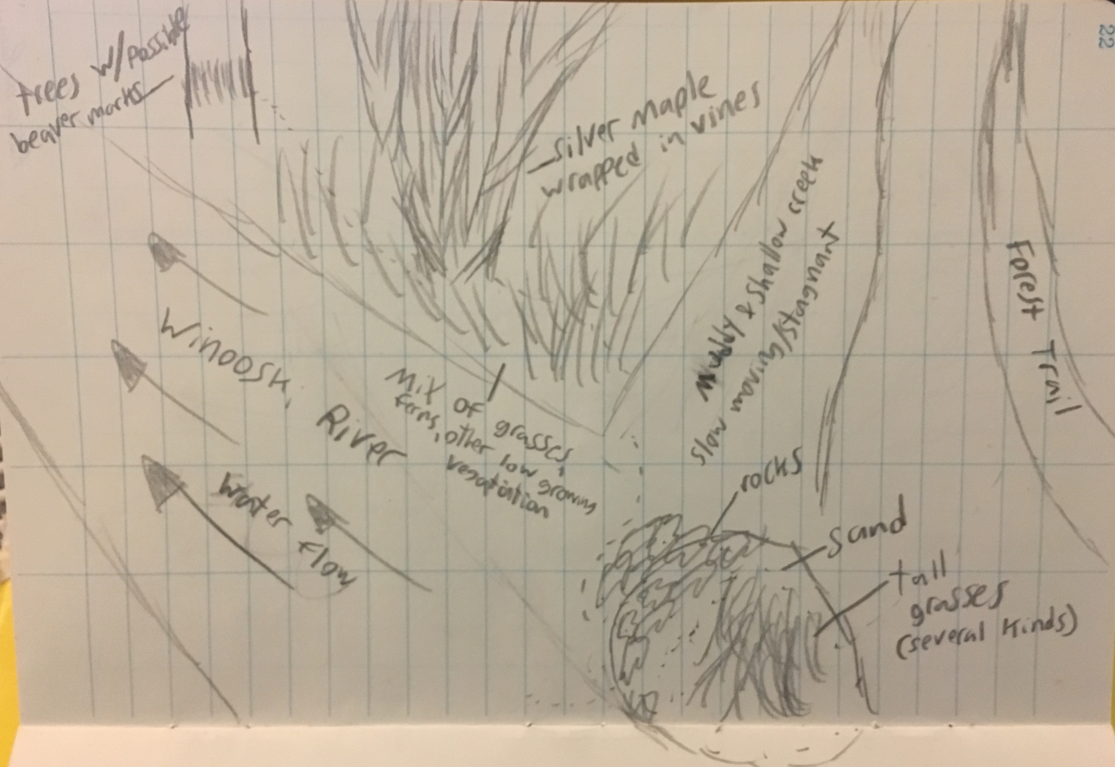
Nature and culture have both played a role at my spot. The Casavant Natural Area is one of the few places in Winooski where the citizens can go and enjoy the natural world, making it a culturally significant area. Also, as we learned in class, since the spot is a silver maple-ostrich fern floodplain, it has very important natural features, such as keeping the structural integrity of the river and filtering pollutants. The fact that such a significant ecosystem is frequented by large waves of people every day makes my phenology spot an even more fascinating place.

I have grown to be very fond of my phenology spot, and all in all, I have started to consider myself apart of it. I say this because over the last several months I have learned and experienced much there. My phenology spot became an area I knew a plethora about, but it also became a spot for me to go to for break or breather from stress. It was through the treks where I traveled alone off of campus to Winooski and sat under a tree when I first began to feel this way. Spending time at my spot began to feel safe and comforting after a couple of months. This, I believe, was when I first felt like I was apart of my place.

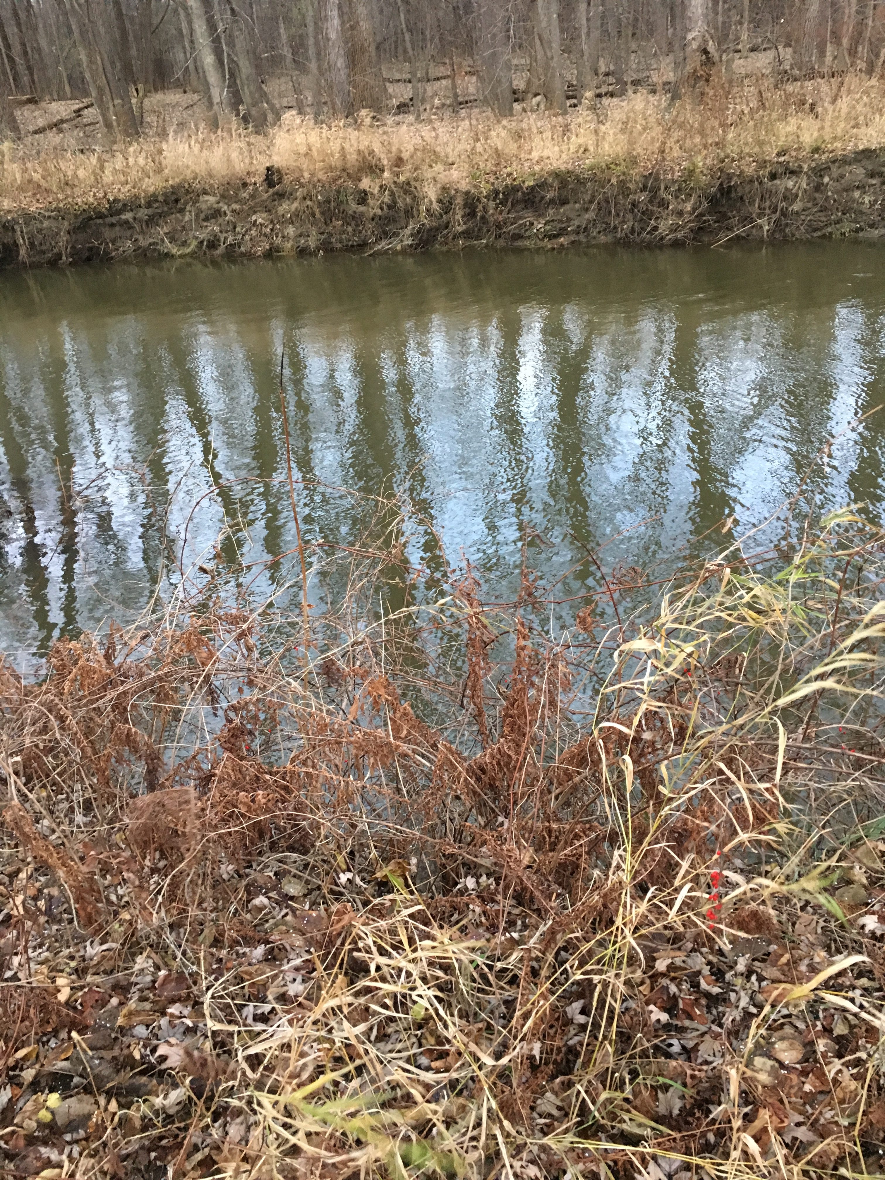
The closest to my original spot possible (without a boat, of course)

During my last visit, I found it fascinating how much my spot looked like it did originally. Witnessing the changes from fall to winter, then winter the spring, has been a remarkable experience. Never before have I thought so much about how a specific spot changes in a year. I wish I could be able to stay for extra weeks to see my penology spot make it full circle. Throughout the next three years I hope to occasionally return to the Casavant Natural Area to see how my phenology spot is keeping up.

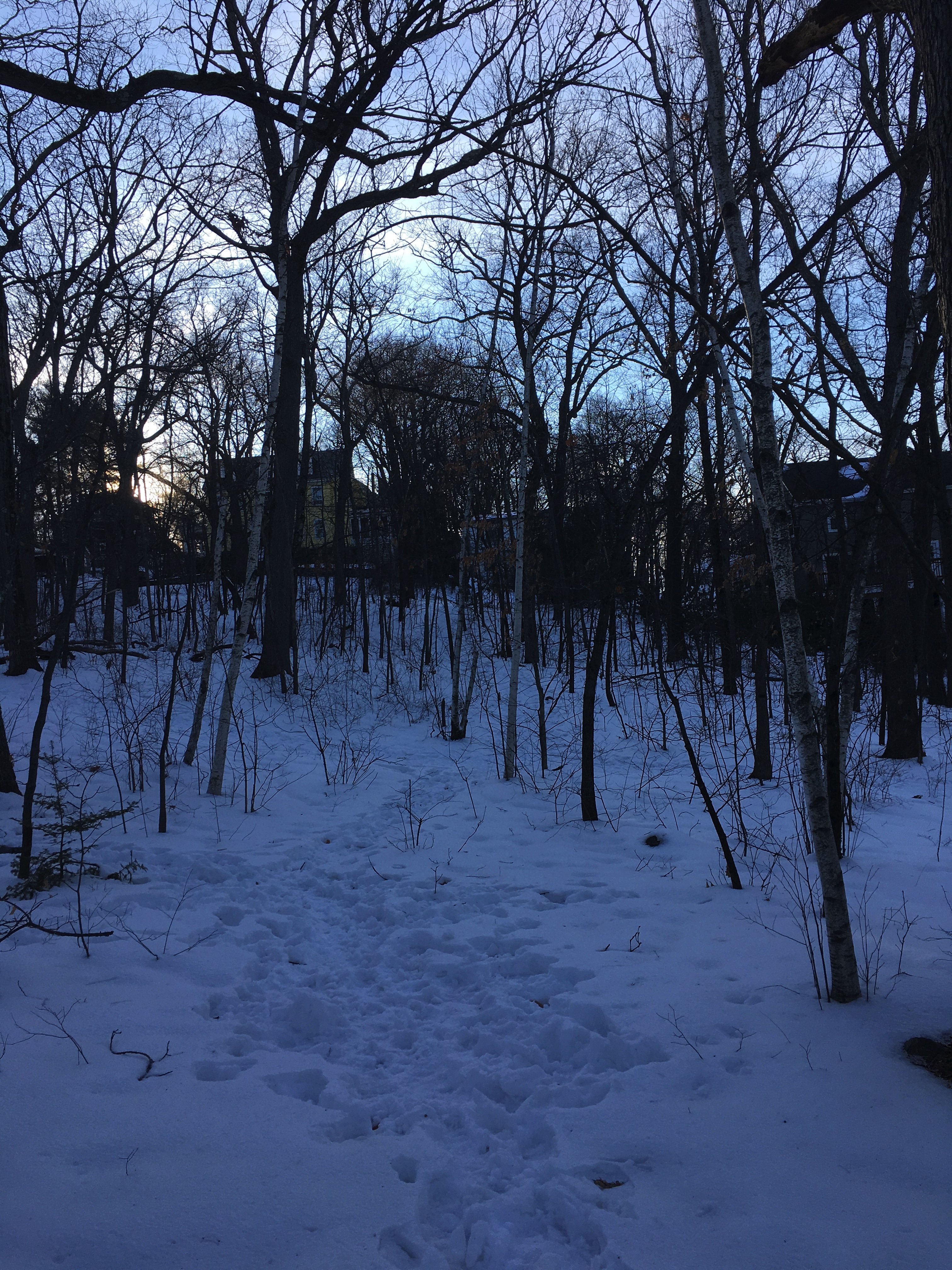
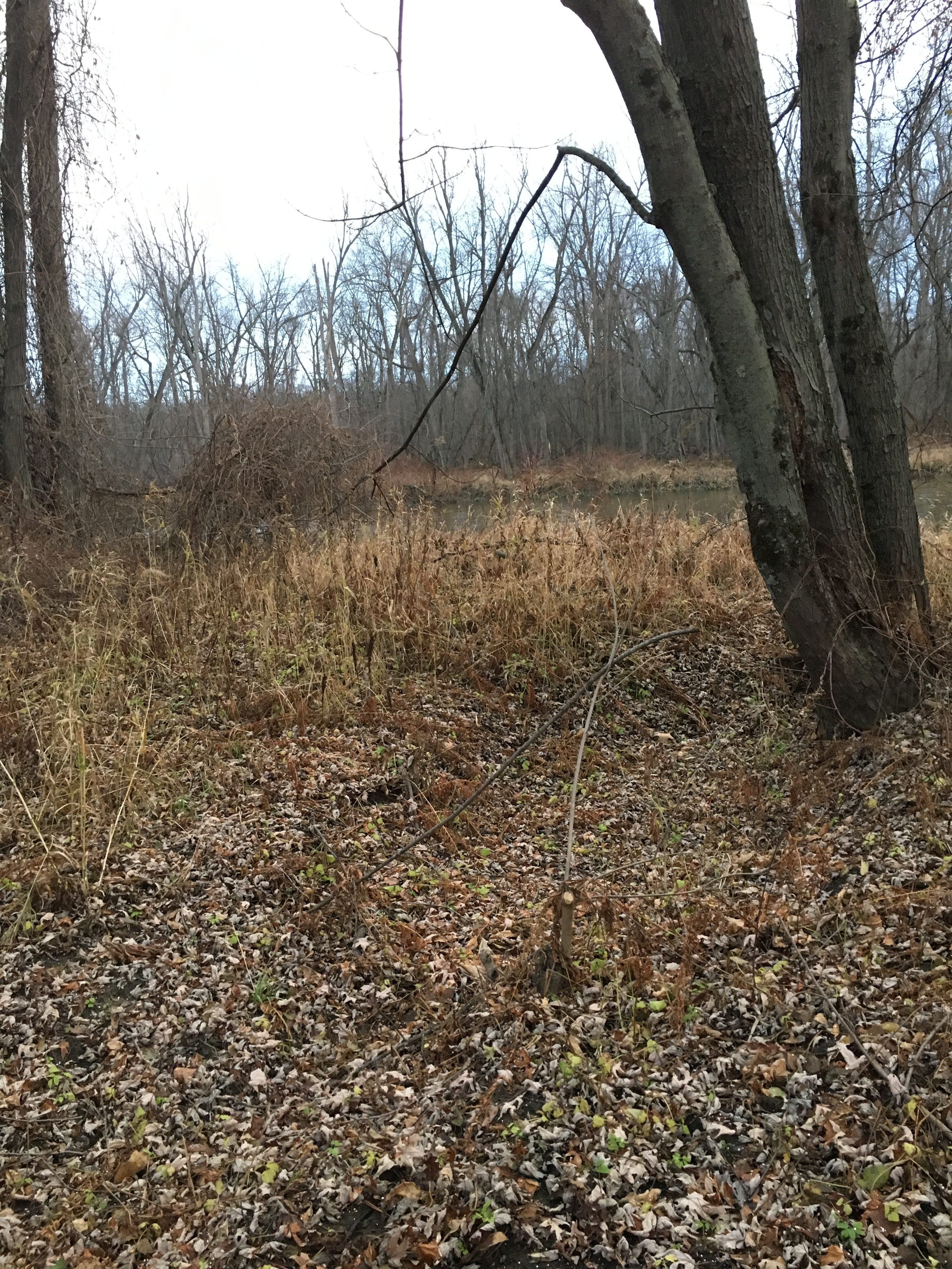
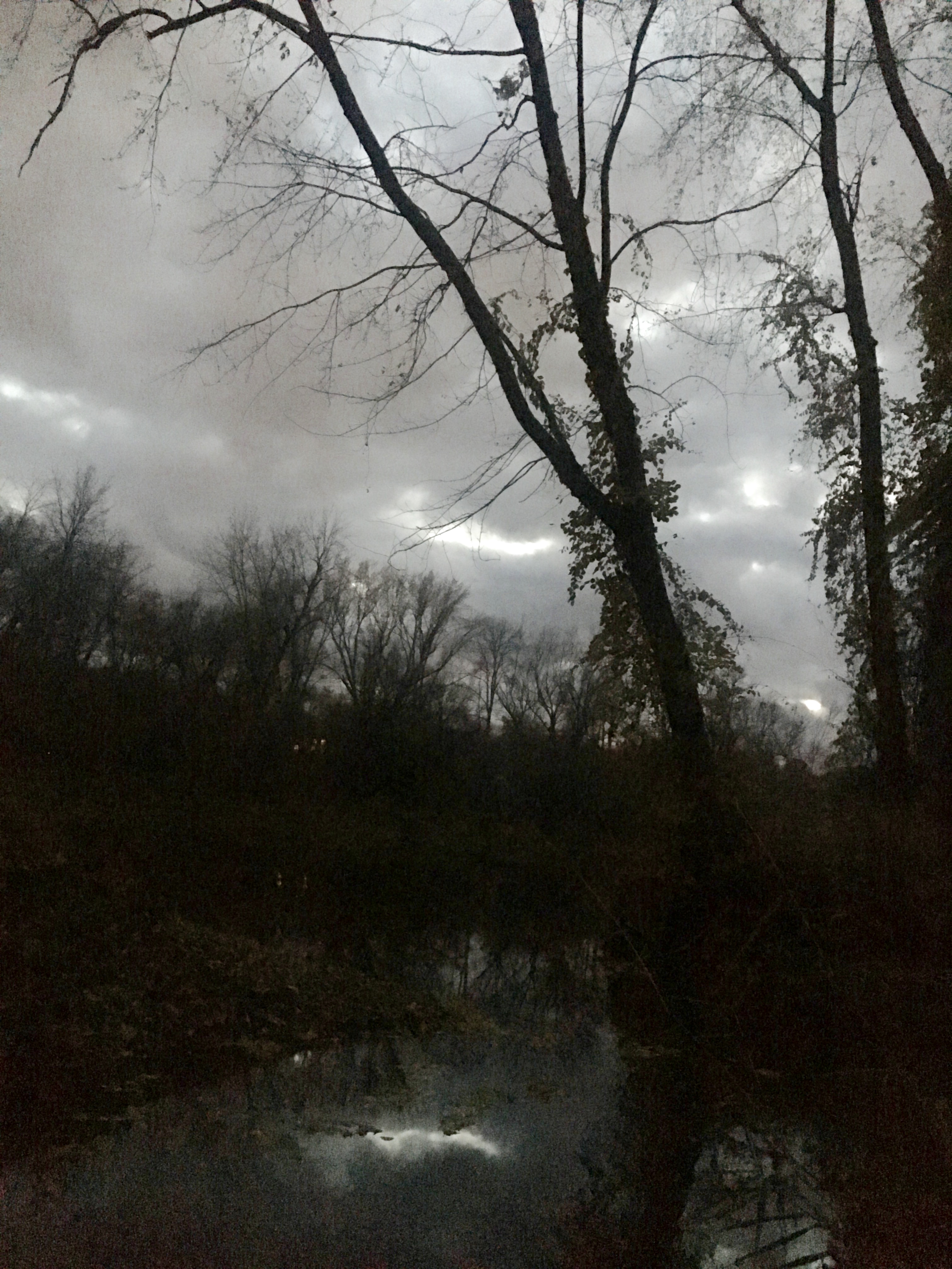
My last photo (May 5, 2017)

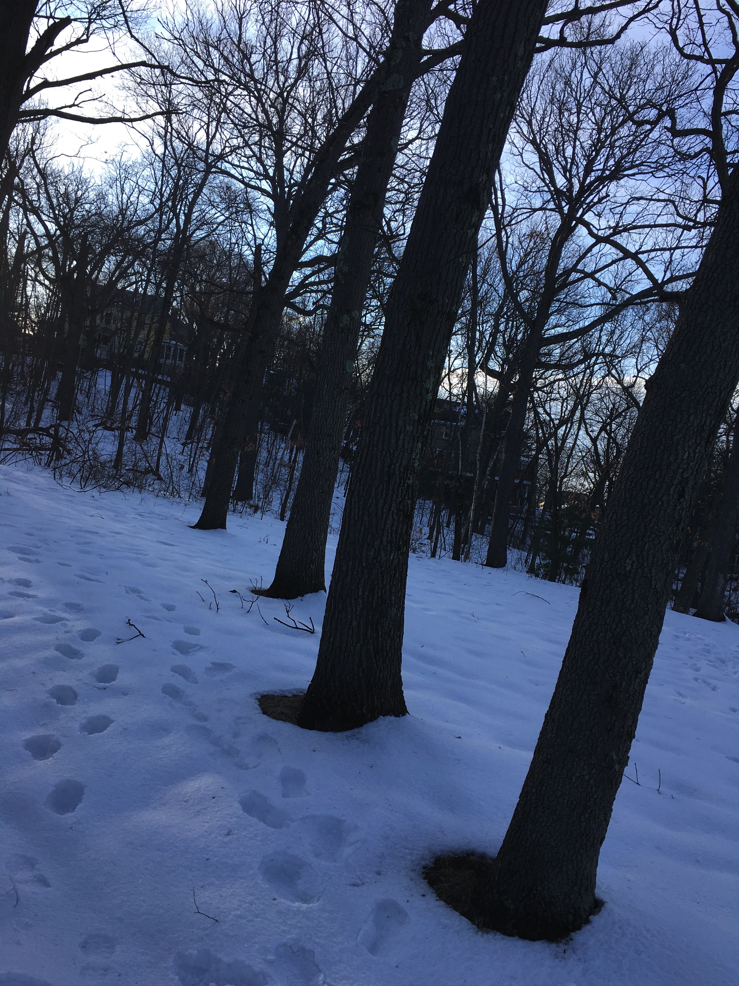
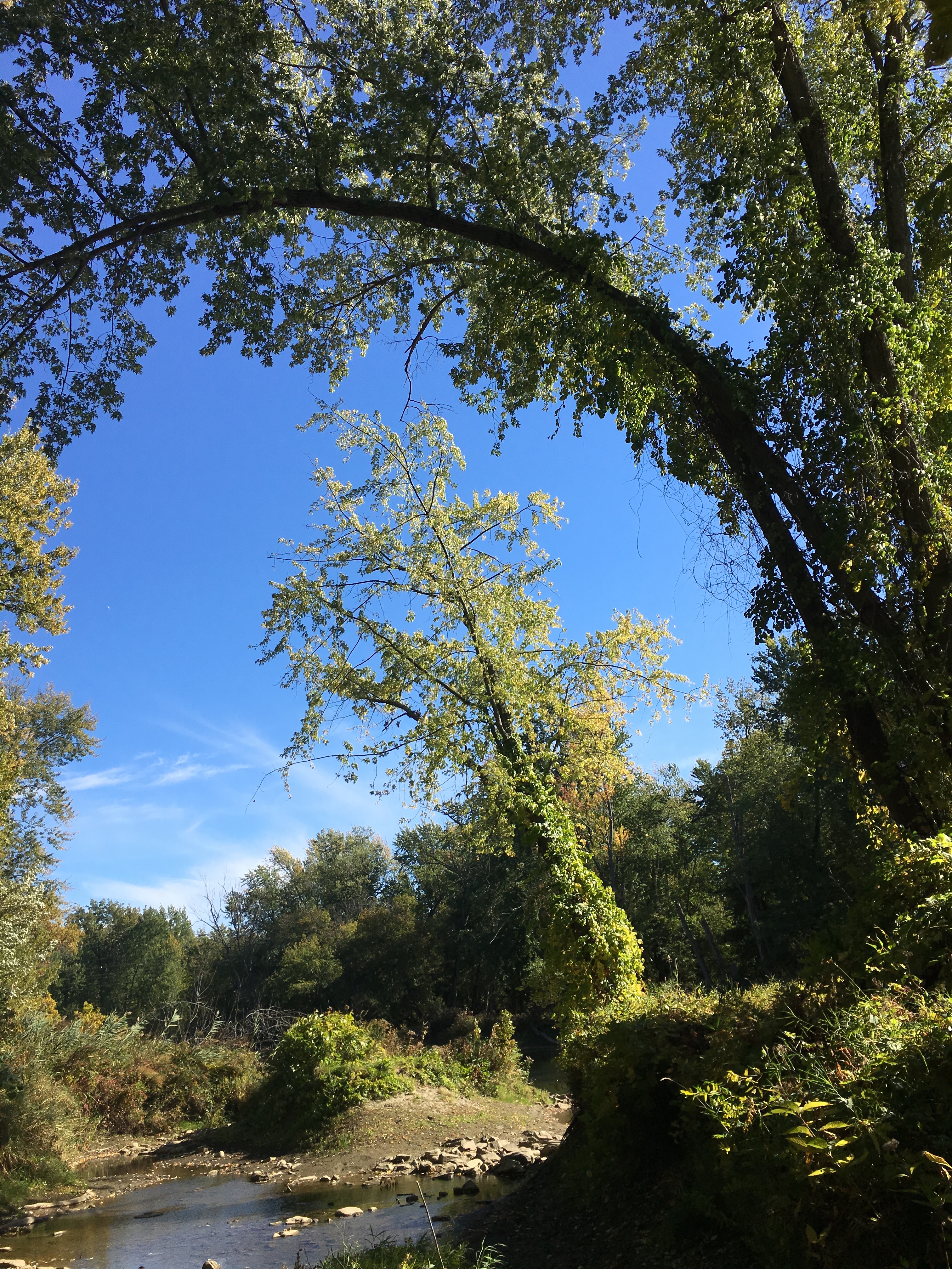
My first photo (October 15, 2016)


Signs of Spring!

15 Apr

During my latest visit to my spot, I encountered some new signs of spring. Right off the path that leads to my location, there was a possible vernal pool. Vernal pools, of course, are temporary pools of water that form in the spring. They are quite important because they give amphibians a safe place, away from predators, to spawn. Hopefully, as Spring continues, I will be able to witnessing some amphibians or at least clear signs of them. I was not expecting to encounter a vernal pool, since for my last few visits there were not any, so finding one this trip was a wonderful surprise.

Possible Vernal Pool

For the most part, my phenology spot was saturated with colors of brown and grey (as seen in the image above). With that being said, if you got closer to the bank of the river, you could see some clear signs of the changing of seasons. In a muddy slope right next to the river small green sprouts were starting to poke up from the earth. These small and fragile plants, maybe only one or two inches in height, cover the bank. In the weeks to come, when these plants continue to sprout up further, I am sure this area will become quite the sight to gaze at.

Bank with sprouting plants

My location’s primarily organism is silver maple. There is not a spot where a silver maple is not hanging above you. This means that my entire location has these vibrant silver maple buds scattered across it. As you can see in the photo below, the buds are a distinct red, which make them quite a beautiful sight. The combination of the small green plants and the vibrant red buds, although subtle, makes my spot seemed filled with life.

Fallen silver maple buds

The fact that my phenology spot is right along the Winooski River has large implications to why its species distribution is the way it is. There is a very abrupt beginning and end to the landscape, which increases the difficulty for a large biodiversity to be established. The volatile nature of a river makes it so not many species can dwell with ease in this area. Silver Maples compose almost all the tree population, which makes sense, since they are capable of surviving in flood plains. Almost all the other plant species are various ferns. This edge effect, which occurs from two distinct habitats bordering each other, is a very important and interesting topic to study, since it is a negative occurenace that we promote when fragmenting landscapes. I do not believe that my spot provides habitat for any interior species. My spot is traversed by a highly trafficked trial on one side and by a river on the other side. The Casavant Natural Area is not big enough and too populated by humans to harbor any species that require extensive continuous land to be successful.

Overall, the signs of Spring, although subtle, are surely present at my phenology spot. In the last couple of weeks of this semester, I will be excited to see my location slowly looking more like it did when I first discovered it back in the end of summer.


Hold up, that’s not Winooski!

20 Mar

Over spring break I ventured to a salubrious natural area known colloquially as the Ottoson Woods, due to its close proximity to my alma mater The Ottoson Middle School.  Everyday, or rather every school day, these woods are utilized by savvy middle schoolers attempting to shave a few minutes off their daily morning trek. All these teenage feet have carved several paths throughout the woods, which fragment the  area into distinct parcels. The parcel I paid special attention to strangely lacks trees besides a few scattered trees and a neat row of four. All these trees I believe are some kind of oak. A few of the branches were holding onto a small but noticeable amount of leaves. This leads me to believe that they are possibly red oak or pin oak, for these are species known to occasionally hold onto dead leaves in the winter time. At my spot there also were scattered birches in an area of smaller shade intolerant trees and the occasional woody plant. With that being said, mostly oaks comprised the land.

A tidy row of oaks

I am guessing that this patch is empty of trees because it was once cleared. The spot is at the top of a fairly steep drop off, making it a good view in the winter when the trees have shed their leaves. It is my theory that the land was cleared to give the folks of Arlington a nice place to go and look at a moderately pretty view. Due to the fact that hoards of middle schoolers trample through the Ottoson Woods twice a day, many smaller and young species are not able to develop into larger versions of themselves. Also, there is a thick suburban neighborhood. The Ottoson Woods is one of the few natural area close by that these people can enjoy. So besides young students, there are always humans and dogs walking and running, which further disturbs the woods.

Probable shade intolerant species and small trees

On the day I visited the woods it was ominously quiet. I looked in the canopy for signs of birds, but I was not able to spot any with my eyes. As I started to make my way out of the forest, I heard a caw in the not so distant distance. I am fairly sure it was a crow, but it also could of been a raven. Overall the dearth of birds and bird calls was disappointing, although not surprising when one considerate the size (small) and the surrounding environment (residential neighborhoods) of my spot.

A lofty view of Ottoson


Embedded Map of my spot, which I just learned is called Crusher Lot!


Digging deeper into the natural community

10 Mar

I am confident that my phenology location is best described as a silver maple-ostrich fern riverside flood plain. At my spot the first thing one most likely notices is that it is an island sticking out close to the shore of the Winooski River. At certain times of the year the flood plain in directly connected to the shore of the river. At my last visit, which was after a series of warmer days, the river height was much taller than it usually is. This is intuitive, since melting snow was feed into the river. The second aspect of my spot that would be noticed are the towering silver maples that create a canopy 100 or so feet above you. Besides these maples, there are not many other trees, only vines and a thick layer of ferns covering the whole forest floor. Wetland, Woodland, Wildland describes silver maple-ostrich fern flood plain as having “towering silver maples with pillar-like trunks and arching crowns” which “create the impression of a cathedral interior”(251). The lofty silver maples and the openness below the canopy that is illustrated vividly in Wetland, Woodland, Wildland is exactly what made me find this spot so mesmerizing back in semester one. This cathedral effect is displayed well in photos from early posts.

As I alluded to above, the melting of snow that has occurred and will continue to occur when winter draws to a close is going to significantly affect my phenology spot. I am eager to see how high the water level will rise. If the water level breaches over the bank, how will the natural community react? As one can see in the photo below, fresh debris was washed down the river. Since there are signs of beavers at my spot (trees gnawed on), as melting snow increase and more debris flows with the river, I wonder if beavers will use these materials for the construction of dams. For my most recent visit I was hoping to find some vernal pools, but unfortunately this was not the case. I will keep my eyes open on future visits, but the thick layer of ferns on the forest floor and the prospect of flooding might prevent vernal pools from occurring at my spot.

Debris gathering as the water level rises

My location is marked at highest priority on Biofinder. The whole Winooski River and its surrounding ecosystems are all highest priority as well. This makes sense, because flood plains are important environments that are easily affected by negative impacts. Biofinder marks my spot as an area without vernal pools, which confirms that I probably will not encounter any. The island is also notated as a wetland and an uncommon natural community. All in all, these details uncovered by Biofinder and my observations about the spot agree well with the description of a natural community labeled as a silver maple-ostrich fern riverside flood plain.


First Spring Semester Post!

05 Feb

My phenology spot appears to be fairly active over the winter. When I visited recently the river that makes my location an island was frozen over. Although not solid enough for a human to walk across quite yet (we had to balance carefully over a fallen tree), the ice was surely solid enough for most animals. As soon as we crossed over to the island, we saw rabbit tracks (pictured below). These tracks, along with other rabbit tracks, wandered all over the area. Other tracks we identified include squirrels and a some type of bird, possibly a raven. The squirrel tracks led to a spot with over hanging branches acting like a canopy (also pictured below). The snow under the branches was all trotted apon and indecipherable, which tells us that the squirrel could have been searching for food or lying down under the cover created by the tree.

Rabbit Tracks


More tracks under a canopy of branches

Below is an image of a bud is found at my spot and all over the island. I am not perfectly confident on its identification, but my best guess would be a silver maple. My phenology spot is almost entirely comprised of silver maples, so it would makes sense if this bud was also one, and it does share some key characteristics, such as smooth buds and crescent shaped leaf scars, but it is not a complete match. I will make sure to watch these buds as they develop so I can hopefully reach a more desicive answer.

A slightly out of focus bud


Sketch of bud


An intrepid NR2er confidently identifying tracks

Overall, the biggest phenological change to my spot is that it can now be reached by animals and critters since the river froze over. This means that there will be an increase in activity on the island. Signs of this include features such as a more noticeable amount of vegetation gnawed on. The fact that my phenology spot can only be accessed in the winter when the river is frozen and the summer when it is dried, means that the animals in the Casavant Natural Area have a dynamic and constantly shifting relationship with the spot.


Final Post: Human History of My Spot

09 Dec

My location for the phenology project has been in the Casavant Natural Area by the Winooski River in the city of Winooski. Winooski, which in the language of the Abenaki Tribe means “land of the wild onion”, is a small 1.5 square mile city in the metropolitan Burlington area. Due to the size of the land and the industrial history, Winooski is not overflowing with natural places where the people can explore and relax, in fact, the Casavant Natural Area is one of a few such places. Because of that circumstance, two reasonable conclusions can be drawn. First off, the Casavant Natural Area is frequently visited by Winooskians. I have observed many attendees as dog walkers who reside in the apartment complex next door. And secondly, much care and preservation goes into the maintenance of the land.


Stream between island and trail

Stream between island and trail


Mentioned in a post below, my specific spot in the protected area is nestled away from the trail and, as seen in the picture above, is turned into an island when the river water rises. Only those willing to balance across a fallen tree and a series of floating logs are able to access the island. While strolling around my spot during my previous visit, I came across natural signs that seem to depict a past of relatively little human interruption.

One of many fallen trees

One of many fallen trees

The main piece of evidence I noticed was the amount of seemingly naturally fallen trees. There are not many trees in the area, which I speculate is due to the harsh and unpredictable nature of growing within close proximity to a river. Out of the trees present, it seems there are about the same number of living standing trees as there are toppled decaying ones. Also, the surface is not level. Throughout almost all the island the ground is defined by random mounds and ditches. This phenomenon mirrors the old sugar maple stand on Ricker Mountain, where over time, the natural occurrence of trees falling and roots uplifting created mounds in the forest.

Uplifted roots

Uplifted roots


Example of mound/ditch pattern

Example of mound/ditch pattern

All this evidence makes it very plausible that the my spot in the Casavant Natural Area has had the opportunity throughout its past to grow, decay and change with little influence or destruction stemming from human interaction. If my analysis of the land is accurate, then my spot is under very curious conditions. This is because, the land has been able to develop separate from humans but at the same time is near a plethora of human structures. For example, at my spot, if you gaze down the river you see old brick buildings that were once industrial mills, and if you turn up the river you are staring right at a bridge that carries route 89 over the water, and then often times if you look up you see an airplane preparing to land at the Burlington International Airport. Even when you are walking through this preserved and beautiful natural area, it is challenging to feel detached from the human world for more than a second when you can constantly hear planes flying and cars bustling in a hurry. This acts as a reminder of how hard it is to truly escape from the commotion and sounds of cyclical human life.

View up the river

View up the river


Comparative Phenology Spot at the Middlesex Fells

27 Nov

For my location near home, I choose a spot in the Middlesex Fells, a place my friends and I would often explore during our childhood and high school years. The Fells is a state park roughly 2,200 acres of land which was reserved in 1891. Also, the Fells is one of the six suppliers of water in the Boston Area.

My Fell's Location

My Fell’s Location

My spot is located next to a trail on a hill near the edge of the Fells and is a few minutes walk away from a quiet suburban neighborhood. It is mostly comprised of pine trees but also has a few scattered oaks. This means that the canopy remained full and green when I visited. In terms of vegetation, my Fells location differs widely from my spot in Winooski. For starters, the Winooski spot contains a few towering silver maples and a plethora of vines, grasses and bushes. Mentioned above, at the Fells the plant life is almost exclusively pine and a couple oak. The fact that my spot in Winooski is adjacent to the Winooski River could possibly be why grasses and bushes dominate it. The constant change in water level might make the ecosystem too unstable to support large amounts of trees.

Oak Tree!

Oak Tree!

Pines are shade intolerant trees, which means they are often signs of early succession. Oaks have an intermediate shade tolerant. With this in mind, it is an educated guess that my spot in the Fells is in early growth stages, eventually changing from a pine dense forest to a more oak, maple, basswood, etc concentrated forest.  Also, because my location is close to the border of the reservation, there is an increased likelyhood that is was once deforested or altered by human interference.

Pine Trees!

Pine Trees!

A similarity between my two spots is that they are both places where people go to bike, run on trails, walk dogs or other outings in nature. Trails are present all over the Casavant Natural Area and the Middlesex Fells and their close proximities to suburban and urban living makes them an excellent way for folks to spent time in nature and escape from regularly programmed life for a bit.


Screen shot of map

Screen shot of map


Link to Google Maps:

https://drive.google.com/open?id=1H5U6UF31kRtMXCUhNNLgQpzcbHc&usp=sharing


Post Number Three! Update + Event Map

07 Nov

There have been some significant changes at my location since last visit. For starters, all the leaves on the trees over hanging and in my spot have shed themselves, while all the vines which densely wrap around the trees still contain their foliage. Because of this shift, yellow leaves now scatter the shore banks and the muddy and shallow river water. It will be curious to watch through the weeks the sediment in the water. It is my guess that soon the dirt and sand particles in the water will settle out, making the water clearer and less muddy. There is a distinct line between the creek like water way that juts out and the Winooski River. As the water level rises, I would expect that the distinguishing line becomes less clear.

Event Map

Event Map

Due to a small bus mishap and the effect of ending daylight savings time, I got to my spot as dusk was beginning to fall. Shrouded in the darkness along the Winooski River, I was able to take some artistically interesting, but not entirely useful photos (from a more scientific perspective). The one below is my favorite picture, for the shadows on the glassy water and the overcast, ominous sky creates quite the vivid image.

A gloomy, shadowy site

A gloomy, shadowy site


Second Post! Fall changes and signs of wildlife

24 Oct

Over the last week, the signs of fall have made themselves clear at my location on the Winooski River. During my last visit, I was taken back how distinctly green all the plants were. Now, in just a weeks time, yellow shades have been painted across the leaves still hanging to the trees and across the leaves recently scattered to the ground. This however is not the most obvious change in my spot. Since my previous visit, the water level has risen significantly, submerging the rocky, sandy and muddy area that I was able able to trudge over last time. It will be interesting to see how much the water level rises before it eventually freezes over.

The new river water that has covered part of my spot has implications for the wildlife found there. Although I have not noticed anything yet, I will be paying extra attention for aquatic wildlife, for because their habitat has expanded, I am expecting to see an increase in the presence of water dwelling creatures. When I am walking along the trail to my location, I have noticed several trees that have marks that I believe are from beavers. Although none of the trees directly in the area I am covering have these gashes, it is still very possible for me to encounter a beaver during the upcoming weeks.Also, there have also been tracks in the previously muddy zone which is now submerged, but, due to my close proximity to the trail, I think that it is more likely that these tracks are from dogs, not from any kind of wildlife.

Birds-eye View Map

Birds-eye View Map


First Post! Read to learn about my unequivocally beautiful place

17 Oct

My spot for the Phenology blog is located right on the scenic Winooski River. The area I choose is at the tip of a thickly vegetated island that is about 15 meters off of the main path that cuts through the Casavant Natural Area (Shown in maps found on previous blog post). Since the water level is low, for the time being, the land between the path and the island is just a muddy ditch with a tiny amount of water flowing through. Also residing in my spot is another mini island located at the tip of the larger one. The land between the two islands is rocky and not submerged by the river at this point in the year.

Panorama taken from mini island

Panorama taken from mini island

The vegetation in my spot is comprised of low growing bushes, grasses, thickly tangled vines and towering trees. The two trees on the part of the island that I am including in my zone both are wrapped around by several types of ropy vines. Also, both trees branch out at many points, which creates a wide canopy about 100ft above the Winooski River. One of the trees actually sprouts into three trunks right at the base. Both trees are tall Silver Maples, but I am unaware of the names of the cacophony of snake-like plant species that are entangled around them. The areas in my spot that do not have grass, bushes or trees are the spots lower to the river. These parts are comprised of rocks, sand and river water.

Two Silver Maples

Two Silver Maples

When I was trying to find a location for this project, I knew I wanted to go to a place that was a little ways away, or in other words, a place far enough away that I could feel detached from school and school work. A few friends and I looked at a map of the Burlington area, found a nature area, and bused there to find spots. Lucky for us, the land area we choose is beautiful as well as easy to get to, for it takes only 30 minuets, which includes walking to the bus stop, taking the bus and walking through the woods to our spots. I picked my specific spot mainly for its proximity to the river and its uneven elevation. Later in the year, it is possible that the river level will rise, therefore submerging half of my plot. Another large factor for picking this spot is that it is absolutely gorgeous. Hopefully my photos will be able to capture how pleasant and pleasing it is to be present there.


After visiting my spot twice, I am feeling thrilled for the rest of the phenology project. I am truly excited to intimately understand a piece of land and to trace its subtle and distinct changes over the weeks to come.

Now that's a tree!

Now that’s a tree!


Skip to toolbar