Week 5: And So it Ends

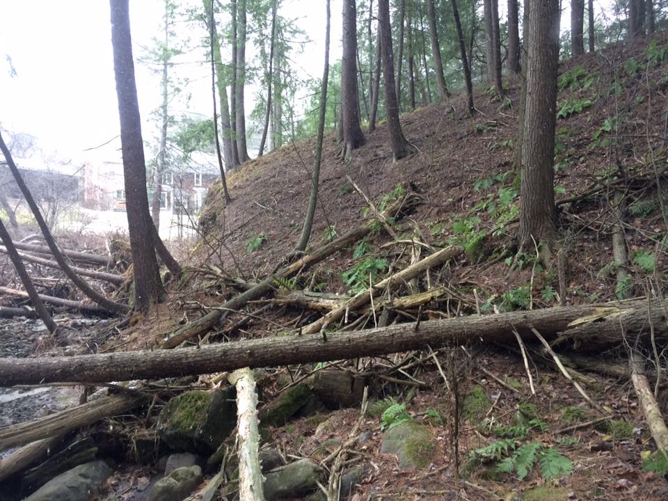
It comes with great sadness that I must report: this is the final post I’ll be submitting for the phenology project. I know, I know, all my adoring fans are quite disappointed. Where else will you all learn about the tiny hemlock forest squeezed in between I-189 and a suburb in South Burlington? Alas, it must be this way.

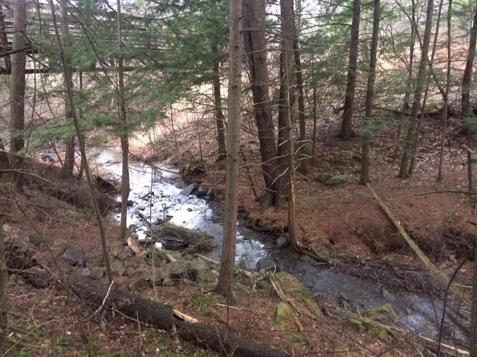
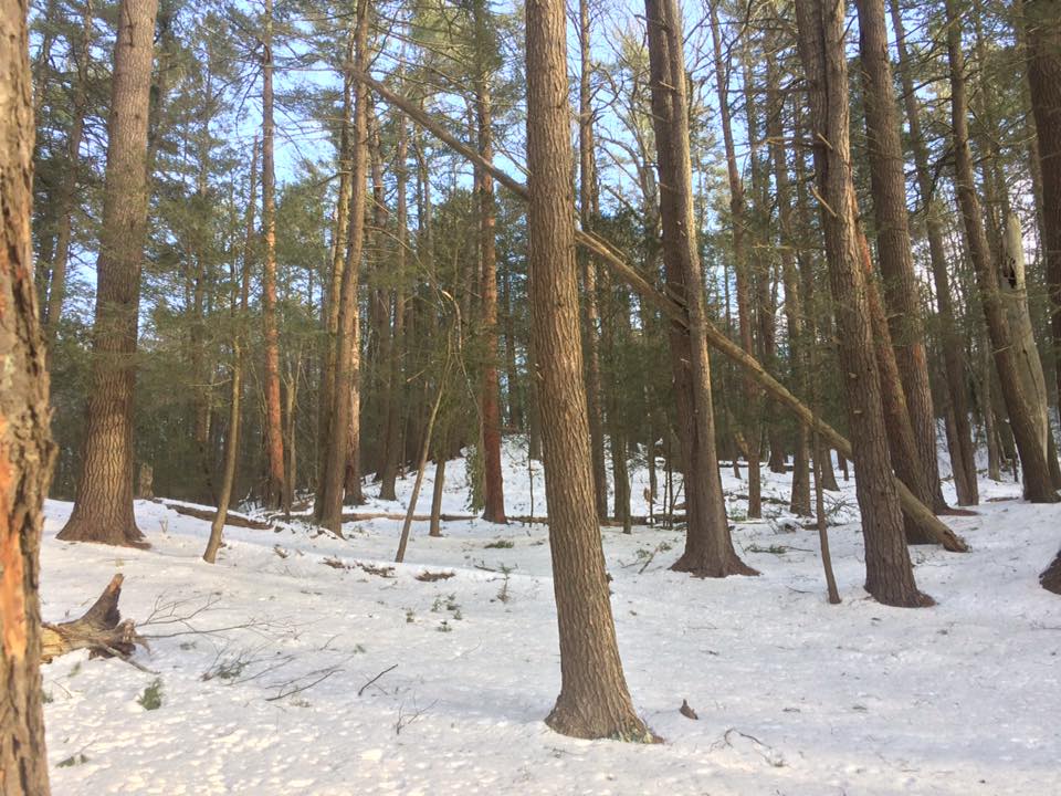
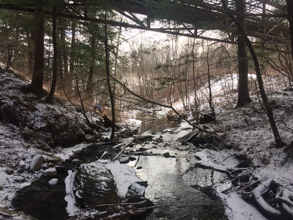
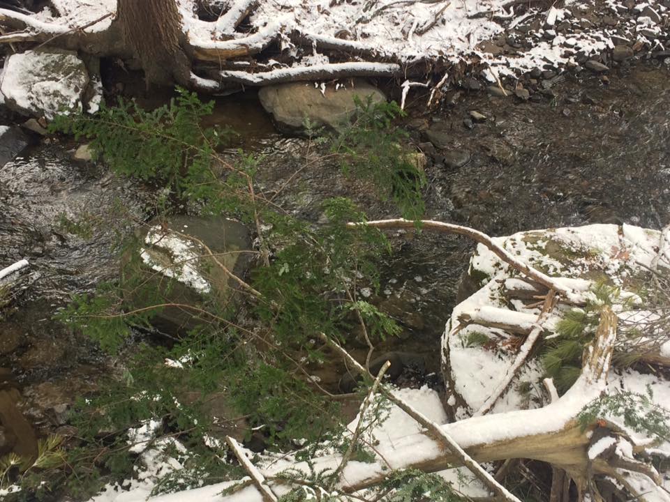
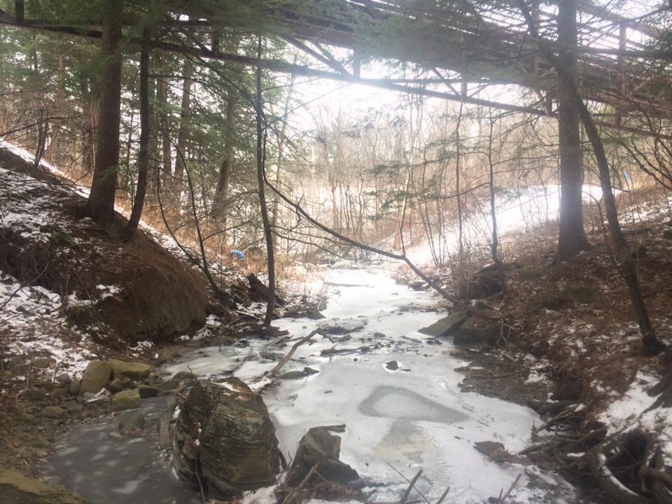
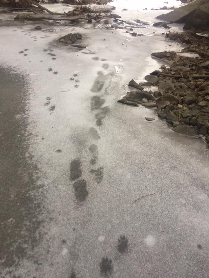
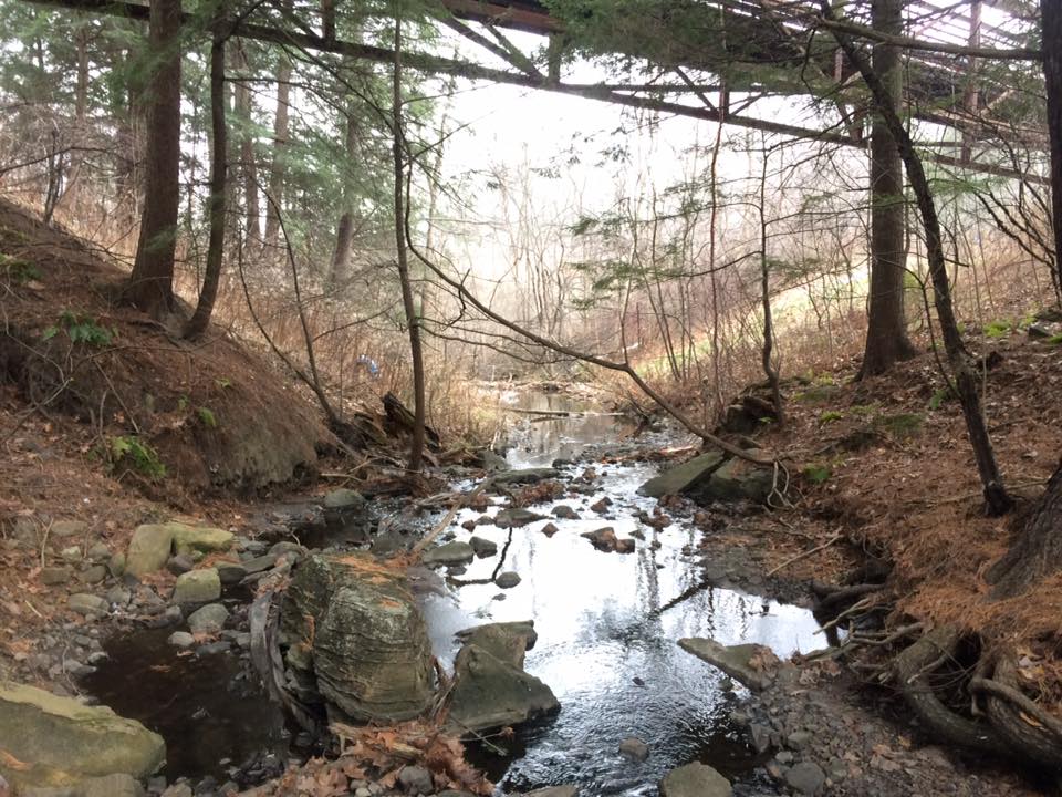
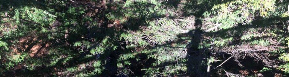
The final May tracking shot (McHale, 2017)

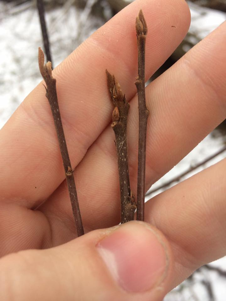
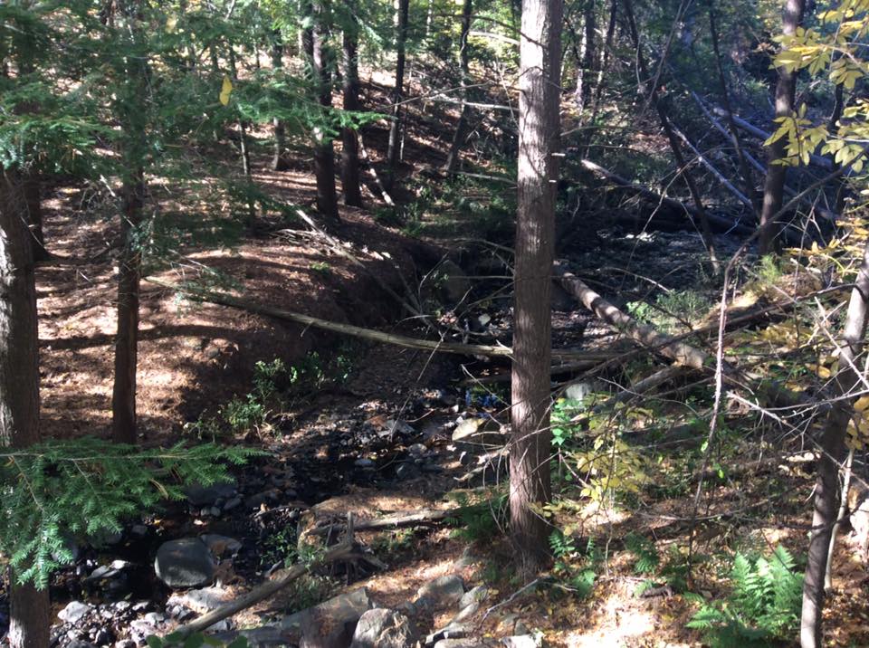
Nonetheless, it was exciting to see the new signs of spring at my site. What I presume to be the jewelweed from the fall had begun to sprout up on the banks.

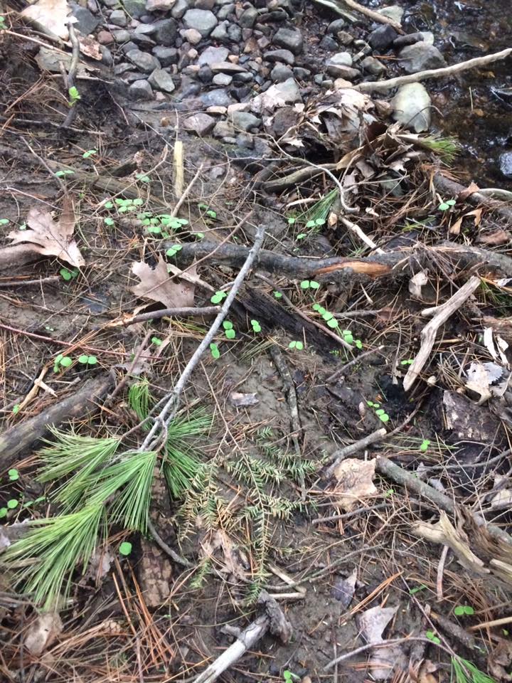
Jewelweed shooting up along the stream (McHale, 2017)

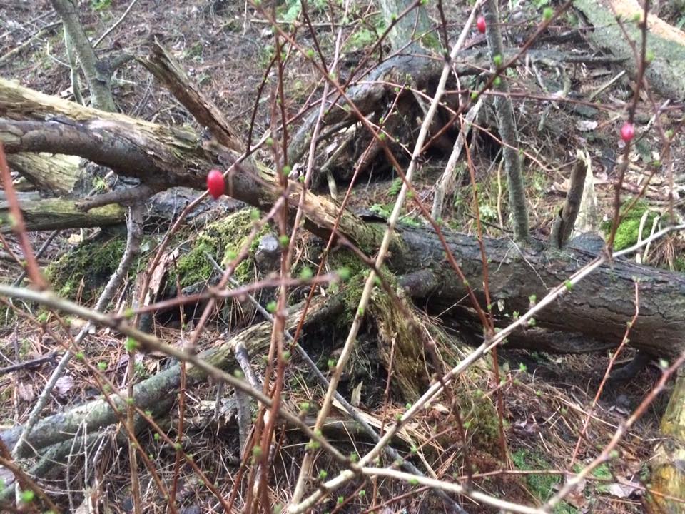
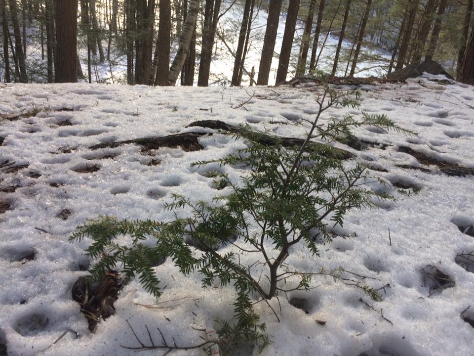
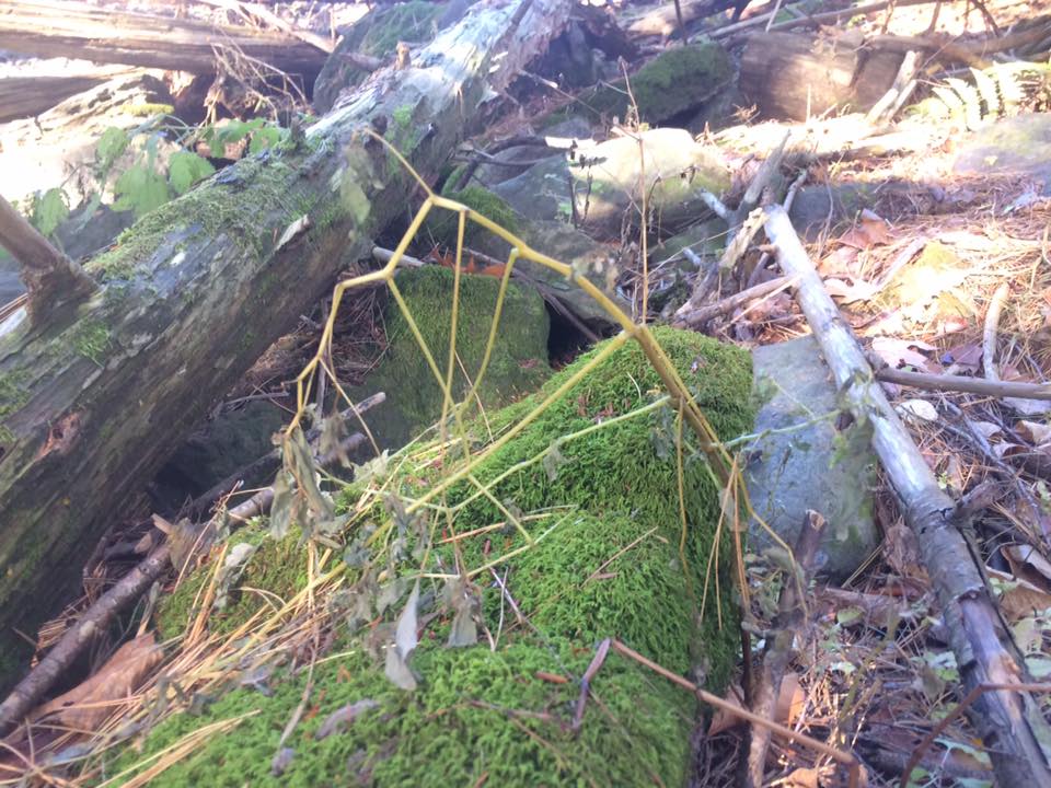
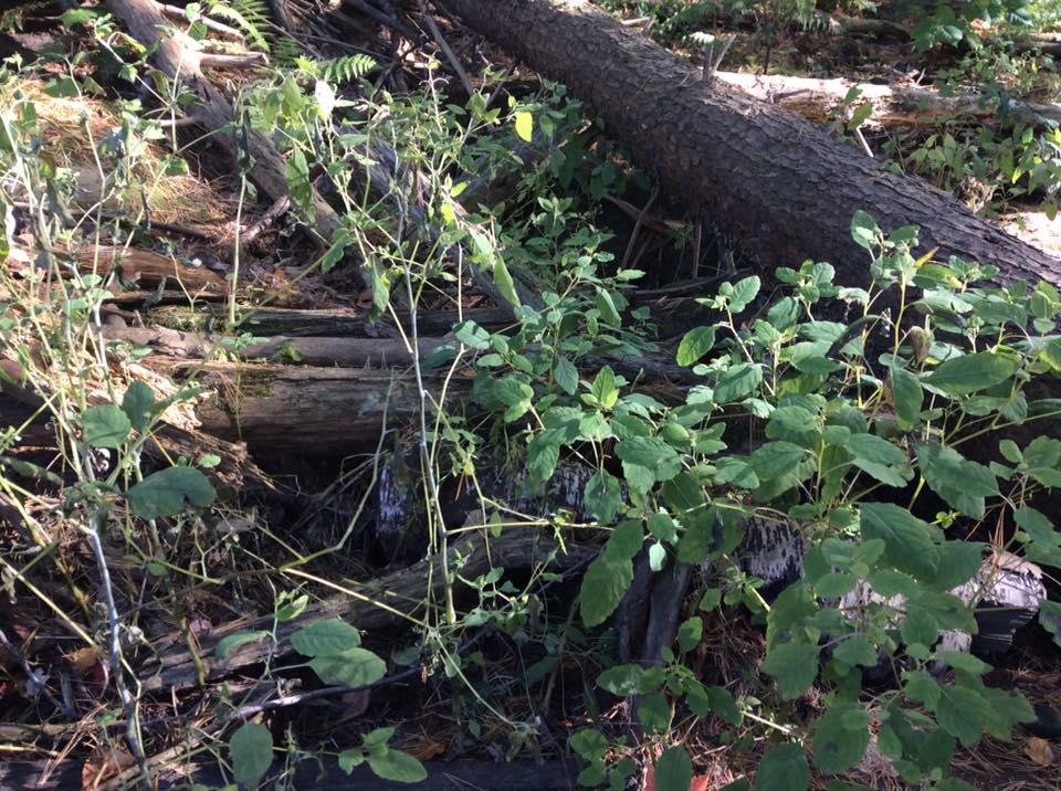
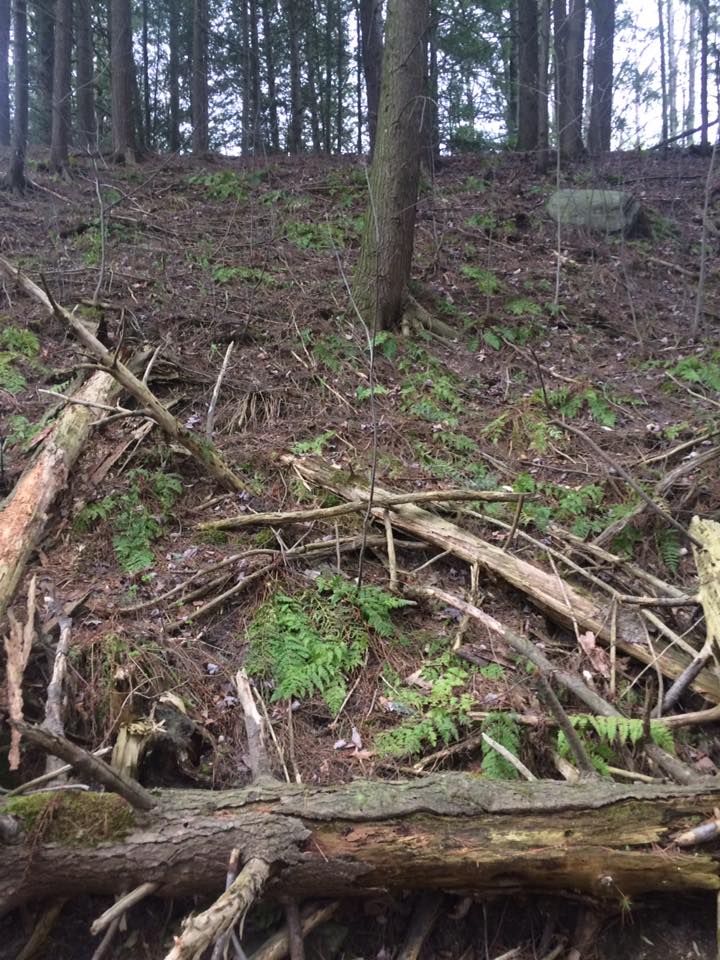
I was also psyched to see an entire section of ground sprouting up with an unidentifiable undergrowth plant. It also created one of my favorite photos on my site.

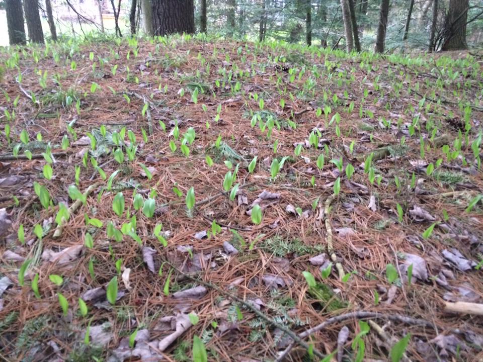
Some awesome green undergrowth (McHale, 2017)

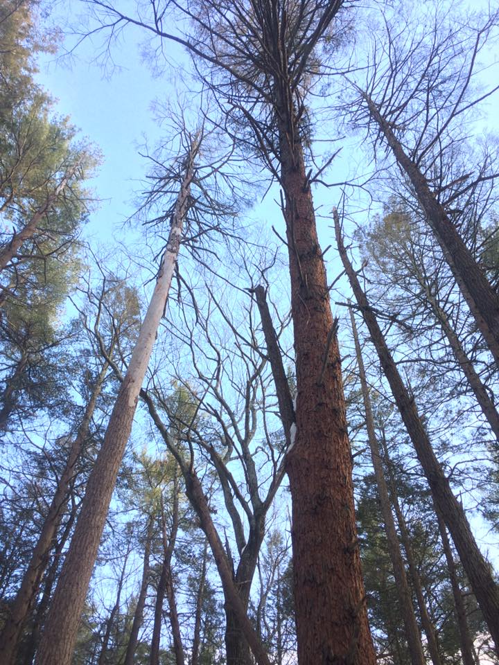
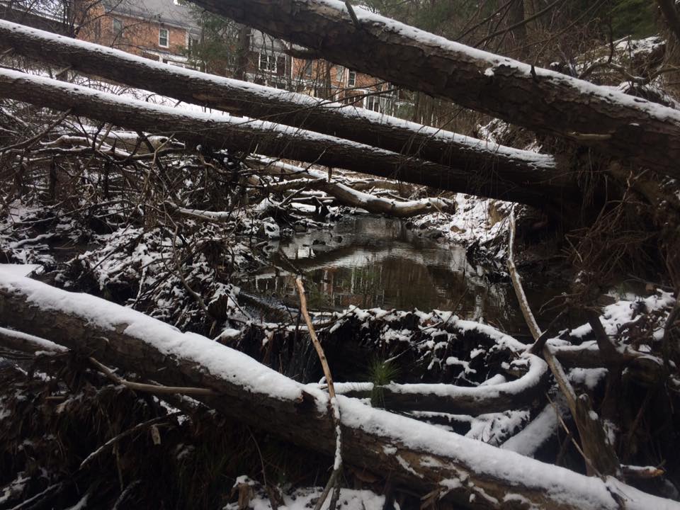
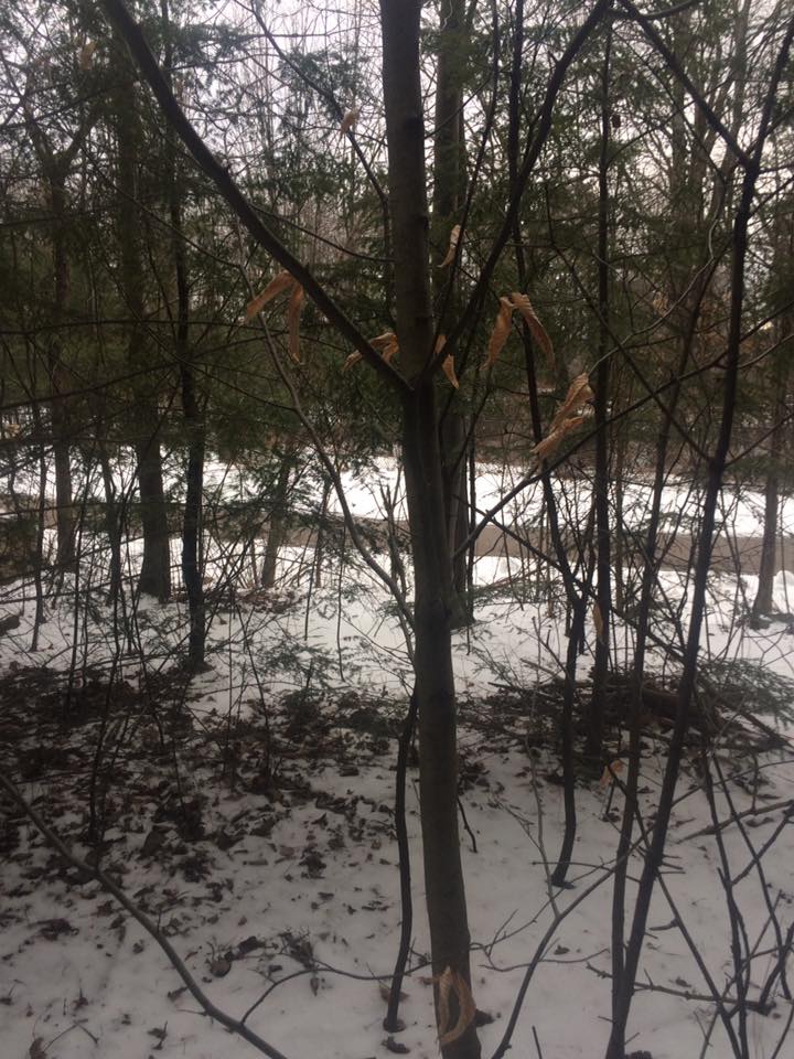
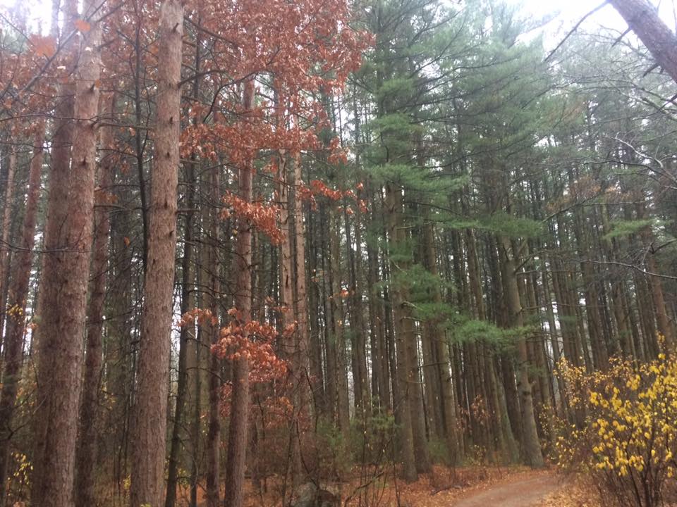
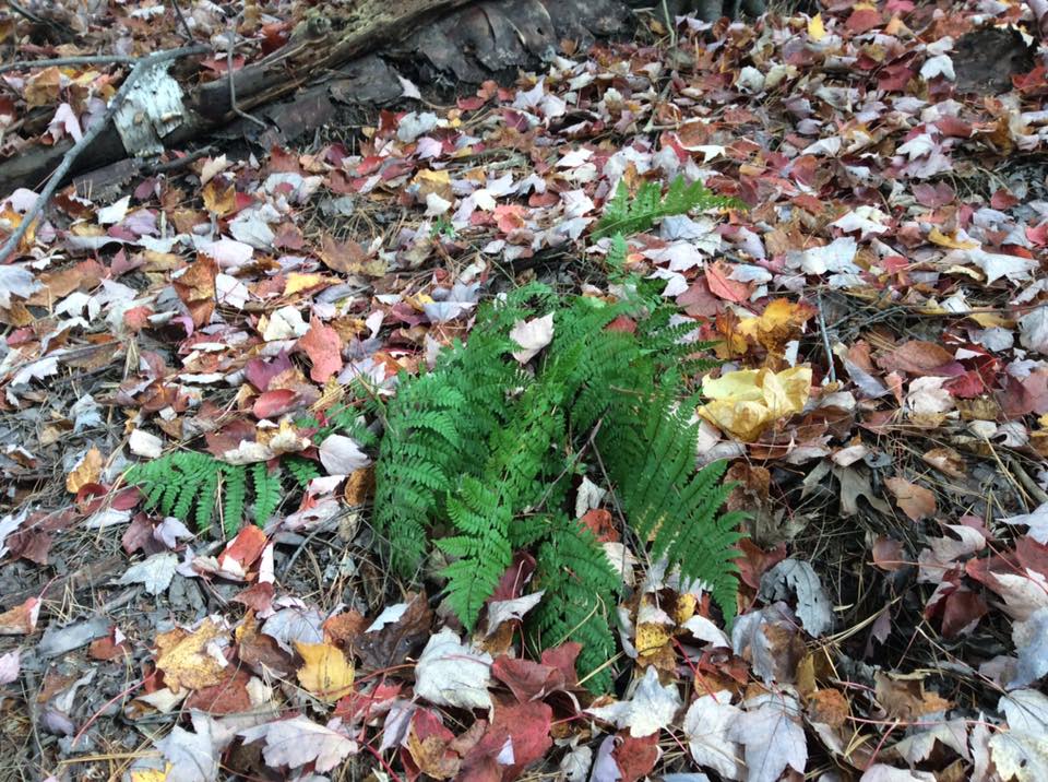
The site simply appeared greener. Some wild grasses had made an appearance. The beautiful ferns in the understory were on the resurgence too.

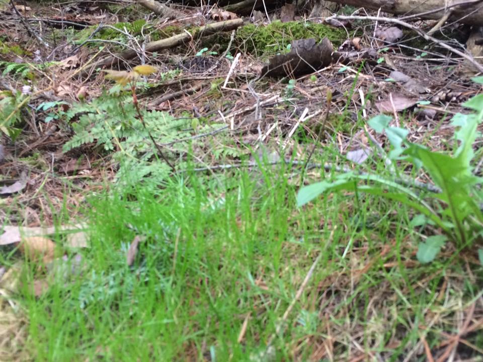
The reemergence of ferns and grasses at my site was quite…cool (McHale, 2017)

For the first time, I also had a visitor at my site. My friend Nick joined me while I observed my site. We were running a 5K using the South Burlington Recreation Path that runs over the area.

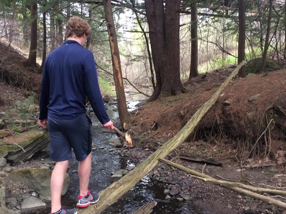
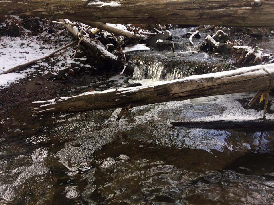
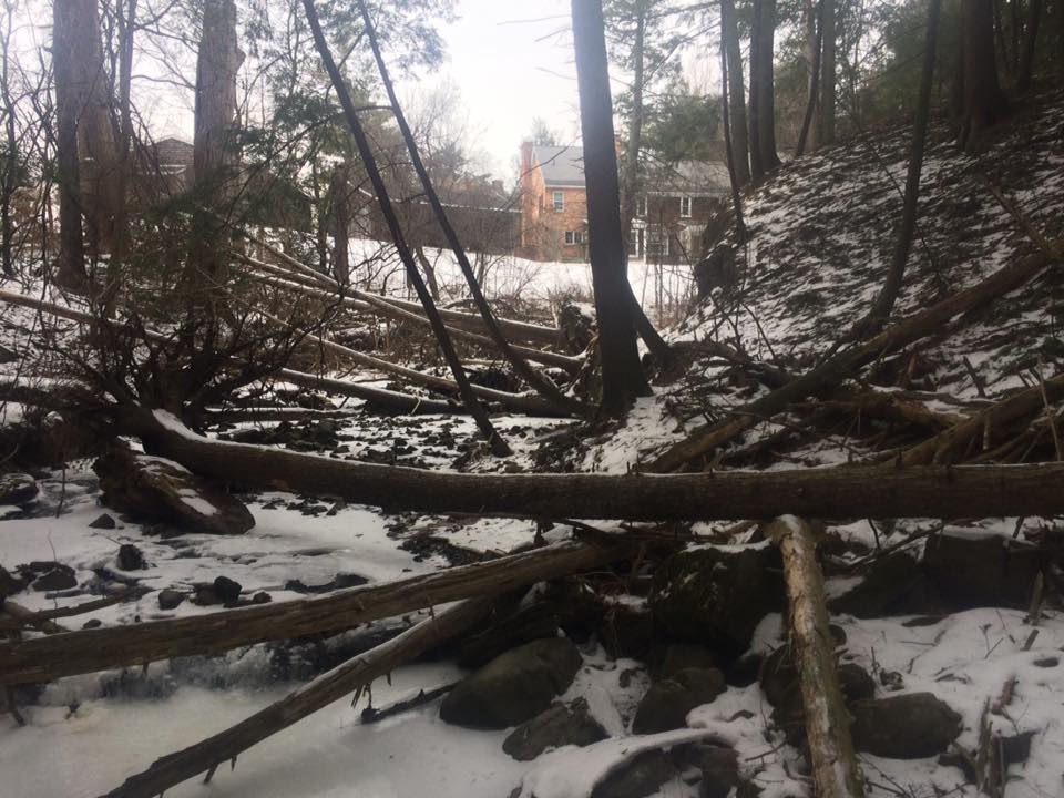
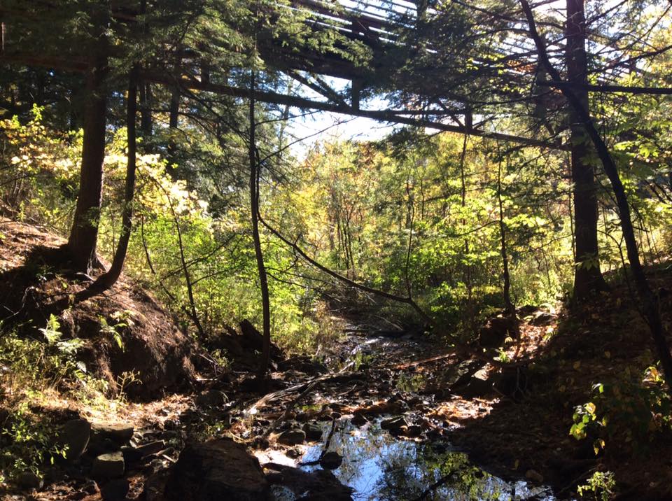
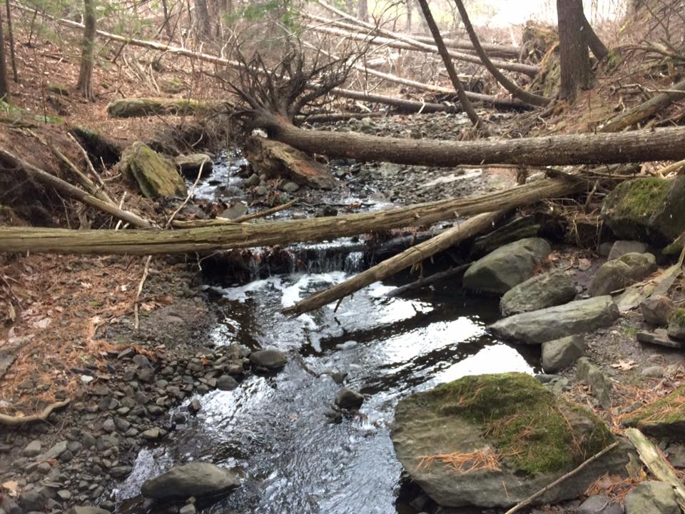
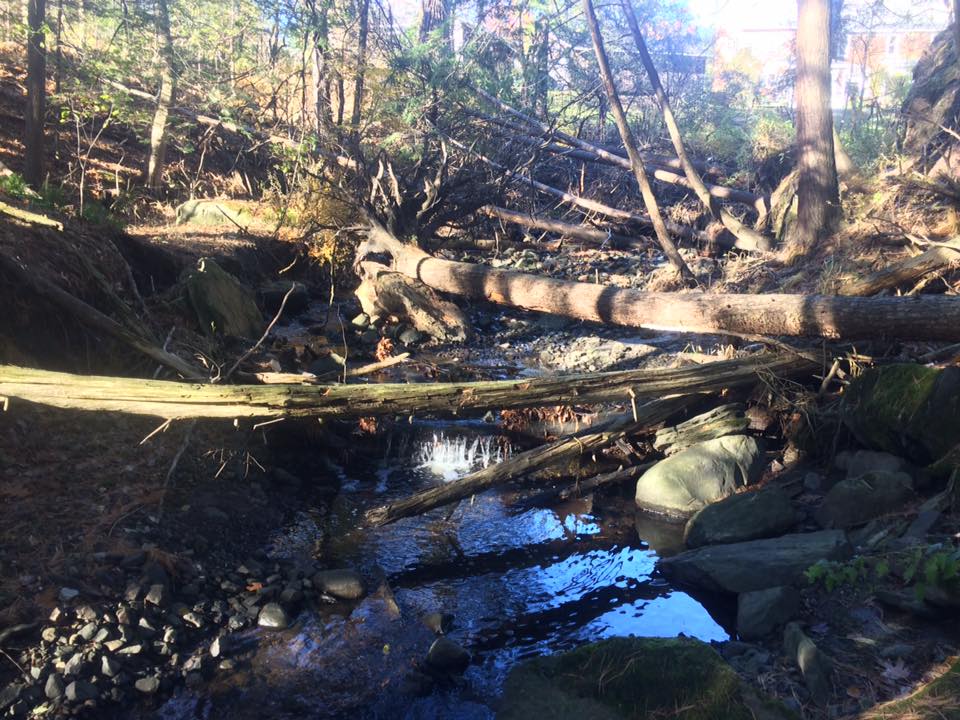
Nick decided to perform a risky stream crossing…(McHale, 2017)

In a way, my friend Nick and I running to the site demonstrates how nature and culture intertwine at my site. Nick and I decided to use the rec path because we love the nature and beauty that it brings us to, while also allowing us to stay healthy. The fact that the South Burlington Rec Path bridge is such a present and important part of my site shows and obvious connection between nature and the culture of healthy living that Vermont, or at least the Burlington area. Rather than promoting fitness in other ways, the city of South Burlington decided to create a rec path through beautiful natural areas like my hemlock forest site. While I would have preferred my site to not have been even touched, I would likely not know of its existence without the path. So, the rec path is something that to me, is equal parts annoying and awesome.

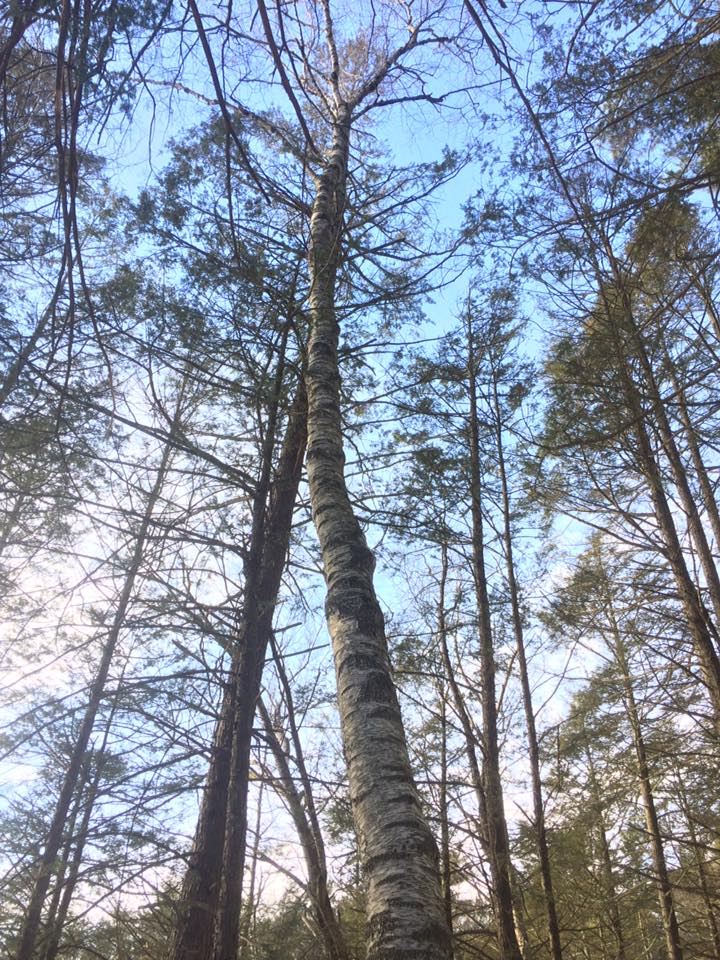
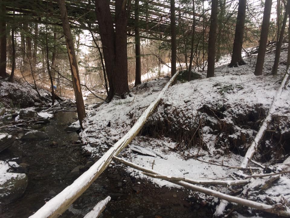
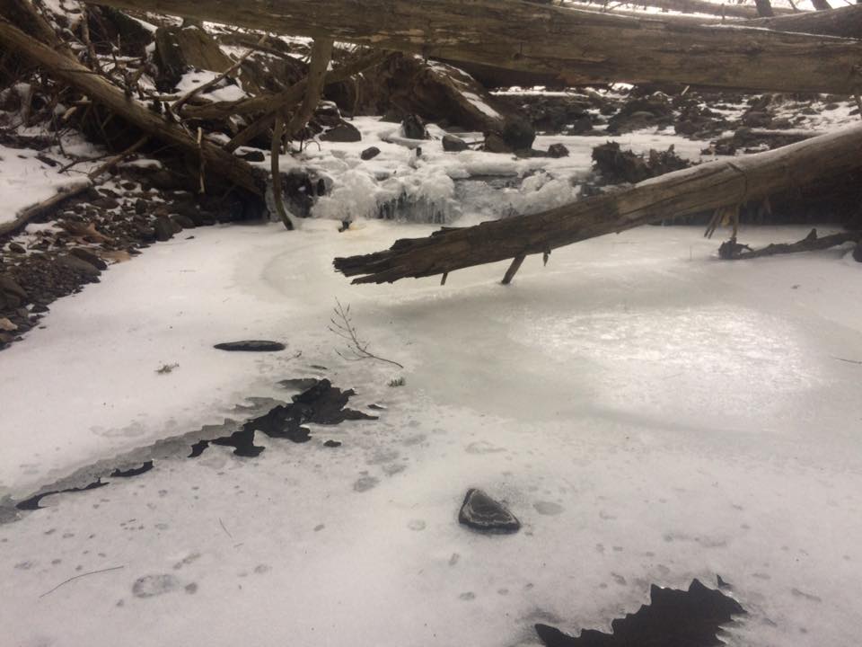
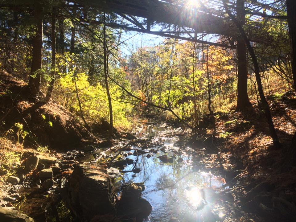
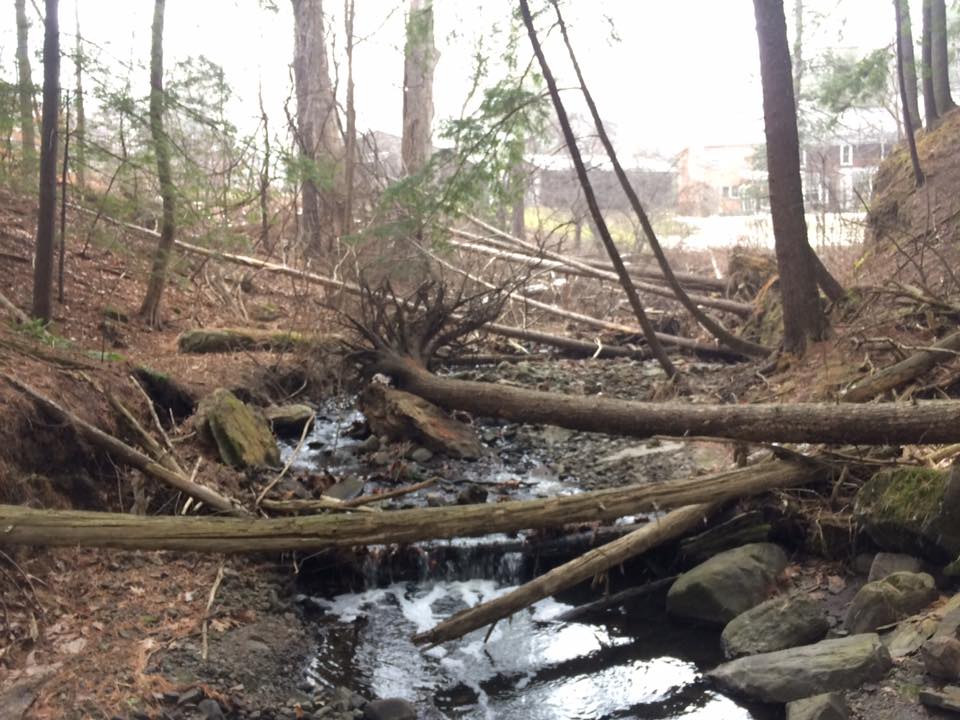
Greenery isn’t all there yet, but it is nonetheless beautiful (McHale, 2017)

For me, I’ll never truly be a part of my site. I will never truly be one with the natural environment; unless perhaps I was in Africa, where the human species originates. In Africa, I’d at least technically be within my native range. In Vermont, I am in essence, an invasive species.

I strive to be closer to nature. But, I will never be close enough to nature to consider myself one with it, or one with my site. I am a humble observer of nature’s immense power and nothing more.

Posted in Uncategorized | Leave a comment

Week 4: Spring-ing Into the Season

The tracking shot I’ve used in my past posts, the most “springy” it’s ever been. (McHale, 2017)

Visiting my site this week was probably the first week it has really felt as if spring as sprung. The signs were all there: I didn’t have to wear 3 layers of clothing and a buff on my ride over to the site, there was absolutely no sign of snow, and the plants with buds were beginning to flower.

A nice overview of my site. (McHale, 2017)

Unfortunately, I saw no signs of amphibians at my site. I did however, hear a chickadee, and I saw an American Robin zoom through site near its edge at the recreation path. I also saw no wildflowers. I know from my site visitations in September that there is a sizable patch of jewelweed that grows along the stream, however, I had seen no sign of it regenerating yet.

Some invasive barberry was first beginning to show its berries. (McHale, 2017)

Since my site is practically all Eastern Hemlocks, there is a real lack of flowering plants. However, the well established barberry and glossy buckthorn plants were beginning to flower. The barberry on the site showed its berries, and the buckthorn’s buds were beginning to expand. I also spotted a red maple bordering the recreation path with expanding buds as well.

My sketch of the red maple bud I saw (McHale, 2017)

Looking at my site with a landscape ecology perspective, I would definitely would not call it interior forest. There are plenty of nearby edges surrounding my site. To the south, is I-189 and the pedestrian path. To its west is a set of electrical lines. To its north is a medium sized suburb. To its east, the hemlock forest does continue another 100 yards or so, but then it runs into the field surrounding the Aiken Research center on Spear Street. Nearby East Woods would likely provide better interior forest habitat than my site. However, BioFinder did identify my site to be part of an important wildlife corridor. While I-189 probably prevents any significant movement of species from East Woods to my site, the continuing stretch of hemlock forest that follows the stream northeastwards has the potential to provide a valuable water source for a variety of wildlife, including large mammals.

Edges surround my site closely, including this suburb to its north. (McHale, 2017)


Posted in Uncategorized | Leave a comment

Week 3: Hemlocks, Naturally

https://www.google.com/maps/d/edit?hl=en&hl=en&authuser=0&authuser=0&mid=1YuUAB7bTVxOKfINXOaJcI2ChSoI&ll=42.64134414154343%2C-70.99652261989593&z=19

Is Eastern Hemlock my favorite tree species? Probably. Thus, I did not BRANCH out (I love tree jokes) all that much with choosing my spring break phenology site. Like my phenology site in South Burlington, I located a hemlock forest to study about 20 minutes from my house in the Boxford Wildlife Sanctuary.

A general overlook of my site (McHale, 2017)

At first glance, there were a lot of similarities between my local hemlock forest and my one in South Burlington. In both sites the majority of the trees are Eastern Hemlocks (they composed about 75-80% of the trees there), with the only other major tree species in the overstory being Eastern White Pine. Also like my South Burlington site, there is only one mature hardwood tree within the site: a Paper Birch. In both sites, there is little visible seasonal change in the tree species since the dominant species are conifers that never lose their foliage.

One rogue birch tree amidst a forest dominated by conifers. (McHale, 2017)

Furthermore, in both sites, the hemlocks suffocate most undergrowth. However, at the South Burlington forest, invasive plants like Buckthorn, Barberry, and Japanese Knotweed form the limited understory, while at the Boxford forest, invasive plants were not present, and only some Eastern White Pine saplings appeared in the understory from a small opening in the canopy.

Some feisty white pine saplings (McHale, 2017)

There are also some young hemlocks as well, of course.

A young Eastern Hemlock (McHale, 2017)

Downed woody debris are present at both sites, though in greater abundance at the South Burlington site. Though, I likely would have observed more woody debris at the Boxford site if there hadn’t been at least six inches of snow on the ground.

No invasive plants were at the Boxford site; however, the Boxford Wildlife Sanctuary is well within the range of the Hemlock Wooly Adelgid, a small invasive insect that feeds on Eastern Hemlock. The insect has been killing nearly 100% of the hemlocks within its current range. After observing the Boxford site, it was clear that it had been affected by the HWA. While the hemlocks at the South Burlington site all appear to be quite healthy, about 25% of the hemlocks at the Boxford site were dead or almost dead.

A few dead or dying hemlocks in the overstory (McHale, 2017)

There were plenty of hemlocks that were losing needles as well. The hemlocks also didn’t have the deep rich green that I saw in South Burlington. Many trees had a yellow tinge to their needles or their bark appeared more gray than brown. I also spotted a tree that appeared to have holes bored into it, which were then filled by fungi feeding on the dying tree. HWA has been known to weaken a trees defenses so they are susceptible to attacks from boring beetles. That may have been the case with a tree I spotted.

Some holy hemlock bark filled by fungi, perhaps as a result of the HWA (McHale, 2017)

Woo! More dead hemlocks. Always a bummer to see dead trees (McHale, 2017)

As if I needed any more evidence that the HWA was at my new site, I also saw its characteristic dry, white, woolly balls on the bottom of a hemlock branch.

Evidence of the HWA on the bottom of a hemlock branch (McHale, 2017)

The pines, at least, seemed to be in a quite healthy condition. Perhaps they could eventually take over the site if the hemlocks die as a result of the HWA.

Judging by the presence of mature hemlocks, and its location on the top and slope of a hill, the site was probably never developed, at least not significantly. The areas around it were most certainly farmland, however. I spotted an old stone wall cutting through the woods on my walk in to the site. An old campfire circle is found in the site, so perhaps part of the site could act as a campsite within the wildlife sanctuary.

A wide shot of the hill containing my site from across a small pond (McHale, 2017)

I spotted two birds while visiting my site, though I did hear near constant bird chatter in the overstory. Of course, my awful cellphone camera was not able to capture either of them effectively (Thanks Steve Jobs!). I first spotted a woodpecker in a dead snag. I’d like to say that it was Walter Poleman’s favorite Pileated Woodpecker. Though, it was most likely a Hairy Woodpecker since they prefer mature forests like hemlock forests, and appeared to be smaller in size than a Pileated Woodpecker.

A quality picture of a hairy woodpecker (Daniels, 2011)

I also spotted a Tree Swallow flying out of a nest in a dead snag. Once again, I was unable to capture an accurate photo, though please enjoy a picture of one produced by a professional photographer.

A beautiful Tree Swallow (Wilton, 2012)

All in all, it was interesting (and slightly depressing) comparing the two hemlock forests I selected. Though, I can’t wait to get back to my regular site.

Posted in Uncategorized | Leave a comment

Week 2: Inklings of Spring

The same shot looking south. Not too different from my previous visit besides a lack of ice. (McHale, 2017)

I have noticed numerous changes at my site since the last visit. Most notably was the state of the stream. The ice had completely melted, and it appeared to be flowing faster. This is most likely due to the snow melt from numerous days of above freezing weather. The moist soil, consistent with great Eastern Hemlock growing conditions, under a dusting of snow, appeared to be more moist than normal. It was very different from the layer of dry top soil I consistently saw in the fall. I also heard consistent bird sounds for the first time. Sadly, I did not spot any birds at my site, but judging by how loud they were, there had to be some birds nearby.

The stream was flowing quite briskly! (McHale, 2017)

I also noticed that there appeared to be more downed, woody debris strewn around my site, like this hemlock branch that landed near the river’s edge.

A downed Hemlock branch (McHale, 2017)

Despite the light snow covering, spring still appears to be on its way at my site. Patches of green, most notably a few ferns, were beginning to emerge from the snow. A major sign of spring that I saw was the development of defined buds on the shrubs in the understory. For instance, the glossy buckthorn buds were particularly interesting to me. I enjoyed how the buds almost look like wisps of dirty cotton.

Some interesting glossy buckthorn buds (McHale, 2017)

Unfortunately, there didn’t appear to be any vernal pools in my site or in the immediate vicinity. Still, the stream water had built up behind some downed logs and rocks and formed some pools of still water. Here, I’d assume, at least some of the same processes that occur in vernal pools could happen.

A pseudo-vernal pool, perhaps? At the very least it’s a pool 🙂 (McHale, 2017)

The Biofinder data showed that my site laid within an area of “Riparian Wildlife Connectivity”, or an area that could be used as connecting lands for terrestrial wildlife movement. My site was also considered “Priority” and “Highest Priority Surface Water and Riparian Area.” This doesn’t necessarily mean that my site is special though. All of the land bordering the tributary was considered high priority riparian area. A “Highest Priority Wildlife Crossing” was also found just south of my site across I-189.

The Biofinder overlay of my site. Notice the wildlife crossing just south of it. (McHale, 2017)

As for the ecosystem classifcation, my site is almost definitively a small patch of Hemlock Forest. This is because Eastern Hemlock is the clearly dominant species, with only one large Eastern White Pine to look over the site. Near the borders of the site, as you walk away from the stream bed, it transitions into Hemlock-Northern Hardwood Forest.

A Hemlock Forest with one feisty White Pine. (McHale, 2017)

All in all, this was a fascinating visit as always!!

Posted in Uncategorized | Leave a comment

Week 1 (New Semester): Snow Invasion

The same shot that I used from the previous semester, now much more snowy (McHale, 2017)

With the first phenology assignment of the new semester, I was able to witness my site with a fair amount of snow. The dense over story of the Eastern Hemlocks prevented the snow from completely covering the ground in most of the site. However, there was enough snow to identify a few animal tracks. The stream (a tributary of Potash Brook) was frozen over for the first time since last semester. I was not going to test the ice though. The stream still seemed to be flowing fairly rapidly beneath the ice.

I could see the stream still flowing strong beneath the ice. (McHale, 2017)

A view of the site looking north. (McHale, 2017)

I also noticed that there seemed to be even more debris on the ground. The only Eastern White Pine in the site had dropped some sizable branches. A winter storm that rolled through over winter break probably produced this.

My site is practically an Eastern Hemlock monoculture, so finding twigs to identify would require moving outside what I would consider to be the bounds of my site. I knew there was some buckthorn in my site, but it was oddly difficult to find a suitable twig to sketch. I headed up to the top of the stream bed where I found some mature paper birches and maples, but their twigs were too high off the ground to reach. Luckily, I discovered a small American beech to photograph and sketch the buds of.

My site is almost exclusively Eastern Hemlock, however, I was able to find a small Beech to use for twig ID. (McHale, 2017)

The beech twig in all its glory. (McHale, 2017)

My sketch of a beech twig. Notice the terminal bud, lenticel(s), and lateral buds. (McHale, 2017)

I discovered at least three animals at my site. Firstly, I found some cottontail rabbit tracks on top of the ice on the stream.

Some Cottontail rabbit tracks. (McHale, 2017)

Secondly, I found some tracks that resemble those of a gray fox; however, due to the close proximity to the pedestrian path, they are most likely those of a dog. Then again, I didn’t find any human tracks accompanying them.

Dog? Probably. Maybe a gray fox though. (McHale, 2017)

Finally, the tracks that I found all over my site were those of a small bounder, most likely a mink, since it was near or on top of water. However, it also could have been a weasel or both. I noticed that it looked like the animal had slid across the ice at one point.

Mink perhaps? (McHale, 2017)

It appears in this photo that the bounder slid across the ice for some reason…(McHale, 2017)

All in all it was a great visit. The site appeared to have gone through the most dramatic changes that I’ve seen it go through between two separate visits. I’m excited to see what comes next!

Posted in Uncategorized | Leave a comment

Final Week: Winter is Here (Season 6 of Game of Thrones)

The undergrowth has been stripped bare. Winter is practically here. (McHale, 2016)

The undergrowth has been stripped bare. Winter is practically here. (McHale, 2016)

This week I delved (or at least attempted to delve) into the human history of my site. After visiting the Special Collections section of Bailey Howe for nearly three hours, I’d be lying if I said I found anything very significant. I did however, find out some interesting information about my site.

Firstly, someone named J. Lang owned a sizable chunk of land with my site on it off of Spear Street in 1869. Judging by the forest composition, my site was never developed; at least not to a great extent. The fact that my site is practically a gully suggests that it was at least never turned into farmland. Some limited logging perhaps occurred at my site, though it doesn’t appear it was clear cut. Minus the drainage stones and the pedestrian path, and power lines surrounding it, my site has been largely untouched by humans.

One more comparison between the site over the past few weeks. A southward facing photo from the first week. (McHale, 2016)

One more comparison between the site over the past few weeks. A southward facing photo from the first week. (McHale, 2016)

The same shot, three weeks later. (McHale, 2016)

The same shot, three weeks later. (McHale, 2016)

And finally, this week, with all the vegetation stripped of its leaves. (McHale, 2016)

And finally, this week, with all the vegetation stripped of its leaves. (McHale, 2016)

J. Lang does not appear in the South Burlington section of the Child’s Chittenden County Directory of 1882-1883, suggesting that he no longer lived on or owned the land at that point. Perhaps J. Lang had moved out west like many Vermont settlers. Subsequent searches yielded nothing about J. Lang to shed light on the reasons why he didn’t appear in the directory. In 1967, the site was considered to make the site an “outdoor education classroom” in cooperation with nearby Rice Memorial High School. Damming part of the stream and forming a small pond for ice skating was also proposed. These plans never came to fruition, probably because of the nearby Interstate 189 and power lines, and the suburbs blocking the school from the site.

Even more stream flow is most likely due to recent snow melt. (McHale, 2016)

Even more stream flow is most likely due to recent snow melt. (McHale, 2016)

Winter view of the site looking northwards. (McHale, 2016)

Winter view of the site looking northwards. (McHale, 2016)

Yeah, my site history is pretty boring in my opinion. But, I find it peaceful, so it’s okay. In other news, all the hemlocks on my site appear to be healthy, and show no signs of the invasive hemlock woolly adelgid. Also, I removed the Japanese Knotweed planting that was at site, so hopefully that invasive will STAY OUT. All in all, it’s been fun time examining my site.

(1967). Natural resource inventory: prepared for the Town of South Burlington. Report no. 1: Potential recreation and conservation sites. South Burlington: Chittenden County National Resource Technical Team.

(1883). Child’s Chittenden County Directory: 1882-1883. Burlington: Chittenden County.

Posted in Uncategorized | Leave a comment

Week 4: My Hometown Forest is Pretty Rad

https://www.google.com/maps/d/edit?hl=en&authuser=0&mid=1ju8Ececn53xnygUgHUf9YE-PykQ&ll=42.55410377364256%2C-71.12473190000003&z=18

This week’s phenology site was not at my usual one in South Burlington. Instead, I examined a site in my hometown: the Council Ring in the Reading Town Forest.

Reading, Massachusetts, my hometown, is home to a 290 acre forest in the northwestern portion of the town. The town forest was, according to my town’s website, largely created in 1930, when Boy Scouts and other interested citizens planted 100,000 spruce, balsam, and red, white, and scotch pine trees. I ventured deep into this abnormal evergreen forest to compare it to my Vermont site.

On the walk in to my site I saw a dramatic divide between Eastern White Pines and Red Pines, indicative of human planted trees

On the walk in to my site I saw a dramatic divide between Eastern White Pines and Red Pines, indicative of human planted trees. (McHale, 2016)

The Council Ring, where I centered my site, is a clearing in the middle of a eastern white pine grove. The site is used frequently by local Boy Scout troops, and perhaps because of it, there is almost no undergrowth except for some glossy buckthorn.

The Council Ring. The area is used frequently by the Boy Scouts (including my troop a number of times). A number of Eagle Projects are present in the forest, including the benches pictured around the fire circle.

The Council Ring. The area is used frequently by the Boy Scouts (including my troop a number of times). A number of Eagle Projects are present in the forest, including the benches pictured around the fire circle. (McHale, 2016)

Some limited buckthorn undergrowth, but that's about it

Some limited buckthorn undergrowth, but that’s about it. (McHale, 2016)

My South Burlington site also had a buckthorn undergrowth presence and a predominantly evergreen overstory, but the similarities end there. The Town Forest site is a near monoculture of Eastern white pines, while my South Burlington site has a greater variety of species including Eastern Hemlock, Jewel weed, and Maples and Birches further up the stream banks.

Another view of the Council Ring.

Another view of the Council Ring. (McHale, 2016)

Pretty much nothing is growing here besides Eastern white pines...

Pretty much nothing is growing here besides Eastern white pines… (McHale, 2016)

Also, the sense of place seems to be stronger in Reading. The town forest is used so much that there is greater appreciation of it, and the resources it provides. My South Burlington site meanwhile, stuffed between I-189 and a suburban neighborhood, is largely ignored. Plus, minus some drainage rocks and the bridge extending over the site, there is little human presence in the South Burlington site.

Some dead trees are marked with white x's, indicating that they be removed through some forest management practices.

Some dead trees are marked with white x’s, indicating that they be removed through some forest management practices. (McHale, 2016)

The lack of undergrowth, numerous Eagle Projects in the forest, the large fire ring, and forest management practices indicate there is a real human presence in my Reading site. Nonetheless, both of them are beautiful locations!

She's a brick! House! Some bricks left behind are probably the remnants of previous campers violating 'leave no trace' principles.

She’s a brick! House! Some bricks left behind are probably the remnants of previous campers violating ‘leave no trace’ principles. (McHale, 2016)

Posted in Uncategorized | Leave a comment

Week 3: Winter is Coming

Game of Thrones references aside, it appears that winter is coming to Vermont, and my site is feeling it. It seems like my site is already shifting to more winter style vegetation. The Eastern Hemlocks, as expected, haven’t changed since the first visit. The vegetation underneath, however, has already begun to wither and die. The jewelweed for example, which at one point, lined the banks of the stream with abundance, has largely wilted and died. The Buckthorn and Barberry has also continued to yellow and lose its leaves. The stream itself has appeared to increase in volume again, following another rainy week in Burlington region. There were now some appearances of white water in the riffles of the stream that I hadn’t noticed before. The extent of the water had also increased, flooding the rocky bottom stream bed at the northern part of the site.

Notice the appearance of white water as an indicator of greater stream volume

Notice the appearance of white water as an indicator of greater stream volume. (McHale, 2016)

A southward facing photo from the first week. (McHale 2016)

A southward facing photo from the first week. (McHale, 2016)

The same shot, three weeks later. Notice the greater stream volume and yellowing of vegetation.

The same shot, three weeks later. Notice the greater stream volume and yellowing of vegetation. (McHale, 2016)

A shot of the wilting jewelweed. See you next spring!

A shot of the wilting jewelweed. See you next spring! (McHale, 2016)

The more water appeared to flood the rock and gravel bed, and form a small pool adjacent to the running water

The more water appeared to flood the rock and gravel bed, and form a small pool adjacent to the running water. (McHale, 2016)

This week I also sketched an event map showing some of the thoughts I had at my site and some of the events that occurred there, in an artistic manner. Please enjoy!

The "Event Map" of the Potash Brook tributary

The “Event Map” of the Potash Brook tributary. (McHale, 2016)

Posted in Uncategorized | Leave a comment

Week 2 of Site Examination

This week’s visitation of my phenology site brought a few changes. The stream appeared to be flowing faster and with greater volume due to the previous few days of rainfall in the Burlington area. Also, with regards to the vegetation, the some of the jewel weed (the unidentified plant from last week) appeared to be shriveling up and dying. The invasives, the Japanese Knotweed, Buckthorn, and Barberry, were also all yellowing, likely in accordance with the changing season.

A birds-eye sketch of my site

A birds-eye sketch of my site

Barberry appeared more yellow than last week

Barberry appeared more yellow than last week

Perhaps it was because I did not know what to look for, but I did not see much for wildlife or signs of wildlife at the site. I did see some trampled ferns that could have been squashed by a deer or other large mammal, but judging by the proximity to a pedestrian path, it could have just as easily been a human who wandered off the path to explore the forest. I did see two squirrels mingling among the hemlocks, however. A bird call directed me to the left bank of the stream where I spotted a cardinal sitting on one of the larger hemlocks.


These trampled ferns could have been the result of human activity

These trampled ferns could have been the result of human activity. (McHale, 2016)

While I am not competent enough to take a photo like this one, a cardinal was spotted.

While I am not competent enough to take a photo like this one, a cardinal was spotted.

Sherony, D. (2007, April 6). Northern Cardinal (Cardinalis cardinalis) [Digital image]. Retrieved December 9, 2016, from https://www.flickr.com/photos/9765210@N03/2587737594

Posted in Uncategorized | Leave a comment

Welcome to My Phenology Site!

https://www.google.com/maps/d/edit?hl=en&authuser=0&mid=1ZGAVWTQ7odFZq2zqIYa2T0FN9FY&ll=44.45118497355105%2C-73.19495740000002&z=18

Hello and welcome to my phenology blog! As part of my NR1 assignment, I will be exploring a specific site in the Burlington area for the next few weeks. The site that I chose is centered around a tributary of Potash Brook in South Burlington. I-189 is immediately to the south of the site, and a small residential neighborhood is immediately to its north.

The site is directly south of the UVM campus. To access the site, pick up the South Burlington Recreation Path next to the Gutterson Field House, and follow it south for about 1.5 miles. Stop when you reach a distinct wooden bridge that crosses a shallow stream. Venture off to the right of the bridge and down the hill that surrounds the stream, and you have found my phenology site.

While I find my phenology site immensely peaceful, I would be lying if I said I did not choose it for purely practical purposes as well. I had a couple practical reasons for choosing my site. Firstly, the site is very close by, and less than 10 minutes away by bike. Secondly, the Burlington Rec Path is a simply beautiful bike ride. Thirdly, the site is on its way to Chipotle, which is a favorite addiction of mine. Also, I wanted to choose a site that no one else would have, and venturing outside of the Burlington town boundary was a good way of ensuring that.

There are moderately steep hills on both stream banks at my site. The most dominant tree species at the site is definitely Eastern Hemlock. The hemlocks line the left and right sides of the banks, and provide a fairly large shady area. There are some maples, birches, and green ash trees farther up the hill from the stream bank. The stream is crisscrossed with numerous downed trees, which is likely a result of erosion. For undergrowth, I saw numerous Glossy Buckthorn growths, some ferns, and a few Barberry and Japanese Knotweed plantings. I also noticed one low-lying vegetation species that lined both banks that I could not identify.

More site updates are to come! 


phenology-unidentify-species

A plant species I saw a lot of but could not identify (McHale, 2016)

phenology-pic1

A view from the top of the bridge. (McHale, 2016)

A photo of the site looking south

A photo of the site looking south. (McHale, 2016)

Posted in Uncategorized | Leave a comment