That’s a Wrap, Folks!

This last time around when I visited, there was no more of that pesky snow like there was when I visited in April. There were also many more birds and small animals roaming around that are migrating back up or are coming out from hibernation. The trees are budding and the leaves are starting to come out. Everything is starting to turn green again and it’s so pretty and wonderful. However, the annoying mosquitoes and flies are coming back out again which is the only awful part about spring… well that, and the humidity. I had forgotten how much I despise both of those, but the constant rain and few thunderstorms cool it down every once and a while and it goes back to being perfect weather again.

Nature and culture definitely intertwine at my place because not only is there so much history from what had happened in the past at this place in Centennial Woods, (which you can read about in my other blog post – History of My Phenology Location), but there is also so much happening currently. Centennial Woods should put some kiosks up with some information because the rich history of this place plays a key role in all of the activity going on now and people should be informed about the culture of this location and how it connects to the diverse ecosystem and all of the nature that lives within these borders.

I consider myself a part of my place, but not a huge part. I have only visited this location a couple of times compared to the people and animals who roam here everyday exploring it’s every nook and cranny. This location will always resonate with me and I will always have a sweet spot for it in ways I can’t say about other locations. However, with spots back home that I did visit almost everyday for years and that I would go to in times of happiness and sadness, this place does not have that big of a spot on my heart and vice versa. So I do think that I consider myself a part of my phenological place, but not as big a part as others have on this location. Although, I will come back and visit to catch up wit my place and see how it and everything around it is doing, like catching up with an old friend you haven’t seen in a while.
Snow in April?!

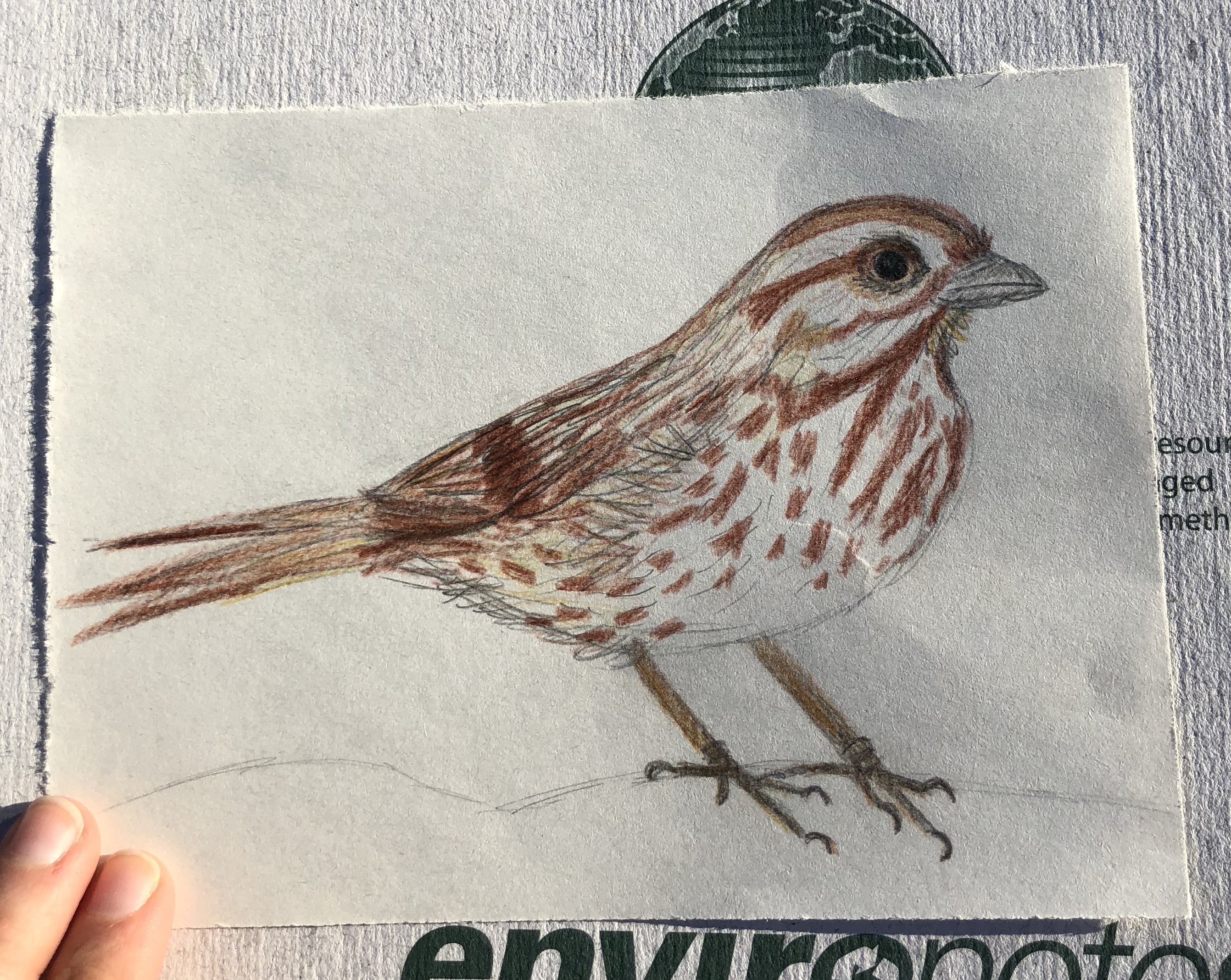
I am just as surprised as you are! When are we going to be able to see the flowers and trees start budding and blooming? When are the animals – like amphibians and hibernators – going to start coming out so that the woods can become alive again? The only signs of life are the trees starting to bud, animal tracks, and birds that are starting to migrate back. You can hear the first of the songbirds that have undertaken the long journey here to cold Vermont. Their songs echo through the empty, white forest that is slowly becoming green. Right now you can only see the green of evergreens and some tree buds that are trying to beat out the winter like maples and oaks, however there are no signs of any flowers or plants trying to break through the snow except for little evergreen saplings. Since the nearest edge is about a quarter mile back up the trail to the road, there aren’t really any edge effects which provides an “okay” habitat for many forest interior species. Since the main road is in pretty close proximity, my location does not provide the best habitat for animals like birds and deer who need a good expanse of interior habitat in order to thrive, however, it is far enough away that some habitats are able to be formed within the area. I have posted some photos on the Photos page of this blog site from today, and the drawing below is of a Song Sparrow I saw hanging out by the river bead.

Spring Break Phenology Spot

I visited the George Lewis Memorial Trail which is part of the Wolbach Farm reservation. Wolbach Farm is part of the larger Great Meadows ecosystem along the Sudbury River, much of which is owned and managed by the U.S. Fish and Wildlife Service’s Great Meadows National Wildlife Refuge. Sudbury Valley Trustees’ Wolbach Farm offers a diversity of woods, wetlands and field for exploration. The oak-hickory-pine forest straddles the rocky hill behind the main house. Along Winter Brook, there is a rich diversity of wetland plants and some very large trees, including sycamore, black birch, and black and red oaks. The fields behind the barn grade from a very dry little bluestem grassland to a wet meadow with many wildflowers including willow herb, goldenrod, swamp candles and bugle weed.

Anna and Burt Wolbach purchased the property known as Wolbach Farm in the 1910s. At the time, most of the property was used for a dairy farm, though the lower fields near the barn were used for horse pasture. The area was most likely cleared for pasture in the 1800s with the exception of the stream corridor and seepage slopes. The Wolbach’s converted the farm from an active dairy farm to a gentleman’s farm. The lower field continued to be maintained for horses. In the 1930s, during the depression, both the Wolbach family and the Newton family next door employed people to plant red pine, Norway spruce and eastern hemlock in previously pastoral areas on the grounds surrounding the house and barn. John Wolbach, Anna and Burt’s son, left this 54 acre property to Sudbury Valley Trustees in his will. SVT took ownership of the property in 2002. John Wolbach’s wishes were to preserve the land “predominantly in its natural, scenic and open condition.” For added protection, Mr. Wolbach provided that The Trustees of Reservations hold a conservation restriction over the property as well.

The trees and other plants that reside in this area are the ones previously listed in the history above, along with: eastern white pine, paper birch, thorny greenbrier, nodding trillium, red baneberry, and doll’s eyes (which appear in the Riparian corridors), and the occasional white oak, red cedar, or a sapling of a sugar maple, red maple, or American beech. You can also see some spice bush close to the wetlands area and some black gum trees within it. The invasive species in this area are buckthorn, oriental bittersweet, Japanese barberry, multiflora rose, purple loosestrife and certain varieties of honeysuckle.

You can see and hear the activity of the local winter birds within this area. The birds that I have seen in this area include: mourning doves, cardinals, chickadees, goldfinches, dark-eyed juncos, hairy woodpeckers, downy woodpeckers, pileated woodpeckers, red-bellied woodpeckers, northern flickers, white-breasted nuthatches, tufted titmouse, and great horned owls.


Pictures of My Wolbach Farm Site

Google Map Link of My Wolbach Farm Site

Sources:

https://www.svtweb.org/sites/default/files/property/map/wolbach.pdf

https://www.svtweb.org/properties/page/wolbach-farm-sudbury

Using BioFinder to Analyze My Spot

According to the Wetland, Woodland, and Wildland, I would classify my place as a Hardwood Swap Natural Community, and more specifically a Red Maple- Northern White Cedar Swap. I think this would most accurately describe my place because when walking in and around my spot, I not only noticed a lot of hardwoods, but also a lot of red maples and a few cedars. What helped me identify my natural community was the fact that my spot was definitely a forested wetland, and that surrounding and within my spot are mostly hardwoods, not shrubs or softwoods.

It has warmed up a little since the last time I visited my site, so a bit of the snow has melted, but as of right now it is flurrying and we are supposed to get another huge snowstorm soon. The river has melted a little so there are more signs of life, however I have not heard any birds yet except for the occasional crow or seagull flying overhead which is very odd. I have also not seen too many tracks mostly because of the melting snow or human and dogs tracks covering them. Overall not too many phenological changes have occurred at my place since my last visit.

Using the BioFinder, I discovered that in parts of my place and around my location in Centennial Woods, there are spots that are the Highest Priority on the Community and Species Scale and the Landscape Scale from the Vermont Conservation Design. There were also a bunch of other things within Centennial like Class 1 and Class 2 Wetlands and Highest Priority Wildlife Crossings. There were also other Community and Species Scale and Landscape Scale Components including: Rare Animal Species, Rare Natural Communities (Wetland and Upland), Riparian Wildlife Connectivity, Highest Priority Surface Water and Riparian Areas, Priority Interior Forest Blocks, and Representative and Responsibility Physical Landscapes.

Animal Tracks After a Fresh Dusting

I have returned to my phenology site from last semester after a long hiatus. After a few months and numerous snow falls, freezes, and thaws, my spot has seemed to become a completely different location. Everything looks so drastically different covered in snow and ice. The hill leading down to the tip of the peninsula has frozen over and it is now very difficult to venture down to this area. I was slipping and sliding all over the place on the way down while I was trying to be precarious and not step on anything that looked close to being a footprint or a track of some kind. This was one of the most difficult feats that I have encountered thus far, and I even almost fell into the water at the bottom of the slope because I couldn’t catch myself quick enough. However, if I would have fallen in the water, I would have just slid on some ice because the stream was frozen over enough to stand on which I figured out later in my journeys. Due to the ground being frozen over and having snow on top of the ice, following the animal tracks was tricky, however I was able to follow a pair of tracks which led me all over the woods. Unfortunately, I was not able to find any scat or any other remnants of what I thought was a weasel (but I have no clue because I’m awful at tracking), but I was able to find two holes in the ground that it’s tracks ultimately led me to. I was only able to find the tracks of a weasel (or a mink) and a dog, but I think I also found some other tracks (which I will include on the photos page) which I was unable to identify. I also was able to get some twigs  to try and identify the tree species (which I will identify in the photos section), but I was unable to reach some of the more prominent trees in the area since those were super tall and well developed. Overall it was a kind-of successful trip, also sort-of disappointing, since I wasn’t able to find more animal tracks, but I will try and go back soon after the next snowfall and see if I can find some more animal tracks!

History of My Phenology Location

Centennial Woods is made up of 70 acres of diverse habitat, this includes mixed hardwoods, conifer stands along with streams, fields and wetland area. Located within Burlington it is right next to the UVM campus, being on of the most visited of UVM natural areas. Used for academic study, students in Environmental Studies, Botany, Zoology, Forestry, Recreation Management, and Education use this areas vast array of trails to look at the natural ecosystem and landscape features found here. Looking into the history of Centennial Woods shows a complex history of different uses, through the time periods. Going back about 10,000 years the sandy soil that is found throughout the area can be traced back to the Champlain Sea. It was deposited from the delta of what would become the Winooski River. As the Abenaki were living by and along the Winooski River it can be assumed that they were in Centennial Woods pre-European settlement. A 1998 University of Vermont Archaeology class discovered a 2,800 square foot site that contained evidence and examples of Native American tools. Numerous stone tools were uncovered, the biggest artifact being a four inch long stone spear head. The land was then owned byFred Fiske, C. Baxter Est., H. Stevens, Hickok Est. who most likely used the land for agricultural purposes. This would explain the barbed wire and stonewalls as well as similar aged trees. Although now the forest is one of the oldest in the area it still isn’t a old growth forest. Most surprisingly, during the mid 1900s, Centennial was used as a ski resort. The South Burlington Kiwanis Ski Area occupied the land in the winters of 1962 until 1967, when the area was destroyed by arson. The ski slope included a 500 foot tow rope, wooden tow shack, and flood lights donated by South Burlington High school. Only charred remains are visible today. The land was officially designated a UVM Natural Area in April 1974.

Also check out my last post of photos for Fall Semester here! Sadly, there hasn’t been any snowfall yet!

Sources:

http://www.uvm.edu/~uvmsc/Centennial%20Woods/UVM_Natural_Areas_1974001.pdf

http://www.uvm.edu/~uvmsc/Centennial%20Woods/Changing_Landscapes_Centennial_Woods

http://www.uvm.edu/~uvmpr/vq/vqfall99/inbrief.html

http://www.nelsap.org/vt/sburl.html


Thanksgiving Phenology Site

My phenology site from back home is very interesting because it is now in a Wildlife Refuge, however, it used to be a part of Fort Devens during WWII as a training facility. Initially, this area (Assabet National River Wildlife Refuge) was settled by Native Americans that had established villages. The landscape offered great fishing opportunities and subsistence living. Land use in New England started to change with the onset of King Phillip’s War in 1675 and English colonization. The area was transformed into a farming community and agriculture become quite prosperous. One famed farmer included Henry Ford founder of the “Model T”. The remaining stonewalls that bisect the refuge are visual reminders of the farming history. In 1942, the United States Army purchased the property from landowners to establish the Fort Devens Sudbury Training Army bunker Jan Wright Annex. During the years of military ownership, the land became a storage area for ammunition and a training location for troops. Although the refuge is located in a largely-developed area, it has been protected by the Army since 1942. That protection has allowed the maturation of extensive, diverse wetland habitats whose ecological integrity is enhanced by its surrounding forests and grasslands. The refuge was established in 2000, when the Army transferred 2,230 acres to the Service. This transfer was made under the Defense Base Closure and Realignment Act of 1990, for its “particular value in carrying out the national migratory bird management program.” Remnants of the Training Annex remain, including: army bunkers, barbed wire, rusty fencing, some brick chimneys from houses, paved roads and telephone poles, among other things.

My location is on one of these main transport roads, not really anywhere near anything fancy including those remnants, but it is on a bridge over a man made concrete pond divider (or at least that’s what I think it is). My spot is surrounded by a pond on both sides, with a partially tree and bush-lined road dividing it. The trees on this road are mostly Eastern White Pines with maybe one or two White Oaks thrown in there. There are also a lot of dead trees in the pond which look like pines of some kind just based on their appearance. Since the land around this area was used as farmland and then replanted to provide tree coverage, a lot of the trees are Eastern White Pines, Red Oaks, White Oaks and occasionally you will see a maple (usually red or sugar). The only other outlier that I have seen a few of are Pitch Pines which are large and super fascinating and very pretty. There aren’t a lot of hardwood invasive species in Assabet that I know of, but when I do volunteer service there with a bunch of the staff and other volunteers, we take out a lot of bush non-native, invasive species (non-hardwoods) including Japanese Knotweed, Black Locust, Spotted Knapweed, and occasionally Bittersweet when they overgrow the area because the berries provide no nutritional value for the birds in the area. My area is home to many animals including beavers, woodpeckers, hawks, song-birds, herons (usually blue), muskrats, deer, bears, squirrels (red and grey), chipmunks, snakes, ducks, swans, turtles including the occasional extremely large snapback, owls and pretty much anything else you can imagine. I keep coming across new species of animals every time I enter the refuge which is half of the fun, discovering new animals you didn’t know resided in the area. My location in the Assabet National River Wildlife Refuge is just a very small part of the overall ecosystem of this area and I am very lucky to be able to live so close to this refuge. To see photos of my location and other places within this refuge, you can visit the photos section of my website! You can also click on the link below to see where this refuge is actually located within the world!

Google Maps Location of My Thanksgiving Site

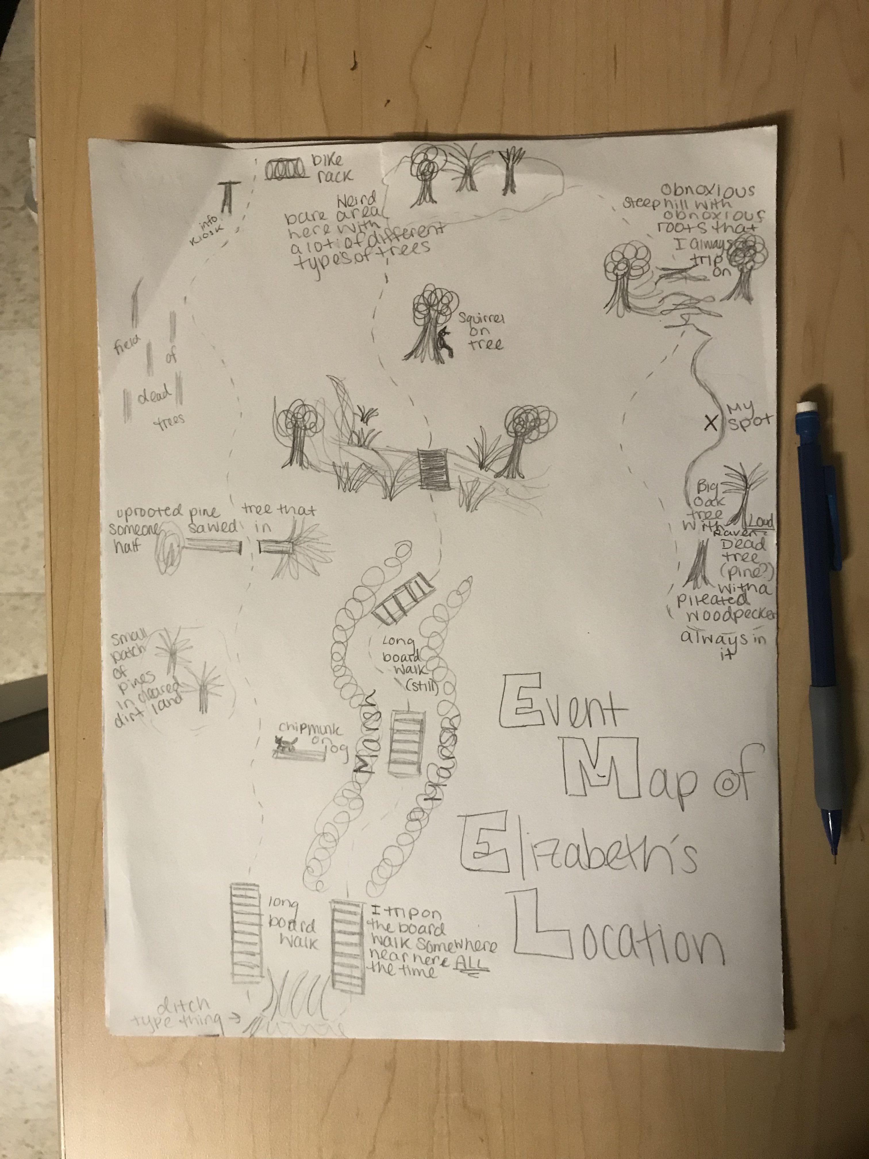
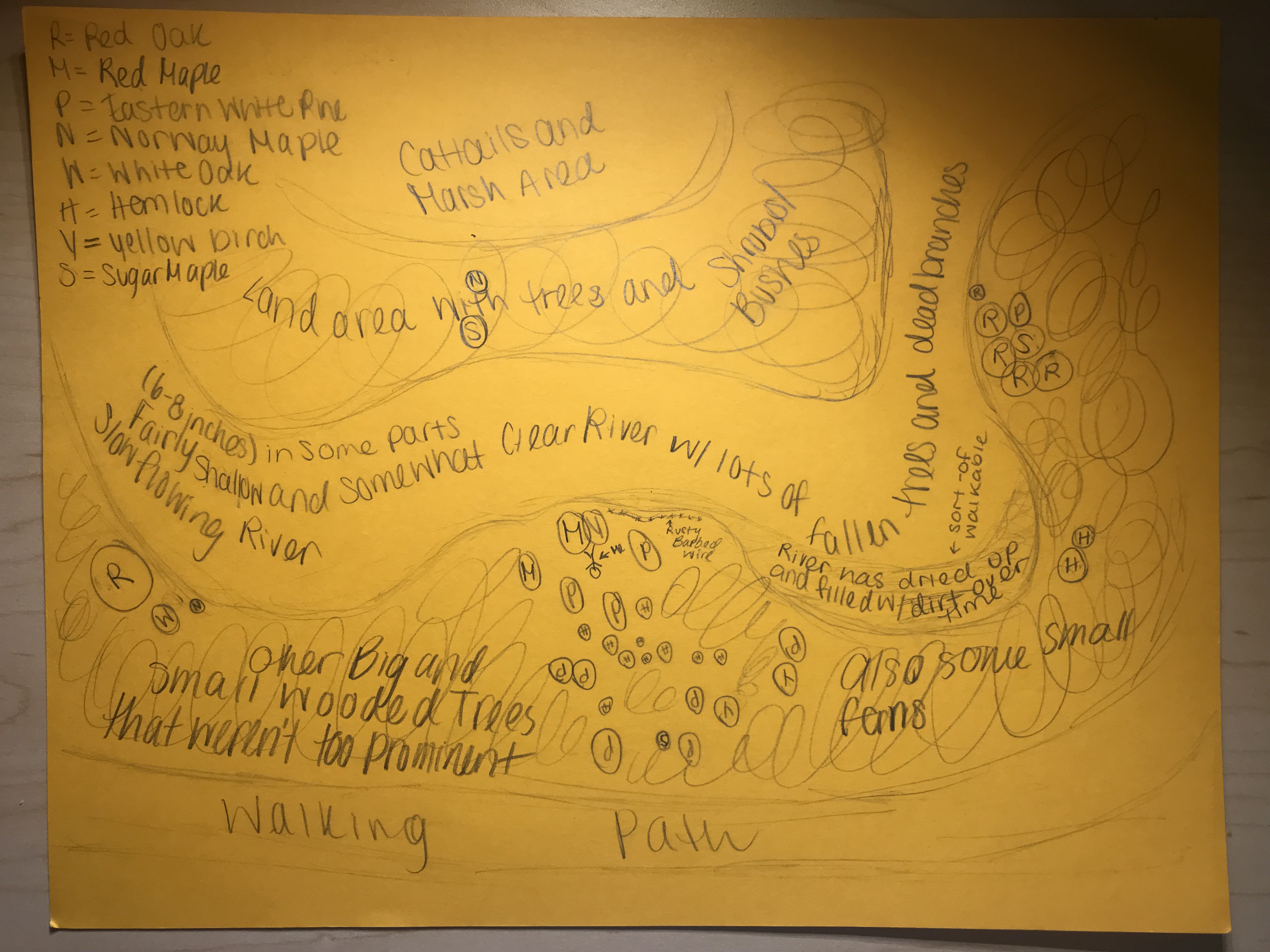
An Event Map of My Location

Along with this creating this event map on my way to my location, once I was at my location, I noticed that some of the trees had lost a lot of leaves since I was there last. I also noticed that the river had dried up a little, or since a lot of leaves had fallen, the leaves could have been covering some of the flowing water that I could not see because the river does not flow fast at all. I uploaded some pictures on the Photos page of this Blog Site if you want to see for yourself!

Happy Exploring!

Changing with the Season

As October rolls through, fall is really starting to show it’s colors with all of the leaves changing on the trees around my spot! A lot of the leaves have fallen off of the trees, however, on the Red Maples, and the White Oaks, the leaves are a vibrant yellow. Refusing to give in to the weather, the Red Oaks, Norway Maples and Sugar Maples are, for the most part, unchanged, remaining a gorgeous green just like the Evergreens around me. The leaves of everything else, including the Yellow Birch and all of the small trees and bushes, have sadly fallen off becoming a staple of the forest floor. Today as I sat in my location for many hours, I became a part of the forest allowing the chipmunks and squirrels to scurry all around the forest floor. This also allowed for a lot of birds to spread their wings and make themselves known to me. These birds included multitudes of Black-capped Chickadees, White-Breasted Nuthatches, Downy and Hairy Woodpeckers, Tufted Titmice, the amazing Pileated Woodpecker, Brown Creepers, Blue Jays, American Crows and what sounded like a Red-tailed Hawk. Everything was out in full force today looking and sounding amazing as always.

Here is an aerial view of my location and how it looks to me:

My Location!

I chose this location because it is easy to get to, but covered enough by the foliage so that you feel like you’re alone in the woods. It’s also a very pretty and quiet spot to just sit, do your homework and watch the wildlife in three sub-ecosystems: the wetlands, the river and forest bed, and the tree canopy above. My location consists of some small herbaceous plants and a lot of very large deciduous and evergreen trees (woody plants). These plants include ferns, Eastern White Pines, Sugar Maples, Red Maples, Norway Maples, Nothern Red Oaks, White Oaks, Eastern Hemlocks, Yellow Birches and various other plants that were too far away or small for me to identify. These plants make up my gorgeous peninsula in the woods.

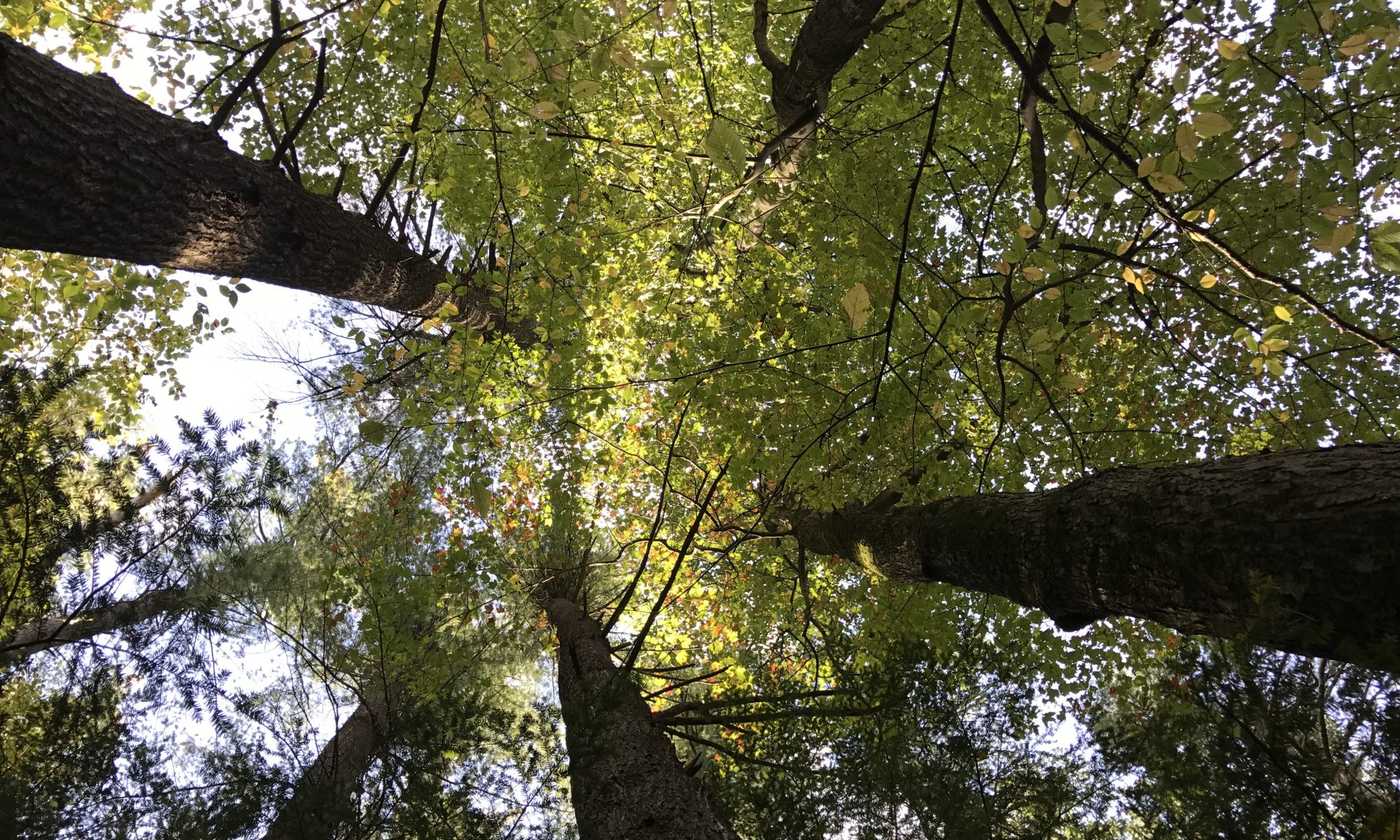
P.S. Look up into the canopy if it is sunny, you won’t regret it! 🙂