RSS
 

Final Post

04 May

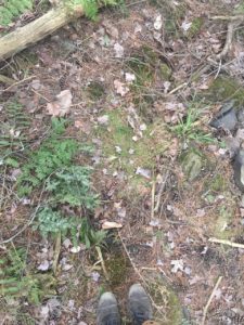
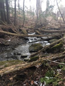
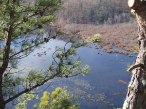
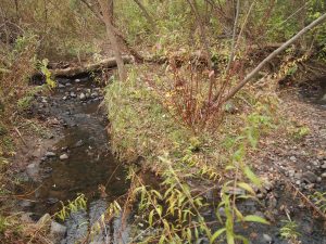
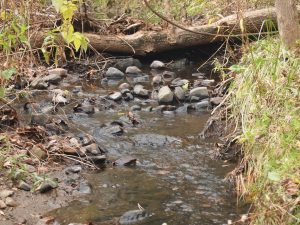
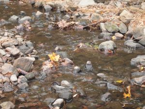
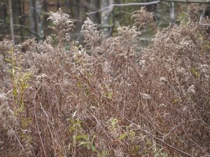
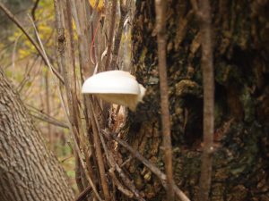
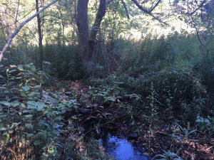
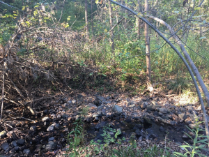
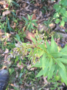
Upon my final visit to my phenology spot, I could finally notice strong phenological changes that came in the tide of spring. Clovers and wild grass were starting to sprout from the ground, you could see the buds on the twigs starting to sprout, and the site was generally a lot greener than it has been all winter.

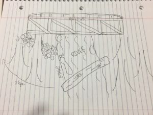
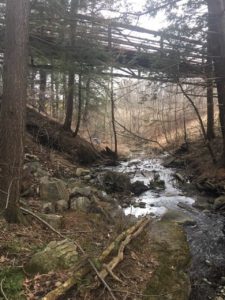
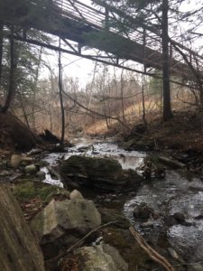
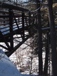
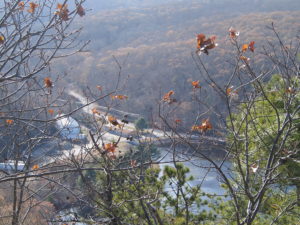
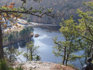
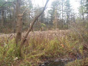
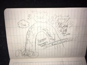
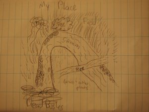
I think that there is a very unique intersection of nature and culture that takes place at my phenology spot. The space houses a very present integration of human development and impacts, as well as a serene nature spot. There is evidence of people even having lived underneath the bridge on my spot, clearly showing that intersection. I would consider myself a guest within my place rather than a part. I feel that if I were to consider myself a part of that place it would almost be asserting a sort of dominance over the land. The natural parts of the space are sparse and heavily impacted by human development and other impacts. I don’t think any person has a right to consider themselves a part of a space that their kind has done so much to degrade. The best I can do is consider myself a guest, and leave no trace of my presence.

Greenery starting to sprout out from the soil

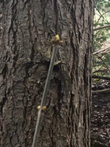
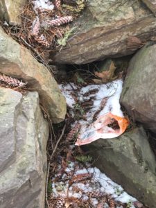
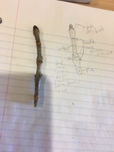
Buds starting to sprout

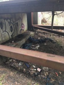
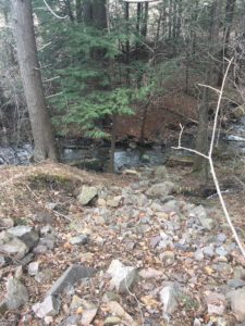
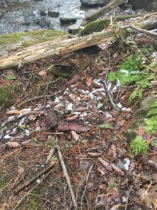
Evidence of people living within the space. Heavy littering.


Spring?

16 Apr

Upon returning to my spot, I noticed a few changes. There has been a significant amount of plant recovery after the long winter, which isn’t entirely over. I tried to see if there was evidence of spring wildflowers starting to sprout across the ground, but I didn’t any. The only plants that seemed to be starting to perk back up after the winter were the ferns and some wild grass (pictured below). With the return of spring, I attempted to see if there were any signs of amphibious life taking place along the river. I wasn’t able to identify any signs of activity, but I feel as though there is a high probability of it taking place.

There seems to be a good amount of edge effect taking place in my phenology spot. For starters, my spot has a trail and bridge running directly through it, and is completely surrounded by human development including a highway and houses. I’m certain that these have been major disruptors in the biodiversity of the place. The river also separates the two main areas of my spot, but during the winter i don’t think that it impedes any sort of movement. Due to the large amount of development, I don’t think that my spot is habit to a very biodiverse set of interior species.

Sketch of place

Ferns and grass recovering


Spring Break Phenology

19 Mar

During my spring break this semester I visited a friend in Brooklyn, NY. He lives in the neighborhood of Park Slope, which is one of the 6 neighborhoods that border Prospect Park. It was originally formed by the same designers of Central Park, and holds a lot of inspiration from ideas of romanticism and transcendentalism that were forming around its creation. It became a park for the community, and has a lot of man made structures within it to push people in the city out into nature.

For obvious reasons, this park is far different from my site in Burlington. One of the largest differences would be the fact that Prospect Park is an extremely landscaped and man made park, while my site is a small river and forest underneath a bridge in Burlington. However, you can see evidence of human impact/ development within them both, as well as natural water formations.

Due to its placement within the city, Prospect Park is a migration hot spot that on a peak day can see up to 110 different bird species. Among those species can be found 5 different species of vireo, Eastern Bluebird, numerous warblers (possibly 35 species yearly), Vesper Sparrow, White-crowned sparrow, Rose-breasted Grosbeak, Indigo Bunting, Bobolink, Orchard Oriole, and Baltimore Oriole.

The phenological conditions of the park were a bit difficult to identify, only because a large majority of the park is heavily groomed and maintained. However, in certain areas within the park it is completely closed off to the public to allow for regrowth. That area was looking pretty healthy, as much as it can at this time of year.

Waterfall pictured near dog park.

Trees spanning across field. 

Dog park closed off for the winter.

https://www.google.com/maps/place/40%C2%B039’43.4%22N+73%C2%B058’16.7%22W/@40.66206,-73.9735017,17z/data=!3m1!4b1!4m5!3m4!1s0x0:0x0!8m2!3d40.66206!4d-73.971313?hl=en-US


March 5

05 Mar

When identifying the natural communities of my site, I determined that it most closely aligned with the Pitch Pine-Oak-Heath Rocky Summit. While the site does contain a few other tree species than listed in the substrate descriptor from Wetland, Woodland, Wildland (including willow, green ash, and red maple) I do think that the different physio-ecological factors align with this descriptor. Some of these characteristics include the rocky summit, pine needle coated soil, and shrub populations. I can tell that many of the shrub populations are currently in rough condition due to the winter, but once spring comes around, the ecological potential of the site will promise more ground life.

Since my last visit to my site there has been a number of changes, as well as much more visibility all across the ground. This is due to the large change in temperature since my last visit, and the lack of snow all across the ground. Due to the packing of the snow on the plant life, all of the ferns in the area were smashed. The river was also much more visible, and had a fairly high stream due to the melting snow.

Using the BioFinder, I was able to determine that my site is neighboring a lot more development than I realized, and is really just a nook in the jumble of parking lots, highways, parks, and houses that exist around it. The program also showed me that my site is not any sort of protected area, as well as home to any particular species that the program would set off. The site is generally an interior forest block, with a bridge running over it.

Slope leading down to site.

Soil composition in site. Needles, pine cone, and mild moss.

Decomposing trees fallen due to the slope.

Bridge over site, lower end.

Trash found on site. Evidence of human presence.


New Spot

05 Feb

With the new semester I decided to get out of Centennial and connect to a different space within the area. You can find my spot by following the bike path that starts at the fields and golf course on athletic campus all the way down to a bridge. My spot resides underneath the bridge.

While observing the species that inhabit this new spot I collected twigs and tried to determine as many tree species as I could. From the twigs I could determine, I think that the dominant deciduous species are willow, red maple, and Green Ash.

Entrance to the lowest part of my spot

White-Tail Deer tracks found at the river crossing

Green Ash twig and drawing depicting each part

Bridge towering over spot

The embedded map kept on disappearing when I uploaded it, so here is the short URL for the google map: https://goo.gl/maps/zxXq66MYrmy


Human History of Centennial Woods

09 Dec

Centennial woods has a rich history of interaction with humans and being utilized for its natural resources. Native Americans from the Abenaki Tribe are known to be the first settlers of this land. There is evidence of tools and other supplies found throughout the park. Post-Native American settlement, European colonizers were the next to put this land to use and set up a large dairy/ agriculture operation. When they did this, it accompanied mass deforestation that took out 80% of Vermont’s trees. There is evidence of this farm all throughout the park through the forms of barbed wire and stone walls used to divide the farm. The walls could indicate either a two wall agriculture system or a means of controlling the livestock. After some time the land was abandoned and released to public lands, and eventually turned over to UVM as a natural area.


Thanksgiving Phenology

27 Nov

Mabel Osgood Wright Style:

Hustle and bustle, chilly and windy! Scrape the dirty water and brush the dancing cattails, scrape all the silty soil and shine until neat. Hustle and Bustle, chilly and windy! Scaling is scary don’t get blown off your feet! Visitors beware you may have a good scare with a hawk above you observing…

…The plants and local species were all moving quickly, some largely due to the strong winds. The lake was full of algae and was likely a result from a small scale factory neighboring the water. The sky was clear and made for some fear as you scaled down the steep cliff. As you climbed down you could slip from either the silty soil or the strong winds… On days like that it added a sense of danger and adventure to the spot, making it even more appealing to me. The presence of humans was extremely prominet and the trees had adapted to defend their land. At the base of each tree was strong biodiversity to make up for the poor soil. The cattails were dancing in the wind along with the cedars, hemlocks, and various invasive species. The dance of the wind was the way of the land.

Mary Holland Style, Comparison:

The locations in Connecticut and Vermont have many similarities on purely just a ecology level, but once you dive into specifics you start to see lots of division. The soil type of my Connecticut spot has much less minerals and biodiversity inhabiting it as it isn’t on water. It looks out onto a (unhealthy) lake while my Vermont spot has water running directly through it. Comparing the local species is quite difficult as there is very little in both, but the do both share habitats for squirrels. What other species Vermont did have are long gone for the winter, they cannot survive the cold that awaits them. Similar to the lost species in Vermont, Connecticut has snakes that inhabit the area during the summer that slip away during the winter since their warm blood cannot survive in that type of cold. Connecticut has many hawks fly above scouring the land. As winter approaches both spots prepare by losing their leaves on deciduous trees. There are far many more conifers in Connecticut. Since my Connecticut spot is on protected Native American land the trees are much larger as they haven’t had to face nearly as much deforestation. That said, the personalities of the trees are just the same and are preparing for winter in similar ways. The two environments adapt and brace for winter in their own fashions and personalities.

https://www.google.com/maps/d/u/0/viewer?mid=19K4wTZN8Ascvm08KVkIhqetFCCZc22uP&ll=41.46374830000002%2C-71.94585319999999&z=17


November Developments

06 Nov

Since my previous October visit my site has undergone a number of changes. The leaves that had fallen previously are starting to decompose, the water levels are much lower than before, the wheat type species that dominates the neighboring field are starting to die, and there is a much more noticeable presence of birds and squirrels.


Front view of the peninsula. You can see the way the water wraps around the center land mass. This for me, was essential in forming a strong sense of place. I am able to tune in to the water as it naturally flows around me in a calm manner.


While sitting in my spot I am constantly fascinated by the water that flows through. These are some of my favorite photos I have taken of them in my time there.

The wild wheat species that neighbors the left-hand side of my spot are beginning to lose their seeds and in some cases, die.

I found this mushroom on a tree near my spot. I found it on many other trees in the area, and I expect at some point to be able to find them on some of the trees in my site. Pictured next to the mushroom is an updated map of the site including all of the changes I have observed since my last visit.


Early Changes and Site Map

22 Oct

Since I last visited my site it has gone through a number of changes. Leaves are littered across the ground as the trees are beginning to shed them. The dominant species within the field have begun to lose their seed at the top, especially the ones that weren’t in the actual field. This could either be due to season change or from human activity in the site.


Introduction

01 Oct

To get to my spot you enter into centennial woods and follow the main path until it forks. At the fork you take the left path down to a large rock and a river. From there you follow the river down until you reach an isolated peninsula surrounded by small trees including a dead yellow birch, a large boxelder, and many types of small plants including a large a field of a wheat type species (pictured below). I chose this spot due to its isolation, and the fact that there is water running through it.

https://www.google.com/maps/d/u/0/viewer?mid=1GPu-2vafm4x_L6x7K3i6rn463rx_k8uq&ll=44.476004%2C-73.18678499999998&z=17

Large tree on the top left area of my spot.

Small river running through the right side of the peninsula.

Dominant unidentified wheat species in the area.


Skip to toolbar