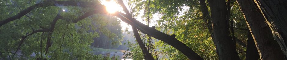
The fall semester is coming to an end, and I’m sad to say this is likely the last time I’ll see my phenology place for a while. This visit was on an unusually warm December day, it was about 40 degrees with the sun beaming down. As I pedaled my bike down the intervale road withering evidence of the summer’s farming season lay to either side of me. A pileated woodpecker flew through the trees lining the road, bringing a flash of red color to the otherwise dull canopy. The presence of an elegant focal species of NR1 seemed fitting for my final visit this year.
Though the landscape seems rather bare at this time of year, even in the beginnings of winter it is easy to see why people have been drawn to the intervale for so long. The rich soils, the proximity of the river, and an abundance of flora and fauna make the intervale highly habitable for people. There is a rich history of land use on the intervale, dating back well before European settlement.
The Abenaki were the first known settlers of the intervale, and their presence dates back to around 3000 B.C. The area was used for fishing, hunting, and some subsistence farming. Repeated flooding from the Winooski River renews the fertility of the Intervale when high waters bring new, nutrient-rich soils and sediment to the floodplain. Accordingly, the area continues to be biologically productinve after thousands of years of human use.
Once European settlers arrived, they quickly realized the area’s agricultural potential and began farming, more intensely than the Abenaki. Settlers flocked to the area, including Ethan Allen, whose homestead is not too far from my phenology place.The commodities being produced have varied over time, from grain to dairy, and now vegetable farming, but farming has been a ubiquitous part of human culture at the intervale.
In the twentieth century, the land use diversified. For a time the intervale hosted a municipal dump, though that was closed in the 1970s. The intervale saw more industrial operations as well, including a wood-fired power plant that still runs today. Right now, the intervale is primarily used to produce local vegetables as well as a recreation area, which is evident from the network of trails and agricultural fields.
(Information sourced from Burlington Geographic, The Lake Champlain Basin Program, and The Intervale Center)
Today I was just a passerby, thinking about the history of my place but also making observations in the present. A flock of crows gathered at the dairy farm across the river, their calls mingling with the few brave songbirds that overwinter here. Since my last visit, my place feels even more dead, with fewer plants covering the ground. The river itself has changed too, likely due to recent rainfall the riverbank has eroded leaving steep unstable banks. I sat for a while, listening to the birds and noticing the earthy scent that accompanies the river. After some time passed, it was time to leave. I noticed some signs of beaver activity for the first time, the more open ground revealed that saplings along the riverbank have been chewed off and harvested. With each visit I learn something new about my place, and I’m sure that there is still much more to discover.
Here are some photos from today:
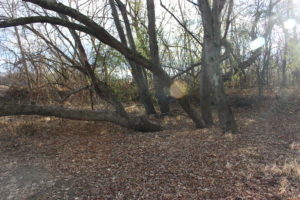
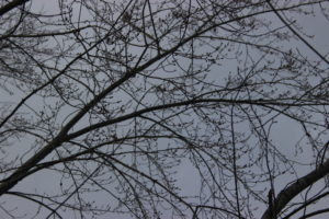
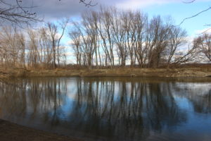
Much of my place has gone into dormancy, and it looks ready for winter
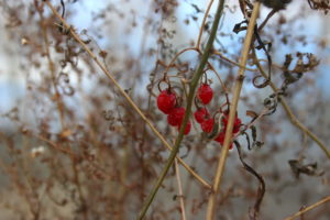
A few shriveled berries were some of the only splashes of bright color left
Even late in the season, my place sees other human visitors
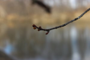
Next spring’s buds have formed on the silver maples
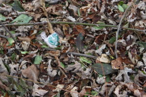
The lack of ground cover makes it easier to see a concerning amount of litter along the riverbank
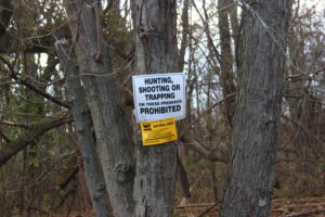
Regulations on land use have been posted
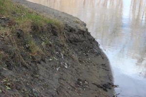
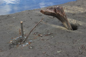
Erosion of the riverbank
Today was likely my final visit this year, luckily it was on a rather pleasant day