Our projects are funded by the National Oceanic and Atmospheric Administration (through CIROH), the US Army Cold Regions Research and Engineering Lab, the US Geological Survey, the US Environmental Protection Agency, the US National Science Foundation, and the Vermont Agency of Natural Resources. See links below for details on individual projects.
Cold Weather Summit-to-Shore Environmental Observation Network
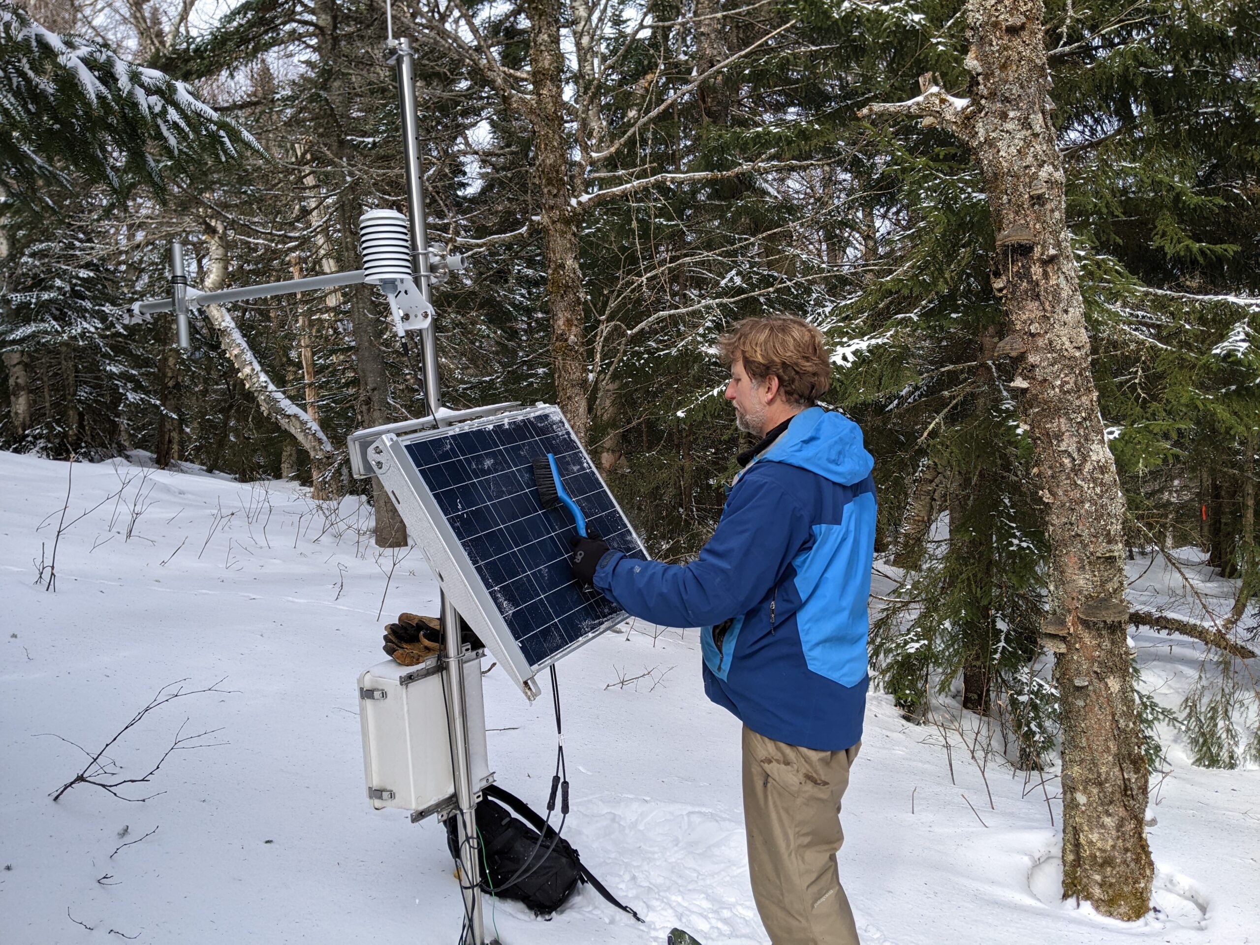 We are developing a cold-weather environmental observation network in collaboration with Cold Regions Research and Engineering Laboratory (CRREL) that spans the summit-to-shore continuum in Vermont to advance environmental planning and operational decision-making capability. The project will advance snow measurements using distributed ground-based sensors combined with unmanned aircraft system (UAS)-based sensing, in collaboration with UVM’s Spatial Analysis Lab, to provide improved understanding and characterization of snowpack spatial and temporal variability. The sensor locations span from near Lake Champlain toward the east, including a high altitude station near the summit of Mt. Mansfield and extending to the Sleepers River research site in Danville, Vermont. Using UAS sensing, the point measurements acquired by the transect sensors are augmented and expanded with repeated LiDAR collects to determine snow depth over complex terrain. A key research goal is to use point and areal measurements, combined with spatial datasets of land cover and topography, to improve understanding of the landscape determinants of snowpack heterogeneity. We are using process-based models and machine learning to improve predictive capacity of the northeastern snowpack. The project leverages strengths at the University of Vermont in hydrology, environmental modeling, machine learning, and remote sensing technologies.
Improved Representation of Floodplains and Natural Features for Channel Routing in the National Water Model
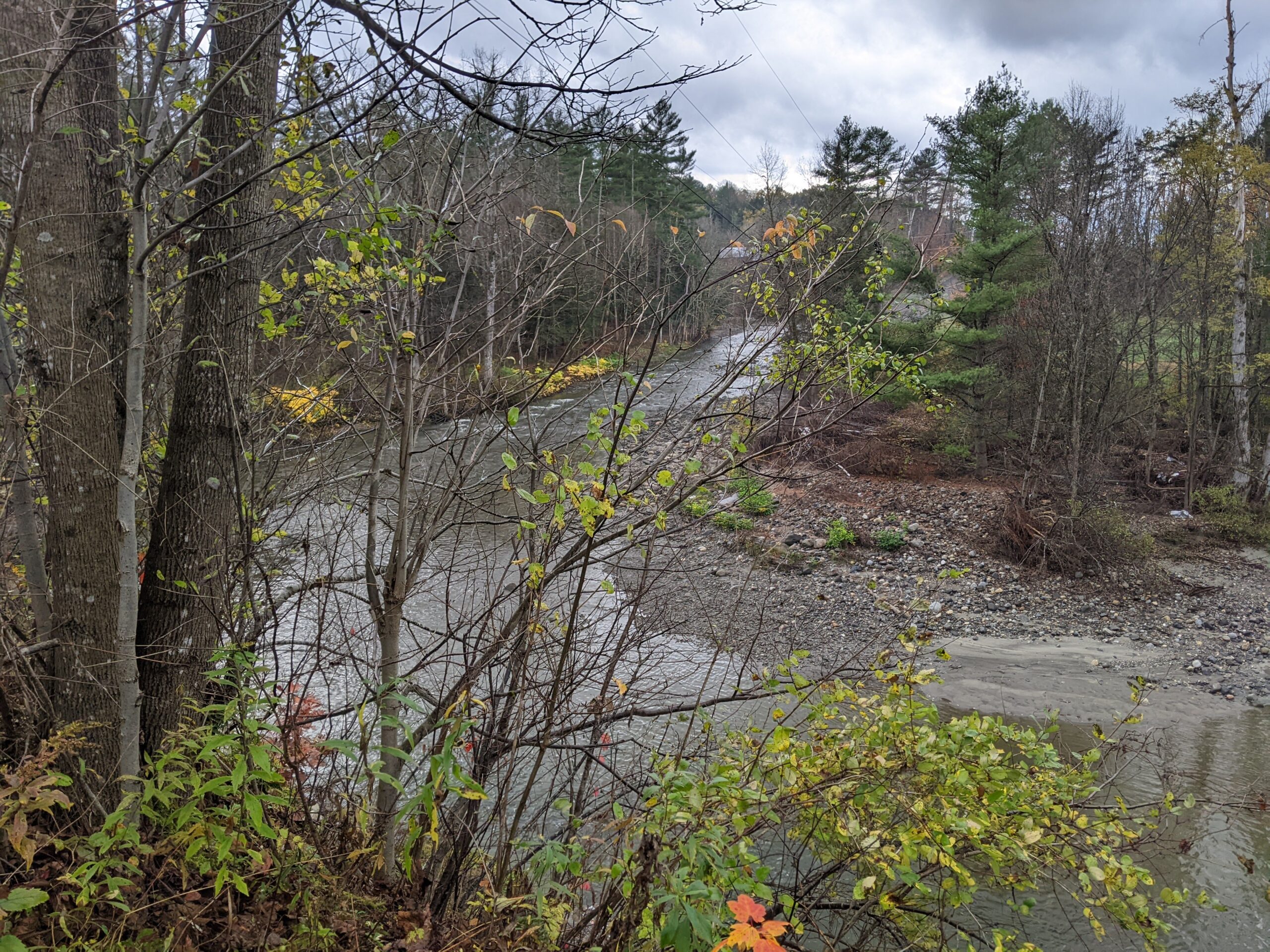 Funded through the Cooperative Institute for Research to Operations in Hydrology (CIROH), this project the aims to improve our understanding and modeled representation of the influence of floodplain-channel connectivity on flood celerity and flood routing processes. Our initial use case is situated in the Northeastern US, comprising over 3000 river reaches in the Vermont portion of the Lake Champlain basin. We use the high-resolution topographic data to develop river reach morphological signatures in cross section and planform to characterize floodplain types. A supervised machine-learning algorithm was used to cluster reaches based on their hypothesized influences on flood attenuation. The workflow for topographic signature extraction is publicly available on a GitHub repository, with future improvements planned as we integrate planform complexity into our characterization. We aim to develop a prototype heterogeneous routing scheme that assures proper representation of process while optimizing computational efficiency to improve the performance of river stage forecasts and inundation extent predictions. Products developed through this project will be helpful for the National Water Center (NWC) and its partners (e.g., USGS) in the development of the Next Generation Water Resources Modeling Framework (NextGen) and geospatial data that support national hydrologic modeling applications.
Leveraging emerging sensing technology and machine learning to improve and expand hydrological forecasting to hyper-local scales with NWM-coupled adaptive sensor networks
The National Water Model (NWM) offers considerable potential to improve flood and drought warning systems for the nation, though no attempts have been made, to date, to assess NWM performance for montane headwater catchments. These systems tend to have limited gaging infrastructure to inform modeling. This deficiency, coupled with complex topography and highly spatially heterogeneous response to precipitation, results in models that are unable to provide accurate forecasting for significant events. In this project, supported through the Cooperative Institute for Research to Operations in Hydrology (CIROH), we are assessing the performance of the NWM in headwater catchments of Vermont. We are mining existing gage data, deploying low-cost water level sensors, and developing machine learning (ML) informed algorithms to improve forecasts at montane sites where our team has conducted extensive hydrologic research. Our approach can be readily adapted to other headwater sites in montane settings to improve hyperlocal forecasts of streamflow for downstream communities.
 High-Elevation Hydrology
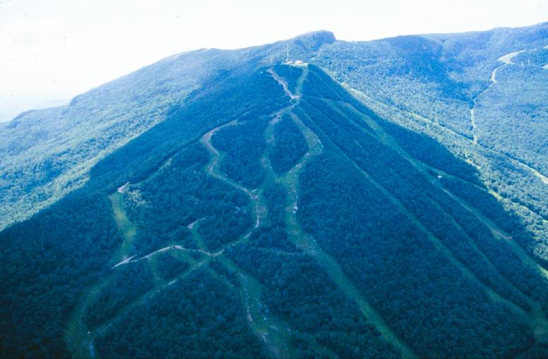
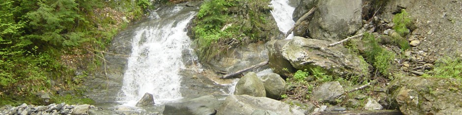
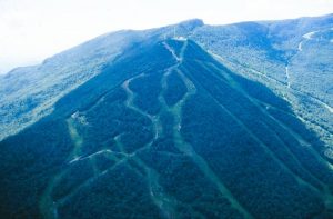
The Mt. Mansfield paired watershed study was initiated in 2000 through a joint collaboration between the Vermont Monitoring Cooperative, the U.S. Geological Survey, and the University of Vermont, to establish a long-term high-elevation hydrologic observatory and document the impacts of ski area development. We maintain stream gages on two watersheds — West Branch (11.7 km2), which encompasses an alpine ski area, and Ranch Brook (9.7 km2), which serves as our reference watershed. Our work to date has shown how development alters water quality in this setting. We are currently focusing on extreme events at high elevation.
Evaluating floodplain potential for sediment and nutrient deposition
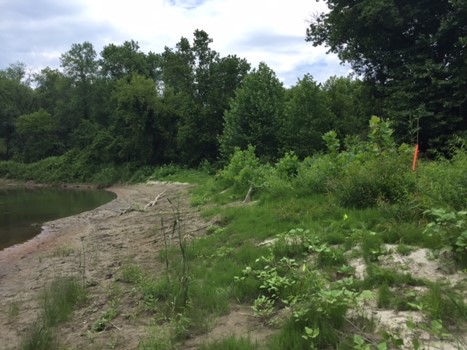 This project aims to map the spatial extent of floodplains in the Lake Champlain Basin under a range of recurrence intervals and quantify the effectiveness of floodplain surfaces in storing sediment and nutrients during flood events. Launched in 2019, the two year project involves development of a computationally efficient mapping approach and establishment of field monitoring plots to quantify deposition during inundation. The project is led by Dr. Rebecca Diehl, with collaborators Dr. Don Ross (UVM Plant & Soil Science) and Dr. Kristen Underwood (UVM Civil & Environmental Engineering).
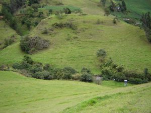 Tropical Ecohydrology

In collaboration with la Fundación Cordilla Tropical we are establishing community-based monitoring program and studying river flows and sediment and nutrient export through the Mazar River Project on the eastern cordillera of the northern Andes in Ecuador. We presented our preliminary results at the Fall 2015 American Geophysical Union (AGU) meeting and at the AGU Chapman Conference on Tropical Ecohydrology in June 2016.
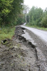 Evaluating gravel road impacts on pollutant production in the Lake Champlain Basin
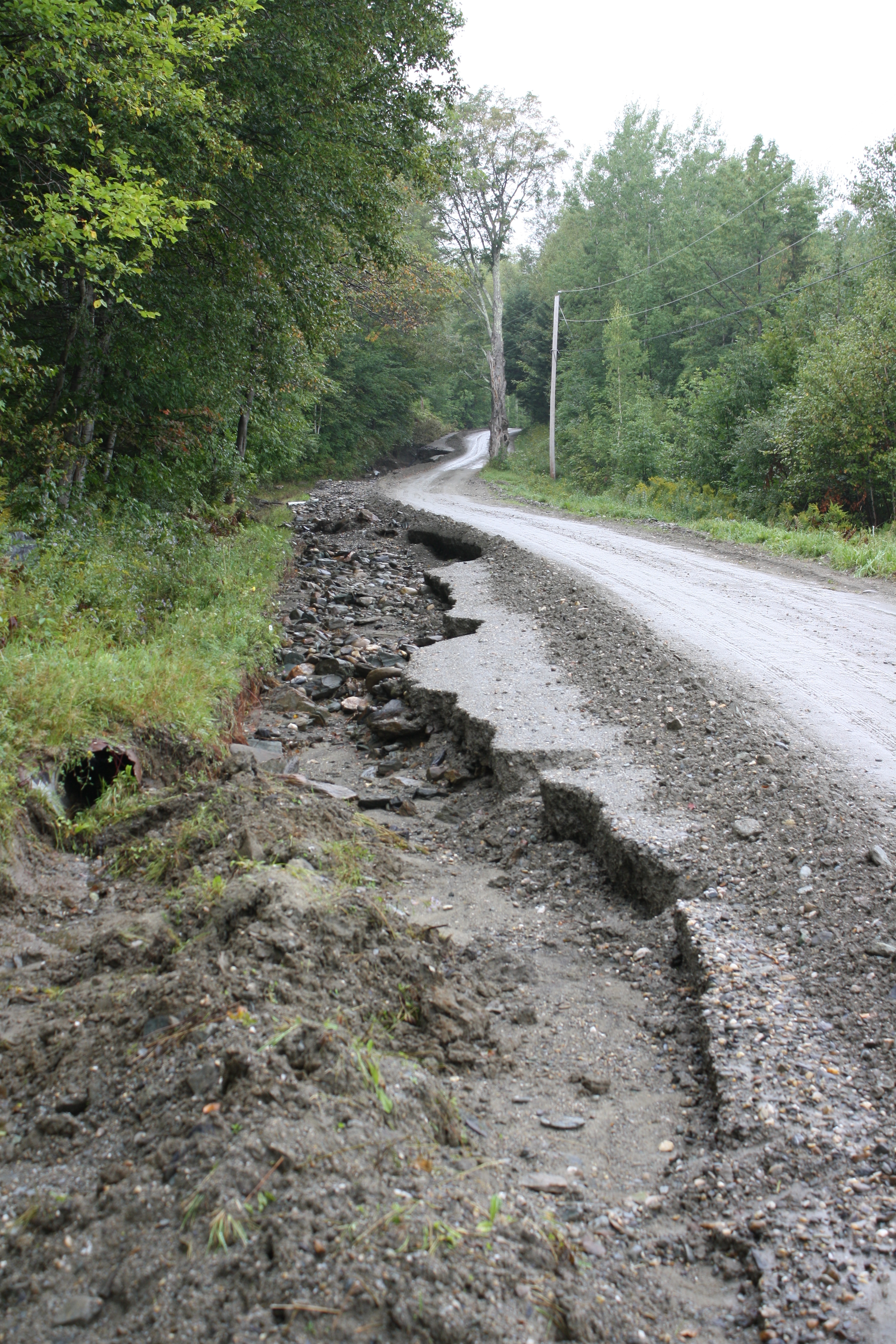
Unpaved roads constructed in steep terrain modify flow paths, drainage density and the production and transport of sediment and nutrients through watersheds. In this project, we documented the importance of this source of sediment and phosphorus production for receiving waters in the Lake Champlain basin. Our results have been published as a technical report and in Earth Surface Processes and Landforms and were used to develop the recently released total maximum daily load (TMDL) allocation for Vermont segments of Lake Champlain.
 Improving water quality and flood resilience in rural communities through transportation system interventions

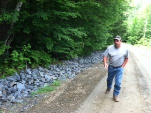
This project, a follow-up to our study of gravel road impacts on water quality, was conducted in collaboration with stakeholder in rural Vermont towns. We used experimental manipulations on selected road segments, retrospective assessments of past design interventions, and interviews with town officials to assess effectiveness of erosion control interventions on improving water quality and improving flood resiliency of rural transportation networks. A paper on our results was published in a special issue of the Vermont Journal of Environnmental Law.
Collaborative Team Projects
Basin Resilience to Extreme Events (BREE). This interdisciplinary project, funded by the US National Science Foundation, will study the dynamics of extreme events and examine the role of adaptive interventions in improving flood resiliency. Our work will include both field-based studies of biogeochemical dynamics along river corridors and modeling efforts to optimize the implementation of interventions to mitigate flooding impacts on stormwater runoff and water quality degradation.
![]() Sensing the Americas’ Freshwater Ecosystem Risk from Climate Change – this interdisciplinary project, funded by the Interamerican Institute for Global Change Research, seeks to use high frequency environmental sensing to detect condition of and changes to freshwater ecosystems across the Americas. Project partners include collaborators in Argentina, Chile, Colombia, Uruguay, Canada and the U.S.
Sensing the Americas’ Freshwater Ecosystem Risk from Climate Change – this interdisciplinary project, funded by the Interamerican Institute for Global Change Research, seeks to use high frequency environmental sensing to detect condition of and changes to freshwater ecosystems across the Americas. Project partners include collaborators in Argentina, Chile, Colombia, Uruguay, Canada and the U.S.
Research on Adaptation to Climate Change (RACC) in the Lake Champlain Basin – This interdisciplinary project, funded by the US National Science Foundation, seeks to understand how climate change will alter nutrient runoff and the ecological condition of Lake Champlain![]() . As part of the RACC project, we developed a model to assess changes in flow regime under climate change scenarios.
. As part of the RACC project, we developed a model to assess changes in flow regime under climate change scenarios.