Salmon Hole Phenology

A Study of Salmon Hole Through the Seasons

November 4, 2018
by aesherma
0 comments

Flooding at Salmon Hole

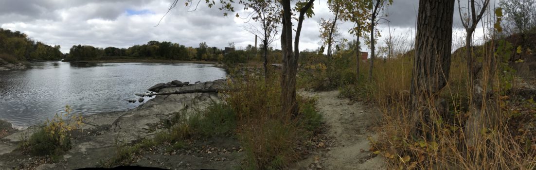
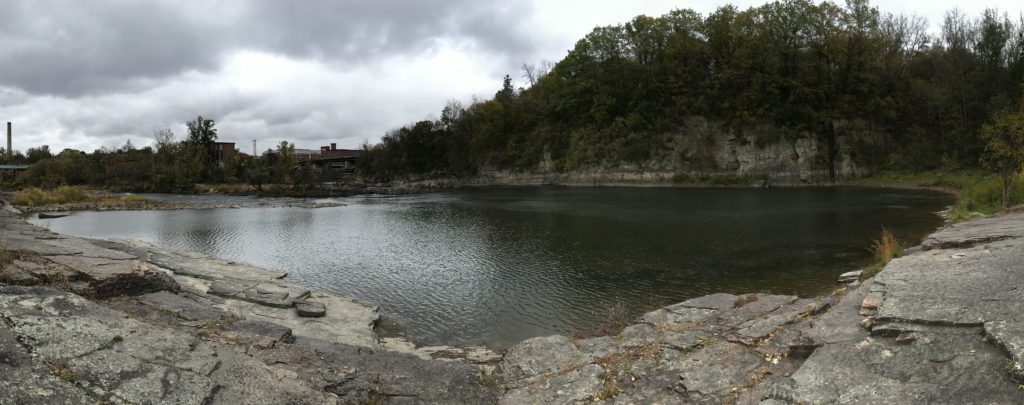
A view from the Salmon Hole parking lot! Notice the islands on far side of the river, which are usually one large island, and notice the new rapids in the center.

The past two weeks have brought many cloudy days and a few days of heavy rain. Yesterday particularly, it rained from morning until night almost nonstop! As I got close to Salmon Hole today, I could hear the roar of the water over the music in my headphones, which I have never noticed before. When the Winooski came into view, I got a good look at how drastically my site had changed! From the roadside parking lot, I could see that the long outcrop of rock that reaches out into the river was now submerged, and the far end of the outcrop was now an island. In the place of the long rocks and what I thought were vernal pools were rapids, and the shore line on both sides of the river had shifted dramatically.

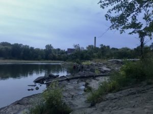
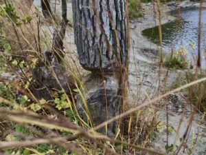
The grass in the center of the image is my center point. Notice how far up the water is!

After taking the trail down to the shore and entering my site, I saw that the focal point of my site was nearly submerged! The center of my site is a patch of tall grass on the sandy shore behind the tall outcropped rocks, and usually it is about ten feet away from the edge of the water, at least. Today, it was right on the waterline!

I took some pictures of the current water levels relative to some landmarks at the site, and will be comparing over the coming weeks.

On my bird’s eye view map, I outlined the changes to the river’s shape and the water’s reach. The red lines outline where there is now water, and what land is now submerged.

New water levels due to flooding.


October 21st Visit (Gallery)

October 21, 2018 by aesherma

A cottonwood, a beaver favorite, that has been chewed on.

A view of Salmon Hole from the end of the trail.

Some very dry burs.

A lone seagull flying overhead.

Trees that have stunted their growth sideways. EDIT: After observing seasonal flooding at Salmon Hole, I now know these trees become submerged and the flow of the water forces them to grow this way.

Panorama of the small bay with the dam in the distance.

A pool of water which I initially thought was something like a vernal pool. These pools actually form when flooding recedes and some water stays in lower areas on the rock.

The changing leaves on the trees in late fall.

Maples.

A fisherman leaving with his dog after fishing for some time.

This gallery contains 27 photos

October 21, 2018
by aesherma
0 comments

October 21st Visit: Beavers, Snow, and the Changing Leaves

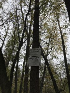
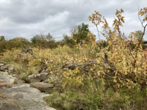
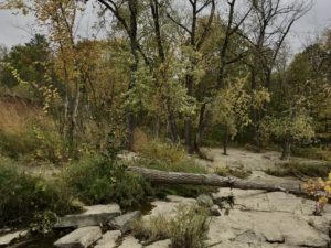
Today’s visit involved a long walk around the entire site, looking for changes and signs of wildlife. I didn’t see much wildlife, though with today’s temperatures in the high 30s, cloudy skies, and some light snow, I can’t blame the animals for not coming out.

I did spot a lone gull flying around, however it was flying too high to identify further. Also observed was some work the local beavers have been doing on a cottonwood on the shore of the Winooski, along with an older stump nearby from another tree previously felled by beavers. Later during the same visit I observed some squirrels, likely preparing for the long winter ahead.


The most noticeable change at the site was, of course, the changing color of the leaves. Most trees have begun to change, leaves slowing chlorophyll production and revealing the carotenoid yellow beneath. At the moment, the majority of leaves are yellow, few if any are red or brown. Some plants, mainly shrubs and vines, remain mostly green at the moment.

After walking around and making observations, I sat down to draw a bird’s eye sketch of the area. I will be posting that map separately.

October 8, 2018
by aesherma
0 comments

Introduction: Welcome to Salmon Hole!

Hello! Welcome to my phenology blog, where I will be studying Salmon Hole for the next few months. Salmon Hole is an outcrop of rock along the Winooski River, right on the border between Winooski and Burlington. Coming from the University Campus, it is quite simple to get to, but a bit of a longer walk. To get to Salmon Hole, you should make your way to Colchester Ave. on the northern side of campus, and then follow Colchester Ave. all the way down to the final intersection before the bridge over the Winooski River. There, make a left onto Riverside Ave., where you will come upon a parking lot with signs for Salmon Hole. Continue along the right side of the road for approximately another fifth of a mile, and you will come upon the trailhead. Take the trail down to the water, and there you are!

Upon reaching Salmon Hole, one could see why someone would want to keep coming back there time and time again. The trail takes you out onto a bare-rock shore, the wide river bending with marsh on the far side. To your right there’s a big wall of rock, and down and to the left a trail will take you into the woods along the shore. A factory sits nearby, unclear if it is operational, but nature still commands the space. It is beautiful and inspiring to look at, and when I first saw it I knew it was the right place for me.

Over the next few months, I will be paying attention to the vegetation at Salmon Hole, how the plant and animal life changes with the seasons. Some of the present common species include Sugar Maple, Silver Maple, Buckthorn, Northern Red Oak, Paper Birch, and American Beech.

I look forward to spending time here in the next year, and seeing how the space changes as I learn more about it.

Skip to toolbar