Salmon Hole Phenology

A Study of Salmon Hole Through the Seasons

May 3, 2019
by aesherma
0 comments

A Farewell to Salmon Hole

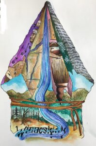
(Get it? Like A Farewell to Arms? Anyway.)

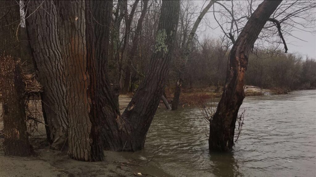
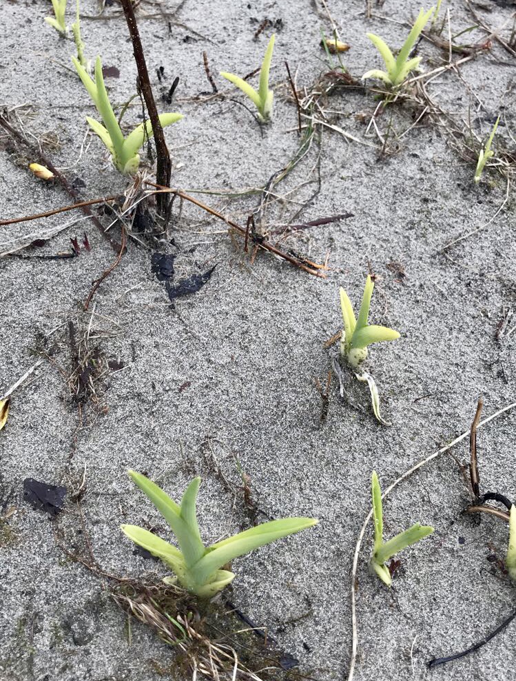
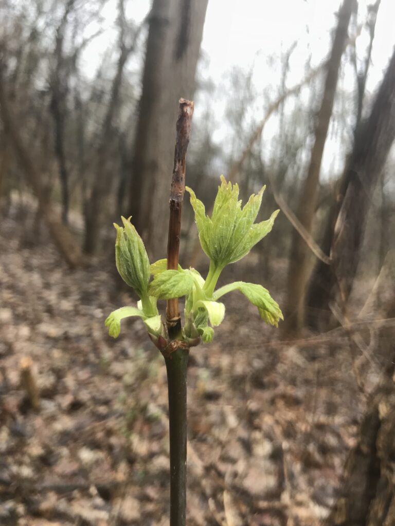
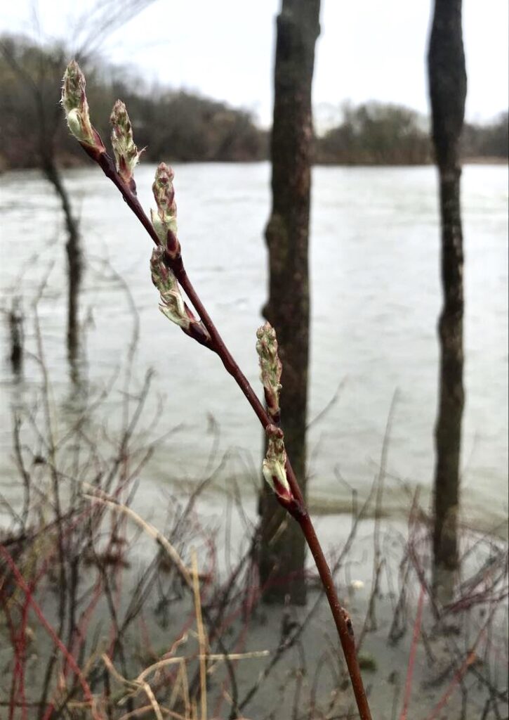
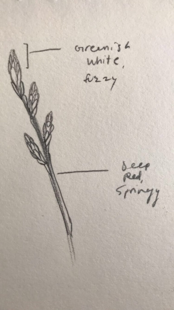
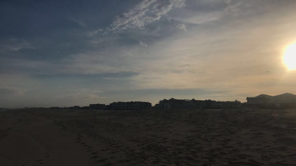
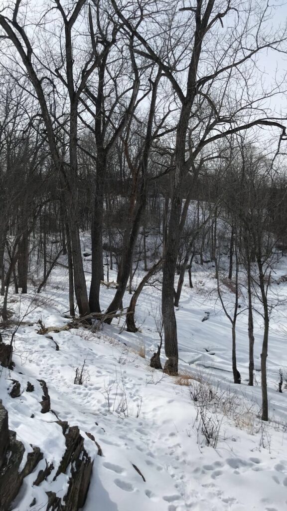
Today I visited Salmon Hole for the last time. Not much has changed since last Saturday, but I have noticed more birds and also that the buds have grown larger. Because of all of the rain, the water levels are still really high, and I expect them to continue to be that way well into the summer. It is probably only by late summer that they will fall drastically, or that is how it was in my experience. Looking back, I am shocked to have watched this place change throughout the year, at least with clear intent. Obviously we watch phenological changes occur all the time, wherever we live, anywhere we frequent. It is the intention, the focus that varies, and I have never done that before for such a long period of time.

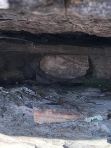
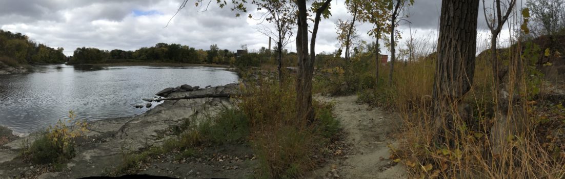
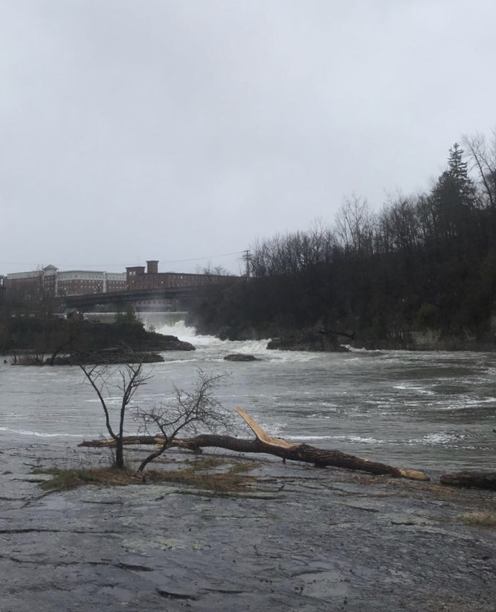
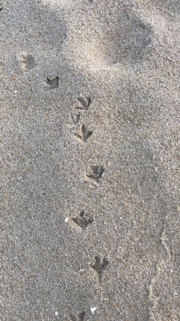
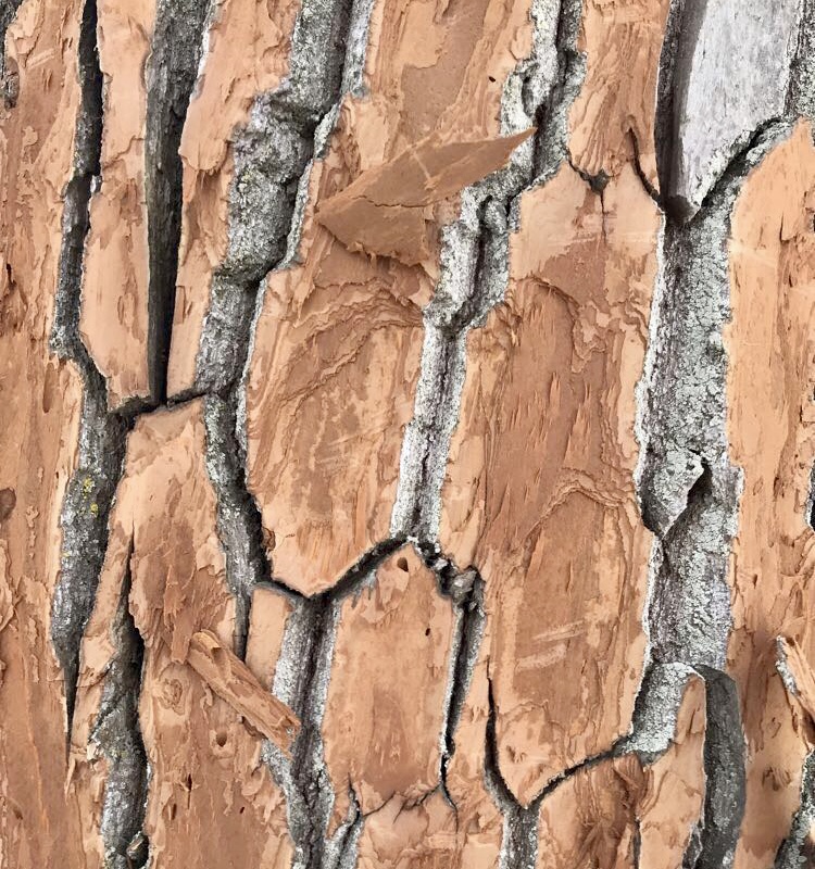
Through having to do these assignments, I have also learned a lot about the natural and cultural history of Salmon Hole, which has been generally unobstructed. The most significant instance of this are the rocks where the trails lead out to the Winooski. They are covered with ridges, remnants of when the waves of the Iapetus Ocean lapped up on those rocks. Since then, the Champlain Sea and eventually the Winooski River formed, and created a site for human activity dating as far back as 12,000 years. The toponym Winooski stems from “winooskiok,” meaning “the land of onions,” and it is the reason that the City Market/Onion River Co-op has its name today. Before colonial settlers came to what we now know as Vermont, the Abenaki lived here, as the site is a rich breeding ground for Salmon and had vibrant plant communities to sustain a foraging community. Though people no longer live at Salmon Hole, the town of Winooski is seen behind the dam, and the Riverwalk trails beginning at Salmon Hole offer a new use for the land: recreation.

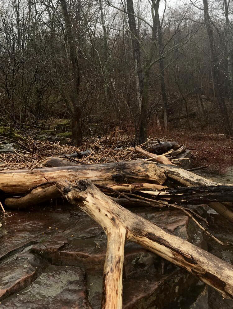
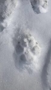
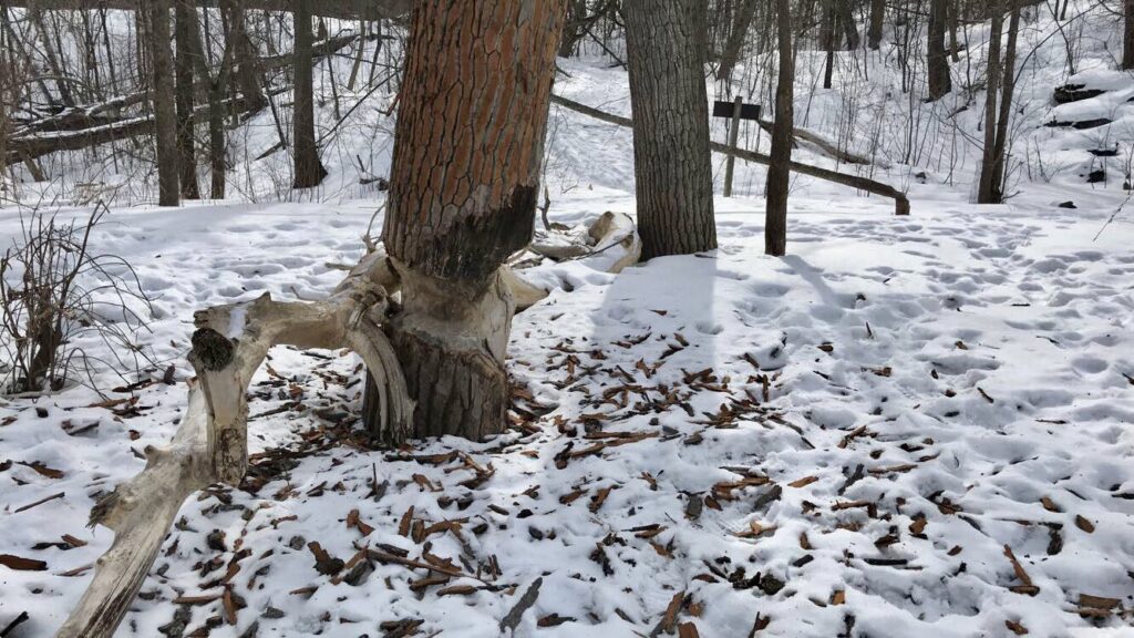
While I would not say that I am a part of my place, I have certainly gotten to know it well. For me, Salmon Hole was a place outside campus, outside my zone of everyday life. I was a diligent visitor, but I do not see myself as a part—and I think that’s okay. Over time, coming back every 1-3 weeks, I have started to make specific connections and notice increasingly minute changes. I know which trees the beavers come back to and I know where the water level has been based on where the driftwood has shifted to. Maybe for some people, that makes them feel like a part of the place. I think that personally, I would need to continue coming back for a long time to feel that way, but that isn’t to say that I won’t. I’d like to come back, and I intend to. Maybe not often, but enough to test the knowledge of place that I have gained.

April 27, 2019
by aesherma
0 comments

04/27 Visit

When I went to Salmon Hole early this morning, it was raining pretty heavily. Because of this, I did not see any other people while I was there, but unfortunately did not hear any songbirds or see any mammals either. When I arrived, I saw how flooded the area had become, due to all of the recent rain and snowmelt coming from eastern Vermont. About half of my site was underwater, and water was bursting from the dam.

I had hoped that the sandy clay, being smoothed over from all the water, would show clear animal tracks, but unfortunately there were no tracks to be seen. I did see a black cormorant fly over the water and settle down near the dam, but could not get a clear photo of it. I later saw some geese farther downstream that had just flown in and landed, which means geese are returning for the summer!

There were no wildflowers growing, as I do not think sand is favorable for them, but I did notice a patch of these plants sprouting on the bank of the river. I was unable to identify this plant myself, but will be uploading a picture to iNaturalist for assistance.

The mysterious plants.

I saw a few different flowering buds, one from a tree on the path to my site and one from a plant on the river shore. I am still working on identifying these as well, as I do not have much experience with flowering bud identification. The cottonwoods seem to have buds beginning to flower, but none were low enough to look at up close. I did notice the moss on the surrounding rocks looking much greener and thicker, as all the grass around town has started to look. I sketched the bush buds, as well.

While this was not a super eventful visit, I am really excited about seeing the cormorant, as I have not seen one at my site before, only from a distance on Champlain and most often on the St. Lawrence Seaway in New York.

March 18, 2019
by aesherma
0 comments

Spring Break Visit to the Jersey Shore

The Jersey Shore with the town of Belmar in the back.

A tradition many local kids in my area keep is to drive to the beach on the first day of spring that it is reasonably warm enough to go. It is often a celebration of an unseasonably warm day, or a 70 degree outlier during a 50 degree week. My friends and I have partaken in this tradition since the first of us got our licenses in high school, and this week at home was no exception. The high on Thursday was 73ºF, and my best friend and made a spur of the moment decision to go to the beach at Belmar, our closest beach at 40 minutes away. By the time we got there it was 5pm, and the temperature had dropped to 53ºF, 48ºF with windchill. When we got down to the water, I noticed the tracks of the many different shorebirds walking around, and made the decision to stay for an hour and use this spot for this phenology assignment. The seashore ecosystem is drastically different from Salmon Hole, or really any site in Vermont, so I thought observing something so contrasting would be interesting.

Because it had gotten cold by the time we reached the beach, there were not many if any other people around on the sand. I got to just sit and watch the shorebirds for an hour. The gulls are very used to large quantities of people being around and during the summer rely heavily on human food and trash to eat. It was interesting to watch them when there were not many people around. The water was still very cold, so I did not see many birds interacting physically with the water, mostly they were flying overhead and poking around in the sand. I observed a few different tracks of different birds, but was unable to find a comprehensive tracking guide for shore or seabirds specific to the Mid-Atlantic region. However, based on individual google searches, I did my best to identify them below (in captions).

I don’t see many birds at all at Salmon Hole, likely because they have more cover and more means to avoid humans, and also because I do not have strong birding skills. It was nice to be able to watch birds out in the open, and hopefully I will be able to see more birds at my site in Burlington as it gets warmer. Also, I am always surprised to see gulls around Burlington, as it is strange and surprising to remember that Lake Champlain and its microclimate attract gulls as well.

Using Rock’d, I also took a look at the geology of Belmar beaches, since different formations lie under different regions of the Jersey Shore. I found that the substrate is a “lower member of the Kirkwood Formation,” and that the local yellow-white sand has been excessively stained by iron oxides. The lithology is 83% sand and 17% clay, and the formation is 61m deep. It is interesting to compare this to Salmon Hole, since Salmon Hole was once the shore of the Iapetus Ocean, the waves of which have been imprinted on the Winooski dolostone at the site.

March 5, 2019
by aesherma
0 comments

March 5th at Salmon Hole

Upon coming to Salmon Hole this week, I did not immediately notice any major changes. Though there had been a lot of snow melt the last few weeks, the past few days it has gotten very cold again and has snowed every other day, which I think made my site look very similar to how it had a month ago, despite undergoing changes.

Whenever I come to my site, I like to stop at the Salmon Hole parking lot first so that I can get an aerial view of the river. Comparing today’s image with the one from my last post, they look very similar. Perhaps the ice is covering slightly more of the river than it was a month ago, and the large ice rifts are no longer so pronounced. I hope I will be able to see Salmon Hole with all of the snow melted before the school year ends, as I am curious as to how all the fluctuations in water have affected the riverbanks and rocky outcrops.

Aerial view of Salmon Hole from the visitors’ lot.
Dog track.

I then began to walk around, searching for tracks or signs of wildlife. Because of the recent snow, I struggled to find any tracks clear enough to follow, with the exception of dog tracks. Salmon Hole is a popular place for locals to bring their dogs, and it is interesting to see how even their tracks reflect things about the dog and owner. The dog tracks I saw today were very fresh and clear to see, they were of a larger dog, and the dog walked in a straight path with its owner. I feel relatively confident that it was a well-trained dog and not a wolf because of the spacing of the toes and the register of all four claws, whereas often coyotes’ only front two toe claws register.

Something interesting that I noticed as well was a tree surrounded by pieces of its own bark popped off, all the way up the tree. After doing some research, I found that it is common for trees to lose their bark when there are very sharp temperature swings, but I wonder why this was the only tree in the vicinity that it happened to. I believe this tree is an eastern cottonwood, and the other cottonwoods nearby did not seem to have experienced the same thing.

In terms of what kind of natural community Salmon Hole is and could be, there are a few options. As the Winooski River is the centerpiece of the site, providing freshwater as well as the lowest point in the immediate vicinity, the presence of the river is a main actor in determining natural community. Of the types of communities listed in Wetland, Woodland, Wildland, it may be a riverside outcrop or a erosional river bluff. It also has the potential to be a lakeside floodplain forest, defined by both the presence of a lake, adjacency to a river, and a deciduous forest, all of which describe Salmon Hole. I think that I personally would combine these three options, seeing it as a lakeside floodplain forest that has erosional bluffs and outcrops. There is much exposed rock in the vicinity of my site, but just fifty feet away much of the shoreline becomes raised erosional bluff, caused by the runoff issues in the Champlain Basin and the fluctuation of water volume in the Winooski. If there was less development in the area, I think the forest aspect of this natural community would become clearer, filling with more deciduous hardwoods and potentially some conifers. There is also boggy land across from my site on a small triangle of land in the middle of the river, but since I cannot travel to it, there is not much more I can determine about that.

February 3, 2019
by aesherma
0 comments

Return to Salmon Hole!

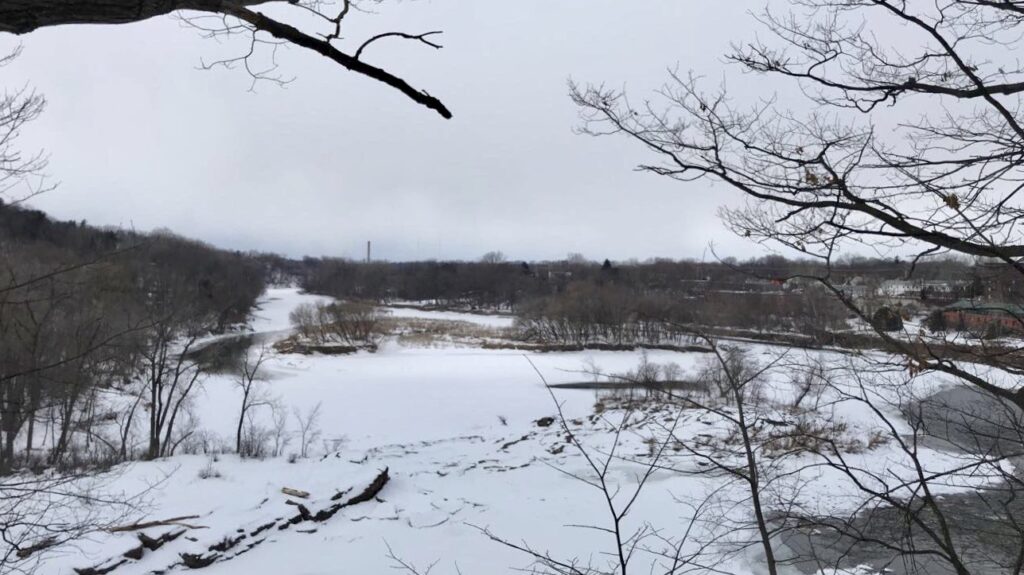
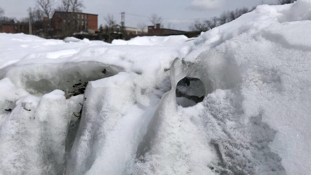
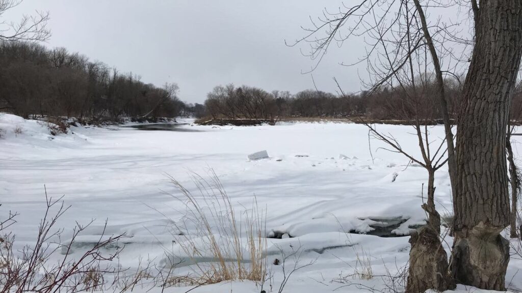
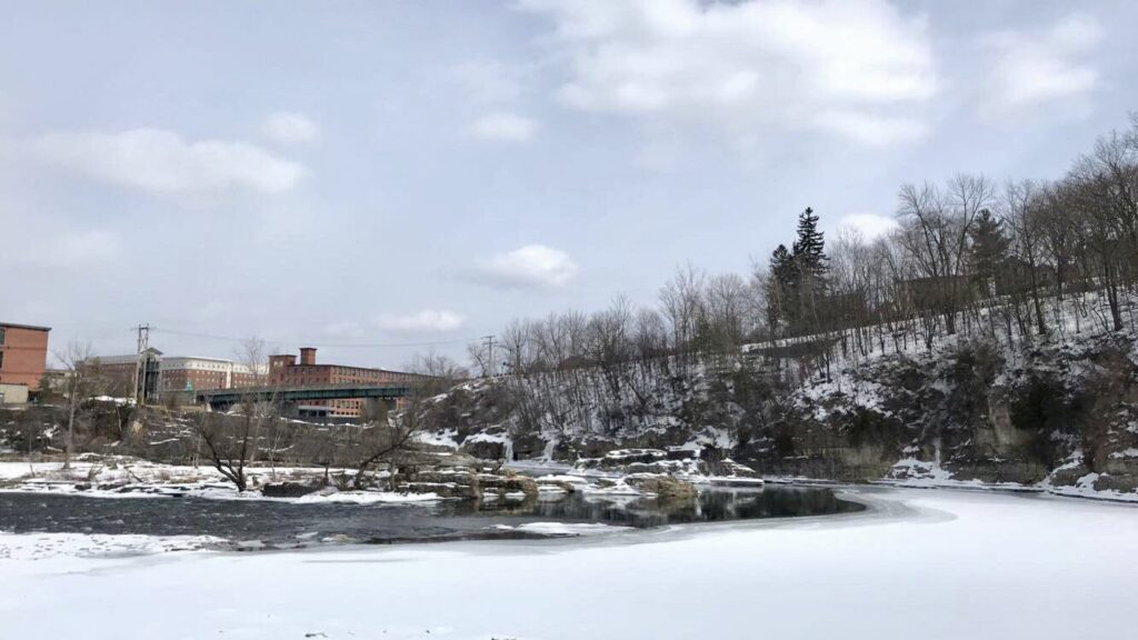
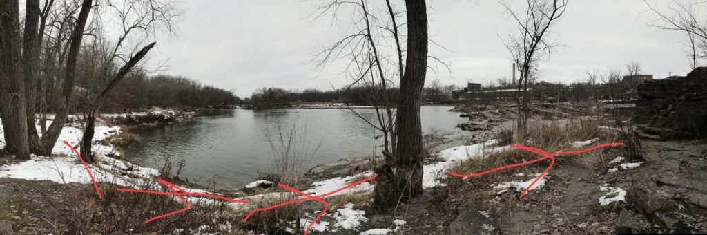
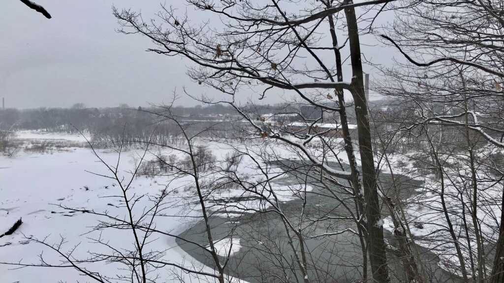
Salmon Hole looks very different from the last time I saw it! There are many changes at the site that have appeared since early December, the most noticeable of which is that large parts of the Winooski have frozen over and the ice has rifted multiple times. The shape of the river looks different because of the snow sitting on the ice wherever the current is not strong enough.

Ice rifts at the shore of my site.

At my site, there a few smaller more specific changes, some natural and some man-made. For one, some of the trees right next the shoreline are surrounded by chicken wire, probably put there to keep beavers from chewing on these younger trees during the winter—however, I am not sure.

Chicken wire around the base of a tree.

On the note of beavers, there is also what I believe to be potential animal activity, but may just be driftwood. There is a large debarked tree laying by the group of cottonwoods that is filled with smaller sticks, branches, and pieces of bark. As far as I know, the waterline has not risen to that height before, and I think it is unlikely that the branches would arrange themselves in this way. However, I also know that beaver impoundments have their entrances underwater, and this shelter could not have that based on where it is on the ground. It may be the shelter of another animal, but I not sure which one.

Beneath the large piece of driftwood and behind the sticks, there is a hollow that may be the shelter of an animal.

While I was at my site, it was snowing and has been snowing since yesterday. As a result, the snow is very light and fluffy and not good for keeping tracks. Tracks that were already present had been mostly filled in, and fresh tracks would not be impressed in the snow very well. Because of this I had a hard time finding tracks to follow, however, I did observe some tracks out on the ice in my site’s little bay.

Since the tracks were out on the ice and I knew there was still water flowing beneath, I did not feel safe going out to look at them up close and made observations and estimates about measurements from afar. The track I observed went from left to right (in the picture) at first, then came up close to a rift in the ice, turned sharply almost 180 degrees, and quickly moved in the other direction.

The track I observed on the ice.

It is possible the animal realized the ice was unsafe, or heard whatever it was following move in the other direction. The animal can be identified as a diagonal walker, the initial tracks actually appearing in almost a straight line. I estimated measurements from where I was as well, ball-parking the width of one track to be about 3 inches, the straddle around 4 inches (or relatively narrow), and a stride of about 18 inches (1.5 ft). Upon returning to my computer and consulting my tracking guide, I believe this animal may be a fox. My estimates align with the measurements listed for a fox, which is a diagonal walker known to track almost in a straight line.

Finally, I attempted to do some winter twig identification. Here are the drawings I did and their corresponding photos, I was able to identify what I believe to be eastern cottonwood (populus deltoides), red maple (acer rubrum), and glossy buckthorn (frangula alnus). While I am confident about the two formerly mentioned trees, I am not as sure about the latter.

Twig diagrams.

Eastern cottonwood.

Glossy buckthorn.

Red maple.

December 7, 2018
by aesherma
0 comments

Human History of Salmon Hole

Historically, Salmon Hole has been used by humans intermittently for the last 12,000 years. The name “Winooski” comes from the Abenaki word “Winooskiok,” a toponym meaning the land of wild onions. (Also why the City Market Co-op is also called the Onion River Co-op! And why its symbol is an onion!) 

As a spot on the Winooski River only slightly inland from Lake Champlain, it has many important attributes that have helped support human life for a long time. Because of its small bays along the sharp bend in the river, it has important spawning grounds for fish such as salmon, alewives, and shad. This makes it great for fishing, and would allow for fish to safely reproduce and return to Champlain for fishing as well. The area also is also a resource for nuts and berries, and the water attracts animals as well.

Signs protecting sturgeon from fishing, as opposed to other fish that are not protected.

The area around Salmon Hole has also been appealing to humans throughout time because of its location in the Champlain Valley. Valleys sometimes form warmer microclimates, which create a longer, more prolific growing season. Additionally, valleys have extended elevation gradients, resulting in many different resources and a lot of biodiversity in a smaller local space. This has made this part of Vermont attractive for agriculture to this day, but especially in the pre-contact period as a safe, supportive place to stay for people who could not migrate into the mountains.

In my time visiting Salmon Hole, I have seen many people fishing, walking their dogs, and hiking. Salmon Hole is now a park, and so has changed to include trails and trail signs. There is also a dam located here, the Winooski One Dam. According to the Vermont Fish & Wildlife Department, the base of the dam has a great diversity of fish that congregate there throughout the year. However, the dam also does not have  fish ladder, which prevents fish from swimming even further upstream to spawn. During our lab this past Monday, we learned that sometimes people would fill baskets of fish and carry them around the dam to help the fish spawn further up.

December 1, 2018
by aesherma
0 comments

Last Visit to Salmon Hole Before Winter Break!

Notice the space between the water and where the bushes begin to grow and thicken. That is where the water used to be.

Bird’s eye view of the site. The rocks connecting that small island in the center have become mostly revealed again.

When I got to Salmon Hole today, the first thing I noticed was the new change in water level. The last time I went, it had just rained for an entire week and the water level had dramatically increased to cover much more of the shoreline and the rocks jutting out into the river. Today, those rocks were mostly uncovered (they were aggressive rapids two weeks ago) but still had some water going over them, and the newly un-submerged banks were still very wet. Some underwater bushes as well as my own memory indicate that the water level has yet to return to how it was at the beginning of fall, though I would not expect that to happen until the summertime. The receding water has created a relatively steep decline to the water, and there is a lot of driftwood on that incline.

The young woodpecker, shortly before flying away.

At the very beginning of my visit, I had a young woodpecker pointed out to me, drilling a hole in the large snag closest to the water. This woodpecker was very small and fluffy, leading me to believe that it was probably very young. I have not seen an actual woodpecker at my site yet, just signs of their presence, so this was very exciting for me.

Unfortunately, the warmer temperatures of the last few days and the resulting rain melted most of the snow, but there was enough left that I was able to find some animal tracks. The most ubiquitous tracks were these I found, I believe they are of a coyote based on the mammal scat/tracks guide I used. Salmon Hole is also heavily trafficked by people with dogs, so I was careful to not misidentify dog tracks as coyote tracks, but based on the research I did about the two, I identified a major difference that helped me distinguish the tracks present.

The metacarpal pad has a center lobe, which leads me to believe this is a coyote print and not a dog print.

The metacarpal pad on dogs does not have a center lobe at the bottom, and thus has three rounded points. A coyote’s metacarpal pad has a center lobe out in the same spot, resulting in four rounded points. Also, the center two toes on coyotes are closer together than that of most dogs. I am not totally confident as I have little experience in tracking, but I feel pretty good about the distinctions I have identified.

The path of the coyote through the enter of my site, based on available and observed tracks.

November 25, 2018
by aesherma
0 comments

Thanksgiving Break Visit to the Billie Johnson Mountain Lakes Preserve

Palmer Lake, the lake built for ice harvesting in the late 1800s.

This Thanksgiving break, I returned to a place that is very special to me. I went to the Billie Johnson Mountain Lakes Nature Preserve in Princeton, New Jersey, about 20 minutes from where I grew up.This is my favorite place to hike locally, because while it is relatively small and contained, the properties which make it up are very diverse in their characteristics. There are forests, fields, boulder fields, a cave, a lake, and brooks to name a few. Each trail feels like it takes me to a different place, but they are all actually part of one space that is in the heart of my life in New Jersey. I went there a few times as a kid with my family, but began visiting in my junior year again almost weekly, weather permitting. The center of the main property is a manmade lake with a damn, which at the beginning of the 20th century was used for ice harvesting. (Because back then, it got cold enough in New Jersey for that!) As in other local parks and preserve, the some of topography surrounding the body of water is actually shaped by the earth excavated to create the lake

My spot along Stony Brook.

The spot I chose to study in particular is a stream on the edge of the preserve that is on a trail, where there are stepping stones across the stream. The water comes from Stony Brook, connecting briefly with the lake water but not coming from it or directly to it. It is hugged on one side by a private farm, and on the other side by the lake and the preserve. It is a small, easily crossable stream, and I really enjoy the stepping stones across it. On one side of the brook at my site there is a wildlife habitat restoration taking place, where another trail is sectioned off to allow for the forest to recover.

The sign for the restoration site.

On the other, there is a patch of crushed grass that is said to be the result of deer, which are often sighted in or around the brook. The trees surrounding my site were mainly large hardwoods: shumard oaks, white oaks, and witch hazel, one of which has actually fallen across the brook.

The witch hazel fallen across Stony Brook, labeled by the preserve staff.

I also used the Rock’D app recommended by my TA, which showed me geological information about the site, from which I learned that I was on a embayed coastal plane, aged in the Late Triassic period (~230 MYA). The lithology of the site, that is, the rocks present were listed as mudstone, shale, sandstone, and argillite (the results switched between two identified groupings). At Salmon Hole, the bedrock is Monkton Quartzite from the Middle Cambrian (~500MYA). There is sandstone and dolostone present, which indicates the major similarity between the two sites. Both bedrocks are composed of shale because both sediments were originally beneath oceans/seas, though the Passaic/Lockatong formation in New Jersey was formed more recently and because the water receded from there more recently. I think the main differences lie in climate and elevation, where I live is barely above sea level and is warmer than the climate in Vermont. Otherwise, I think the two spaces are pretty similar, though obviously the Winooski is much larger and has a greater impact on its surrounding landscape. I haven’t been to Salmon Hole in a while, but in the preserve all of the leaves are on the ground, though the shrubs and vines still have their leaves. Both landscapes were also cleared in the previous two centuries, and have since been allowed to regrow.

Map:

Photos I took during my visit:

Erosion along the side of the stream.


Signage about land-use history in the area. (1/2)

Signage about land-use history in the area. (1/2)

A different section of the brook.

The deer wallow.

The tree fallen across the brook.

Another view of the brook.

Another view of the brook.


November 4, 2018
by aesherma
0 comments

the bend of a river / is a funny place

the bend of a river

is a funny place

both a breeding ground

and a dumping ground


it is the island of misfit toys

toys — both gifts of nature and trash of ours

driftwood, glass bottle, lost tennis ball

each with a life lived and others touched


it is home to pools and trees and stone

to beavers and birds and snakes

it is the home of a stronger, colder breeze

you are more exposed out here, open


ready to be carried away or perhaps

ready to rest on this sandy shore

not quite a final resting place

but at least a stop on your journey

November 4, 2018
by aesherma
0 comments

Changes in Wildlife and Plantlife

Norway maple leaf I took to press.

When I was on the phone with my mother on my way to my site, she asked me if all the trees in Vermont still had their leaves, I replied that yes, most trees still had their leaves but that all of those trees changed color—this was still on campus. This held true when I entered the woods at Salmon Hole to access my site today, I noticed that most trees still had many leaves despite there also being many leaves on the ground. I noticed that many of the leaves on the ground were bright yellow Norway Maple leaves, and I took one to press.

Bare eastern cottonwoods on the shore of the Winooski.

When I came out to the river, I noticed that the trees on the shore were either completely or almost bare of their leaves, pretty much regardless of species. The most bare were the large eastern cottonwoods by my center point, as well as some American beeches. I also observed some buckthorn plants, whose leaves were yellow-green and beginning to brown, but had yet to fall from their branches. I think that in addition to species losing their leaves at different times, a big reason why the trees on the shore are more bare is because they are more exposed to strong winds and similar disturbances, which would likely detach leaves more quickly, as opposed to trees in the woods which shield one another from strong wind.

Tree with missing patch of bark.

Fallen tree stripped of bark with mushroom growing from it.


In the time I spent observing the eastern cottonwoods, they reflected many activities in animal life to me. Though I previously noticed two trees with significant signs of being chewed on by beavers, today I observed a new patch of bark missing from a nearby cottonwood. The missing bark along with the frayed ends of remaining bark above and below the bark leads me to believe this is a beaver’s work. Another nearby fallen tree was stripped of all bark as well, though I do not know if that is related.

Cottonwood with woodpecker holes.

Additionally, I noticed this tree deeply cut into by beavers, as well as with some evidence of a woodpecker drilling holes into it. One of these holes appears slightly older, but the oblong holes with frayed bark are likely the work of a woodpecker.

On the topic of birds, I again saw gulls and also observed a pair of bluejays. I only saw one, but could hear the two calling to one another throughout my time at the site.

My most exciting discovery of the day was while looking at the rock outcrop I climb up and down to get to my center point, where I found old shedded snake skins in a crevice between the rocks. There were also many dead spiders in this space, and what were potentially small bone fragments. Unfortunately, I was not comfortable reaching in to check, but was able to take some pictures of the snake skin inside from outside the crevice.

Shedded snake skin found in the space between two large rocks.

Skip to toolbar